Consider this post sort of a companion piece to Larry’s “American Fire, Tahoe National Forest” post below. The West Fork 2 wildfire started via a lightning strike early Sunday morning. Yesterday, was yet another 90+ day in Missoula (adding to the record total number of days over 90 this year). By mid-day humidity bottomed out at 16% and the winds gusted from the west at 40 mph.
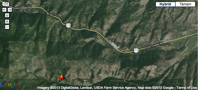
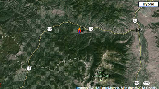
As a result the West Fork 2 fire – burning through a heavily fragmented, clearcut, logged, roaded, weeded landscape just west of Lolo, Montana – ripped pretty good, burning some houses and dumping smoke, ash and charred bark into the Missoula Valley.
Here’s another image of the general location of the fire from a wider angle, showing more of the heavily fragmented landscape.
P.S. And thank goodness the Tar Sands megaloads came through – and blocked all traffic – on US Highway 12 a few days ago…and not during the course of this wildfire incident. One has to wonder how the evacuation of homes, people, pets and belongings and the response of firefighters, sheriffs and emergency personal would have been impacted a few days earlier with the Tar Sands megaloads blocking the highway.