 This is a news article about a PLOS study. It was originally published in the Washington Post here.
Below are some excerpts:
A new study of satellite images taken over 10 years starting in 1990 shows the rural forest canopy disappearing. Forest space disappeared from the United States in such big chunks that the average distance from any point in the nation to a forest increased by 14 percent, about a third of a mile.
While that’s no big deal to a human driving a car with a pine-scented tree dangling from the rearview mirror, it is to a bird hoping to rest or find food on epic seasonal flights across the globe, according to the study published Wednesday in the journal PLOS One.
But forests aren’t just for the birds. They improve the quality of life for fauna and flora, from bears to flowers. Altering forests can change the dynamics of ecosystems and can potentially “affect water chemistry, soil erosion, carbon sequestration patterns, local climate, biodiversity distribution and human quality of life,” a statement announcing the report said.
[The new California gold rush: Loggers see money sprouting from millions of dead trees]
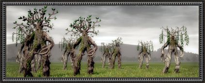
Using forest maps over the continental United States, researchers Sheng Yang and Giorgos Mountrakis of the State University of New York at Syracuse marked tree canopy that disappeared over a decade in red to highlight the change. In one illustration included in the study, the page appeared to bleed.
“So if you are in the western U.S. or you are in a rural area or you are in land owned by a public entity, it could be federal, state or local, your distance to the forest is increasing much faster than the other areas,” Mountrakis said. “The forests are getting further away from you.”
In California and Colorado, trees stressed by drought are being eaten to death by beetles, standing dead on mountainsides by the hundreds of millions, virtual ghost forests. Ecologists argue whether fires that might consume them are a good or bad thing, in that it would kill the beetles yet threaten homes too close to the forest edge. Human development is another grim agent of tree canopy loss.
The researchers said they hope public land managers, such as the U.S. Forest Service and Bureau of Land Management, along with officials at the state level, will pay attention to their research. They hope to follow up the study with research into the drivers behind the loss of forests.But the pictures don’t lie, he said. There’s no doubt that huge clumps of trees are disappearing.
As a long term resident of the western US, I know exactly where the local trees are and have been and they haven’t disappeared- some have been killed and/or burned down. I guess you could lose canopy due to fuel breaks around your houses and new houses if you live in a forested area. But in the article urban areas are doing fine. Maybe I just don’t get it, or maybe the person who wrote the story wasn’t clear, or maybe looking at something through a satellite doesn’t really add much to what people on the ground are observing?
Here’s the link to the PLOS article (which is free, hurray for them!) and an excerpt from the discussion:
<
“> Among the skewing factors are urbanization levels and land ownership. While urban areas have received most of the attention, our study shows that it is the rural areas that suffer higher attrition levels. Furthermore, it is the federal and state lands that exhibit higher attrition, necessitating improvements in public land management. A visual example showcasing the differences between eastern and western regions is depicted in Fig 6. Forest losses are dominant in Forest attrition spatial patterns in conterminous U.S. gap areas in western ecoregions leading to severe forest attritions, whereas in eastern regions forest losses appear in the interior or near the forest edge thus causing lower attrition. This difference may be attributed to many factors including lower tree density and higher terrain heterogeneity in western than eastern ecoregions. In addition, the predominant disturbance classes are fire and insect activities in the west compared to harvesting in managed forests in the east [81], possibly leading to different attrition patterns in these two strata. From the biodiversity conservation perspective changes in climatic conditions, such as temperature and precipitation, can be projected after forest attrition is estimated. Estimating these climatic changes can lead to better understanding of potential impacts on genetic diversity of various species [41]. In addition, in order to promote carbon sequestration in forests and in turn mitigate climate changes, biomass and carbon changes from forest attrition need to be carefully evaluated to determine most profitable mitigation measures, for example reforestation [46], because forest attrition often causes irreversible carbon losses compared to other geographic patterns of forest loss. Finally, the locations of primary forests in more pristine condition or scattered forest patches serving as keystone structures can be overlaid with the forest attrition maps for informing forest management planning. This is especially critical in conserving climate, biodiversity, soil nutrient, and microclimate [43,99].
Italics mine because of the mention of forest management planning. Finally, I thought it was interesting that in their abstract, the authors say
“Here, we study forest attrition, the complete removal of forest patches, that can result in complete habitat loss, severe decline of population sizes and species richness, and shifts of local and regional environmental conditions.” So they define fire and bug kill as problematic ecologically, whereas other ecological thinkers consider them a part of the dynamics.
It seems to me that if you are arguing that a new tool is useful because you can see something others can’t, then you should be able to articulate that based on describing what people already know and what your tool has to contribute. If you give advice to others such as federal and state land managers, you should have some idea of whether they are already considering things like this. Oh, reviewers, where are thou?
For some people, “Whatever Happens” is just fine, as long as humans don’t intervene. This includes drought, bark beetle blooms, firestorms and catastrophic erosion. If “global warming” is killing our forests, then shouldn’t we be doing something about the unnatural tree densities? (Oh, yeah…. that’s right, bark beetles and uncontrolled wildfires are ‘better at thinning’ than humans. *smirk* )
He hates to see me *smirk*
Forest canopy is only one metric of a forest and by using this one variable measured from a satellite, at least in western forests, you get a skewed result when you start talking about “distance to forest”.
Burned forest still have a lots of diversity and habitat.
What about all the range encroachment sites in eastern Montana alone over the past 60-70 years. You could adjust you temporal and spatial scales and have a study that says forest land is increasing in eastern Montana.
Just another GIS toy. Helpful? In the right context….but “distance” to forest is arbitrary and misleading.
Smokey & Sharon:
Good comments.
The source document for the Washington Post article clearly states that this study is only looking at changes in CANOPY over a 10 year period at 1 hectare pixel resolution generated (resampled) from 30 meter resolution imagery, anything harvested (including some recent thinnings) or anything lost due to fire, insects or disease would be treated as a conversion/loss even if it is a young stand of healthy trees with more grass, brush or bare ground showing through and around the trees as seen from above. Also note that these images were not taken “over 10 years” as stated in the Washington Post article. They are comparisons “between land cover in 1992 and in 2001” as stated by the source document. In addition they state: “The overall accuracy of forest cover changes for the retrofit change product is close to 80%”. I’m not sure how to interpret that but if it is 80% individually for each of the two years then the net change accuracy could be as low as 64% depending on how many of the mis-classifications were in different places on the two sets of imagery. Overlaying such mismatched errors would create false readings of conversion/loss.
Regarding the statements that:
– “While urban areas have received most of the attention, our study shows that it is the rural areas that suffer higher attrition levels.” — That only makes sense since the urban areas have very little forest acreage over the threshold size to loose. For a pixel to be classified as forest the threshold would have to be larger than 1/2 of a hectare or approximately 1.25 acres.
– “Furthermore, it is the federal and state lands that exhibit higher attrition, necessitating improvements in public land management.” — Amen brother!
NASA also got balled up playing with their GIS toy and satellite imagery making such a similar claim. Seems that imagery can’t tell what is: recently regenerated, awaiting regeneration by natural or artificial means or former crop/range land returning to forest land.
Here are some good sources of information that counter this “experiment”:
1) https://www.fia.fs.fed.us/library/brochures/docs/2012/ForestFacts_1952-2012_English.pdf
Pages 7 & 8 “Nearly two-thirds of the net conversion to other uses occurred in the second half of the 19th century, when an average of 13 square miles … of forest was cleared every day for 50 years. By 1910, the area of forest land had declined to an estimated 754 million acres… In 2012, forest land comprised 766 million acres… Forest area has been relatively stable since 1910, although the population has more than tripled since then.” See the note at the bottom of page 19 which confirms the problems associated with the use of present day algorithms to analyze satellite imagery (note: page 18 on forest fragmentation does roughly confirm the numbers given by Sharon’s reference).
2) https://www.fia.fs.fed.us/slides/major-trends.pdf – Especially note slides 3 & 6
Of course, some people tend to blame the present for the past forest practices. In the Sierra Nevada National Forests, clearcutting has not happened since the early 90’s. Same for old growth harvesting. Preservationists are more than happy to let the gullible think otherwise.