Yosemite Visit

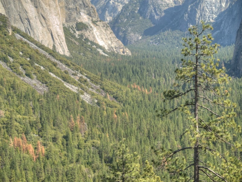
I recently spent three days in the Yosemite National Park area, shooting each day, in different locations. Yes, I did find a marvelous group of dispersed camping sites (free!) within the Rim Fire perimeter. Of course, they were there before the fire but, those spots still look great. Yes, there are also patches of high-intensity burn along Hardin Flat Road (the old highway) that have been salvage logged, too.

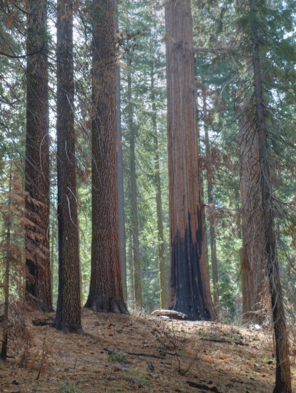
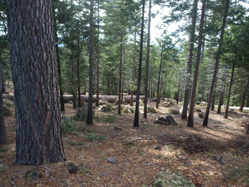
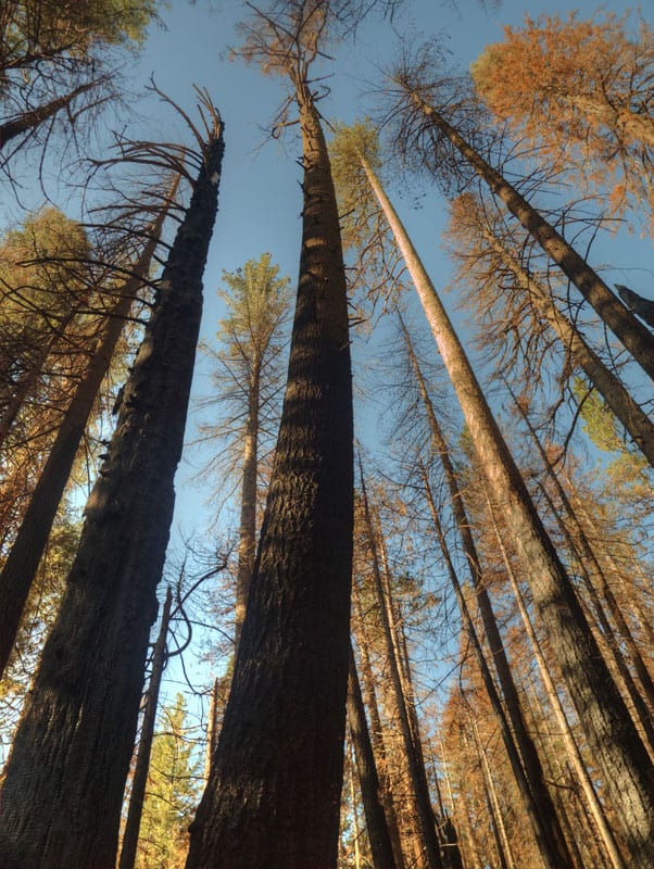
One of the places I went to, inside the park, was a large patch of high-intensity burn, all around Hodgdon Meadow. The campground wasn’t really impacted much by the fire. All around the fringe of the large meadow were green and healthy trees. They should be a good source of seeds, and it looks like most sugar pines had an excellent “cone year”. The problem will be the inevitable re-burns, with heavy fuels from trees like these:

OLYMPUS DIGITAL CAMERA

Yes, there are some tufts of green up there but, will the trees be able to fight off drought and bugs, with damaged cambium? Probably not. Yosemite has become a giant incubation “Motherland” for bark beetles, who don’t stay inside the lines on the map. However, I would recommend Hodgdon Meadow Campground (right near the Highway 120 Entrance Station) for your visit to Yosemite. There is something very primitive to camping under such giant trees (non-Sequoias).

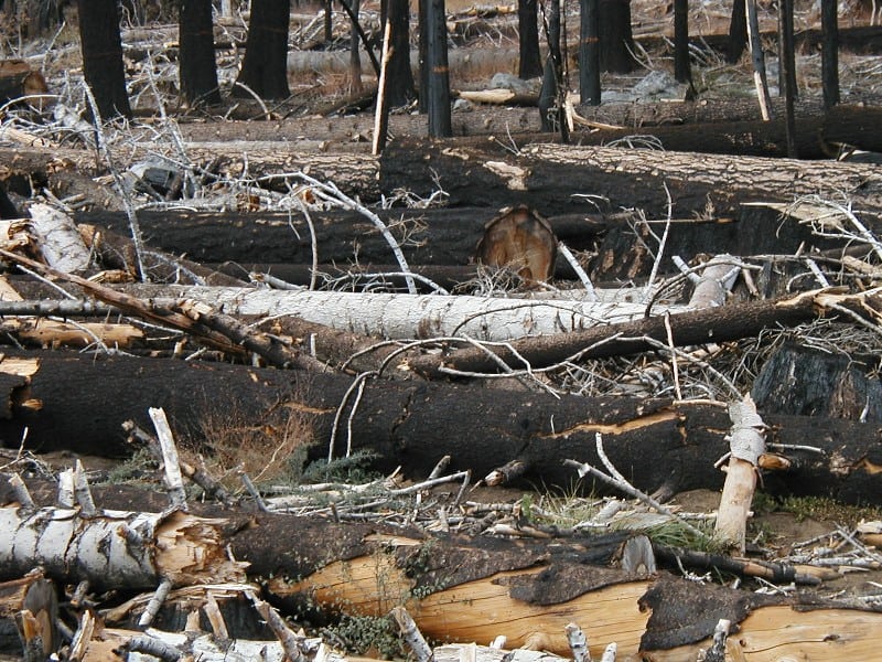
Speaking of Giant Sequoias, I dropped into the Tuolumne Grove, to see how the Rim Fire impacted the area. I knew that firefighters had set up sprinklers, and I could tell by looking at the Google Maps view that there wasn’t much intensity there. This area (pictured below) was about as scorched as much as I could find, along the trails. Certainly, nothing to worry about. I’ll bet there is more insect mortality in the area than fire mortality. I’m sure that some will say they wished it had burned a little more intensely. Most of the grove didn’t burn nearly as well as in this picture.

P9204060_tonemapped-web

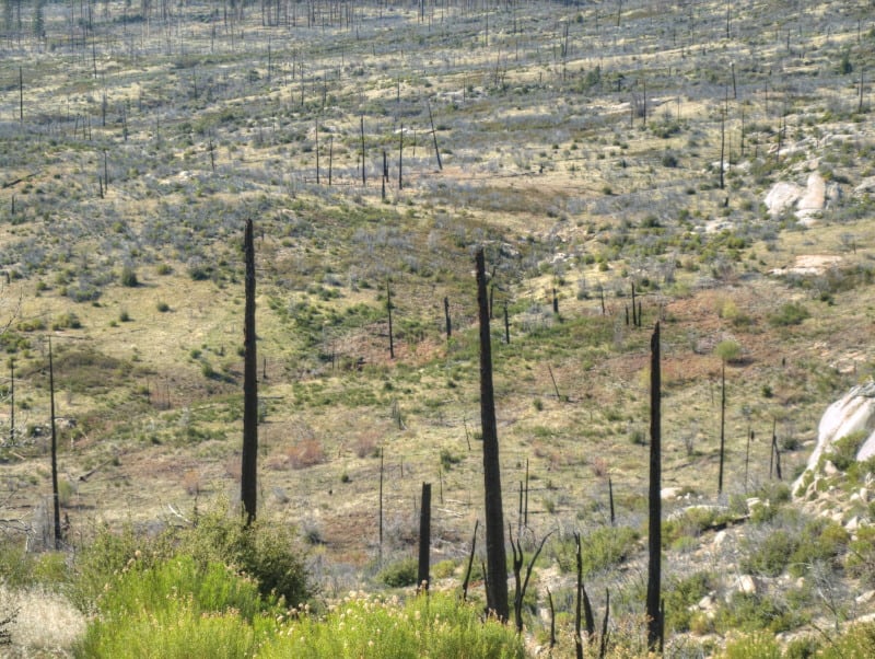
I went to Foresta, to view last year’s re-burn and the progress of “recovery” of the Yosemite side. Here are some views of that situation:

P9193965_tonemapped-web

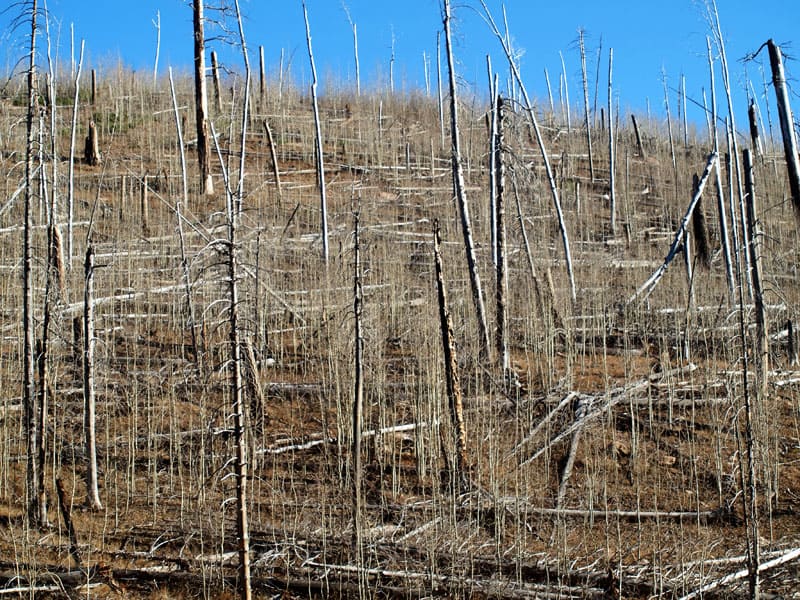
Nine years after the re-burn, and 25 years after the original A-Rock Fire, this area remains desolate. Even brush is having a hard time growing, in soils with very little organic matter. The soils dry out and growth stops, during the hot summers.

P9193947_tonemapped-web

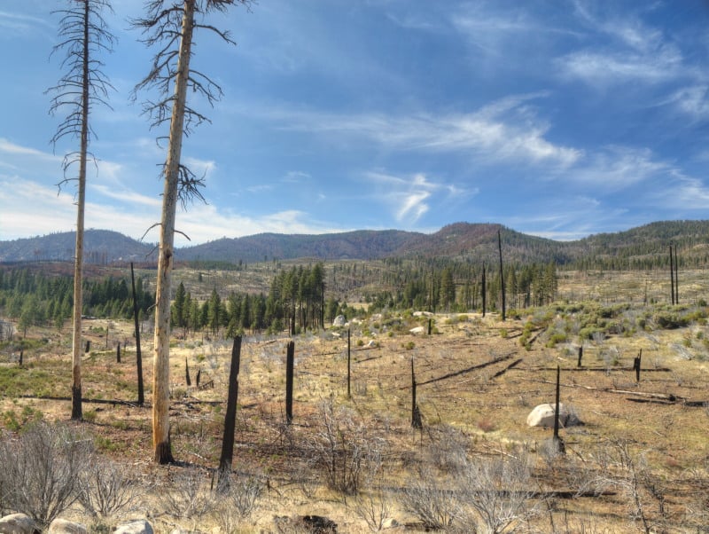
Looking westward, you can see last year’s re-burn, mostly on the Forest Service lands outside the Park. I worked on the original A-Rock salvage project, way back in 1991. I still have some Kodachrome slides from those days, up on that long ridge. The snags in this view probably survived the A-Rock Fire but not the Big Meadow Fire.

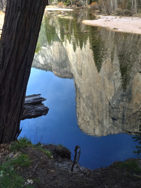
Yes, I did go into Yosemite Valley and found some uncrowded hiking along the Merced River.

P9214119_tonemapped-web

I did see some significant pine beetle patches, in Yosemite Valley. It seems like a “normal” level of bark beetles, considering the horrible drought, and all.

P9214227_tonemapped-web

There is a lot more to see over on my Facebook page www.facebook.com/LarryHarrellFotoware
The Tahoe Basin

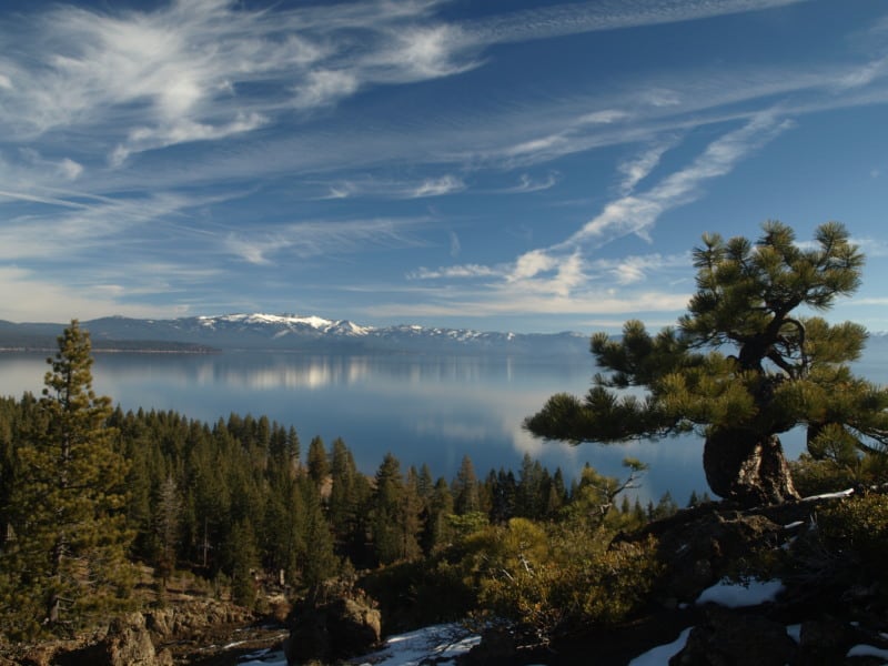
Lake Tahoe would probably be a National Park, by now, if the Comstock Lode had never been found. There was clearcutting right down to the lakshore, for mining timbers, in the silver mines. Incline Village was named for the switchback road that transported logs to a flume that went all the way down to the Washoe Lake area, thousands of feet below.

Today, there is very little “logging” next to all that blue Tahoe lake water. Newspapers especially like to describe the basin as “pristine”, apparently not knowing the actual meaning of the word.

P9123090-web

Much of the Lake Tahoe Basin is “de facto” Wilderness, with very little management happening, even when wildfires occur. Residents seem to be in denial about wildfire issues, not remembering the last drought that decimated their forests. However, it is easy enough to see the results of the last bark beetle infestation, in the form of accumulated fuels far beyond what is “natural”. Many areas of forest mortality were left “to recover”, on their own. Well, sometimes “recovery” takes decades or even centuries, as long as humans don’t intervene. That might also include multiple wildfires, opening the ground to accelerated erosion and having clarity-declining sediments flowing into Lake Tahoe.

P9123100-web

Ironically, the lake’s level isn’t all that far down, thanks to the lobbying of lakeshore land owners, putting pressure on water regulators. That can only go so far, as Reno area interests need more water to keep growing and thriving. We’ll just have to see how the battle goes, as the Truckee River drops further and further.

Dry Sierra Winter

I recently drove over California’s Carson Pass and spent a day in the Lake Tahoe Basin. The weather was good, so I decided to save some money and camp out (!) for two nights (and spending $42 for a night in Reno).

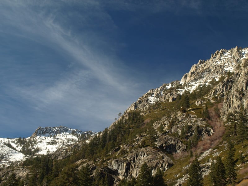
My day at Tahoe began encased in ice, as moist and cold air flowed down the canyon I was camping in. I quickly gathered my frozen gear and stuffed it into the car, making my way to Truckee, and precious morning coffee. From there, I drove down Highway 89, which was very familiar to me, as I used to bicycle, hitch hike and drive it, many times a week, when I lived there, in the 80’s. I continued along the west shore of Lake Tahoe, to reach my first planned stop at Eagle Rock. I had last climbed it in the mid 80’s, and I didn’t know there were now two trails to the top. It was still a bit icy on top but the amazing views sure hadn’t changed. Eagle Rock is a post-glacial volcanic plug, where Blackwood Canyon meets Lake Tahoe.

It appears that the bark beetles haven’t yet arrived in Tahoe yet but, they sure are knocking on the door. I did see bug patches in the southern part of the Eldorado. I heard about one landowner who had 42 bug trees on their property.

P9123021-web

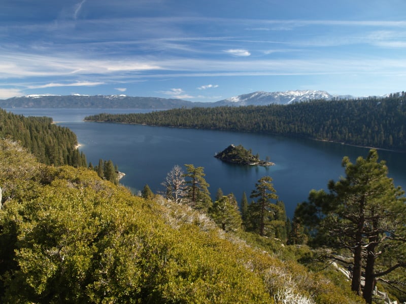
I later visited the famous Emerald Bay, and you will see pictures of that in another post.

Along Highway 88, on the Eldorado National Forest, they have this interesting project being worked on, during the winter. I’m guessing that units have to find other ways to spend their timber bucks since litigation has returned diameter limits to the old unreasonable sizes imposed in 2000. It looks like this project is a highway strip, intended to be a quasi-fuelbreak. It does appear that some trees up to 9″ dbh were taken out, for spacing. There are going to be a ton of tiny piles to burn, and the California Air Resources Board has not been kind to the Forest Service in granting waivers on No-Burn days. And, yes, the piles are covered with burnable material that will keep the pile dry, so ignition will be easy.

P9102965-web

Can we start calling these things “Big Thin Lies”? It is what people see, and they think all forests look like these cleanly thinned and piled forests.

Grand Canyon Fire Recovery

This is an interesting picture from the North Rim of Grand Canyon National Park. The fire burned and killed off all the pines but, the underground mass of aspen roots and shoots survived. I wonder how a pine component could “naturally” come back, or, did Indian burning favor old growth pines? Certainly, the higher pine forests of the Kaibab Plateau are overstocked and at risk, today.

OLYMPUS DIGITAL CAMERA

Urgent Action Needed to Save Sierra Forests

This viewpoint shows more of the reasons why the desire to have larger and more intense wildfires, in the Sierra Nevada, is the wrong way to go.

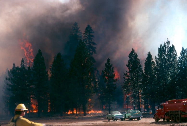
In this picture below, fire crews were run out of this stand, and back into the “safety zone”, on this fire I worked on, back in 1988.

campbell_fire1-web


http://www.sacbee.com/2014/09/28/6737076/viewpoints-urgent-action-needed.html

Air quality the past two weeks has been several times worse than some of the most polluted cities in the world due to smoke from the King fire. Last year’s Rim fire emitted greenhouse gases equivalent to 2.3 million vehicles for a year.

Also, the lost habitat and recreational opportunities from major fires like these are significant. It is not an exaggeration to say that virtually all Californians are affected when these “megafires” occur.

The report points out that wildfires are getting larger and burning at higher intensity than ever before. The Rim fire burned at nearly 40 percent high intensity – meaning virtually no living vegetation is left – covering almost 100,000 acres. More acres have burned in the first 4½ years of this decade than in seven decades of the last century.

What can we do about it?

The main bottleneck in treating more acres is in implementation. The Forest Service is unwilling to increase the size of its Region 5 timber management staffs. They use some of the usual excuses, some of which are beyond their control but, not all of those issues are really significant, looking at the big picture. Yes, it is pretty difficult to implement extremely-complex plans when you are constantly training new temporary employees, hired right off the street.

The Rim Fire: Landscape View

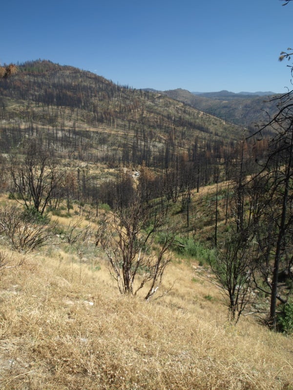
Here is a view of the Granite Creek watershed, and a peek at the Tuolumne River canyon, too. The Rim Fire burned all the way to those most-distant ridgetops. For scale, you can see a vehicle in the middle of the picture. That road is the Cherry Oil Road, which connects Cherry Lake with Highway 120. That greenish tint is the vast growth of bearclover, easily reclaiming their “territory”. Bearclover is one of the reasons why clearcutting has been banned in Sierra Nevada National Forests since 1993.

P9232905-web

In Idaho, Tracing What Remains After the Flames

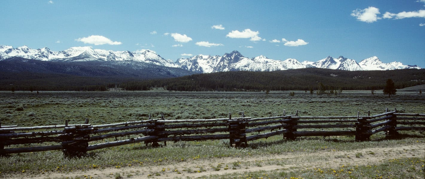
Dick Boyd sent me this article featuring the Sawtooth National Recreation Area. The Stanley area is one of my favorite spots, with hot springs, jagged peaks, pristine lakes, spacious meadows and abundant wildlife.

http://www.nytimes.com/2014/08/17/travel/in-idaho-tracing-what-remains-after-the-flames.html?emc=edit_th_20140816&nl=todaysheadlines&nlid=66809837

Sawtooth-panorama-fence-web

As we neared Stanley, Idaho, a hamlet carved by creeks and framed by mountains with spiky peaks that reminded me of a punk rocker’s hair, the landscape surrounding the winding highway on which we’d climbed 7,000 feet gave way from rugged canyon to flat expanse of grass speckled by lodgepole pine and aspen. We were on the northern edges of the Sawtooth National Recreation Area, three hours from Boise, when scars from an old fire came into view.

My daughter, Flora, and I had been playing a makeshift game in which we pointed out the nature surrounding us, the sort of mindless thing you do to entertain a 5-year-old on a road trip. I see a deer, I see a birdie, I see snow, I see a purple flower, we called out.

“I see trees,” I said, pointing to a cluster of an unrecognizable species to our left, their crooked branches denuded by flames that had torched them.

“Those are not trees,” Flora retorted. “Trees have leaves!”

This article reminded me of the time I spent working on the Boise National Forest, after the massive 1994 Rabbit Creek Fire took 2 months to burn before the Sawtooths and fall rains finally extinguished it. The public rarely sees any of the 150,000 burned acres, as it isn’t visible from the highways. I stumbled upon this vintage video that shows how devastating such fires can be, as storms deposit moderate rains upon highly hydrophobic soils.

It is not always easy to display the damages that occur when soils cannot absorb even moderate rainfall. As the storms and high winds came in, that day, Forest Service employees were called in, due to the danger. Oddly enough, they forgot about me. I weathered the storm, not knowing what was happening. The next day, I patrolled the roads, finding a plugged culvert, with excessive soil movement. I pulled out my trusty shovel and diverted all the water into the roadside ditch, getting it to flow down and through the next downhill culvert.

Repeat Photography: Part Deux

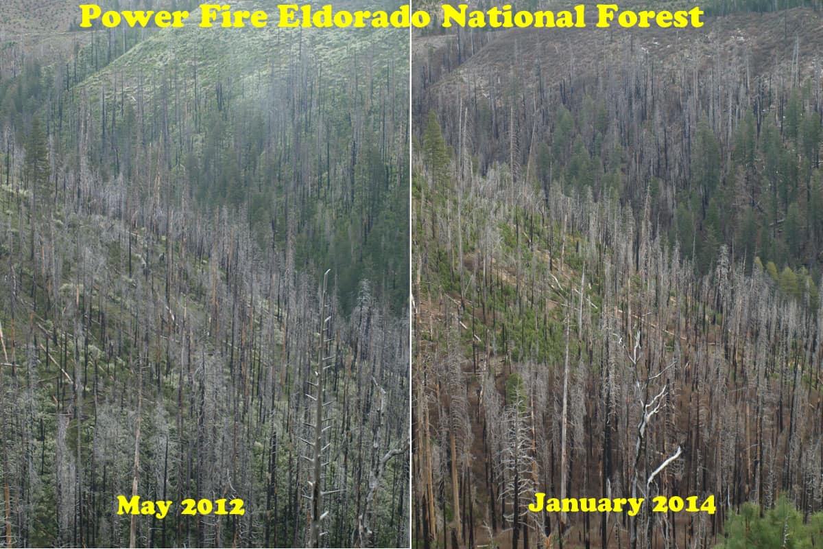
It’s kind of a challenge to assemble pictures shot in different years, from different spots, and from different cameras. This is an excellent way to view and monitor trends, showing the public what happens over time to our National Forests. Sometimes, you have to look hard to see the differences. In any future repeat photography projects, I will be using very high resolution, to be able to zoom in really far.

East-Panther-Power-Fire-web

One of the reasons why you don’t see much “recovery” is that the Eldorado National Forest has finally completed their EIS for using herbicides in selected spots, almost 10 years since the fire burned. This is part of the East Bay’s water supply. Sierra Pacific replanted their ground in less than 2 years. So, the blackbacked woodpeckers should be long gone, as their preferred habitat only lasts for an average of 6 years. As these snags fall over, the risk of intense soil damages from re-burn rises dramatically. Somewhere, I have some earlier pictures of this area which may, or may not line up well with this angle. I’ll keep searching through my files to find more views to practice with.


Examining Historical and Current Mixed-Severity Fire Regimes in Ponderosa Pine and Mixed-Conifer Forests of Western North America

The other day I got the following note and link to some new relevant research from Douglas Bevington, author of The Rebirth of Environmentalism: Grassroots Activism and the New Conservation Movement, 1989-2004.  Bevington’s note is shared below with his permission, along with a link to the new study and article. . – mk

——————

I wanted to let you know about an important new study that was just published by the high-profile science journal PLOS ONE. The article, titled “Examining Historical and Current Mixed-Severity Fire Regimes in Ponderosa Pine and Mixed-Conifer Forests of Western North America,” was co-authored by 11 scientists from various regions of the western US and Canada.

Their study found that there is extensive evidence from multiple data sources that big, intense forest fires were a natural part of ponderosa pine and mixed-conifer ecosystems prior to modern fire suppression. These findings refute the claims frequently made by logging and biomass advocates that modern mixed-severity forest fires (erroneously called “catastrophic” fires) are an unnatural aberration that should be prevented through more logging (“thinning”) and that more biomass facilities should be built to take the resulting material from the forest.

In contrast to these claims, logging done ostensibly to reduce fire severity now appears to be not only unnecessary, but also potentially detrimental when it is based on erroneous notions about historic forest conditions and fire regimes. These findings have big implications for biomass and forest policy, so I encourage you to take a look at this article.

The full article in PLOS ONE is available here.

Here are a few key points from the abstract and conclusion:

Abstract, p. 1

“There is widespread concern that fire exclusion has led to an unprecedented threat of uncharacteristically severe fires in ponderosa pine and mixed-conifer forests of western North America. These extensive montane forests are considered to be adapted to a low/moderate-severity fire regime that maintained stands of relatively old trees. However, there is increasing recognition from landscape-scale assessments that, prior to any significant effects of fire exclusion, fires and forest structure were more variable in these forests….We compiled landscape-scale evidence of historical fire severity patterns in the ponderosa pine and mixed-conifer forests from published literature sources and stand ages available from the Forest Inventory and Analysis program in the USA. The consensus from this evidence is that the traditional reference conditions of low-severity fire regimes are inaccurate for most forests of western North America….Our findings suggest that ecological management goals that incorporate successional diversity created by fire may support characteristic biodiversity, whereas current attempts to ‘‘restore’’ forests to open, low-severity fire conditions may not align with historical reference conditions in most ponderosa pine and mixed-conifer forests of western North America.”

Conclusion: p. 12

“Our findings suggest a need to recognize mixed-severity fire regimes as the predominant fire regime for most of the ponderosa pine and mixed-conifer forests of western North America….For management, perhaps the most profound implication of this study is that the need for forest ‘‘restoration’’ designed to reduce variation in fire behavior may be much less extensive than implied by many current forest management plans or promoted by recent legislation. Incorporating mixed-severity fire into management goals, and adapting human communities to fire by focusing fire risk reduction activities adjacent to homes, may help maintain characteristic biodiversity, expand opportunities to manage fire for ecological benefits, reduce management costs, and protect human communities.”

Democrats Comment Against Forest Thinning

Here is an early July LA Times article that, apparently, says that only Republicans are seeking to thin our forests, as we watch our forests burn. Clearly, this is a tactic to rile up their mostly Democratic readers.

http://www.latimes.com/news/nation/nationnow/la-na-nn-gop-fire-hearings-20130703,0,2185679.story

Cole-creek-logs-web

Yes, it did rile them up, as evidenced by the wild comments. Here are a few examples:

As a logger in Susanville, California said at a Forest Service public comment session (1997), “But Trees are Dying in the Fiorest”!!!! (and therefore NOT making a profit for him).

My response, People are dying in the streets, so what is YOUR point.

The aLand Raping Logger coundn’t answer, because the only thing he cared about was turning a PUBLIC RESOURCE into his own private profit.

Dead trees in a dorest serve as nesting sites for birds and other animals and eventually fall to rot, providing food foe grub eating bears, light spaces for juvenile trees to start and replenishing the forest soil, for the next generation of trees.

When a person dies, what good do they do the Planet?

This commenter doesn’t realize that clearcuts have been banned in the Sierra Nevada for over 20 years.

The logging companies will only clear cut…not select cut, making for the ugliest scars and worse…ecological destruction of forest habitats.  This is not a good idea.  The problem is not the density of trees…it’s the residential areas built near thick forests.  Bad planning is a result of homes destroyed in forest fires.

Ummm, I think it is the wildfires that are causing “deforestation”, bud!

Is that what the GOP is calling deforestation for profit these days, as they bend over for their lumbering lobbyists?

Was this supposed excessive harvesting done in THIS millennium??!?

They have a point, but the GOP has a history of letting “thinning” evolve into excessive “harvesting” by lumber companies.

This person is in denial about current forest management practices that have eliminated high-grading AND clearcutting, while reducing fuels in the form of trees in the 10″-18″ dbh size class. The last 20 years of active management has not resulted in adverse effects. On the other hand, wildfires lead to MORE insects, as they kill the fire-adapted pines, through a combination of cambium kill and bark beetle blooms.

Much of the GOP have forest management/preservation for the past 40 years. While some may see forests as natural resources to be preserved and cherished, others see them as purely economic resources to be exploited. Timber interests in California have utilized the same pretext to no avail. Note that thinning the forests would have little effect in preventing or curtailing wild fires. Let nature take its course becasue fires are a natural occurance; and are necessary for killing insects, spreading new seeds and burning away dead wood.

Really, though, THIS is a big part of what we are up against. Loud-mouthed partisan politics, not based in fact, is harming our ability to do what is right for the “greatest good”. Shouldn’t we be “thinking globally and acting locally”, regarding forests? Is this mindset fitting into “If you are not part of the solution, then you are a part of the problem”?? It looks like commenters will say ANYTHING to bash the GOP, even if it is hyperbole and rhetoric. Sadly, this ignorance of forest facts continues to have a harmful and hazardous effect on our forests.