Not All Acres Burned Are Bad Nor Due to Climate Change- White House Factsheet Misses Region 3 WFU Successes

Wooden Corral sustains no damage from the Pass Fire
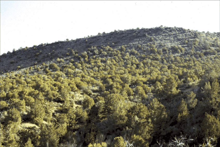
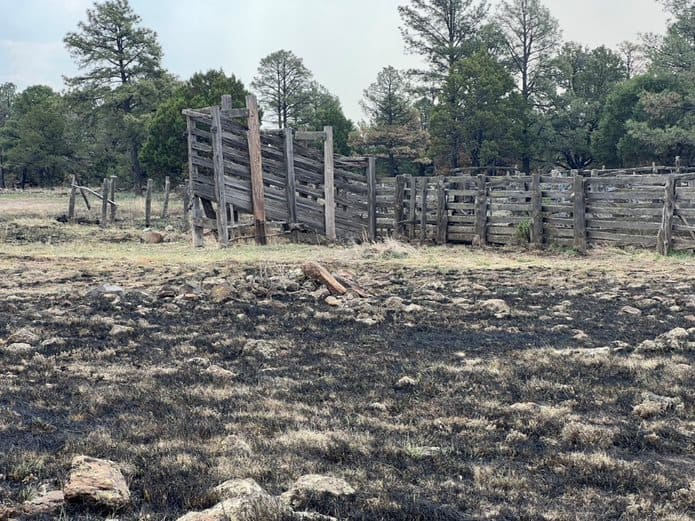
Firefighters strategically used fire to reduce the existing fuel load as the Pass Fire approached the area, which saved the wooden corral structure.

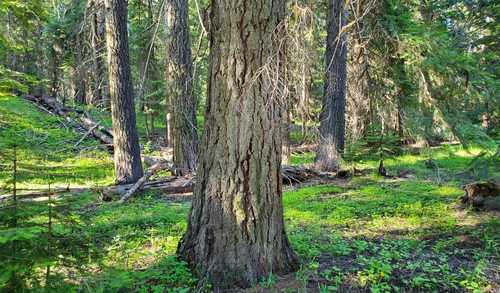
So, wildfires used to be bad. Enter Smokey Bear.  But we wised up and discovered that we need to live with fire, and if we don’t want to have destructive wildfires, we need to manage fuels on landscapes including using prescribed fire and wildland fire use (see photo above). But as far as I can tell, if we’re not careful, we mix up WFU acres with “true” wildfire acres, and then use the total in statements about wildfires and climate.  And if we do, we’re back where we started, assuming all wildfires are bad. Let’s not do that.

Or we could use numbers of wildfires like the EPA..


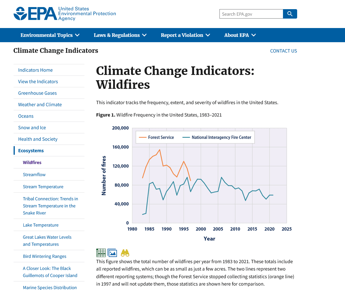
Is number of wildfires an indicator of climate change? Seems like before you made that claim you would have to separate human ignitions from lightning..

We hear that (1) wildfires are caused by (anthropogenic contributions to) climate change.  And yet we know that not to be true, in a plain English sense of causality, as wildfires have long predated humans.  If we pushed back, we might hear (2) “wildfires are made more likely due several factors, one being an increased frequency in some weather conditions conducive to wildfires and those that make firefighting more difficult, some or all of which is due to anthropogenic climate change (AGW).” So how does 2, which I think most of us agree on, mutate into 1? Sloppy public affairs folks?

Here’s what the White House said on June 8

More than 100 million Americans are under Air Quality Index Alerts due to smoke drift from historic wildfire activity throughout Canada, which is facing one of its worst wildfire seasons on record.  There are over 425 active wildfires in Canada and nearly 10 million acres have burned, 17 times the 20-year average.  Since January 1, 2023, 19,574 wildfires have burned 616,486 acres across the United States.  Most current large fire activity in the United States is concentrated in the Southwest.

These latest events are another stark reminder of how the climate crisis is disrupting communities across the country. That’s why from day one President Biden recognized climate change as one of the four crises facing our nation, and why he made historic investments to tackle the climate crisis and strengthen community resilience.

So I suppose you can pivot from the Canadian fires to climate change but the US story is not exactly pivotable.    And here’s what NIFC said on June 22, 2023 about the US.

Since January 1, 22,052 wildfires have burned 636,031 acres across the United States. These numbers are below the 10-year average of 25,006 wildfires and 1,478,575 acres burned.(my bold)

But to further complicate things, some of these fires here (and in Canada) are being managed for resource benefits.. or whatever the current terminology is.. (thanks to the Hotshot Wakeup for info on the Pass Fire) so more acres (without destroying things of ecological or human value) are actually a good thing. That’s what our folks have trained for, and what we all want done. As far as I know.

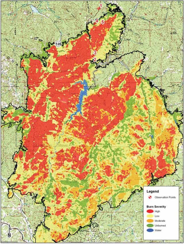
The largest fire is the Pass Fire in NM that shows 55, 683 acres as of today.

The overall strategy on the Pass Fire is to allow the low to moderate intensity of the fire to play its natural role on the landscape as firefighters take appropriate actions to keep the fire within the designated planned boundaries while protecting private land, infrastructure, and natural resources. The Gila National Forest is a fire-adapted ecosystem. It is dependent on fire to play a natural role in restoring the landscape to more natural conditions while preventing the occurrence of extreme fires in the future.

So for this fire, the largest one currently on the board, lots of acres are a good thing, attributed to good management and possibly to some good luck with weather conditions.

NIFC on the 22nd had this one, the Pulp Road fire, at 15,642, I think it’s at 16K or more now.
This fire was an escaped prescribed fire by the North Carolina Forest Service. Escapes tend to be caused by other things than AGW, but perhaps AGW could play a role.. we’ll have to see what the investigation discovers. Anyway, for this one acreage over the target is a bad thing, but dubiously attributed to climate change.

The next largest is the 10,279 Wilbur Fire on the Coconino

The Wilbur Fire is being managed with multiple strategies to meet suppression and resource objectives. Those objectives include the release of nutrients back into the soil and the reduction of hazardous fuel accumulations. Objectives also include protecting critical infrastructure, watersheds, wildlife habitat and culturally sensitive areas from future catastrophic wildfires.

Again, more acres here are good.  I wonder if there’s a place where WFU acres are tracked separately from total acres, or how difficult that is to do. Wouldn’t it be great if we had a table that included:

Prescribed fire acres

Wildfire Use Acres

Unintentional Wildfire Acres

The sum of the above two (WUA plus UWA)  would be the total wildfire acres.

Then the Unintentional Wildfire Acres (or True Wildfire Acres) could be broken down by

Lightning

Human  with subcategories that included:

Escaped prescribed fires

Escaped WFU fires.

Arson

Accidents by individuals

Equipment (powerlines etc.)

Or maybe that table already exists somewhere?

For now, it’s June, the season’s off to a slow start here in the US, and let’s celebrate the folks who are successfully using managed wildfire!

Introducing the Climate-Model Burger and Friedman’s Law of Disciplinary Symmetry

I was surprised by the intensity of the discussion around the wildfire post. I don’t think we’re going to solve the “how dire is the climate situation and what is the best policy solution?” here in the humble TSW world. However, we can talk about what we know about, that is, forests.

First, there seemed to be a tendency to attack Cliff Maas’s views on bad meteorological luck being a component of what made wildfire smoke go to New York.  I’d like to bring up two ideas here. One was the concept that a meteorologist doesn’t know about climate.

Are weather and climate related?  Here’s what NASA says

“The difference between weather and climate is a measure of time. Weather is what conditions of the atmosphere are over a short period of time, and climate is how the atmosphere “behaves” over relatively long periods of time.”

NOAA has a page about it as part of the National Centers for Environmental Information. (If the USG ever needs to save money, they might want to look at duplication of efforts among agencies in the climate/environmental arena).

Though they are closely related, weather and climate aren’t the same thing. Climate is what you expect. Weather is what actually happens.

Let me invoke Friedman’s Law of Disciplinary Symmetry, which states, “if two or more disciplines are necessary to understand a phenomenon, then neither can be invoked as the sole source of scientific authority or knowledge on that phenomenon.”

This is equally true for wildfires. We can imagine that meteorology, the different fire sciences, plant scientists (what plants are there in what complexes and fuel conditions?) plus practitioners should all be involved in discussions of both “why did this happen?” and “what will happen in the future” .
*********************
The Climate-Model Burger

I developed the Climate Burger analogy trying to explain to people how climate models work, and why some people (including me) are skeptical of some of the confidence placed in them for real-world predictions (not research use). I’d like to have an analogy that incorporates the linear process, so if you can think of one, please post in the comments. Also if you have questions or clarifications. It’s pretty simplified.

When people talk about climate modelling, they tend to talk about the whole burger. But it’s really composed of three layers. First there’s the

bottom bun.

Those are the assumptions that go in to projecting future CO2 levels, land use, and other factors that go into the meat layer. This includes economic models and various combos of assumptions. Some of us are leery of economic models, and economists themselves tend to be humble about projections. I think this is the point where some skeptics leave the discussion especially older folks from different fields. Back in the old days, you couldn’t be more certain of a projection than the uncertainties within each variable you used to estimate it. (There are mathematical ways of stating this from statistics that engineers and others learn). When people talk about RCP 4.5 or 8.5 or whatever, they are talking about the assumptions in the bottom bun.

The meat

This takes the CO2 and other variables from the bottom bun and runs them through atmospheric models, which tell us things like future global temperatures. This is the true realm of climate modeling, and most of the people we think of as “real climate scientists” work in this arena.

I honestly have no clue about the atmospheric physics assumptions. I do know that I once asked if modellers did sensitivity analysis on the assumptions (in a meeting at the Temple of Modeling, NCAR in Boulder) and the scientist we spoke with said it was too complicated to do that..that there wasn’t enough computing power available. Perhaps that’s not true or has changed.

The top bun

The top bun then takes those outputs and translates them into impacts. But there are at least two serious problems with the way this is done.

1. Impacts to plants and hence to animals, and to fuel conditions, are actually a function of microscale changes (imagine a tree on a north slope versus a south slope- in the same climate, those are very different micro-environments as perceived by trees- hence in Colorado we can see different species on each aspect). We don’t really understand (1) the environment as a tree perceives it (2) how that might change (3) how much plasticity an organism has to changes (4) how those changes would influence predators, diseases, mycorrhizal associations and their interaction (4) conditions for establishment of seedlings (5) genetic variability of seedlings and so on.

(Note: I’ll point out here that some people feel that you don’t need to understand those things to understand the broader picture- that’s a philosophy of science question we can discuss at greater length.)

2. Impacts are also a function of human beings.. the very same human beings who were working with the environment prior to climate change projections. So.. people can plant trees. People can fight wildfire with different suppression strategies. People can and do develop new firefighting technologies. But these are not possible to enter into models. So.. most impacts don’t consider “adaptation” at all. Like projecting wildfires without fire suppression; or going backward in time. Modeling fuels of the past, but not changes in suppression strategies and technologies. Or in agriculture, the existence of plant breeders or switching

To me, where “the emperor has no clothes” is in the top bun. Yes, the assumptions in the bottom bun are probably not very accurate either. One of my unpopular ideas is to away with them and just talk about potential future concentrations. Then policy makers could talk about different ways to get to the desired concentrations with all their possibilities and imaginations open.. without the sidebars and assumptions of the RCP’s. I think that would clarify discussions greatly and make the trade-offs clearer.

Clearly, the top bun as it is today privileges certain sources of information (biophysical modeling) over other scientific disciplines (fire scientists, practitioners, meteorologists, agronomists, forest ecologists, social scientists and so on) not to speak of practitioners (water managers, fire suppression folks and so on). I’m not the only person who thinks this.. there’s quite a list of disgruntled disciplines and practitioners, if you listen.

But don’t believe me! Here’s some earth scientists saying some of the same things in Earth Science-ese

Note that the concept of Siirila-Woodburn et al. paper in Nature Reviews was to characterize uncertainty and suggest ways of dealing with it.

And from the same paper:

Making science usable for decision- making requires strong trust between the parties 245. This trust often develops over deliberate, long- term collaboration 246, with mutual understanding of the science, models and tools being discussed and demonstration of the credibility, saliency and legitimacy of the new approach(es) 247. Institutional, technical and financial capacity to implement these approaches must also be overcome 233. Scientists must also recognize that practitioners are often directly responsible, sometimes even personally liable, for the outcomes of decisions made, which makes them hesitant in the application of new climate science 236, especially if perceived as not fitting with existing knowledge or policy goals 233,248.A path forward can be made by including Earth scientists, infrastructure experts, decision scientists, water management practitioners and community stakeholders, in a collaborative, iterative process of scientific knowledge creation through a co- production framework 41,42,249,250. This process helps to ensure that new science is suited to challenges at hand and can provide meaningful input into decision- making processes.

And..

Thus, at the same time that science evolves to increase predictive understanding of the mechanisms of hydroclimatic change, management practice must evolve to accommodate uncertainty regarding the changing patterns of current and future hydrologic variability. Developing a robust strategy and selecting investment options that balance competing societal objectives and multisectoral interactions (such as the interaction among water and energy 186 or water and carbon 207 reduction goals) requires new approaches to integrate water resource planning. Frameworks and planning methods for decision- making under deep uncertainty that acknowledge and accommodate imperfect knowledge regarding the probabilistic range of possible future conditions such as decision scaling 241, robust decision- making, dynamic adaptation pathways 242 and scenario planning can identify scientifically informed adaptive strategies that leverage best available science without overstating its confidence 243.

But back to the Climate-Model Burger..what do you think of this analogy? How could it be improved?

Let’s Discuss: the Norm-and-Jerry MOG Op-ed in Politico

Side note: whatever your thoughts, please comment on the MOG ANPR here. That is Mature and Old Growth Advanced Notice of Proposed Rulemaking.  Some people have had trouble finding the link, perhaps due to the bizarre title “Organization, Functions, and Procedures; Functions and Procedures; Forest Service Functions.”  Comments are due June 20th. We appear to be in the middle of a major media campaign on the MOG, so this seems like a good time to discuss some concepts.

Norm Christenson and Jerry Franklin had a an op-ed in Politico yesterday.  I’m a big Jerry Franklin fan, based on my personal interactions with him since the 80’s. I’ve told some of the stories before, so I won’t bore you with them again. Mostly our disagreements have been about west-side vs. east-side practices, ecology and experience.

I like how they tagged on the wildfires in Canada to “underscore the need to let our current mature forest grow old.”  You could also argue that the wildfires in Canada underscore the fact that wildfires are a danger when trying to use forests to mitigate climate change.  Because if you believe that climate change will cause forests not to grow back, you’ve just blown your last tree sequestration opportunity plus released much carbon (and PM2.5).

“It turns out the age and composition of forests makes a big difference in what role they play in preventing wildfires and storing carbon. Old growth forest is the best at both, but there is very little old growth left in either the western or eastern United States.”

I would argue that old growth forest in some species/places is not the best in “preventing” wildfires (what does “preventing” even mean in this context?).  Take a mixed ponderosa/true fir understory stand with large old pp.. how exactly does that “prevent” wildfires? I won’t go into carbon because the sequestering/storage burning up all depends on assumptions which may differ.

As part of the MOG effort, the FS counted the BLM and FS Old Growth acres and you can see them in the above table. It looks like 33 mill acres or thereabouts, or about 18% of the total. Note that this is just FS and BLM, there is probably OG on other state and country and private lands as well. So.. are 33 ish mill acres plus other unknown acres “very little” or not? How would we know what the “right” amount is?

But a large amount of the forests on public lands is what foresters call “mature” forest, which is nearly as good as old growth and in fact is on the brink of becoming old growth. It is these older forests that will help us prevent future forest fires and will do the most to reduce climate change, and its these forests that we need to protect at all costs.

I’m still interested in the mechanism of older forests helping us “prevent” fires.  I have to admit, the old forests in my neck of the wood seem to be slacking off on this.

Then there’s  the “p” word.. protect- the question is “protect from what?” This op-ed seems to mean “protect from removing any trees”.. but you can in the chart below (in the ANPR) see the timber harvest acres (including ecological restoration and fire risk reduction) are relatively tiny compared to fire and bugs and diseases.  I guess I can see the argument “we can’t affect wildfire, and insects and diseases, so let’s focus on timber”; except that we can affect acres impacted by wildfire by thinning.  Unless you believe that fuel treatments, PODs, etc. don’t help protect mature and older forests.  Which isn’t the view of the fire science community nor practitioners.  In fact, that isn’t addressed in this op-ed.

Within a few years, tree seedlings grow quickly, and their canopies expand to form a continuous green “solar panel.” The time it takes for this growth depends on the site’s fertility and the number of pioneer trees in the environment. The result is an immature forest composed of trees of small stature and similar age. These immature forests pose a high risk of wildfire due to the abundance of fine fuel, small branches and leaves, near the ground.

This reminds me of our 1980’s Central Oregon silviculture workshop with Bruce Larsen and Chad Oliver- when trees compete for water, they don’t grow the same way as the standard models and thinking based on competition for light.  The old mesic forest bias.  And when water is limiting, then thinning can increase vigor of trees and reduce beetle outbreaks in some cases. This isn’t scientifically controversial. There’s probably a literature review out there;  here’s one example from the Northern Rockies

Our results show treatments designed to increase resistance to high-severity fire in ponderosa pine-dominated forests in the Northern Rockies can also increase resistance to MPB, even during an outbreak.

So “protecting”  increases risks from pine beetles and wildfire, which doesn’t actually sound, in those cases, very protective.

As to the green “solar panel” well..that kind of implies an even-aged stand, which many stands that I observer are not. And then there are forests that never form continuous crowns due to competition for water.

I can understand if some don’t want to count pinyon-juniper as forests, but then maybe each kind of forest should be considered separately,  including mesic and dry forests.


Here are some interesting and relevant Q&As from the ANPR.

Q. What restoration options are available to restore old-growth forest structure in frequent fire forests?
Mechanical thinning and prescribed fire represent the primary approaches to active restoration of frequent-fire mature and old-growth forest areas to reduce their vulnerability to wildfire. Reduction in tree density often increases resilience to the climate-driven impacts of droughts, insects and wildfire.
Restoration prescriptions generally aim to increase the diversity of trees – age, size, and species – and retain the largest trees of the most fire-resistant species in the area. Diverse forests are more resilient because threats are less likely to impact trees species, ages and sizes at once.

Q. Are old-growth forests climate resilient?
Many old-growth forests have resilient characteristics like thick bark, high canopies, and deep roots. Some, like coastal redwoods, require moderate year-round temperatures and abundant moisture to thrive. As such, they are highly vulnerable to shifting conditions. As climate continues to deviate from historical
norms, even otherwise resilient forests are expected to be at increasing risk from acute and chronic disturbances such as drought, wildfires, disease, and insect outbreaks. These threats heighten the vulnerability of mature and old-growth forests resulting in higher chance of forest loss.

Your thoughts?


Are large, eastside grand firs friend or foe?

Large-diameter grand fir (Abies grandis) in a mesic, mixed-conifer forest of northeast Oregon. Credit: Conservation Science and Practice (2023).

A new release from a some of our favorite authors about the proposed amendment to the Oregon and Washington Eastside Screens forest plan requirements – the “21-inch rule.”  The primary focus is summarized here (and there is a link to the research paper):

“Interest is growing in policy opportunities that align biodiversity conservation and recovery with climate change mitigation and adaptation priorities. The authors conclude that “21-inch rule” provides an excellent example of such a policy initiated for wildlife and habitat protection that has also provided significant climate mitigation values across extensive forests of the PNW Region.”

Until I saw this photo, I had imagined an army of evil grand fir trees sneaking up under pines and larch, and stealing their water and threatening to burn them up.  They seem to be the Forest Service’s Enemy #1 these days in eastern Oregon and Washington.  So dangerous, in fact, that the agency undertook another dreaded forest plan amendment process to give the agency more weapons to fight off this scourge.

This paper portrays them in a much different light, as providing benefits to both carbon storage and resilience to fire (along with their original wildlife protection benefits targeted by the original Eastside Screens amendment) – and NOT posing a substantial barrier to fuel treatment.

“The key rationale for amending the 21-inch rule is that increased cutting of large-diameter fir trees (≥53 cm DBH and <150 years) is needed to facilitate the conservation and recruitment of early-seral, shade-intolerant old ponderosa pine (Pinus ponderosa) and western larch (Larix occidentalis) by reducing competition from shade-tolerant large grand fir (Abies grandis) (USDA, 2021).

This represents a major shift in management of large trees across the region, highlighting escalating tradeoffs between goals for carbon sequestration to mitigate climate change, and efforts to increase the pace, scale, and intensity of cutting across national forest lands. The potential impacts of removal of large grand fir on wildfire are unclear, although a trait-based approach to assess fire resistance found that the grand fir forest type had the second highest fire resistance score, and one of the lowest fire severity values among forest types of the Inland Northwest USA (Moris et al., 2022).

Large ponderosa pine co-mingle with large grand fir about 14% of the time (259 plots), leaving 86% of plots with large ponderosa pine without large grand fir (1616 plots). Similarly, large western larch co-mingle with large grand fir about 56% of the time. Large ponderosa pine and grand fir are found together on only 8% of all plots in the region, while large larch and grand fir are found together on only 4% of all plots in the region.  (I added the emphasis for clarity.)

Enhancing forest resilience does not necessitate widespread cutting of any large-diameter tree species. Favoring early-seral species can be achieved with a focus on smaller trees and restoring surface fire, while retaining the existing large tree population.”

If nothing else, these conclusions clearly refute the Forest Service argument that reducing fire risk is “impossible” without logging the few (but important) large grand fir trees.

Science Friday: Can Forest Trees Adapt to Climate Change? I. Questions Raised in Recent WaPo Story

Thanks to readers sent in this fascinating WaPo story Trees are moving north from global warming. Look up how your city could change. The graphics and mapping, as so often happens, are way better than the assumptions behind them.

There’s much to question there. For one thing, the article is talking about hardiness maps and so “people planting trees”. Beware of English in headlines! To most of us, “moving” is different from “being moved”. Active versus passive.

Modeled vs. Observed

Another obvious problem is that it’s not exactly clear that it’s all modeled changes. So not, “moving” but “being moved on the basis of models.”

In fact, modeled results are better than observed results, according to this reporter (!), who is admirably careful about being clear on modeled vs. observed.

Unlike the government’s official plant hardiness zones, which were released in 2012 and are based on temperature observations from 1976 to 2005, the projections shown here include a time range closer to the present day and allow for comparisons over time.

But my favorite topic, of course, is what the article says about tree adaptation. I’m not criticizing the reporter here. I also had trouble finding current experts; in fact it appears that forest genetics, like tree physiology, and forest entomology and pathology have become less cool over time, That’s just the way it is, universities have to keep up with trends of what’s cool or they won’t get funding. So no blame to anyone here, we are all parts of a system. But I will try to shed some light on this particular question.

Let’s think about this together and I’ll share some research.

Trees’ ranges adapt to change, but modern climate change is fast. Over the past century, the earth has warmed about 10 times faster than when it emerged from historical ice ages. With some difficulty, humans will adapt to global warming. For trees and the ecosystems that depend on them, adapting will be even harder.

Actually trees’ “ranges” don’t adapt to change, tree populations do. So let’s look at how fast climate change is happening.

How fast? I found this on an EPA website. Note that they are observed differences over the last 100 years.

Since 1901, the average surface temperature across the contiguous 48 states has risen at an average rate of 0.17°F per decade (see Figure 1). Average temperatures have risen more quickly since the late 1970s (0.32 to 0.55°F per decade since 1979).

Some parts of the United States have experienced more warming than others (see Figure 3). The North, the West, and Alaska have seen temperatures increase the most, while some parts of the Southeast have experienced little change. Not all of these regional trends are statistically significant, however.

I thought the patterns over 120 years were very interesting, especially for the Southern US.

So there are two questions.  First is “will the rate of change increase in the future?”  .. I’ll ask some climate folks about that.

But the question that presents itself now is “are the observed differences too fast for tree species to adapt?”

We have historical evidence, and our own lived experience (of the elders among us) that there are many trees over 100 years old.  In fact, the FS and BLM just mapped them for the MOG initiative!  Which seems like evidence that not only populations of trees, but individual trees, have been able to survive the current rate of temperature change.

Caveat- average temperature is not particularly helpful to understand how tough trees find it to survive.  The timing of frosts, cold extremes, season of drought and moisture, soil type, aspect, mycorrhizae, pathogens, competitors and so on..

The comments on the WaPo story point this out; also that more people seem to have problems with invasive pests and diseases than climate change. So what does looking at average temperature tell us? Probably not much.

I’ve seen them burn up. I’ve also seen them have tough times due to age (not a problem unique to trees- how do I know this?). For example, according to the Rocky Mountain LPP averages 150-200 years, thanks to this handy Fire Effects Information System (2003)  compendium of info.

Silvics of North America also has good information.  Biology hasn’t really changed.

Which reminds me of this box.

Time alone won’t kill a tree, but climate change might.
Unlike most living things, many trees can live indefinitely. There are trees among us today that took root before European settlers first arrived here. They have avoided fire, pestilence, drought and infestation, but some will not survive global warming.

Here’s what the cited paper says:

A preponderance of evidence has suggested that trees do not die because of genetically programmed senescence in their meristems (Mencuccini et al., 2014), and rather are killed by an external agent, either biotic or abiotic.

In the last 50 years, I’m not sure that I’ve observed climate change killing a tree, but certainly observed fires and bugs killing trees.  And so, yes the 1980’s outbreak in Central Oregon may have been influenced by climate change (although at the time it was thought that was part of a natural disturbance cycle). Perhaps not so much bb outbreaks in the 20s and earlier.

I found this fascinating paper on The Battle for Old-Growth Ponderosa Pine in Northeastern California: Efforts to Control the Western Pine Beetle in Remnant Old-Growth Stands During the 1920s 

Fig. 2. Personnel of a forest insect control camp, Shasta National Forest. The crew of an average-sized beetle control camp consists of the foreman, cooks and flunkey, spotting crew, treating crews, and truck driver. Mess and bunk tents are shown in the background. Van Brewer Wells camp. Photo by J.E. Patterson, Oct. 1920.[/caption]

With terrific photos.  Very, very cool.

The next post in this series will be on “some things we know about conifer genetics and adaptation.”

Forest Tree Regeneration Considerations: How Do Concepts of Ecological Integrity and Climate Resilience Fit?

Burn severity map of Hayman Fire


Jon and I got into one of our usual discussions about NRV and what it means in the comments here, related to the MOG- NPR.  What I thought might be useful and fun is to take two topics we know something about … reforestation and stocking level.. and look at them through different lenses, specifically those of climate resilience compared to ecosystem integrity and see if they’re the same or different, and how they might be applied. There’s also the question of what exactly is the role of the Forest Plan.  Is it relevant? How should it be relevant?

I think we concrete and abstract people can easily talk past each other, as in this 2010 post, so here is a specific example and I’m hoping that we can illustrate how the answers might be different if we were operating under “climate resilience” versus “ecosystem integrity” or NRV as a goal; or not.  If they are identical concepts the FS has it easy, if they are different, we need to talk about how and why.

Example:Replanting, What, Where and How Much-The Grandiose Fire

Your district recently had a large fire, the Grandiose Fire.  You are assigned to help determine if replanting is needed, and where and what species, and planting density.  For this example, imagine your own local area where you understand the species mix and characteristics.

I’d start with the biology and reproductive characteristics of the trees that were growing/continuing to grow there.

First, I’d  look for areas where natural regeneration is going to have a tough go.   Suppose places are, say, more than a mile from living, seed-producing trees. I’d also look at the topography and soils and location by water that influence which species tend to grow where.  I’d want to make sure that the rarer species are still represented in their current topo/soils niche. In this area, ponderosa is common and Doug-fir and spruce also occur in spots.  From what’s left in less intense areas you can get an idea of what was growing there. In more intense areas, you might remember or have records.

In other areas, with remnant seed producers (or serotinous cones for LPP), lodgepole and true fir may come in on their own and ponderosa may need interventions (planting) to become established. Or grass or brush competitors may come, in such that if you don’t plant right away a window is lost. How long does that take?

What do you know about natural regeneration? What about seedling survival? What about diseases? Browsing? Insects? Porcupines? How much work can yo do? How much money do you have? Do you have seed? Do the nurseries have capacity?

Check out what the Coconino has been doing to keep natural aspen regeneration alive. Tree regeneration, in many dry places,  is not a job for the easily discouraged nor the faint of heart

In many dry places, it can be a tough life for planted seedlings.  If you’re in a situation where the only stocking will come from planted trees, do you overplant, to increase the likelihood that some will live? But then you might have to come back and thin to desired stocking, which costs money.

When I think about all these considerations, and then I think of climate resilience, I tend to think more along a generic scenario “what if it gets hotter and drier?”  Probably  in our area, you would want low density of trees in case of drought.. but you are still working in the window of “some, but not too many,” with many survival unknowns.

It might also be more important to get more dry-loving and fire-resistant species in the mix, so plant pine where it isn’t coming back (maybe some proportion more than you would have otherwise?).

When I think about this real world question (plant/not plant, how many, what species, where), it seems it’s fairly easy to consider climate resilience. Are integrity and NRV covered simply by trying to get the same species back? Or it is more complicated?

And for those of you currently working in forest regeneration, tell us your thoughts and experiences.

A First Look at MOGgie ANPR. II. Let’s Ground Truth the New FS Climate Risk Viewer!

The Secretary’s Memo directs the Forest Service to spatially identify wildfire and climate change-driven threats and risks to key resources and values in the National Forest System, including water and watersheds, biodiversity and species at risk, forest carbon, and reforestation. Further, section 2 of E.O. 14072 specifically directs Federal agencies to identify mature and old forests on Forest Service and Bureau of Land Management (BLM) lands.

Through this ANPRM, USDA is sharing the beta version of a new Forest Service Climate Risk Viewer ( https://storymaps.arcgis.com/​collections/​87744e6b06c74e82916b9b11da218d28) for public feedback (see Section 1 below). This beta version was developed with 38 high-quality datasets and begins to illustrate the overlap of multiple resource values with climate exposure and vulnerability. The viewer also includes current management direction on National Forest System lands. The viewer allows for a place-based analysis of the need for climate adaptation to maintain, restore, and expand valued forest ecosystem and watershed characteristics. Additionally, the viewer supports identification of gaps between current management and potential conservation and adaptation practices. The beta version of the mature and old-growth (MOG) inventory that is being developed pursuant to E.O. 14072 and the RFI for MOG is also being released to help inform policy and decision-making on how best to conserve, foster, and expand the values of mature and old-growth forests on our Federal lands. Core information from the MOG inventory has been integrated into the viewer.

I took a brief look and it was very complex.  With a lot of RCP 8.5. So I will take some time and dig in for my own area, and hope others will do the same.

Synchronistically, Roger Pielke Jr. just posted a piece on his Substack this AM on another topic, but I think his thoughts are relevant to these maps.

Question 1: What scenarios are used to produce the estimates?

As frequent readers here will well know, the choice of scenario used in a climate projection can make the difference between an apocalyptic-looking future and one that appears much more manageable. You won’t be surprised to learn that many, if not most, studies that project future public health impacts of climate change rely on extreme, implausible or even impossible scenarios.

Question 2: How your analysis factor in adaptation?

One of the most incredible success stories of science, technology and policy over the past century has been the incredible progress around the world in improving adaptative capacity to weather and climate. This success story rarely gets reported on but that makes it no less real. There is of course more to do and continuing efforts are needed to maintain the progress made to date.

One dirty little secret in most studies of the future impacts of climate change (and not just on the effects of changes in extreme temperatures) in that future adaptation to climate variability and change is simply left out of projections. Assumptions are made that the climate will change, but people’s behavior will not. This is not how the real world works.

Adaptation- that’s the world of the natural resource professional.  Wildland fire technologies and people, and so on.  That’s us. We’re not included.

Note:  I am absolutely not criticizing the FS nor the USDA for doing it this way. They have to do what they are told, and use existing stuff. They have to go with the flow.

At the same time, in our quest to understand whether that information has any value, we need to take Roger’s points into consideration. And as I’ve said before, no one understands how populations of organisms will respond to any changes. So there’s that.

Lotsa New Stuff from Admin: MOG Inventory, Reforestation, ANPR for Resilience, Climate Risk Viewer and Field Guidance

These are all of interest. Please take a look and let us know what you think! Here’s the press release. My first few thoughts are in italics.

“WASHINGTON, April 20, 2023 – Today, in anticipation of the upcoming Earth Day celebrations, the U.S. Department of Agriculture (USDA) and the Department of the Interior (DOI) announced actions to foster forest conservation, enhance forest resilience to climate change, and inform policymaking on ensuring healthy forests on federally managed lands administered by the USDA Forest Service and the Bureau of Land Management (BLM).

To support these actions, USDA and DOI worked together to develop several reports, as directed by President Biden’s Executive Order on Strengthening the Nation’s Forests, Communities, and Local Economies (E.O. 14072), which he signed on Earth Day 2022. The Executive Order calls for inventorying mature and old-growth forests, setting reforestation targets on federally managed lands, and analyzing reforestation opportunities on state, Tribal and private lands. In addition, the Forest Service is releasing a new tool that illustrates the risks and vulnerabilities of climate change across the landscape along with a call for public input on how national forests and grasslands should be managed for climate resilience.

These actions represent concrete progress on the goals and priorities outlined one year ago in President Biden’s Executive Order, Secretary Vilsack’s Memorandum on Climate Resilience and Carbon Stewardship, as well as in the USDA Forest Service’s Wildfire Crisis StrategyClimate Adaptation Plan (PDF, 26.1 MB), and Reforestation Strategy (PDF, 7 MB).

“Our forest ecosystems and communities are struggling to keep up with the stresses of climate change, whether it’s fire, drought, or insect infestations, it is clear that we must adapt quickly,” said USDA Under Secretary for Natural Resources and the Environment Homer Wilkes. “The USDA and our federal, tribal, state, local and community partners are working together to meet these challenges, pooling knowledge, sharing resources and discovering new ways to conserve resources, protect communities and ensure future generations can enjoy the countless benefits our forests provide.”

“Healthy, resilient forests are critical to helping us respond to the climate impacts being felt by communities across the country, because they store carbon, provide clean air and water, and sustain biodiversity,” said BLM Director Tracy Stone-Manning. “The reports released today will help enhance our work to protect and grow forests by creating a scientific framework for further study and public engagement for effective forest management and protection.”

Newly Released Joint Reports on Forest Conservation

The Mature and Old-Growth Forest report defines what mature and old growth forests are, establishes the first-ever initial inventory of those forests, and shows their distribution across lands managed by the USDA Forest Service and the Department of the Interior’s Bureau of Land Management. The initial inventory identified more than 32 million acres of old-growth and around 80 million acres of mature forest across 200 types of forests. The initial inventory found that old-growth forest represents 18% and mature forest another 45% of all forested land managed by the two agencies. Recognizing the many values of mature and old-growth forests, both agencies conducted significant outreach to gather public input from communities, tribes, scientists, and agency professionals in the report’s development.

Like all the nation’s forests, mature and old-growth forests are threatened by climate change and associated stressors. The initial inventory and definitions for mature and old-growth forests are part of an overarching climate-informed strategy to help retain carbon, reduce wildfire risk, and address climate-related impacts, including increased insects and disease.

As directed in President Biden’s Executive Order and laid out in the report, the USDA Forest Service and the Interior Department’s Bureau of Land Management will use these definitions and initial inventory to continue to refine results, assess threats to old growth and mature forest stands, and conduct public engagement. In the near future, the USDA and BLM also plan to incorporate information gathered from the National Aeronautics and Space Administration’s (NASA) Global Ecosystem Dynamics Investigation mission, which will provide forest inventory and analysis plots using space-based laser measurements. These efforts will help the agencies meet the science-based approach required in the executive order as well as develop management policy and strategies to recruit, sustain, and restore mature and old-growth forests.

Pinyon and juniper woodlands are the most abundant forest type in the federally managed inventory of mature and old-growth forests, with nine million acres of old-growth pinyon-juniper across BLM and Forest Service lands and an additional 14 million acres of mature pinyon-juniper. This summer, the Forest Service and the BLM will be co-hosting public workshops focused on sustaining resilient pinyon-juniper ecosystems. The workshops are intended to ensure robust public engagement and scientific expertise and knowledge are underpinning the approaches taken to fulfill the Executive Order and other management strategies for ensuring healthy, resilient pinyon and juniper woodlands.

Interesting because as I’ve pointed out, previous forest policy issues and debates have always had a mesic/timber framing.  “Robust public engagement” might mean with those inhabiting those ecoystems- perhaps a different set of folks than the usual suspects.

USDA and DOI are also releasing a joint reforestation report (PDF, 471 KB) which includes reforestation targets, assessments and recommendations for increased capacity for seeds and nurseries.

In response to feedback from stakeholder engagement, the report offers recommendations to conduct seed and nursery operations, improve coordination with non-federal partners, leverage opportunities for innovation with the private sector, and build a reforestation workforce with partners like the Conservation Corps.

To develop targets for reforestation on public lands by 2030, USDA and DOI evaluated recent peer-reviewed assessments and datasets conducted on public lands and identified more than 2.3 million acres in need of reforestation. This report also includes an assessment of more than 70 million acres of possible reforestation opportunities with state, tribal and private landowners, providing valuable insight on how existing partnerships and programs could be focused where they are needed most.

Advanced Notice of Public Rulemaking to Build Climate Resilience

With climate change and related stressors causing rapid, variable change on national forests and grasslands, the Forest Service is asking for public input on how the agency should adapt current policies to protect, conserve, and manage national forests and grasslands for climate resilience. This Advanced Notice of Proposed Rulemaking for National Forest and Grassland Climate Resilience will be published in the Federal Register and publication will begin a 60-day public comment period. The Forest Service is also consulting with tribes and requesting feedback on current issues and considerations related to relying on the best available science including indigenous knowledge, as well as climate adaptation, mature and old-growth forests, and considerations for social and economic resilience.

I wonder why the BLM isn’t doing this also?  They don’t need a comment period, as they already know how to build climate resilience?  One could argue the FS also has a pretty good idea.  So, what is this really about?

Climate Risk Viewer

As part of today’s announcement, the USDA Forest Service is sharing the beta version of a new tool to assess climate risks and vulnerabilities called the Forest Service Climate Risk Viewer. Developed with 28 high-quality datasets, it shows how resources overlap with climate exposure and vulnerability. This allows for more localized analysis of how climate adaptation can maintain, restore and expand forest ecosystems and watersheds. The viewer includes the new mature and old-growth forest inventory data for the Forest Service as well as datasets to identify gaps between current management and potential conservation and adaptation practices.

Bipartisan Infrastructure Law Field Guidance

In keeping with the spirit of President Biden’s Executive Order, earlier this week Forest Service Deputy Chief Chris French sent a letter to Forest Service Regional Foresters outlining leadership direction related to implementation of section 40803(g) of the Bipartisan Infrastructure Law regarding, which requires the consideration of how to manage for among other things, large trees and old growth stands in forest health projects.”

I’m not sure how this last one might fit with legislative intent, but if it’s not, I’m sure that Congressional folks will point it out.


Nantahala-Pisgah forest plan revision – done


The Nantahala-Pisgah National Forest has completed revising its forest plan.  The final plan was released on February 16 and implementation began last week.  The revision website is here, and the response to the objections is here.

Said Sam Evans, leader of the National Forests and Parks Program for the Southern Environmental Law Center (and Smokey Wire contributor) “A big disappointment for me here at the end of the process is that it is more of the same. It’s going to drive a wedge between stakeholders that had found consensus.” “We can sue over the plan,” Evans said. “We can oppose projects as they come up under the new plan. I would say the only thing that’s not an option for us is letting this plan roll out and be implemented in a way that continues to degrade those same resources — unroaded areas, healthy, intact forests like the state Natural Heritage Areas and existing old growth.”  The ”stakeholders” would be the Nantahala-Pisgah Forest Partnership of 20 interested organizations.  This article continues to discuss these disappointments in more detail (though apparently not all of the stakeholders are unhappy).

The Partnership wanted to see various tier objectives tied together so that, for instance, the Forest Service couldn’t move on to Tier 2 timber harvest goals without first meeting Tier 1 goals in other areas, such as invasive species management and watershed protection. Additionally, the Partnership said, the plan should require ecological restoration treatments to be paired with any commercial timber harvest occurring on the forest landscape.

The group was also concerned that 54,000 acres of state Natural Heritage Natural Areas were placed in management areas open to commercial logging and road building, and that the plan didn’t allow for protection of old growth patches found during timber projects. The group wanted to see a “cap and trade” approach to the 265,000-acre Old Growth Network identified in the plan, so that lower-quality patches in the network could be swapped out for higher-quality patches encountered during projects.

According to Evans, only 30,000 acres of the 265,000 acres is at the minimum age level to qualify as old growth, and the remainder is middle-aged forest of 60-100 years. Meanwhile, known old growth stands were not included in the network. The Forest Service does not have a figure for the number of acres in the network that currently qualify as old growth. “We’re trading young forest that maybe will become older one day for existing old growth now,” Evans said, “and that isn’t a good trade for the species that live in old growth forests and don’t move around.”

The forest supervisor had an interesting response to this old growth issue:  “Because of the complexity of the forest, there’s always going to be places that we might find a particular stand that is in that older forest type, and we can say, ‘You know what, that’s an area that’s special, and that we want to favor for those types, and that’s part of a larger project that’s holistic in a given area,’” he said.  They CAN say that project-by-project, but by allowing that flexibility, does the PLAN comply with the requirements for it to affirmatively provide habitat for at-risk species?

There is also disagreement about whether it does what it should to address climate change.  It apparently pits carbon storage (mitigation) vs “resilience” (adaptation).  Shouldn’t carbon storage projections include any additional risk of having less “resilient” forests?  There was a recent question on this blog about how forest plans are dealing with climate change.  This article (which also highlights the criticisms of the plan) lists the Forest Service’s seven main goals for “dealing with the impacts of climate change” (which are about adaptation rather than mitigation)

  • “Where there are species at risk that are susceptible to the effects of climate change, promote activities that support suitable habitat enhancement.
  • “Consider and address future climate and potential species range shifts when planning restoration projects, facilitating species migration and adaptation when possible.
  • “Monitor for new invasive species moving into areas where they were traditionally not found, especially in high-elevation communities. Utilize the monitoring information to assess threats and prioritize treating highly invasive infestations.
  • “Restore native vegetation in streamside zones to help moderate changes in water temperature and stream flow and enhance habitat.
  • “Anticipate and plan for changes in natural disturbance patterns.
  • “Prepare for intense storms and fluctuations in base flow using methods that maintain forest health and diversity, including controlling soil erosion, relocating high risk roads and trails, and constructing appropriately sized culverts and stream crossings while retaining stream connectivity.
  • “To maintain genetic resiliency, consider locally adapted genotypes for use in restoration projects.”

What’s next?  Will Harlan, a scientist for the Center for Biological Diversity said (here) communities still  not satisfied with the decision will “use every tool possible” including “public engagement, community involvement (and) litigation” to push back against what the plan could do to forests.

However, the Eastern Band of Cherokee Indians was “pleased.”

New CEQ Guidance on Habitat Connectivity

Cascade Forest Conservancy

On March 21, the Council on Environmental Quality provided “Guidance for Federal Departments and Agencies on Ecological Connectivity and Wildlife Corridors” to federal agencies.  The Forest Service was a member of the working group that developed this guidance.

Connectivity is the degree to which landscapes, waterscapes, and seascapes allow species to move freely and ecological processes to function unimpeded. Corridors are distinct components of a landscape, waterscape, or seascape that provide connectivity. Corridors have policy relevance because they facilitate movement of species between blocks of intact habitat, notably during seasonal migrations or in response to changing conditions… Increasing connectivity is one of the most frequently recommended climate adaptation strategies for biodiversity management.”

“To the maximum extent practicable, Federal agencies are expected to advance the objectives of this guidance by developing policies, through regulations, guidance, or other means, to consider how to conserve, enhance, protect, and restore corridors and connectivity during planning and decision-making, and to encourage collaborative processes across management and ownership boundaries. Any existing corridor and connectivity policies or related policies should be updated as needed to align with the objectives in this guidance. Federal agencies should have new or updated policies ready to implement by the first quarter of 2024 and make their policies publicly available. Federal agencies should also actively identify and prioritize actions that advance the objectives set forth in this guidance.”

“Federal agencies should not limit engagement in restoration activities only to circumstances when restoration serves as a mitigation strategy to compensate for adverse impacts from projects or actions. Instead, Federal agencies should consider where there are opportunities in their programs and policies to carry out restoration with the objective of promoting greater connectivity.”

One of the specific “focal areas” listed in the memo is “forest and rangeland planning and management.”  “Connectivity and corridors should factor into high-level planning and decision-making at Federal agencies as well as into individual decisions that lead to well-sited and planned projects.”  “In carrying out large-scale planning required by statutory mandates (citing NFMA and FLPMA) Federal agencies should consider updating inventories of Federal resources under their associated management plans to assess connectivity and corridors.”

The Forest Service 2012 Planning Rule already includes language requiring that forest plans address connectivity as part of its wildlife viability considerations.  I had something to do with that, but I was regularly disappointed in the agency’s unwillingness to “think outside the green lines” about how species occurring on a national forest depend on connectivity across other land ownerships, so I’m always happy to see someone try to make them do that:

“Ecological processes and wildlife movement are not limited by jurisdictional boundaries. Therefore, Federal agencies should seek active collaboration and coordination with other Federal agencies, Tribes, States, territorial, and local governments, as well as stakeholders to facilitate landscape, waterscape, and seascape-scale connectivity planning and management, and consider appropriate collaboration with other nations. Prioritization and strategic alignment of connectivity efforts across partners improves the effectiveness of each entity’s activities and enables larger-scale conservation, enhancement, protection, or restoration to occur.”

“Federal agencies with investments on Federal lands or in Federal waters adjacent to designated areas that may have conservation outcomes (e.g., National Park System units, national monuments, national forests and grasslands, national marine sanctuaries, national estuarine research reserves, wilderness areas, national wildlife refuges, etc.) should explore collaborative opportunities to enhance connectivity across jurisdictional boundaries.”

These kinds of initiatives seem to come and go, but we should at least expect to see the land management agencies tell us what they think under this administration by next year.  If anyone happens to notice, let us know!