4FRI and the Phase II RFP Cancellation: The Forest Side of the Story

From a video of the Lockett Meadow Fuelwood Project from the 4FRI website. 


As we discuss topics on The Smokey Wire, sometimes there are echoes of the Timber Wars.  The idea being that forest industry is bad and forests should be left alone. But that is not so true in dry forests, because there are millions of tons of wood to be removed fore restoration and/or fuel treatment; either before or instead of prescribed fire; and across the West, thousands of landowners other than the feds who would like to do something useful with the wood they remove, and have those projects cost less, plus not have to burn piles and release the carbon directly.

Perhaps the peaceful settlement of the Timber Wars is that (1) ENGOs and others agree on what needs to be removed for restoration/fuel treatment purposes, then, (2) industries that utilize that material  can become partners instead of enemies.

A problem has been, though, for industry to invest in facilities and equipment, they need long-term contracts. Which has always been a stumbling block.. at least until 4FRI broke down that wall. In 4FRI, everything seems to be lined up that different folks in different places have found to be problems…

  1. Agreement with ENGO’s on tree removal do’s and don’ts.
  2. Large EIS
  3. Long-term contracting approval
  4. Some industry capacity (timber and biomass)
  5. Political support at all conceivable scales
  6. All kinds of research support by NAU, including this chip’n’ship program. Thinking outside the container…
  7. A GTR.. after the success of the Sierra GTR in California, I’ve heard folks say “we really need a GTR.” (this is a General Technical Report generally done by FS research scientists and others, that round up the relevant scientific information).
  8. And, I bet, support from the Region and the WO of the FS.
  9. Plus partners of all imaginable kinds and a collaborative spirit.

The 4FRI folks- FS and a whole host of partners- are pioneers in the world of forest landscape scale restoration.  And yet, with all these advantages, they keep running into (and ultimately surmounting, not to forget) problems.  All of them must get weary of being at the forefront, and I’d hope that we in their wake can take a moment to appreciate their work and encourage them. The most recent example of a challenge is the recent contract cancellation of the Phase II RFP.  This is the first of two posts, and in this post I’ll focus on the Forest answers to my questions.  My questions are in italics, and the Forest answers are in bold.

  1. Given all your support and collaborative success, why did this go wrong?

Forest answer:

This effort was unprecedented; the FS has never done a contract like this and never attempted a stewardship contract of this magnitude before, which would be for performance on over half a million acres over 20 years and designed to significantly enhance industry capacity.

During the procurement process, we changed the requirement and amended the solicitation multiple times to add certainty and/or reduce risk to offerors.  Despite that, we concluded that significant risks persist which compromise the likelihood of successful performance over 20 years.  We have also concluded that issuing any additional amendments at this time would warrant issuing a new solicitation and re-advertisement. 

(2) Your press release gave some information but perhaps you could go into more detail… you think you need to change X so that folks will be more likely to bid on it?

We need to re-assess the requirements so that any new solicitation issued would better address all risks to offerors and the Government, including financial and investment risks including:

    • Economic Price Adjustment requirements;
    • Acreage and volume of material to be offered;
    • Biomass treatment requirements;
    • Road maintenance requirements; and
    • Cancellation ceiling.

Until these risks associated are better addressed, there is no reason to expect an outcome from the current RFP process that will meet the needs of the Forest Service or Industry.

(3) Are there anything you would like to add or clarify from the newspaper articles? (they are in the next post)

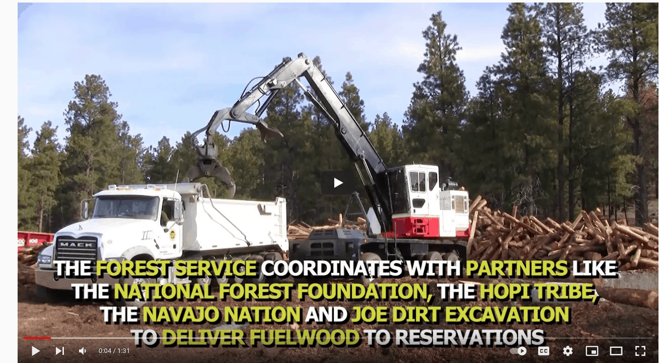
First, the cancellation of the 4FRI Phase 2 RFP does not affect any ongoing forest restoration or fuels reduction work.  We are continuing to get work done across the 4FRI landscape including critical fire risk-reduction projects in key municipal watersheds including C.C. Cragin, Flagstaff Watershed Protection Project (FWPP), and Bill Williams Mountain. We have several Good Neighbor Authority agreements (GNA) in place between the Forest Service and the State of Arizona to get this work done. We also have several stewardship agreements in place for forest restoration with key partners including the National Forest Foundation, National Wild Turkey Federation, and the Nature Conservancy. 


Second, the goals of the 4FRI project have not changed due to the RFP cancellation. We are deeply invested in landscape restoration and our intention is to work with our partners together on a new RFP as soon as possible. We are actively working with our partners, stakeholders, industry, and elected officials to ensure success when implementing future contracts or agreements. Starting with the 4FRI Stakeholders Group (SHG) and continuing with the Natural Resource Working Group (NRWG) we have discussed what we’ve all learned and how we can integrate it for success. We have already received clear feedback from our partners and industry to move forward rapidly and we will. In the next few weeks, there will be an Industry Roundtable, SHG meetings, and many discussions leading to a new proposal. The Forest Service is grateful for this support.

Changing the Game: Using Potential Wildfire Operational Delineation (PODs) for a Better Future with Fire


FACNET (Fire Adapted Communities Information Network) is one of my favorite information sources.  This article was originally posted on the Fire Adapted Communities Learning Network Blog and is reproduced here with their permission.

The whole thing is worth a read and I’ve included some excerpts that give you a taste for it. It probably won’t surprise you that I like the combination of local knowledge and spatial analytics. Check out the video about the Arapaho Roosevelt NF and the Cameron Peak fire.  The maps of that fire reminded me that we can talk past each other when people write “fuel treatment in the “backcountry” can’t help protect communities” and in some parts of the country with current megafires, we actually don’t have a “backcountry.”
************************************************************************************************************************************************************

Editor’s Note: Tyler A. Beeton and Katarina Warnick are Research Associates with the Colorado Forest Restoration Institute at Colorado State University. They recently took part in a well-attended February, 2021 virtual workshop hosted by the Rocky Mountain Research Station’s (RMRS) Wildfire Risk Management Science team (WRMS). The workshop focused on Potential Operational Delineations also called PODs. The POD framework is an emerging collaborative spatial fire planning and decision support tool. Here Tyler and Katarina share their perspective on three key themes that emerged from the February workshop. They focus on how PODs can change the game for fire operations, strategic multi-year restoration investment and planning, and co-managing wildfire risk.

It was clear from the get-go that we weren’t the only ones excited for the inaugural Potential Operational Delineations (PODs) Collaborative Fire Planning Workshop, hosted by the Rocky Mountain Research Station’s (RMRS) Wildfire Risk Management Science team (WRMS) held virtually in February 2021. Well over 500 people registered in just 3 weeks after registration went live, which maxed out the Zoom room capacity and forced the planning committee to close registration. This event and topic was something folks were ready to engage on. And there is reason why – the PODs process is an exciting and emerging framework that leverages local expertise with sophisticated modeling tools to identify features on the landscape – the streams, roads, ridges and fire scars – that have a high likelihood of containing a fire (see example below). Since taking off, the PODs framework has been developed and deployed in different contexts across the United States (over 40 national forests and counting). And while PODs were initially envisioned to support incident management, managers and communities have expanded the application of this tool in a number of ways. Several key themes related to the potential benefits of PODs emerged from the workshop, here are three.

PODs network on the Pike San Isabel National Forests. Fire managers deliberate and hand-draw effective control lines based on their local knowledge and spatial analytical tools. The control lines are then digitized to develop the PODs network seen here.

…..

Shifting strategy from random acts of restoration to a targeted approach

Several individuals emphasized that the current model of ‘stands and compartments’ vegetation management where ‘random acts of restoration’ occur opportunistically on the landscape have been largely unsuccessful at managing wildfire at scale. Big, bad fires are still happening and worsening, and the social and ecological impacts are significant. Panelists and participants noted that PODs provide a framework to shift our strategy to long-term, landscape-scale treatment prioritization. The scale of actions needed to restore fire-adapted ecosystems is immense, and it is impractical to treat the entire landscape. Using the adage ‘the only way to eat an elephant is one bite at time,’ one panelist suggested the need to strategically restore landscapes one POD at a time. Doing so could contribute to meaningful outcomes at meaningful scales, in this case changing wildfire behavior across the “fireshed”. A fireshed is conceptually similar to a watershed, though is defined as areas that encompass similar wildfire risk and where the identification and prioritization of treatments can modify wildfire behavior (Bahro et al. 2007).

The Arapaho Roosevelt National Forests leadership tested this new model of thinking. Forest managers worked with partners to construct a line of PODs running north to south slated for thinning treatments and prescribed fire, the goals of which were to inhibit fire spread and protect communities and other assets to the east. This line of defense was tested during the 2020 Cameron Peak Fire, the largest wildfire in Colorado state history. Although the fire occurred before the strategy was fully implemented, fire behavior was significantly modified in most cases where it interacted with treated PODs and previous fire scars. Check out the video below depicting the fire spread, dark red polygons depict previous fire scars. Blue polygons denote PODs that were treated (thinning, burned) prior to the fire.

This shows that if the management objective is to change wildfire behavior and risk across large landscapes, there is a need for a multi-year restoration strategy. PODs provide a useful way to carve up the landscape making it more manageable for restoration and more relevant for fire operations. In addition, PODs can provide more meaningful outcomes and a more useful and visual tool in communicating the “what” and “why” of management actions across specialists, organizations and communities. Lastly, the strategy of collaborative planning allows for a shift in focus from standard performance-measures that emphasize outputs, such as timber volume, to outcomes that promote resilient landscapes and communities.

The Rest of the Story: the LAVA Project, the Mullen Fire, and Ongoing Implementation

From the LAVA Story Map, you can click on this image to get better resolution

We’ve talked about condition-based NEPA before in several posts. At the time I worked on a CBN project (2010-ish, Obama Administration), it was considered a way to deal with the need for management at the landscape scale. You’ll remember that “increasing the pace and scale” “landscape scale” and some version of “all lands, all hands” has been the view of several Administrations, and I don’t think is all that controversial. The idea goes something like this.. with climate change and past fire suppression (Ds) or past fire suppression and lack of timber management (Rs), there is a need to reintroduce prescribed fire and to protect watersheds, communities and species from uncontrolled wildfires (exacerbated by climate change.)

If I recall correctly, condition-based NEPA is in the current Forest Service NEPA regulations. But naturally, there are disagreements about specific NEPA approaches and specific projects.

We discussed the LAVA project on the Medicine Bow National Forest as an example of condition-based NEPA. Their argument, as with the Black Hills bug project, was that the changes in conditions due to bugs required flexibility. I wrote two posts on the WaPo story on the project (usually the WaPo is not too interested in Wyoming) here and here. It attracted much attention by some environmental groups.

I also delved through the documents to find their approach to site-specific public involvement, since some had expressed concerns about how/whether that would happen.

Last summer, there were major fires in that country, so what happened with the project? Fortunately, they have a handy webpage that summarizes the current status.


February 1, 2021 – During the fall of 2020 the Mullen Fire impacted the Medicine Bow National Forest, burning portions of six of the 14 accounting units that make up the LaVA project area. LaVA implementation is on hold in the six affected accounting units while Forest staff develop a supplemental information report assessing post-fire conditions in these areas. Additional information about the supplemental information report will be shared as it becomes available. LaVA implementation may proceed in accounting units that were not affected by the Mullen Fire in the Sierra Madre Mountain Range and the Northern Snowy Mountain Range (click here for details). Additional LaVA checklists for treatments in the unaffected accounting units will be released over the next few months. The LaVA StoryMap is being updated to reflect changes in the implementation schedule due to the Mullen Fire. Launch of the updated StoryMap is planned for early spring of 2021.

  • The LaVA StoryMap is an interactive GIS map where users can:

    • Learn more about the LaVA decision.

    • Utilize interactive maps of the Sierra Madre and Snowy Ranges in combination with LaVA project analysis data.

    • View past/current/future treatment locations and information.

    • Provide feedback on future treatments and focus areas.

    • Learn about cooperating agencies.

      I thought the story map was pretty cool and I posted an image from it above. I particularly like how they’ve made it easy for people without GIS skills to look at the overlays.

      So far, there has been no litigation and implementation of the project is ongoing. I wonder why, or what changed such that organizations which were against the project have apparently chosen not to litigate.

North Versus Hanson

Experts Frustrated by Stalled Efforts to Counter Megafires

“Use every damn tool you’ve got,” he said. “If we could have beavers on crack out there I’d be donating to that process — anything that will speed up the pace and scale of this thing.”

Dr. Malcolm North

Hundreds of Giant Sequoias Considered Dead From Wildfires

It appears that rumors of ‘natural and beneficial’ wildfires in the southern Sierra Nevada have been ‘greatly exaggerated’. Even the Alder Creek grove, which was recently bought by Save the Redwoods, was decimated. Of course, this eventuality has been long-predicted.

https://www.latimes.com/environment/story/2020-11-16/sierra-nevada-giant-sequoias-killed-castle-fire

A Closer Look at the Mexican Spotted Owl CBD-Forest Service Agreement

The distribution of 200 sampling units for the Mexican Spotted Owl occupancy monitoring project in Arizona and New Mexico. The spatially balanced, random sample of sites to be included in the acoustic monitoring program are marked by purple pentagons. Symbols are not to scale.(from monitoring project https://birdconservancy.org/mso2017/)

Many thanks to Jon for finding and linking to this interesting document that describes the Mexican Spotted Owl Leadership Forum notes.  First.. who’s at the table. Looks like CBD, the FS, the USFWS, representatives of Eastern Arizona counties, timber industry, and I’m not sure of the affiliation of the others.  Maybe this is “the room where it happens,” in terms of decisions being made, in the words of the Hamilton musical. The group identified some “systemic issues.” I picked the first 13 to post here. Some of them sound very familiar from other NEPA and collaborative discussions. It’s not clear how much of that is due to the use of CBM (or condition-based management). My comments and questions are in bold.

 The “Systemic Issues” section identifies issues to be addressed to prevent future projects from being challenged. Critical among others:

1. There is a disconnect between the broader scope public documents readily available for review and what actually happens on the ground during implementation. (<em>I’m not sure whether this is a contracting/marking kind of problem, or related to CBM, or ???).

2. Site specific MSO field data necessary to select Recovery Plan recommended treatments is generally not available prior to NEPA analyses. This is likely due to cost constraints, workforce limitations and slow pace of technology deployment (e.g. LiDAR) at a time of accelerated landscape scale restoration.  (I wonder whether this matters if the field data is developed prior to design of projects?)

3. Consistent/standardized templates across projects are not used for data analysis and presentation.  (The idea of templates has been popular with NEPA improvement efforts for years, but has met with resistance from (some) practitioners. This group has a good point IMHO, that individuality and creativity by each unit works for many things, but perhaps not when folks are trying to implement projects across ownerships at the landscape scale.)

4. Data requirement interpretation varies across project (e.g. post treatment data inclusive or not of post treatment fire).

5. Generally, the NEPA process does not analyze actual stand treatments for the MSO projects but broad ranges of allowable treatments. Actual treatments are decided during field trips prior to project implementation. NEPA analyzes actions at a broad scale and in some cases (e.g. Hassayampa) appears insufficient.

6. Project level documents such as BA, BO, stand inventories, etc. are difficult for the public to access; and data that should be readily available such as project shapefiles are near impossible to obtain. Further, interagency documentations of changes are generally not accessible to the public. Such documents are, with very few exceptions, public documents that must be made available to the public. There is no ‘one-stop-shop’ location for documentation of specific projects. (This seems relatively easy to do on the FS site for the project..at the same time for many projects in many parts of the country, there is not this level of interest (e.g. shapefiles) by most of “the public”).

7. Documents tiering across agencies (from USFS to USFWS) and processes (from NEPA to consultation to implementation), combined with difficult documents access complicates
public understanding of treatments and monitoring that are implemented. For example, one project referring to another project’s monitoring plan is confusing to those not familiar with the other project.

8. Monitoring as a reasonable and prudent measure often lacks clarity and specificity at the NEPA stage and the final plan is not always appended to the BO.

9. There is no clear tool or method in place to account for the cumulative effect across various projects’ actual treatments, and to reconcile the distribution of treatments along the spectrum of intensities (including no treatment) within the landscape, as recommended in the Recovery Plan, to establish an environmental baseline among neighboring projects. (I don’t really understand what this would look like “reconcile the distribution of treatments”? but it’s probably clear in the Recovery Plan).

10. The current management practice of relying on post NEPA field trips by a few select individuals to decide upon actual treatments is not scalable to landscape scale restoration.(This probably is also relevant to other CBM protocols, we’ve discussed this about programmatic kinds of CE’s).

11. Current MSO management appears to be a precursor of the proposed general “Condition Based Management” (CBM) in the on-going NEPA Revision. Lessons learned in the MSO Workshop are likely applicable to CBM at-large, as relates to communicating to the public the treatments and monitoring that are actually implemented.

12. The lack of succession plans and depth of bench for critical resource personnel with unique projects knowledge, compromises the robustness of the USFS and USFWS processes. (I just ran across an old NEPA review in my files that said access to specialists was a problem (at least for one forest, about 20 years ago).

13. A workshop or series of workshops is needed to address the systemic issues.

BLM Great Basin fuel break EIS

The BLM has released its final decision to implement 11,000 miles of fuel breaks in six states.  The figure is in miles because the fuel breaks would be constructed along roads and right-of-ways.  Given our discussion of the Forest Service trend towards large landscape “condition based” management decisions, this language from an article quoting the BLM piqued my curiosity (my emphasis added):

According to Jennifer Jones, a spokeswoman for the BLM, the program will help streamline the implementation process by reducing or eliminating the need for environmental analysis. Once the plan is finalized and funding available, said Jones, “offices will be able to use it immediately and for many years to come.”

The timeline for implementation and the location of fuel breaks will depend on what offices develop plans and apply for funding.

The BLM’s notice of availability added:

… these potential treatment areas cover approximately 38 million acres within the project area boundary.

The goal of these Programmatic EISs is to significantly minimize the subsequent National Environmental Policy Act (NEPA) work required to approve on-the-ground projects.

(A second EIS will address “fuel reduction and restoration” over the same area.)

These statements sound like the more conventional approach to programmatic NEPA analysis (such as has been done for the use of herbicides).  They are intended to provide context for subsequent site-specific analysis that will produce overall savings in planning efficiency.  They make no pretense that this large scale analysis would necessarily be a substitute for site-specific analysis as some Forest Service proposals have stated. This kind of “merely programmatic” analysis has sometimes been given more leeway by the courts because a subsequent site-specific analysis would follow that would address site-specific issues and effects that have not been addressed.

The BLM decided also to do an EIS, unlike some of the Forest Service efforts that used an EA.  This analysis of effects of fuel breaks is also probably more site-specific than area-wide, “condition-based” Forest Service proposals because they know where the candidate corridors are, and they know the area of BLM lands where no action would be taken (away from these corridors).   (The scientific validity of fuel breaks is also discussed.)

Multiagency Effort Spawns Giant Forest, Recreation Project in Pend Oreille County

From the Spokesman-Review here via the Forestry Source. Note: “This is the first time that a tribe is doing environmental analysis for the forest service using state funds.”

Twenty years ago, the proposal being presented at public meetings in January for forest restoration and recreation projects on 90,700 acres in Pend Oreille County would only have been a pipe dream.

That was at the height of the “timber wars,” pitting pro-logging interests against environmentalists and bringing logging to a halt.

The project area north of Newport and east of the Pend Oreille River is a patchwork of tribal, state, federal and private lands. This is the first time that a tribe is doing environmental analysis for the forest service using state funds. When complete, it should vastly improve forest and watershed health for all land owners with a bonus of increased recreation opportunities.

Project area land owners are: Colville National Forest, 41,600 acres; Kalispel Tribe of Indians, 3,700 acres; Washington Department of Natural Resources (DNR), 8,200 acres; private, 37,000 acres; and Washington Department of Fish and Wildlife, 200 acres.

All the actual work in the project will be done on forest service land, but the partners hope others will follow, especially private timber land owners. The DNR and Kalispel Tribe have been working on forest health and watershed improvements on their land already.

This project is the culmination of years of increasing forest fire danger caused by poor forest management and a new spirit of collaboration between forest managers and some environmentalists. It is also a milestone for this new-age management, because it is the first project in the nation with so many partners working on this large of an area.

But it isn’t without challenges.

“Get past the feel-good part and reality is, it is hard to get agreements,” said Gloria Flora, project coordinator for the Sxwuytn-Kaniksu Connections Trail Project. “We proceed with caution.”

The Kalispel Tribe refers to the project as Sxwuytn (s-who-ee-tin), a Kalispel Salish word that roughly translates to connection or trail. This planning effort is also referred to as Kaniksu Connections to acknowledge the building and strengthening of connections and relationships across landscapes and boundaries.

Flora said that everyone won’t agree with what the group proposes and challenges in court are possible. But she said she feels that “old-school protests” need to change.

She points to the 9th Circuit Court of Appeals statements last year in the ruling in favor of the Colville National Forest and its large A to Z forest restoration project in Stevens County. The court said the environmentalists objecting had a chance to be at the table in the planning process and should have been involved but weren’t.

Flora has been at the table for forest planning projects for many years. She has worked 23 years in forest management around the country with the past seven in this region.

She founded and directs Sustainable Obtainable Solutions, a nonprofit organization that works to ensure the sustainability of public lands. Her former forest service career included serving as forest supervisor on two national forests.

Given the scale of forest health problems in Eastern Washington, the DNR, federal agencies and other partners agree that to meaningfully reduce wildfire and forest health risks, it will take coordinated actions across land ownership boundaries at a watershed scale. The forest land owners can’t just work their patches independently or not at all.

Condition-based project in Georgia

We’ve discussed “condition-based” NEPA analysis and its legal implications – mostly thinking about timber management.  Here’s the Foothills Landscape Project, affecting 157,000 acres on the Chatahoochee-Oconee National Forest.  It raises the usual concerns about  NEPA sufficiency (it’s an EA, which was a key factor in the Tongass case injunction).  Here’s how it works, according to the EA:

The locations and timing of treatments would continue to be selected and prioritized using a systematic process that evaluates restoration needs, determines appropriate treatments to address those needs (through use of decision matrices) and balances implementation of those activities with operational feasibility, agency capacity, and social considerations, to the extent possible.

But apparently no further consideration of environmental impacts.  Here’s a statement that caught my eye, because the whole point of NEPA (as stated in many court opinions) is to analyze effects before you take action, whereas it sure looks like their intent is to act and then see what the effects are:

If, as a result of monitoring, the effects of activities require management or maintenance treatments that fall outside of the treatment toolbox options assessed within this EA and the forthcoming decision, additional analyses could be warranted.

I’ve also got NFMA concerns if what they are doing is establishing new long-term management direction (which should be in a forest plan) without going through the forest planning process.  How are “project design” requirements different from forest plan standards?

But what was new to me was the application to developed recreation sites, as described here:

On the recreation side, the project looks to make strides to improve the visitors’ experiences by enhancing existing trails and campsites that are used heavily while closing those that are not rarely used and no longer sustainable.
“We don’t have any specific proposals in any specific campground, but we are going to look at the conditions in areas that make sense … “We don’t have a lot of hard proposals, but basically we just want to make investments in areas that have high resource protection and high visitors’ satisfaction,” Grambley said. “We’re proposing reroutes to properly layout trails because we realize that a lot of our trails go straight up a ridgeline and we don’t want that because it causes erosion and it’s not fun to hike quite honestly. So we want to make the trails more sustainable and more-friendly layouts.”

These sound like the kinds of priorities that a forest plan should establish.  But when we want to implement them?  Just trust us to know what “makes sense.”


150,000 acre “project” on the Bitterroot

Well, not exactly, maybe.  This could be a good example of how to get the public involved early enough in the process for timber harvest decisions that the locations have not been determined yet.  But consider that the decision-maker is the same one who applied “condition-based” NEPA analysis to the Prince of Wales area of the Tongass, which has ended up in court.

Bitterroot National Forest Supervisor Matt Anderson has added a new “pre-pre-scoping” stage to the process, not part of the traditional process in which a set of options is presented to the public for review and analysis.

The new approach is meant to get the public involved prior to coming up with any specific actions being planned for any specific location.

That much I like the sound of.

“There is confusion,” said Anderson. “It’s hard for the public to get involved. We are asking ‘What do you want to see? What’s your vision?’” He said the agency was “starting at the foundational level, not any particular location.” He said it was important to get to those particulars but the way there was to first describe the “desired future condition that we want and then look at the various ways we can achieve it.”

Asked about the fact that the current Forest Plan describes a desired future condition for the Bitterroot Front that involves returning it to primarily a Ponderosa pine habitat with little understory, Anderson said that is in the current plan, but that the plan is about 30 years old. He said a lot has changed in that time on the ground. There have been lots of fires and areas where no fires have occurred, and the fuel load has gotten extremely high. He said current conditions need to be assessed and they were currently compiling all the maps and other information they need to get an accurate picture of what is on the ground today in the project area.

This should raise a concern about how this process relates to forest planning, since forest plans are where decisions about desired conditions are made.  However, old forest plans typically didn’t provide desired conditions that are specific enough for projects, so that step has occurred at the project level.  Under the 2012 planning rule, specific desired conditions are a requirement for forest plans, but the Bitterroot National Forest is not yet revising its plan. Whatever desired conditions they come up with should be intended as part of the forest plan, and the public should be made aware of this.  If the new decision is not consistent with “Ponderosa pine habitat with little understory,” they’ll need an amendment to be consistent with the current plan.  (I’d add that changes in the on-the-ground conditions over the last 30 years shouldn’t necessarily influence the long-term desired condition.)

“The Tongass is so different than the Bitterroot,” said Anderson. “There is not much similarity. I’m not trying to replicate that process here. It was a conditioned-based process up there. It’s like comparing apples to oranges.” In reference to conditioned-based projects, he said, “One difference with this project is that some of that will be pre-decision and some of that will be in implementation. We are trying to shift some of the workload to the implementation stage.”

He said they have a slew of options, from traditional NEPA, to programmatic NEPA to condition-based NEPA “and we are trying to figure it out.”

He insists that the NEPA process will be followed with the same chance for public comment and involvement on every specific project that is proposed in the area.

There’s some ambiguous and possibly inconsistent statements there.  Condition-based NEPA seeks to avoid a NEPA process “on every specific project.”  I could also interpret shifting workload to “pre-decision” and  “the implementation stage” is a way to take things out of the NEPA realm.

And then there’s this:

In response to the notion that the huge project is being driven by timber targets and not health prescriptions, Anderson said that the Regional Office had set some timber targets for different areas of the region, but that those targets were not driving the analysis.This project has nothing to do with meeting any target,” said Anderson.

This feels a little like “There was no quid pro quo.”  Would timber harvested from this project not count towards the targets?  (I’d like to see  targets for achieving desired conditions.) All in all this project would be worth keeping an eye on.

(By the way, here’s the latest on Prince of Wales.)