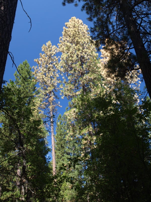
Rocky Mountain Restoration Initiative- Focused Landscape Restoration

In La Plata County, about 53,800 people, or 96.9% of the total population, live in the wildland-urban interface where residents are at-risk of wildfire. A pilot project aims to build a better buffer around these homes.
Durango Herald file
I hadn’t heard about this effort until the the Durango Herald story here. The article has great photos, also it was interesting that 96.9% of folks in La Plata County live in the WUI. The National Wild Turkey Federation is coming out with more info later this week, so stay tuned.

Southwest Colorado could be the focal point of a pilot project that seeks to make strides in improving forest health in the face of increasing dangers from wildfire, disease and beetle kill.

Earlier this year, the National Wild Turkey Federation approached the U.S. Forest Service to talk about the challenges in forest management that impede fast-paced and large-scale landscape restoration.

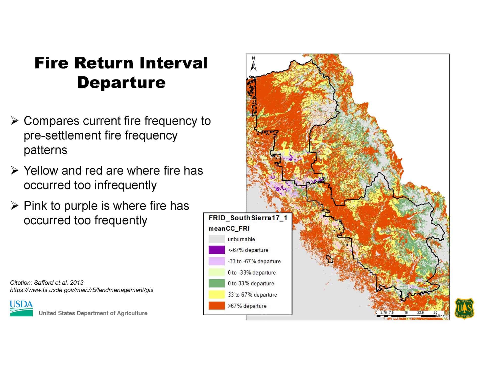
In the past, the Forest Service has tried to spread its budget for forest health projects evenly across a landscape, said Kara Chadwick, supervisor for the San Juan National Forest.

“We’ve been struggling with this as an agency for a while,” Chadwick said. “We get a little bit done everywhere.”

But forest officials started to wonder: What if you directed all your resources, in terms of time and money, to one or two places to accomplish critical improvements, rather than make slow progress in multiple places.

“The idea is to focus in one place, and once you’ve achieved that change on the landscape, move to another,” Chadwick said.

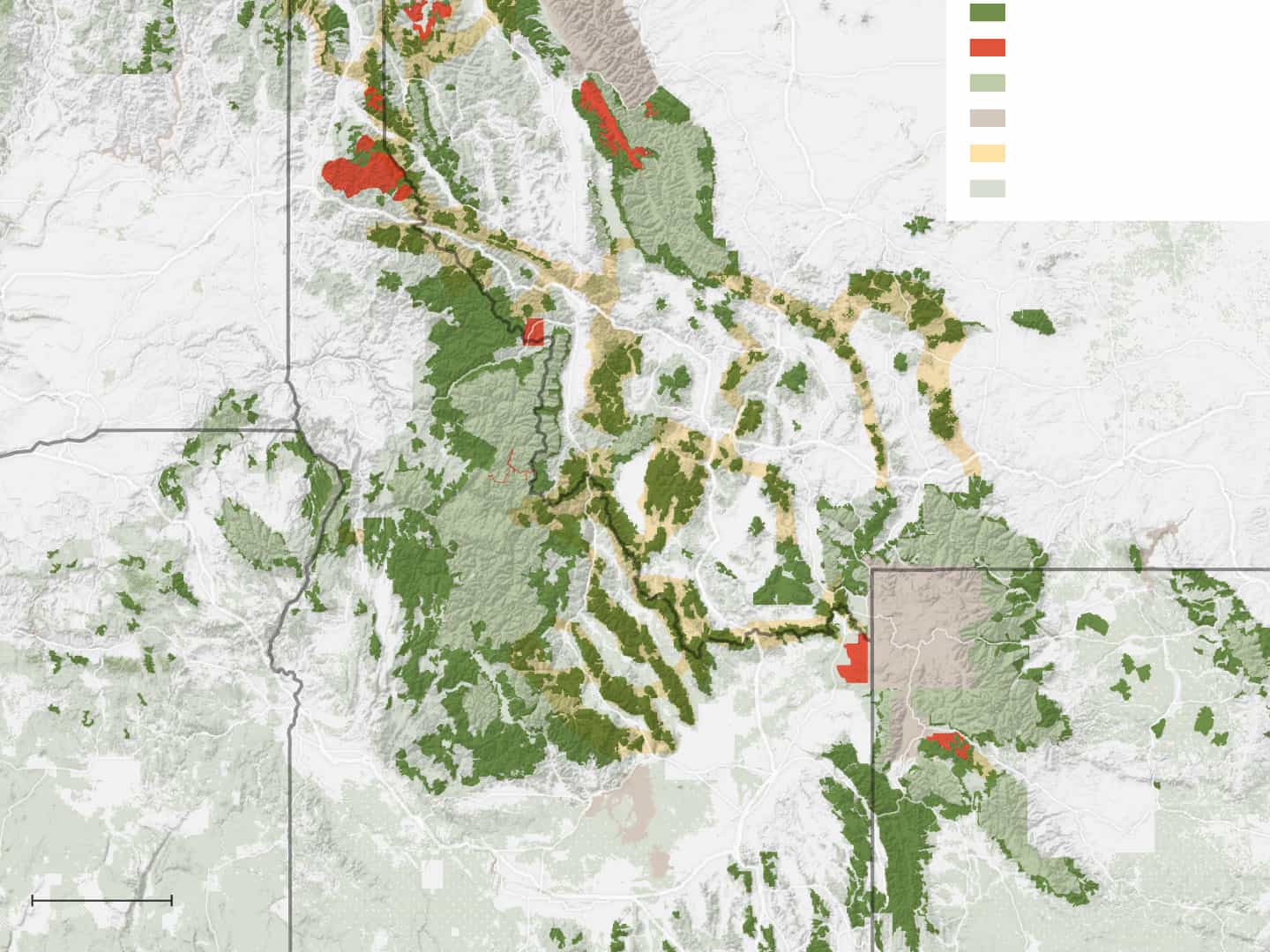
The project is called the Rocky Mountain Restoration Initiative, or RMRI.

Colorado was chosen as the state to pilot the project for several reasons: It’s home to the headwaters of four major river systems; nearly 3 million people live in the wildland-urban interface; and outdoor recreation is a big part of the state’s economy, to name a few.

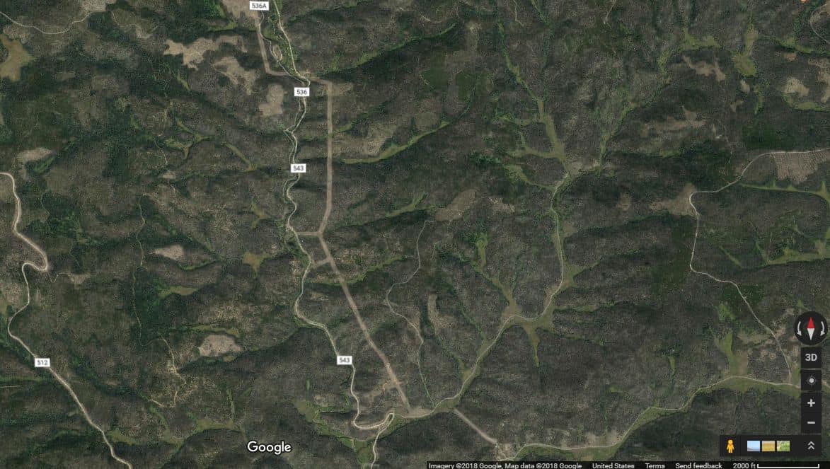
Within the state, three regions are being considered to test the project: the central Front Range, the Interstate 70 corridor and Southwest Colorado.

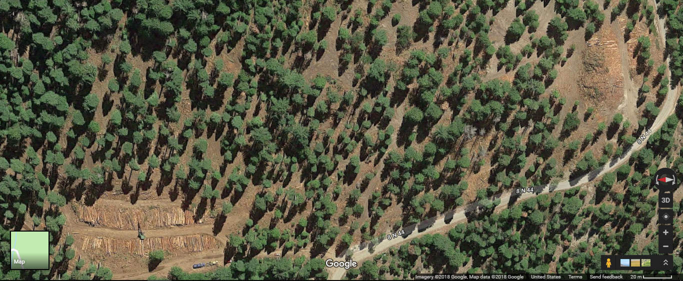
The idea, Chadwick said, is to work across all boundaries – federal, state and private lands – to make “transformative change” on the landscape through projects like forest thinning, prescribed burns and boosting logging operations.

Chadwick said areas around Durango, west along the U.S. Highway 160 corridor and up to Dolores could be areas of particular focus.

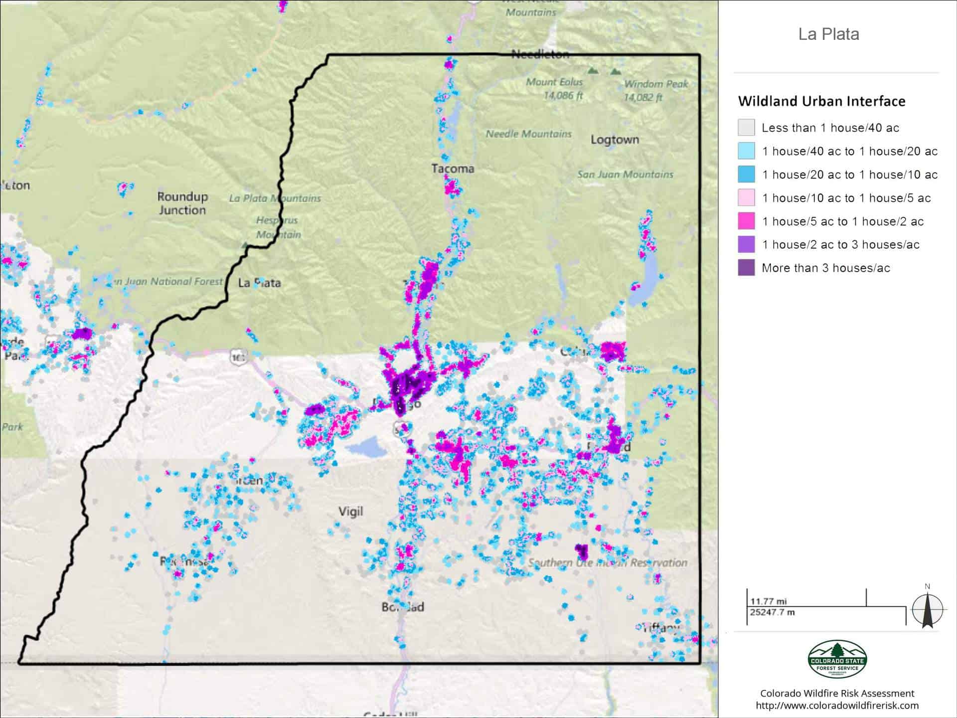
In La Plata County, for instance, about 53,800 people, or 96.9% of the total population, live in the wildland-urban interface.

Another major part of the program is to improve and protect watersheds. Mike Preston with the Dolores Water Conservancy District said the pilot project could also be used to thin badly overgrown ponderosa forests in the Dolores River watershed.

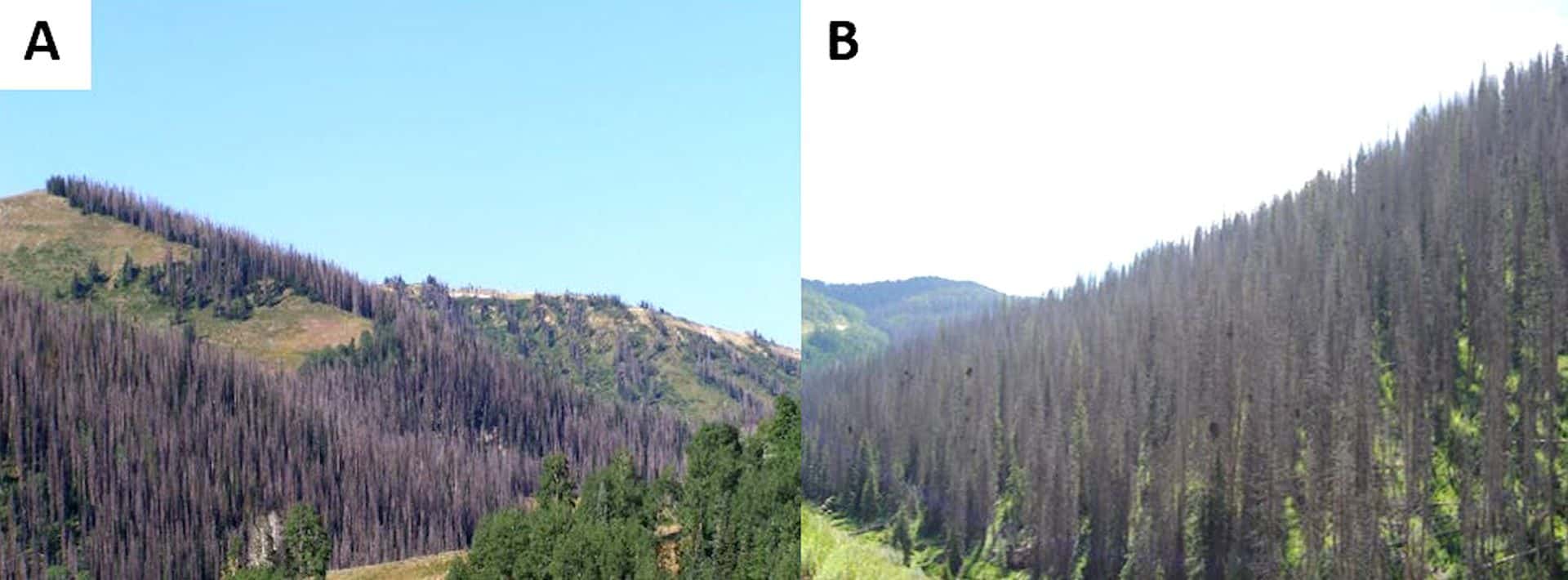
Past forest management practices have created too-dense tree stands, which can exacerbate issues with wildfire and beetle spread, as well as suck up an inordinate amount of water, Preston said. Encouraging prescribed burns and forest thinning through harvest sales could help with all these issues, he said.

“The problem is, with limited resources available to advance forest health, the pattern has been to spread resources across the entire forest,” he said. “With this project, we’re attempting to concentrate on one or two projects and see what can be accomplished moving more aggressively and timely.”

Chadwick said the hope is to have a final decision on the pilot project by this December. Any work on the landscape would have to go through the National Environmental Policy Act, which requires a study on the environmental impacts of a particular project.

“I think we can get a lot of really good work done, and in the process, build better relationships across the landscape,” she said.

Initiation of “Moving Toward Resiliency Within the Mokelumne to Kings Landscape” (MOTOR M2K) Project

Thanks to Sue Britting for bringing this to our attention. Below are links to the information presented at the public meeting with regard to the large landscape NEPA project currently being initiated on the Stanislaus and Sierra National Forests.

Their argument seems to be that they want to work towards NRV, and based on historic conditions and acres burned, that will take doing more than they currently are doing. They have this interesting table in their briefing paper (attached below). Note that the total acreage of both forests is approximately 2,200,000 acres (not sure that is exactly the right denominator to use) so treating 20K acres per year, as they are currently doing, would be about 1 percent. Please feel free to check my math. Based on this table, their desire is to treat 10% of the Yellow Pine Mixed Conifer, but that 100K per year would be about 5%/year  of the acres on the two forests. I agree with others the this is perhaps overly ambitious personnel and funding-wise, but I also don’t see that it hurts to be ready NEPA-wise for some unknown increased level of activities and to be able to take advantage of opportunities as they occur.

Please check out all the NRV documentation, maps and photos in the Powerpoint 2019-0711_MOTOR_M2K_JUL 11 Presentation_V5revised. The 2019-0702_MOTORwithinM2K_Project_Brief describes the idea and the process. The BP also has links to other landscape-scale NEPA projects.

One suggestion for discussing this.. doing things differently is not necessarily a highly valued trait in Forest Service culture. I can’t remember who said something like “organizational antibodies to change attack new ideas, and suck the life out of them until they are dried up husks and blow away”. In my own experience, it can be hard on employees to be asked to devote their attention to something new, that isn’t “the way we’ve always done it”, and might not work out. So let’s try to assume the best about their intentions, and not give these human beings any unnecessary grief.

Large-Scale NEPA and Specificity: Tennessee Creek Project Litigation

Note, this might not be the final map.

I’m pretty sure we’ve talked about these landscape NEPA documents before. They have been questioned for lack of site specificity for treatments. Here’s another one that’s been successful, with an endangered species involved.

It’s the Tennessee Creek Project on the PSICC National Forest. The project area is 16,450 acres, and activities are expected to occur over 10- 15 years. Actions are a mix of thinning, clearcutting (lodgepole) and prescribed burning. Here are the acres treated:

Regenerate lodgepole pine through mechanical means on 3,790 acres.
Thin 2,685 acres of mature lodgepole pine stands. Pre-commercial thin 345 acres of advanced regeneration of lodgepole pine (3,030 acres total would be thinned).
Improve the health of aspen stands through prescribed fire and/or mechanical means on 180 acres.
Utilize prescribed fire on 5,485 acres.

I think it will be interesting to compare this with other successful landscape projects. We could track two things about them, project area, and acres treated divided by years, in this case about 10K/10 years or a “1K a year project.” Due to the number of acres treated this wouldn’t fit into the restoration CE. It’s interesting to speculate if you were a NEPA practitioner and had that CE possible, would you reduce the number of acres to fit, and how much work would that save (knowing that you still wanted to do more acres), with perhaps another future CE? Or is the limiting factor the budget, and your District’s budget allows a certain number of acres treated per year, and then you would decide how many years the work approved in a restoration CE would last?

From a Colorado Springs Gazette story here:

But the plan, known as the Tennessee Creek Project, which targets more than 16,000 acres of the Pike and San Isabel National Forests, hit a snag a few months after its final approval. On April 23, WildEarth Guardians, a nonprofit environmental advocacy group, sued the Forest Service, claiming that the agency’s plan has miscalculated the harm that would be done to the habitat of the threatened Canada lynx.

The project also represents what could be a disturbing trend in Forest Service practice, where logging projects are approved without specific details about areas that will be logged
, said John Mellgren, an attorney with the Western Environmental Law Center that represents WildEarth Guardians.

“The real problem with the project is the Forest Service just drew a big circle on the map,” Mellgren said. “(They) are going to log some part of this circle, but won’t tell you where they are going to log. If they stayed out of those areas, we might not have a problem with the project right now.”

This quote raised some questions for me, because it seems to me that part of a landscape scale project would be to say what treatments would go where, not spatially, but say in terms of lynx habitat. Note: lynx was reintroduced to Colorado.

Sure enough, Judge Hartz did not agree with WEG, and also not on their idea that the project required an EIS. Note to Jon: SRLA figured prominently in the Judge’s discussion.

Here’s a link to his decision. With regard to “site-specific”

But Richardson did not hold that an agency’s EA or EIS always must specify the precise locations within a project area that will be affected. The problem in Richardson was simply that there had been no environmental assessment of the ultimate plan. The earlier assessment contemplated a significantly different project from what was later selected. That is hardly the case here. The EA analyzed what could happen whatever sites were eventually chosen for treatment by the Project, so long as the Project restrictions were satisfied. The Service’s analysis accounted for the uncertainty about treatment locations by evaluating the Project’s effects on lynx in a worst-case scenario in which all the mapped lynx habitat in the Project area is treated, and by including conservation measures to protect high-quality lynx habitat, such as not treating healthy spruce-fir stands or any stands with greater than 35% dense horizontal cover. Moreover, the Service had a valid reason for not identifying specific treatment sites in its EA: it intends to select treatment units based on changing on-the-ground conditions over the 10 to 15 years of the Project. NEPA leaves “substantial discretion to an agency to determine how best to gather and assess information” about a project’s environmental impacts. Biodiversity Conservation Alliance v. U.S. Forest Serv., 765 F.3d 1264, 1270 (10th Cir. 2014). The Service used that discretion reasonably, assessing the Project’s maximum possible effect on lynx habitat while also conserving agency resources and retaining flexibility to respond to changing conditions. See Utah Shared Access Alliance, 288 F.3d at 1213 (“By conducting an EA, an agency considers environmental concerns yet
reserves its resources for instances where a full EIS is appropriate.” (internal quotation marks omitted)). We note that the Service was not postponing the requisite environmental analysis until it picks the specific sites for treatment under the Project; rather, it was saying that such future analysis would be unnecessary because, in its expert opinion, whatever sites it ultimately chooses (within the constraints imposed by the
Project), there would not be a negative impact on the lynx.

“Landscape-level” Utah Project

The Salt Lake Tribune has this story on “a landscape-level program of salvage logging, thinning, prescribed burns and reseeding in a 171,000-acre project area along the crest of the Wasatch Plateau.”

Since 2000, bark-boring beetles have killed nearly 90% of the Engelmann spruce on the plateau separating Sanpete and Emery counties, according to Ryan Nehl, supervisor of the Manti-La Sal National Forest. Other areas have become overrun with subalpine fir, crowding out aspen.

Currently spruce occupies 5% of this forest, while fir makes up 85%. The Forest Service’s goal is get that species mix to the 60%-30% range favoring spruce, but it could take decades. Nehl also wants to see aspen stands revitalized because of their importance to watershed health and wildlife and their ability to slow big fires.

“While this project is couched as a timber sale, it’s primarily a hazardous fuels-reduction project to try to stem the risk of uncharacteristic wildfire. It’s overstocked right now,” Nehl said. “Another primary purpose of this is to reduce risk to communities and firefighters, particularly culinary and irrigation water supplies, as well as water supply to the [Huntington Power] Plant.”

Here’s the Canyons HFRA Project Environmental Assessment FONSI.

The Forest Service proposes to salvage dense dead standing and down Engelmann spruce (Picea engelmannii) and implement fuel reduction treatments under the Healthy Forest Restoration Act (HFRA). These actions are proposed to be implemented on the Ferron-Price and Sanpete Ranger Districts, Manti-La Sal National Forest, in Sanpete, Carbon, Emery, and Sevier Counties, Utah (Figure 2). The project area where treatments are being considered is approximately 171,000 acres.

Bark Beetle Epidemic in Calaveras County


The bark beetles started their invasion when I used to live there, in Mark Twain’s famous Calaveras County. Now it looks like it has reached epidemic levels, requiring emergency action, from multiple agencies.

http://www.calaverasenterprise.com/news/article_fbc896b8-7d6f-11e9-94ea-7b4b381822a0.html

Even with recent wet winters, tree mortality will remain a pressing issue as long as bark beetle infestations and drought conditions continue, said Brady McElroy, a hazard tree specialist in the Calaveras Ranger District of the Stanislaus National Forest.

“By no means is the issue going away,” McElroy said. “What the Forest Service has to focus on are the high priority areas, the immediate hazards to homes, roads and highways.”

In the long-term, McElroy said the Forest Service hopes to increase the pace and scale of thinning projects to restore overstocked forests that have been allowed for by a century of fire suppression.

“Our forests are overstocked, which increases competition (and) stressors on the trees, (and consequently) their ability to defend against bark beetle,” McElroy said. “The ongoing goal is to thin forests to a healthy kind of pre-European settlement stand to where they’re a little more resilient. We’re focusing on high-priority areas in the wildland-urban interface … We know what happens when these overstocked forests catch fire – we lose them.”

Diana Fredlund, a public affairs officer with the Stanislaus National Forest, said that although federal budget decreases have impacted the scale of the work for the Forest Service, the agency has been able to collaborate with private, county, state and other federal agencies and contractors for tree removal projects.

“We do what we can with what we have,” Fredlund said.

The Forest Service offers its own tree mortality program for homeowners with properties adjacent to Forest Service land. Property owners can fill out a Hazard Tree Evaluation Request Form to be considered for hazard tree abatement.

A big timber project gets a big lawsuit

(Clear-cutting in the Tongass Forest, Alaska | by musicwood)


Over the years, the Forest Service has dreamed of being able to do “big gulp” projects, or in contemporary terms, “landscape scale” projects. These essentially amount to doing one EIS for a large area and a long time period before the actual locations and treatments have been determined. There are many of these in progress now across the country, and the approach is being tested (again) in court in Alaska on the Tongass National Forest. This Earthjustice news release includes a link to the complaint (filed May 7), which includes the following:

The Prince of Wales Landscape Level Analysis Project (the Project) in the Tongass National Forest includes extensive old-growth and second-growth logging. The project area is roughly 2.3 million acres. The project area contains about 1.8 million acres of national forest land. The Project authorizes logging of up to 656 million board feet (mmbf) of timber. The U.S. Forest Service (Forest Service) estimates that this logging would occur on over 42,000 acres. The Forest Service estimates about 164 miles of roads associated with the logging would be constructed as part of the Project. The Record of Decision authorizes implementation of the Project to take place over a span of fifteen years.

The Forest Service has authorized this Project using an approach that has been soundly rejected by the courts. The agency authorized the Project before identifying specific locations for logging or road construction. As a result, the FEIS does not adequately describe the direct, indirect, or cumulative impacts of the Project on the human environment or on subsistence uses.

In the 1980’s, the Forest Service lost at least two court decisions for failure to provide adequate site-specific information and analysis in the environmental impact statements (EISs) for Tongass timber sales. City of Tenakee Springs v. Block, 778 F.2d 1402 (9th Cir. 1985); City of Tenakee Springs v. Courtright, No. J86-024-CIV, 1987 WL 90272 (D. Alaska June 26, 1987). In subsequent Tongass timber sale EISs, the Forest Service began including comprehensive, detailed quantitative and qualitative descriptions of the logging and road access plans for each harvest unit proposed for sale. When it did so, the courts upheld the adequacy of the site-specific information. Stein v. Barton, 740 F. Supp. 743, 748-49 (D. Alaska 1990).

The FEIS’s Response to Comments states that “it is not possible to determine all of the direct, indirect, or cumulative impacts to wildlife habitat or connectivity that could result from this project before implementation.” Implementation of a particular part of the project has begun, apparently with no project-specific NEPA planned to determine those effects. Plaintiffs necessarily are challenging the entire project decision for violation of NEPA (and ANILCA) procedures.

There is a related NFMA issue that results from the Tongass forest plan imposing data requirements on projects that are hard to meet at this large scale, making the project inconsistent with the forest plan.  While this involves specific language in the Tongass plan, all forest plans explicitly or implicitly require certain analysis prior to projects.  The bigger the area, the harder that is to do.  And the trend of recent plan revision documents is to put off decisions about things like ecological integrity until project planning.  If successful, this could create an imposing analytical burden for large-scale projects like this one.

They are still going to have to do a site-specific NEPA analysis somewhere. The end result of all this may be that the Forest Service will create another level of planning and NEPA for “timber programs.” Just like the old days, except now added to the existing current plan and project level processes.

Northern Rockies Ecosystem Protection Act- Groundhog Day Stew with a Dash of Trump

Apologies, I couldn’t get the color explanations to print out.  Dark green is new wilderness and orange “wilderness recovery areas.”

I looked this Act up on Wikipedia and it turns out that the same (?) bill seems to have been introduced in 2011 (and dates back to 1993?) by the same folks with testimony by Carole King starting in 1994. Nevertheless, we are assured the New York Times writers, Mike Garrity of Alliance for the Wild Rockies and Carole King, of singing fame, of this op-ed that it’s particularly important to do it now because:

To be fair, the Obama administration also pursued some of those actions. But the current administration’s zealotry threatens the region’s wild landscape and rich biodiversity…

Of course, when the Times writes about the interior West, we can assume that we are dealing with the imperial gaze. There are a couple of interesting points I’d like to draw out, but would like to hear from people who know more about the bill and about the history (and the other Rocky Mountain Front Wilderness additions and how they fit together), and to link to our recent discussions, what are “Wilderness Recovery Areas?”

Big Gulps Mean Big Targets.  There is a reason that the FS and partners aren’t usually thrilled about “big gulp” projects or “landscape scale restoration via large projects”.  They mean big total numbers that can be used in media campaigns, and attract big attention from folks who are of a litigious bent.

In August, a three-judge panel of the United States Court of Appeals for the Ninth Circuit voted unanimously to halt a planned 125-square-mile logging and burning project in the Payette National Forest in western Idaho. The court concluded that parts of the project ran counter to the forest’s management plan.

Under that project, so many trees would have been cut that the forest would have no longer provided elk or deer with the cover they need. Forest streams would have been filled with sediment from bulldozers building miles of new logging roads — further damaging the native fisheries for which the Northern Rockies are internationally famous.

Without looking at the EIS, I think “the forest no longer providing elk and deer the cover they need” is probably an overstatement.

Forest streams “full of sediment”? Doesn’t the State of Idaho have water quality requirements? Yes, they do, in fact they have audits and a continuous improvement program. I did not get the “full of sediment” feeling from reading the 2016 audit found here.

All Roadless to Wilderness
Under the 2001 Rule, the only things you would be kicking out to change to Wilderness are pre-existing oil and gas leases (before 2001 RR or possibly gap when 2001 RR was enjoined), OHV’s and bikes. But that’s based on reading the Maloney summary linked in the op-ed here and not the whole bill.

  • Designate all of the inventoried roadless areas in the Northern Rockies as wilderness, protecting 23 million acres of land that is home to vital ecosystems and watersheds

  • Establish a system to connect biological corridors, ensuring the continued existence of native plants and animals

  • Keep water available for ranchers and farmers downstream until later in the season when it is most needed

  • Allow for historic uses such as hunting, fishing and firewood gathering

  • Protect forest canopies that absorb greenhouse gases

I don’t know many folks who gather firewood in wilderness, nor in roadless areas… because they gather firewood near roads to get it home.

Et tu Wikipedia?
The entry in Wikipedia says under Opposition to the Legislation here:

Opponents to the NREPA state that there will be a loss of extraction jobs in the northern Rockies; mining, logging, and oil/gas production as a whole account for many of the jobs in the five affected states. [5

But if they’re already Roadless, then how much mining, oil and gas, and logging is going on? This is all very confusing. It would be great if every Wilderness bill or RWA or any special designation, for that matter, would simply have a table of “what’s currently allowed in terms of plans/rules/designations currently” “what will not be allowed under the new designation” “what existing users (actually on site, not potential) will not be allowed to continue their uses” and “what do we know about where those people will go.” IMHO,so much drama and needless carbon -impacting electrons could be saved by a standard Change Of Use Table for every potential change in designations!It also directly would acknowledge that the kicked out folks will go somewhere else and perhaps introduce opportunities and resources for helping them transition as part of the designation process.

Oregon logging history map

Oregon Wild has compiled an  interactive map of logged and thinned areas on public and private lands across the state of Oregon.  If nothing else, it’s hard to look at this and accuse anyone wanting to keep logging out of new parts of their public lands of being an “extremist.”

Oregon Wild intends to use this mapping tool to help advocate for forest conservation and demonstrate that while there have been temporal pulses of increased logging intensity over the years, logging is always very active on both public and private forests in Oregon. In fact, if anything, the analysis on this site underrepresents the true extent of logging taking place.

The tool is also a great visualization of the few Wilderness and roadless wild lands remaining in the state – while it does not highlight these areas, they are clearly visible by their noticeable lack of logging units. These last bastions of wild landscapes are far too rare in Oregon, a reason Oregon Wild is working to protect what is left.

We can also use the tool to push back on misinformation spouted by timber interests.

  • Many say that logging on public land was “shut-down” by the spotted owl and Northwest Forest Plan, first implemented in 1994, but the data shows that logging continued apace throughout the Northwest Forest Plan region after the plan was adopted.
  • Logging advocates also say we need the increase the “pace and scale” of logging to reduce fire hazard in the dry forests of eastern and southwest Oregon, but the data show that thinning has already occurred across vast portions of these forests.

Sierra Nevada Logging Examples

Back in 2012, I worked my last season with the Forest Service, on the Amador Ranger District of the Eldorado National Forest. In particular, I led the crew in marking the cut trees in this overcrowded unit.

The above picture shows the partially logged unit, as well as the sizes of logs thinned.

This part of the same unit shows a finished portion, and two other log landings.

Here is a link to the larger view.

https://www.google.com/maps/@38.6022239,-120.3284245,1019a,35y,90h/data=!3m1!1e3?hl=en

There are also other completed cutting units in the area, which I worked in. Most of those were also cut in 2018, six years after they were marked. The existing plantations were cut back in the 80’s. At least one new goshawk nest was found, and the cutting unit was dropped.

Increasing the Scope and Scale of Treatments- WaPo Story on the Medicine Bow Landscape Project- II of II

From Google Maps. You can look around the town of Encampment, WY at different scales and scan areas in the mountains to the E and W. You can also click on this photo for more detail on a small area.

This is the second of two posts on the Washington Post story here about the Medicine Bow Landscape Vegetation Analysis LAVa project. All project information available here.

As to environmental groups, there’s a quote from Chris Topik, at The Nature Conservancy:

“If we are going to have a chance at combating climate change, forests are one of our best tools for mitigation because they sequester carbon,” said Chris Topik, director of the Nature Conservancy’s Restoring America’s Forests initiative. “So it’s vital that we help them to adapt.”

And then there’s the “science” angle. The story says “some biologists,” but only one is quoted.

Not everyone considers the plan a good idea. Some biologists say science does not back up the efficacy of the treatments proposed, particularly logging and the prescribed burns that the Forest Service calls necessary for lodgepole pine to reproduce and more diverse species to take root.

“They say they are going to reduce fuel loads to limit wildfires, and the literature doesn’t support that,” said Daniel B. Tinker, an associate professor at the University of Wyoming, who has studied the region for 23 years. “We’ve had fires this summer that burned through areas that were clear-cut 15 years ago. Those stands weren’t supposed to burn for 100 years.”

Reducing fuel loads, as we have seen, to change fire behavior and to provide opportunities for suppression forces to operate, are indeed supported by massive amounts of literature and the relatively humble fuels treatment effectiveness reports, as we have shown on this blog. Taking a look at Tinker’s recent pubs on the U of Wyo website here, doesn’t convince me that he’s an expert on wildfires nor fuels. But good one to the WaPo for interviewing someone local.

We can read this and instead think that conservation groups are divided on this.. first we have TNC, and then we have WEG.

Conservation groups also say that the Forest Service truncated scientific review in a rush to meet congressional demands for increased timber production on public lands. For now, the proposal does not specify which parcels would be targeted and where those hundreds of miles of road would be built.

“They are trying to fast-track this,” said Marla Fox, an attorney for WildEarth Guardians. “This is in line with the agency’s shift and approach under the Trump administration to ‘get out the cut,’ which means ‘let’s do some logging in the name of restoration.’ ”

NEPA-ites may chuckle at the use of “rush” when talking about an EIS. The article also says “Some pushback is internal. A group of Forest Service employees is skeptical that the agency can pull off an undertaking of this size.” Now I don’t doubt that many FS employees think different things, but this makes it sound like current employees are “pushing back” whatever that means. It sounds as if Andy polls a bunch of employees before he says anything, which I don’t think is the case (Andy?).

One more thing on this topic. Andy’s quote was that there is not enough money, which is of course probably true- but they’re setting the table, not guaranteeing a specific menu at a specific time. To my mind, the Med-Bow is not like the 4FRI at all. When I was working, I heard much about the ups and downs of industry in that area, and I admit that I don’t know what the story is currently. Still, I did see log trucks last summer there, so the industry is currently working. I might have interviewed someone from the industry on their situation, or Bill Crapser, the State Forester, if I had written the article or even NAFSR, the retiree organization. I suspect NAFSR would say something like:

“The U.S. Forest Service has been trying to move this direction for several years but has not yet been successful due to the novelty and technical complexity involved,” Andrew Larson, associate professor at the University of Montana, noted in an email. “If this project moves forward to implementation, it will become a case study in how to approach truly large-scale landscape planning and management.”

And what kind of professor is Dr. Larson, we might ask? Here’s some info. He’s also a forest ecologist. Which would mean that scientists (even within a sub-field) may not exactly agree with each other. Just like conservation groups and everyone else..

From last summer. My photo.