OSU Forestry: Saving our planet by letting US forests burn and rot

Here is a follow-up to yesterday’s post regarding the persistent and well-funded (by taxpayers) effort to make the climate “better” by not logging our nation’s forests and continue letting them burn and rot instead, as we have been doing the past 20+ years: https://forestpolicypub.com/2013/09/26/forest-modeling-global-warming-academic-job-security/

This is the kind of irresponsible nonsense that made me develop a safe distance from “conservation biologists” in the first place. Oregon State University — including much of its College of Forestry, sadly — has brought in millions of taxpayer dollars during the past 20 years catering to this type of “science” while promoting Global Warming scare stories. Quite the racket.

From: Society for Conservation Biology
Published September 25, 2013 06:24 PM

Climate Change Insurance: Scientists Call on President Obama to Protect Public Forests

WASHINGTON – Scientists specializing in forest ecosystems and climate change called on President Obama today to protect public forests from logging and development in efforts to forestall global warming and compliment the president’s recent proposal for tighter restrictions on coal-fired power plants.

New forest inventories show that the nation’s forests absorb nearly one-quarter of our greenhouse gas pollutants if left undisturbed. In contrast, logging releases most of the carbon stored as carbon dioxide, a global warming pollutant.

The scientists discussed the role of carbon in forest management and climate change mitigation at a presentation at the Heinz Center for Science, Economics and the Environment.

“The nation’s older forests cleanse the air we breathe, help regulate our climate, and provide clean drinking water for millions of Americans, said Dominick DellaSala, chief scientist of the Geos Institute and president of the Society for Conservation Biology North America Section. “Cutting these forests down is no different than releasing carbon dioxide pollutants from coal-fired power plants.”

In June, President Obama announced a bold Climate Action Plan that builds on his 2009 pledge to reduce America’s greenhouse gas pollution by 2020. The plan specifically refers to the importance of forests in climate change, noting that the conservation and sustainable management of forests helps to remove carbon from the atmosphere and that the Administration is working to identify new approaches to protect and restore forests and other critical landscapes in the face of a changing climate.

Pointing to forests in the Pacific Northwest, Dr. Bev Law, a forest carbon scientist at Oregon State University, said that forests play a critical role in mitigating climate change. Forests in this region and the Tongass rainforest in Alaska store more carbon acre for acre than nearly any ecosystem on earth.

“Protecting carbon stored in these forests and reforesting abandoned fields would help mitigate global warming,” Law said.

Forests are a critical part of the global atmospheric carbon cycle that contribute to climate stabilization by absorbing (sequestering) and storing vast amounts of carbon dioxide in trees (live and dead), soils and understory foliage. As a forest ages, it continues to accumulate and store carbon, functioning as a net carbon “sink” for centuries. Ongoing carbon accumulation and storage have been measured in forests more than 800 years-old.

“Approximately half of the carbon stored in an old-growth forest is emitted as CO2 when it is converted to a tree plantation, via decomposition of logging slash, fossil fuel emissions from transport and processing, and decay or combustion (within 40-50 years) of forest products, often in landfills,” said Dr. Mark Harmon, a forest carbon scientist at Oregon State University. “Planting or growing young trees does not make up for this release of CO2 from a logged forest.”

Globally, deforestation and forest degradation contribute about 17 percent of the world’s annual greenhouse gas pollutants, more than the entire global transportation network, which is why many countries are seeking ways to reduce greenhouse gas pollutants from logging. Part of the solution to global warming must come from reducing emissions from forest losses, as recognized by the United Nations REDD+ (Reduce Emissions from Deforestation and Forest Degradation) Programme in developing countries. The U.S. can provide these countries with a leadership example by conserving its own older forests.

“If we manage the planet like the linked biological and physical system that it is, we can reduce potential climate impact to a significant degree,” Dr. Thomas Lovejoy, Biodiversity Chair at the Heinz Center for Science, Economics and the Environment, said.  “Forests are critical to this and U.S. leadership would be exceedingly welcome.”

President Obama has not announced specific measures on limiting forestry related global warming emissions or protecting carbon stored in older forests on public lands and, according to these scientists, has a unique opportunity to leave Americans with a legacy of climate change insurance by enlisting older forests in efforts to curtail global warming.

Left to right Drs. Dominick DellaSala, Mark Harmon, Beverly Law and Tom Lovejoy presented at “The Role of Forests in Mitigating Climate Change” at the Heinz Center for the Science, Economics and Environment on Sept. 25, 2013

Logging in the Tongass rainforest releases vast amounts of CO2 as global warming pollutant

The Society for Conservation Biology (SCB) is an international professional organization dedicated to promoting the scientific study of the phenomena that affect the maintenance, loss, and restoration of biological diversity.  The Society’s membership comprises a wide range of people interested in the conservation and study of biological diversity: resource managers, educators, government and private conservation workers, and students make up the more than 4,000 members world-wide.

Contact Info: Nathan Spillman
[email protected]
202-234-4311 (x114)

Tour Red Shale Wildfire in the Bob Marshall Wilderness

RedShaleMap
The Great Falls Tribune and Helena Independent Record recently teamed up (whether they knew it or not) to present a fairly cool multi-media education about the Forest Service’s “let it burn” policy as it applies to the Bob Marshall Wilderness complex and this summer’s Red Shale wildfire.

Not surprisingly, the Forest Service is finding that following nearly 30 years of following such a policy in the Bob Marshall Wilderness complex, fuels have been reduced, wildlife habitat has been created and US taxpayers have enjoyed significant wildfire suppression cost savings (again, whether they know it or not).

First, I highly recommend watching this short video from the Great Falls Tribune. Mike Munoz, Rocky Mountain District Forest Ranger on the Lewis and Clark National Forest is interviewed and gives some of the recent wildfire history in the Bob Marshall, as well as some of the rationale and justifications for the Forest Service’s “let it burn” policy. The video includes some pretty cool GoPro footage from high about the Bob Marshall, so enjoy some of those images.

Next, Eve Byron of the Helena Independent Record has a more extensive story, parts of which are highlighted below.

Twenty-five years ago this month, the Canyon Creek fire roared out of the Scapegoat Wilderness after slowly burning unfettered for more than three months, deep within the mountains, under part of the so-called “let it burn” U.S. Forest Service policy.

Eventually, the Canyon Creek fire burned across more than one-quarter of a million acres, forced the deployment of shelters by more than 100 firefighters and threatened the town of Augusta.

The local firestorm of criticism over the Forest Service’s handling of the Canyon Creek fire lasted even longer than the conflagration. But valuable lessons were learned, and this summer, as the Red Shale fire was allowed to burn relatively unchecked through the wilderness, it did so with little fanfare.

Brad McBratney, the fire staff officer for the Helena and Lewis and Clark national forests, and Rocky Mountain District Ranger Mike Munoz smile at questions about various firefighting tactics used by the Forest Service, well aware that the public typically has a limited understanding of how decisions are made as to whether to try to extinguish wildfires in wilderness areas or let them burn. They pull out two yellowed documents from the early 1980s, which foresters have used in the ensuing decades to put policies into practice on the ground, and half a dozen maps showing how fires have shaped the 1.5 million-acre Bob Marshall Wilderness Complex landscape since then.

“In 32 years, we have seen some significant fire activity on the landscape,” Munoz said….

McBratney and Munoz point toward this summer’s Red Shale fire as a textbook example of fire management, even though it is still burning after being started by lightning on July 18, about 35 miles west of Choteau. The fire has spread over 12,380 acres in a typical mosaic pattern, burning trees in one area but leaving others standing. Most of the burned area is within the footprint of the Gates Park fire, which ended up totaling about 52,000 acres.

They do more up-front planning, which includes examining various long-term scenarios. They get daily briefings on weather. More resources are in place — both people and equipment — if it’s needed. They map using satellites and infra-red radars. The develop models on where the fire is expected to burn and revisit those models regularly to tweak them.

Public information officers posted daily updates on a fire’s size, location and the number of resources assigned to it in Choteau and Augusta. There’s even an “app” that allows cell phones to scan it and go directly to the online “InciWeb,” a national incident management website that posts fire information, to learn more about the Red Shale fire.

Even if they’re not actively trying to extinguish the flames, they still use helicopters to drop water to cool the blaze and try to direct it away from some areas. They’ve wrapped historic cabins with fire-resistant materials and installed sprinklers as protective measures.

At the height of the Red Shale fire, about 25 people were assigned to it, including about 10 people on the ground. Today, four people are watching the fire, which is mainly smoldering after recent rains and cooler fall temperatures.

Today, after 100-plus fires in the Bob Marshall Complex have burned hundreds of thousands of acres since 1980, there’s less fuel to add to the fires. Munoz points to the Red Shale fire map, which shows how it burned to the edge of the 2001 Biggs Flat fire, then stopped without human intervention.

In addition to the natural fires within the wilderness area, forest officials have used prescribed burns to remove fuels outside the boundaries, with the hope that will make it easier to catch a fire that makes a run toward private property.

They’ve also worked on building relationships with local and state firefighters. McBratney is a member of the Augusta volunteer fire department, and Stiger said that during the recent fire season local volunteers meet weekly with state and federal representatives to talk about potential issues.

RedShaleBurn

Forest Modeling & Global Warming: Academic Job Security

Here is a presentation that will be made by Oregon State University professors to Congress later today in Washington DC:

Preserving the Role of Forests in Mitigating Climate Change

The majority staff of the Senate Environment and Public Works Committee, the Senate Energy and Natural Resources Committee, and the Senate Agriculture Committee encourage you to attend a briefing where forest-carbon scientists will discuss the role of carbon in forest management and climate change mitigation in relation to the President’s Climate Action Plan and to carbon strategies underway by federal land managers and of consideration to members of Congress.

When: September 26 at 2 pm

Where: Senate Environment and Public Works Committee, 406 Dirksen Senate Office Building

Who: Beverly Law, Mark Harmon, Dominick DellaSala

America’s forests play a critical role in addressing carbon pollution, removing nearly 12 percent of total U.S. greenhouse gas emissions each year. In the face of a changing climate and increased risk of wildfire, drought, and pests, the capacity of our forests to absorb carbon is diminishing. Pressures to develop forest lands for urban or agricultural uses also contribute to the decline of forest carbon sequestration. The Administration and Congress are working to identify new approaches to protect and restore our forests, as well as other critical landscapes including grasslands and wetlands, in the face of a changing climate.

Presenters will focus on four key questions:

1 – What does the best science say about the role of forest ecosystems in climate change mitigation and adaptation planning and how can forests be best managed to optimize their carbon uptake and storage potential?

2 – What role do natural disturbances (fire, insects) play in forest carbon budgets and how do forest management strategies such as thinning affect carbon budgets on federal lands?

3 – How does forest carbon management and forest carbon preservation fit with the President’s Climate Action Plan and with efforts of federal land managers to treat carbon as a “multiple use” on federal lands?

4 – What role has federal lands management such as the Northwest Forest Plan and the forest planning rule had in managing forests for carbon storage and uptake?

Presenter Biographies

Mark E. Harmon is the Richardson Chair and Professor in the Department of Forest Ecosystems and Society at Oregon State University and co-director the Cooperative Chemistry Analytical Laboratory (CCAL). From 1999 to 2006 he served as the lead principal investigator for the NSF-sponsored H. J. Andrews LTER and lead OSU scientist for the H. J. Andrews Experimental Forest in Oregon.  He has published over 120 peer-reviewed journal articles on a topics ranging from tree growth and mortality, decomposition of wood in the natural environment, management of coarse woody debris, carbon dynamics of forests, disturbances, and ecosystem modeling.

Dr. Beverly Law is Professor of Global Change Biology & Terrestrial Systems Science in the College of Forestry, and an Adjunct Professor in the College of Oceanic and Atmospheric Sciences at Oregon State University. Her research focuses on the effects of climate, fire, and management on forest carbon and water cycling, addressing issues such as vulnerability of forests to drought, and carbon implications of forest harvest regimes.

Dr. Dominick A. DellaSala is President and Chief Scientist of the Geos Institute in Ashland, Oregon and President of the Society for Conservation Biology, North America Section. He is an internationally renowned author of over 150 technical papers on forest and fire ecology, conservation biology, endangered species management, and landscape ecology.

Here is a comment I made to this blog two months ago concerning a presentation I gave more than 20 years ago on the exact same topic (Note: Bev Law was a fellow OSU forestry student at the time, as was Mark Harmon who also presented at the same conference) https://forestpolicypub.com/2013/07/19/lets-analyze-the-npr-story-fires-will-worsen/#comment-9124

Sharon: Thanks for excellent analysis and relevancy of Westerling’s work. I wrote a paper for EPA in 1993 that looked at the principal Global Warming computer models at that time (James Hanson’s heyday) in relation to carbon sequestration and forest plantations:

http://www.nwmapsco.com/ZybachB/Reports/1993_EPA_Global_Warming/index.html

Although one of my conclusions pointed to the “critical” value of new and improved modeling so far as gaining insights into “biospheric responses to climate change and to large-scale conifer forests,” the very first conclusion was: “Selection of a model is dependent upon the temporal and spatial scale of the question that is being asked.” The very same points you made about generalizing Westerling’s work.

My second conclusion was: “None of the models in current use has demonstrated an ability to make accurate or reliable projections.” My approach was to provide documented forest history conditions and see if the models could predict “backward” with any accuracy. They couldn’t. They still can’t. A model that can’ predict the past is incapable of predicting the future, by definition.

I won’t make any snarky comments as to how I think these things get funded and who pays the bills, but I will say that Westerling’s conclusions as a modeler with an economics background are significantly different than my own, based on my Phd and subsequent research in the study of forest fires. Westerling is probably a great guy and a proven scholar, but there are far more qualified and knowledgeable individuals than him when it comes to forest fire behavior. He was not an appropriate selection for this review, and for the reasons you give.

Calculating the True Costs of Wildfire: the Douglas Complex

Marker-Zybach_20131000

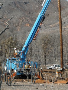
This post is based on an article written by John Marker and me that will appear in the October Society of American Foresters newsletter, The Forestry Source: http://www.nxtbook.com/nxtbooks/saf/forestrysource_201310/index.php#/11, and will also appear in the Fall issue of Oregon Fish & Wildlife Journal. The photograph was provided by Pacific Gas and Electric Co. and shows workers replacing a power pole burned in the Rim Fire, near Yosemite National Park in California.

Wildfires have become financial big-ticket items in the United States. The cost of fighting fires continues to escalate, the negative impact on people, wildlife and property grows, and damages to the land and its resources mount. But rarely do we hear discussion of these damages in terms the general public can understand, and when economic damage is discussed it is seldom a front page item. And when wildfire economics are discussed, it is usually in terms of suppression costs and property damage, little else. Other costs, such as for the effects of fires on water supplies, wildlife, and Public health, are not reported.

As this is being written in early September, we have received news that the Douglas Complex fires in SW Oregon have been 100-percent contained. This Complex was started by multiple lightning strikes on July 26 and was essentially comprised of two large fires, Dad’s Creek and Rabbit Mountain, each about 24,000-acres in size.

Three weeks after the fires had started, the August 16 Salem Statesman Journal reported: “The Douglas Complex already has burned 46,059 acres and was listed Friday as 65 percent contained. Suppression costs heading into Friday were calculated at $42.25 million, with 2,093 people assigned to it, according to ODF.” ODF is the Oregon Department of Forestry and is responsible for calculating costs of firefighting for the State’s services. But it is the only dollar figure given in the news account, and few readers have any idea what the number actually represents.

On September 4 the Medford Mail Tribune reported: “The 48,679-acre Douglas Complex fire burning just north of Glendale is now 95 percent contained. Total cost of fighting that fire is $51.76 million, ODF reported.” This is to illustrate how numbers commonly distributed by local and national media are often limited to basic fire suppression costs – in this instance, still more than $1,000/acre.

Our research has shown that the actual cost of damage caused by the Douglas Complex will likely be much closer to $500 million than to the current figure of $50 million. The fire might be contained, but many of its actual costs and damages are only now beginning to accrue.

The true scope of the problem

The $500 million estimate might sound outrageous to many readers, but examples are easy to come by in which it has been shown that suppression costs are likely to account for as little as 2% to 10% of the actual damages caused by a large wildfire. Some examples:

• In 2009 the Western Forestry Leadership Coalition released a report titled The True Cost of Wildfire in the Western U.S. The authors examined six major US wildfires, and compared suppression costs and tactics with “total costs.” Two examples were the 2000 Cerro Grande fire in New Mexico — suppression costs reflected only 3% of total damage estimates — and the 2003 Old, Grand Prix, and Padua fire complex in California, in which suppression costs were only 7% of total costs to 2005 – with total losses expected to increase dramatically in years to come (Dunn et al, 2005).

• The 2003 fires in San Diego and Southern California were catastrophic by any measure – 24 fatalities, more than 3,700 homes destroyed, and suppression efforts were $43 million. However, in 2009 Matt Rahn of San Diego State University presented findings that put suppression costs at less than 2% of the total long-term cost of the fire (www.youtube.com/watch?v=1Y8Ef9qc0F0).

• The 2002 Hayman Fire burned 138,000 acres and cost $42 million to suppress. In 2004 Dennis Lynch of Colorado State University estimated that an additional $187.5 million in losses had accrued within a year. Suppression costs were only 18% of the total, and Dr. Lynch stated, “I recognized the need to follow costs into subsequent years to more completely identify a fire’s true impact.”

On July 12, 2010 National Association of State Foresters released a briefing paper titled State Forestry Agency Perspectives Regarding 2009 Federal Wildfire Policy Implementation. The paper avers that State Foresters have no say so in how the Federal Interagency and Interdepartmental Wildland Fire Management Community fight fires that threaten communities and natural resources, and that they would prefer that the Feds implement aggressive fire suppression strategies for any fire with a chance of burning private land and property.

Most State Foresters, the report notes, recognize that safe and aggressive initial attacks are the time proven best suppression response to reduce fire damage and keep suppression costs down – but recognize that the federal agencies are not likely to do so. They also recognize that Federal wildfire management policies impact state fire suppression efforts when Federal fires move across jurisdictional boundaries and burn state protected lands and private property. As such, the federal agencies have increased risk to families, communities, and wildlife by allowing some wildfires to burn without containment efforts, and are not providing credible explanations for doing so — not to State Foresters’ satisfaction at any rate.

These “let it burn” wildfires are allegedly for resource “benefits” and fire fighter safety, but often blow up, crossing onto state-protected land, putting communities at risk, and placing tremendous burdens on the states to control fires escaping from Federal lands.

This is a serious issue in states and counties where the federal government manages 50, 60 or even 90 percent of the land, and pays no land taxes. Further complicating the situation is an apparently influential group of people claiming wildfire is “natural” and the land will “heal” and everything will be better if nature is allowed to “take her course” — they do not explain, however, why such “ecosystem services” can’t be provided more effectively, safer, and with far less risk, fear and cost to taxpayers and wildlife via prescribed fires, ignited by people with stated objectives and written plans.

By mid August of this year the federal government had spent more than $1 billion fighting wildfires in the West, creating an estimated $10 billion to $25 billion in actual costs and damages. During the same time states and local fire units have spent hundreds of millions more for fire fighting. On August 21, 51 wildfires of significant size were uncontrolled. On August 22 the US Forest Service announced it was going to take more than $600 million from non-fire programs to pay its anticipated 2013 fire fighting costs.

What can be done?

There is little discussion of local economic damages caused by these fires other than structural losses, and often such losses are reported without mentioning the dollar amounts involved. However, the federal agencies are constantly challenged by members of Congress to reduce fire fighting costs, but without any sense of total fire costs.

Four years ago we were faced with the same problems and same questions, and it appears little has changed: these problems took quite a while to become established, and they will take sometime longer before they can be resolved. At that time a small group of individuals with similar backgrounds, interests and concerns in these matters asked ourselves what we could do to help resolve these problems. It was easy enough to come up with examples and complaints, but it was difficult to figure out how to make things better – particularly for such a small group.

The result of these discussions was an informal ad hoc – and truly grassroots – effort we titled the “Wildfire Cost-Plus-Loss Project.” Our intent was to develop analytical tools and sources of information that could be used by most citizens and not limited to agencies, professional organizations, or special interest groups.

The focus of much of our efforts was to design a simple tool that could be used effectively by almost anyone to assess the true damages of large wildfires. Target audiences were students, journalists, landowners, residents, elected officials, insurance adjustors and resource managers. Our initial efforts resulted in: 1) development of a “one pager” wildfire damage checklist/accounting form that could be used by almost anyone with access to the news; 2) a peer-reviewed article published online with an appropriate federal agency, including instructions for using the one-pager; and 3) a public informational website for anyone to use who was interested in the topic or use of these tools.

One-pager worksheet: www.wildfire-economics.org/Checklist/One_Pager_Checklist_2009.pdf

Peer-reviewed online publication with a federal agency: www.wildfirelessons.net/Additional.aspx?Page=240

Informational website (“under construction”): www.wildfire-economics.org/index.html

These efforts were generally well received and promoted on local, statewide, and national media and during several high-level meetings, but have never been properly field tested or adopted. In our opinion, not considering the true economic impact of wildfires to governments, businesses, and people is an unfortunate omission. For resource managers it is difficult to explain the realities of fire protection and its nuances to Congress and to citizens directly affected by these events. The lack of communications also implies that the land has no economic value for production of resources or public enjoyment. To the public the impression can be that it is government waste spending money fighting fire if there are no damages.

The “one-pager”

The focus of much of our group’s efforts was to design a simple tool that could be used effectively by almost anyone. Target audiences were students, journalists, landowners, residents, elected officials, insurance adjustors and resource managers.

The one-page checklist is intended to make initial estimates – based entirely on available data and personal estimates — of total fire costs, and to ultimately be used in conjunction with a comprehensive ledger for better tracking costs and losses over time. We believe the use of these tools would better inform land and resource managers in the management of water, fuels and wildfires by identifying true costs of decisions and allowing better judgment in the establishment of resource use priorities. Such uses would also generalize discussion topics and terminology for better communication with the public.

The checklist is divided into 11 categories: Suppression costs; Property; Public health; Vegetation; Wildlife; Water; Air and atmospheric effects; Soil-related effects; Recreation and aesthetics; Energy; and Heritage (cultural and historical resources). Each of the categories was considered in terms of direct costs (e.g., fire suppression, lost lives, evacuations, burned homes, etc.), concurrent indirect costs (fire preparedness equipment and training, fire insurance premiums, air and water quality, aesthetics, etc.), and post-fire costs (long term damages to society and the environment; e.g. loss of timber, crops, and wildlife habitat, chronic human health problems, reservoir sedimentation, etc.).

By using this basic approach we think the economic effects of large wildfires can be readily quantified, compared and described in terms understandable to our lawmakers and to the general public. By combining this data with digital spreadsheets, we think better ecological, economic and strategic decisions can be made in the management of our common lands and resources.

Conclusions

Few people seem to understand the critical importance of our nation’s natural resources to the future of the United States. Calculating economic damages may not be the best way to describe the total impact of wildfire on the land and people, but it is a method of creating awareness of damage by using a vehicle that most people understand: money. An analysis of actual wildfire damages provides needed context for evaluating protection and prevention programs, as well as overall natural resource management goals and objectives.

While we have focused on economics we are very much aware of biological considerations, their complexities, their importance to meeting the natural resource needs of 300 million people — but that is for another study. Now might be a better time to test our earlier efforts and conclusions, and perhaps the Douglas Complex provides an ideal circumstance for doing so.

Hazard Tree Lawsuit Update- Volunteers Needed for “Adopt a Project”

I spoke to Ms. Boggs, the Executive Director of the Conservation Congress. She said that she does not post or make available the 990’s and Board of Director information but that that can be found in the State of California records since the organization is incorporated in California.

I asked if she had a plain English version of what the issues are, but she said that if people were “too lazy” to read the complaint it was too bad. She also said that the things written on our blog about the project were not true (as to me, I just looked at the project map and the ESD). What was interesting to me about this conversation is that most people I speak with are interesting in explaining their point of view, so as to get public support. One of the things I don’t like about managing forests from the courtroom, as Tony articulated in a comment in the last week or so, is that it’s a confrontational kind of win/lose world. Sometimes it’s hard to be civil in that kind of atmosphere.

Now, as you all know I have read EA’s, maps, appeal responses, and complaints in the past on various projects, but I would appreciate if others (closer to the project?) would be willing to do that work.

1) Look at the complaint and the project documents (sometimes it’s as simple as comparing the claims in the complaint to the wildlife bios’ report or the FWS letter)

And write.. “this is the claim in the complaint and here is what the FS says in their documents here, plus here’s what common sense tells you (e.g., gravity causes dead trees to fall down)” for posting on the blog and general public information. Media around the area might also be interested in a summary.

2) Take photos of the area when the project documents don’t have them. And or send us a googlemaps link. Note to FS folks- this would generally be handy to include in project documents.

I am willing to help any volunteers, but what I do is not difficult.

Study: Is fire severity increasing in the Sierra Nevada?

new study published in the International Journal of Wildland Fire found that, contrary to what has been claimed in some of the news coverage of recent forest fires, there is not a trend toward increasing fire severity in the Sierra Nevada. Previously, those who claimed that fire severity was increasing relied primarily on two publications by Jay Miller of the Forest Service (Miller et. al 2009, Miller and Stafford 2012).

However, Dr. Chad Hanson and Dr. Dennis Odion found that the Miller studies left out hundreds of thousands of acres of fire data from their analysis. In contrast, Hanson and Odion used all of the available fire severity data for the Sierra Nevada, and that data showed no trend toward increasing fire severity.

Furthermore, they found that rate of high severity fire since 1984 has been lower than it was historically. These results refute some of the main claims we see on this blog and elsewhere.

Abstract
Research in the Sierra Nevada range of California, USA, has provided conflicting results about current trends of high-severity fire. Previous studies have used only a portion of available fire severity data, or considered only a portion of the Sierra Nevada. Our goal was to investigate whether a trend in fire severity is occurring in Sierra Nevada conifer forests currently, using satellite imagery. We analysed all available fire severity data, 1984–2010, over the whole ecoregion and found no trend in proportion, area or patch size of high-severity fire. The rate of high-severity fire has been lower since 1984 than the estimated historical rate. Responses of fire behaviour to climate change and fire suppression may be more complex than assumed. A better understanding of spatiotemporal patterns in fire regimes is needed to predict future fire regimes and their biological effects. Mechanisms underlying the lack of an expected climate- and time since fire-related trend in high-severity fire need to be identified to help calibrate projections of future fire. The effects of climate change on high-severity fire extent may remain small compared with fire suppression. Management could shift from a focus on reducing extent or severity of fire in wildlands to protecting human communities from fire.

Hazard Tree Lawsuit in California

We had previously discussed how dead and dying hazard trees are considered to be an opportunity for different kinds of uses in Colorado. That’s so we don’t burn them in piles and put more carbon into the atmosphere.. also if we could use them for something, we might get some bucks, which would be good, since the Feds, at least, are in deficit. And we don’t want trees falling on people or blocking roads.

Well, it sounds like they are trying to use dead hazard trees in Northern California. I even hear tell that they developed an “Emergency Situation Determination” that went all the way to the Chief to be approved. Which means OGC lawyers must have weighed in. So THEY must think that they’re obeying the law.

So it turns out that this project is being litigated…someone sent me this email…

Plaintiffs Challenge the Bagley Hazard Tree Project on the Shasta-Trinity National Forest for violations of NEPA, NFMA and the APA in Conservation Congress v. United States Forest Service. On September 156, 2013, the Conservation Congress filed a lawsuit in the United States District Court for the Eastern District of California alleging the Forest Service violated NEPA and the APA for this project approved under an emergency situation determination by failing to prepare an EIS; failing adequately to disclose and analyze cumulative effects of the project along with nearby past, present and reasonably foreseeable timber sales; and, failing to analyze the direct and indirect effects of the project on the northern spotted owl and its critical habitat, late successional reserves and inventoried roadless areas. Plaintiff also alleges the Forest Service violated NFMA and the APA by failing to comply with the Forest Plan standards and guidelines for management consistent with recovery plans (13-01922, E.D. Cal.).

So we might wonder, who are these people and what is their interest in this project?

I looked up the Conservation Congress and found this…somehow I couldn’t find 990’s or a Board of Directors. I will call the Executive Director in Livingston Montana (?) to see if I can find who is litigating, who is paying for it and what their rationale is..

Their accomplishments seem to be many other litigation efforts here.

I think this is an interesting example, because we all would like NSOs to be successful, yet I wonder how they can use dead trees that are right next to, or fallen on, roads.

Here’s a link to info on the project, and here’s one to the emergency determination letter. Here’s what the ESD letter says about the project..

Now, the Conservation Congress says it’s “Holding the Federal Government Accountable to Environmental Laws and Regulations.” But here we have a D administration with very smart lawyers. So a person’s gotta wonder.. if somehow smart D lawyers think it’s legal, is something else wrong with the system?

Would this be different if mediation and public release of the mediation discussion and results, were required?

Theme Trial

I am going to be testing different themes.. the point is to be able to use Jetpack comments so we get replies indented..if you want this to work I think you need to go to the bottom of the comment you are replying to and click on “reply.”

I appreciate feedback on these themes.. and anyone not design-challenged like me is welcome to volunteer to fiddle with colors, etc. Let me know… terraveritas at gmail dot com.

Also feedback on other improvements that could be done would be helpful.. especially if you are interested in exploring how to make them happen.

More On Floods and Rainfall..

WEADFloodMarkerCard3-1

We had the discussion of the “1,000 year flood” on this blog earlier here so I thought I would post this followup information from a seminar at CU this week…from Roger Pielke, Jrs.’blog here.

His post seems to address the point we stumbled upon in our discussion here.

In an article titled “The Science Behind Colorado’ Thousand-Year Flood” Time magazine explains:

Parts of Boulder are experiencing a 1-in-1,000 year flood. That doesn’t literally mean that the kind of rainfall seen over the past week only occurs once in a millennium. Rather, it means that a flood of this magnitude only has a 0.1% chance of happening in a given year.
Time is a fixture of the mainstream media and what is written there is widely read and repeated.

A big problem with Time’s article is that Boulder did not actually experience a “1,000-year flood.” In fact, according to an analysis presented by fellow CU faculty member John Pitlick yesterday, using standard hydrological methods, Boulder experienced between a 25- and 50-year flood. (I am focusing here on Boulder, I have not seen similar analyses for other Colorado streamflows, though they are sure to come.) Pitlick further noted that the flood waters did not reach the 50-year flood marker on the Gilbert White memorial (seen at the top of this post.)

Pitlick walks us through maps of estimated inundation for 25-yr, 50 & 100 flood. Observations over recent days look more like 25-yr maps.

How is it that the “1000-year flood” has come to characterize the flood in Boulder? Let’s take a quick look.

The Time article points us to an article on the floods at Climate Central, a non-profit group focused on reporting all things climate change. That article made the following claim:

The Boulder, Colo., area is reeling after being inundated by record rainfall, with more than half a year’s worth of rain falling over the past three days. During those three days, 24-hour rainfall totals of between 8 and 10 inches across much of the Boulder area were enough to qualify this storm as a 1 in 1,000 year event, meaning that it has a 0.1 percent chance of occurring in a given year.

So right away we see an error. Climate Central was discussing rainfall which Time mistakenly converted into floods. They are not the same thing. As John Pitlick explained yesterday, return periods for rainfall and flooding for the same event can vary by several orders of magnitude.