UC Berkeley Gets it Right, and Gets it Wrong

A Cal-Berkeley fire scientist shows his unawareness of current Forest Service policy but, his other ideas favor active management of our Sierra Nevada National Forests.

Canopy2-web

The situation is compounded by the gridlock between environmentalists and commercial foresters. The former favor thinning, but they want all logging plans to leave the larger trees, particularly those with trunks over 30 inches in diameter. But the timber companies maintain it is necessary to take a significant number of bigger trees to fund thinning and restoration programs.

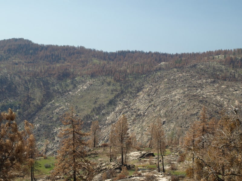
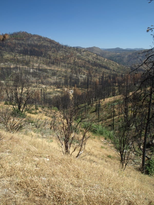
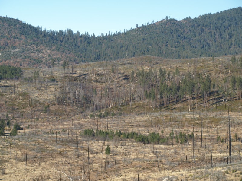
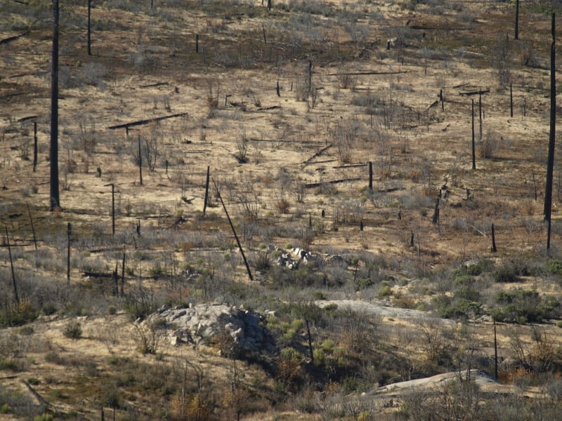
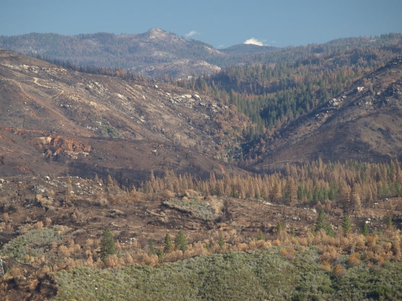
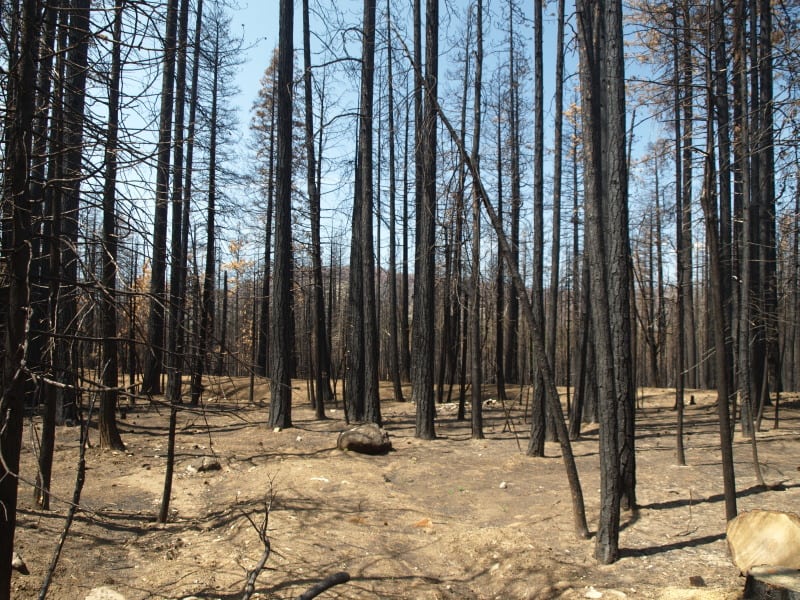
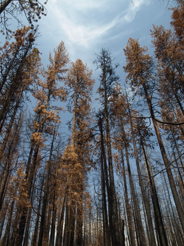
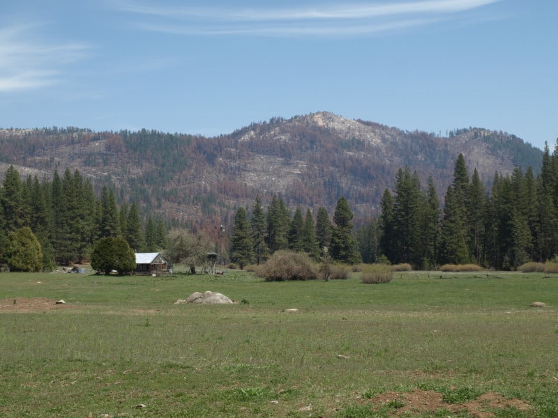
Stephens generally favors the enviro position. Landscape-scale wildfire damage is driven by vast acreages of small-diameter, closely-packed trees, he says. By leaving the larger trees, the essential character of a natural forest can be maintained, even accelerated. And he thinks markets can be found for products produced from thinned, scrawny trees.

http://alumni.berkeley.edu/california-magazine/just-in/2014-09-26/brush-flame-king-fire-narrowly-misses-proving-fire-prevention

Of course, there has been a ban on the cutting of trees larger than 30″ dbh, since 1993. Ditto for clearcutting! These are two big hot-button issues for most “conservationists” but, there are still people out there who want timber sales banned, altogether. There are others who would love to go back to the Clinton rules of the Sierra Nevada Framework, which would shutdown much of Region 5’s timber management programs. A 22″ dbh tree, underneath a 36″ dbh tree cannot be considered “scrawny”.  Generally, most of the thinned trees are in the 10-18″ dbh size, averaging about 15″ dbh.

No TRO for the Rim Fire Salvage!

As I predicted, there will be no TRO for the Rim Fire, from District Court. Once the sales are sold, restoration work can begin. Let’s hope that SPI has an army of fallers, ready and waiting. I also hope that they will leave the plantation salvage for last. *smirk*

P9202316-web

Sonora, CA –A Federal Judge in Fresno has denied a temporary restraining order regarding the lawsuit filed against the Rim Fire Recovery Record of Decision.

Forest Service Spokesperson Wyn Hornbuckle says, “We are pleased with the court’s decision.” He would not comment further.

As reported earlier this month, three environmental groups including the Center for Biological Diversity were seeking an injunction to halt logging within the 37 occupied California spotted owl territories within the burned area. The Chair of the Yosemite Stanislaus Solutions (YSS) group and President of Sierra Resource Management, Mike Albrecht, worked with local environmental groups and the Forest Service to hammer out a compromise on the Rim Fire Record of Decision. He applauds the Judge’s decision.

http://www.mymotherlode.com/news/local/223061/logging-injunction-denied.html

Rim Fire Logging Lawsuit

Yes, we all knew it was coming but there is one surprise. (See the 3rd plaintiff)

Again, owls will “occupy” almost ANY landscape, as long as there is prey there. If the nest stands were cooked, then they will have to find, and build, new nests. Owls are notoriously lazy in building nests, and often will use abandoned goshawk nests (and vice versa). One question I’ve wondered about for a long time is; Why do PACs retain their “protected” status when nesting habitats (the reason the land is protected) are destroyed? The loss of spotted owl (AND goshawk) nests is merely another part of the “whatever happens” strategy, so loved by the plaintiffs.

P9202313-web

“The complaint issued by the Earth Island Institute, the Center for Biological Diversity, and the California Chaparral Institute seeks an injunction to halt logging within the 37 occupied California spotted owl territories within the burned area. That would prevent logging in about 40% of the Rim Fire areas already approved by the decision for tree removal.”

http://www.mymotherlode.com/news/local/221678/rim-fire-logging-lawsuit.html

Preparing For Rim Fire Logging Litigation

The battle has begun!

The picture below was taken in April, within the Rim Fire, and shows how quickly the bearclover returns, after a fire. Even the manzanita and deer brush have difficulty when the bearclover is so entrenched. California Indians knew that old growth pine and bearclover were the best of their available land management outcomes. Those landscapes had great advantages for humans living in the mid elevations of the Sierra Nevada.

http://www.mymotherlode.com/news/local/221325/preparing-rim-fire-logging-litigation.html

P9202274-web

Deputy Stanislaus National Forest Supervisor Scott Tangenberg spoke before the Tuolumne County Supervisors this morning, and said the Forest Service has been contacted by several individuals, or groups, that will likely file litigation later this week.

Well, we all knew that was coming and who was opposing the project. While on the Rim Fire tour, and at the SAF meeting, it was funny to see the Forest Service tiptoeing their way around “those who shall not be named”. *smirk*

The Rim Fire: Landscape View

Here is a view of the Granite Creek watershed, and a peek at the Tuolumne River canyon, too. The Rim Fire burned all the way to those most-distant ridgetops. For scale, you can see a vehicle in the middle of the picture. That road is the Cherry Oil Road, which connects Cherry Lake with Highway 120. That greenish tint is the vast growth of bearclover, easily reclaiming their “territory”. Bearclover is one of the reasons why clearcutting has been banned in Sierra Nevada National Forests since 1993.

P9232905-web

Rim Fire Salvage Logging, by SPI

Bob Zybach and I went on a field trip to the Rim Fire. The first stop on the tour showed us the Sierra Pacific Industries’ salvage logging results. I’m posting a medium resolution panorama so, if you click on the picture, you can view it in its full size. You can see the planted surviving giant sequoias on their land which were left in place. You can also see some smaller diameter trees, bundled up on the hill, which turned out to be not mechantable as sawlogs. You might also notice the subsoiler ripping, meant to break up the hydrophobic layer. They appear to have done their homework on this practice, and it is surprising to see them spending money to do this. SPI says that their salvage logging is nearly complete, and that they will replant most of their 20,000 acre chunk next spring. They have to order and grow more stock to finish in 2016.

SPI-panorama-big-web

Yosemite’s Re-re-Burn

The El Portal Fire, burning in Yosemite National Park and the Stanislaus National Forest, has taken a familiar path. Starting very close to where the 1989 A-Rock Fire began, it easily burned up the steep canyon slopes, out of reach of firefighters. Not too many people are making the connection between this set of fires, the A-Rock, the Big Meadow and now the El Portal Fire, and the Rim Fire re-burn (and its prior fires).

Below is what the Foresta area looked like in November. Did those green trees survive this fire? We can’t be sure until the bark beetles have decided their fate, over the next few years. The forested slopes in the background were salvaged under the original A-Rock salvage project, and you can see that it looks about as good as a burned and salvaged landscape can be. Parts of that ridge top have had 13 fires in the last 100 years. The northern third of the fire burned into areas partially burned in the Big Meadow Fire. Up there, fuels are much heavier, and some of it had made it to the ground.

Edit: The fire’s boundary has slopped over that far ridge top but, there is less fuel on that dry west-facing slope, and the fire is just smoldering at the north end. Now, with more re-burn! It will be interesting to see how intense it was, burning through the salvaged part of the A-Rock Fire.


P9132004-web

So, how long do you think it will take to turn this former pristine old growth stand back into a viable forest? Remember, this was a prime summer site for Indians, who expended a lot of time and energy to manage the ladder fuels. You can also go see the bigger picture here, at https://www.google.com/maps/@37.7045826,-119.7624808,7211m/data=!3m1!1e3?hl=en The northern end is very close to Crane Flat. Suppression costs have topped 8 million dollars. Also, how long will it take before blackbacked woodpeckers are on THIS piece of land? We need to learn from this example, or be doomed to repeat this moonscape.

P9132021-web

New Aerial Photos of the Rim Fire

Google Maps now has updated photos that include the Rim Fire. Now, we can explore the whole of the burned areas to see all of the damages and realities of last year’s epic firestorm.

P9132051-web

.

Here is where the fire started, ignited by an escaped illegal campfire. The bottom of this deep canyon has to be the worst place for a fire to start. It’s no wonder that crews stayed safe by backing off.

http://www.google.com/maps/@37.8374451,-120.0467671,900m/data=!3m1!1e3?hl=en

.

While there has been talk about the forests within Yosemite National Park, a public assessment has been impossible, in the National Forest, due to closures. Here is an example of the plantations I worked on, back in 2000, completed just a few years ago. What it looks like to me is that the 40 year old brushfields caused most of the mortality within the plantations. A wider look shows some plantations didn’t survive, burning moderately. When you give a wildfire a running start, nothing can stand in the way of it.

http://www.google.com/maps/@38.0001244,-119.9503067,1796m/data=!3m1!1e3?hl=en

.

There is also a remarkable view of Sierra Pacific Industries’ partly-finished salvage logging. Zoom into this view and take a look at their latest work, including feller-bunchers. Comments?

http://www.google.com/maps/@37.9489062,-119.976156,3594m/data=!3m1!1e3?hl=en

More Rim Fire Pictures

All too often, once a firestorm goes cold, a fickle public thinks the disaster is over with, as the skies clear of smoke. In the situation of the Rim Fire, the public hasn’t had much chance to see the real damages within the fire’s perimeter. All back roads have been closed since the fire was ignited. Besides Highway 120, only Evergreen Road has been opened to the public, within the Stanislaus National Forest.

From my April trip to Yosemite, and Evergreen Road, this unthinned stand burned pretty hot. This would have been a good one where merchantable logs could be traded for small tree removal and biomass. Notice the lack of organic matter in the soil.

P9202313-web

Sometimes people say there is no proof that thinning mitigates fire behavior. It’s pretty clear to me that this stand was too dense and primed for a devastating crown fire. I’m guessing that its proximity to Yosemite National Park and Camp Mather, as well as the views from Evergreen Road have made this area into a “Park buffer”. Now, it becomes a “scenic burn zone”, for at least the next few decades.

P9202306-web

There is some private land along Evergreen Road, which seem to have done OK, at least in this view. Those mountains are within Yosemite National Park. Sadly, the media likes to talk about “reduced burn intensities, due to different management techniques”, within Yosemite National Park. Only a very tiny percentage of the National Park lands within the Rim Fire have had ANY kind of management. Much of the southeastern boundary of the fire butts up against the Big Meadow Fire, generally along the Tioga Pass Road (Highway 120). Additionally, much of the burned Yosemite lands are higher in elevation, as well as having larger trees with thicker bark. You can also see that there will be no lack of snags for the blackbacked woodpecker. Can anyone say, with scientific sincerity, that over-providing six years of BBW habitat will result in a significant bump in birds populations? The question is really a moot point, since the Yosemite acreage, alone, does just that.

P9202301-web

People have, and will continue to compare the Yosemite portion of the Rim Fire to the Stanislaus National Forest portion, pointing at management techniques and burn intensities. IMHO, very little of those comparisons are really valid. Apples versus oranges. Most of the Forest Service portion of the fire is re-burn, and there is no valid Yosemite comparison (other than the 2007 Big Meadow Fire). It has been a few months since I have been up there, and I expect that there are plenty of bark beetles flying, and the trees around here have no defense against them, with this persistent drought. Everything is in motion and “whatever happens” is happening.

Rim Fire Terrain Effects

Below is a picture of the Tuolumne River and Poopenaut Valley, just a mile or so below Hetch Hetchy’s O’Shaughnessy Dam. As you can see, the area burned rather lightly. What might be the reason for this area to survive, almost unscathed? I think there is a “micro-climate” at play, here. Most of this is Yosemite National Park.

P9202324-web

Certainly, there are plenty of fuels, and California is in a historic drought. Firefighters did not “heroically” save this area from the flames. No management was done to make this area more resilient. Comparing this area to scorched places downstream, I think I have the answer. Farther downstream, the fires were enhanced by the nearly constant breeze, flowing down during the night and morning, and flowing up, with the heat of the day. Cold air sinks and warm air rises. This spot is pretty unique along the Tuolumne River. As the canyon turns from a glacier-sculpted valley into a V-shaped gorge, the cold air from higher elevations runs into this bottleneck, pooling up in this last valley, going downstream. Temperature inversions stay longer and stabilize the breezes, reducing fire behaviors.

One thing I did notice in this area was that many single digger pines were “selectively burned” as individuals. Those long slender needles were good at catching the small embers.