Smoke maps can be handy for planning outdoor activities.
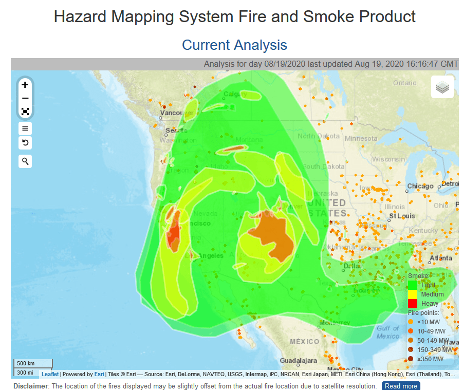
I’d always appreciated getting smoke maps from Bill Gabbert on Wildfire Today. Here’s how to get one for current and past days. If you don’t see the smoke colors, just go to the three lines on the left and make smoke toggle on. For some reason, I get the smoke overlay on some devices/days and not others, so if you don’t see it don’t give up.
This morning I found the landscape covered with fluffy flakes of white ash. Despite the lack of high winds, the fires are burning fiercely. Some areas are ‘re-burning’ after just two years of new growth. Half of the city of Vacaville is being evacuated, and the town is over 70,000 people. Closer to home, a fire is burning in Santa Cruz County (where I live) and it is burning in thick timber, with no containment. It’s already over 10,000 acres. I live in town so, there’s no danger here at home.