New Report: Climate Change Could Cripple Southwestern Forests

From the University of Arizona:

Combine the tree-ring growth record with historical information, climate records and computer-model projections of future climate trends, and you get a grim picture for the future of trees in the southwestern United States.

That’s the word from a team of scientists from Los Alamos National Laboratory, the U.S. Geological Survey, the University of Arizona and other partner organizations.

If the Southwest is warmer and drier in the near future, widespread tree death is likely and would cause substantial changes in the distribution of forests and of species, the researchers report this week in the journal Nature Climate Change.

Read the entire article here.

Also, I’ll paste the Abstract of the study below, but the entire study may be view here.


Abstract


As the climate changes, drought may reduce tree productivity and survival across many forest ecosystems; however, the relative influence of specific climate parameters on forest decline is poorly understood. We derive a forest drought-stress index (FDSI) for the southwestern United States using a comprehensive tree-ring data set representing AD 1000–2007. The FDSI is approximately equally influenced by the warm-season vapour-pressure deficit (largely controlled by temperature) and cold-season precipitation, together explaining 82% of the FDSI variability. Correspondence between the FDSI and measures of forest productivity, mortality, bark-beetle outbreak and wildfire validate the FDSI as a holistic forest-vigour indicator. If the vapour-pressure deficit continues increasing as projected by climate models, the mean forest drought-stress by the 2050s will exceed that of the most severe droughts in the past 1,000 years. Collectively, the results foreshadow twenty-first-century changes in forest structures and compositions, with transition of forests in the southwestern United States, and perhaps water-limited forests globally, towards distributions unfamiliar to modern civilization.

Forest Service logs (err, “thins”) old-growth to help aspen

Earlier this summer Sharon had a post titled, “Tree vs. Tree: An Aspen Restoration Project,” which looked at some of the issues surrounding the Tahoe National Forest’s “Outback Aspen Restoration Project.”

Well, this morning, the Sacramento Bee’s Tom Knudson took another look at the project, this time with local residents, who are not too happy with the Forest Service and with the Tahoe National Forest supervisor, who is not too disappointed with the project.  Although, in fairness, the Forest Service supervisor did decide to halt logging (or do we call it “thinning?”) of trees 40 inches in diameter or greater on the remaining 190 acres of the project.  Here are some highlights from the article:

Standing amid a scattering of stumps last week, an official from the U.S. Forest Service acknowledged the agency made mistakes by logging too many pine trees, including majestic old-growth giants, in an effort to help another Tahoe species: the quaking aspen.

But he rejected calls from local residents that the Tahoe National Forest sharply scale back the cutting along Independence Creek north of Truckee.

“Are there places where there are some trees that I’ve seen out here – some live trees still standing and some stumps – that I would have preferred be marked for retention? Yes,” said Tom Quinn, supervisor of the Tahoe National Forest….The extensive cutting has incensed residents and conservationists, who were out in force at Friday’s meeting.

“We are shocked at the situation, the catastrophic damage being done by our government with absolutely no care for public input,” said Mary Leavell, who grazes cattle in the national forest with her husband.

“We all ultimately want forest health,” said Lauren Ranz, who lives part-time on a former 450-acre ranch near the logging zone. “But I don’t think this is the way to get it.”

Despite his concerns about cutting too many large, old trees, Quinn defended the project…He said the agency’s decision to allow the cutting of old-growth trees was consistent with the goal of aspen restoration, even though it angered neighbors.  “They were probably social mistakes, more than ecological mistakes,” he said of the agency’s actions.

To try to quell criticism, Quinn announced that Forest Service officials have decided to halt logging of conifers 40 inches in diameter or greater on the remaining 190 acres of the 479-acre project. But he rejected suggestions to limit cutting to trees 30 inches in diameter or less….

“I’m extremely disappointed,” said Fred Mitchell who lives on 80 acres near where the cutting is taking place. “There are so few trees 40 inches and above, anyway.

“They’re brushing off the public like we are a minor nuisance, like we don’t count for anything,” Mitchell added.

Mitchell is one of a group of residents who have marshaled opposition by handing out flyers, contacting lawyers, political representatives and environmentalists, even placing mock tombstones on the stumps of large trees – some more than two centuries old – that have been logged.

“It’s not what they told us it would be,” said Gary Risse, a part-time area resident who is among those opposed. “I can tell you without a doubt there was no mention of clear-cuts whatsoever. That would have stopped it.”

…Chad Hanson, director and staff ecologist for the John Muir Project, said other agency projects have succeeded with less intense cutting.

“Scientific studies … do not support the assumption that you need to clear-cut forests, especially 150 feet or more away from aspen stands, or that you need to remove old- growth trees,” he said. “That is not scientifically necessary.”…

“I’ve covered about 300 acres of this project looking for legacy (old-growth) trees,” Mitchell said. “From what I can gather, there has only been one legacy tree left for every four and a quarter acres, which is not a very good number.”

Post-Fire Photos Las Conchas and Cerro Grande

There was a long, pretty interesting and wide-ranging, discussion in the comments to this piece in High Country News, titled “Fire scientists fight over what Western forests should look like.”

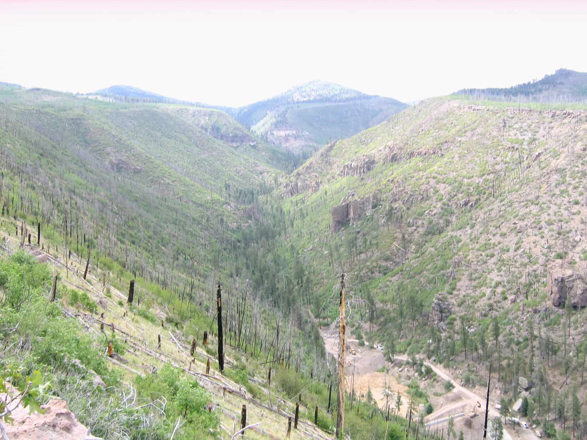
Bryan Bird linked to the photo above of the Las Conchas fire, USGS gallery here.

Greg Nagle had these photos that couldn’t be posted there, so I am posting them here.

Here are Greg’s comments.

First two views are west up the canyon. I did not check closely for conifer regen but on the northerly facing slope aspen regen is vigorous. Sedimentation dam in the canyon, which I believe was put in to catch sediment contaminated by old waste dumps burned over in the fire, Note the large older trees surviving the fire on the valley floor.

Third is a view of a southerly slope showing variability in revegetation.

You can click on the photos if you want to look more closely. I tried to make them larger here but they seemed to lose their perspective. I tried to make the Las Conchas one above smaller, and it got too small.

Here are some USGS photos and the comment with it by Colin Holloway

Needless to say, you can find better & worse spots of regrowth (it does seem that the photos tend to the optimistic). in some of the slopes immediately adjacent to Los Alamos it’s all still rather desolate. In the drainage’s that managed to hold onto a little soil, things are better.
I had avoided Los Alamos for the better part of my time here, the place is kind of like David Lynch does Twilight Zone. My first impressions of the place was that it was going to be toast in a few years. I had started surveying for environmental remediation work up there in ’99. Don’t know if you’ve ever smelt that smell a ponderosa forest smells like when it’s ready to go up? Not that sweet is-vanilla-or-is-it-butterscotch smell, don’t know how to describe it but there’s a distinct odor of a distressed ponderosa stand. Or so I’ve convinced myself. Any rate the place reeked of it.
Those places are have just started to have the oaks tangle, ten years on. I haven’t had the heart to get up there since Conchas. Makes me feel like Treebeard “Many of these trees were my friends”.
On a note of insane Conehead (local vernacular for the lab rats up there) over management, engineering insanity, they built these insane check dams up there in those tuff slot canyons. Just crazy. Talk about destroying the village to save it. Of course the photos don’t describe the enormity, though one photo, in the link below, does show a huge ol’ excavator for scale.

http://ec.forestermedia.us/november-december-2000/after-the-fire.html

Of course, at Los Alamos, they were worried about radioactive material.

Costs of Colorado Fire Rehab in Denver Post

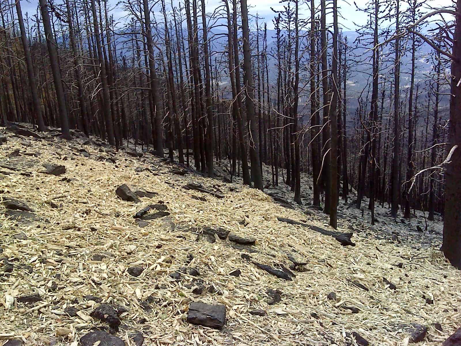
The U.S. Forest Service is using wood shreds to protect heavily burned hillsides this fall.
U.S. Forest Service

Costs of fire and fire rehabilitation/restoration, and the need to do any, has been a topic on this blog, and this was in the Denver paper this morning so I thought I’d post a link to this Denver Post story. More info and photos of mulching can be found here.

Note: I am not saying we should suppress all fires. I am not saying we should do fuel treatments everywhere. I am just pointing out some places that the funding and how much, is coming from.

A federal program to provide emergency watershed protection on Thursday poured $2.45 million into work stabilizing land burned during the devastating High Park and Waldo Canyon fires this past summer.

The Natural Resources Conservation Service in Colorado received an allocation of $1.2 million for Waldo Canyon in Colorado Springs and $1.25 million for High Park in Larimer County.

The sum is less than requested, said NRCS state conservation engineer John Andrews but will help to complete projects to stabilize soil, slow runoff and protect the watershed in areas that are considered moderately to highly burned.

In High Park, where more than 87,284 acres were burned, the money will be supplemented by about $410,000 from the cities of Fort Collins and Greeley, Larimer County, Northern Water and three small water districts known as the Tri-Districts, NRCS district conservationist Todd Boldt said.

There, the work includes reseeding and mulching, clearing debris, flood protection and efforts to keep sediment from flowing into tributaries of the Big Thompson River.

Logging debris matters: better soil, fewer invasive plants

New research from the U.S. Forest Service’s Pacific Northwest Research Station and authors Timoth B. Harrington and John Kirkland:

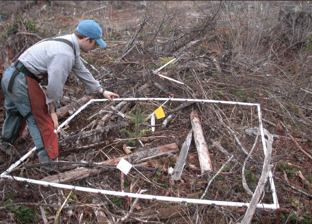
Abstract: The logging debris that remains after timber harvest traditionally has been seen as a nuisance. It can make subsequent tree planting more difficult and become fuel for wildfire. It is commonly piled, burned, or taken off site. Logging debris, however, contains significant amounts of carbon and nitrogen—elements critical to soil productivity. Its physical presence in the regenerating forest creates microclimates that influence a broad range of soil and plant processes. Researchers Tim Harrington of the Pacific Northwest Research Station; Robert Slesak, a soil scientist with the Minnesota Forest Resources Council; and Stephen Schoenholtz, a professor of forest hydrology and soils at Virginia Tech, conducted a five-year study at two sites in Washington and Oregon to see how retaining logging debris affected the soil and other growing conditions at each locale. They found that keeping logging debris in place improved soil fertility, especially in areas with coarse-textured, nutrient-poor soils. Soil nitrogen and other nutrients important to tree growth increased, and soil water availability increased due to the debris’ mulching effect. The debris cooled the soil, which slowed the breakdown and release of soil carbon into the atmosphere. It also helped prevent invasive species such as Scotch broom and trailing blackberry from dominating the sites. Forest managers are using this information to help maximize the land’s productivity while reducing their costs associated with debris disposal.

The entire study can be downloaded here.

Pole Creek Fire Report -Thinning Was Effective Around Sisters

Photo by Jim williams of the Sisters Nugget.

I couldn’t easily find a copy of this report by searching or by checking the Deschutes website, nevertheless, here’s a report from Oregon Public Broadcasting; below is an excerpt.

Back in 2009, the Deschutes National Forest began a number of forest thinning projects to protect the community of Sisters in the event of a wildfire.

When the Pole Creek Fire began three weeks ago, fire managers knew there was a good chance they’d have a front row seat to see if those efforts worked.

Bill Aney is a fuels specialist with Forest Service. He helped write the report. Aney says it’s clear the those treatments did what they were supposed to do.

He explained, “Instead of having fire in the crowns of these trees the fire was just on the ground as it approached these areas. And as a result the forest stand and the area that was treated is in tact, survived the fires, looks really nice.”

Bozeman’s water supply less vulnerable to fire


According to Cottonwood Environmental Law Center, all of the trees in this picture that are not painted orange would be cut down as part of the Bozeman Watershed logging project. Photo by Cottonwood Environmental Law Center.

The Gallatin National Forest’s Bozeman Watershed Logging Project has been the subject of much debate and commenting here at the blog.   Well, it appears as if the next chapter of the story has been written, as the Bozeman Daily Chronicle took another look at the issue in this morning’s paper.  Excerpts from the article are highlighted below [emphasis added]:

This summer’s Millie fire prompted renewed calls for thinning the forests south of Bozeman to protect the city’s water supply from fire. However, upgrades to the water plant are nullifying the argument that the water supply needs protection.  The Bozeman water plant’s antiquated filtration system, built in 1984, couldn’t filter much more sediment than what is carried by the streams on a normal day. Any increase in the amount of sediment in Bozeman or Hyalite creeks was a source of concern.

But that will change when a new $43 million system comes online in a little more than a year, said water treatment supervisor Rick Moroney. Construction started a year ago.  “It adds an important extra step – sedimentation – which makes it vastly superior,” Moroney said. “I can’t guarantee it could handle everything, but it will be able to handle the sediment from a fire.”

The new facility removes the urgency from one side’s argument in what is now a 2-year-old battle over a forest-thinning project.

In March 2010, the Gallatin National Forest published its Bozeman Municipal Watershed Project, a plan devised with the city to harvest, thin and burn 4,800 acres in the Hyalite and Bozeman creek watersheds.

The $2 million project had the stated objective of protecting the watersheds that provide 80 percent of the city’s summer water supply from being polluted after a severe fire. But wildfire doesn’t pose the only risk to water quality.

The Alliance for the Wild Rockies, the Montana Ecosystems Defense Council and the Native Ecosystems Council opposed the project because more than seven miles of new logging roads would be required, and such roads can add as much sediment to area streams as a fire….

Hydrologist Mark Story said decades of research show roads are responsible for 90 percent of the sediment produced during logging. The groups argued thinning wouldn’t prevent a wildfire, which would add still more sediment.  “There’s no science that will fireproof a watershed,” said Michael Garrity of the Alliance for the Wild Rockies. “We have no problem with thinning as long as they can do it without building roads that are just as bad for the watershed.


Fire scientists continue debate in the comments section

Last week this blog featured a couple of recent news articles with fire scientists discussing their latest research and understanding of the role severe fire plays in some western landsacpes.  One of those articles I highlighted was Emily Guerin’s piece over at High Country NewsFire scientists fight over what Western forests should look like.”

As interesting as Guerin’s original article was, perhaps even just as interesting has been the discussion taking place in the comments section to the article – a discussion that includes some of the leading fire scientists themselves.  Below are some excerpts from the on-line comments section, but the entire comments section is certainly worth a read:

Richard Hutto
Sep 19, 2012 09:02 AM

Swetnam and Brown “…questioned how ponderosa pines could regenerate if Baker and Williams are correct about severe fires having scarred Western landscapes for generations.” They regenerate the same way most wingless pine seeds do–by animal dispersal. I have numerous photos of Clark’s nutcrackers and Mexican jays extracting seeds from cones on severely burned ponderosa pines (see photo evidence on our facebook page here: http://www.facebook.com/AvianScienceCenter). The more you learn about severe-fire ecology, the more it all makes sense–plant, beetle, and bird adaptations that are apparent even in many of our dry mixed-conifer forest types!

————

Chad Hanson
Sep 22, 2012 12:54 PM

In the artice Malcolm North incorrectly states that the General Land Office data used by Williams and Baker is a “very scant data set” that does not allow for extrapolation to the landscape scale. In fact, this GLO data comprises thousands of sites over entire landscapes. The data used by Williams and Baker, in fact, is by far the largest data set ever used to address the historic occurrence of high-severity fire in ponderosa pine and mixed-conifer forests. As for the comments by Swetnam and Brown, who imply that ponderosa pine and mixed-conifer forest does not naturally regenerate after high-severity fire, this assumption is contradicted by the scientific literature. Savage and Mast (2005) (Table 3) found hundreds of stems per hectare of natural regeneration following high-severity fire in Southwest ponderosa pine forest. Haire and McGarigal (2008) and Haire and McGarigal (2010) had similar findings, indicating substantial natural regeneration of ponderosa pine and other tree species even in large high-severity fire patches, especially within about 200 meters from the edge of high-severity fire patches (which accounts for most of the area experiencing high-severity fire), and lower but still significant levels (for the purposes of establishing new forest stands) even farther than 200 meters into high-severity fire patches. Similar results have been reported outside of the Southwest in mixed-conifer and ponderosa pine forests (Donato et al. 2006, Shatford et al. 2007, Donato et al. 2009, Collins et al. 2011 [Plumas Lassen Study 2010 Annual Report]). There are likely numerous mechanisms for this, including seed survival (which may occur more often that some assume), dispersal by animals, and dispersal by wind.

————

Peter Brown
Sep 25, 2012 02:34 PM

Hey, all I know is what the photo above shows: recent high severity fires in Front Range ponderosa pine forests are not coming back as dense even-aged stands of trees. Far from it, in fact. That photo was taken this past June, almost 10 yrs to the day after Hayman took out about 50,000 acres of forest with nary a living tree left. You could search for days for a seedling that was not planted by either FS and Denver Water (they’ve planted a few 1000s of acres, but still a lot of treeless landscape out there). Maybe those corvids are busy as bees somewhere, but they’re not having much luck with re-establishing those 50,000 acres very fast. And it’s not just Hayman; wander around in any recent fires in the Front Range and see how treeless those areas still are.

And this is in the exact same area we reconstructed fire history before the fire (published in 1999) that was the first fire history in a ponderosa ecosystem that provided concrete evidence of crown fire. But the crown fire patches we reconstructed were acres to 10s of acres in size, not the 1000s to 10000s of acres we’re seeing today.

And hence the crux of the question: what was the scale of crown fire relative to surface fire in the historical forest, and how has that changed today? No one disputes that *passive* crown fires occurred (where fire spread across the landscape was primarily through surface fuels, but occasional trees or patches or trees would crown), whereas current fires are dominated by *active* crown fires (with fire spread mainly through aerial fuels). One other point about the uncharacteristic nature of recent fires, at least Hayman: 400-600 yr old trees we sampled in our 1999 study that had recorded multiple fire scars (i.e., had experienced 6, 8, 10, 15 *surface fires* in their lifetimes) all died during Hayman. Hanson, I have to laugh every time I see your report on “the myth of catastrophic fire” [link here, added by MK] because in the cover photograph there is what looks to be a dead tree that takes up the entire left side of the photo, with what sure looks to be a catface with maybe 8-10 fire scars recorded in it. An incredibly unintended ironic comment on your entire thesis in that paper. Here’s a tree that experienced 8-10 surface fires in its lifetime, and then dies in a recent high-severity fire.

————

Richard Hutto
Sep 25, 2012 02:54 PM

The picture above is indeed instructive; it shows that there are no big ponderosa pines! Why? They were all harvested before or after the severe fire event…might that have something to do with the fact that there is little recruitment? The more unnatural treatment a forest gets, the more unnatural the result.

The fact that charcoal trees have fire-scars is also instructive. Of course fire-scarred trees eventually burn down…that’s the point! If they didn’t burn down every 300 years or so, on average, they’d live 4,000-5,000 years, just as the other tree species that REALLY have a history of avoiding severe fire do. A little more perspective from evolutionary ecology might help here.

Again, nobody is arguing that some dry PIPO forests are in an unnatural state, and getting unnatural results from recent fires…the BIG point is that the story applies to a small proportion of western forests, and to almost none of the mixed-conifer forest types.

Salamanders under fire: Burning forests among threats as feds contemplate endangered status

Jemez mountains salamander
Thanks to Terry Seyden for this link.

Well, we’ve been discussing a woodpecker who likes fires and specifically post-fire habitat.

In this story we find an animal that apparently doesn’t like them so much and appears to be also rare. I wonder how a pattern of burning for woodpecker habitat in the Sierra would affect their local salamanders?

Here’s the link, and below is an excerpt.

One of the chief threats facing the lung-less amphibian is the combination of an overgrown forest and the likelihood of severe wildfire, according to the U.S. Fish and Wildlife Service.
While the salamander has evolved over centuries with low-intensity fire, the waves of fast-moving, intense fires that have charred tens of millions of acres in the West over the last decade is a problem.
Biologists say that between 1995 and 2010, severe fires have burned more than one-third of known salamander habitat on national forest lands.

In 2011, the Las Conchas Fire burned nearly 18,000 acres of salamander habitat.
The U.S. Fish and Wildlife Service points to fire restoration, logging, grazing, roads, trails and recreation as other threats to the salamander.

Aside from the proposed listing, the agency is suggesting setting aside more than 140 square miles in three New Mexico counties as critical habitat for the salamander.
The agency will make a final decision on the salamander after a 60-day comment period.
Environmentalists have been pushing for salamander protections for more than two decades.

Hmm. I hope if they figure it’s hard to stop fires, they won’t shut instead stop “fire restoration,” logging, grazing, roads, trails and recreation instead…

Angora Project Appeal Denied

Here’s a photo of a tour from 2008 of the area.

We have discussed the Angora project before on this blog.

Here’s the link to a Sacramento Bee article.

Here’s an excerpt:

In a published opinion issued Thursday, a three-judge panel of the 9th U.S. Circuit Court of Appeals said the Lake Tahoe Forest Plan did not require the Forest Service to demonstrate that the Angora project would maintain viable population levels of certain species, including the black-backed woodpecker.
The panel concluded that the Forest Service ensured the scientific integrity of the final environmental assessment, properly responded to dissenting scientific opinion, properly considered proposed alternatives to the environmental assessment, and took the requisite “hard look” at the impacts of the project.
Thus, the panel found, the Forest Service’s analysis of the environmental effects “was not arbitrary and capricious,” as that phrase is defined in federal law.
The opinion was authored by Circuit Judge N. Randy Smith, with the concurrences of Circuit Judges Stephen Reinhardt and Richard R. Clifton.
The Angora fire, determined to be human-caused, destroyed 254 homes and scorched more than 3,100 acres, including approximately 2,700 acres of national forest land.
In 2010, the Forest Service approved the restoration project to “reduce the amount of dead and downed trees” in order “to reduce long-term fuel (accumulation) to reduce future fire severity.”
The thinning project called for the removal of both live and dead trees. Twelve zones were “retained as habitat for a diverse set of species,” including the black-backed woodpecker. Most of the trees “will be hauled … for disposal at … biomass energy facilities.”
The Forest Service was free to proceed with the project once Burrell ruled. Both he and the circuit panel denied the environmentalists’ requests for an injunction halting implementation of the project pending appeal.

We have had numerous posts on this appeal and litigation. You can search on “Angora” in the search box to review the history.

We started with this post which I called “Much Ado about relatively little”. Check the comments out for a conversation between Dave Iverson and me on different aspects of the project and the assertions made.

So here we are, years and hundreds of thousands of dollars later. I wonder about the quantity of taxpayer funds have been spent on the original litigation and the appeal of the original decision, by the unit, the regional office, the OGC and by DOJ? It might be interesting to take a few cases at the beginning of litigation and just keep track of the tasks involved and who gets paid what, just so the public has a better idea of the investments they are making. Hopefully this is the end of the story for this 1411 acre project..

Here are the details as I found several documents ago.. those knowledgeable please let me know if this has changed.

Alternative 2, as modified, includes the following activities:
Fuel removal of standing dead and downed wood and thinning of live trees on
approximately 1,411 acres.
Within the 1,411 acres:
o 6 acres of conifer removal for aspen stand enhancement;
o approximately 77 acres of treatment proposed in wildlife snag zones (39 acres in
SEZ; 38 ac Subdivision);
o 13 acres of conifer removal for meadow restoration/aspen enhancement in the
Gardner Mountain meadow.

A ground-based logging system on up to 964 acres (including 13 acres of Cut-to-Length
mechanical thinning in Gardner Mountain Meadow) located in areas with slopes under
30%.
New construction of new roads (up to 7.7 miles) and landings to facilitate fuel removal.
Reconstruction or opening of existing roads, trails, and landings to facilitate fuel removal.
Decommissioning/restoring 1.9 miles of road and 16.7 miles of trail.
Existing and new landings and staging areas would be utilized to facilitate removal of
fuels for ground-based operations.
Reconstruction of 1,200 feet of Angora Creek.
Treatment of the following noxious weeds: bull thistle, field bindweed, St. John‘s wort,
tall whitetop, and oxeye daisy.