Western Solar Energy Plan update

It’s past time for a follow-up to Sharon’s post on the BLM’s western solar plan.  The final plan was released at the end of August.   The BLM says it received 162 formal protests during that 30-day protest period that are being reviewed (but apparently won’t release the names of the parties, unlike the Forest Service objection process).

A number of conservation groups have protested the failure to protect the integrity of the Old Spanish National Historic Trail. Lynn County, Nevada, just southeast of Reno, is concerned the proposed plan will “result in fiscal impacts as it will be left to deal with speculative solar applications in inappropriate areas.”  Apparently, the Western Congressional Caucus doesn’t like it because it “risks taking lands offline for purposes other than solar use, limiting the potential for mining, grazing and public access.”  And, of course, enviros are unhappy, too.

According to the BLM,

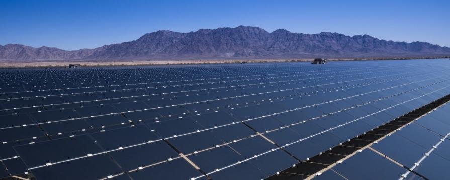
“It would make over 31 million acres of public lands across 11 western states available for potential solar development, driving development closer to transmission lines or on previously disturbed lands and avoiding protected lands, sensitive cultural resources and important wildlife habitat.

Steering project proposals away from areas where they may conflict with other resources or uses will help ensure responsible development, speed the permitting process, and provide greater predictability to the solar energy industry.”

That sounds like good planning.  However, a scientist says that, instead, “It makes available to solar areas that are ecologically sensitive, areas that include sensitive species. It stands to significantly impact and alter ecosystems across the Great Basin and Mojave Desert.”  The federally threatened desert tortoise is a particular concern.

The Center for Biological Diversity would have opted for an alternative that prioritized already developed or degraded areas on public lands and rooftop solar on structures.  There seems to be some debate about whether it is necessary to essentially plow up the desert in order to install solar facilities.  But things may be different in Wyoming, where local conservationists see this as additional protection for big game habitat.

And then there’s some “sensitive cultural resources” that got missed.

There are also questions about how responsive the BLM will be to site-specific concerns that arise when more information is available for a proposed project.  We have an early example of that with the Rough Hat Clark Solar Project in Nevada.  According to E & E news, “The Bureau of Land Management is paving the way for a major solar power project to be built in a valley west of Las Vegas despite the objections of environmental groups that have petitioned the agency to protect the region.”

This is obviously a very large-scale planning effort, where it is not possible to identify more localized issues (though it seems like there was local knowledge that was provided by the public that might have been incorporated). The total acreage “available” is admittedly much greater than what is needed, so presumably further “unavailability” is expected and will be provided as future projects are considered.  As a Wyoming representative of the Wilderness Society put it, “The implementation is going to matter.”  A final decision is expected by the end of the year.

Federal Lands Litigation – Bulletin: Utah seeks to declare the BLM unconstitutional

Grand Staircase – “Visit Utah” (Larry C. Price)

On August 20, the State of Utah asked the U. S. Supreme Court to consider its claim that parts of the Federal Land Policy and Management Act (FLPMA) that allow it to retain and manage lands as federal property are unconstitutional.  (The State’s “news advisory” includes a link to the court documents.)  It will ask the Court to:

Order the United States to begin the process of disposing of its unappropriated federal lands within Utah, consistent with existing rights and state law.

Utah argues that the Constitution does not give the federal government the authority to retain lands that it has not designated for a federal purpose.  The key language at issue in the Constitution, which has been traditionally viewed as establishing such federal authority, is the Property Clause of Article IV, which provides:

The Congress shall have Power to dispose of and make all needful Rules and Regulations respecting the Territory or other Property belonging to the United States

Which plaintiffs interpret this way:

By its terms, that Clause empowers the federal government to regulate and “dispose of” land belonging to the United States—not to retain such land indefinitely, without regard to whether it is needed to carry out any enumerated federal function.

They read this language as requiring the federal government to dispose of such lands.  Maybe that’s ambiguous, but even it were to now be reinterpreted it this way, there is a counter-argument that any such authority was supplanted by western state enabling acts:

University of Colorado environmental law professor Mark Squillace said the lawsuit was unlikely to succeed and was “more a political stunt than anything else.”  The Utah Enabling Act of 1894 that governed Utah’s designation as a state included a promise that it wouldn’t make any claim on federal land, Squillace said.

If the court accepts the case, it will be interesting to see how many other states want to join in this “stunt.”  Utah has been preparing for this case for years, and challenges to other federal lands had been considered.  If this lawsuit is successful, would the Forest Service be immune to something similar?  This should all make the “local control” fans ecstatic.


CBD FOIA Finds BLMers Disagree About Lithium Mine Analysis Process

Interesting story from E&E News, and no paywall on this one (perhaps because it came as a link from Center for Western Priorities).  When groups disagree about a project, it seems like once again the BLM is darned if it does and darned if it doesn’t..in the interests of fair use, I can’t post the whole thing, but there are good parts I am leaving out.


A senior Bureau of Land Management official warned the federal government might be rushing the review of a controversial lithium mine in Nevada that’s at the center of a raging fight over an endangered wildflower, according to an internal email.

“This is a very aggressive schedule that deviates from other project schedules on similar projects completed recently and concurrently at the District and State,” said Scott Distel, a supervisory project manager, in a Dec. 21, 2023, email.

Distel told Douglas Furtado, a BLM district manager in central Nevada, the review of Ioneer’s Rhyolite Ridge project was poised to move forward with limited input. “The groundwater model is approved on 12/26/2023, without any edits or comments that need to be addressed,” he wrote in the email, which was also sent to officials at Ioneer.

Check out the email yourself.  I don’t know what the right way to go about it is, but in my experience agreement about processes, analysis and documents is difficult to get.  There are naturally forces to “move it along” versus forces to analyze more.  Sometime different specialists disagree about the same topic (e.g. fish bios and hydrologists). Someone has to make a call at some point.  Or maybe agencies will just give up on trying to do things.

The email illuminates the challenges federal regulators face in complying with legally required deadlines for completing environmental reviews of complicated projects under the National Environmental Policy Act. BLM and its parent, the Interior Department, declined to comment on the email, which the Center for Biological Diversity obtained under the Freedom of Information Act and shared with E&E News.

BLM’s ongoing environmental review of Ioneer’s proposed Rhyolite Ridge lithium mine has drawn national attention because of the sprawling mine’s potential impact on the habitat for an endangered desert flower, Tiehm’s buckwheat. The project is in the Silver Peak Range, about 40 miles southwest of Tonopah.

The CBD cited Distel’s email in an unsuccessful request asking BLM to extend the comment period on a draft environmental impact statement the agency released in April. That draft review concluded the mine — through fencing, locked gates and dust-tampering measures — would not drive the endangered wildflower to extinction.

Currently, BLM appears poised to make a decision on the mine in October. Once a record of decision (ROD) is issued, the project is expected to receive a conditional loan of up to $700 million from the Department of Energy.

According to Distel’s email, the revised schedule under NEPA shows BLM approving a “camera ready” final EIS in August along with a briefing at the agency’s headquarters, followed by a final ROD in October.

************

The timing, duration and intensity of environmental reviews have become an issue both within agencies and on Capitol Hill, as regulators review projects needed to produce minerals like lithium while protecting pristine areas and critical habitat.

Distel’s email illuminates the tensions.

Kevin Minoli, a partner at the law firm Alston & Bird and a former career EPA lawyer who served during the Clinton, Bush, Obama and Trump administrations, said the language Distel used about the “very aggressive” schedule is not incredibly unusual for federal officials. But Minoli said it does appear to reflect a federal employee’s concern with the time frame.

“What appears to be the case is the person expressing that they wish they had more time … to do something like this,” said Minoli, who also advises clients on complying with NEPA.

Minoli said the email appears to show BLM complying with revisions to NEPA that came into effect fairly recently through amendments that set two-year time frames for agencies to complete EISs. BLM confirmed the agency is complying with the Fiscal Responsibility Act (FRA) amendment to NEPA, which includes a two-year timeline for EISs.

“What I expect is happening is you’re seeing an agency midaction having to comply with that deadline and some concern about that being expressed,” said Minoli.

But Minoli cautioned against equating longer NEPA reviews with better work, noting that regulators can do good work quickly. He also noted that while some have been pushing for deeper reviews, especially for contentious projects, others have been long fighting to reach a final decision more quickly.

“People are probably unhappy on both sides, it’s a timing question,” he said.

******************

Pat Parenteau, emeritus professor and senior fellow for climate policy at the Vermont Law and Graduate School, said amendments in the FRA don’t change the legal requirements for NEPA reviews. Any issues raised in the email will need to be addressed, said Parenteau, including those tied to the groundwater model, which was highlighted in Distel’s email.

“If this is, in fact, someone within BLM in a position to know, who’s raising questions about the process … if these are not corrected by the time the ROD is issued, it’ll be grounds for a lawsuit,” said Parenteau.

There is language in the law, Parenteau noted, that allows agencies to take more time to conduct reviews and EISs, but that will ultimately be up to BLM. He also emphasized that BLM isn’t alone in facing the pressure caused by artificial deadlines.

“We’re going to see a lot of these cases, a lot of these issues,” he said. “Any time you put artificial deadlines in the law, you run into this problem because it denies the reality of the way the world works.”

****************

Bernard Rowe, managing director of Ioneer, said in a statement last week as the public comment period for the draft EIS closed, that the company has engaged with federal, state and tribal officials, as well as community members, for more than five years, and sought a “new standard for domestic lithium project development.” Added Rowe: “Listening has made our project stronger, and we look forward to addressing feedback to the Bureau of Land Management from the public comment period.”

Conservation groups and tribes disagree and are warning the draft EIS doesn’t give a full picture of just how much water the mine will use. The critics contend the mine could drive the Tiehm’s buckwheat to extinction. The plant was listed as endangered in December 2022.

Currently, eight subpopulations of the plant have been mapped and extensively studied within the mine’s project area. The most recent population census was conducted last May and June and counted 24,916 plants.

In the draft EIS, BLM concluded that while the plant’s desert habitat would be disturbed by construction of the Rhyolite Ridge project, the agency also pointed to steps that Ioneer would take to minimize and mitigate the potential damage. The company also modified its original plan to reduce the environmental impact.

A coalition of groups including the CBD, the Western Shoshone Defense Project, the Sierra Club and Earthworks argued in comments to BLM that the draft EIS is insufficient and fails to fully consider the effect on groundwater and cultural resources

**************

I have much sympathy for the BLM,  and wonder whether the FRA timelines are retroactive for ongoing projects.   The BLM is definitely “darned if they do and darned if they don’t”. Also,  I wonder what the weight of one employee’s concern should be, when the complete array of tedious details of substance and process will no doubt be part of future litigation.

Time for Planning and Re-Planning: Sage Grouse Edition

Nice poster, Sage Grouse Initiative!

Somehow I hadn’t been following sage grouse, but apparently there’s another plan in the works. Pew sent out this notification…


Dear Wilderness Supporter,

Populations of the iconic greater sage-grouse have fallen significantly over the past six decades, with an 80% decline across their range since 1965—and half of that drop occurring since 2002. These disturbing findings, together with the Biden administration’s focus on combating climate change, compelled the Bureau of Land Management (BLM)—the largest federal land manager of sage-grouse habitat—to reexamine its management of the 67 million acres of habitat in California, Colorado, Idaho, Montana, Nevada, North and South Dakota, Oregon, Utah, and Wyoming.

We have an opportunity to slow the alarming decline of the sage-grouse and its habitat.
The public comment period closes June 13th! Act now to ensure your voice is heard.

The sagebrush steppe of the interior American West covers tens of millions of acres and is one of the nation’s most imperiled ecosystems. Sagebrush landscapes—which are home not only to greater sage-grouse but also to mule deer, pronghorn, pygmy rabbits, and more than 350 other species—continue to shrink rapidly because of a host of growing threats, including wildfire, energy development, and the spread of invasive plant species.

While the draft plan is a step in the right direction, science points to the need for even stronger management so that the greater sage-grouse population can recover. The BLM is requesting public input on its draft plan. Please take a moment to submit your comments so that the BLM hears a resounding message from the public urging it to:

  • Provide strong and consistent management action that takes into account changing climatic conditions to stem the ongoing population declines.
  • Protect and expand intact landscapes that support sage-grouse and the 350 other species that depend on the sagebrush steppe through designations of Priority Habitat Management Areas and Areas of Critical Environmental Concern.
  • Mitigate against any impacts across this vulnerable habitat to ensure the long-term viability of the species.

Please act today to help slow the alarming decline of the sage-grouse and its habitat. The deadline to submit comments is June 13th. Act now!

**************

Note: were it not for the last-minute twist I described in this post. the Obama Admin could have had a sage grouse deal that stuck. Here is what my source said:

Folks from Garfield County, CO did a FOIA and found out that the changes were associated in time with meetings with various environmental organizations, including Pew. One particular idea added during these last changes was the idea of “focal areas”. The States went ballistic.

If the Obama Admin had not listened to these groups,  it’s likely that we would have spared the sage grouse workers, BLM folks of all stripes, (and the public) two more goes at this planning effort (one Trump and one Biden).

I’m always interested in lessons learned from various efforts and it turns out that there was a paper written about Wyoming’s lessons learned.  Since 2003, Local Sage-Grouse Working Groups worked together (LWGs) , Wyoming also had an SGIT:

In 2007, a statewide SageGrouse Implementation Team (SGIT) was appointed to advise the governor of Wyoming on all matters related to the Wyoming Greater Sage-Grouse Core Area Protection Policy. The Core Area Policy was established by a governors’ executive order and provided mechanisms for limiting human disturbance in the most important sage-grouse habitats. Federal land management agencies have incorporated most aspects of the Core Area Policy into their land use planning decisions

Process and project implementation.
Successes at the statewide scale appeared to be largely the product of sound science used to inform policy making and effective leadership by Governors Freudenthal and Mead as well as the SGIT chairman, Bob Budd. While the potential for ESA listing certainly provided economic motivation for individuals and interests not otherwise dedicated to wildlife and habitat conservation to earnestly participate in the process, charismatic leadership should not be underestimated as a compelling force guiding diverse interests to work cooperatively toward a mutually acceptable outcome. Even so, challenges remain at both the local and state scale. These include:
• Increasingly infrequent LWG meetings impact group dynamics, as LWG members need to refresh their memories and reestablish working relationships.
• LWG project outcomes are often unquantified and undocumented, so their effectiveness is uncertain.
• The consensus decision-making model often results in more discussion and deliberation on an issue than would have occurred under a simple majority vote model. In the Wyoming LWGs, this appears to have led to better decisions being made. However, the resulting decisions can alternatively be a compromise that insufficiently addresses an important issue, but stands nonetheless as parties to the decision prioritize cooperation over outcome.
• Some individual LWG members harbor modest resentment of the SGIT, which has greater policy-making influence. Including more LWG representation on the SGIT could improve these relationships.
• Although adaptive management is an operative concept in the CAP, the reality is that people, and especially business, prefer stability and certainty. Consequently, resistance to change can be a difficult challenge to overcome, even in the face of compelling science.
• Overriding of advisory group recommendations by decision-makers may threaten the success of the group process. Examples of this include the federal designation of “Sagebrush Focal Areas” in the federal land-use planning process completed prior to the 2015 listing decision, the Department of Interior Secretarial Order 3353 directing review of all planning decisions made by the previous administration relative to sage-grouse, and 2016 legislation in Wyoming allowing private bird farms to collect eggs from wild sage-grouse and develop captive flocks. Each of these decisions was made with no or minimal consideration of established advisory group processes, resulting in concern from various participants that might
undermine their interest in continuing to be involved.

Paramount to all is the fact that both the local and state processes are reliant on the ability of diverse participants, who often hold adversarial viewpoints, to develop and maintain positive working relationships in seeking to achieve mutually agreeable goals. We believe the Wyoming model has potential to succeed in an era of political polarization.

I think there’s probably a better way to go than Partisan Policy Ping-Pong on western lands. Hopefully the Biden Admin will ultimately pick something of a more peace-keeping and likely to be permanent nature, and not a pre-election sharp stick in the eye that would lead us into another round of (potentially pointlessly provocative) planning..

BLM Provides Offsite Mitigation for Private Land Development… Gets $ for Restoration.. Without Conservation Leasing

From Bakersfield.com

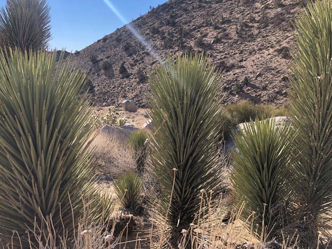
We’ve been following the federal land preservation vs. renewable energy build-out debate for some time.  Right now this seems to have caught some media attention as the Joshua Trees vs. solar panels debate.  According to K.T. Lynn, who writes the Substack “The Joule Thief”,

Last week, a little-known conservation group called Basin and Range Watch went viral in energy and environmental circles on Twitter (now X), drawing attention to the imminent plight of the Joshua trees in the following post:

4,200 Joshua trees are scheduled to be removed are [sic.] replaced by solar panels for the Aratina Solar Project near Boron, CA in June of this year. They will not be salvaged but funds based on the size of the tree will be placed in a mitigation bank

According to its Draft Environmental Impact Report, The Aratina site sits on 2,317 acres of privately owned land in the high desert of eastern unincorporated Kern County. Project plans include the installation of 530 MW of solar PV modules, and an energy storage facility providing capacity of up to 600 MWh for the electrical grid. Located in the Antelope Valley on the western edge of the Mojave, the topography is elevated and mostly flat, and therefore highly suitable for utility-scale solar.

*************

The L.A. Times’ environment columnist Sammy Roth mentioned Avantus in an ode to building renewables on public lands , praising the company’s habitat restoration projects — a classic PR deflection technique that should have raised skepticism and prodded further investigation. As Mr. Roth accurately reported, Avantus purchased 215,000 acres of grazing rights in Kern County from the federal Bureau of Land Management (BLM) in order to retire those rights and restore the natural Mojave ecosystem, including desert tortoises, burrowing owls, ground squirrels, and…Joshua trees. What the Times apparently did not bother to find out was that this land acquisition serves (at least in part) as the mitigation bank that will be used to offset the destruction of the 4,200 Joshua trees on the Aratina solar site. For those unfamiliar with the mitigation bank concept, it is a variation on the carbon offset program, where, according to Investopedia “ecological loss…is compensated by the preservation and restoration of wetlands, natural habitats, and streams in other areas.” These plans are blatantly stated on Arantina’s website:

One novel mitigation approach is the Onyx Conservation Project, which Avantus created in partnership with the Bureau of Land Management (BLM), the California Department of Fish and Wildlife (CDFW), and the U.S. Fish and Wildlife Service (USFWS). In Eastern Kern County, Onyx permanently protects 215,000 acres of critical California habitat – home to 20 sensitive wildlife species, including the Mojave desert tortoise and Mohave ground squirrel, as well as an estimated 80,000 acres of western Joshua Tree habitat.

The story of Joshua Tree protection is fairly interesting.  KT goes on to say:

It is likewise noteworthy that supposed environmental NGOs are fully onboard the bandwagon to build utility solar on virgin desert, without so much as acknowledging the apparent contradiction to their original missions of conservation. In a letter to BLM submitted by a coalition of advocacy groups (NRDC, Audubon, The Wilderness Society) and for-profit energy companies (EDF Renewables, Intersect Power, Longroad Energy), the unholy alliance of signatories urged the agency to hasten the construction of solar projects on federal lands (which inevitably comes at the cost of performing due diligence and thorough environmental impact studies).

What was most interesting to me, though, is the Onyx Conservation Project which “permanently protects” 215K acres of critical habitat.  It sounds like the company bought out a grazing allotment and has done some kind of deal with the State of California for that to count for mitigation for their industrial facility on private land.  From Power magazine:

The resulting Onyx Conservation Project (Onyx), in collaboration with the Bureau of Land Management, the California Department of Fish and Wildlife, and the U.S. Fish and Wildlife Service, reflects Avantus’ creative and concerted approach to building clean energy responsibly while preserving precious land and delivering on President Biden’s America the Beautiful campaign. Onyx conserves and reallocates more than 215,000 acres — roughly seven times larger than San Francisco — from an active grazing allotment to an area permanently dedicated to wildlife forage in Kern County.

Here’s a bit more explanation:

Going beyond the requests of local residents and requirements of the WJTJCA, Avantus purchased the grazing rights on 215,000 acres of federal land in Kern County and created the Onyx Conservation Project. The contiguous land area is seven times larger than the city of San Francisco and considered among the largest mitigation projects in the nation.

The habitat is home to 20 sensitive wildlife species including the California condor, Mojave Desert tortoise, American badger, Mohave ground squirrel and golden eagles. It is also estimated to include more than 80,000 acres of western Joshua tree habitat, including 3,000 acres of dense woodland. This conservation effort will help sustain the health and diversity of the desert ecosystem, which is underlaid by designated Wilderness Areas, Desert National Conservation Lands, and Areas of Critical Environmental Concern. All 215,000 acres will also be open for public recreational use, including hiking and camping.

Avantus will also invest millions of additional dollars for habitat enhancements across Onyx to jumpstart restoration for desert plants and wildlife species.

I’m glad that Avantus buying the grazing leases didn’t enable them to kick off the public.

My Questions:

1. Should federal land (possible removed from current uses) be used to mitigate private development? Since most federal land is more or less conserved, wouldn’t it be better for the environment to buy and mitigate private land?

2. If industries are using taxpayer land for mitigation (remember conservation now counts as a use, at least according to BLM PR) how much should they be paying the taxpayer? Should this be consistent? What should it be based on?

3. Is the concept of “permanent” as in “permanently dedicated” a journalistic error, or is there something going on outside the RMP process, or were they already permanently protected by  their existing RMP based status and this is just marketing for the company to claim credit?

4. If the BLM can do this kind of thing already, why did it need a new rule to do “conservation leasing”?

5. Could this increased desire for mitigation on federal lands have anything to do with political donations?

In some areas, if you take off cows, you end up with large amounts of dry grasses that are fire hazards.  Hopefully that is not the case in this area.

E&E News on Implementation of BLM Rule- Doubling Down on Things People Were Wary Of

Many thanks to a TSW reader who supplied this Scott Streater story in E&E News, which is quite comprehensive.  In addition to an oligarchy vibe, I now get a “separation of powers” vibe about this regulation and its implementation.  It seems like kind of a sharp stick in the eye to the Governors and others who did not support these elements of the proposed rule; in fact, in Streater’s reporting, they “doubled down” on policies people disagreed with.  Feature or bug? I’m so not a politician.   Anyway, in the interests of fair use, I excerpted the two areas of most interest (to me). Feel free to excerpt other sections in the comments.

Stone-Manning and others promised the rule will be implemented in a deliberate fashion when it goes into effect on June 10. This will include a “preliminary suite of implementation guidance” developed by “interdisciplinary and intra-organizational teams” to help guide staff, said Brian St. George, BLM’s deputy assistant director of resources and planning.

***************

But Thursday’s webinar also provided key details about some of the policy and regulatory changes associated with the rule’s overarching goal to elevate conservation as a formal use of BLM lands, on par with energy development, mining, recreation and livestock grazing.

But let’s not forget that BLM “conservation” is not the same as USDA “conservation”.

And it underscored just how much work will be required. The webinar included a chart outlining the work of three “implementation teams” that will assist staff in executing key components of the rule, including conservation leasing, land health standards and the designation of “areas of critical environmental concern,” which the new rule makes an agency priority. For example, a “Restoration and Mitigation Team” has been working for months to develop procedures for one of the most contentious provisions in the rule — the creation of a restoration and mitigation leasing system that energy developers, mining companies and others will be able to use as as part of doing mitigation to offset project impacts on other lands.

I don’t know if this means “other” BLM lands, federal lands, or any lands.

The team is developing a “lease application worksheet” for staff, according to the slide, as well as instruction memorandums to field offices set to be issued soon detailing what project applications should be prioritized for restoration leasing.  Critics have argued that environmental groups, among others, could purchase the leases and lock up public lands from energy development and mining for years. While the rule allows for nongovernmental groups to buy these leases and pay to conduct restoration work on the land, this should not be interpreted by staff as conveying “exclusive rights to the use of the public lands” under a 10-year lease, said Deblyn Mead, a BLM national mitigation specialist.

I just don’t get it.  If they are paying for good things to happen, and that doesn’t preclude other things from happening, then they don’t really need leases.  I don’t see that the BLM has had trouble administering outside money to do good things, while maintaining the option of allowing other things on site.

What’s more, criticism by congressional Republicans that private entities or individuals associated with “foreign adversaries” such as Russia could purchase a restoration or mitigation lease is unfounded, said Mark Ames, a BLM realty specialist. “Foreign persons may not be granted a restoration lease,” Ames said.

I don’t want to be overly skeptical here, but when organizations, including “conservation groups” aren’t required to show who is funding them (as in the various c3s and c4s I’ve been following) how is anyone to know? Take Hans Wyss for example; for sure, Switzerland is not Russia, but he is a foreign national who seems to be funding many some ENGO’s.

Temporary ACEC protections

BLM doubled down on a potentially contentious aspect of the rule that would allow the agency to implement “temporary management” procedures for some parcels nominated for designation as areas of critical environmental concern, or ACECs, that would block energy development and other uses on sensitive rangelands, potentially for years at a time.

Brenda Lincoln-Wojtanik, a senior planning and environmental analyst, outlined to staff the process of applying these temporary measures to nominated parcels. BLM state directors are authorized under federal law to implement these temporary management measures on nominated parcels, with few restrictions. Directors can take this step before parcels go through the lengthy land-use revision process required before the designation of an ACEC — which are managed primarily to protect their environmental, cultural, historic or scientific values, restricting activities that conflict with that priority.

To qualify for these temporary management measures, the nominated parcels must be determined to have “relevant and important values,” and that “special management attention” is needed to protect the resource values.

As a former bureaucratic writer, I could probably write such such a rationalization for any BLM acre as requested :).

The Information Bulletin sent to staff late Thursday says the new rule establishes “a presumption” that all potential ACECs that meet these three requirements “will be designated” as such. It also includes a chart stating that BLM staff should “immediately” begin to consider ACEC nominations “and implement interim management as appropriate.”
The temporary management measures would be lifted once BLM makes a determination about the ACEC as part of a larger resource management plan (RMP).
But some land-use plans can wait decades to be revised.

I don’t get it, I thought this Admin was all about NEPA, public involvement and addressing the views of marginalized communities (which RMPs do and this does not). Another idea, if RMPs are too hard to do.. maybe change those regs?  Ask Congress for help amending the statute? I don’t actually see “three” requirements in the story, I just see “values” and “attention”??

House Natural Resources Chair Bruce Westerman (R-Ark.) highlighted this aspect of the rule on the House floor last month prior to the approval of H.R. 3397, which would require BLM to withdraw the rule. Even though this has been used by BLM only a handful of times in the past 25 years,  it’s an option that the bureau may use more frequently now. “If we decide that we’re going to evaluate that nomination and we find that it meets all three criteria, we are required then to protect those values” through temporarily protective measures, or the start of a new resource management process to evaluate the ACEC nomination, Lincoln-Wojtanik said.

In addition to vibes of oligarchy, separation of powers issues, I get a strong vibe of hornswogglery with this one.

BLM Conservation Rule Finalized- Kept Controversial Leases But Renamed Them

Biden-Harris Administration Finalizes Strategy to Guide Balanced Management, Conservation of Public Lands

Public Lands Rule will help conserve wildlife habitat, restore places impacted by wildfire and drought, expand outdoor recreation, and guide thoughtful development 

A skeptic might wonder how the Forest Service could possibly “conserve wildlife habitat, restore places impacted by wildfire and drought, expand outdoor recreation, and guide thoughtful development” without such a rule? Here’s a link to the Rule. There are also fact sheets and other information here.

So let’s take a brief look to see what has changed based on the comments received. Hopefully, paid legal folks will look more intensively at it. Just in case you’re curious, they received “over 200,000 comments, the vast majority of which supported the effort. In response to the substantive comments received, the BLM clarified and refined concepts laid out in the proposed rule.”

Kind of sounds like they didn’t change anything, just clarified and responded.

***************

I’m not a fan of the temporary ACEC idea, from the FAQS:

If the BLM finds the area meets the criteria for ACEC designation and determines that the relevant and important values could be irreparably harmed if not protected, then the BLM may implement temporary protections that could maintain the condition of identified resources until a potential ACEC can be fully evaluated through land use planning. The public would be notified of any temporary protections.

In response to comments received from individuals, state, Tribal and local governments, industry groups, and advocacy organizations, the BLM clarified that ACECs should typically be evaluated in land use planning because their designation is intended to be a proactive decision made in concert with other considerations that affect the same lands and resources. The Final Rule also refines procedures for ACECs that are nominated outside of the land use planning process, recognizing that the BLM can defer consideration of those areas and, in the rare instances when it may be necessary, can also implement temporary protections.

So the response to the comments was to state that they expect it to be used rarely? And so some group of whatever location and funding could nominate the area, and the public would be “notified”.
This does not sound like a robust public involvement process with considerations of Tribal view; I guess that would be OK because it’s “temporary” only until the next RMP.. and what is the RMP schedule, again?

******
I also wonder about the offsite mitigation idea. It doesn’t sound like there’s a role for both sets of communities to weigh in. Of course, the communities near the siting will weigh in, but what about the community receiving the mitigation lease?

Let’s look at an example in the FAQs

Appropriate places for restoration and mitigation leasing on public lands include degraded habitats in need of restoration, as well as intact landscapes and functioning ecosystems that can serve as compensatory mitigation for a particular action. For example, as part of authorizing a renewable energy project on public lands, the BLM and the project proponent may agree to compensate for loss of wildlife habitat by restoring or enhancing other habitat areas on public lands. A mitigation lease could be used to protect the restoration and enhancement actions.

But who and what are the lessees protecting the “restoration or enhancing” from, other than existing users? Just logically, if the project doesn’t need to be protected from existing users, why do you need a lease? If it does need to be protected, then from whom or what exactly? Some other new use such as another solar or transmission line? This puzzles me. But if it’s a new use, it would have to go through permitting and perhaps the “restored or enhanced” area could have been avoided (or mitigated elsewhere, perhaps via chains of mitigation..).

The Bird Example

The environmental analysis for an interregional transmission line finds the project would have unavoidable impacts on a bird species that is managed as imperiled by the BLM and by state governments where the transmission line is proposed. The authorizing agencies determine that compensatory mitigation is warranted to address impacts to the species, and the best remaining habitat is found on BLM-managed public lands.
In this case, the BLM could consider an application for a mitigation lease to conserve the bird’s habitat on public lands. The lease would identify conservation measures that address the unavoidable impacts to the bird species and would help ensure that these measures remain effective for the duration of the transmission line’s impact. The mitigation lease could be terminated or modified in response to changing habitat conditions.

Why would a lease be preferred to something more flexible? Suppose BLM goes to all the work of doing a lease for an area for some bird. But then the area is burned over. Wouldn’t it make more sense to have something more flexible and robust to change? Or maybe it makes more sense to make one intervention for a species in one place, and then make that same intervention in another place as opposed to making a series of interventions in the same place.

I am reminded of my first run-in with ideology. I was working in US Congresswoman Carrie Meek’s (17th District Florida) office in the mid-1990s. The issue was deregulation of power in Florida. No matter what questions I asked, deregulation was always the answer. It was impossible to engage with the proponents in a down-to-earth way- it was like pragmatism vs. ideology. Deregulation is great. Deregulation is better than sliced bread. Deregulation will only have positive effects. If you point out negatives, let me assure you the positives will outweigh the negatives. No, we don’t need those protections included because… Deregulation is great. It is better than sliced bread…

I have the same feeling about these leases, even if they changed the name.

Governor’s Task Force Arrives at Recommendations on Rock Springs RMP

In a breakout task force group to discuss the Rock Springs Area Resource Management Plan Revision, stockmen John Hay III, president of the Rock Springs Grazing Association, and T. Wright Dickinson of the Vermillion Ranch work on the Wyoming alternative. (Angus M. Thuermer Jr./WyoFile)

This is an interesting story from Wyofile on the Rock Springs RMP.  Turns out that the Governor got together a panel to review the draft.

Despite representing disparate interests, the 11 members of a governor-appointed task force reached consensus on more than 100 recommendations for the Bureau of Land Management’s controversial draft plan for managing some 3.6 million acres in southwestern Wyoming.

The guidance, released in a report late Wednesday, represents a cool-headed note in a public process defined by furor at the federal agency. Many of the packed meetings convened last fall to discuss the plan unfolded with anger and misinformation — including misinformation the BLM itself disseminated by mistake.

Gov. Mark Gordon held the recommendations up as an example of how Wyoming knowledge can inform a better Rock Springs land management plan.

“This particular effort was initiated out of necessity,” he said in a statement. “It was critical we amplified the public’s involvement in this important BLM planning document, and shared with BLM how Wyoming, through collaboration, creates durable and quality land management policy.”

The final recommendations include conserving landscapes around the prized hunting grounds of the Greater Little Mountain Area, protecting development of the trona assets contained within the Known Sodium Leasing Area as well as proposals for managing the “checkerboard” area of the field office that recognize access needs and wildlife migration. They support continued motorized use and continued grazing. They also urge protections for key cultural features and natural resources, but advise special designations in just a few limited areas.

***********

Though many Wyoming denizens came out forcefully against the agency’s preferred alternative, which prioritizes conservation and gives large zones new designations of “areas of critical environmental concern,” Stone-Manning stands by the draft.

“The BLM believes there are a lot of shared values and goals in this plan that strike a balance with conservation and multiple uses,” Stone-Manning said.

*********

“We look forward to carefully considering [the task force’s] thoughts and the public’s comments as we finalize the plan,” Stone-Manning said.

***************

Critics decried the closure of large acreage to energy leasing, the roughly 2.5 million acres that would be excluded for new right-of-way consideration and the transference of lands into “areas of critical environmental concern,” a designation used to protect important historic, cultural and scenic values. Designated ACECs would swell from current acreage of 286,000 to more than 1.5 million acres under B.

Conservationists, however, have championed the vision outlined in the preferred alternative, saying the area is ecologically valuable enough to warrant a conservation-forward approach.

******************

One major source of consternation spawned from a typo. The BLM mistakenly left in a provision saying it would close 4,505 miles of routes and eliminate another 10,006 miles of undesignated, illegal routes under Alternative B. BLM officials assured that mistake would be fixed.

But claims of the agency shutting down traditional activities like hunting, camping and recreating were unfounded, agency officials maintain.

“For whatever reason, people latched on very quickly that any ACEC designation was going to automatically restrict public use,” Rock Springs Field Office Manager Kimberlee Foster told WyoFile during a September open house. “And none of that is true.”

*********

The agency has battled misinformation through the process, Stone-Manning said. “One significant area of misinformation has revolved around access to our public lands,” she said in the email. “For example, there have been rumors about no longer being able to walk your dog on public lands, roads closing, and hunting no longer being allowed. None of this is true and we are taking every opportunity to separate fact from fiction. Public lands are open to the public and there are no decisions to open or close roads being made as part of updating this resource management plan.”

***************

Not to be unnecessarily skeptical (not being a BLM expert), but is this a case of carefully worded “sleight of planning”?  Decisions to restrict access would  not be in the plan itself, but the plan would set the context for follow-on decisions.  I note the qualifiers “automatically” restrict public use, “no decisions.. being made as part of updating.”

I also wonder if Director Stone-Manning meant this:

The BLM’s approach to defusing the hot situation, Stone-Manning said, is to start with what’s universally important about the land. “One starting place for us is always that clean water, abundant wildlife and the sustainable use of natural resources on our public lands is something that everyone cares about,” Stone-Manning said. “From this place, we are working to engage in grounded conversations and dialogue on how alternatives and details in the plan support and balance that.”

Perhaps they could have not developed the “hot situation” in the first place by talking to local folks and elected officials; or rather talking to them and following through on what they said.  If the Biden Admin is carefully watching its two land management agencies (which I don’t think it is.. but still) it might notice that many forest plan revisions have stakeholder groups that work together to develop recommendations.  Why does this RMP effort seem so relatively top-down in comparison? My BLM retiree friends would probably tell me its because FLPMA has political appointees as leading the agency.  Whether this is good governance or unnecessarily drama and ill-will-provoking is another question.

*****************

Here’s a note I received from Pew today: (Take Action Now!). The RMP has the potential to “chart a new course for public lands management here and across the country.” Why Rock Springs though, of all places?  And the “best possible policy for the region’s wildlife and people.” Because those people..who live there.. don’t actually know what’s best for them, I guess.

Dear Wilderness Supporter,

The Bureau of Land Management (BLM) is deciding how to conserve migration corridors and habitat for more than 350 wildlife species while preserving cultural sites and sacred landscapes across a wide swath of public land in Wyoming. When finalized, the Resource Management Plan (RMP) will dictate conservation and management of this breathtaking landscape for the next 20 years or more, and the BLM needs to hear from you in order to make the best possible policy for the region’s wildlife and people.

The Wyoming Red Desert, at the heart of this management plan, is a wild place. It is one of only a handful of vast landscapes that host such an intact assemblage of wildlife, ranging from a one-of-a-kind resident population of desert elk, the world’s longest migration corridor for mule deer, and pronghorn antelope and prairie dog colonies as far as the eye can see. Further, significant Indigenous petroglyph sites and ancient trails crisscross the landscape. At the same time, oil and gas rigs encroach on the important habitat here, as do other proposals for developing the land.

Help shape the future of our public lands by lending your voice for wildlife and wild places.

The BLM issued a draft management plan that favors a strong conservation approach, proposing to limit additional energy development while ensuring that many of the undeveloped areas and cultural resource sites remain undisturbed. With several important changes, especially for migration corridors, the Rock Springs management plan has the potential to chart a new course for public lands management here and across the country. Don’t miss your opportunity to weigh in on this critical plan and help ensure that its final version is the best it can be for wildlife and wild places!

Fall 2023 Unified Agenda of Regulatory and Deregulatory Actions FS and BLM

Here’s a link to the Agenda

Here’s a screenshot of the BLM section:

Looks like the “Conservation and Landscape Health” CLH rule will be out soon.
Here’s a screenshot of the FS section:

Looks like MOG is not on the list for now. Many of these are unknown to me… if any of you are familiar with them or have links to reporting, please put in the comments (that’s also true for the BLM regs other than the CLH reg.

Rock Springs RMP: Renewables, Carbon Capture, Transmission and Rights of Way- Wyofile Story

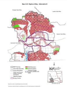
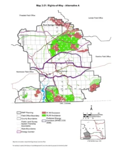
This map depicts rights-of-way exclusion areas as proposed in the Bureau of Land Management’s preferred “conservation” Alternative B of the Rock Springs Resource Management Plan draft environmental impact statement. (Wyoming Bureau of Land Management)
This map depicts rights-of-way exclusion areas in the Bureau of Land Management’s current management plan. (Wyoming Bureau of Land Management)

We have been discussing the Rock Springs RMP. First, the Cowboy Daily had an article about a retiree’s views on the process.  Then we had the NY Times story.   I’m always wondering about whom the Biden Admin is serving when it comes to making decisions on renewable energy vs.  “protection.” Fortunately for all of us who don’t want to read draft EIS’s (without getting paid),  a reporter from Wyofile looked into specifically my question.

This map depicts rights-of-way exclusion areas as proposed in the Bureau of Land Management’s preferred “conservation” Alternative B of the Rock Springs Resource Management Plan draft environmental impact statement. (Wyoming Bureau of Land Management)

Undeveloped areas will be largely off-limits to industrial-scale energy projects — be they fossil fuels, trona, hard minerals, wind, solar or a combination — under the Bureau of Land Management’s preferred “conservation” scenario for managing 3.5 million acres of federal land in southwest Wyoming, some observers say.

That’s primarily because the BLM’s conservation priority spelled out in “Alternative B” — one of four management scenarios in the Rock Springs draft environmental impact statement guiding its resource management plan — would vastly expand “exclusion areas” for rights-of-way, hampering greenfield development for projects that require new roads, pipelines and electric transmission lines.

Nearly 2.5 million acres — 71% of the planning area — would be excluded from consideration for new rights-of-way.

That’s a 481% increase in acreage off-limits to things like maintained roads, power lines and pipelines. BLM officials say it’s also a means to inhibit permanent industrial facilities in other areas — a state-owned land section, for example — because they typically require infrastructure like power lines and pipelines. 

“Conservation, that’s what’s driving that particular alternative,” Wyoming BLM spokesman Brad Purdy told WyoFile. “So there would be less development overall.

“Rights-of-way,” Purdy continued, “that’s how we [permit] solar. It’s how we do roads, how we do power lines. I think all of those types of things would be impacted.”

The proposed rights-of-way exclusion areas take into account conservation values weighed against “marginal” energy yield opportunities in yet-to-be-developed areas, according to the BLM. Legislative leaders, however, say it’s another example of the agency’s failure to find a balance that doesn’t harm Wyoming’s “bedrock industries.”

My bold. But if they are marginal energy opportunities, why do they need to be taken off the table?

So here is what the Wyoming Outdoor Council folks think.

A close examination of where the 2.5 million acres of rights-of-way exclusion areas are drawn suggests a recognition of marginal development opportunities, particularly for wind, solar and geothermal energy, according to Wyoming Outdoor Council Energy and Climate Policy Director John Burrows.

There are simply higher-value wind resources in other areas of the state, Burrows said, while the preferred alternative still allows for adequate growth in both wind and solar development where industrial infrastructure already exists — primarily along the Interstate 80 corridor. The proposed exclusion areas, he noted, mostly encompass large areas of the northern and southern portions of the management area, where there’s little to no existing industrial infrastructure.

“The BLM’s preferred alternative keeps just under 1 million acres of land open and available to wind and solar leasing,” Burrows said. “In our assessment, this is more than adequate to give future opportunities for responsibly sited renewable development while also protecting the truly outstanding wildlife habitat, wide-open spaces, cultural resources and other values across the planning area.”

Is it possible that maybe the Wyoming Outdoor Council is not on the same page as DOE might be on the need and preferable locations for renewable development (and transmission lines)?

Industrial-sized carbon management projects such as the Sweetwater Carbon Storage Hub, which would pump and store carbon dioxide deep underground, and Project Bison, which would pull carbon dioxide from the atmosphere in what’s referred to as “direct air capture,” are located just outside the BLM’s Rock Springs Field Office management area. However, those projects require pipelines, power lines and other infrastructure that may need rights-of-way approval from the BLM in the Rock Springs management area.

For example, the Sweetwater Carbon Storage Hub partnership will rely on constructing facilities to collect carbon dioxide from multiple existing trona mining facilities near Green River and pipe it to injection sites near Granger.

Trona, oil and natural gas

The BLM’s preferred conservation alternative would also further restrict potential expansions of trona mining and, especially, oil and natural gas development due to the proposed growth of rights-of-way exclusion areas and myriad wildlife habitat projections.

It would “increase the level of impacts to trona development and could result in further reduction of trona extracted via mining activities,” according to the draft EIS. It would also result in a 73% drop in projected federal oil and gas drilling over the next 20 years “due to an increase in areas that are closed to fluid mineral leasing and managed with [no surface occupancy] stipulations.”

It seems like different departments within the USG are funding climate actions, technologies and subsidies, while others are blithely cutting off possibilities for the future use of those technologies and increasing the difficulty of siting.  If we are in a “climate emergency” wouldn’t we want to map the potential build-out of renewable and transmission needed first, and then “protect” what’s left?  And certainly mining our the minerals we use,  and not importing them (from countries of questionable friendliness) has some value, even if they do not fit the definition of “strategic.” Because they provide jobs and tax dollars, and if our environmental regulations are not as tight as other countries’ are, they can be fixed.  The point of view of “get it somewhere else” applied to the US seems to me to be economically and national security-wise a really bad idea.  And I thought Covid had made us rethink supply chains? At the same time, according to this Admin, made in the US is a good thing, while minerals produced in the US are not, except for some.  It’s all very puzzling.

Anyway, thanks to Dustin Bleizeffer of Wyofile for looking into this.