More on the Nez Perce-Clearwater-Lolo revision (and the Great Burn)

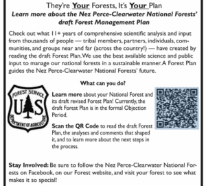
Here’s a little more (added to this) on the Nez Perce-Clearwater revised forest plan.  Mostly I wanted to share this graphic of how they are “reaching out” to the public.  They ask an important question:  “What can you do?”  The obvious meaning seems to be what can you do about the forest plan, and the answer for most people is “nothing.”  They say that the plan is in the objection period, but don’t tell us that the only people who can participate are those who have already done so.  They invite us to “learn more,” about this nearly-done deal, which they misleading label as a “draft Forest Management Plan.”  (At the draft EIS stage, the Planning Rule refers to it as the “proposed plan,” and at the objection stage it is just the “plan.)   While they have must have included similar outreach at earlier stages in the process, for those encountering this for the first time, it’s almost disingenuous.

But while I’m at it , there was also another article recently that focused on the State Line Trail, which runs through the Hoodoo Recommended Wilderness Area in the Great Burn between Idaho and Montana.  (I’ve been there but haven’t been directly involved in the planning, so know only what I read.)

“It used to be a marquee backcountry ride for mountain bikers, too. That ended in 2012 when the Nez Perce-Clearwater National Forest, which controls the Idaho side of the trail, approved a new travel management plan that barred bicycles from its portion of the trail. On the Montana side, the Lolo National Forest has long allowed bicycles on the trail.”

A new revised forest plan for the Nez Perce-Clearwater could change that, by determining that bicycles are an appropriate use in the portions of Idaho around the trail, which would mirror access on the Montana side. If the changes in the plan are finalized, possibly later this year, that would set the stage for the Nez Perce-Clearwater to revisit and alter its 2012 travel plan to formally re-allow bicycles on the trail.”

The rationale behind these changes, according to the forest supervisor, don’t seem to include consistency (more on that later):  “We have these types of very primitive, amazing, out in the middle of nowhere experiences that you can get to no matter what your matter of conveyance is.”  No apparent agency recognition that the conveyance is part of the experience for those who encounter it, and for some it makes it feel unpleasantly more like “somewhere.”

One of the supporters added, “It’s a small segment of the sport that this is going to appeal to,” he said. “It’s not that close to Missoula. It’s hard. The trail’s in deteriorating condition. But this opportunity is, for certain people, something they really, really want.” That small segment of certain people (who apparently want to deteriorate the trail even more) must be pretty special to get this kind of personalized attention.

“Some mountain bikers are drawn to remote, rugged, and challenging backcountry trail experiences on wild and raw landscapes,” a group of supporters commented. “These are places where it is uncommon to see other trail users, and where riding requires a high level of physical fitness and technical skill — in many cases it involves pushing a bike instead of riding at all.”  That would be like hiking, wouldn’t it?  So, it’s not like closing the area to this use would exclude these physically fit people from these wild and raw landscapes.  I’ll admit that I don’t understand the rationale of wanting to experience a “wild and raw landscape” on a machine, which (to me) reduces the rawness and wildness of the experience.

The aura of personal opinion and politics behind these wilderness debates is why I focus my energy on other things.  Here there is also talk about snowmobiles and mountain goats, and why mountain goats are treated differently in adjacent national forests.

As for the effects of snowmobiles on mountain goats, the Idaho Department of Fish and Game blamed them for disappearance from one part of this area, but the founder of the Backcountry Sled Patriots says otherwise (citing other research).  The Lolo National Forest cited the negative effect of motorized over-snow machines as reason for designating them a species of conservation concern.  The Nez Perce-Clearwater is not concerned about mountain goats.  The Forest Service minimizes the importance of the areas at issue to mountain goats (though they apparently used to be some places they are not found now).

About the Lolo, Marten, the regional forester, who determines which species are SCC, wrote:

“Compared to other ungulates, the species appears particularly sensitive to human disturbance. Motorized and non-motorized recreation, as well as aerial vehicles, are well documented to affect the species, particularly during winter and kid-rearing season, with impacts ranging from permanent or seasonal (displacement), to changes in behavior and productivity.”

The regional director for ecosystem planning said that she didn’t see the different listing decisions as being in conflict with each other. Rather, she said, they reflect that mountains goats are doing better overall on one forest than the other.  This may be technically/legally possible since SCC are based on persistence in an individual forest plan area.  However, it doesn’t make a lot of sense to me to manage one national forest to increase the risk to, and to contribute to SCC designation on, another forest.  Moreover, the Planning Handbook states that “species of conservation concern in adjoining National Forest System plan areas” should be considered by the regional forester in making this designation.  This all has kind of an arbitrary ring to it.

As for consistent management across national forest boundaries, The Nez Perce-Clearwater plans to change the shape of the Hoodoo RWA to remove the key snowmobile areas from it, so that boundary between the national forests becomes a boundary for the RWA.  The Forest Service points out that the plan revision process in the hands of forest supervisors, not the regional office.  The forest supervisors disclaim any obligation for consistency, and even suggest that travel planning may produce a different result, and “forest plans and travel management plans are continually updated and amended” so they could change again.  That doesn’t square well with history.  The every-third-of-a-century Forest plan revision should be the time to get it right.  Even if the regional forester doesn’t want to say what the plans must do, that person could simply order them to be consistent along this boundary.
Over the Weekend – Blue Mtn. blues, Flathead secrets and monumental benefits

I guess this is a bookend to Sharon’s “Friday News Roundup.”


BLUE MOUNTAINS

I recently provided an update on the status of the Blue Mountains forest plan revisions here.   And here’s a little more detail on that, especially on the question of “access.”  (This term gets used for a couple of different things, and this one is about closing roads on national forests rather than creating access across private property to reach public lands.)

One group says its leading the charge to fight for what they call “original rights” is Forest Access for All.  “We defend the rights that we’ve had since Oregon was a territory, free reign where we go and utilize the forests which are public lands,” says Bill Harvey, a group member and former Baker County Commissioner. “A couple decades ago the Forest Service began closing off sections of the forest and that’s when Forest Access for All was formed.” Harvey says his group’s particular ire is at the Wallowa-Whitman National Forest (WWNF), which he claims “have closed thousands of miles of roads in the forest the last twenty years.”

The group also has other “conflicts” with the Forest Service include the need for  more vegetation management, economic benefits of (motorized) recreation, and better public engagement.

“By law right now, we have an open forest. They will admit it, everybody admits it, and it’s in the books, I’ve seen it a million times. It is an open access forest,” says Harvey. “Why in God’s name would we want to give that up? Nothing benefits us to give up our rights that we have currently. We’re not asking for more rights, we’re asking for the existing rights to stay in place.

I’m going to disagree with him on this one, and I hope the Forest Service does, too (although it looks like they could have done a better job of setting the locals straight on this before now).  In 2005, Subpart B of the Travel Management Rule changed the culture of motor vehicle use on roads, trails, and areas from “Open unless closed” to a system of designated routes.  As for why?  The goal was to reduce resource damage from unmanaged motor vehicle use off that road system.


FLATHEAD

Newly revealed emails show that the Flathead National Forest under then supervisor Kurt Steele looked to keep a proposal of a tram up Columbia Mountain from public view for more than year prior to it being first proposed.

Does this sound familiar?  It sounds to me like the “Holland Lake Model” that got the forest supervisor a “promotion” to forest planning.  In this case the Forest properly rejected the proposal as inconsistent with its forest plan (thank you forest plan!).  But it does suggest a pattern of incentives and behavior that may be broader than the Flathead National Forest.

“The process where the public comes into play is when it becomes the NEPA process,” Flathead Forest spokesperson Kira Powell said about the emails.

“Bringing you into the conversation about this potential project on the Flathead NF because it’s coming from investors who apparently have the financial resources to build a tramway, meaning they likely have political savvy also … wrote Keith Lannom, who was deputy regional forester for Region 1 at the time …”

This account offers a window into the role of “political savvy” in Forest Service decision-making.


ORGAN MOUNTAINS – DESERT PEAKS NATIONAL MONUMENT

Since President Barack Obama created the Organ Mountains-Desert Peaks National Monument in 2014, visitation has tripled and the national monument has spurred economic growth in the Las Cruces area as well as other communities near the national monument, according to a new report.

According to this overview, the report looks at the various factors that made this particular monument so successful, including its location relative to population centers and the uses it caters to.  Also local community support.

“We have always recognized that the establishment of the monument was due in large part to the grassroots effort at the local community organizations and individuals,” Melanie Barnes, the state BLM director, said. “And due to this engaged and proud community, the monument has seen an increase in visitation.”

She said the BLM is working on a resource management plan that will address land use and resource protection. The public scoping period for that plan recently ended.


Recreation effects on wildlife conference

The effect of recreation on wildlife is a topic that has come up a few times here.  It has apparently reached the visibility of a “conference theme,” at least in Canada: “Responsible Recreation: Pathways, Practices and Possibilities.”  This conference in May focused on the Columbia Mountains in southern B. C., but may be of broader interest.  You can still sign up to see the recorded conference until the 16th, but the written proceedings are available from this website.

From the conference description:

Recreation and adventure tourism opportunities and activities are expanding globally, with the Columbia Mountains region being no exception. From hiking, mountain biking, snowmobiling, dirt biking, cross-country skiing, to motorized and non-motorized watercraft use, all activities can have an impact on wildlife and ecosystems. However, empirical measures of impacts are often difficult to obtain, with unknown thresholds that ultimately affect the viability of wildlife populations and ecosystems. This limits policy development and impact management. Furthermore, the cumulative effect of multiple overlapping recreational and industrial activities on the landscape are seldom considered or addressed.


Effects of e-bikes on wildlife management areas

by AltoRider

We’ve discussed e-bikes, and one of the questions was what kinds of effects they have, and on wildlife in particular.  It looks like some places have seen enough use to say something about that.  Here is one report on that from the Utah Division of Wildlife Resources.

Class II and Class III e-bikes are now banned in off-road areas at all 193 wildlife and waterfowl management areas in the state, according to the Utah Division of Wildlife Resources…

Division officials explained that they altered the rule because some e-bikes were “ruining” habitat meant to protect the state’s wildlife. They believe the rule change can help reduce habitat destruction.

“In areas where there is a lot of e-bike use, notable habitat damage is occurring,” said Utah Division of Wildlife Resources Capt. Chad Bettridge in a statement Thursday. “With the increased use of e-bikes, we are seeing these properties damaged, ultimately limiting our ability to manage them for their intended purpose.”

“While we would like to provide recreational opportunities on our WMAs, these properties were purchased for the benefit of wildlife and wildlife habitat,” he said. “These properties are public land, but they are not multiple-use like many other state and federally-owned properties.”

California Nine-Forest Hazard Tree Plan: Currently in Prep

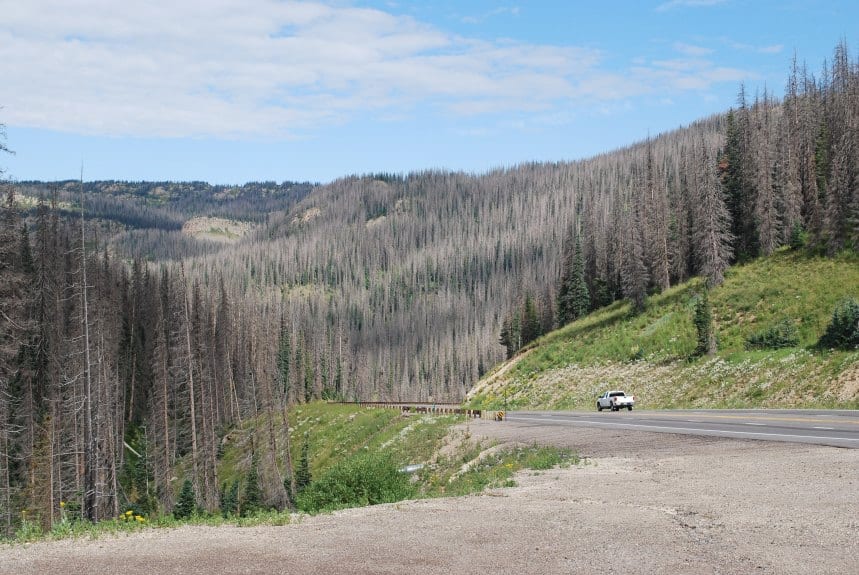
I couldn’t find a photo of a cleared California highway or forest road.. this is from Colorado.

Region 5 is working on a  hazard tree decision for certain burned areas on certain (9 total) Forests with wildfires.  It sounds like they are looking toward doing one EA per zone. This seems like an interesting experiment to see what can be standardized and what is best done at the zone or forest level.

Here’s a link to the documents. From scoping letter.

I am writing to inform you of the opportunity to provide input on the R5 Post Disturbance Hazardous Tree Management Project in the Forest Service Pacific Southwest Region (Region 5). Due to the time-sensitive nature of the proposed hazard tree removal, I am requesting your input on the proposed action briefly described below within the next 21 days, by November 15, 2021, to ensure your comments are fully considered during this public scoping opportunity.


The record wildfire years in 2020 and 2021 in California have resulted in fire-killed or damaged trees that pose threats to public health, safety, and property. The R5 Post Disturbance Hazardous Tree Management project includes hazard tree felling and removal, as well as removal of downed woody fuels resulting from hazard trees (slash), to reduce public safety hazards along portions of roads, trails, and near facilities (campgrounds, trail heads, Forest Service offices). We have identified a need to expedite analysis and decision making related to this project, which includes activities that are not novel, and for which the effects are generally well-known.


Hazard tree felling, removal, and slash removal is proposed in specific project areas within the following national forests: Inyo, Klamath, Lassen, Mendocino, Modoc, Plumas, Sequoia, Shasta-Trinity, Sierra, and Six Rivers within the North, Central, and Southern Sierra sub-regional zones.


To initiate the scoping process for this project, a more detailed description of the proposed action has been developed to provide the public and other stakeholders an opportunity to review and comment on the proposal. A copy of the proposed action and associated maps can be found on the project website (https://www.fs.usda.gov/project/?project=60950).

Based on the nature of activities being proposed, we intend to document the National Environmental Policy Act environmental analysis for these activities within separate environmental assessments for each of the three zones. The environmental assessments will be made available for public review during an upcoming 30-day comment period per 36 CFR 218.22 (anticipated January 2022). Ultimately, the Forest Supervisors will decide whether to implement the proposed actions on each Forest, implement an alternative action that meets the purpose and need, or take no action.

What’s interesting to me about this article about it from California Wild, compared to our Williamette discussion, is this idea..

In the past, wildfire-damaged hazard trees in undeveloped areas and along backcountry roads and trails are removed annually before the start of the summer recreation season. This reduces the hazard of trees falling on recreational visitors. And it also allows for the conservative retention of trees damaged but not necessarily killed or condemned to die by the fire. But the Forest Service no longer has the funding or staff to remove fallen or soon-to-fall trees on an annual basis and over the hundreds of thousands of acres that have burned in the last few years. Roughly 120,000 miles of trail, or about 75% of the National Forest trail system, already require some level of maintenance or repair. The massive hazard tree removal program proposed by the agency may lead to significant trail repair in some areas, but at the expense of the wilderness and recreational experience.

This is the “do it as they fall, but they can’t afford to” argument.

CalWild’s comments did not opposes hazard tree removal along roads, although this too has its drawbacks. Wide swaths of forest along some of the most scenic highways and roads in Northwest California and in the Sierra Nevada are proposed for clearing. Eliminating hazard tree removal taking place in sensitive wild places like roadless areas will help expedite the process. In addition, our comments requested that project not be expedited in a manner that bypasses the crucial public review, comment, and alternatives development process provided by the National Environmental Policy Act (NEPA).

California Wild also thinks that “swaths” or “denuding” along trials impairs “outstanding recreation values”. That might be in the eye of the beholder, especially in a burned over area.

They also say:

The Forest Service may seek an “Emergency Situation Determination” (ESD) from the Chief of the Forest Service to expedite the proposed project. This would enable the agency to sell hazard trees for their commercial value before they begin to rot, but it bypasses the pre-decisional objection process, which allows the public and other affected agencies to object to project actions and negotiate positive changes.

I’m kind of sympathetic to this.. the more detailed a project proposal is, the less need there is for two bites at the apple (comments and objections). It does draw attention to the objection “negotiation” process.  I’ve only heard stories about these and would be interested in peoples’ experiences.  For a different thread, though…

Some roads may be useful for clearing a corridor due to their location for potential strategic fire breaks…(plus for roads with faster speeds, it seems like it would help reduce vehicle/wildlife collisions.)

In fact, CalTrans has a plan about the former for state highways.

Overview

State highways extend through every county and range of elevation in California.  Over 5,000 centerline miles of state highways are built in a rural setting of natural landscapes, including forestland, chaparral and grassland winding through mountains and along coastlines.  Historically, active forest management of forests was discouraged in California, but this has resulted in unhealthy, overly dense timber and vegetation which increases wildfire vulnerability and decreases forest health. Drought has triggered widespread accelerated forest mortality.

Defensible space, in the context of fire control, is a natural or landscaped area around a structure that has been maintained to reduce fire danger. Through the Division of Maintenance, Caltrans prepared a Wildfire Vulnerability Analysis (2020-2030) which identifies the highway corridors that are a priority for fuels reduction to create defensible space.  Fuels reduction projects with local, state and federal partners would reduce wildfire vulnerability to life, property and ecosystem services.

Defensible space can also mitigate the probability of wildfire ignitions originating from vehicles and travelers, reduce direct impacts to state highway assets when wildfires do occur, and maximize traffic flow for all modes of transportation during normal and emergency operations.

So roads as defensible space are a thing also, at least in California.  Another reasons to focus on getting PODs delineated ASAP, IMHO.

Recent forest plan litigation

Litigation about the validity of a forest plan doesn’t happen very often, but two revised forest plans have been in the news for that lately.

Flathead court decision

The Montana District Court has decided the first case reviewing a forest plan revised under the 2012 Planning Rule, and it rejected decisions made in the Flathead plan related to roads because of the Fish and Wildlife Service and Forest Service had not adequately analyzed the effects of roads on grizzly bears and bull trout.  The court held that the process of revising the forest plan violated the Endangered Species Act; plaintiffs did not challenge compliance with NFMA or the Planning Rule. The court found no violations of NEPA and travel planning requirements.  The revised plan remains in effect pending additional analysis, but additional analysis will also be required for ongoing projects.  I haven’t read the opinion yet, and it’s not clear to me why these projects should not also be required to comply with the old plan direction for roads, which would have limited road construction, unless/until the revised plan complies with ESA.

This article quotes the judge on the crux of the case regarding grizzly bears:

“The mere fact that the (NCDE) population was increasing from 2004-2011 does not justify moving away from the existing management requirements of Amendment 19. In effect, by recognizing that Amendment 19 laid the foundation for recovery of the NCDE population and then using that recovery as justification for getting rid of the existing access conditions, the Fish and Wildlife Service eschews Amendment 19 precisely because it was working. This action is arbitrary and capricious,” Molloy wrote.

Additionally, the article continues:

Molloy agreed the choice of conditions in 2011 was arbitrary. Even had the choice been acceptable, the U.S. Fish and Wildlife Service should have analyzed whether the new Forest Plan would have exceeded the 2011 baseline, which was a reflection of conditions existing while Amendment 19 influenced the plan. But the agency didn’t do that.

The USFWS also didn’t explain why it didn’t recommend culvert removal as part of road abandonment to aid bull trout survival. Molloy pointed out that the agency’s 2015 Bull Trout Recovery Plan emphasizes the importance of culvert removal and road decommissioning. But then the agency backed off, saying culvert removal wasn’t necessary in its 2017 biological opinion on the Flathead National Forest plan. Molloy acknowledged that part of the reasoning is because the roads aren’t being accessed, but evidence showed that at least two-thirds are being used.

Finally, Molloy said the Fish and Wildlife Service had failed to analyze how the new plan would harm grizzly bears on Forest Service land outside of the NDCE core area. So the biological opinion is flawed, as is the agency’s calculation of bears killed or affected by the plan, and the Flathead National Forest erred in basing its plan on a flawed opinion, Molloy wrote.

A key factor in the decision was apparently evidence presented by plaintiffs that requirements for road closures in the forest plan would actually result in continued public use of the closed roads.

This article quotes timber industry intervenors:

“It’s a pretty thorough and nuanced opinion,” said Lawson Fite, an American Forest Resource Council attorney representing the Montana Logging Association.

Colville new lawsuit

There may be more legal action ahead involving NFMA in new litigation filed on the recently revised Colville Forest Plan, which was summarized here (this plan was revised using the 1982 planning regulations). Most of the attention is probably on the Sanpoil Project, where plaintiffs raise issues related to the site-specificity of the analysis (see condition-based NEPA). They also make a NEPA claim related to our many discussions of historic/natural variability (versus an alternative that “was actually focused on maximizing timber revenue”); more on the forest plan aspects of that below.

One of the forest plan issues is old growth – specifically the elimination of the Eastside Screens which imposed a diameter limit on trees harvested, and whether the revised plan direction adequately provides for viability of old growth species in accordance with the provisions of the 1982 planning regulations, which require that old growth be “well-distributed.”  The revised plan also eliminated pileated woodpeckers and American marten as management indicator species for old growth and did not replace them with anything.

The Forest prepared an “issue paper” on old growth as part of the objection process, which I will highlight below (you might want to keep in mind our recent HRV vs NRV discussions, though this is not an explicit requirement of the 1982 regulations):

The proposed Forest Plan replaces Eastside Screens with a series of desired HRV conditions (described in FEIS, Vol. 1, pp. 92-94, 99-132) but allows cutting of individual large trees when needed to meet desired conditions for structural stages, along with several other exceptions (FEIS, Vol. I, pp. 28-30). It provides a desired condition for forest structure (FW-DC-VEG-03) that provides for a diversity in forage and wildlife habitat. Additionally, forest-wide desired condition (FW-DC-WL-03 and FW-DC-WL-13) state that habitat conditions should be consistent with the historical range of variability.

Instead of fixed reserves in the current Forest Plan the proposed Forest Plan would have late structure contained throughout the landscape and all actions that affect forest vegetation would be assessed and compared to HRV, with the goal of moving the overall landscape toward HRV.

The proposed Forest Plan will result in approximately 780,592 acres of late forest structure in 100 years, which is slightly less than the current Forest Plan (810,583 acres). The proposed Forest Plan would, however, allow structure classes to shift around the landscape in response to disturbance and may result in more resilient forest landscapes.

The effects analysis described in the FEIS shows that maintaining a 21″ diameter limit reduces the ability to attain the desired future condition of having a majority of most vegetation types in late structure.

It’s great that they actually projected the amount of late forest structure.  Based on the planned/expected reduction, I would have to conclude that their assessment told them they had too much of this compared to historic conditions.  I think that would be fairly unique and create a burden to demonstrate that using best available science (which plaintiffs seem to be disputing).  The last two paragraphs are a little hard to reconcile since the current plan would produce more old growth, but maybe there is too much of some old growth vegetation types and not enough of others?

The forest structure desired condition (FW-DC-VEG-03) includes an evaluation of the historical range of variability (HRV) and vegetation treatments at the project level will need to show movement toward this desired condition. This means that until the desired condition is reached, existing late structure would need to be maintained on the landscape.

This is an important interpretation of what they think their forest plan requires.  Hopefully it says something close to this in the plan itself, but regardless, their EIS effects analysis would have been based on it and they should be held to it when project consistency is evaluated.

Forest plans and legislation – Blackfoot-Clearwater wilderness proposal

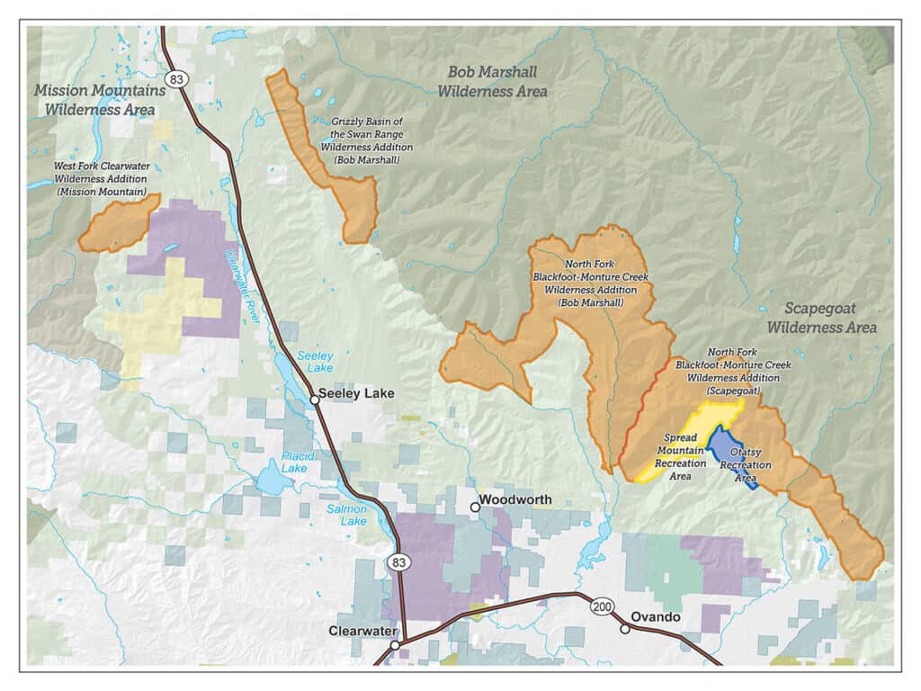
Blackfoot-Clearwater Stewardship Project map, Feb. 2018.

Wilderness designation has always been controversial in Montana.  No new wilderness areas have been established by Congress since I believe 1977, and unlike most states there has never been statewide wilderness legislation.  The Blackfoot-Clearwater proposal to designate 90,000 acres on the Lolo National Forest was locally developed and has been pending in Congress for several years.  Its development included addressing issues related to motorized and mechanized recreation that we have been discussing here, and designates areas for both.  This article provides some background, and includes a link to the written statement from the Forest Service regarding the proposed legislation.

The statement relates to forest planning in a couple of ways.  First, the Forest Service uses the Lolo National Forest forest plan as the foundation for its position on the legislation.

We also have concerns about implementing section 202, which establishes the Spread Mountain Recreation Area for the apparent purpose of enhancing mountain biking opportunities. The Lolo’s current land and resource management plan identifies this area as recommended wilderness. This area is characterized generally by steep topography, sensitive soils, and contains sensitive fish and wildlife habitat. Trail 166 is the main access into this area. This trail is not maintained, not passable by riders on horseback, and becomes difficult to locate after the first mile. While we acknowledge the interest in expanding opportunities for mountain biking on the Lolo, we are concerned that the site designated for the Spread Mountain Recreation Area is not well-suited for this use, and that this designation could create conflicts with wildlife and other recreation uses.

Two of the three wilderness designations in Title III are consistent with the recommendations made in the existing Lolo National Forest land and resource management plan. The third designation (West Fork Clearwater) was not recommended in the management plan to be Wilderness, it was allocated to be managed to optimize recovery of the Grizzly Bear.

One might argue that the 1986 forest plan is outdated, and recent local efforts should be given greater consideration.  However, those efforts have not been through any formal public process, so I commend the Forest Service for using its forest plan.  I’m not sure whether NFMA’s consistency requirement applies to taking positions on legislation, but it is probably the right place to start.  The proposal is also interesting in its legislative designation of two “recreation areas,” taking these decisions out of the forest planning process.

The Lolo is scheduled to begin its forest plan revision process in 2023, and the Forest Service is also concerned about the interaction between the revision process and this legislation.  It sounds like mostly a budgetary concern:

Our primary concerns pertain to Title II. Section 203 which would require the Forest Service to prepare a National Environmental Policy Act analysis for any collaboratively developed proposal to improve motorized and non-motorized recreational trail opportunities within the Ranger District within three years of receipt of the proposal… If passed in its current form, this bill could require recreation use allocation planning for site-specific portions of the Seeley Lake Ranger District ahead of the broader plan revision process, which would forestall the Lolo’s ability to broadly inform land use allocations across the forest through the plan revision process… If enacted, the explicit timeframes currently contained in the bill could result in prioritizing the analysis of a collaboratively developed proposal to expand the trail system over other emergent work.

But they might also be suggesting that the site-specific recreation planning would benefit from waiting until the forest plan is revised.  (Or maybe they just don’t like deadlines.)

Good news for wildlife on two national forests

Here are two different kinds of success stories about restoring wildlife species that have been missing from national forests.


Grizzly bears – Lolo National Forest.

Current efforts on the Lolo National Forest demonstrate one way that forest plans can improve conditions for at-risk species; in this case the plan is contributing to conservation of the federally threatened grizzly bear. Grizzly bears have been sighted in recent years in this part of the Forest, but none are females or considered to be residents.

In 2011, the forest plan was amended to include what is commonly referred to as the Access Amendment (similar amendments also applied to the Kootenai and Idaho Panhandle national forests, prior to the revision of their forest plans).  The amendment established “standards” for motorized road and trail density in grizzly bear management units (BMUs, there is one on the Lolo).  In many cases, the current conditions did not meet these standards, so in the terminology of the 2012 Planning Rule, these would be desired conditions or objectives to be achieved.  In addition, their achievement was assumed in the biological opinion on the effects of the forest plan on grizzly bears prepared by the Fish and Wildlife Service, and failure to achieve them would likely trigger the need to reinitiate consultation on the forest plan (which had happened on the Flathead National Forest).  So there is a little added incentive, but here is what they are doing now.

The Forest has completed the “BMU 22 Compliance Environmental Assessment.”  In it they have proposed to formally close some roads that are effectively closed already and 21 trail miles currently open to motorized use.  In response to public comments, they are also considering an alternative that would close fewer trails, and instead close some roads currently open to motorized use.  In addition to other closures included with some prior vegetation management projects both alternatives “would bring the Forest into compliance with the Forest Plan motorized access management standards for the Cabinet-Yaak grizzly bear recovery zone.”

Brown-headed nuthatch – Mark Twain National Forest

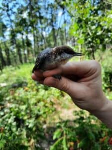
The nuthatch is not at-risk range-wide, but they have not been found in Missouri for at least a century.  The species requires shortleaf pine and oak woodland forests, which have been greatly reduced from historic levels.  The loss of these forests has prompted an ecosystem restoration effort across Missouri, Arkansas and Oklahoma (notably using the Collaborative Forest Landscape Restoration Program).  Restoration of such forests is a desired outcome of the Mark Twain forest plan.  Curiously, there is no mention of the brown-headed nuthatch in the 2005 forest plan, although it does address other species using the same habitat:

Objective 1.4a Improve open woodland conditions on at least 10,500 acres to provide habitat for summer tanager, northern bobwhite, Bachman’s sparrow, and eastern red bat.

The EIS states that the nuthatch is a Management Indicator Species for forest plan monitoring, but that doesn’t seem to be in the plan itself.  Of course, a species that is absent from a national forest would not make a good MIS.  In any case, it looks like there was no interest by the Mark Twain in reestablishing a species that was not present on the forest under that rules applicable to forest planning in 2005.

However, Forest Service, state and university researchers came to the rescue of the species, determining that sufficient woodlands now exist in Missouri to support a population of Brown-headed Nuthatches, that populations in Arkansas were robust enough to supply birds to Missouri, but that nuthatches are not likely to make the return on their own because of the distance and habitat fragmentation.  The Mark Twain National Forest site was chosen for the release of 100 birds because it is the largest area of open pine woodlands in the state.

Under the 2012 Planning Rule, the Forest Service would probably argue that this species is not “known to occur” in the plan area, so the requirement to provide ecological conditions for it (as a species of conservation concern) would not apply.  However, the separate requirement for ecological integrity requires “species composition and diversity” to occur within the natural range of variation.  That should make the Forest Service more proactive in reestablishing species that historically occurred there.  (The forest plan also omits the listed red-cockaded woodpecker, which also uses these habitats, is also absent, but must be conserved and recovered.)

(For a look at how the natural range of variation might work under the 2012 Planning Rule see Table A-2, “Desired conditions for natural community types.”)

The Fight For Wildcat Canyon: Guest Post by Patrick McKay

The author’s Jeep on the currently open section of the Hackett Gulch trail in Wildcat Canyon.

Patrick McKay is a board member of Colorado Offroad Enterprise (CORE) and Colorado Offroad Trail Defenders.

A coalition of motorized access groups led by Colorado Offroad Enterprise (CORE), has recently uncovered a disturbing plot by officials in the Pike San Isabel National Forest to illegally close one of the most popular motorized trail systems in Colorado in circumvention of the ongoing travel management process and in violation of the National Environmental Policy Act (NEPA).

Background

For many decades, off-road vehicle enthusiasts nationwide have enjoyed driving the rugged four-wheel-drive roads in Wildcat Canyon in the Pike National Forest. Located in a steep canyon along the South Platte River about an hour’s drive west of Colorado Springs on the border between Teller and Park Counties, these Jeep trails are also known as “The Gulches” after the three primary trails of Hackett, Longwater, and Metberry Gulches. Since roughly the late 1950s, these roads have been one of the most popular off-road trail systems in the Front Range for recreation enthusiasts seeking adventure, offering a unique set of off-road challenges, river access for swimming and fishing, and spectacular scenery in a rugged gorge filled with towering rock formations.

Since the early 2000s, however, Wildcat Canyon has been ground zero for one of the most contentious battles in Colorado between off-roaders and environmental groups determined to close these roads and lock motorized users, but not themselves, out of the canyon in the name of “conservation.” In 2002, the area around Wildcat Canyon was devastated by the Hayman Fire, the largest wildfire in Colorado history. All of the roads in the region were temporarily closed after the fire, and the Forest Service subsequently began working on a new environmental analysis to determine how to manage the roads in the burn zone.

After a highly contentious public comment period with off-road groups facing off against environmental groups wishing to close Wildcat Canyon to motorized use, the Forest Service issued a decision in 2004 which concluded that re-opening the roads in the canyon was the best option both to meet the public demands for motorized recreation and to protect the environment. However, due to its limited resources, the Forest Service would only allow the roads to be reopened if the relevant county governments agreed to take responsibility for maintaining these roads.

Teller County immediately applied for and was quickly granted easements allowing it to take over management of the eastern half of the Gulches trail system, which was reopened to the public by 2009, with the Colorado Springs off-road group Predator 4WD agreeing to maintain the trails on behalf of the county as they had already done for many years prior.

Park County, which contains the western half of the trail system, first applied for an easement in 2008. In contrast to Teller County, Park County’s attempts to obtain easements were repeatedly stonewalled by the Forest Service. Ultimately, Park County submitted no less than four easement applications between 2008 and 2014, with each being met with either silence or excuses from the Forest Service such as claims to have lost the paperwork or not having the budget to process it. Internal Forest Service emails obtained by CORE show agency employees, including two different South Park District rangers, repeatedly searching for reasons not to grant the easements and attempting to discourage Park County officials from moving forward with their request.

Finally in 2015, Park County Manager Tom Eisenman retracted the county’s easement application, apparently without obtaining the approval of the Park County Commission, leaving the Park County roads in limbo. With the eastern half of the trail system open and no signs or barriers at the county line to indicate the roads in Park County were closed, they have continued to be regularly driven by motorized users to this day.

New Travel Management Process

Also in 2015, a lawsuit by a coalition of preservationist groups resulted in a settlement agreement in which the Pike San Isabel National Forest agreed to completely re-do its motorized travel plan with a new travel management process. During the scoping period in 2016, the Forest Service received numerous comments asking it to reopen the closed roads in Wildcat Canyon.

The Forest Service responded by including an alternative in the draft EIS published in 2019, which considered reopening some (but not all) of these roads, leaving out crucial connecting routes to restore the loop opportunities provided by the original trail system. This analysis was flawed from the start, as it relied on a 2015 Travel Analysis Report written by South Park District Ranger Josh Voorhis. That report rated most of these roads as having low recreational value solely because they were currently closed, rather than considering the incredibly high value they had for motorized recreation when they were open, which had been repeatedly acknowledged by the Forest Service in prior environmental analyses.

Internal emails show that Mr. Voorhis strongly opposed including these roads in the travel management EIS at all, as he had already decided to permanently close and decommission them. As a result of the wide latitude Voorhis was given in making decisions for the roads in his district, the preferred alternative in the 2019 draft EIS proposed to decommission almost all of the Wildcat Canyon roads in Park County, with no indication that any serious consideration was ever given to reopening them. The preferred alternative also contained more road closures in the South Park District than in all other districts combined.

The Plot to Decommission the Roads

Instead of waiting for a final decision on the Wildcat Canyon roads to be made in the travel management process, Mr. Voorhis (along with South Platte District Ranger Brian Banks) decided to circumvent that process entirely and began working with local anti-motorized user groups to illegally decommission the roads with no environmental analysis or public involvement.

In May of 2018, Voorhis wrote an internal memo kicking off a decommissioning project with three elements: (1) Removing all existing metal signs and fencing from the Park County roads, (2) installing heavy metal barriers blocking access to the closed Park County roads from the open roads in Teller County, and (3) re-contouring the roads on the west side of the river to physically remove them from the ground. Another Forest Service employee strongly objected to Voorhis’ plan, saying in an email that decommissioning these highly desirable roads in a controversial area with no supporting environmental analysis or public input was illegal and invited distrust and justified outrage from the motorized community.

Nevertheless, Voorhis moved forward with his project, purchasing the metal barriers in the summer of 2019 and searching for contractors to install them that fall. Simultaneously, he and a Forest Service biologist with a demonstrably strong bias against motorized recreation wrote up a document claiming “changed circumstances” which would prevent Park County from being granted an easement under the 2004 EA, thereby thwarting a renewed push by CORE and other motorized groups to get Park County to re-apply for an easement in spring 2019.

It was during the public comment period for the draft EIS in fall 2019 that CORE first became aware of Voorhis’ plans to decommission these roads, when he unsuccessfully sought permission from Teller County to barricade the roads on the east side of the canyon further up in Teller County. CORE subsequently hired an attorney to file a FOIA request for all Forest Service documents pertaining to Wildcat Canyon, which we obtained in early 2020.

The Forest Supervisor’s Response

Having learned through the documents provided in response to our FOIA request of Voorhis’ plans to install permanent barriers blocking access to the Park County roads sometime in 2020, CORE wrote to Forest Supervisor Diana Trujillo this spring asking for her assurance that no actions would be taken to decommission any roads in Wildcat Canyon until after a final decision was made in the travel management EIS.

After a phone conversation with the Supervisor in May, Deputy Forest Supervisor Dave Condit wrote to us on her behalf on July 1 stating that, “The Forest does not plan to do any work on the roads in Wildcat Canyon this year. There will be no changes until we complete our Travel Management Final Environmental Impact Statement (FEIS) and sign the subsequent project Record of Decision (ROD).

Unfortunately, this assurance turned out to be false. On the same day Mr. Condit sent his email, Wild Connections (the lead environmental group pushing for closure of Wildcat Canyon) published their July monthly newsletter in which they announced they had received a grant from Park County and permission from the South Park Ranger District to move forward with a “metal removal project” in Wildcat Canyon later this summer.

This project was the same as the first element of Mr. Voorhis’ decommissioning plan from May 2018, removing all the old signs and fencing from the Park County roads in preparation for obliterating the routes from the ground. Those signs and fences were originally placed decades ago by Predator 4WD in partnership with the Forest, and continue to be helpful today in preventing drivers who inadvertently drive the closed roads without knowing of the closure from going off trail. They would also be critical for this purpose if the roads were ever legally reopened.

When CORE contacted Ms. Trujillo again in August with these concerns and asked her to prevent Wild Connections from completing this project until a final travel management decision has been made, she dismissed our concerns, falsely claiming that the metal removal work was not decommissioning and it would not affect the outcome of the travel management process. This is unfortunate as it shows the Forest has no interest in partnering with or maintaining the trust of motorized groups who wish to see these trails reopened, and has already predetermined to close them regardless of public demand for motorized recreational opportunities in Wildcat Canyon.

Conclusion

At this point CORE has no choice but to assume the Forest has not been proceeding with good faith in this matter, and to prepare for inevitable objections and likely litigation over the Forest Service’s malfeasance regarding these roads. We are calling on all motorized recreationists to write to Supervisor Trujillo, as well as the Park County Commission and other elected officials, expressing extreme disappointment over the decision to proceed with decommissioning these roads before the travel management process is complete.

The fight is not over yet. The off-road community in Colorado is hopeful that, if enough individuals get involved and show that motorized recreation is important to them, these treasured roads will once again be open to all outdoor recreation enthusiasts

Winter motorized recreation planning – behind the curve again?

credit

The trend continues – technology makes it easier for more people to get farther into the less trammeled  parts of public lands.  Good planning would project future changes in technology over the life of a plan and – plan for it.  I haven’t researched this question directly, but my impression is that winter travel planning (required by Forest Service regulations) mostly responds to the current state of technology.  I’ve even seen statements like, “we don’t need to worry about closing these areas,” or at least “we don’t need to worry about people complaining if we close these areas,” because people can’t get to them.  What happens when that is no longer true?  NEPA requires consideration of new information relevant to environmental impacts, which may lead to changing a decision.

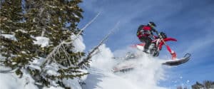
“Snowbikes” – I imagine there are some national forests that ought to be thinking about going back to the drawing board on their winter travel management plans (and maybe forest plans).  Especially where there are snow-dependent species like lynx and wolverine that are listed under ESA (where new information must be consulted on) or at risk of being listed (and regulatory mechanisms are a consideration).

“After Polaris bought Timbersled in 2015, that’s when things took off,”

“The snowbike market is in its infancy right now, but it’s exploding,”

“It’s a riot,”  “You can make your own line wherever you want to go.”


“They’re so agile,”  “You’re able to get into places you never would get into with a snowmobile.”

“It’s just like riding a dirt bike in the woods,”

“For those who have never ridden a snow bike, the best analogy I can think of is this; it is like riding a Jet Ski on sand dunes. There is a freedom unlike anything else I have ever done.”