Cyanobacteria in Wyoming: Toxic Mystery

Shoshone National Forest hydrologist Gwen Gerber and Wyoming Department of Environmental Quality staffers Kelsee Hurshman, Ron Steg and Jillian Scott check out the shoreline of Brooks Lake Creek just below the outflow from Upper Brooks Lake. Although the water flows through a remote, wild, high-altitude landscape, the watershed is plagued by potentially harmful algal blooms. (Mike Koshmrl/WyoFile)

The toxic mystery of Wyoming’s backcountry cyanobacteria blooms

Water quality specialists have found evidence of so-called blue-green algae blooms in rivers, frozen lakes and even in seemingly pristine subalpine watersheds. From Wyofile.

Many unknowns

A mysterious environmental influence — or combination of factors — is believed to be triggering the blooms. There are theories, but DEQ employee Ron Steg, who leads the agency’s Lander office, is clear: There’s no saying exactly why cyanobacteria are striking this area every summer.
“This particular watershed, the geology is high in phosphate,” Steg said. “It could be atmospheric deposition. We don’t know, and that’s why we are studying this.”
The DEQ is specifically examining what’s going on in the Brooks Lake watershed in detail because its 234-acre namesake lake has struggled with algal blooms that, on the worst occasions, have been implicated in fish kills so severe that fish went belly up miles downstream in the Wind River. Since 2018, Brooks Lake has occupied a slot on the Wyoming DEQ’s “impaired list.” At one time, fingers were pointed at Brooks Lake Lodge and its formerly surface-discharging sewage lagoon, but problems with nutrients and cyanobacterial blooms higher in the watershed have led to a more holistic investigation.
The Brooks Lake watershed, however, isn’t the only place in Wyoming where people and their pets are finding harmful cyanobacteria blooms in unlikely places.

****

Then there’s the backcountry. Cyanobacteria blooms are often associated with abundances of nutrients, like fertilizer from agriculture, and warm water typically found at lower elevations. So why are blooms showing up in places like Togwotee Pass?

Gerber, the Shoshone National Forest hydrologist, doesn’t have any firm answers, but she has noticed a trend within the 17 waterbodies on the national forest where cyanobacteria have been detected in high enough concentrations to warrant an advisory. All of them except for one, she said, are located in the Absaroka Volcanic formation — which suggests a component of the geology could be a contributing factor.

The “new” Clean Water Act and federal land management

Source:  EPA

The Supreme Court recently decided to (re)redefine the scope of the Clean Water Act (CWA) as it pertains to wetlands, which is likely to affect federal land management, as mentioned here.  Here is a recent analysis of that specific question.

Some attorneys feel that “By establishing a jurisdictional test that focuses entirely on surface waters, while ignoring the dynamic interaction of streams with shallow groundwater, a significant number of headwaters streams located on public lands will become non-jurisdictional,” and lose some protections, depending on what state they’re in (state Clean Water Act administration applies to federal land management).  Other attorneys (including one we know) said, “Laws like the National Forest Management Act, Federal Land Policy and Management Act, etc. extend protection to aquatic features too, making CWA application duplicative.”  The article mentions NEPA, but its procedural requirements can’t be considered substitutes for CWA’s substantive limits.  (“The Interior Department and the US Forest Service declined to comment.”)

Though federal public land laws and policies do include some requirements for federal agencies to protect water, agencies would have to choose to fill any gap between that level of protection and what the CWA requires.  My 2¢ – removing statutory protection will lead to erosion of other federal and state-imposed measures that may have been seen as supportive of the Clean Water Act, but will now become seen as more discretionary.  And land managers always seem to prefer “flexibility,” which often seems to mean flexibility to provide less protection.

“Proforestation” It Aint What It Claims To Be

‘Proforestation’ separates people from forests

AKA: Ignorance and Arrogance Still Reign Supreme at the Sierra Club.

I picked this up from Nick Smith’s Newsletter (sign up here)
Emphasis added by myself as follows:
1)  Brown Text for items NOT SUPPORTED by science with long term and geographically extensive validation.                                                                                                                                                        2) Bold Green Text for items SUPPORTED by science with long term and geographically extensive validation.
3) >>>Bracketed Italics for my added thoughts based on 59 years of experience and review of a vast range of literature going back to way before the internet.<<<

“Proforestation” is a relatively new term in the environmental community. The Sierra Club defines it as: “extending protections so as to allow areas of previously-logged forest to mature, removing vast amounts of atmospheric carbon and recovering their ecological and carbon storage potential.”          >>>Apparently, after 130 years of existence, the Sierra Club still doesn’t know much about plant physiology, the carbon cycle or the increased risk of calamitous wild fire spread caused by the close proximity of stems and competition driven mortality in unmanged stands (i.e. the science of plant physiology regarding competition, limited resources and fire spread physics). Nor have they thought out the real risk of permanent destruction of the desired ecosystems nor the resulting impact on climate change.<<<

Not only must we preserve untouched forests, proponents argue, but we must also walk away from previously-managed forests too. People should be entirely separate from forest ecology and succession. >>>More abject ignorance and arrogant woke policy based only on vacuous wishful thinking.<<<

Except humans have managed forests for millennia. In North America, Indigenous communities managed forests and sustained its resources for at least 8,000 years prior to European settlement. It is true people have not always managed forests sustainably. Forest practices of the late 19th century are a good example.                                                                                                                                                 >>>Yes, and the political solution pushed on us by the Sierra Club and other faux conservationists beginning with false assumptions about the Northern Spotted Owl was to throw out the continuously improving science (i.e. Continuous Process Improvement [CPI]).  The concept of using the science to create sustainable practices and laws that regulated the bad practices driven by greed and arrogance wasn’t even considered seriously.  As always, the politicians listened to the well heeled squeaky voters.  Now, their arrogant ignorance has given us National Ashtrays, destruction of soils, and an ever increasing probability that great acreages of forest ecosystems will be lost to the generations that follow who will also have to cope with the exacerbated climate change.  So here we are, in 30+/- years the Faux Conservationists have made things worse than the greedy timber barons ever could have.  And the willfully blind can’t seem to see what they have done. Talk about arrogance.<<<

Forest management provides tools to correct past mistakes and restore ecosystems. But Proforestation even seems to reject forest restoration that helps return a forest to a healthy state, including controlling invasive species, maintaining tree diversity, returning forest composition and structure to a more natural state.

Proforestation is not just a philosophical exercise. The goal is to ban active forest management on public lands. It has real policy implications for the future management (or non-management) of forests and how we deal with wildfires, climate change and other disturbances.

We’ve written before about how this concept applies to so-called “carbon reserves.” Now, powerful and well-funded anti-forestry groups are pressuring the Biden Administration to set-aside national forests and other federally-owned lands under the guise of “protecting mature and old-growth” trees.

In its recent white paper on Proforestation (read more here), the Society of American Foresters writes that “preservation can be appropriate for unique protected areas, but it has not been demonstrated as a solution for carbon storage or climate change across all forested landscapes.”

Proforestation doesn’t work when forests convert from carbon sinks into carbon sources. A United Nations report pointed out that at least 10 World Heritage sites – the places with the highest formal environmental protections on the planet – are net sources of carbon pollution. This includes the iconic Yosemite National Park.

The Intergovernmental Panel on Climate Change (IPCC) recognizes active forest management will yield the highest carbon benefits over the long term because of its ability to mitigate carbon emitting disturbance events and store carbon in harvested wood products. Beyond carbon, forest management ensures forests continue to provide assets like clean water, wildlife habitat, recreation, and economic activity.
>>>(i.e. TRUE SUSTAINABILITY)<<<

Forest management offers strategies to manage forests for carbon sequestration and long-term storage.Proforestation rejects active stewardship that can not only help cool the planet, but help meet the needs of people, wildlife and ecosystems. You can expect to see this debate intensify in 2023.

Science Friday: Law et al. Paper on Prioritizing Forest Areas for Protection in 30 x 30

We’ve looked at two scientific papers in the last week,  last Friday Siirila-Woodburn et al.   “low to no snow future and water resources” as we discussed here.  Then yesterday we took a look at Ager et al. 2021. as part of a discussion about the Forest Service 10 year wildfire risk reduction plan.  Today I’d like to look at a recent paper by Law et al. that Steve brought up in a comment yesterday. It’s interesting for many reasons, not the least of which is that the journal, Communications Earth and Environment publishes the review comments and responses, and is open access. Apologies for the length of this post, but there’s lots of interesting stuff around this paper.

The first question is “what is the point of the paper?”  In the discussion, the authors say

“We developed and applied a geospatial framework to explicitly identify forestlands that could be strategically preserved to help meet these targets. We propose that Strategic Forest Reserves could be established on federal and state public lands where much of the high priority forests occur, while private entities and tribal nations could be incentivized to preserve other high priority forests. We further find that preserving high priority forests would help protect (1) ecosystem carbon stocks and accumulation for climate mitigation, (2) animal and tree species’ habitat to stem further biodiversity loss, and (3) surface drinking water for water security. Progress has been made, but much work needs to be done to reach the 30 × 30 or 50 × 50 targets in the western US.”

Basically, to put words in their mouths, they used geospatial data from various sources to help figure out how to meet 30×30 and 50×50 goals. It seems to me that they equate “preervation” to “conditions that are good for carbon stocks, biodiversity, and drinking water.”  This is perhaps fine in a non-fire environment (and we can all make assumptions about future fires on the West Side, but if we were perfectly honest we’d admit that “fires may well occur on the west side as well and possibly increase” but “no one knows for sure.”

Now if we were to raise our sights from the details of the geospatial framework, we might see that 30 x 30 is a current policy discussion about how much conservation versus protection and what practices count.  So they might have taken the same tack as Siirila-Woodburn and Ager’s coauthors.. “let’s ask the people who know about these practices and are working in the area what they would like to know that would help them. Keeping in mind that these systems are so complex, we can’t really predict and need to be open about uncertainties.” There’s also a substantial literature about these national or international priority setting analyses, and their tendencies to disempower local people. No reviewers of this paper that I could tell were social scientists.

Nevertheless, it seems like they ran some numbers, and then had a long discussion in a mode of an op-ed with citations.

Differences in fire regimes among ecoregions are important parts of the decision-making process. For example, forests in parts of Montana and Idaho are projected to be highly vulnerable to future wildfire but not drought, thus fire-adapted forests climatically buffered from drought may be good candidates for preservation. Moist carbon rich forests in the Pacific Coast Range and West Cascades ecoregions are projected to be the least vulnerable to either drought or fire in the future25, though extreme hot, dry, and windy conditions led to fires in the West Cascades in 2020. It is important to recognize that forest thinning to reduce fire risk has a low probability of success in the western US73, results in greater carbon losses than fire itself, and is generally not needed in moist forests79,80,81,82.

Biodiversity- wise, though, you don’t need a PhD in wildife ecology to think.. protecting more west-side Doug-fir isn’t as good for biodiversity as protecting some of that and some of Montana or New Mexico.. so really carbon and biodiversity don’t always lead us to the same places.  It’s interesting that the reviewers didn’t catch the claim that “forest thinning has a low probability of success” What is paper 73, you might ask?  It’s a perspective piece in PNAS (so another op-ed with citations) by our geography friends at University of Colorado.  And “results in greater losses than fire itself?”  See our California versus Oregon wildfire carbon post here.

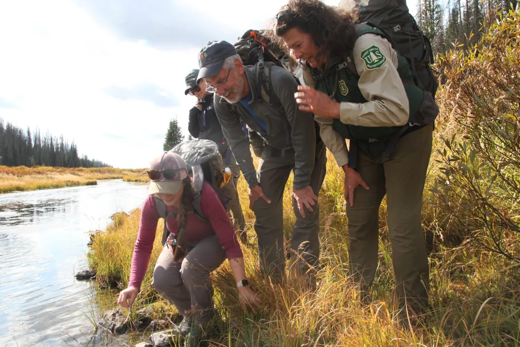
Forests help ensure surface drinking water quality63,64 and thus meeting the preservation targets would provide co-benefits for water security in an era of growing need.

This was an interesting claim for “protected” forests, as our hydrology colleagues (who perhaps are more expert in this area?) wrote in their review..

Changes in wildfire frequency, severity and timing are particularly catastrophic consequences of a low- to- no snow future. Indeed, alongside continued warming, a shift towards a no- snow future is anticipated to exacerbate wildfire activity, as observed169,170. However, in the longer term, drier conditions can also slow post- fire vegetation regrowth, even reducing fire size and severity by reducing fuels. The hydrologic (and broader) impacts of fire are substantial, and include: shifts in snowpack accumulation, snowpack ablation and snowmelt timing171; increased probability of flash flooding and debris flows172,173; enhanced overland flow; deleterious impacts on water quality 174,175; and increased sediment fluxes176,177. Notably, even small increases in turbidity can directly impact water supply infrastructure178,179. Vegetation recovery within the first few years following fire rapidly diminishes these effects, but some longer term effects do occur, as evidenced with stream chemistry180 and above and below ground water partitioning both within and outside of burn scars181.

There’s even a drive-by (so to speak) on our OHV friends..

Recreation can be compatible with permanent protection so long as it does not include use of off-highway vehicles that have done considerable damage to ecosystems, fragmented habitat, and severely impacted animals including threatened and endangered species37

Here’s a link to the review comments. The authors did not include fragmentation in their analysis as one reviewer pointed out, so they added

Nevertheless, our current analysis did not incorporate metrics of forest connectivity39 or fragmentation48, thus isolated forest “patches” (i.e., one or several gird cells) were not ranked lower for preservation priority than forests that were part of large continuous corridors.

To circle back to handling uncertainty and where the discussion of these uncertainties takes place (with practitioners and inhabitants or not), another review comment on uncertainty and the reply:

The underlying datasets that we used in this analysis did not include uncertainty estimates and thus it is not readily possible for us to characterize cumulative uncertainty by propagating uncertainty and error through our analysis. We recognize the importance of characterizing uncertainty in geospatial analyses and acknowledge this is an inherent limitation in our current study. To better acknowledge this limitation and the need for future refinements, we added the following text to the end of the Discussion (lines 445-447): Next steps are to apply this framework across countries, include non-forest ecosystems, and account for how preservation prioritization is affected by uncertainty in underlying geospatial datasets.

It makes me hanker for old timey economists, who put uncertainties front and center. Remember sensitivity analysis?

But the reviewers never addressed the gaps that I perceive between what the authors claim in their discussion and what the data show. I suspect that’s because “generating studies using geospatial data” is a subfield, and the reviewers are experts in that, but the points in the discussion (what’s an IRA, what’s the state of the art on fuel treatments) not so much. I think that that’s an inevitable part of peer review being hard unpaid work- at some point reviewers will use the “sounds plausible from here” criterion. And so it goes..

Snowless Western Mountains and Co-Design and Co-Production of Useful Scientific Knowledge

This paper was excerpted by the WaPo here.

But a new study projects that in about 35 to 60 years, mountainous states may be nearly snowless for years at a time if greenhouse gas emissions continue unchecked and climate change does not slow. The resulting lack of water would be “potentially catastrophic,” according to the study’s authors.

It’s a really interesting paper with lots of great graphics and explanations of sources of uncertainty. For RCP watchers, it’s a review paper and there is some 8.5 and some 4.5 in the studies used, with a chart in the supplemental information page.
My favorite part was about planning, though. The numbers are citations.

Thus, at the same time that science evolves to increase predictive understanding of the mechanisms of hydroclimatic change, management practice must evolve to accommodate uncertainty regarding the changing patterns of current and future hydrologic variability. Developing a robust strategy and selecting investment options that balance competing societal objectives and multisectoral interactions (such as the interaction among water and energy 186 or water and carbon 207 reduction goals) requires new approaches to integrate water resource planning. Frameworks and planning methods for decision- making under deep uncertainty that acknowledge and accommodate imperfect knowledge regarding the probabilistic range of possible future conditions such as decision scaling 241, robust decision- making, dynamic adaptation pathways 242 and scenario planning can identify scientifically informed adaptive strategies that leverage best available science without overstating its confidence 243.

For instance, the United States Bureau of Reclamation and water management agencies within the Colorado River Basin engaged in a robust decision- making study that identified a range of potential future climate conditions under which water delivery obligations would be vulnerable. Portfolios of adaptation strategies aimed at demand reduction (including agricultural, municipal and industrial conservation) and supply augmentation (including reuse, desalination and water import) were evaluated for their ability to alleviate these vulnerabilities and for their trade- offs in cost, yield, technical feasibility, legal risk and other criteria. The portfolios generally increase system robustness but have a wide range of implementation costs, especially under the declining supply conditions, and vary between the Upper Basin and the Lower Basin 244. Making science usable for decision- making requires strong trust between the parties 245. This trust often develops over deliberate, long- term collaboration 246, with mutual understanding of the science, models and tools being discussed and demonstration of the credibility, saliency and legitimacy of the new approach(es) 247. Institutional, technical and financial capacity to implement these approaches must also be overcome 233. Scientists must also recognize that practitioners are often directly responsible, sometimes even personally liable, for the outcomes of decisions made, which makes them hesitant in the application of new climate science 236, especially if perceived as not fitting with existing knowledge or policy goals 233,248.A path forward can be made by including Earth scientists, infrastructure experts, decision scientists, water management practitioners and community stakeholders, in a collaborative, iterative process of scientific knowledge creation through a co- production framework 41,42,249,250. This process helps to ensure that new science is suited to challenges at hand and can provide meaningful input into decision- making processes.

My bold.

I picked out some interesting-looking citations below:

Arnott, J. C., Mach, K. J. & Wong- Parodi, G. Editorial overview: The science of actionable knowledge. Curr. Opin. Environ. Sustain. 42, A1–A5 (2020).246.
Meadow, A. M. etal. Moving toward the deliberate coproduction of climate science knowledge. Weather Clim. Soc. 7, 179–191 (2015).247.
Cash, D. W. etal. Knowledge systems for sustainable development. Proc. Natl Acad. Sci. USA 100, 8086–8091 (2003).248.
Dilling, L. & Lemos, M. C. Creating usable science: opportunities and constraints for climate knowledge use and their implications for science policy. Glob. Environ. Change 21, 680–689 (2011).249. Lemos, M. C. etal. To co- produce or not to co- produce. Nat. Sustain. 1, 722–724 (2018).250.
Cash, D. etal. Salience, credibility, legitimacy and boundaries: linking research, assessment and decision making. SSRN https://doi.org/10.2139/ssrn.372280 (2002).251. Cash, D. W., Borck, J. C. & Patt, A. G. Countering the loading- dock approach to linking science and decision making: comparative analysis of El Niño/Southern Oscillation (ENSO) forecasting systems. Sci. Technol. Hum. Values 31, 465–494 (2006).252.
Goodrich, K. A. etal. Who are boundary spanners and how can we support them in making knowledge more actionable in sustainability fields? Curr. Opin. Environ. Sustain. 42, 45–51 (2020).

How to get rid of non-native fish in wilderness

Utah Division of Wildlife

Since we had such fun discussing use of chainsaws in wilderness and eliminating wolves from wilderness, here’s another example of challenges to managing under the Wilderness Act. The Lolo National Forest is seeking comments on the North Fork Blackfoot River Native Fish Restoration Project which is located in the Scapegoat Wilderness.  They have prepared an Environmental Assessment.

The project would authorize Montana Fish, Wildlife & Parks (FWP) to implement fish management and stocking actions within the wilderness that would establish a secure population of native trout, replacing an existing hybrid population.

To restore and secure this population, the project proposes the following actions; application of a piscicide, rotenone, to eradicate the non-native fish species; use of motorized equipment such as a boat motor, generator, and a helicopter to transport equipment, supplies, and fish for stocking; temporary development of structures or installations; and use of chemicals (pesticides or herbicides). Additionally, public access in the area would be closed for 7-10 days during the late summer of 2021 to reduce user conflicts with management actions.

The Forest Service has assessed the suitability of the proposed activities in the Scapegoat Wilderness through a process called a “minimum requirements analysis.” This is a process used to identify, analyze, and recommend management actions that are the minimum necessary for wilderness administration, as directed by the Wilderness Act of 1964.

From the linked article:

Opponents challenged the plan’s use of motorized equipment in a federal wilderness area where such machinery is typically prohibited, the idea of stocking otherwise fishless waters in wilderness, use of fish poison and the potential of harming non-target fish in the area.

There doesn’t seem to be much disagreement with the project purpose, but resistance to how they would do it.  The exception where “mechanical transport” and “structure or installation” would be allowed by the Wilderness Act is:  “except as necessary to meet minimum requirements for the administration of the area for the purpose of this Act.”  It seems like their argument that they need motorized access is weak (see photo), but if chemicals are the only way to remove the non-native species, should they not do it?

Then there is the requirement to maintain viable populations of native species on national forests, which might for some species (maybe amphibians that evolved without fish predators) require them to do it.


Climate Change, Water, and Population Growth in Colorado: Homestake Creek Geotechnical Proposal

Field scientist Delia Malone stands by a beaver pond near Homestake Creek, at the edge of Colorado’s Holy Cross Wilderness, on Friday, Aug. 21, 2020. (Daniel Brenner, Special to The Denver Post)

Here’s an interesting article from the Denver Post with the Forest Service in the middle of a larger issue. There is a tension between climate change adaptation (may need more water due to drought) and not building (and removing current) dams. There is a bit of a mantra that “leaving things alone is necessary to stave off the worst impacts of climate change” but examples such as this tell us it may not be that simple (and fuel treatments and prescribed burns, and probably a host of others).

A few things that might be misleading in the article.. thanks to the FS folks for helping me find more accurate information.

(1) Delia Malone is not working with or on behalf of the Forest Service as stated in the article. She’s a member of a local Sierra Club chapter.

(2) There is a categorical exclusion on the geotechnical proposal, which is available here Note: there aren’t “categorical exemptions.”

(3) There is currently no proposal for a dam or a reservoir, just the current proposal to investigate whether the site would be suitable geologically. The White River would, of course do an extensive NEPA analysis with multiple opportunities for public review if they were to receive a proposal for a reservoir.

Excerpts from the story..

Three decades after the federal government killed the proposed $1 billion Two Forks Dam project along the South Platte River southwest of Denver, Front Range cities again are taking first steps toward moving more water across mountains. Their reservoir partially inside the Holy Cross Wilderness, between Leadville and Minturn, would sacrifice natural processes for the purpose of sustaining population growth and a development boom — harnessing nature to slake human thirsts.

……

Over the past decade, the economy has shifted away from resources extraction toward high-tech innovation and a booming recreation and tourism industry — built by touting pristine unaltered nature.

Does this remind anyone of Governor Tom McCall’s comment about Oregon in 1971 (50 years ago now) “come to visit, but for heaven’s sakes don’t stay?”

Tapping wilderness water

When Congress in 1980 established the Holy Cross Wilderness, lawmakers included provisions allowing Colorado Springs, Aurora, the Climax Mine, Vail Resorts, Eagle Valley authorities and others in western Colorado to tap a total of 30,000 acre-feet of water a year. A first dam on Homestake Creek, built in 1968, already had reduced flows and natural fluctuations.

Now U.S. Forest Service officials must decide whether to grant a special-use permit allowing Aurora and Colorado Springs to conduct geologic testing along Homestake Creek — a first step, without the participation of Vail and Eagle Valley water suppliers. Forest managers decided against a full environmental review for this proposed testing, saying bore holes drilled in forests qualify for a “categorical exemption” of the sort frequently granted for fossil fuel drilling and road work in forests.

American Rivers and Trout Unlimited raised concerns about the lack of scrutiny.

“The Front Range municipalities need to realize that there’s no more reliable water supply available from the West Slope and Colorado River Basin. And that was true before the impacts on water from climate change were really incorporated in our thinking,” American Rivers’ Colorado projects director Ken Neubecker said. “A large new reservoir would be pretty devastating.”

Anyway, I’m agnostic on this particular dam (which may not be geologically feasible anyway) but it’s reflective of a water/climate/population conundrum.

San Francisco Should Pay Yosemite the Dam Rent: PERC Report

I ran across this interesting idea from Sara Sutherland at PERC. There are many dams on FS land. I wonder if it would make sense to harmonize regulations for dam permittees across BLM, NPS and FS, possibly with some kind of negotiated transition period? It’s interesting to think about the idea “are they paying “enough” and what you would base “enoughness” on. Sutherland has some ideas, including the benefits of a dam-free valley.

Summary:

In 2018, Yosemite National Park had the highest deferred maintenance backlog of any national park in the country, with $646 million worth of overdue maintenance projects. The park may have a long-overlooked source of funding to tap for maintaining and preserving the public’s access to its scenic grandeur: an outdated lease on part of its property.

The Hetch Hetchy Valley, located entirely within the park, provides water to San Francisco and other Bay Area communities. In addition, San Francisco receives approximately one-tenth of its power from hydroelectricity generated by the gravity-driven flow from the Hetch Hetchy Reservoir. The 1913 Raker Act authorized the unprecedented dam inside the park and also set the fee that the city pays to rent the entire valley in which the dam sits: $30,000 per year. It may be the worst contract in the history of the National Park Service.

While the lease price has remained constant over the past century, the value of the valley has not. Yosemite today is exceptionally congested—it is the fifth most visited national park—and restoring the Hetch Hetchy Valley would increase both the quantity and quality of recreational opportunities available to the park’s 4.5 million annual visitors. A benefits-transfer study conducted by a consulting firm calculated the potential recreational-use value of undamming the valley to be between $1.7 billion and $5.4 billion.

San Francisco’s water supply is also valuable. The city earns about $440 million annually from the sale of Hetch Hetchy water to its own customers and other municipalities. Thus, there is clearly a trade-off between keeping the dam and tearing it down. The former would continue to prevent recreation in the valley, while the latter would force the Bay Area to reassess its entire water supply. What is also clear is that under the current agreement, Yosemite, its visitors, and the American public are all losing.

In light of the park’s needs, the annual lease price San Francisco pays could be adjusted to raise revenue that could help maintain infrastructure inside the park, a move that would also be consistent with how other national parks structure their concessions and special-use contracts. Three methods can provide a range of potential lease prices.

A more equitable payment to the park from the city for its use of Hetch Hetchy water would provide enormous benefits for the 4.5 million people who visit the park each year. It is time to update the century-old arrangement between Yosemite and San Francisco.

Options to Adjust Hetch Hetchy Lease Price:

Account for inflation that has occured since the price was set by the Raker Act.
Treat San Francisco as a National Park Service concessioner and charge a franchise fee according to agency rules.
Set the annual price equal to the annual value of an undammed Hetch Hetchy Valley.

Webinar Tomorrow: Managing Fire for Water: Lessons Learned from Watershed Protection Partnerships for Wildfire Risk Reduction

May 27, 2020 10:00 am – 11:00 am PDT

FREE
Register

Among the values at risk from wildfire are community drinking water supplies, as forested watersheds on public land are often a primary or significant source of drinking water. In some places across the West, watershed protection partnerships have formed to address this threat by bringing together the stakeholders of these watersheds for collaborative planning and investment in source water protection. This webinar will explore the concept of watershed protection partnerships and how they span organizational boundaries for collective action to address wildfire and other risks. We will offer lessons learned from how these partnerships have been implemented in Colorado and New Mexico, and direct implications and applications for communities in Oregon.

Clean Water Act major court decisions

Not long ago we were discussing EPA’s new regulations redefining WOTUS to exclude areas that were not obviously connected to navigable waters, as summarized in the graphic above.  It was the latest iteration of a political dispute over the scope of the Clean Water Act.  Now the U. S. Supreme Court has, in a 6-3 decision, stepped in to apparently invalidate the recent “bright line” rule established by the EPA to again make point source permit requirements contingent on the actual risk of pollutants getting into navigable waters.  This somewhat splits the difference between the Obama and Trump interpretations, but clearly rejects the latter’s new absolute position.  “Significant nexus” has now become “functional equivalent.”

On April 23, 2020, the United States Supreme Court ruled that the addition of pollutants to groundwater which travels a half mile to enter navigable waters is the functional equivalent of a direct discharge, and subject to the protections and requirements of the Clean Water Act (“CWA”). The decision in County of Maui v. Hawaii Wildlife Fund, 590 U.S. (2020), represents a sea change in CWA interpretation, and may spell the end of the Navigable Waters Protection Rule issued by EPA and the Army Corps of Engineers only two days earlier. That rule (colloquially known as the 2020 WOTUS Rule) specifically excluded groundwater from the protections of the CWA under a new definition of “Waters of the United States.”

In determining that the CWA requires a permit when there is a functional equivalent of a direct discharge from a point source to navigable waters, the Supreme Court acknowledged that application of the statute will be highly fact dependent, with time and distance being critical issues in most cases.

In addition, a federal district court has stopped the Keystone Pipeline because its Clean Water Act permit for stream crossings is invalid.  This is significant because the permit was kind of the Clean Water Act equivalent of a NEPA categorical exclusion, a nation-wide blanket permit requiring limited environmental review that could be used for certain kinds of projects.  The court said that when the permit was renewed in 2017, the Army Corps of Engineers failed to adequately consider effects on species listed under the Endangered Species Act.  Since then the permit has been used 37,000 times.  So here’s what’s happening ….

The U.S. Army Corps of Engineers has suspended a nationwide program used to approve oil and gas pipelines, power lines and other utility work, spurred by a court ruling that industry representatives warn could slow or halt numerous infrastructure projects over environmental concerns.

The Trump administration is expected to challenge the ruling in coming days. For now, officials have put on hold about 360 pending notifications to entities approving their use of the permit, Army Corps spokesman Doug Garman said Thursday.

Pipeline and electric utility industry representatives said the effects could be widespread if the suspension lasts, affecting both construction and maintenance on potentially thousands of projects. That includes major pipelines like TC Energy’s Keystone XL crude oil line from Canada to the U.S. Midwest, the Mountain Valley natural gas pipeline in Virginia and power lines from wind turbines and generating stations in many parts of the U.S.

The Forest Service is involved with litigation of the Mountain Valley Pipeline as discussed most recently here.