I had another flashback today.. as an undergrad at Cal Forestry, I was required to take a forest policy class (teacher was Hank Vaux, for people who remember him) -and two quarters of forest economics, with two quarters of an econ prerequisite, and forest sociology). I remember thinking “what a waste, who cares about the 1872 Mining Act?” And here we are 50 years later, and the 1872 Mining Act is of interest.
My question to legal minds: do forest plans and RMP’s have a nexus with the Mining Act, or does the Forest or BLM unit just do an environmental analysis and decision.. and is “don’t mine there” an alternative in such analyses?
The 60-Day Waiting Period: The presidential proclamation explicitly states that the land is not open for mineral entry or staking claims until 60 days post-announcement. Because Kimmerle Mining filed seven claims on July 14—less than 24 hours after the announcement—legal experts note these initial filings are technically unauthorized and invalid. However, the company can simply refile them once the waiting period expires on September 11. [1, 2, 3, 4, 5]
No Immediate Right to Mine: Staking a claim only reserves the rights to the underlying minerals against other prospectors. It does not grant permission to dig. Kimmerle Mining must still clear extensive federal environmental reviews and obtain permits from the Bureau of Land Management (BLM) or U.S. Forest Service before any extraction begins. [1, 2, 3, 4]
Pending Tribal and Environmental Lawsuits: A coalition of tribal nations (including the Hopi, Pueblo of Zuni, and Ute Mountain Ute) represented by the Native American Rights Fund (NARF) alongside groups like Earthjustice are actively suing the administration. They argue the Antiquities Act allows presidents to create monuments but does not grant them the constitutional authority to revoke or shrink them. If the courts rule the monument’s reduction was illegal, all new mining claims will be permanently voided. [1, 2, 3, 4, 5]
Apparently, this also happened the last time the Monument was shrunk.
Easy Peasy Mine: Following the 2017 reduction of Bears Ears National Monument, Kimmerle Mining staked claims and opened the small “Easy Peasy” exploratory mine, excavating roughly 30 tons of ore before operations ceased due to low uranium market prices and the site was reburied. [1, 2]
**********************
This (from Google AI) was also interesting..
Pending Tribal and Environmental Lawsuits: A coalition of tribal nations (including the Hopi, Pueblo of Zuni, and Ute Mountain Ute) represented by the Native American Rights Fund (NARF) alongside groups like Earthjustice are actively suing the administration. They argue the Antiquities Act allows presidents to create monuments but does not grant them the constitutional authority to revoke or shrink them. If the courts rule the monument’s reduction was illegal, all new mining claims will be permanently voided. [1, 2, 3, 4, 5]
The above map is of the Canyon of the Ancients National Monument, which, like almost all others, doesn’t have the back and forth across Admins of Bears Ears and GSE.
New folks may have never seen this TSW piece from 2020, where I suggested a unification approach to Bears Ears.
Mark Squillace, a professor at the University of Colorado Law School, tells the story of when he accompanied Interior Secretary Bruce Babbit to affected communities to discuss Grand Staircase-Escalante National Monument. The way his story goes, talking person to person with Babbit may have actually changed minds, or at least reduced the atmosphere of antipathy. (Of course, that’s Mark’s side of the story, but we don’t have another one, so I’ll go with it.)
Here’s my unifying approach based on that:
1. Send the Secretary out there (presence is a great symbol) as part of a public comment period
2. Determine to listen respectfully to the other sides, including elected officials from the other party (!). As the President-elect said, they are not your enemy.
3. Do a deal with the goal of stability.. “can everyone live with this?”
Actually, it sounds a lot like plain old collaboration. It’s also what states have to do regularly, which is why I like former western governors and DNR directors for Interior Secretaries.
It’s interesting to think about why it is that when the stakes are higher than at the State level, it seems like collaboration takes a back seat and “winner takes all” takes over. But internationally, we’d reject that approach in supporting peace processes. Perhaps national politics are some kind of anomaly. Not in a good way.
There was this quote from Babbitt about another Monument, Canyon of the Ancients, which I thought was interesting but sadly the link to the Durango Herald is now broken.
The pushback from the energy production industry is a major obstacle, but Babbitt said he has long held the belief that the two, preservation and industry, can co-exist.
“How many of you know, that there is gas production at the Canyon of the Ancients?” Babbitt asked the crowd of about 30 members and non-members. “The opponent says you’re taking things off the slate of use and production, that the land is just being set aside for weak environmentalists. But (oil and gas) can be managed with minimal impact. It is possible to make them work together.
The comments on the TSW piece are also interesting, not much has changed. One link in the post was to this story in the Deseret News with details about the campaign and funding, as well as tribes for and against.
But Clarke said most of the tribal leaders who visited Bears Ears for the Jewell meeting had probably never been there before and likely will not be back again.
“The more distant you are as a Navajo and tribal member the more likely you are to support the monument because you view it as an abstraction or concept or theory of tribal sovereignty,” he said. “The closer you get to the monument, the more likely you are to view it as land that can and should be used properly.”
The Conservation Lands Foundation boasts on its website that the marathon listening meeting in Bluff attended by more than 1,500 people for Jewell was an “incredible success,” with huge showings from their Friends Grassroots Network that includes multiple Colorado-based organizations.
Supporters of monument designations sported blue T-shirts to draw attention to themselves at the event designed for Jewell to hear the issues surrounding the monument debate.
“Secretary Jewell, you came to Utah seeking local input. Unfortunately, what you saw and what you heard was theater staged by radical environmentalist outsiders intent on smothering local voices. This wasn’t local grass roots. This was Astroturf,” blogged Matthew Anderson, the Sutherland Institute’s policy analyst for the Coalition for Self Government in the West.
Chaffetz said he has no doubt tribal leaders are being influenced by environmental groups seeking monument designation.
“I sat with the president of the Navajo Nation last August and he had no idea what Bears Ears was or where it was,” he said.
Clarke wonders at what he says is a contradiction inherent in the monument designation.
“Everybody who came out here says it’s beautiful, it’s wonderful and pristine and we want to keep it that way. I say ‘thank you,’ because we have been taking care of it the last 100 years,” he said.
Patrick brought up the differences between Monumentization and Wilderness, (and forest plans and RMP’s and Roadless) in his comment on the previous post:
The 2000 management plan for Grand Staircase Escalante closed thousands of miles of primitive dirt roads, most claimed as RS-2477 roads by the state of Utah. Massive sections of the monument are completely inaccessible by vehicle, not because there are no roads but because the public isn’t allowed to use them. Most of these roads were boundary roads for Wilderness Study Areas that predated the WSA and are technically outside of them, but were closed when the BLM decided to manage most of Grand Staircase as de facto wilderness.
And this is the real problem that keep triggering backlash – the fact that certain groups have been attempting to use national monuments as backdoor de facto wilderness designations. Real wilderness designations are settled by Congress and involve political compromises that usually cherry stem roads to preserve existing access. Monument proclamations bypass the political process and allow wilderness groups to force their will on the public, with massive wilderness-like areas shutting down all access to entire regions of the state. Grand Staircase is the prime example of this because it closed so much. The current travel management plan left maybe 5% of existing roads open. That monument set the precedent that monument designations remove public access to public lands. Before that, new National Monuments and National Parks often increased public access, involving building new roads and infrastructure to allow the public to more easily visit spectacular places. If you contrast somewhere like Zion or Colorado National Monument, which both have some impressively engineered roads built to allow public access to very forbidding terrain, with Grand Staircase which only closed existing roads, the difference is striking.
It seems like there are public processes of some kind (meetings) but not necessarily what we have come to expect in terms of formal comment periods. Still, some, even large Monuments, receive little pushback.
My current thinking is that folks like Hewlitt (who apparently funded TWS and others involved in the campaign, according to the reporting) want land “conserved” From their current strategy document.
To date, we are approximately 65% of the way toward the foundation’s long-term goal of protecting half of the North American West. In the past five years, our grantees achieved new protections on approximately 10 million acres, which was our goal.
Canyons of the Ancients National Monument (CANM) is a multiple use national monument. Over 81% of the monument is leased for oil and gas development to a dozen different operators and corporations. One of the largest CO2 fields in the world is found under the McElmo Dome within the boundaries of the monument. Almost 500 billion cubic feet of CO2 is extracted from within the monument and sent via high-pressure pipeline to the Permian Basin in west Texas where it is used to enhance petroleum production. This CO2 production business is the largest source of tax revenue for both Montezuma and Dolores Counties.
Approximately 160,000 of the monument’s 177,000 acres are also available for livestock grazing, including 23 grazing allotments allowing for 6,400 animal use months of grazing use. Additionally, the monument is open to small and big game hunting following Colorado state hunting and fishing laws. The monument also contains 190 miles of motorized vehicle routes open for public use including off-highway vehicles.
The proclamation designating the area states that the monument has the densest concentration of cultural sites found in our country with an estimated 30,000 sites. Twenty-six modern day tribal nations are affiliated with the cultural sites and landscape of Canyons of the Ancients.
We might have a win-win, Hewlitt gets to claim more acres as “protected” (they’re Monuments) and leave the details to those closer to the ground.
Apparently, it’s not in the Monumentizing per se, but what’s in the proclamation exactly, and the question is “what kind of collaborative or public engagement processes led to those?” Because as Patrick points out, and Don experienced, most Monuments don’t switch back and forth over time, so there is something distinctive about Bears Ears (and GSE). What is it?
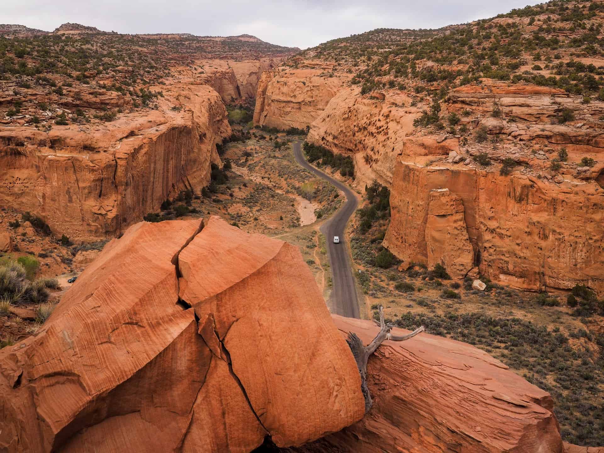
Here are more photos from the CofA Manager’s Report. Canyon of the Ancients is one of my faves.
Don Amador sent in this post on the recent Bears Ears changes.. for me it raises an interesting question. What leads to Monument agreement and what to backlash and reversal? Design factors (were there groups working toward consensus, or was it imposed from above? By state (Biden established some in Arizona without apparent interest in reversal?). What about disagreements (say Dolores Canyon)- how are they handled? Does it depend on which uses are at the table (e.g. mining, oil and gas, timber) to be potentially excluded? Because most tend to reduce OHVs and grazing, but not exclude. Is the fear of becoming an industrial tourism destination a new thing or has it always been there? What entities took leadership for establishing collaboration? Feds, states, locals, NGOs?
It seems like a good graduate student project- helping to make a roadmap for folks who want to design a Monument that is stable politically. Maybe all the rest have been stable, and if so, what are the unique characteristics of Bears Ears? But back to Don’s post, which focuses on the need for collaboration for stable decisions.
********************
President Trump’s recent Executive Order modifying the boundaries of the Bears Ears National Monument has reignited a familiar debate across the West. Depending on which headlines or social media posts you read, the action is either being celebrated as a major victory for public access or condemned as an unprecedented attack on conservation and Tribal interests. As is often the case with public land issues, the reality is considerably more complex.
After reviewing the Executive Order, the recently approved Bears Ears Resource Management Plan, and the initial reactions from recreation, conservation, and Tribal organizations, I believe there is value in stepping back from the political rhetoric to look at what the Order actually does—and just as importantly—what it does not do.
For the off-highway vehicle community, the Executive Order does not immediately reopen trails or create new riding opportunities. It reduces the monument boundaries and restores those lands to traditional Bureau of Land Management (BLM) and U.S. Forest Service multiple-use management. Existing travel management decisions, designated route systems, and resource management plans generally remain in place until they are modified through future planning processes. In other words, this is not an “opening” of public lands. It is the beginning of another planning process.
That distinction is important. Future decisions regarding motorized recreation will still require compliance with the Federal Land Policy and Management Act (FLPMA), the National Environmental Policy Act (NEPA), the National Historic Preservation Act, the Endangered Species Act, and other applicable federal laws. Public involvement, environmental analysis, and collaboration among stakeholders will remain essential components of any future travel management decisions.
For those of us who have spent decades working on travel management plans throughout the West, this is familiar territory. Executive Orders can establish policy direction, but they do not replace the detailed work of inventorying routes, evaluating resource conditions, balancing competing uses, and engaging the public in developing sustainable travel management plans.
Ironically, one fact that received relatively little attention during the previous Bears Ears planning effort was that the Bureau of Land Management estimated that approximately 98 percent of previously designated motorized routes would remain available for public use, even under the recently approved monument management plan. While many in the OHV community understandably focused on the proposed closures, the broader story was that the vast majority of designated routes remained open. That illustrates how public perception and the actual details of land management decisions are not always the same.
From my perspective, however, the most significant issue is not the number of miles that may eventually open or close. It is the continuing instability in public land management.
Bears Ears has now experienced multiple major policy reversals under successive presidential administrations. Each change has required agencies to begin new planning efforts, redirect limited staff resources, revisit previous decisions, and prepare for the inevitable legal challenges. Local communities, Tribes, counties, recreation groups, conservation organizations, and agency personnel are once again left wondering what the next administration may decide.
Throughout my career, I have learned that durable public land management is rarely achieved through political victories alone. It is built through collaboration.
One of the reasons I publicly supported the expansion of California’s Berryessa Snow Mountain National Monument was because the process brought together Tribes, conservation organizations, local governments, and the OHV community in meaningful discussions about the future of those public lands. Designated motorized recreation remained part of the conversation, not because everyone agreed on every issue, but because participants were willing to work toward practical solutions that balanced conservation with public access.
My impression has been that the Bears Ears process never achieved that same level of trust among all interested stakeholders. Whether that perception is entirely accurate is almost beside the point; rebuilding trust should now become a priority regardless of one’s position on the Executive Order.
The motorized recreation community also has an opportunity to demonstrate leadership. Rather than viewing this Executive Order solely as a political victory, we should continue advocating for what has consistently produced successful outcomes across the West: sustainable recreation on designated routes, protection of archaeological and cultural resources, respect for Tribal history and traditions, science-based travel management, and meaningful collaboration with other public land interests.
Likewise, the conservation community has an opportunity to recognize that many responsible OHV organizations have spent decades promoting route designation, resource protection, volunteer stewardship, restoration projects, wildfire recovery, and partnerships with public land managers. Managed motorized recreation and conservation are not mutually exclusive. In many places across the West, they have become complementary objectives supported by strong local partnerships.
The greatest challenge facing public lands today is not simply deciding where people can ride, hike, hunt, mountain bike, or camp. It is developing management strategies that can endure beyond the next election cycle. Constant policy reversals consume agency resources, discourage stakeholder investment, and make it increasingly difficult to build the trust necessary for successful long-term stewardship.
Whether one supports or opposes President Trump’s Executive Order, we should all recognize that the future of Bears Ears—and countless other public lands—will ultimately be determined not by headlines or executive actions alone, but by the quality of the planning and collaboration that follows.
For those of us who care deeply about America’s public lands, that should remain the common ground.
# # #
Don Amador is a longtime public lands advocate with over 34 years of experience in recreation policy, trail stewardship, and collaborative land management and former Chair of the CA State Parks OHMVR Commission
The Utah Monuments football has been kicked again…I think what’s missing from some of the stories are (once again) the mechanisms of how things actually work
Our friends at Center for Western Priorities made some claims in their newsletter that made me wonder.
It seems to me that the RMP based on the previous designation would still hold until amended. If you look at the current ROD (January 2025.. hmm) on page 17
Numerous rights and privileges have been established on BLM-administered lands under law, regulation, or planning decisions. The decisions included in this ROD and Approved RMP supersede the 2020 BENM ROD/MMPs, the 2008 Monticello RMP, the 2008 Moab RMP, and the 1986 MantiLa Sal LRMP, as amended. Beyond the decisions in the Approved RMP, all BLM-administered lands remain subject to valid existing rights and to the stipulations and conditions of approval associated with the given right at the time it was granted.
Poor BLMers.. there was a whole lot of planning going on and we can only expect them to have to start again. I wonder who is enjoying the political football, and who just wants a sustainable deal to be done. And previously we’ve discussed the mapping that suggests there is not oil and gas.
Finally, a monument designation and reservation of land were unnecessary to protect many of the objects of historic and scientific interest identified by Proclamation 10285, which are already subject to enhanced protections under Federal laws enacted after the Antiquities Act that preserve archaeological, historic, cultural and paleontological resources, as well as plants and animals and their respective habitats. These laws, including the Archaeological Resources Protection Act of 1979 (16 U.S.C. 470aa–470mm), National Historic Preservation Act (54 U.S.C. 300101 et seq.), Bald and Golden Eagle Protection Act (16 U.S.C. 668–668d), Endangered Species Act of 1973 (16 U.S.C. 1531 et seq.), Federal Cave Resources Protection Act of 1988 (16 U.S.C. 4301 et seq.), Federal Land Policy and Management Act of 1976 (43 U.S.C. 1701 et seq.), National Forest Management Act (16 U.S.C. 1600 et seq.),Migratory Bird Treaty Act (16 U.S.C. 703–712), Native American Graves Protection and Repatriation Act of 1976 (25 U.S.C. 3001 et seq.), and Paleontological Resources Preservation Act (16 U.S.C. 470aaa–470aaa–11), authorize the BLM or the USFS to limit and condition activities on Federal lands for the protection of certain natural or cultural resources, whether they are within or outside a national monument.
For instance, more than 500,000 acres of the Monument were already being managed to maintain, enhance, or protect their roadless character before they were designated as part of a national monument. Specifically, the BLM manages approximately 380,759 acres of lands within the existing monument as Wilderness Study Areas, which the BLM is required by law to manage so as not to impair their suitability for future congressional designation as Wilderness. On lands managed by the USFS, 46,348 acres are part of the congressionally designated Dark Canyon Wilderness Area, which, under the 1964 Wilderness Act (16 U.S.C. 1131-1136), and the Utah Wilderness Act of 1984 (Public Law 98-428), the USFS must manage so as to maintain or enhance its wilderness character. As a result, many of the objects previously designated as monuments by Proclamation 10285 are already adequately protected by Federal law and do not require a reservation of land under the Antiquities Act for protection.
1.2.1 Summary of Management Decisions
The Approved RMP provides a detailed account of the management directions authorized by this ROD. The Approved RMP includes the following key management decisions:
• Manage recreation based on a zoned approach on all BLM and NFS lands within BENM and designate four zones: Front Country, Passage, Outback, and Remote. Establish six Management Areas and seven Sub-Areas that underlie the recreation zones on BLM administered land.
• Recreational shooting will be prohibited in campgrounds, developed recreation sites, rock writing sites, and structural cultural sites. Additionally, recreational shooting will be prohibited in all developed recreation sites and areas under 43 CFR 8365.2-5(a) and 36 CFR 261.10(d) in all portions of the Monument.
• Allocate 162,217 acres as unavailable (BLM)/not suitable (USDA Forest Service) and restrict 10,917 acres to trailing/trailing with emergency grazing only. Apply adaptive management to John’s Canyon, North Cottonwood, and North Cottonwood Upper Pastures.
• Designate the San Juan River, Lavender Mesa, Shay Canyon, Valley of the Gods, Indian Creek, and Aquifer Protection ACECs to protect relevant and important values with special management.
• Designate 591,185 acres as closed to off-highway vehicle (OHV) use and 483,917 acres as limited to OHV use on BLM-administered lands. On NFS lands, designated wilderness will be closed to OHV use and all non-wilderness NFS lands will be limited to OHV use. Public use of BENM for landings and takeoffs of motorized aircraft will be limited to Bluff Airport and Fry Canyon Airstrip or on routes designated for such use in the travel management plan (TMP).
• Manage 205,594 acres of LWC to protect their wilderness characteristics while allowing for compatible uses. Manage 216,371 acres of LWC to minimize impacts to wilderness characteristics. Under the Approved RMP, LWC are only applicable to BLM-administered lands
It seems like it’s not about logging (most of it is not timber country) or oil and gas, or mining. Remember this piece in 2020 about sharp-stickery?
It will be interesting to see if we agree on the SSE (sharp stick) factor. I’d give Bears Ears an 8 on a 1-10 scale.
I don’t think the “uniting” approach would be to “immediately reverse” what the Trump Administration did. That would be just another sharp stick in the eye.. haven’t we had enough of those? What about sitting down again with folks in the area and concerned groups looking at a variety of alternatives without the drama of the Nationally Significant Focus by Some Groups as a Symbol. Certainly the only choice is not “these 2016 lines with these 2016 restrictions”. As Chris Wood said about the 2001 Roadless Rule, “it wasn’t written on stone tablets.”
Despite the fears, we didn’t see any oil and gas nor additional uranium development. Maybe, as we have seen, increasing recreation in the area would be bad for the environment, or people come whether or not it’s a Monument, or people overuse trails and spread Covid to locals. Seems like the last four years have had changes that could be considered in such a discussion.
So here we are on another doom loop, requiring both BLM employees and the public to engage on yet another of these efforts. Whose job would it be to work on a finding a durable solution? Certainly the political feds aren’t doing so well.
Oops.. last time this happened, there was much wringing of hands (almost word for word, the same as today), but not much in the way of oil and gas nor uranium actually happened. Was that because it takes four years to get another RMP out? Or because there isn’t oil and gas to speak of, and maybe the Energy Fuels people were telling the truth. At the same time, there is a renewed focus on strategic minerals which may include uranium for national security goals.
If we go by the ROD, the issues seem to be grazing and OHVs. But maybe more OHVs are not as scary to put in press releases, although possibly more accurate?
The new Bears Ears National Monument is already impacting land use in the region after a judge said an 12-year-old proposal to build an off-road trail is contrary to the presidential proclamation.
A judge with the Interior Board of Land Appeals ruled this week that no work can begin on the 6.4 mile ATV loop the Bureau of Land Management approved for the Indian Creek area until an appeal brought by environmental groups is settled.
The loop, sought by San Juan County since 2005, was approved by the BLM in December, just a little under two weeks before then-President Barack Obama made the 1.35 million-acre monument designation in southeast Utah.
The Center for Western Priorities had piece in their newsletter that I think is worthy of discussion.
The Dolores River Canyon in southwestern Colorado contains significant historical and Indigenous cultural sites, spectacular geological formations, world-class recreation opportunities, and incredible biodiversity, all in the largest stretch of unprotected public lands in Colorado. A presidential monument designation—which 92 percent of respondents said they support in a Colorado College poll released last month—would help protect this canyon from industrial and extractive development, while increasing economic activity in rural communities along the river corridor.
Contrary to inaccurate claims made by a small contingent of monument opponents, all existing mining, drilling, and grazing rights will continue to exist if the monument is designated. That means anyone who holds a valid mining claim, drilling lease, or grazing right will be able to use the land just as they would have prior to designation. In addition, visitors and local residents would be able to continue engaging in a wide variety of recreation activities, and Tribal members would also be able to continue accessing land inside the monument for cultural, spiritual, and traditional uses and activities.
Finally, a monument designation would likely have a positive economic effect on Mesa and Montrose Counties due to increased tourism.A 2017 report by Headwaters Economics looked at the economic impact of national monuments on seventeen neighboring western communities and found that they all experienced economic growth following the designation of a new national monument. Learn more about the proposed Dolores Canyons National Monument in a new blog post from Center for Western Priorities Communications Manager Kate Groetzinger, and in this short film, part of CWP’s Road to 30: Postcards series.
“Protected” seems to be a code word used by certain interests. Is standard BLM and FS management not “protected”? On The Smokey Wire, we spend many, many electrons on various facets of protective designations and regulations. I’d like to substitute for “protected” in this discussion “not protected enough for us” which would encourage them to tell us to learn exactly what the land is to be protected from. If there is some looming threat out there, what is it?
I’ve seen maps in which Roadless doesn’t count as “protected” because to some folks’ way of thinking, it’s not “permanent.” In real life, though, Roadless has stood the test of time. Using the Antiquities Act to make land management decisions actually may not stand the test of time.
Again, we hear the argument “your access won’t change” but that’s not folks’ experience. Maybe another option to Monumentizing would be to restrict future mining and oil and gas via a withdrawal.. if that’s really the point. but maybe withdrawals don’t count in meeting the “protected” target.
The USFS and BLM requested 224,713 acres of lands be withdrawn from all forms of entry, appropriation, and disposal under the public land laws, mining laws, and mineral and geothermal leasing laws, subject to valid existing rights
To ensure these values are lasting, in October 2022, the Biden administration announced it would protect the area from new oil and gas drilling. This move, formally known as a “mineral withdrawal,” would take more than 225,000 acres off the table for oil, gas, and mining development, protecting an area long known to be too special to drill.
Just an aside, when I worked on Colorado Roadless, some groups did not want leasing even with NSO stipulations (no surface occupancy), which means that it could be drilled only from structures outside the “protected” area. I asked them why this mattered since there is no environmental impacts to the protected area (other than carbon, but that’s another story). All I can figure is that there is a deeply imbedded form of “oil and gas” hate in some folks, which I would like to understand better. Or perhaps I should say a “domestic oil and gas hate”. Which may remind us a bit of the wood products industry.
But what I think is most interesting is the economic argument. What happened to Edward Abbey’s thinking? I thought that that was part of the western US environmental movement.
“Growth for the sake of growth is the ideology of the cancer cell.”
There is certainly a counterargument from the quality of life perspective. First, “economic growth” doesn’t help everyone equally. Trails become more crowded. You can’t find a place to park at the trailhead. Camping needs to be restricted to campgrounds due to overuse. Then you have to make reservations through recreation.gov and a large corporation gets its take. And more than likely you won’t be able to get a reservation at all. Tourists need housing, they use water and sewage and electricity. Rentals become too expensive for workers in comparison to tourists. Life is just not as good for people who live there, especially for those who are at the lower economic rungs.
Headwaters Economics, a non-partisan, non-profit economic research institute conducted three studies covering 17 national monuments designated between 1982 and 2001. They have released new numbers for 2017, and those numbers are exciting. According to Headwaters: “…trends in important economic indicators either continued or improved in each of the regions surrounding the 17 national monuments studied. Data for per capita income, a widely accepted measure of prosperity, show that this measurement increased for the studied counties adjacent to every national monument in the years following establishment. This rise in personal wealth is significant, particularly in rural areas where average earnings per job are often declining.”
With all due respect to our Headwaters friends, and given that some of my favorite people are economists, per capita income may be greater because more well-off people moved there. Or some people are making more money from tourists. What if we interviewed people (not in the tourism industry) about their quality of life and how it has changed? How is this process different from gentrification in cities, which everyone acknowledges has a good and a bad side?
Anyway, it just seems odd to me that an Admin who cares about the marginalized and lower income folks may be acting in ways that are counter to their interest. I wonder whether this point of view is expressed in WH discussions about Monumentization. And if the communities are not as well off, shouldn’t their voices be heard more or less as preferentially as other less-well-off communities? If Monumentizing is about what Western Priorities says it is.. then why not do a mineral withdrawal? If not, what is it about? Other than meeting someone’s protection targets.
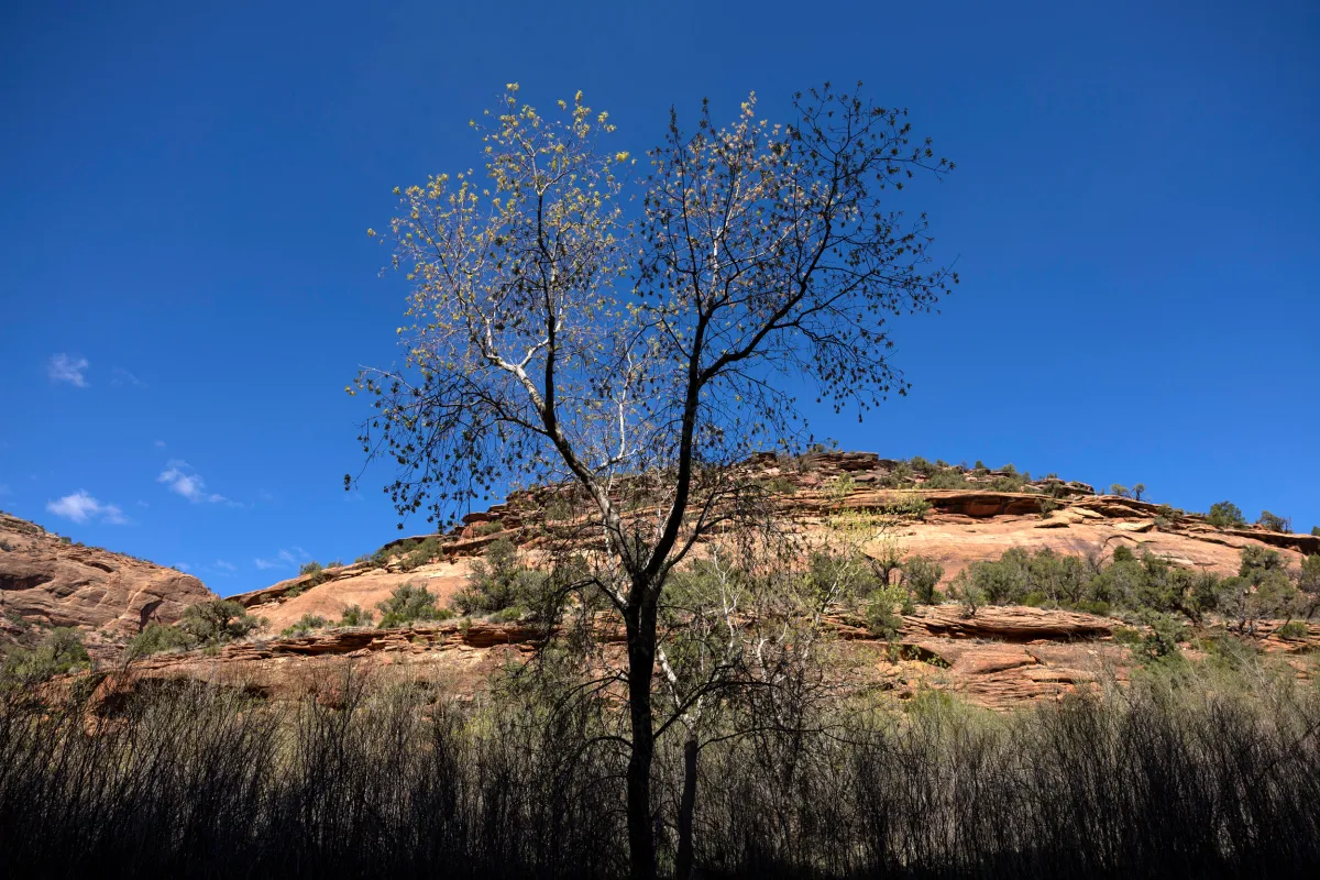
A tree begins to bloom inside Dolores River Canyon, Apr. 23, 2023, near Bedrock. (Hugh Carey, The Colorado Sun)
Shout-out to Jason Blevins of the Colorado Sun for this story that shows the different local points of view around Monumentizing.
Pond, a former nuclear engineer who now runs an RV park in Naturita, quickly launched a petition at change.org saying the monument designation would cancel all mining in the uranium-rich area, end hunting and cattle grazing and curtail motorized travel.
“I think it absolutely, positively could be a threat,” Pond told The Colorado Sun. “If you look at the history of monument designations over time, more and more restrictions are put in place as more people start coming. We could start losing access. These are public lands me and my family and our neighbors have enjoyed for decades. A lot of local people have a lot of concerns.”
In the first 10 days more than 2,100 signed the online petition, many leaving comments blasting the plan.
Scott Braden, a Western Slope conservation advocate whose Colorado Wildlands Project is among the 13 conservation groups behind the monument proposal, said the petition “is making mischaracterizations about what a monument will or won’t be.”
“It will not end ranching. It will not close Jeep trails. It will not stop hunting. That is simply not what we are proposing,” said Braden, pointing to an online fact sheet he helped assemble to better inform residents about the plan.
This is the old “not in this decision” trick, as we have seen with the BLM Rock Springs draft RMP.. no, strictly speaking, this decision isn’t made in the designation but it narrows the activities allowed in future decisions. And if the point is not to change activities to “protect” things.. ultimately.. why make BLM and FS folks go to the work of developing a new plan for the Monument.. unless the whole point is to attract more tourists.. and thereby not really “protect” it at all. Puzzling.
And the ever-popular State of the Rockies poll, (generic and biased questions asked of people who aren’t familiar with the issue, IMHO).
Colorado College’s annual State of the Rockies poll this year asked 436 Colorado residents about protecting existing public lands surrounding 162 miles of the Dolores River to “conserve important wildlife habitat, and safeguard the area’s scenic beauty and support outdoor recreation.” The poll showed 92% of respondents support the protection plan and 6% oppose.
Advocates for the monument last year commissioned the nonprofit research group Conservation Science Partners to identify “biologically rich pockets of unprotected public lands” in Colorado. The group’s report showed the five-county region around the Dolores River as the largest and most biodiverse of the 71 areas identified, with high biodiversity values that support a variety of animals and plants.
Here we go.. unprotected from whom and what, exactly?
Natalie Binder, who has converted a 120-acre former mining camp above the San Miguel River in Naturita into a boutique retreat and artist compound, said even if a national monument increases visitation to the region, “it will not change the remoteness of these lands.”
“A monument is not the magic wand, nor does it come without some complexities,” she said. “However, we are rooted in supporting efforts that allow us to bring more people together, provide opportunities for more people and open our doors with kindness to all travelers who are passing through looking for something a little different.
It does sound a bit like.. more people are wanted, at least by some.
Pond said a shutdown on new mines would not work for the communities along the Uravan Mineral Belt, a 210-square-mile geological zone that has produced more yellowcake uranium and radium than any other region in the country. But there hasn’t been any hardrock mining in the 2,100-resident West End community for several decades and the coal-fired power plant in Nucla closed in 2020 and was demolished. There are hundreds of dormant mines in the area needing remediation.
But the price of uranium is up, over $100 a pound for the first time since 2007. There is a buzz in the West End communities of Bedrock, Naturita, Nucla and Paradox around a mining revival, Pond said.
What I think is missing from that part of this piece is: there seems to be a nuclear energy renaissance going on around the world, including this COP28 statement:
At COP28, Countries Launch Declaration to Triple Nuclear Energy Capacity by 2050, Recognizing the Key Role of Nuclear Energy in Reaching Net Zero
Logically that would require more uranium mining. And as we know, some Tribes don’t want it, so.. wouldn’t we want to think about that before Monumentizing? As to polls, here’s another one (granted it was Australia)
An exclusive Newspoll conducted for The Australian shows 55 per cent of all Australian voters supported the idea of small modular nuclear reactors as a replacement technology for coal-fired power. But support was highest among 18 to 34-year-olds – the demographic most concerned about climate change – with 65 per cent saying they would approve of such a proposal.
If I were involved in that discussion, I’d ask the proponents exactly what they are looking to “protect” from.. industrial scale recreation? Moabization? and then have the discussion move on from there. Because right now, it looks to me (to link to our previous discussion on targets) that certain groups, those with a heavy influence on certain politicals, have a “protection acres”… target. And in pursuit of that target, perhaps they don’t actually care what “protection” means exactly. And these local people in the article do care about the specifics. So, given that.. what is the right process to involve local people in Monumentizing?
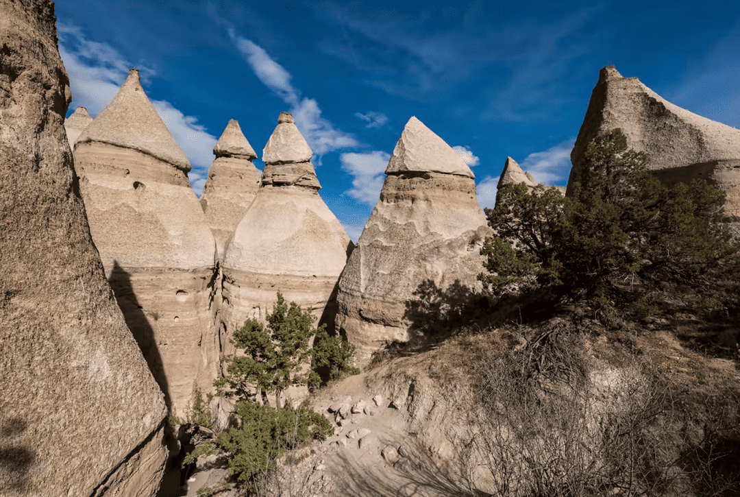
This is related to yesterday’s post..Kasha-Katuwe Tent Rocks is considered to be a co-managed federal unit between the Cochiti Pueblo and the BLM. It’s been closed for three years.
Here’s a story from KRQE News 13. The story starts out with how difficult it was to find anything out about the closure and when it might be reopened:
The National Monument was closed to the public in the 2020 pandemic shutdown and it remains closed today. Why? KRQE News 13 went digging for answers.
For months, emails and phone calls requesting interviews with the state’s Tourism Department, the Bureau of Land Management, the Secretary of the Interior’s Office, Congresswoman Teresa Leger Fernandez, and Senator Martin Heinrich were answered with replies such as, “We will not be providing a comment or participating in this story at this time.”
“BLM has been meeting regularly with the Pueblo,” said Jamie Garcia, an outdoor recreation planner with the BLM. “We have been in discussions about what reopening looks like.”
This isn’t very transparent. Conceivably it could have been possible to give that answer sooner. One wonders if the co-management aspect may have made it more difficult to arrive at one answer that could be communicated.
On to the Monumentization aspect:
A ‘Double-Edged’ Sword
Garcia said they’re addressing long-standing issues including over-visitation, staffing needs, and resource protection, alongside Pueblo de Cochiti. “We’ve had such high recreation use and we want to make sure that we are taking a step back and really looking at that big picture item there, and seeing how we can move forward in a more sustainable and responsible way,” Garcia told KRQE News 13.
The Cochiti Pueblo remains closed citing Covid-19 restrictions, blocking road access to the national monument which sits on BLM land. As part of the presidential proclamation, the site is managed by the BLM in “close cooperation and partnership” with the Pueblo.
“I suspect that the designation of the National Monument was a double-edged sword,” said Dr. Smith. “On one hand, it provides resources and legal protections for preservation. But once someone sees a national monument on a map, it’s close to Interstate 25, it’s close to the Albuquerque-Rio Rancho-Santa Fe metropolitan areas — then that just becomes a magnet to draw more people,” Smith explained.
DR. GARY SMITH, UNM PROFESSOR
There’s a calculus here.. do more resources show up in enough quantities to deal with the enhanced visitation from Monumentizing? What, I wonder, was the Monument protected from?
Data published in a government-issued 2020 science plan shows visitation levels each year since the monument designation. In 2000, Tent Rocks recorded 14,674 visitors.
In 2001, that jumped to 25,000 annual visitors with the presidential proclamation. And since then, visitation has soared to more than 100,000 people a year before the covid shutdown.
(Tent Rocks Visitations by Fiscal Year )
“But even before the pandemic, I recall seeing activity discussions between the BLM and Cochiti trying to think about how to handle the large crowds, that it was having a detrimental impact on the landscape that they were joint stewards to preserve,” explained Smith.
“In the past few weeks, they’ve been over-capacity,” said Danita Burns during that Spring Break surge in 2018. “People from Australia, people that are coming in from Japan. It’s quite the destination now,” she said.
Monuments can attract tourists from outside the area.. this may be good for some in local communities, but lead to problems of overcrowding and reduction of the experience for locals and wildlife.
According to the pre-2020 data report, “Current visitation is nearly three times the original planned capacity,” which was designed to hold about 50,000 visitors annually. That’s been a concern for those working at the site.
Dr. Gary Smith with UNM students at Tent Rocks in 1992.
Timed ticketing, fee increases
So, will visits to the monument move to timed ticketing? Garcia says an online reservation system along with a fee increase has been proposed.
“We have not implemented anything yet, but it is something we would like to do, make sure that we can keep up with growing costs of supplies and demand,” Garcia told KRQE News 13.
Meanwhile, locals are still seeing advertisements for Tent Rocks, and still waiting for the monument to reopen. “Oh, I’ll look forward to going back again, for sure,” said Smith.
Dr. Smith said his colleagues and friends have been messaging him, asking for updates about the monument. “Do you think Tent Rocks will open this spring? How long can they keep it closed? You know, so it’s – everyone wants to know,” Smith said.
The Bureau of Land Management says it will update plans for Tent Rocks on its website, but they have yet to provide a timeline on when the national monument will reopen. Part of that depends on when the pueblo decides to open its gates to the public once again.
It seems to me that Monumentizing, in some cases, is like many politically symbolic activities. Someone announces something that sounds good and makes a splash… then leave the same old folks with the same pots of dollars and competing priorities to actually carry it out.
I guess this is a bookend to Sharon’s “Friday News Roundup.”
BLUE MOUNTAINS
I recently provided an update on the status of the Blue Mountains forest plan revisions here. And here’s a little more detail on that, especially on the question of “access.” (This term gets used for a couple of different things, and this one is about closing roads on national forests rather than creating access across private property to reach public lands.)
One group says its leading the charge to fight for what they call “original rights” is Forest Access for All. “We defend the rights that we’ve had since Oregon was a territory, free reign where we go and utilize the forests which are public lands,” says Bill Harvey, a group member and former Baker County Commissioner. “A couple decades ago the Forest Service began closing off sections of the forest and that’s when Forest Access for All was formed.” Harvey says his group’s particular ire is at the Wallowa-Whitman National Forest (WWNF), which he claims “have closed thousands of miles of roads in the forest the last twenty years.”
The group also has other “conflicts” with the Forest Service include the need for more vegetation management, economic benefits of (motorized) recreation, and better public engagement.
“By law right now, we have an open forest. They will admit it, everybody admits it, and it’s in the books, I’ve seen it a million times. It is an open access forest,” says Harvey. “Why in God’s name would we want to give that up? Nothing benefits us to give up our rights that we have currently. We’re not asking for more rights, we’re asking for the existing rights to stay in place.
I’m going to disagree with him on this one, and I hope the Forest Service does, too (although it looks like they could have done a better job of setting the locals straight on this before now). In 2005, Subpart B of the Travel Management Rule changed the culture of motor vehicle use on roads, trails, and areas from “Open unless closed” to a system of designated routes. As for why? The goal was to reduce resource damage from unmanaged motor vehicle use off that road system.
FLATHEAD
Newly revealed emails show that the Flathead National Forest under then supervisor Kurt Steele looked to keep a proposal of a tram up Columbia Mountain from public view for more than year prior to it being first proposed.
Does this sound familiar? It sounds to me like the “Holland Lake Model” that got the forest supervisor a “promotion” to forest planning. In this case the Forest properly rejected the proposal as inconsistent with its forest plan (thank you forest plan!). But it does suggest a pattern of incentives and behavior that may be broader than the Flathead National Forest.
“The process where the public comes into play is when it becomes the NEPA process,” Flathead Forest spokesperson Kira Powell said about the emails.
“Bringing you into the conversation about this potential project on the Flathead NF because it’s coming from investors who apparently have the financial resources to build a tramway, meaning they likely have political savvy also … wrote Keith Lannom, who was deputy regional forester for Region 1 at the time …”
This account offers a window into the role of “political savvy” in Forest Service decision-making.
ORGAN MOUNTAINS – DESERT PEAKS NATIONAL MONUMENT
Since President Barack Obama created the Organ Mountains-Desert Peaks National Monument in 2014, visitation has tripled and the national monument has spurred economic growth in the Las Cruces area as well as other communities near the national monument, according to a new report.
According to this overview, the report looks at the various factors that made this particular monument so successful, including its location relative to population centers and the uses it caters to. Also local community support.
“We have always recognized that the establishment of the monument was due in large part to the grassroots effort at the local community organizations and individuals,” Melanie Barnes, the state BLM director, said. “And due to this engaged and proud community, the monument has seen an increase in visitation.”
She said the BLM is working on a resource management plan that will address land use and resource protection. The public scoping period for that plan recently ended.
Grand Staircase – “visitutah.com” (Larry C. Price)
Dismissal of a lawsuit against President Biden’s proclamation restoring the boundaries of the Grand Staircase and Bears Ears national monuments allows the NEPA process to develop a management plan for these areas to proceed unhindered. Biden ordered the BLM to work on replacing the Trump Administration’s resource management plan, and the BLM published its draft RMP on August 11 for public comment.
BLM may proceed unhindered, that is unless Congress decides to hinder them. The FY2024 Interior, Environment, and Related Agencies Bill the House Appropriations Committee passed in July, which the full House of Representatives is expected to vote on in September, includes a rider that would require the BLM to manage the Grand Staircase NM in accordance with the plan finalized after Trump reduced the monument.
Which is the better planning process – RMPs based on public involvement through NEPA or RMPs based on appropriations riders?
The bill would also deny funding to implement the BLM’s public lands rule (a popular topic with many posts here from Sharon). Another bill would force BLM to withdraw the rule (without considering all those public comments).
Kya Marienfeld, wild lands attorney for SUWA, called the Utah congressional delegation’s lack of support for the state’s public lands disappointing but adds that opposition is offset by more enlightened members of Congress who actively support the Grand Staircase and other public lands.
Appropriation riders seem to be kind of crap-shoot in the turmoil of budget negotiations, so I have no idea what the betting line would be on President Biden signing off on this one. The “more enlightened members of Congress” may have more of an influence on defeating the withdrawal proposal. Is that a bad thing?
A few quotes and reflections about Monuments. In some sense, they seem more about politicians getting credit from supportive groups, rather than good things happening on the ground. And those experienced with BLM processes please correct me if I’ve gotten some things wrong.
**************
First of all, there’s kind of a philosophical question about “protection.” If there are the many wondrous things talked about, say, in a Monument proclamation, then existing laws and regulations must have already protected them, so no biggy, really. To protect archeological sites on far-ranging areas like 1.1 mill acres, you probably need more law enforcement. The same groups that work so hard on Monuments (I’m talking big NGOs) could easily fund those kinds of collaborative efforts.
So if we go by the rhetoric, then there are unspecific future things that could be proposed, that we need to keep from happening before they are proposed, because we can’t trust existing statutes, regulations and processes to protect the environment. And the environment in this place is more important than elsewhere, for various reasons.
So what is this desire to Monumentize really about? For the Prez, it could just be politics as usual, rewarding friends with a frisson of punishing enemies (Utah is right next door to this one). But that’s not entirely it.
*********
I ran across an article in the Wall Street Journal about a rich person named Elaine Wynn in Las Vegas and the Basin and Range National Monument. This story is about Congress, but the principle’s the same..important ($) people want Monuments.
She has remade herself as a world-level art collector and a force in public art, supporting the Los Angeles County Museum of Art and using her influence to help create a national monument designation to protect land around Michael Heizer’s City—a 1.25-mile-long earthwork sculpture in Nevada. She has taken her work in Nevada education to the national level: She is chairman of Communities in Schools, which provides resources to disadvantaged children. It recently received a surprise $133 million gift from MacKenzie Scott, Jeff Bezos’s ex-wife.
***
Michael Govan, director of the Los Angeles County Museum of Art, says Wynn was a key figure in the 2015 creation of Basin and Range National Monument, which protects the 704,000 acres surrounding Heizer’s City. President Barack Obama approved the designation. “When [Elaine] started making calls to Congress,” Govan says, “somehow I was received in a different way.”
“There is a new community-led movement for the president to designate the Dolores River Canyon Country as a national monument, which would open new avenues for local economic growth, increase resources to thoughtfully manage these wildlands and deepen the quality of life in our community. We believe that a landscape-scale national monument would open the door to better management and conservation, and provide additional resources to land managers to accommodate for sustainable recreation and continued access.”
Hmm. “New avenues for local economic growth”- what does that mean exactly? More people coming to town? But the area is overcrowded already. And as we’ve seen with the San Gabriels, a Monument does not necessarily come with more funding attached. I don’t know about “deepening the quality of life” but in other parts of Colorado, more people does not actually deepen the quality of life. And again, the author says “provide additional resources to land managers.”
I see several problems with this thinking. 1. More growth and people is not necessarily better, not if it leads to housing problems, etc. 2. Monuments need Monument plans, which distracts managers from.. actually managing (and reopen disagreements, which doesn’t necessarily “deepen the quality of life” at least not for the people involved). 3. Even if they did get additional resources, would the new number of bodies outstrip the new resources? and 4. Even if they did get more resources, as new Monuments pop up everywhere, they will be competing with each other and who is to say that a Dolores River Monument would beat out Chimney Rock, Brown’s Canyon, or Canyon of the Ancients, or Bears’ Ears or ..
Another interesting part of the op-ed is this..
Senators Michael Bennet and John Hickenlooper are leading the way to protect the Dolores River Canyon County, and have introduced legislation to designate a National Conservation Area to protect nearly 68,000 acres of the river corridor through Ponderosa Gorge. We are very supportive of this legislation and urge the senators to do anything they can to ensure it becomes law. However, the legislation does not encompass the entirety of the watershed, and politics in Congress are so uncertain that there may not be a viable path for the bill to become law.
If you take a look at the bill, it tends to have the same feel as a Monument; it is in fact very detailed about what’s in and what’s out. It has a FACA committee to be established within 180 days.. good luck with that! It’s got motorized travel only on existing routes, no new temp or permanent roads except for public health and safety, yes to grazing, but withdrawals from future minerals (401b). Uranium crops up again..
(1) IN GENERAL.—Nothing in this title affects valid leases or lease tracts existing on the date of enactment of this Act issued under the uranium leasing program of the Department of Energy within the boundaries of the Conservation Area.
UPDATE: BASED ON CORRECTION FROM TSW READERS
So there are National Conservation Areas. Congress gets NCAs, the Prez gets Monuments. One can imagine if political friends of an Admin want this kind of thing, it’s much easier to get.. just a stroke of a pen (OK, so obviously they do talk to some people in advance). But of course, as with NCA’s, first they make the decision about what’s in and out, and then have public comment and an EIS on any decision space left. Which kind of leaves the impression.. yes, NEPA is superimportant, as is public involvement, including marginalized communities.. but not for really important decisions.
It seems like an advantage of Monuments that they can do some Service-First-y things with the FS; whereas I don’t know how they handle FS land in and around NCAs.
But anyway, for now, just for the BLM, we have a variety of conservation designations – Monuments, ACECs, NCAs, Wilderness, and WSAs. Perhaps other citizens find this to be needlessly confusing? And there’s more encouragement of ACECs in the proposed BLM public lands rule.
If I were elected President (a candidate of the Good Governance Party), I’d ask the Secretaries to make a table of all the existing protected area designations on the Forest Service and BLM. The table would include what activities are allowed and which not, with maps. For each specific area, I’d ask how much funding went to work within those areas. Then I think Admins and Congress would have a better picture of the whole array of land restrictions, and where the bucks actually get to the ground. I’d also think that some of these designations could be fitted into simplified bands across the FS and BLM as to what activities are in and out, to increase public understanding of, and perhaps make it easier to enforce, the rules designed to protect from impacts.