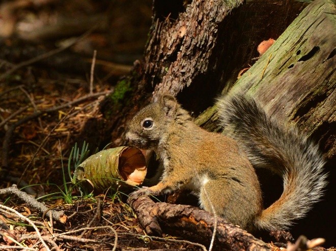
In 2017 the Arizona Game and Fish Department estimated that there were only 252 Mount Graham red squirrels left. They only inhabited a few hundred acres in the 10,000-foot Pinaleño Mountains, not equipped to survive the heat of the surrounding deserts. Then, a lightning strike started a 48,000-acre fire in that section of the Coronado National Forest, incinerating all but 35 of the Mount Graham squirrels in existence. Federal and state wildlife officials thought the species faced likely extinction.
It is a more common story than you might think. The Journal Science published a study in 2020 called “Fire and biodiversity in the Anthropocene,” analyzing the danger of wildfires to threatened and endangered species. Across nine taxonomic groups, the study found that “at least 1,071 species are categorized as threatened by an increase in fire frequency or intensity…” That included 16 percent of all endangered mammals, nearly 20 percent of listed birds, and almost a third of non-flowering plants such as evergreen trees.
Recent wildfires in California reportedly pushed dozens of species to the brink of extinction, utterly devastating miles of habitat that will take decades to recover. Less widely reported was how many endangered birds and animals were burned in those fires (nobody really wants to see that on TV), but as the study euphemistically concluded, “wildlife often cannot adapt quickly enough to escape rapid changes in fire patterns.”
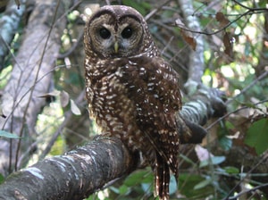
In Colorado we know the extreme fire seasons of 2002 and 2020 destroyed much of the habitat for the Mexican spotted owl, and the Hayman Fire alone destroyed over half the known habitat of a rare yellow butterfly called the Pawnee montane skipper. In California the same is now said of the mountain yellow-legged frog and the Amargosa vole, both of which are now nearing extinction. Burning most of them alive certainly didn’t help.
****************
One bit of good news: contrary to the dire predictions, there are more than 200 Mount Graham red squirrels again, apparently more adaptable than the “experts” expected.
Our synthesis shows that interactions with anthropogenic drivers such as global climate change, land use, and biotic invasions are transforming fire activity and its impacts on biodiversity. More than 4400 terrestrial and freshwater species from a wide range of taxa and habitats face threats associated with modified fire regimes. Many species are threatened by an increase in fire frequency or intensity, but exclusion of fire in ecosystems that need it can also be harmful. The prominent role of human activity in shaping global ecosystems is the hallmark of the Anthropocene and sets the context in which models and actions must be developed. Advances in predictive modeling deliver new opportunities to couple fire and biodiversity data and to link them with forecasts of multiple drivers including drought, invasive plants, and urban growth. Making these connections also provides an opportunity for new actions that could revolutionize how society manages fire. Emerging actions include reintroduction of mammals that reduce fuels, green fire breaks comprising low-flammability plants, strategically letting wildfires burn under the right conditions, managed evolution of populations aided by new genomics tools, and deployment of rapid response teams to protect biodiversity assets. Indigenous fire stewardship and reinstatement of cultural burning in a modern context will enhance biodiversity and human well-being in many regions of the world. At the same time, international efforts to reduce greenhouse gas emissions are crucial to reduce the risk of extreme fire events that contribute to declines in biodiversity.
Seems to me that targeted fire suppression to protect species habitat is quite valuable, although it doesn’t seem to be on this list. Also the 35 left and back to 200 story.
Here’s what the USFWS is doing to help the Mt. Graham Red Squirrel (known as MGRS), including various silvicultural manipulations of interest, pheromones, cone collection, fuel treatment projects, as well as supplemental feeding and shooting Abert squirrels to decrease competition. Perhaps it’s less controversial than the PNW owl shooting for various reasons? Birds vs. squirrels have different advocates? Numbers and dollars involved? What do the Arizonans out there think?
One of the hills I died on near the end of my Forest Service career was an attempt to get national forest planning to coordinate with future plans for adjacent ownerships to provide for wildlife habitat connectivity among them, including local government planning and land trust conservation easements. I thought the Forest Service could play a leadership role in coordinating this. The response I got was that anything to do with private lands was a “third rail” that they didn’t want to go near. This sounds different.
On October 21, a Department of Agriculture memo announced “a Department-wide effort to support connectivity of wildlife habitat on working landscapes through the management of National Forests and voluntary conservation assistance on private agricultural lands.” Specifically, a new Secretary’s Memorandum directs USDA agencies to:
Incorporate consideration of terrestrial wildlife habitat connectivity and corridors into relevant planning processes, programs, and assessments.
Improve the coordination, compatibility, and delivery of USDA planning processes and programs to improve outcomes for terrestrial wildlife connectivity.
Increase inter-jurisdictional coordination with states, tribes and other federal departments.
Coordinate within USDA to implement the actions outlined in this memo, with the goal of improved delivery of USDA programs and outcomes for terrestrial connectivity.
Needless to say, I like the recognition in the first bullet that planning, specifically recognized later to include “FS land management planning,” is important to a desired outcome that requires designing bridges connecting multiple owners; otherwise, the result may be bridges to nowhere or with missing spans.
The memo recognizes that “A recent revolution in animal tracking, remote sensing, and computational analysis is improving the prioritization of conservation and restoration actions.” It also notes, “The agency’s 2012 planning rule, which governs land management planning across these lands, included requirements for evaluating, maintaining, or restoring connectivity” (my contribution to posterity). The directive includes a specific proposal related to forest planning:
Improving planning through Forest Service analytic tools, including a Climate Risk Viewer that identifies climate change-driven risks to key resources, such as corridors and connectivity, as well as migration corridor tool development among the National Forest System, Research Stations, and partners.
Because “Federal lands often serve as anchor points for wildlife, but most of the country’s wildlife reside on private lands,” much of the emphasis may be on supporting private land conservation. However, “this collaboration will build on the crucial connection between public lands and the private lands around them.” (Or at least to the extent that a Secretary’s memo can accomplish anything.)
Somehow I hadn’t been following sage grouse, but apparently there’s another plan in the works. Pew sent out this notification…
Dear Wilderness Supporter,
Populations of the iconic greater sage-grouse have fallen significantly over the past six decades, with an 80% decline across their range since 1965—and half of that drop occurring since 2002. These disturbing findings, together with the Biden administration’s focus on combating climate change, compelled the Bureau of Land Management (BLM)—the largest federal land manager of sage-grouse habitat—to reexamine its management of the 67 million acres of habitat in California, Colorado, Idaho, Montana, Nevada, North and South Dakota, Oregon, Utah, and Wyoming.
The public comment period closes June 13th! Act now to ensure your voice is heard.
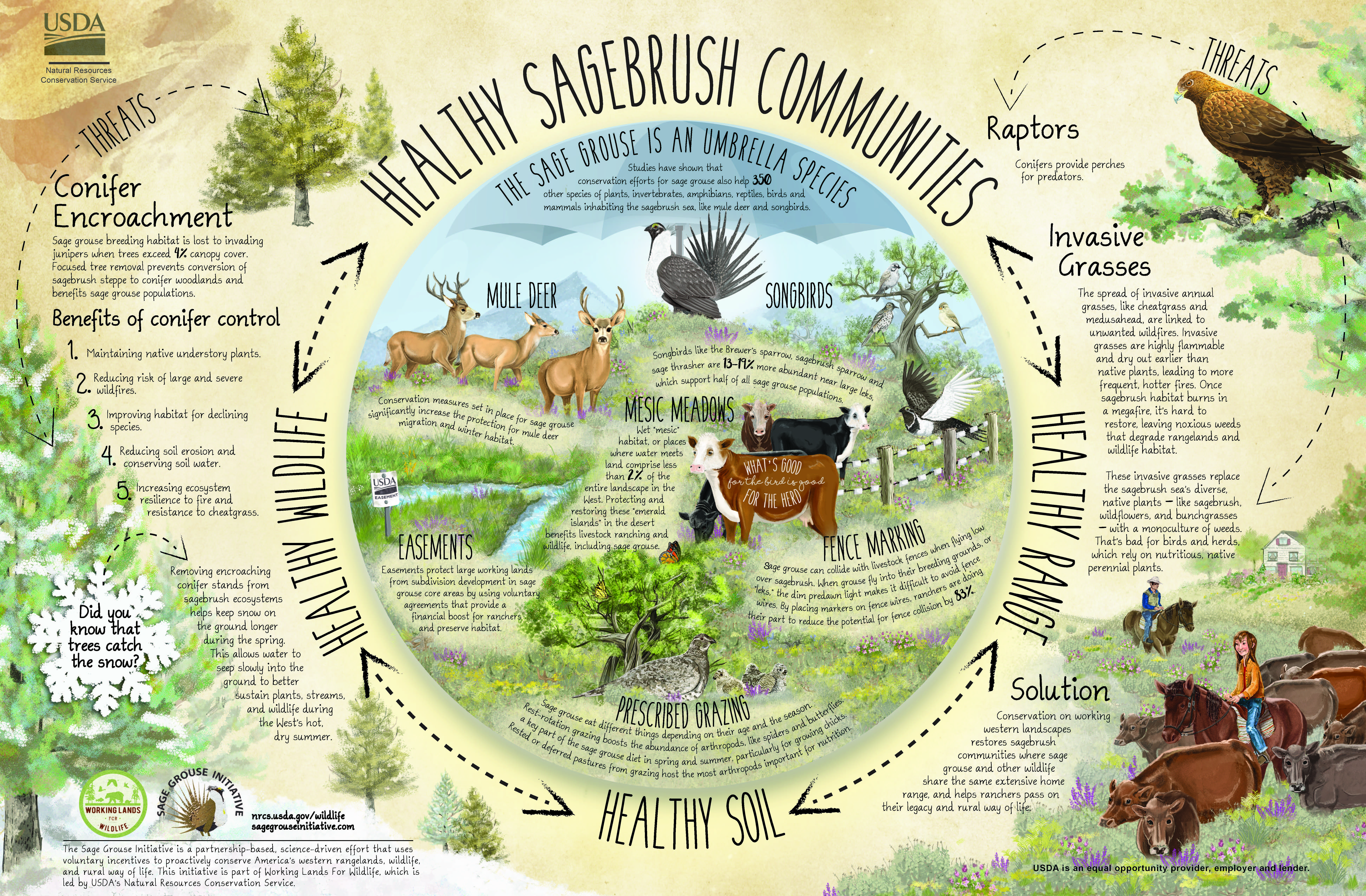
The sagebrush steppe of the interior American West covers tens of millions of acres and is one of the nation’s most imperiled ecosystems. Sagebrush landscapes—which are home not only to greater sage-grouse but also to mule deer, pronghorn, pygmy rabbits, and more than 350 other species—continue to shrink rapidly because of a host of growing threats, including wildfire, energy development, and the spread of invasive plant species.
While the draft plan is a step in the right direction, science points to the need for even stronger management so that the greater sage-grouse population can recover. The BLM is requesting public input on its draft plan. Please take a moment to submit your comments so that the BLM hears a resounding message from the public urging it to:
Provide strong and consistent management action that takes into account changing climatic conditions to stem the ongoing population declines.
Protect and expand intact landscapes that support sage-grouse and the 350 other species that depend on the sagebrush steppe through designations of Priority Habitat Management Areas and Areas of Critical Environmental Concern.
Mitigate against any impacts across this vulnerable habitat to ensure the long-term viability of the species.
Please act today to help slow the alarming decline of the sage-grouse and its habitat. The deadline to submit comments is June 13th. Act now!
**************
Note: were it not for the last-minute twist I described in this post. the Obama Admin could have had a sage grouse deal that stuck. Here is what my source said:
Folks from Garfield County, CO did a FOIA and found out that the changes were associated in time with meetings with various environmental organizations, including Pew. One particular idea added during these last changes was the idea of “focal areas”. The States went ballistic.
If the Obama Admin had not listened to these groups, it’s likely that we would have spared the sage grouse workers, BLM folks of all stripes, (and the public) two more goes at this planning effort (one Trump and one Biden).
I’m always interested in lessons learned from various efforts and it turns out that there was a paper written about Wyoming’s lessons learned. Since 2003, Local Sage-Grouse Working Groups worked together (LWGs) , Wyoming also had an SGIT:
In 2007, a statewide SageGrouse Implementation Team (SGIT) was appointed to advise the governor of Wyoming on all matters related to the Wyoming Greater Sage-Grouse Core Area Protection Policy. The Core Area Policy was established by a governors’ executive order and provided mechanisms for limiting human disturbance in the most important sage-grouse habitats. Federal land management agencies have incorporated most aspects of the Core Area Policy into their land use planning decisions
Process and project implementation.
Successes at the statewide scale appeared to be largely the product of sound science used to inform policy making and effective leadership by Governors Freudenthal and Mead as well as the SGIT chairman, Bob Budd. While the potential for ESA listing certainly provided economic motivation for individuals and interests not otherwise dedicated to wildlife and habitat conservation to earnestly participate in the process, charismatic leadership should not be underestimated as a compelling force guiding diverse interests to work cooperatively toward a mutually acceptable outcome. Even so, challenges remain at both the local and state scale. These include:
• Increasingly infrequent LWG meetings impact group dynamics, as LWG members need to refresh their memories and reestablish working relationships.
• LWG project outcomes are often unquantified and undocumented, so their effectiveness is uncertain.
• The consensus decision-making model often results in more discussion and deliberation on an issue than would have occurred under a simple majority vote model. In the Wyoming LWGs, this appears to have led to better decisions being made. However, the resulting decisions can alternatively be a compromise that insufficiently addresses an important issue, but stands nonetheless as parties to the decision prioritize cooperation over outcome.
• Some individual LWG members harbor modest resentment of the SGIT, which has greater policy-making influence. Including more LWG representation on the SGIT could improve these relationships.
• Although adaptive management is an operative concept in the CAP, the reality is that people, and especially business, prefer stability and certainty. Consequently, resistance to change can be a difficult challenge to overcome, even in the face of compelling science.
• Overriding of advisory group recommendations by decision-makers may threaten the success of the group process. Examples of this include the federal designation of “Sagebrush Focal Areas” in the federal land-use planning process completed prior to the 2015 listing decision, the Department of Interior Secretarial Order 3353 directing review of all planning decisions made by the previous administration relative to sage-grouse, and 2016 legislation in Wyoming allowing private bird farms to collect eggs from wild sage-grouse and develop captive flocks. Each of these decisions was made with no or minimal consideration of established advisory group processes, resulting in concern from various participants that might
undermine their interest in continuing to be involved.
Paramount to all is the fact that both the local and state processes are reliant on the ability of diverse participants, who often hold adversarial viewpoints, to develop and maintain positive working relationships in seeking to achieve mutually agreeable goals. We believe the Wyoming model has potential to succeed in an era of political polarization.
I think there’s probably a better way to go than Partisan Policy Ping-Pong on western lands. Hopefully the Biden Admin will ultimately pick something of a more peace-keeping and likely to be permanent nature, and not a pre-election sharp stick in the eye that would lead us into another round of (potentially pointlessly provocative) planning..
I believe the Rio Grande revision is one of only two developed under the 2012 Planning Rule that have been litigated (the Flathead being the other). Two lawsuits were filed against the Rio Grande in November 2021. One of them (Defenders of Wildlife v. U. S. Forest Service) was decided a year ago by the district court and is on appeal to the 10th Circuit. That case is worth some discussion, so here it is. There has not yet been a district court hearing for the other case (San Luis Valley Ecosystem Council v. Dallas). (The Colville revised plan litigation involved the previous 1982 planning regulations.)
On January 27, 2023, the district court upheld the Rio Grande revised forest plan’s compliance with the Endangered Species Act and NEPA for Canada lynx. The judge framed the issue in this case as whether the Forest failed to “protect the lynx by inadequately limiting logging in the Forest under a revised forest plan in violation of the ESA, the National Environmental Policy Act (“NEPA”), and the Administrative Procedure Act (“APA”).” The court found no violation of ESA in the Biological Opinion by the Fish and Wildlife Service, and it summarily dispensed with the NEPA and ESA claims against the Forest Service as being based on “substantially the same arguments.”
The case involves changing forest plan management direction for Canada lynx from that included in the Southern Rockies Lynx Amendment in response to insect-killed trees and blowdown over a large portion of the Forest. The opinion asserts at the outset that, “Petitioner’s position is fundamentally flawed for at least three reasons.” Two of these are troubling.
The court minimizes (or perhaps rejects) the need for ESA consultation on national forest plans because they are “programmatic,” and (citing the BiOp), “no immediate consequences occur directly to Canada lynx caused by the proposed action,” and therefore “implementation cannot be said to jeopardize the lynx directly.” If plan cannot jeopardize a species, then there should be no need to consult.
These statements and this conclusion would be contrary to national Fish and Wildlife Service policy on consultation on “programmatic” or “tiered” decisions. Forest plans are decisions that both promote activities that could adversely affect species through desired conditions and objectives, and limit those activities through standards and guidelines. Consultation on such decisions is based on the effects that would be allowed to occur using the “design standards” in the decision. There is no requirement that consequences potentially leading to jeopardy be “immediate.”
The court’s conclusion is also at odds with other cases, which emphasized the broad scope of agency “actions” subject to ESA. The 10th Circuit has determined that, “Much like the promulgation of a regulation, we have little doubt after Norton that the act of approving, amending, or revising a LRMP constitutes “action” under § 7(a)(2) of the ESA.” Forest Guardians v. Forsgren, 478 F.3d 1149, 1154 (2007). The 9th Circuit held, “RMPs are actions that “may affect” the protected salmon because the plans set forth criteria for harvesting resources within the salmon’s habitat.” Pacific Rivers Council v. Thomas, 30 F.3d 1050, 1055 (1994). A requirement to consult on forest plans must presume that there could be some basis for finding substantive violations of ESA, so this court’s finding of a fundamental flaw here seems fundamentally flawed.
A second “fundamental flaw” results from the fact that, “lynx habitat in the Forest amounts to just over 2 percent of the lynx habitat in the contiguous United States,” and “none of that habitat was designated as critical.” Therefore, “even if the lynx were extirpated in the Forest, that would not significantly affect the status of the lynx across the contiguous United States.” This raises questions about the effectiveness of applying ESA’s requirements to wide-ranging species if no individual project or even a forest-wide plan could be viewed as capable of causing jeopardy. This is a reason why the western lynx amendments were applied across ranges of the lynx, and consultation occurred on multiple national forests simultaneously. The reasoning the court applied here highlights the risk of now disassembling a regional strategy on a forest-by-forest basis. Doing so on one forest should arguably trigger the need to reinitiate consultation across the range of lynx (in this case the southern Rockies national forests).
This court’s view of ESA highlights the need to challenge species conservation provisions of forest plans under the viability requirement of the 2012 Planning Rule, even for listed species. The requirements pertaining to species viability must be met based on their probability of persistence in the “plan area.” Various statements cited by the court would support a conclusion that lynx are not likely to persist on the Rio Grande National Forest plan area over time. This argues for strict scrutiny of forest plan components that would allow any adverse effects to occur from management activities. Similar to ESA, the viability requirement contemplates long-term consequences of multiple activities over time, and effects need not be direct or immediate. (In another context, the court points out that, “the revised forest plan is intended to remain in effect only until about 2036,” but it may be that management actions during the life of this plan would contribute to the “long-term” decline, which is the test applied by the 2012 Planning Rule).
There is a counter-argument that the 2012 Planning Rule applied the viability requirement explicitly only to “species of conservation concern,” which are defined to not include listed species, for which the requirement is to “contribute to recovery.” However, at the point at which the species recovers, it should immediately become an SCC (see Planning Handbook §12.52d.2.b) and would need to meet the viability requirement. Regardless, logic requires that what is needed to “contribute to recovery” should be something beyond what is needed to maintain viability after recovery, and that plan components for listed species must at least provide habitat for viable populations.
This outcome would be consistent with court interpretations of the NFMA diversity requirement under the 1982 planning regulations. When the Forest Service argued that it did not have to meet the viability requirement for listed species, the 9th Circuit found, “The effect of the Forest Service’s position in this litigation, were it to be adopted, would be to reward the Forest Service for its own failures; the net result would be that the less successful the Forest Service is in maintaining viable populations of species as required under its regulations, the less planning it must do for the diversity of wildlife sought by the statute. This is directly contrary to the legislative purpose of the National Forest Management Act.” Seattle Audubon Society v. Evans, 952 F.2d 297, 301 (1991). (The San Luis Valley Ecosystem Counsel claims against the Rio Grande plan include NFMA violations for lynx and the Uncompahgre fritillary butterfly, but relative to the “contribute to recovery” requirement for listed species, and not the viability requirement.)
The third “overarching flaw” appears to derive from judicial deference principles. The court specifically notes that, “the Court does not find that the presumption of validity that attaches to agency action is overcome merely because the revised forest plan changes the way the SRLA was previously applied in the Forest.”
The remainder of the opinion discusses the scientific rationale provided by the agencies for their effects analysis and decisions, and finds that they properly address questions raised by plaintiffs, and the court was “not persuaded that implementation of the revised forest plan is likely to make conditions worse for the lynx.” (Perhaps under stricter scrutiny called for by the NFMA plan area viability requirement the court might have been persuaded.) So maybe the court’s findings of “fundamental flaws” were just window dressing?
On January 17, 2024 the 10th Circuit held a hearing (listen here) in this case. I have not read the briefs, but the hearing did not discuss the overarching issues reviewed above, so it appears that they are assuming (and apparently the government did not object) that the Rio Grande revised plan could theoretically cause jeopardy to lynx.
The hearing was narrowly focused on two issues, and particularly on the question of whether the northern portion of the Rio Grande should be managed as an area of low lynx use with less protection, as it is in the revised forest plan. That turned on the question of best available science. The only research on lynx that included the northern portion (Ivans) concluded that there could be high lynx use. The Fish and Wildlife Service concluded otherwise based on discussions with unnamed biologists that were not specifically documented. Importantly, there is no record of the reasons why the Ivans study was not accepted by the FWS (or the Forest Service). If there were no conflicting information in the record, the unattributed sources might be sufficient, but that is not the case here. The FWS conclusions could be considered arbitrary.
The second issue was about the importance of the lynx population on the Rio Grande, and/or the importance of the Colorado lynx population to the listed species. The record indicated that the Rio Grande lynx are important to the Colorado population. The FWS had also said elsewhere that all six populations in the lower 48 (the listed entity) are important, but then discounted the current importance of the Colorado lynx population because it was not historically important. Ultimately the question appeared to be whether the FWS properly considered the importance of these lynx in its jeopardy determination for the species.
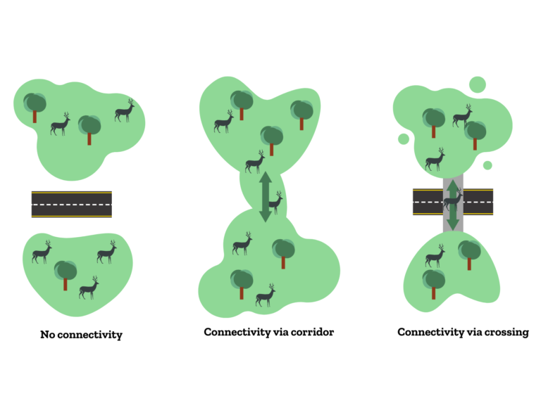
Federal lands are separated by highways all over the west. Those highways are a barrier to many species of wildlife, including species listed under the Endangered Species Act and those identified as Species of Conservation Concern (SCC) in national forest planning. Climate change is recognized as increasing the importance of wildlife movements.
Forest Service planning regulations pertaining to designation of SCC require consideration of all threats to the species’ persistence in the plan area, whether or not the threats occur within the plan area or are the result of national forest management. Often, significant threats to these at-risk species come from outside of the federal lands; one of these is the effect of highways on connectivity. The Forest Service could improve prospects for some species to persist in the plan area by making it easier for them to get to and from it. They can do two things to promote that. They can 1) collaborate with other agencies managing land, wildlife and transportation to identify the most important areas to jointly manage for connectivity, and 2) manage their lands in or near these areas to minimize barriers to wildlife movement, first by recognizing them as such in forest plans.
There’s a new tool from the Center for Landscape Conservation that could help with identifying the important areas consistently across the west. As with any newly available science, the agencies involved should be looking at this mapping tool and determining whether and how they will use it, and ideally documenting the rationale, especially for disregarding this new information. National forests should be checking their forest plans to see whether their assigned management areas would make these connectivity areas less attractive to wildlife movement, and amending plans as needed.
The study that produced these maps also found that “1,523 of the CC (“collision and connectivity”) segments (338 mi) have enough collisions to make it more cost-effective to build a wildlife crossing than to do nothing,” and land management agencies should support such efforts and manage their lands to facilitate their use by wildlife.
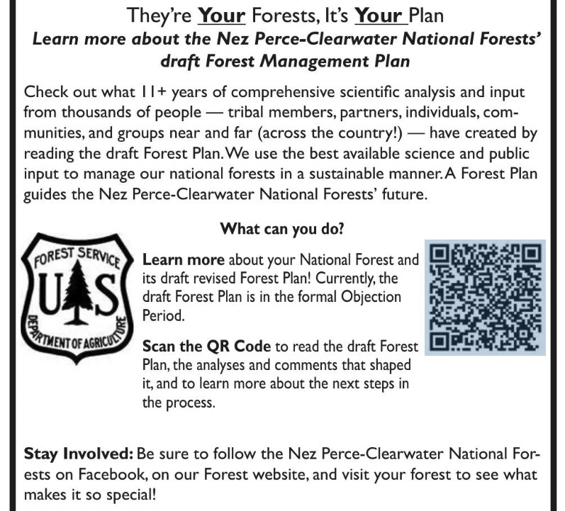
Here’s a little more (added to this) on the Nez Perce-Clearwater revised forest plan. Mostly I wanted to share this graphic of how they are “reaching out” to the public. They ask an important question: “What can you do?” The obvious meaning seems to be what can you do about the forest plan, and the answer for most people is “nothing.” They say that the plan is in the objection period, but don’t tell us that the only people who can participate are those who have already done so. They invite us to “learn more,” about this nearly-done deal, which they misleading label as a “draft Forest Management Plan.” (At the draft EIS stage, the Planning Rule refers to it as the “proposed plan,” and at the objection stage it is just the “plan.) While they have must have included similar outreach at earlier stages in the process, for those encountering this for the first time, it’s almost disingenuous.
But while I’m at it , there was also another article recently that focused on the State Line Trail, which runs through the Hoodoo Recommended Wilderness Area in the Great Burn between Idaho and Montana. (I’ve been there but haven’t been directly involved in the planning, so know only what I read.)
“It used to be a marquee backcountry ride for mountain bikers, too. That ended in 2012 when the Nez Perce-Clearwater National Forest, which controls the Idaho side of the trail, approved a new travel management plan that barred bicycles from its portion of the trail. On the Montana side, the Lolo National Forest has long allowed bicycles on the trail.”
A new revised forest plan for the Nez Perce-Clearwater could change that, by determining that bicycles are an appropriate use in the portions of Idaho around the trail, which would mirror access on the Montana side. If the changes in the plan are finalized, possibly later this year, that would set the stage for the Nez Perce-Clearwater to revisit and alter its 2012 travel plan to formally re-allow bicycles on the trail.”
The rationale behind these changes, according to the forest supervisor, don’t seem to include consistency (more on that later): “We have these types of very primitive, amazing, out in the middle of nowhere experiences that you can get to no matter what your matter of conveyance is.” No apparent agency recognition that the conveyance is part of the experience for those who encounter it, and for some it makes it feel unpleasantly more like “somewhere.”
One of the supporters added, “It’s a small segment of the sport that this is going to appeal to,” he said. “It’s not that close to Missoula. It’s hard. The trail’s in deteriorating condition. But this opportunity is, for certain people, something they really, really want.” That small segment of certain people (who apparently want to deteriorate the trail even more) must be pretty special to get this kind of personalized attention.
“Some mountain bikers are drawn to remote, rugged, and challenging backcountry trail experiences on wild and raw landscapes,” a group of supporters commented. “These are places where it is uncommon to see other trail users, and where riding requires a high level of physical fitness and technical skill — in many cases it involves pushing a bike instead of riding at all.” That would be like hiking, wouldn’t it? So, it’s not like closing the area to this use would exclude these physically fit people from these wild and raw landscapes. I’ll admit that I don’t understand the rationale of wanting to experience a “wild and raw landscape” on a machine, which (to me) reduces the rawness and wildness of the experience.
The aura of personal opinion and politics behind these wilderness debates is why I focus my energy on other things. Here there is also talk about snowmobiles and mountain goats, and why mountain goats are treated differently in adjacent national forests.
As for the effects of snowmobiles on mountain goats, the Idaho Department of Fish and Game blamed them for disappearance from one part of this area, but the founder of the Backcountry Sled Patriots says otherwise (citing other research). The Lolo National Forest cited the negative effect of motorized over-snow machines as reason for designating them a species of conservation concern. The Nez Perce-Clearwater is not concerned about mountain goats. The Forest Service minimizes the importance of the areas at issue to mountain goats (though they apparently used to be some places they are not found now).
About the Lolo, Marten, the regional forester, who determines which species are SCC, wrote:
“Compared to other ungulates, the species appears particularly sensitive to human disturbance. Motorized and non-motorized recreation, as well as aerial vehicles, are well documented to affect the species, particularly during winter and kid-rearing season, with impacts ranging from permanent or seasonal (displacement), to changes in behavior and productivity.”
The regional director for ecosystem planning said that she didn’t see the different listing decisions as being in conflict with each other. Rather, she said, they reflect that mountains goats are doing better overall on one forest than the other. This may be technically/legally possible since SCC are based on persistence in an individual forest plan area. However, it doesn’t make a lot of sense to me to manage one national forest to increase the risk to, and to contribute to SCC designation on, another forest. Moreover, the Planning Handbook states that “species of conservation concern in adjoining National Forest System plan areas” should be considered by the regional forester in making this designation. This all has kind of an arbitrary ring to it.
As for consistent management across national forest boundaries, The Nez Perce-Clearwater plans to change the shape of the Hoodoo RWA to remove the key snowmobile areas from it, so that boundary between the national forests becomes a boundary for the RWA. The Forest Service points out that the plan revision process in the hands of forest supervisors, not the regional office. The forest supervisors disclaim any obligation for consistency, and even suggest that travel planning may produce a different result, and “forest plans and travel management plans are continually updated and amended” so they could change again. That doesn’t square well with history. The every-third-of-a-century Forest plan revision should be the time to get it right. Even if the regional forester doesn’t want to say what the plans must do, that person could simply order them to be consistent along this boundary.
You can read any number of articles right now about this that say ESA was adopted by a nearly unanimous Congress and signed by President Nixon on December 28, 1973. Its supporters find success in its protection of 99% of the species listed from extinction, while critics complain that only 3% have been recovered. To me, that’s apples vs oranges, because it is much easier for a law to stop bad things from happening than to make good things happen. I’d love to see those who complain about ESA out there arguing for more money to implement recovery plans. (And I fail to see the logic of opposing additional listings because recovery is unlikely, when recovery without listing is even less likely.)
But I was curious about what the Forest Service might have to say about this momentous anniversary, and this posting showed up on their website. It’s written about California, but must represent the agency’s perspective. The current priority is evident in the second paragraph:
Large, extremely hot fires have ripped through many of these lands, charring if not destroying habitat crucial to species survival. To help reduce the risk of large, devastating fires, the Forest Service is working to remove vegetation that could feed a fire and is working with the U.S. Fish and Wildlife Service to simultaneously support the conservation of listed species.
That would be listed species that depend on “vegetation that could feed a fire,” which would be removed. We’ve seen that with spotted owls, the Fish and Wildlife says this should mean focusing fuel reduction projects on areas that are less important to the species. It would be interesting to hear about how this approach is being implemented through agency policy, forest plans, and/or implementation strategies. This explanation by the Forest Service falls a little short of a “strategy” for accomplishing this.
The U.S. Fish and Wildlife Service, which manages the species program, often partners with the Forest Service on steps to protect species listed under the act. Collaborative efforts carry intertwined goals forward. Wildlife specialists and biologists from each agency review project plans, survey forests for species populations, collect data, and analyze the best available science. The Forest Service often includes wildlife conservation measures in as part of land management planning, which means on-the-ground activities needed to increase forest resilience align with the needs of wildlife.
For example, specific types, sizes and heights of trees are left in areas of a forest known to be actively used as nesting or denning sites by threatened or endangered species. The Forest Service plans work to occur during times of the year that will not disrupt key life stages, such as mating season or when adults are caring for young. The Fish and Wildlife Service reviews these plans before work is started to ensure that species needs are being met.
I like that they recognize the importance of forest plan standards as a key tool for protecting species, but I’d like to know more about “Collaborative efforts carry intertwined goals forward.”
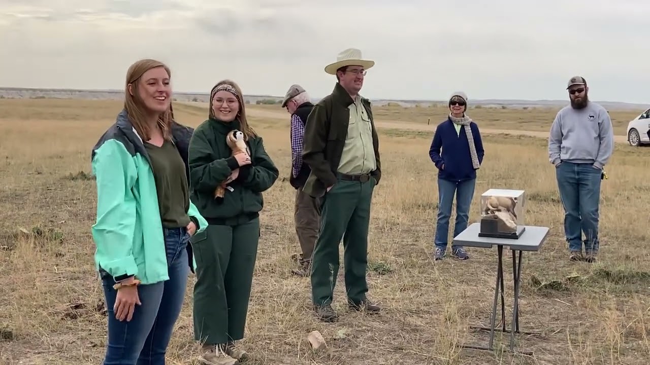
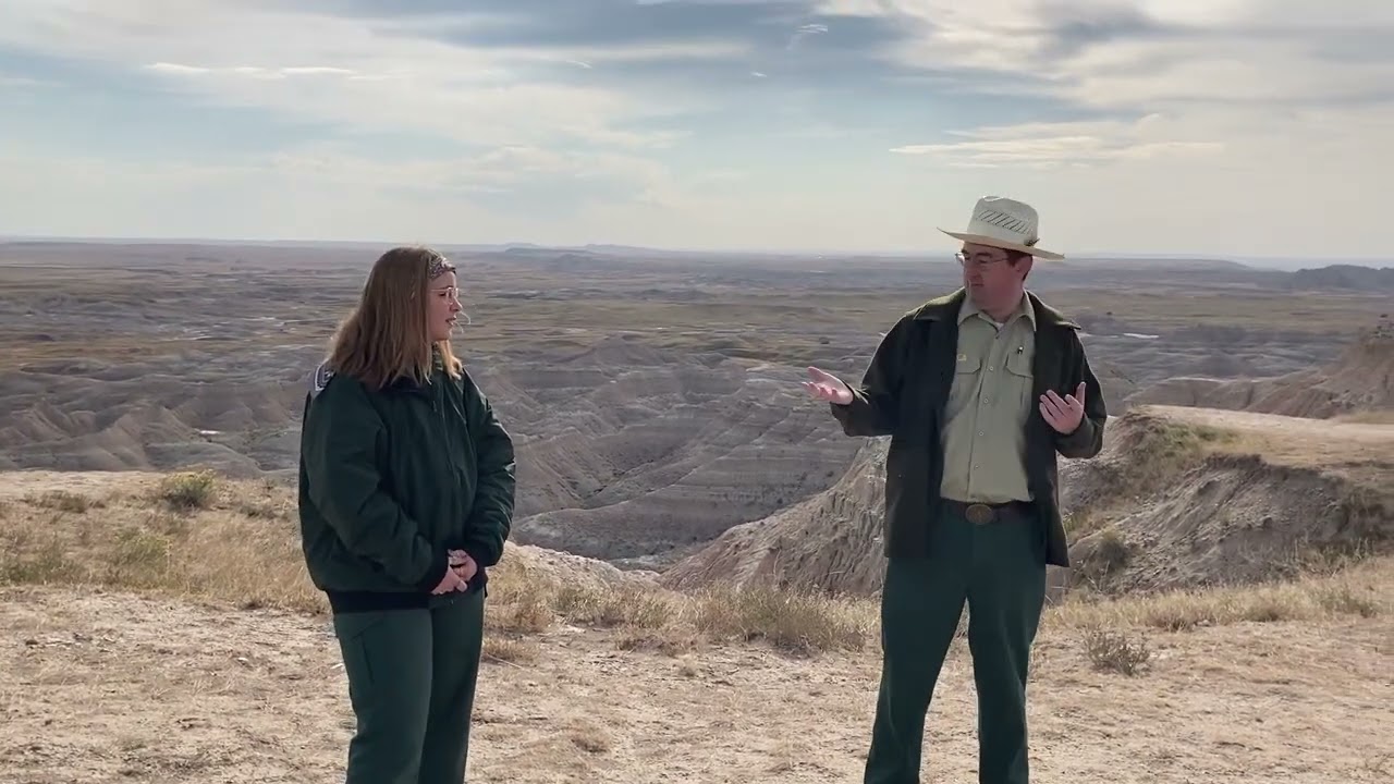
A recent Rocky Mountaineers (Forest Service retiree organization) annual gathering included a field trip to the Buffalo Gap National Grassland. Wall, South Dakota is also the home of the National Grasslands Visitor Center that tells the story of the National Grasslands.. an important part of our country’s natural heritage. For those of you who like field trips, you can get some of the fun without the travel. Travis Mason-Bushman (with the hat) and all those young people we met are outstanding at telling their stories and answering questions. They are dedicated, committed, professional with a depth of knowledge and experience. I know I can shuffle off this mortal coil and these folk will take care of the National Grasslands and Forests just fine.
One of the videos has some breathing at the beginning, which is distracting, but it goes away.
The story of the black-footed ferret recovery is very interesting, including how they are being managed to protect from disease, and their genetics. The black-footed ferrets that are alive today in the United States come from a foundation of seven ferrets.There’s even a discussion in the video of using high-tech techiques.. cloning.. to increase genetic diversity. Tissue samples of Willa, a captured ferret from Meeteetse, were cryopreserved when she passed away. They were thawed and used to produce a cloned ferret who was an exact clone of Willa. Unfortunately she (Elizabeth Ann) required surgery and cannot be bred. If you’re interested, this from the Meeteetse Museums has all the juicy and technical details. The mechanisms that organisms have to continue to live, thrive and survive small population sizes are not really understood. Estimates of MVP are based on many assumptions of things we don’t know and don’t understand. It’s a mysterious human process by which “best guess at this time” is transmuted into “scientists tell us” and then directly into policy.
This is the story of some dispersed recreation challenges the District has. This area is adjacent to the Badlands National Park, which has limited camping, and camping has mushroomed. While the District has little recreation funding or staff; they are doing what they can.
Travis does a great job, as always, explaining the history of the Grasslands. I don’t see it exactly the same way, though. Travis says something like “people determined that the land was best left alone” which I don’t think is how people thought in the 1930s. They wanted to get vegetation back.. hence reseeding and shelterbelts, so that the land could be used for grazing. The idea was also to show neighboring farmers better practices.
The area along Crow Creek near Briggsdale was the first reclamation and demonstration plot in this area. Seventy acres of meadow improvement began with the construction of two dams and three diversion ditches to spread the flood water over the meadows and provide limited irrigation on other areas. Throughout the other acquired areas, existing fences were torn down, moved or new fences constructed to surround an economically manageable pasture. Springs were developed and wells dug. Windmills were erected and “catch basins” constructed to collect as much run-off water as possible. The policy was “no cow would have to go more than three-quarters of a mile for water.” The plowed and denuded lands were planted to mostly crested wheatgrass, an introduced species from Russia which is well adapted to our climate and is palatable to livestock. Trees were planted to form wind breaks and provide habitat for wildlife. Within two years, the planted grasses revegetated the plowed areas and grazing was allowed on a limited basis.
And
This was not accomplished without trials, anger and frustration. Attempts were made to have the land returned to private ownership, but were defeated. The deep-seated individualism of the westerner made it difficult for them to accept a change from the old ways. Successful demonstrations and evident restoration of the land occurred and gradually the new, proven methods of land management were accepted by most of the population, both association members and nonmembers.
One of the reasons I bring this up is that it reminds me of watershed restoration which seems agreed upon and in some senses easier than some of the ideas we have now about “ecological restoration” which requires, in some cases, attempting to bring back all the plants and animals that previously lived there (at the correct densities and age structures, but of course not the same genetics). “We don’t want dirt to blow away and we want vegetation to cover the soil, hopefully something edible for cows” is a water and soil based restoration.. and fast forwarding, if we were to focus on these basics (soil, water, and air) and let the plants and animals fall where they may, the work of restoration would be simpler. Then hydrologists and soil scientists would be in charge instead of economists, endangered species biologists, historic vegetation ecologists, or climate modellers. It would be an interesting thought experiment, anyway.
In researching this post, I ran across an interesting website called the Encyclopedia of the Great Plains. Many interesting topics to browse there, and here’s the entry for climate.
The Great Plains, therefore, has a large range in both annual and daily temperatures. During the midwinter months (January and February), when cold, dry air from central Canada dominates, temperatures are very cold, with mean temperatures varying from 40ºF across the Southern Plains to as low as 10ºF across the Canadian Prairies. During midsummer (July and August), when the Plains are dominated by either warm, moist air from the Gulf of Mexico or warm, dry air from the Southwest, mean temperatures increase to approximately 80ºF through the Southern Plains and approximately 66ºF across the Canadian Prairies. This gives the region a much larger range in annual temperature than is found elsewhere in North America. For example, the range in mean monthly temperature between January and July in Omaha, Nebraska, is approximately 56ºF, while in Philadelphia, Pennsylvania, and San Francisco, California (each at a similar latitude), the ranges are 46ºF and 14ºF respectively.
***
The year-to-year variability in temperature and precipitation across the Great Plains is very large. This variability is especially evident in the recurrent problem of drought. The very warm and often dry summer weather that is characteristic of the Plains leads to high evaporation and transpiration (water loss from plants) rates. Soils are often depleted of their moisture, leading to stressed natural and cultivated vegetation. A measure of the lack of available soil moisture for plants, the soil moisture deficit, has been calculated for the entire Great Plains region for the period 1895 through 1994. From this it is clear that the Plains as a whole has undergone recurrent periods of drought over the last century, especially during the 1930s (the Dust Bowl years) and the 1950s. The large annual (within one year) and interannual (year-to-year) variability of Great Plains climate makes the region a natural laboratory for studying the effects of climate variability on a host of problems associated with the interaction of humans with their environment.
Perhaps the people, animals and plants of the Great Plains have something to teach us about adapting to any changes in climate and climate variability.
Western bumblebee (Xerces Society / Rich Hatfield)
The rusty-patched bumblebee and Franklin’s bumblebee have been listed under ESA and other species are being considered. The Xerces Society considers 11 species of bumblebee to be at-risk. The Forest Service and BLM allow special use permits for non-native honeybee apiaries on their lands based on categorical exclusions. Here is the one applicable to the Forest Service (36 CFR 220.6(d)(8)):
(8) Approval, modification, or continuation of minor, short-term (1 year or less) special uses of National Forest System lands. Examples include but are not limited to: (i) Approving, on an annual basis, the intermittent use and occupancy by a State licensed outfitter or guide; (ii) Approving the use of National Forest System land for apiaries; and (iii) Approving the gathering of forest products for personal use.
Most scientists agree that honeybees are not native to the Americas. They were imported to the continent in the 1600s on cargo ships from Europe and arrived in Utah in the mid-1800s.
Honeybees tend to outcompete native bees for pollen. Tepedino said, “if you put enormous numbers of honeybees on public lands … the native bee population must, by necessity, be deprived.”
A study by Tepedino concludes that the honeybees in a single apiary can, in just four months, remove enough pollen to raise five to 13 million native bees.
O’Brien said that competition is also worsened by climate change. Because climate change leads to more drought and as a result fewer flowers, it is becoming more difficult for native bees to compete with honeybees, she said.
Mary O’Brien (a botanist) also said the CE was instituted in the 1980s, before scientists knew very much about native bees. She points to the western bumblebee, a species she said is “critically imperiled” in Utah. It is particularly threatened by diseases, including ones that are transmitted by honeybees.
Project Eleven Hundred was born about five years ago in response to a request for a permit to place 100 hives each at 49 sites in the Manti-La Sal National Forest. That permit was denied, but there is currently a permit on the Uinta-Wasatch-Cache National Forest that is up for renewal at the end of this year, which is being contested and may be litigated. Project 1100 has also petitioned to remove the CE.
In forest planning under the 2012 Planning Rule, species of conservation concern are to be designated SCC if there is a risk to their persistence in the plan area. Both listed species and SCC must be addressed in forest planning to ensure that the plan decisions (components) adequately protect these species from threats. Since commercial non-native apiaries are a threat to these species, a forest plan should consider, and probably adopt standards that regulate or prohibit issuance of permits for honeybees. (I’m guessing wild honeybees are found on most national forests.)
The proposed revision of the Manti-La Sal National Forest Management Plan allows apiaries, subject to a standard stating that permits “shall not be issued for placement of hives within 5 miles of known insect-pollinated, at-risk plant species locations or at-risk insect populations.” It also states that a maximum of 20 hives can be issued for each apiary special use permit (which is arguably “not commercially viable”). O’Brien said this is an impossible precaution to enforce. “As if they know where [native bees] are,” she said. “…The western bumblebee would be considered at risk, and they don’t know where it flies.”
The western bumblebee was NOT designated as an SCC in the Manti-La Sal’s draft of its revised forest plan.
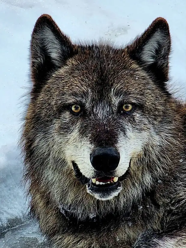
(Photo: Ashley Harrell/SFGATE)More Wolves Return to California Story in the San Fran Chron. I excerpted quite a bit because I thought the DNA tracing and migration patterns were interesting.
Four new packs of wolves have established themselves in California in the past five months, bringing the grand total to eight new wolf packs since 2015 — and counting.
The four packs, announced Wednesday by state wildlife officials, were documented in Tehama County in central Northern California, Lassen and Plumas counties in the northeastern part of the state, and Tulare County in the Central Valley southeast of Fresno.
The Tulare County sighting of an adult female and four offspring was the southernmost report of any wolf pack in California’s modern history, hundreds of miles from the usual spots wolves have settled.
The sightings, and especially the presence in Tulare County, suggest that California is becoming a more habitable environment for its endangered species of gray wolves, according to the Center for Biological Diversity.
“Holy smokes, what fantastic progress we’re witnessing in wolf recovery in California,” Amaroq Weiss, a senior wolf advocate at the center, said in a news release. “The homecoming of wolves to California is an epic story of a resilient species we once tried to wipe from the face of the Earth.”
Though the gray wolf is native to California, the animal was hunted to extinction in the 1920s, the Chronicle reported. It is now illegal to intentionally kill any wolves in the state.
Some ranchers and rural residents, however, remain uneasy over the wolves’ expanded range.
In May, the state Department of Fish and Wildlife announced it had expanded its Wolf-Livestock Compensation Pilot Program, through which ranchers can apply for compensation due to wolf attacks, or seek money for deploying nonlethal deterrents to keep wolves away from livestock.
In March, wildlife officials captured photographs of three wolves in Tehama County from a trail camera on private land. Little is known about the wolves’ origin or full number, according to the Department of Fish and Wildlife.
The Plumas County pack includes at least two adults and two pups. The breeding adults for that pair have been identified through DNA testing as partial siblings from a double litter in 2020.
The Lassen County pack has a minimum of two adults and an unknown number of pups. According to genetic analysis, the male is not from a known California or Oregon pack, but the female is an offspring from the Whaleback Pack’s 2021 litter. The Whaleback Pack is a group of wolves that has been seen in Siskiyou County.
DNA testing from the state Department of Fish and Wildlife suggested the Tulare County pack had contained at least five individuals not previously known to live in California, baffling wildlife experts who wondered how the wolves had managed to travel so far down the state.
The adult female is believed to have come from California from southwest Oregon’s Rogue Pack, while her male breeding pair originated from the Lassen Pack’s 2020 double litter.
Genetic testing also suggested that the female of the pair is a descendant of the first documented wolf to enter the state since the animals were hunted off in the 1920s.
That wolf, known to wildlife officials as OR7, migrated to the state from Oregon in 2011 and later returned, but is presumed dead, the Chronicle reported. OR7 traveled through seven northeastern counties in California before returning to his home state of Oregon, finding a mate, and building his Rogue Pack, according to officials from the Center for Biological Diversity.
Since then, several of his offspring have come to California and established new packs, including the breeding female of the new Tulare County pack and the original breeding male of the Lassen Pack, according to the Center for Biological Diversity.
In any case, gray wolves occupy a small part of their historic range. Scientists say a comprehensive recovery plan encouraging their return is crucial to returning ecological stability across thousands of square miles of still-wild habitat.
Among them was ecologist Chad Hanson, who, in an interview, said the wolf pack has become, of all things, the beneficiary of wildfires that jump-started new generations of nutritious grass and shrubs that attract deer they prey on.
“Higher ungulate abundance provides prey for wolves,” he said. “Logging reduces habitat for deer, adversely impacting endangered wolves.”
That kind of talk leaves some federal forest managers and timber industry advocates quietly seething.
One wonders whether the reporter might have asked federal forest managers and timber industry advocates.. if the reporter spoke with them I’d be curious as to what they had to say. “Hey, I’m seething” doesn’t sound much like any Forest Service public affairs response..
Another obvious question is openings created by logging reduce habitat, but openings created by fire increase habitat. I’d be interested in how that works.
In a recent letter, a group of environmentalists urged the U.S. Forest Service to suspend post-fire logging operations in the region until it can “determine whether any activities associated with those and other projects could adversely affect the wolves.”
That’s because the environmental reviews for the projects have not considered the impacts of hand crews with chainsaws, bulldozers and trucks on endangered gray wolves and wolf habitat.
Environmentalists say their presence is vital to restoring the rhythms of life among countless other animal and plant species that evolved with them.
The story didn’t mention exactly what groups, so I couldn’t find the letter. Perhaps someone from California has it?
“Restoring the rhythm of life?””countless plant and animal species that evolved with them.” I’m not so sure about plants evolving with wolves. Holism sounds great.. but as usual mention of Indigenous folks.. who’ve been around also adapting to the glaciers retreating with organisms presumably co-evolving with them, doesn’t show up in this formulation. Wikipedia had this as part of its entry on “balance of nature.”
Despite being discredited among ecologists, the theory is widely held to be true by the general public, conservationists and environmentalists,[5] with one author calling it an “enduring myth”.[8] Environmental and conservation organizations such as the WWF, Sierra Club and Canadian Wildlife Federation continue to promote the theory,[17][18][19] as do animal rights organizations such as PETA.[20
I like that the reporter characterized this as being a view of environmentalists, not scientists.
Ranchers and Wolves in Northern Cal Getting Along With the Aid of Technology
And here’s a great story about ranchers and wildlife folks working together that I found in the Red Bluff Daily News but was written by a reporter for SFGATE.
Since September, wolves in the Whaleback Pack have killed more than 20 cows and injured another half-dozen across Siskiyou County. It’s the highest concentration of attacks on livestock since wolves first returned to California in 2011. In fact, after 23 years of working with wolves across the United States, this is the first time Laudon can recall a single pack being linked to so many attacks.
*************
Most of the calves targeted by the Whaleback Pack have been residents of Table Rock Ranch, a large cattle operation set squarely within wolf country. The ranch has been using many kinds of deterrents, including a watchman hired to drive around the range at night. But without knowing when wolves were nearby, it was a little like shooting in the dark.
Now, most mornings local ranchers get a text message letting them know the general locations of the two collared wolves. “I was optimistic that it would be helpful, as far as making our deterrents more effective, and being at the right place at the right time,” Table Rock Ranch manager Janna Gliatto told SFGATE.
************
But in Siskiyou County, “ranchers have been a model of patience,” Laudon said. California’s compensation program will soon begin compensating ranchers who implement deterrents. But that money has been a long time coming; Gliatto says she was promised reimbursement for the range rider months ago, but has yet to see a dime. Still, she’s hopeful that the new data from the collared wolves will help with another aspect of the program called “pay for presence,” where ranchers are reimbursed for the impacts of wolves simply being around, such as stress on the animals.