Roadless 2.0: Why a 25-Year-Old Fight May Be Ready for a Different Answer: Guest Post by Don Amador

OHV Folks and Mad River RD Staff with South Fork Mountain IRA after 2015 Route One Complex Fire

For many California OHV riders, the words “Roadless Rule” probably don’t mean much. You may have heard them in a club meeting, seen them in another public-land fight, or watched another battle unfold over a trail that seemed perfectly reasonable but somehow became tangled up in federal land-management policy. For those of us who have been involved in public-land recreation for decades, however, the Roadless Rule is a familiar—and sometimes frustrating—part of the landscape.

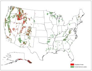
Now, after 25 years of litigation, policy battles and changing conditions on our national forests, the Forest Service has proposed rescinding the national 2001 Roadless Area Conservation Rule. The proposal would remove the nationwide prohibitions on road construction, road reconstruction and timber harvesting in inventoried roadless areas (IRAs) and return those decisions largely to individual forests through their existing land-management planning processes. For California’s OHV community, I think this is something much more interesting than simply another logging issue. It could be an opportunity to reset the way we think about roadless country, forest health and managed motorized recreation. I call that potential reset “Roadless 2.0.”

First, let’s clear up one misconception. The 2001 Roadless Rule did not close all the roads and OHV trails inside inventoried roadless areas. The Forest Service’s original analysis considered—and rejected—an alternative that would have prohibited motorized recreation in roadless areas. The new 2001 ROADLESS AREA CONSERVATION RULE RESCISSION DRAFT ENVIRONMENTAL IMPACT STATEMENT (DEIS) makes the distinction even clearer. It identifies approximately 5,200 miles of motorized trails within the potentially affected roadless areas and recognizes that trailheads around the periphery of IRAs can provide motorized trail access into those areas. Existing OHV use on trails designated for motorized use remains governed by the applicable Forest Plan and Travel Management decisions.

How did we get here? The original Roadless Rule was adopted in January 2001 after years of controversy over how the Forest Service should manage the remaining large blocks of relatively undeveloped national forest land. The rule established national restrictions on road construction, road reconstruction and most timber harvesting within inventoried roadless areas. It immediately became controversial. Environmental organizations viewed it as one of the most important conservation protections ever placed on National Forest lands. Many timber, mining, recreation and multiple-use interests viewed it as another example of Washington imposing a broad management prescription on vastly different landscapes. And the litigation began.

California became part of that long-running legal and administrative struggle. For years, questions surrounded how the Roadless Rule interacted with Forest Plans, Travel Management and local decisions. For riders, however, the practical question was usually much simpler: “Can I legally ride on my motorcycle, ATV or UTV on that trail?” That question didn’t always have a simple answer.

The world has changed dramatically since 2001. California had already experienced major wildfires, but we had not yet experienced the landscape transformation of the last decade. Since then, California has endured fire seasons that have fundamentally changed portions of our national forests. The Camp Fire, Caldor, Dixie, Mendocino and August Complex Fires, Mosquito, and many others have left landscapes dramatically different from what they were when the original Roadless Rule was created.


                                         2019 Post Fire Trail Survey of 2015 Rt. 1 Complex Fire – Pilot Creek OHV Trail System

                                               South Fork Mountain IRA – Six Rivers National Forest

In some areas, what was once called an Inventoried Roadless Area could now reasonably be described by riders as an “Inventoried Treeless Area.” That’s obviously a little tongue-in-cheek, but there is a serious point behind it. A designation created around the idea of maintaining relatively intact, undeveloped forest landscapes now exists in places where fire, drought, insects, disease and extreme weather have radically altered the landscape. The question shouldn’t simply be, “Was this area roadless in 2001?” The better question is, “What is the appropriate management strategy for this landscape today?”

Dan East Trail BEFORE 2015 Rt.1 Complex Fire – Dan East Trail AFTER 2015 Rt. 1 Complex Fire


Pilot Creek OHV Trail System – South Fork Mountain IRA – Six Rivers National Forest

This isn’t an argument to pave the backcountry. Most OHV riders don’t want every mountain road turned into a highway. We don’t want every remote forest landscape turned into a subdivision or motocross track. And we don’t need to pretend that every roadless area is appropriate for motorized recreation. Some places are genuinely remote, special and appropriate for rugged backcountry non-motorized recreation.

But there is a huge difference between saying that some places should remain undeveloped and saying that a national rule adopted 25 years ago should determine the transportation and management options available on every roadless landscape regardless of what has happened since. That’s where I think Roadless 2.0 comes in.

To me, Roadless 2.0 starts with a simple concept: manage the landscape we have—not simply the landscape we mapped in 2001. That means looking at each area based on current conditions, including wildfire history, forest health, fuels, watershed conditions, wildlife, existing roads and trails, historic access, recreation demand, community needs, fire response, post-fire recovery and the potential for sustainable motorized recreation.

The DEIS recognizes that the current planning system includes both Semi-Primitive Motorized and Semi-Primitive Non-Motorized recreation settings. It also identifies approximately 3.1 million acres of potentially affected IRAs as Semi-Primitive Motorized. Motorized recreation is therefore already part of the Forest Service’s legitimate recreation planning framework. Roadless does not have to mean nonmotorized.

California is also showing us what managed OHV recreation can look like. OHV recreation itself has changed. We have moved a long way from the old image of “just go ride wherever you want.” Today’s legitimate OHV system is increasingly based upon designated routes, MVUMs, trail standards, seasonal restrictions, route signing, resource monitoring, law enforcement, trail maintenance, restoration of damaged routes, user education, clubs and volunteers, and purposefully designed trail systems.

This is where conservation and OHV interests have found more common ground than we sometimes did in the past. A legal, designated trail can be mapped, signed, monitored, maintained, rerouted when necessary, closed seasonally, designed around sensitive resources and enforced. An illegal user-created route has none of those advantages. A carefully planned trail connection can sometimes be a conservation tool by concentrating use onto a durable corridor and keeping riders out of fragile areas. A logical loop or connector can also prevent riders from reaching a dead end and creating their own way around it.

The DEIS recognizes that new transportation infrastructure can provide additional access to dispersed recreation and that some temporary roads could potentially become trails after management activities are completed. That’s an important concept for California and for other fire-affected national forests.

The DEIS says the proposed rescission would return decision-making to individual forests and existing land-management plans. That’s good. But local decision-making needs to mean multiple-use decision-making where the OHV community gets skin-in-the-game by showing up and participates.

The DEIS identifies road construction needs associated with much more than timber harvesting. It specifically identifies fuels reduction, pre-commercial thinning, watershed restoration, habitat improvement and recreation development as activities that can require transportation access. That is a very different landscape than the Roadless debate of 2001 and leaves room for hybrid fuel reduction/recreation projects that can meet multiple objectives.

And here’s something every California rider should understand: the Roadless Rule isn’t the only thing that determines whether you can ride. Even if the national Roadless Rule disappears, your Forest Supervisor doesn’t simply get to say, “Open it all.” Forest Plans still matter. NEPA still matters. The Travel Management Rule or a revised version still matters. The MVUM still matters. Wilderness designations still matter. Wild and Scenic River protections still matter. Endangered species protections still matter. Private property rights matter. Tribal interests matter. Site-specific environmental analysis still matters. Roadless 2.0 is not a blank check.

What should California OHV riders support? I think the answer is pretty straightforward. We should support an alternative that ends the one-size-fits-all national prohibition, returns appropriate decision-making to individual forests, requires genuine consideration of motorized recreation, recognizes the difference between roads, motorized trails and unmanaged cross-country travel, and encourages strategic and collaborative transportation access planning efforts.

Roadless 2.0 could be an opportunity. But only if the recreation community helps define what that opportunity looks like.

The Forest Service is currently accepting comments on the proposed rescission, with the comment period scheduled to close September 21, 2026.  https://www.fs.usda.gov/managing-land/planning/roadless

**************

Don Amador is a longtime public lands advocate with over 30 years of experience in recreation policy, trail stewardship, post-wildfire recovery, and collaborative land management and is former Chair of the CA State Parks Off-Highway Motor Vehicle Recreation Commission.


Things Common to All Three Alternatives From Roadless DEIS

This is a handy table from the DEIS:

Things Common to All Alternatives

1. No changes are proposed to state-specific rules for Idaho and Colorado

2. No alternatives would compel the amendment or revision of any land management plan. While the rulemaking would not require such changes, plans may be amended in any manner whatsoever and are revised periodically (16 U.S.C. 1604(f)). Local responsible officials (forest supervisors and regional foresters) would continue to have discretion to amend or revise a land management plan as deemed necessary.

Thank Gaia for that one!

3. Any future administrative changes, amendments, or revisions to land management plans would comply with NFMA and planning regulations (36 CFR 219 or the planning directives at FSM 1920 and FSH 1909.12). 

It sounds as if, for Alternative 1, forests who wanted to go into the Areas Formerly Known as IRAs would have to do a plan amendment because the management as an IRA was incorporated into post-2001 plans and pre -2001 plans would automatically revert? Others probably understand more.

4. No alternatives would compel or authorize site-specific ground disturbing activities.

5.The reasonable exercise of reserved or outstanding rights for access, occupancy, and use of National Forest System lands within inventoried roadless areas would not be affected. The rights include those that exist by law or by treaty. They include, but are not limited to, the right to provide reasonable access across National Forest System lands to private property, mining claims for locatable minerals under the 1872 Mining Law, land uses protected by Native American treaty rights, and uses under the Alaska National Interest Lands Conservation Act.

I know some folks have raised red flags about strategic minerals. Those are (almost all) locatable and subject to the 1872 Mining Act.  So the 2001 is no protection against folks mining them.

6. All alternatives would allow for the continuation, transfer, or renewal of existing land-use authorizations for activities in roadless areas. “Authorizations” refer to land uses allowed under a special use permit, contract, or similar legal instrument. Numerous types of lands and recreation-related authorizations are issued for occupancy and use of National Forest System lands.

7.  Other Forest Activities that are not otherwise prohibited are permissible in inventoried roadless areas under all alternatives, if not restricted by land management plans or other law, regulations,and policies.These activities include, but are not limited to, the following:
• Maintaining existing roads;
• Constructing or maintaining motorized and non-motorized trails;
• Engaging in hunting, fishing, hiking, camping, and other recreational uses;
• Using a motorized vehicle, such as an off-highway vehicle, on a trail open to motorized use;
• Riding a bike on a trail open to mechanized use;
• Implementing prescribed burning; and
• Grazing livestock.

I’m not sure that this list is complete, I would think firewood cutting and other non-commercial (but permitted) tree cutting activities are also OK? What the 2001 says is .. “The cutting, sale, or removal of timber is needed and appropriate for personal or administrative use, as provided for in 36 CFR part 223; ”

36 CFR part 294.13 (b)(3)

Maybe there are others?

Alternative 3 in Roadless DEIS: A Middle Path?

Here’s a link to the DEIS Basically, it  fixes maps, and takes out WUI.

Removing about ½ million acres of non-National Forest System lands from the national inventoried roadless area maps9. The Roadless Rule applies only to National Forest System lands (see also Potentially Affected Environment).

Curious about that? the footnote says:

There are 44.7 million acres of IRAs managed under 2001 Roadless Rule. Review of the geospatial data found that 44.3 million acres of these are on National Forest System lands, meaning about 0.4 million acres of lands have had land ownership change since the 2001 Roadless Rule or there may be vertical integration problems (mapping errors) between the inventoried roadless data and official land ownership boundary data.

*****

• Removing about 4 million acres of Congressionally designated areas, which have more restrictive and more permanent mandates than the Roadless Rule (see also Potentially Affected Environment).

Conceivably both of the above shouldn’t have been in there anyway.

• Removing 17.9 million acres which include 5.1 million acres within the wildland-urban interface and 6.3 million acres of roaded roadless and 4.7 million acres that are both within the wildland-urban interface and within 0.5 miles of existing roads. The remaining acreage was removed as the small, isolated areas did not meet previous mapping criteria.

“Roaded roadless” was just an artifact of the mapping process used in 2001; that’s why there are clauses about “substantially altered” acres being included.

♦ Roaded inventoried roadless areas were defined as the area within 0.5 miles (either side) of existing roads.
♦ WUI based on the Healthy Forests Restoration Act’s (HFRA) definition, which includes the areas identified in an existing Community Wildfire Protection Plans or, where a Plan is not in effect, the extent of at-risk communities and up to a 1.5-mi buffer around the communities and areas around evacuation routes for at-risk communities. The mapping process resulted in some small fragments of former IRAs remaining. Under this alternative, USDA would apply past criteria for designating IRAs and the western US (west of the 100th meridian) and Alaska, only retaining areas that are greater than 5,000 acres or share a border with Wilderness or recommended Wilderness. East of the 100th meridian inventoried roadless areas of any size were retained.

We had many lengthy discussions about WUI definitions and size of buffers (not sure we talked about evacuation routes specifically) during the Colorado process. You have to pick something and the choices were some kind of mapping, or using HFRA definitions. Certainly there are advantages to HFRA definitions.  It might encourage communities to update theirs, although I’m not sure CWPPs are all equally worthy. But the fact is it’s enshrined in legislation, so there’s that.

Footnote 11, for those of you less familiar…

WILDLAND-URBAN INTERFACE.—”The term ‘‘wildland urban interface’’ means—(A) an area within or adjacent to an at-risk community that is identified in recommendations to the Secretary in a community wildfire protection plan; or (B) in the case of any area for which a community wildfire protection plan is not in effect—(i) anarea extending 1⁄2-mile from the boundary of an at-risk community; (ii) an area within 11⁄2 miles of the boundary of an at-risk community, including any land that—(I) has a sustained steep slope that creates the potential for wildfire behavior endangering the at-risk community; (II) has a geographic feature that aids in creating an effective fire break, such as a road or ridge top; or (III) is in condition class 3, as documented by the Secretary in the project-specific environmental analysis; and (iii) an area that is adjacent to an evacuation route for an at-risk community that the Secretary determines, in cooperation with the at-risk community, requires hazardous fuel reduction to provide safer evacuation from the at-risk community”. (Healthy Forests Restoration Action of 2003; 16 U.S.C. 6511 (16)

I heard different things about processes for boundary modifications in the 2001 Rule, one is that you could do it (i.e., there is a formal process) but no one does, and the other you can’t do it. Maybe someone here knows more.  It seems important.

Here’s what Alternative 3 does:

This alternative also includes provisions to make modifications and administrative corrections to inventoried roadless area boundaries, responding to comments about issues with inaccurate national mapping. The following procedures are included in this alternative allow site-specific boundary modifications or corrections:
a. Modifications to boundaries. Responsible officials, working with local government, Tribes, and interested parties, may propose boundary modification to the Chief. Modifications and additions approved by the Chief will be reflected in the set of maps maintained at the national headquarters office of the Forest Service. Modifications of inventoried roadless area boundaries may be made to correspond with geographic features, land management plan management areas, or for other reasons. A boundary modification is not required to perform work done under an exception pursuant to §§ 294.12(b) or 294.13(b). Public notice with a minimum 30-day comment period will be provided for any proposed boundary modifications.
b. Administrative corrections to boundaries. The Chief of the Forest Service may issue administrative corrections. Administrative corrections to the maps of any inventoried roadless area are adjustments to correct clerical errors, to conform with new statutory or regulatory requirements, or to correspond with changes based on improvements in mapping technology.

*************

There are some issues that we had in Colorado that alternative 3 doesn’t touch.. bringing in equipment to fix dams, roads to help manage vegetation along powerlines, and other relatively small issues that could be helped by restricting access on the roads.   But I think this alternative, for the most part, has the greatest potential.


Thinking About the Spatial Scale Where Roadlessness is Decided: Idaho and the Phosphate Mine

We’re probably going to see this a lot in dealing with Roadless; because they wanted to do a national rule, they couldn’t make specific exceptions, even when they seem totally rational to some of us.  If they picked the most obvious cases, where to draw the line?  So nationalizing forced some decisions that didn’t make sense if we look at a different scale.  This is part of looking at what Idaho and Colorado found as a “need for change” with the 2001.

I went back to the 2001 final rule which specifically addressed phosphate mining on the Caribou-Targhee:

The FEIS identified potential impacts on future phosphate mining on the Caribou National Forest, the only area of active phosphate mining on NFS lands. The FEIS acknowledged that phosphate production from the Caribou accounts for about 12% of national production, and is used to supply regional producers of phosphate fertilizer products and elemental phosphorous. The analysis included an estimate of phosphate resources within inventoried roadless areas of 873.3 million tons, and a description that about 8,000 acres of the area of Known Phosphate Lease Areas are within inventoried roadless areas.

Here’s the Department’s decision rationale:

The Department has decided not to adopt the exception for future discretionary mineral leasing because of the potentially significant environmental impacts that road construction could cause to inventoried roadless areas, but instead determined a more limited exception is appropriate. Existing mineral leases are not subject to the prohibitions, nor is the continuation, extension, or renewal of an existing mineral lease on lands under lease by the Secretary of the Interior as of the date of publication of this rule in the Federal Register . Additionally, road construction or reconstruction may be authorized for new leases on these same lands in the event that application for a new lease is made prior to termination or expiration of the existing lease.

The Department recognizes that this decision may have major adverse economic impacts on a few communities dependent on mineral leasing from inventoried roadless areas. However, if road construction and reconstruction were allowed for future mineral leasing on lands not under mineral lease as of the date of publication of this rule in the Federal Register , an estimated 59 miles of new roads would be constructed in inventoried roadless areas over the next five years. Road construction or reconstruction in support of future mineral leasing on lands not presently under mineral lease could continue at this level or in greater amounts into the foreseeable future. Over an estimated 10 million acres of inventoried roadless areas could be roaded for exploration and development of leasable minerals, although the agency believes it is unlikely that more than a small percentage of these acres would contain minerals sufficient for economic development.

It looks like some folks asked for specific exemptions, but the Department had to make a decision for everywhere all at once.  Going back through time, I also wonder if technology has changed a bit.. maybe (some) exploration could be done without roads.  Even in 2001, they believed that only a small percentage would be worth developing. Today we know a great deal more about a) what minerals are important for national security and b) where they might be.

As it happens, the Idaho Rule specifically allowed road construction and surface disturbance for phosphate mining on roughly 5700-6000 (according to Google AI) acres within the Caribou-Targhee. For context, the Idaho Rule covers 9.3 million acres.  Those roads may well be administrative and closed to the public.

It’s another kind of “pick a lane” question.. from the same people I’ve heard both “roads are bad because people light fires and disturb animals” AND “if there’s a road on federal lands we should all be able to drive on it.”

I asked AI about whether these Simplot roads are open to the public.

No, J.R. Simplot Company industrial haul and access roads located within Inventoried Roadless Areas (such as on the Caribou-Targhee National Forest in Idaho) are not open to the general public. These operational and corporate haul roads are authorized strictly under special-use permits for industrial mining, heavy equipment, and company maintenance. [1, 2, 3]

Of course, folks are concerned about environmental impacts of mining, but that is covered in the EIS or EA for whatever activity.

Roadless Rule Rescission Proposal: I of Many: Read the 2001 Yourself

I couldn’t find the new Roadless EIS yet, and apparently there are three alternatives, based on this interactive online map. So we’ll talk about those when they come online, perhaps tomorrow.

FS: please fix year of announcement on the website.

There are already a plethora of news stories about it based on yesterday’s news release. Roadless is one of my favorite topics, having worked on Colorado’s version from 2005 until I was ignominiously removed from working on it in 2011, for reasons that were never made clear to me, but whatever.

As I worked on it, I noticed that many media outlets got things wrong or were missing important context. After I was removed from working on the Colorado Rule, I wrote this piece explaining some of the complexities of the oil and gas so-called gap leases. The first paragraph is likely to fit this Roadless iteration, much as it did in 2011:

As you all know, I think it’s really important that the public gets a chance to understand Forest Service (publicland, natural resource) issues so they can make informed choices. The problem is that institutions such as policy centers don’t really help on the day to day issues and don’t necessarily allow dialogue with the public on the web; I hope this blog helps with that. News stories are intended to help inform the public, but by their very nature and the current structure of the news industry, I don’t think they can ever be the right place.

Even if the journalist takes the time to understand the complexity, and is committed to presenting both sides fairly, there is no guarantee that that can fit into a newspaper article format. It seems like a structural problem that falls somewhere between the Extension role and a journalism role. So in this case I will take a news story and try to clarify the issue according to my understanding.This one I know something about (although I am not currently working on this, just to be clear), so I thought by posting here I could help share with readers my understanding of the somewhat arcane and confusing oil and gas terminology and processes (of course readers are interested in forest planning, so arcane and confusing is familiar territory 🙂 ). Here’s the link. I also need to clearly state that I am not saying that the proposed rule is without flaw and directly transmitted by a Higher Power. I just think it’s important to understand what the issues really are. If we, who know, don’t inform the public, who will? Below is the story with my annotations in italics.

I think I’ve heard every argument about anything in the 2001, plus was peripherally involved in several court cases. I know you will be reading a great deal of “hair on fire” articles, but these are many of the same points that were raised about Colorado and Idaho Rules (by the same outfits), and after the drama (court cases on the rules) died down, we don’t hear much about them.

Anyway, you don’t have to have the 2001 Roadless interpreted by reporters, you can read the key sections of 2001 yourself.

First, I’ll pluck some things from the proposal, and then the EIS, and finally take a look at some of the media takes.

The 2001 Roadless Rule prohibited cutting, sale, or removal of timber—except when one of a limited set of exceptions applied. Per the Rule’s text, the use of these exceptions was “expected to be infrequent” (36 CFR 294.13(b) (2001)). In addition, while exceptions were available, their use was limited and inconsistent due to associated reviews and approvals to demonstrate consistency with the 2001 Roadless Rule.

This is true, while exceptions exist, and have been used, many employees are wary of using them. That is not on the writers of the 2001, but is a fact human nature. For the proposer, it can be like the rat who pushes the lever and sometimes gets a pellet and sometimes gets a shock.  Why push the lever?

People will argue both sides of this, and have… on the one hand “the Rule allows fuel treatments, so why change?” and on the other hand “if you get rid of it the timber industry will ravage roadless areas.” But here’s section 294.13, see for yourself.

Prohibition on timber cutting, sale, or removal in inventoried roadless areas.

(a) Timber may not be cut, sold, or removed in inventoried roadless areas of the National Forest System, except as provided in paragraph (b) of this section.

(b) Notwithstanding the prohibition in paragraph (a) of this section, timber may be cut, sold, or removed in inventoried roadless areas if the Responsible Official determines that one of the following circumstances exists. The cutting, sale, or removal of timber in these areas is expected to be infrequent.

(1) The cutting, sale, or removal of generally small diameter timber is needed for one of the following purposes and will maintain or improve one or more of the roadless area characteristics as defined in § 294.11.

(i) To improve threatened, endangered, proposed, or sensitive species habitat; or

(ii) To maintain or restore the characteristics of ecosystem composition and structure, such as to reduce the risk of uncharacteristic wildfire effects, within the range of variability that would be expected to occur under natural disturbance regimes of the current climatic period;

(2) The cutting, sale, or removal of timber is incidental to the implementation of a management activity not otherwise prohibited by this subpart;

(3) The cutting, sale, or removal of timber is needed and appropriate for personal or administrative use, as provided for in 36 CFR part 223; or

(4) Roadless characteristics have been substantially altered in a portion of an inventoried roadless area due to the construction of a classified road and subsequent timber harvest. Both the road construction and subsequent timber harvest must have occurred after the area was designated an inventoried roadless area and prior to January 12, 2001. Timber may be cut, sold, or removed only in the substantially altered portion of the inventoried roadless area.

Now in 2001, climate change was not quite the major issue it is today. So the clause “within the range of variability…” carries much weight of potential litigation. Reducing fuels is not on the list.  Is a burned stand of dead lodgepole killed by bark beetle “characteristic” or “uncharacteristic” risk. Certainly there have been dead stands of lodgepole since the ice age.. so a person could argue that any fires are “characteristic.”  Sometimes I thought that part of the attraction of the Rule for some groups was the opportunity to lower the litigation boom on projects they disagree with.

For example, remember the Los Padres case (Tecuya Ridge Shaded Fuelbreak Project) about “generally small diameter?”

U.S. Court of Appeals for the Ninth Circuit vacated approval for the project, holding that the U.S. Forest Service failed to adequately justify or substantiate why removing trees up to 21 inches in diameter (dbh) qualified as “generally small diameter timber” under exceptions to the 200

Judge R. Nelson dissented. He agreed with Sections I.B and II of the majority opinion. He wrote, however, that the majority wrongly held that the Forest Service’s determination that 21-inch dbh trees are “small diameter” was arbitrary or capricious under the Administrative Procedure Act. He would deny the petition for review

How the Idaho Roadless Rule Worked on the Orogrande Project: Gary McFarlane

Gary McFarlane sent the below as a comment, but since there are probably less than 50 people in the country who are interested in the details of How Roadlessness Works in Practice (as opposed to Grandiose Pronouncement about same), I thought it was worth posting here for maximal exposure to.. those happy (or not)  few.  Below is his comment and the other side of the Orogrande project that I’ve been able to piece together.

****************

Regarding the Idaho Roadless Rule, there has been little or no litigation brought to protect roadless areas under the rule itself. That isn’t because the rule is protective and working. Rather, it is because the rule is so weak and has many loopholes, there is little to be gained by litigation. That said, there is a history that my colleague, Katie Bilodeau, and I followed while we were on staff with Friends of the Clearwater that relates to the Idaho Roadless Rule and the National Roadless Rule.

About 10 years ago, Friends of the Clearwater brought litigation on the NEPA analysis (not the rule itself) on what the agency called the Orogrande Community Project on the Nez Perce and Clearwater National Forests. The Forest Service proposed roadbuilding according to the Decision Notice, 2.4 miles in the roadless area. In spite of recontouring, the road scar is still obvious. Clearcutting was alos approved, called a shelterwood but it turned out to be a couple hundred acre clearcut with a few leave tree clumps. The agency concluded in the Decision Notice the project would not harm roadless characteristics in the West Fork Crooked River Roadless Area, a chunk of wild country contiguous with the Gospel-Hump Wilderness. There were specialists reports that seemed to conflict with this narrative. Friends of the Clearwater disputed the charge that it would not harm roadless or wilderness characteristics. The court refused to grant a preliminary injunction and the sale went forward. The ostensible reason for the sale was to protect private land on patented mining claims in an area called Orogrande even though most of the logging in the roadless area was well beyond 40 meters of structures and private land, the maximum distance retired Forest Service Researcher, Dr. Jack Cohen, says is effective in preventing structural loss.

After the logging and roadbuilding, the Idaho Roadless Commission visited the area. The Commission agreed the logged area had lost its roadless and wilderness characteristics (they are essentially the same), contrary to what the agency alleged in the EA and in the litigation. Incidentally, the Commission and/or some of its representatives had tried to intervene on behalf of the Forest Service in the litigation. In addition, the Forest Service revealed on the field trip that the road that was built into the roadless area was only going to be partly rehabilitated, contrary to what the Decision Notice and the Idaho Roadless Rule required. Katie Bilodeau, an attorney and the Friends of the Clearwater representative on the field trip, pointed out the error. It took considerable effort and follow-up by the organization to force the Forest Service to comply with what it had promised to do and eventually the agency had to rehabilitate the road.

Furthermore, the “controlled” burn on the timber sale got out of hand and burned some of the leave tree clumps, threatening the private land. A year or two later a natural fire burned in the area. The agency spent millions of tax dollars trying to protect the private land the agency said was “safe” from fire because of the logging. Many private structures on the private land in the area did not follow Forest Service researcher Jack Cohen’s recommendations for making them more fire resistant by removing limbs or trees directly adjacent to buildings.

After this timber sale was completed, Katie Bilodeau and I prepared a report #https://www.friendsoftheclearwater.org/roadless-report/, based on the information that the Forest Service had supplied to the Idaho Roadless Commission and other information we had obtained from the agency through direct contact or through the Freedom of Information Act. We had both been following the roadless issue on national forests for many years, in my case dating back to RARE II. We wanted to see how well the roadless rules were working to protect roadless areas in Idaho and Montana. Here is a summary of what we found:

1. According to Forest Service data, the Idaho Roadless Rule and the National Roadless rule in Montana resulted in far more logging in roadless areas than either roadless EIS had projected.

2. The Forest Service’s discourse has changed over the years regarding logging and roadbuilding in roadless areas. Prior to the roadless rules, the Forest Service recognized in various NEPA documents (usually EISs) that logging and roadbuilding removed areas affected from the roadless base and wilderness consideration. Case law states in the 9th Circuit states that logging and roadbuilding are irretrievable commitments of resources in roadless areas. Since the roadless rules have been in place, the agency now sees roadless logging and roadbuilding as neutral or even beneficial to roadless or wilderness characteristics

That is until it is time to do the wilderness review under a forest plan revision. In spite of the fact that the Forest Service alleged in the litigation and the EA for the Orogrande Community Project that no harm would come to roadless characteristics, the agency refused to include any portion of the West Fork Crooked River under any alternative as recommended wilderness in the 2025 EIS for the Nez Perce-Clearwater National Forests Plan. Friends of the Clearwater provided maps and rationale to drop the acreage affected by the roadless logging and roadbuilding, but include the majority of the area as an addition to the Gospel Hump Wilderness. This is not the only case where this disingenuous bait and switch has occurred in (the former?) Region I.

3. The weak Idaho Roadless Rule and even the National Roadless Rule lead the public to believe the wilder parts of the National Forest System are protected. This is due in part to major segments of the conservation community overselling the roadless rules. Further, the term roadless, originally meant to apply to areas that could be designated as Wilderness, now refers to an essentially static set of lands that include land that is not roadless or undeveloped. Separate inventories are now done under Chapter 70 of the Handbook in forest plan revisions to review lands for wilderness recommendation. Whether by chance or design, this bifurcation obfuscates the on-the-ground reality of an important segment of the National Forest System.

The upshot is, it is not a question of whether the Idaho Roadless Rule is working to protect roadless areas. It was not designed to protect the majority of the roadless national forest acreage in Idaho. And, the question of whether the Roadless Commission has any real power in devolving administration of the National Forest System away from an entity formerly accountable to the entire American public is academic under the current regime.

Gary Macfarlane
[email protected]

****************

To be fair to the Orogrande Community Project folks.. here’s their side..

February 17, 2017:  A decision by the State of Idaho to intervene on behalf of the Forest Service in a lawsuit challenging the Nez Perce-Clearwater National Forest’s Orogrande Community Protection Project is being hailed as a very positive development by the Clearwater Basin Collaborative.

The Clearwater Basin Collaborative, or CBC, is a diverse group of individuals who work collaboratively to enhance and protect the ecological and economic health of the forests, rivers and communities within the Clearwater Basin by working across a diversity of interests.  The group provided information and feedback throughout the development of the Orogrande project.

“The Orogrande Community Protection Project decision is definitely a collaborative product that thoughtfully responded to ideas and concerns expressed by the CBC as well as individuals, agencies and organizations who participated in the process,” CBC co-chairs Alex Irby and Dale Harris stated.  “We commend Forest Supervisor Cheryl Probert for her effort to find the right type and mix of fuel reduction treatments to create a fire break around the small community of Orogrande and its access routes.”

The Forest Service initiated the Orogrande Community Protection Project in response to Idaho County’s Community Wildfire Protection Plan which designates Orogrande, a small community located approximately 15 miles south of Elk City, “a community at risk from wildfire.” The rural area is heavily forested and experiences frequent lightning-caused fires.  Residents were subject to evacuation orders during the fire seasons of 2012 and 2015.

Due to threats posed by recent fires, many residents have taken actions reduce fuels on their property and create defensible space around buildings.  They strongly urged the Forest Service to do likewise, and worked with the agency throughout the development of the project.

..

Probert’s decision included treatment of nearly 3,500 acres with harvest, thinning, hand pruning, and prescribed fire to reduce fuels and improve forest health.  Of those acres identified for treatment, more than 70% will be treated with prescribed fire only.

Only 300 acres (less than ten percent of the area) are identified for treatment with selective timber harvest, with roughly two hundred of those acres located within the 9500-acre West Fork Crooked River Roadless Area located immediately adjacent to and southwest of the community of Orogrande.

***********

Sadly, I couldn’t figure out how to add the Roadless boundaries to the map.  Apparently the 200 acres with shelterwood/selective harvest were in the Roadless Area “immediately adjacent” to the community?

Idaho Roadless Rule Commission: Helping Implement the Rule Since 2008

Daniel Mountains (Daniel Bertram, 2020)

A theme for this week seems to be the challenge of good management practices (continuous improvement) and,  as we try to build what some call “state capacity” how that relates to what we might call “random acts of analysis” or “helicopter analysis”.   In these cases,  folks are gathered, make suggestions, and then move on (take off) to something else- without any feedback on how their recommendations worked or did not.

Yesterday I pointed out that the 2008 Idaho Roadless Rule is an example of an effort having provisions for ongoing review and improvement (at least of implementation, I don’t think anyone wants to engage in changing the rule itself.)

John Robison pointed to this webpage that talks about the ongoing Commission and its responsibilities. I’ve noticed that both Colorado and Idaho had substantial litigation on their Rules, but following their lack of success in overturning the Rule, the national groups who litigate have left implementation to the States. I don’t think the FS has proposed anything litigation-worthy with regard to the Idaho Rule, but folks can tell me if that’s not the case.  Commission members sound like Idahoans from the relevant interests.

Below are screenshots of the Commission’s webpage, please excuse the duplication between the screenshots.

Two Sierra Forests’ Purpose and Need for Veg Treatments, Plus a Look at Thinning in Roadless

Jon and I have been discussing  how NEPA docs should display the uncertainty (probability) of success of fuel treatments.  Should it be a paragraph somewhere saying “under certain conditions, fuel treatments tend not to be effective at changing fire behavior in the ways we want to change it”, and describing the conditions?

Well, I thought it would be interesting to see what people are putting in their environmental documents about that.  So I went to the Seral EIS from the Stanislaus NF.  Now one thing that’s interesting is how different the discussion feels in the Sierra compared to, say, Montana.

Here is what I found (my interpretation so you can check for yourself).  It appears that the primary rationale for veg treatments in that EIS was… HRV (possibly NRV, I’ve never figured out the difference).  Conveniently, the PSW had issued a GTR about past conditions.

So the Stanislaus folks seemed to be making the case (apologies to them if I got this wrong). 1. Plans and the planning rule tell us to move to HRV. 2. That is different density and age classes than what they have. 3. So they need to move in that direction by reducing density. 3. This should be better for wildfire resilience as well as forest health (because healthier trees are more resistant to bugs) and 4. By the way, this should also help with wildfire, and they have complicated models about flame length and so on, that they are using.

So I wonder how other forests are describing their purpose and need?  It seems like the 2012 Planning Rule would inevitably lead to a need for de-densification after 100 years of fire suppression.  Maybe you all could take a look at their neighboring forest’s EAs or EIS’s for vegetation management and see how the purpose and need is framed.

And if it turns out that H-NRV vegetation-wise is  not a good goal.. maybe the 2012 Rule needs to be amended (or NFMA itself).

***********

This is from the FEIS for the North Yuba Landscape Resilience Project:

Treatment Types and Methods
The Proposed Action would apply treatments in different emphasis areas to meet objectives for enhancing forest resilience, restoring fire dynamics, and conserving biodiversity as described below and shown in Figure 2-1. The treatment scenario presented under the Proposed Action identifies approximately 146,000 acres for treatment. Treatments would be conducted in areas where existing conditions triggered a need to reduce fuel loading, reduce stand densities, develop large trees
(particularly fire-resistance pines and oak), create heterogeneous stand structures, and promote tree species composition aligned with an active fire regime.

Vegetation and fuels management treatments proposed include prescribed fire, thinning from below, variable density thinning, creation of 1- to 3- acre openings, strategic tree planting, and sanitation and stand improvement. The Proposed Action addresses a single round of treatments in each location. In this case a “single round” consists of all actions needed to achieve the target vegetation and fuels condition at the treatment site. Achieving target conditions may require multiple “entries”; for example, one entry to conduct thinning frombelow, then another entry to use prescribed fire to reduce fuel loads. Additional entries could also
result from post treatment monitoring indicating that a treatment did not achieve the desired result and further thinning, burning, or other activity is needed to achieve target conditions. However, once target conditions are achieved and restoration actions are complete (e.g., reclamation of temporary roads), a “single round” of treatment is considered complete and no further entries, treatment, or management are part of the action analyzed in this EIS.

Prescribed fire would include understory burning and pile or jackpot burning of fuels. Thinning from below focuses on removing trees from the lower canopy, thereby retaining larger overstory trees in the stand. Variable density thinning is a form of uneven-aged management designed to produce a mosaic of individual trees, clumps of trees, and small openings to enhance stand resilience to severe disturbances, create structural heterogeneity, and foster development of diverse tree species. Creation  of 1- to 3- acre openings would be used to establish structural heterogeneity common in forest systems under a natural disturbance regime (Safford and Stevens 2017). Post-treatment density targets would be set based on residual basal area. Strategic tree planting of conifer and/or hardwood species would occur within approximately 10 to 20% of the 1- to 3-acre openings created while the remainder of openings created would not be planted. Sanitation and stand improvement would include the removal of mistletoe-infected overstory trees in past regeneration cuts in the red fir forest type (see Appendix A for additional detail on these treatments).

Yes, they are using variable density treatments that were deemed controversial (about wildfires) in the Bark vs. USFS case in Oregon. So I decided to take a look at the response to comments.

I never got to that specific response to that comment (fuel treatments don’t work), my rabbit trail energies ran out..but I’d guess it’s well done and interesting. Meanwhile I did find a response to some comments about what is actually allowed under the 2001 Roadless Rule, apparently not what some commenters think.

FEIS Chapter 3, Section 3.15 “Other Required Disclosures” addresses the Project’s compliance with the 2001 Roadless Area Conservation Rule. This section provides rationale for determining what constitutes generally small diameter timber in the East and West Yuba IRAs (36 CFR 294.13(b)(1)), explains why removal of generally small diameter timber is needed to maintain or restore the characteristics of ecosystem composition and structure (36 CFR 294.13(b)(1)(ii)), and describes how removal of generally small diameter timber would maintain or improve roadless area characteristics (36 CFR 294.13(b)(1)). Removing generally small diameter timber in the IRAs would meet multiple objectives, including reducing the risk of uncharacteristic wildfire effects, enhancing forest resilience
to reduce the risk of extensive tree mortality in the event of drought and associated insect infestation, and re-introducing fire in the IRAs, which has been largely absent for over a century.
A definition of generally small diameter timber is not specifically included in the Roadless Rule. “Such determinations are best made through project specific or land and resource management plan NEPA analyses, as guided by ecological considerations” (66 FR 3257). The Rule’s preamble states: “…all such determinations of what constitutes ‘‘generally small diameter timber’’ will consider how the cutting or removal of various size classes of trees would affect the potential for future
development of the stand, and the characteristics and interrelationships of plant and animal communities associated with the site and the overall landscape. Site productivity due to factors such as moisture and elevational gradients, site aspect, and soil types will be considered, as well as how such cutting or removal of various size classes of standing or down timber would mimic the role and legacies of natural disturbance regimes in providing the habitat patches, connectivity, and structural diversity critical to maintaining biological diversity” (66 FR 3257). As detailed in FEIS Chapter 3, Section 3.15, the rationale for determining generally small diameter timber considers site productivity; tree growth rates and maximum tree size; stand development, including the risk of uncharacteristic effects from wildfire and drought; and opportunities for re-introducing fire under low to moderate intensities that more closely mimic the natural fire regime.

The Sierra Nevada Forest Plan Amendment Record of Decision (SNFPA ROD 2004), which amended the Tahoe National Forest Land and Resource Management Plan, contains standards and guidelines for mechanical thinning treatments designed to retain larger trees, basal area, canopy cover, and stand structure (pp. 50 -51). The basis for applying these forest-wide standards and guidelines is California Wildlife Habitat Relationship (CWHR) classes, specifically for mature forest
habitat (CWHR types 4M, 4D, 5M, 5D, and 6). The proposed project-specific amendments for the Environmental Impact Statement – North Yuba Landscape Resilience Project

Based on CWHR tree size classification utilized in the Forest Plan, trees less than 24 inches dbh are within the small tree size class.
Existing and post-treatment diameter distributions for the IRA forest stands presented in the FEIS have been updated to include all tree sizes, including trees less than 10 inches dbh. The mid-point of the diameter distribution, quadratic mean diameter, median diameter, and mean diameter, both under existing conditions and post-treatment, are also displayed. Explanatory text has been added to the proposed action (FEIS Appendix A) and FEIS Chapter 3, Section 3.15 to clarify that thinning from below in the IRAs would involve selective removal of trees less than 24 inches dbh: not all trees less than 24 inches dbh would be removed. Some trees less than 24 inches dbh would be retained within the thinning units based on health of individual trees and crown position (healthy dominant and codominant trees less than 24 inches would be retained) and species (healthy pines would be retained). FEIS Figure 3.15-2. Immediate Post-Treatment Tree Size Class Distribution in Sampled IRA Forest Stands has been updated to illustrate selective removal of trees less than 24 inches dbh in the IRA thinning from below treatments.

As a Roadless geek, I thought this was very nicely laid out.

Roadless Ping-Pong Returns: Chiefs’ Op-Ed and Some Thoughts From the Colorado Roadless Experience


Just picking this one local roadless area, note that there is a separate roadless area on each side of the road. The visitors’ center gets 500K visitors per year, who go by road, trail or cog railway.  Does this count as “pristine” or “backcountry”?

There was an interesting op-ed in the Hill about roadless from four former Chiefs.

Since the 2001 Rule, it seems like there have been endless rounds of Roadless Ping-Pong.  There are two basic schools “2001 is sacred text” and “throw it out.” It seems like the only places where folks are happy with Roadlessness are Idaho and Colorado, which developed their own versions, based on the original 2001 Rule.  Once the lawsuits (by groups adhering to the Sacred Text view) were over, peace seems to have reigned in both states in the world of Roadless.  Even the Trump Admin “throw it out” folks are leaving Idaho and Colorado alone.

As a Colorado Rule veteran deep in the weeds, my view is that the 2001 was a big step forward. It got many things right.  But it could not foresee all the second-order effects and changes that would happen over 25 years, nor should we expect it to have done so.  What we did in Colorado was engage directly with the pros and cons and listened to people with all kinds of concerns.  In our case, we had a great deal of flexibility due to working with the State, which had the capacity to all kinds of things;  they had a Taskforce, they held meetings where each “side” invited scientists, and so on.  At the same time, it was way too much work for most, and most states didn’t have the will or capacity to engage in such an effort. The Colorado Rule was particularly troublesome to the “Sacred Text” folks because a D Governor and D President signed off on it.

So is there a rational path forward?  I’ve already outlined one here.

Did the Trump Admin throw out the idea of getting rid of the Roadless Rule to feed red meat to important supporters but ultimately step back to something reasonable (negotiating tactic?)  or to provide raw meat for ENGOs to focus on while they work on other efforts?  We don’t know.

What would have happened if Trump had not put the kibosh on the alternative the FS was working on in Alaska, post approval and litigation? We don’t know.

I do know that when you get down to specifics, at least in Colorado, there was a great deal of agreement, and even tightening up some restrictions, as well as fixing maps (getting rid of roaded roadless and putting in more unroaded roadless), in a way that lasted through D and R Admins at both the State and National level.  So there seem to be two levels going on… the specific changes level and the Sacred Text level.  And some outfits like Pew were very Sacred Text, while other like TRCP were more interested in specific changes.  So there is plenty of room to end this between the Sacred Text and the Get Rid of It schools, and it has been proven in Colorado and Idaho.  And the Roadless controversy there has been effectively put to bed.

Anyway, back to the Chiefs’ op-ed.  I understand that once the Admin served this round of Ping-Pong, the Chiefs feel they need to return the serve.  And yet.. we can imagine getting together a RACNAC like FACA committee, perhaps similar to the NWFP committee, that puts a national agreement together that most groups can live with.  Rather than return the serve, I would argue for changing the game.. to listening and finding common ground and yes, making some changes.

1. “adopted one of the boldest conservation measures in American history” I agree with this..I’ve probably told the story about during the 95 RPA program development, we proposed Roadlessness, but someone at Chief and Staff said “what about Alaska?” and that was the end of our proposal (I was an underling and Lyle Laverty was the lead).  So, indeed, it was bold to move forward from the position in the Draft 1995 RPA Program which was more or less “let the plan revisions handle it” and “don’t make up ASQs with timber from roadless areas” and “the Forest Service will increase the proportion of areas being managed to maintain their roadless character.”

At this point, the Chiefs’ op-ed goes into some top-down thinking, so I will add the bottom-up perspective.. see this post for an explanation.

2.   The National Forest System already contained 380,000 miles of roads, enough to wrap around the Earth about 15 times. Carving more roads into the remaining undisturbed forests didn’t make economic or ecological sense. The Roadless Area Conservation Rule would protect more than 58 million acres of National Forests from roadbuilding and logging, across 38 states and Puerto Rico.  

If there are too many roads, we need to figure out which ones are extra based on some criteria, environmental damage, affordability or whatever, which is also what the travel management rule tried to do (2005), The Travel Management FS website (weirdly found under “Science and Technology” go figure) say that now there are 371,000.  So maybe 9000 miles have been decommissioned, with no new ones? Current and historic permanent roads and motorized and nonmotorized trails by forest would be another useful entry into the Peoples’ Database.

But not all the forests were unroaded or “undisturbed,” because of mapping issues.  And some logging, is in fact, allowed as in 294. 12 and  13.  Since we don’t know how many areas were even “substantially altered” let alone how many other acres have had various tree-cutting (as we called it in Colorado) or road building based on the exceptions.. we don’t really know how many acres were “protected”.  It’s safe to say “intended to protect” but that’s not the same, is it?

3. “The Forest Service didn’t come to this decision alone. In fact, it facilitated the most extensive public involvement process in the history of public land management.” 

The lived experience of many (I was at OSTP then) was that the public involvement process had deficiencies.  Some people complained about their not being maps available.  Some felt the outcome was already determined.  As I recall, Wyoming’s request to be a cooperating agency was not accepted.   How is “extensive” measured? Easy to say, hard to quantify. In fact, Colorado’s process would be more extensive by any reasonable measurement (total number of meetings/comments per acre) including two DEISs (2008 and 2011) compared to one.  Perhaps the sentence would be accurate if it added “at the time.”

4.  “Each of us has had to strike the difficult balance between leaving some forests intact, while sustainably using others to benefit communities and economies.”

I think the idea of  “intactness” may have moved on based on climate change, recreation pressures, and wildfires.  Generally not allowing roads or tree-cutting is fine..and that’s the 2001 Rule.. but let’s not take credit for more than it is.  In Colorado, we found three major areas of improvement, ski areas, coal mines, fuel treatments, plus some other concerns for non-immanent collapse dam repair and roads to access existing powerlines for vegetation maintenance.  Note that “using to benefit” is not the same as “protection of infrastructure, water and soils from non-immanent floods and fire.” It’s not “use” vs. “protect” anymore.

5. Roadless areas are havens for wildlife, keeping habitats intact and free of industrial development.

Again, this is not always true. Roadless areas have powerlines and pipelines (even new buried ones, as the Bull Mountain case, a restriction that was tightened in Colorado).  The court found that a “linear construction zone” is not a road. And not to be too picky but as written with the “and, ” it seems to imply that habitats are intact if free of industrial development.  But other things like recreation or intense wildfire could conceivably interfere with “intactness” as well.

6.  The U.S. National Forests are the headwaters of our great rivers and the largest source of municipal water supply in the nation, serving over 60 million people in 3,400 communities in 33 states. The 2001 Roadless Rule is vital for maintaining clean drinking water for communities across the country. 

Conceivably then, without the 2001, and with the Colorado Roadless Rule (mostly) being in place since 2012,  the states downstream from Colorado should be currently suffering?

Colorado has 158 named rivers flowing through the state, with all but the Green and Cimarron Rivers having their headwaters within Colorado. These rivers flow either east towards the Atlantic or west towards the Pacific, depending on which side of the Continental Divide they originate. Furthermore, headwaters from Colorado’s eight major river basins provide water to nearly 6 million Coloradans, along with millions of others in 19 downstream states and Mexico. These waters support habitat, wildlife, recreation, food production, energy, industry, drinking water supplies, and more.

It should also be noted that water providers such as Denver Water, are big proponents of fuel treatments around their reservoirs, whether or not those are in Roadless, and whether or not any Roadless Rule hampers those efforts.

7.  Since the Admin framed it as being about timber, it is easy to say it’s about timber. and so the Timber Ping-Pong subset of Roadless Ping-Pong  continues…

Let’s not forget the reasons these backcountry areas do not have roads. The easily accessible high value timber from national forests has been harvested. What little that remains in these roadless backcountry areas is difficult and costly to access. The steep slopes, impacts to watersheds and lack of economical timber harvest and high cost of road building prevented these areas from even being considered for a road.  

If it wasn’t economic then, it’s still not economic, which cuts both ways… to my mind, pushing for timber sales and related roads there doesn’t work (does the Admin know that), and being afraid of too much timber and related roads is equally problematic (if you argue that it’s not economic).

8. Today’s National Forests don’t face the same challenges they did in 2001. But clearcutting old-growth in backcountry forests has never been a science-supported solution to the increasing threat of mega-fires across our National Forest System. 

Is the Admin proposing that, or is that a straw person?

I’ll just explain from my own experience in Colorado.

Clearcuts.. no one wants those except for dead trees (most likely lodgepole) next door to communities, which are probably already allowed under 2001 based on the exceptions- except for temp roads. At least that’s what TWS folks argued during CRR.

Old-growth… ???  Rescinding the Roadless Rule wouldn’t affect the forest plan, which already considers old growth.

Backcountry… not all IRAs are in “backcountry”.. some are on the sides of major roads.. some are in the backyards of subdivisions..

Science-supported ??? But again the Admin is not proposing “clearcutting old growth in backcountry forests.”

Increasing threat of megafires? As we have seen, increases in technology, bucks for fuel treatments and prescribed burning, and even aggressive initial attack are all activities that might decrease the threat of megafires.   At at the same time, in particular spots, shaded or other fuel breaks have been shown by “science” as well with experience to help with suppression. Are any places where preferred PODs of fuel breaks are limited by the 2001 Rule?  I don’t think we know that, and could only find out by listening to fuels folks on each forest.

************

The op-ed is written as a polemic in favor of keeping the  2001 Rule, but the bottom-up working on Roadless world looks much different than the top-down generalized statements.


Roadless Impacts on Recreation: Don Amador

I’m at the Retirees’ Reunion in Missoula, so if you are interested in submitting a guest post, this would be a good time to do so.

I heard from a number of people since I posted about Roadless last week.

There are a couple of interesting things worth pointing out and discussing.

While as the Chiefs’ letter pointed out, the initial Roadless Rule was about logging,

The Forest Service would do well to remember that 80 percent of its road budget was cut as a surrogate to stop the agency from building roads in roadless areas and selling old growth. Road maintenance became a major issue and roadless areas took center stage for political, environmental and budgetary reasons. This led to the suspension of road building and subsequent development of the 2001 Roadless Rule”

recreation folks like Don Amador and Patrick McKay re telling us about collateral impacts on recreation. How did that happen?

I have also been hearing from folks that a difficulty is that given the Roadless Rule, districts that want to get things done often don’t go into them for fuel treatment projects  (given a choice) because they know they will encounter disfavor among certain groups and possibly litigation.  That is absolutely rational, given metrics of organizational success.. and at the same time a potential problem

Something that State Rules considered, or put in, was the need for RF approval of certain kinds of projects.  Which some people think is an opportunity for arbitrary and capricious decisions, as in “don’t do it.”  Again, there’s a theme that the 2001 Rule has flexibility, and doesn’t address recreation (it was about timber) and yet seems to have impacts on whether projects are planned, and how recreation is handled.

I think Don Amador has an interesting idea in his comment and op-ed- maybe it’s time to reimagine the recreation elements of Roadless and give it another name. I believe the Backcountry name is similar to one theme in the Idaho Rule.

*******************

PUSH THE ROADLESS RESET BUTTON

Today marks the deadline for submitting initial public scoping comments in a new rulemaking process by the U.S. Department of Agriculture (USDA) to rescind the 2001 Roadless Rule in an effort to bring clarity on just how our natural, cultural, and recreational resources should be managed in Inventoried Roadless Areas (IRA).

As a motorized recreation lead who participated in many of the “roadless” political, policy, and legal battles (circa 1998-2010), I feel this process could be used as a time for private and public stakeholders to push the reset button on this somewhat contentious issue.

My thoughts today are informed by the past but more importantly guided by my more recent experiences as a participant and/or lead in various recreation or forest health/wildfire collaboratives.

In my view, the Roadless Rule has raised barriers to active management that limit line-officer flexibility when it comes to planning for and/or implementing forest health, fuel reduction, or wildfire mitigation projects.

Also many IRAs have popular designated OHV routes, but that same lack of flexibility in some cases severely limit consideration of designating a new connector trail, constructing a warranted trail reroute, or using a small trail tractor to perform needed route maintenance or construction activities.

I hope this rule-making process finds a way to amend or streamline current regulations or policy to authorize and encourage hybrid multi-objective fuel or wildfire mitigation projects that include a recreation component such as constructing a new trail or reconstructing an old trail within the project footprint to meet visitor needs.

I believe USDA will find both motorized and non-motorized recreation groups in strong support for the use of existing Forest Health Collaboratives that bring diverse stakeholders and partners in local communities together to increase the pace and scale of Forest health, pre/post fire mitigation, and recreation efforts. These groups already consist of representatives from tribes, private timber companies, resource conservation districts, state and local fire agencies, cattle ranchers, conservation groups, hunters, and OHV organizations. Why reinvent the wheel?

Finally, this process might want to consider revising the term IRA to a better descriptive that is more relevant. Since IRAs often contain a meaningful amount of popular roads and trails the stakeholders may want them designated as an official Backcountry area with an “active management” focus.

Let’s hope that all sides can agree that some form of a reset is needed to address current and future needs of these important forest lands.

# # #

Don Amador has been in the trail advocacy and recreation management profession for 35 years. Don is President of Quiet Warrior Racing LLC. Don serves as the Western States Representative for the Motorcycle Industry Council. Don is Past President/CEO and current board member of the Post Wildfire OHV Recovery Alliance. Don is a Co-Founder and Core-Team member on FireScape Mendocino, a forest health collaborative that is part of the National Fire Learning Network. Don served as an AD Driver for the Forest Service North Zone Fire Cache during the 2022, 2023, and 2024 Fire Seasons. Don writes for Dealernews Magazine. Don is a Northern California native and writes from his home in Cottonwood, CA.

Apologies to all.. the below is from Patrick McKay in response to another comment, but provides some context for a long history (including litigation) of whether roadless is intended to be pre-Wilderness and how the two relate.  Due to being in my hotel room somehow I missed explaining that. It’s probably another piece in the puzzle of Roadless as written in the reg, vs. Roadless as carried out in practice.

The Congressional attempts to rein in administrative wilderness designations are the Wilderness Act itself requiring Congress to designate Wilderness, plus every time Congress designates new Wilderness areas with specific boundaries and prohibitions on creating buffer zones or precluding other uses in adjacent areas outside the wilderness because they can be seen or heard inside the Wilderness. Every time an agency closes a cherry stemmed road or boundary road, every time it manages land adjacent to a Wilderness area as some form of “recommended wilderness”, “lands with wilderness characteristics”, “roadless area”, or “semi-primitive non-motorized” ROS zone, it is ignoring the direct intent of Congress and creating de facto administrative expansions of the Wilderness area contrary to Congressional directives.

Regarding the Wilderness Act itself, the legislative history makes it clear it was intended to prohibit all forms of administrative Wilderness designation. Here is something I wrote in my objections to the recommended wilderness areas in the GMUG forest plan that explains it:

The Wilderness Act of 1964 makes it quite clear that new Wilderness areas are supposed to be designated by Congress, not created by administrative agencies. Indeed, the creation of new de facto wilderness areas by administrative agencies was precisely what the Wilderness Act was intended to prevent. As the U.S. District Court for the District of Wyoming explained in State of Wyoming v. United States Department of Agriculture, No. 01-CV-86-B, at *1 (D. Wyo. July 14, 2003) (reversed on other grounds):

“The Wilderness Act declared it the policy of Congress to “secure for the American people of present and future generations the benefits of an enduring resource of wilderness.” 16 U.S.C. § 1131 (a). To effectuate this policy, Congress established the National Wilderness Preservation System (“NWPS”), which would be composed of congressionally designated “wilderness areas.” Id. The Wilderness Act also immediately designated certain areas as wilderness, Id. § 1132(a), and provided the procedure for future designation of wilderness areas, id. § 1132(b). In establishing the NWPS, Congress unambiguously provided that “no Federal lands shall be designated as `wilderness areas’ except as provided for in [the Wilderness Act] or by a subsequent Act.” Id. § 1131(a).
Therefore, Congress has the sole power to create and set aside federally designated wilderness areas pursuant to the Wilderness Act. Parker v. United States, 309 F. Supp. 593, 597 (D. Colo. 1970), aff’d, 448 F.2d 793 (10th Cir. 1971). In fact, the primary purpose of the Wilderness Act was to provide:
“[a] statutory framework for the preservation of wilderness [that] would permit long-range planning and assure that no further administrator could arbitrarily or capriciously either abolish wilderness areas that should be retained or make wholesale designations of additional areas in which use would be limited.”
Id. (quoting H.R. Rep. No. 88-1538). To this end, the Wilderness Act removed the Secretary of Agriculture’s and the Forest Service’s discretion to establish de facto administrative wilderness areas, a practice the executive branch had engaged in for over forty years. Parker,309 F. Supp. at 597, aff’d,448 F.2d at 797. Instead, the Wilderness Act places the ultimate responsibility for wilderness designation on Congress. Id.16 U.S.C. § 1131 (a). In this regard, the Wilderness Act functions as a “proceed slowly order” until Congress — through the democratic process rather than by administrative fiat — can strike the proper balance between multiple uses and preservation. Parker,448 F.2d at 795. This statutory framework necessarily acts as a limitation on agency action. Id. at 797.”

The quote from the Congressional Record in the case above is particularly relevant, as it clearly establishes that the intent of Congress in passing the Wilderness Act was to “assure that no future administrator could arbitrarily or capriciously either abolish wilderness areas that should be retained or make wholesale designation of additional areas in which use would be limited.” H.R. Rep. No. 1538, 88th Cong., 2d Sess., reprinted in 1964 U.S. Code Cong. Ad. News 3615, 3616-17. In other words, Congress intended to entirely remove both the designation and abolition of wilderness-type areas from the purview of administrative agencies like the Forest Service. Such designations and their equivalents were intended to be under the sole jurisdiction of Congress itself.