Shred Act: If Keeping Fees Locally is Good For Ski Permits, Why Not Other Revenues?

Here’s a link to an article on the Shred Act. It’s comprehensive and has much historic perspective. 

It’s a bipartisan bill, and seems (perhaps unsurprisingly) to be supported by Congressfolk with ski areas in their district or State.

My question is: why would ski areas be special.. shouldn’t all recreation permit dollars, logically, go back to the Forest, or does it vary by kind of permit? Looks like NPS fees under FLREA are 80/20 local vs. other Parks and doesn’t go to the Treasury at all.  But maybe the other recreation permit fees are so minimal it wouldn’t matter? I found this page and got lost.  Then there’s the concessionaires, which according to our friends at the Western Slope No-Fee Coalition, is 10-15% of their gross revenue but paid in offsets, which effectively keeps the funding hyper-locally.

Of course, I guess that opens a broader question of “why not grazing fees or timber sale receipts?”  Maybe they already are going back to local units.  I think a table of different revenue sources and the proportion that stays local, goes to other similar programs, or goes back to the Treasury might be helpful in putting this bill in context. Maybe administering how the funds would go back to the unit is more work than it’s worth for smaller-dollar permits?

Colorado congressmen are taking another shot at keeping revenue from ski area fees in the local communities where resorts operate.

U.S. Sen. Michael Bennet, a Colorado Democrat, reintroduced the Ski Hill Resources for Economic Development, or SHRED Act, for the third time. Bennet was joined by co-sponsor Sen. John Barrasso, a Wyoming Republican, and several other lawmakers in bringing it to the U.S. Senate. Colorado Democratic Rep. Joe Neguse and Rep. Blake Moore, a Utah Republican, introduced the act in the U.S. House of Representatives.

“The SHRED Act ensures revenue generated by Colorado’s world-renowned ski areas stays in these rural and mountain communities,” Neguse wrote in an email, adding that the act would “keep ski fees local, reinvest in our national forests, and support the outdoor recreation economy and critical locally led initiatives.”

Currently, ski resorts that operate on U.S. Forest Service land have to pay a permit fee that goes directly to the U.S. Treasury. The fees from the 124 U.S. ski resorts operating on Forest Service land total over $40 million annually.

However, there is no guarantee that these funds go back to the national forests bearing the brunt of the recreational activity, which is what the SHRED Act aims to change.

As drafted, SHRED would establish a framework for local national forests to keep a portion of these fees to offset increased recreational use by supporting local ski permit and program administration.

It would enable 80% of the fees to be used for needs in the forests where they’re generated, leaving 20% for other national forests with winter or broad recreation needs.

Within each national forest, 75% of the funds would support the ski area program and permitting needs, to process proposals for ski area improvement projects, visitor information and wildfire preparedness. The remaining 25% would be set aside for year-round local recreation management and community needs. This includes special-use permit administration, visitor services, trailhead improvements, facility maintenance, search and rescue activities, avalanche information and education, habitat restoration at recreation sites and workforce housing.

If passed, the act could bring in up to $27 million for national forests in Colorado, according to estimates from the Forest Service and information from Bennet’s office.

The majority, around $20 million, would come from the White River National Forest where Vail Mountain, Beaver Creek Resort, Breckenridge Ski Resort, Keystone Resort, Arapahoe Basin Ski Area, Copper Mountain Resort, Aspen Mountain, Aspen Highlands, Buttermilk, Snowmass and Sunlight Mountain Resort all operate.

Exploring the Bipartisan EXPLORE Act

This is a screenshot from the linked High Country News story.
Somehow I don’t think the passage of this bill has gotten the detailed attention it deserves. Hopefully, readers can add links to their own organizations’ summaries and concerns.

This is a bipartisan bill, so Yay! there.
Here’s the bill summary

This bill sets forth policies for the Department of the Interior and the Department of Agriculture related to recreation on certain public lands.

Issues addressed include

itemized budget information for outdoor recreation across departments;
long-distance bike trails;
recreational climbing activities;
target shooting ranges;
overnight campsites in Arkansas;
filming and still photography;
motorized and nonmotorized access;
invasive species;
gateway communities;
real-time information for the public on visitor levels;
broadband and cellular service;
public-private partnerships;
access for persons with disabilities to trails and recreation opportunities;
recreational and job opportunities for military members and veterans;
youth access to recreational lands;
issuance of special recreation permits;
a digital version of the National Parks and Federal Recreational Lands Pass;
extension of seasonal recreation opportunities; and
volunteers on public recreational lands.

Here’s a piece by Jordan Smith of Utah State on the Act

The EXPLORE Act: A Step Toward Solutions

While the EXPLORE Act doesn’t directly address chronic underinvestment—no new federal funds are appropriated—it introduces significant reforms that empower federal agencies to work more flexibly with state governments, universities, and private industry. This flexibility is critical for efficiently expanding outdoor recreation opportunities on public lands.

One of the Act’s standout provisions is a pilot program allowing the Secretary of the Interior to enter into cooperative agreements with states, municipalities, and private corporations to construct, maintain, and manage recreation infrastructure. This is a game-changer. It mirrors the success of the National Forest Ski Area Permit Act of 1986, which facilitated private sector involvement in operating ski resorts on federal lands. Similarly, the EXPLORE Act could pave the way for decades of collaborative and private management of outdoor recreation opportunities.

By opening the door to partnerships, the Act creates opportunities for creative problem-solving at the state and local levels. Whether states and private entities seize these opportunities remains to be seen, but the resources and demand are there. States, particularly in the Western U.S., have been ramping up investments in outdoor recreation, setting the stage for transformative partnerships.

Myself, I’m a bit wary, not of Tribe or county or state and federal partnerships, but of public-private partnerships.

N.S. Lyons has a piece on his Substack on the more general topic of public-private partnerships:

The key problem with the public-private partnership model is that, despite the word “public” appearing in the name, far too often in practice the actual public seem to be left out of the approach entirely. That is to say that the alignment of corporation and state that occurs through the public-private partnership model seems far too often to operate entirely outside the system of democratic governance. The interests of various “stakeholders” – corporations, NGOs, state bureaucracies, and numerous self-interested officials – may be consulted, but the demos notably is not.

In fact, often the advantage of the approach – as perceived by said stakeholders of both corporation and state – seems to be precisely that public-private partnership allows for a convenient end-run around the obstacle of the broader democratic process and any potential concerns that the voting public may hold. And, once they are shielded from democratic accountability, policies and priorities pursued through the public-private partnership model naturally become particularly ripe for rent seeking, regulatory capture, corruption, and abuse. Or, worse, there develops a gross distortion of basic interests between the “agents” involved and their true “owners” – that is, the public.

There’s also this piece in the High Country News that highlights the importance of involving Tribes and the thoughts of some other groups:

Meanwhile, some conservationists remain wary of the alliance between outdoor recreation and conservation, cautioning that increased recreation can strain infrastructure, disrupt wildlife, degrade trails, deplete water resources and increase carbon emissions.

Sanford, the policy director at The Wilderness Society, is hopeful that outdoor recreation interests can be leveraged to pass broader climate and public-lands legislation in the future. He sees the EXPLORE Act as an important milestone in this process, providing a potential blueprint for future laws that balance public lands, climate policy, recreation access and economic opportunity.

I haven’t dug into the nuts and bolts of the bill, maybe someone has done so and would like to add information?

Fecal fears pile up on the Angeles National Forest

Bathrooms at Roberts Camp in Big Santa Anita Canyon went offline after a flood and debris flow washed away a road that allowed them to be serviced. Other toilets in the area have also been removed or destroyed. The area will reopen to the public this fall.

This story from June in the L. A. Times hits some of our favorite topics..poop and funding.  Interesting that this story is located in the “Climate California” section.. Another story in the same section is the takeover of black widow terrain by brown widows. The first specimens were collected in Torrance in 2003. Anyway, back to ..elimination.

*****************

Joanie Kasten remembers peering out the kitchen window of her 108-year-old cabin in the Angeles National Forest and seeing a woman “going potty” near a large rock.

“Poor thing,” the 74-year-old thought. “She doesn’t know I’m right here.”

That was before the fierce Bobcat fire tore through Big Santa Anita Canyon in 2020, closing it to the public. Much of the canyon — which includes the popular Chantry Flat recreation area — is slated to reopen Oct. 1, and some who live there in historic cabins are worried that it’s going to open a floodgate of feces and urine.

That’s because seven toilets in and around the highly trafficked canyon in the San Gabriel Mountains vanished over the last six years — about half the facilities in the area, according to information provided by the U.S. Forest Service. Some were removed to comply with federal water safety regulations; others because they exceeded their lifespan. The fire claimed two. The loss climbs to nine if you factor in another two that were replaced but are currently unusable.

That leaves seven (and one urinal) in operation, including two composting toilets at a hike-in campground. Five of the area’s seven toilets are clustered at the Chantry Flats Picnic Area, a nexus for the most popular trails. Officials plan to install two portable toilets before the reopening.

It’s not just the canyon that’s lost restrooms in recent years. The Environmental Protection Agency ordered the Forest Service to close more than 60 campground pit toilets across seven of California’s national forests in 2018 to adhere to the Safe Drinking Water Act. Other toilets of the same type — known unflatteringly as large-capacity cesspools — were removed proactively in the Angeles National Forest, officials said. Many cesspools were replaced with other types of toilets, but not all.

Forest Service officials say it isn’t practical or feasible to install facilities in some difficult-to-access places — pointing to accessibility regulations and technological challenges. Besides, officials said, it’s not unusual for restrooms to be located in centralized areas on public lands, and it’s incumbent on the public to “leave no trace.”

“If you go hiking, there’s not a lot of bathrooms along trail systems,” said Forest Service District Ranger Ray Kidd, who manages the canyon. “They’re at typically trailheads, parking lots, places where we can get a pump truck or sewage truck to service those facilities.”

Cabin owners argue that visitors have and will continue to poop and pee in the woods without following best practices. If the agency doesn’t step up, they say, they’ll be left to literally clean up the mess — and fear contamination of waterways that snake through the area.

Justin McInteer, 51, said that before the area closed, he would “just go along and pick up s—.”

“It’s disgusting,” said McInteer, an artist who bought a cabin with his partner in the Winter Creek area about five years ago. “I don’t want to make that my habit by any means.”

“If they’re just saying, ‘No, we can’t do it,’ then who does?” he said. “It means that we probably will.”

Before the closure, the picturesque canyon, recently teeming with wildflowers, drew droves of hikers, mountain bikers, campers and picnickers.

Sturtevant Falls is one of the most popular destinations in the canyon. Cabin owners are concerned that the area no longer has sufficient bathrooms for large numbers of visitors.
One of the main draws is Sturtevant Falls, a 50-foot cascade less than two miles from a trailhead near the Chantry Flat parking lot. “By far, the most challenging thing you encounter on this hike is finding parking,” according to californiathroughmylens.com.

One of the casualties of the EPA order were toilets considered large-capacity cesspools at Hoegee’s Trail Camp, a hike-in campground and popular picnic spot just over two miles from Chantry Flat.

Large-capacity cesspools — which serve 20 or more people per day — release untreated sewage, which can contaminate underground sources of drinking water with pathogens, according to the EPA.

McInteer is just downstream from the Hoegee’s campground and said cabin dwellers in the area currently pull water from the nearby creek to filter and drink. But if people are defecating right next to the creek, he worries diseases could spread.

“It’s just a nightmare,” he said. “In my opinion, it’s unacceptable to open it as a campground without some kind of facilities.”

However, that’s the plan.

Forest Service officials said the three toilets at the campground were not replaced partly because of people throwing trash in them. Trash reduces the capacity and makes it difficult to pump sewage, Kidd said, and it’s costly to hire someone to remove the contaminated trash off the site.

Most campgrounds across the forest have restrooms, as well as road access to allow servicing, said Angeles National Forest spokesperson Dana Dierkes.

Pamela Zoolalian, a cabin owner who lives just downstream from McInteer, said she didn’t think the removal order was fully thought out.

*********
Leave No Trace

Dispose of waste properly

Deposit poop in catholes dug 6 to 8 inches deep at least 200 feet from water, campsites and trails. Cover and disguise the cathole when finished. (Some areas, like Mt. Whitney, require solid waste to be packed out.)

Pack out toilet paper and hygiene products.

*************

Zoolalian, an outdoor educator and self-described llama wrangler, said too few people are familiar with “leave no trace” — seven principles intended to reduce humanity’s impact on the outdoors. One is to dispose of waste properly.

“So you’re going to start seeing, I think, a lot of waste in the area from people that want to go and backpack but don’t know how to do it, and are making common first-time mistakes,” Zoolalian said. “And I think the area is going to end up having a bigger environmental impact because of it, versus just something that … seeps down.”

The EPA banned large-capacity cesspools under the federal Safe Drinking Water Act in 2005, but the U.S. Forest Service continued to operate them after the closure deadline, according to the EPA.

Forest Service Pacific Southwest Region leaders agreed to close dozens identified by the EPA by the end of 2020.

Closing the facilities across California’s national forests “is necessary for the health and safety of the forest ecosystem and surrounding environment, employees and forest visitors,” Forest Service Chief Randy Moore said in a statement when the agreement was announced in 2018.

By the deadline, forest officials closed 62 cesspools in the Angeles, Eldorado, Inyo, Los Padres, Plumas, Sierra and Tahoe national forests; it cost approximately $1.4 million to remove the facilities and install replacements, according to a news release.

The EPA, through spokesperson Michael Brogan, advised those with environmental concerns to report them to the agency through an online form.

“Reports from the public have led to state and federal enforcement cases and ultimately served environmental protection well,” Brogan said in a statement.

Chris Kasten hikes along the Gabrielino Trail, from Chantry Flat toward Sturtevant Falls. It’s one of the most popular trails in the area, and crowds are expected to return when it reopens in October.
On the trek to Sturtevant Falls, gushing vigorously in May, there used to be at least two bathrooms.

One, at a junction called Roberts Camp, was removed because it was similar to the toilets targeted by the EPA. Though it was replaced by a facility called a Sweet Smelling Toilet — a type of vault toilet with a plastic liner — fierce storms in the winter of 2022-23 washed away the road that allowed it to be serviced by a pump truck. It was put in after the Bobcat fire forced the closure of the area so it’s never been used.

Kidd, who leads the Forest Service’s Los Angeles Gateway District, said officials are looking into a long-term solution, such as reestablishing the road or moving the bathroom to the other side of the creek. That won’t happen by the time the area reopens, and the agency plans to temporarily put out portable toilets.

A bathroom around the corner from the falls was wiped out by the fire, and another one above the falls — at Cascade Picnic Area — was removed. They weren’t replaced.

(Forest Service officials said the picnic area was decommissioned and there’s no record that the bathroom near the falls was constructed by the agency.)

Chris Kasten, Joanie Kasten’s husband, said his family bought a cabin in 1984, but his history in the area started 10 years before that.

He said he has spent a good portion of his 62 years hiking, serving as camp manager for Sturtevant Camp, volunteering for the Forest Service and even working at the pack station when he was in high school. Every few feet on a recent hike, he’d remark on the beauty of a tree — such as a particularly charming white alder — or recount a chapter of forest history.

Chris Kasten called the Cascade facilities “one of the nicest outhouses ever up here” while he and his wife hiked with a Times reporter through the canyon on a perfect spring day. “Like, if you could say that an outhouse is nice.”

It was in good repair, he said, and didn’t smell.

When Joanie Kasten pointed out the rock she had seen the woman go to the bathroom near, Chris Kasten suggested education might not be sufficient to prevent something like that from happening once the crowds return.

“People want to do the right thing,” he said. “They just need the right place to do it.”

According to Shawn Troeger, a more than 30-year veteran of the Forest Service — who started at Chantry Flat in the early 1970s — asking people to employ “leave no trace” principles might work in the remote wilderness, like far-flung areas of the Sierra Nevada, but may not be practical in the canyon.

“When you’re talking about the kind of amounts of people we’re talking about, I’m not sure how you can keep a healthy environment without having sanitation facilities,” said Troeger, who retired in 2009.

But Forest Service ranks have diminished over the years. Underfunding is a consistent problem. Some areas where toilets were installed may have been along road systems that have since been absorbed by the hills.

Decisions to add facilities are based on staffing, location, maintenance needs, budget and accessibility, forest officials said. Replacing a vault toilet, the standard type in the forest, can cost $50,000 to $100,000. When a bathroom burns or is removed, money to replace it is not already in the operating budget, officials said.

It’s not a perfectly even story of loss. New restrooms have been added in other popular areas of Angeles National Forest, Kidd said, pointing to an additional toilet installed at Oak Flat Campground and another two added at Frenchman’s Flat.

Kidd said the agency is developing a plan in which additional staff will be on hand at times at the canyon to provide information to visitors. The Forest Service has also filled 17 recreation positions that will augment staff in both Kidd’s district and the nearby San Gabriel Mountains National Monument District. The agency maintains it’s difficult to hire for lower-paid positions because of the high cost of living and daunting commutes in the L.A. area.

The monument was expanded this year and some of the newly protected land now falls in Kidd’s district. However, he said the designation does not affect the canyon repair work.

There’s recognition that none of this may be enough to safeguard land so close to a megalopolis. Mirroring a national trend, the forest saw an explosion in visits during the pandemic, and numbers remain elevated.

So the agency is now in the early stages of exploring capacity limits for popular destinations. Studies looking at the issue are underway for Mt. Baldy and the north and east forks of the San Gabriel River.

“What we learn from those studies, we can apply it across the forest,” Kidd said.


New Trails Under Scrutiny, Non-Motorized People Have Impacts Too: Colorado Sun

For non-Coloradans, the White River National Forest is just to the west of the Arapaho-Roosevelt. While it is further from population concentrations on the Front Range, it is also the Forest with many famous ski resorts, including Vail and Aspen.  It’s kind of a Gucci Gulch of Colorado.  Anyway, it would be interesting to hear more from others than Wilderness Workshop in this Colorado Sun story.  Again the difference with motorized seems to be (so far) no new trails, rather than remove existing ones.  Is it a matter of time?

It’s been eight years since Colorado Gov. John Hickenlooper announced his “Colorado The Beautiful” plan to connect 16 gaps in trails across the state, championing development of the highest profile trails, many of which had been in the works for many years.

Only one trail on the list of 16 rural and urban pathways is completely finished: the Palisade Plunge in the Grand Valley. Some appear permanently stuck, like the multi-use trail proposed between Eldorado Canyon and Walker Ranch in Boulder County. Most are winding through complex approvals involving multiple local governments and state and federal land agencies.

The slow, steady trail building is happening as land managers and local governments begin adding extra layers of scrutiny to recreation and its impacts. For many years, recreation was heralded as the easy choice when replacing things like mining, drilling and logging on public lands. That is changing as adventuring skiers, cyclists, paddlers and hikers push deeper into remote areas.

“Land managers like the Forest Service are increasingly recognizing the importance of reducing the ecological impacts of recreation. It’s not an easy task,” said Will Roush, the director of the Carbondale-based Wilderness Workshop. “However, our land management agencies still have a long way to go regarding crafting policy and implementing management decisions and practices to ensure our decreasing wildlife populations are protected from ever-increasing recreational use and development of public lands.”

The recent approval of a small section of the proposed 83-mile Carbondale to Crested Butte Trail — one of Hickenlooper’s 16 priority trails — illustrates the growing wariness of adding new recreational access in wild areas.

****************

In 2023, the Wilderness Workshop commissioned a study to analyze the ecological impacts of recreation in western Colorado’s wild places as participation in outdoor activities exploded. The study detailed how trails can disturb soil and vegetation in wildlife habitat and suggested new trails should be built only after “thorough consideration of the ecological consequences” and a better management strategy would be to concentrate use on existing trails.”

The impacts of recreation are becoming more evident in the 2.3 million-acre White River National Forest, where an estimated 17 million annual visitors inject $1.6 billion into rural Western Slope communities, making it the busiest, most economically vibrant national forest in the country. Roush and the Wilderness Workshop have spent years pushing the Forest Service to consider quality over quantity when it comes to recreation on public land, with additional protections for undeveloped areas. And limited new trail development.

Roush said the underway update to the 2002 White River National Forest Management Plan is a “once-in-a-generation opportunity” for wild lands and wildlife advocates to work with the Forest Service “to ensure our public lands are not loved to death.”

“The science is clear: The most important piece of that is increasing protections for large, unfragmented landscapes,” Roush said.

****************

Seems to me that there are many scientific disciplines to consider. Anyway, the decision for the federal chunk took five years.

The White River National Forest started a National Environmental Policy Act review of five miles of the Redstone to McClure Pass segment on federally managed land in 2019 and issued a final decision in July. The White River’s acting forest supervisor Heather Noel approved a 5-mile, natural-surface trail following an historic wagon trail and the old McClure Pass Road to the top of the pass. Her decision required seasonal closures for construction and maintenance of the trail to reduce impacts for nesting birds, calving elk and lynx. The Forest Service also committed to a comprehensive analysis of the entire trail for future segments planned between Carbondale and Redstone.

Map showing the Redstone to McClure Pass Trail, including proposed and existing trail sections. Named points of interest include Hayes Falls, Redstone Castle, Rock Creek Wagon Road, and Elk Park. This route connects to the broader Carbondale to Crested Butte Trail.
The White River National Forest approved five miles of new trail between Redstone and the top of McClure Pass with seasonal closures to protect wildlife. (Handout)

Roush and the Wilderness Workshop cheered the promise of a landscape-scale review of the trail after working with the Pitkin County and Forest Service to protect wildlife habitat along the Crystal River.

“I’m very glad the Forest Service recognized the need to shift from a piecemeal to a comprehensive approach when considering recreational impacts,” Roush said. “It was also heartening to see Pitkin County amend their trail plan to remove the option for a trail through the ecologically valuable lands near Avalanche Creek. The animals and landscape win as a result. Going forward it will be even more critical for land managers and proponents of recreational development to take this holistic and ecologically centered approach from the start.”

Arapaho-Roosevelt Reservation Concerns and the Oversupply of Front Range Campers

The Peaceful Valley Campground in the Roosevelt National Forest near Allenspark has 17 campsites. Eight are reservable and nine are first come, first served. (Provided by the Arapaho and Roosevelt National Forests)


The Center for Western Priorities, in their newsletter today,  pointed me to the below story, but they also added this.

Increasing amounts of campers on public lands is a phenomenon that is not unique to Colorado. From 2014 to 2020, there was a nearly 40 percent increase in reservable campsite occupancy in the Lower 48, with a particularly significant increase in weekday camping. Recent reports demonstrate that these trends show no signs of slowing down—over the last four years, the share of campers who report having trouble finding an open campsite has skyrocketed.

From the Denver Post:

The AR has some interesting ideas; there should probably also be a story on dispersed camping and its future on various forests. Also the idea that if camping spot supply is less than demand, should people who pay federal taxes to support them have an advantage? Is that a philosophical question or a practical one?

Making summer camping plans in parks and forests along the Front Range has become increasingly exasperating in recent years due to surging demand and unforgiving reservation policies. But take heart, campers, a modicum of relief may be in the offing.

Planners at the Arapaho and Roosevelt National Forests are studying ways to add campsites. They’re also considering ways to make selecting and reserving them a little less onerous.

The Arapaho and Roosevelt forests, which are jointly administered, stretch along the Continental Divide from just south of Interstate 70 to the Wyoming border. They include Clear Creek, Gilpin, Grand, Boulder and Larimer counties. They have 59 total campgrounds with 1,400 campsites.

“I don’t think we’re ever going to meet all the demand for people who want to camp on the Front Range,” conceded forest spokesman Reid Armstrong. “We have a limited amount of land, and we want to protect it. We want to preserve it for future generations.”

**************

This is the first I’ve seen of the concern about non-motorized recreation; however, instead of talking about closing campgrounds, they are talking about not adding more.  Of course, they wouldn’t be adding them in Wilderness nor Roadless, which are conceivably already preserved.  Of course, in a sense all recreation that requires vehicles to get there or tow trailers is motorized in some sense.

Still, public officials feel your pain, and some are exploring creative solutions.

“We have more than five million people along the Front Range, many of whom live in Colorado because they love the outdoors and the access to camping opportunities,” Armstrong said. “In addition, this is a destination for a lot of people. A lot of our camping opportunities are serving people who come from across the country, and even internationally, to visit Rocky Mountain National Park and other well-known sites in Colorado.”

Addressing the supply side of the problem can be difficult because of budgetary and environmental constraints. There are no plans to build new campgrounds in Rocky Mountain National Park, for instance, which attracts more than four million visitors annually, in part because it has a deferred maintenance backlog in excess of $200 million, said park spokeswoman Kyle Patterson.

Nor are there plans to add campgrounds in the White River National Forest, which stretches across the central Colorado high country from Summit County to Glenwood Springs and beyond. White River is the busiest national forest in the nation.

But over the past three years, Colorado Parks and Wildlife has added 181 campsites statewide, bringing its inventory to 4,403. This year, about 40 new sites will open soon at Boyd Lake State Park near Loveland. CPW spokeswoman Bridget O’Rourke said revenue from Keep Colorado Wild passes, which are sold through motor vehicle registration renewals, will help cover the cost.

Arapaho and Roosevelt officials also are thinking about more equitable ways to roll out reservations. Under the current system, campground reservations become available six months in advance, meaning people begin grabbing them for the summer in January and February. But many people don’t get vacation approval from their employers that early in the year, and by the time they’re ready to book reservations, popular campgrounds are fully booked.

“We recognize that many people are booking up all the campgrounds in January, and they don’t necessarily know when they’re going to go, so maybe they’re canceling at the last minute — or they’re eating the (no-show) cost,” Armstrong said. “We want to make the opportunities more equitable for people who work in careers where they don’t necessarily know they’re going to have that particular week off until they get closer to it, and they want to be able to make reservations more last-minute. We’re looking at how we can design more of a rolling reservation system that maybe issues some opportunities in January, and then more as we get closer to the actual date.”

Forest officials are also brainstorming with other public land agencies in the Front Range including Rocky Mountain National Park, CPW and county land managers, through their partnership in a coalition called NoCo Places, to find ways of making the process less confusing. NoCo Places was created specifically to address the impact of Front Range population growth on public lands and the visitor experience.

Under the current system, camping reservations for Rocky Mountain National Park and national forests are made through recreation.gov. Colorado Parks and Wildlife has its own site for camping reservations. Each agency has web pages and maps for locating their offerings with thumbnail descriptions.

“When people look for campgrounds, they know they want to go camping along the Front Range but they don’t necessarily understand all the different agencies and the different camping opportunities,” Armstrong said. “Right now they have to search up camping on state lands on one site and reservations for the forest service on another site. Counties may have opportunities on a different site entirely. So, something we’re talking about is, is there a way for us to create one portal across all public lands where people can find camping opportunities in the northern Front Range of Colorado?”

NoCo Places already has an interactive map that highlights selected public lands attractions in northern Colorado with information about those areas and links to the official information pages of the agencies that manage them.

Arapaho and Roosevelt will add a handful of sites to its camping options in the next two years or so. The Jack’s Gulch campground in the high country west of Fort Collins was heavily damaged in the Cameron Peak of 2020. It is being redesigned for a rebuild, and forest officials are hopeful they can reopen it in 2026. It would have 90 campsites.

West of Empire near Berthoud Falls, the small Mizpah Campground has been closed for more than a decade because of damage to an access road. Forest officials are hopeful Mizpah can reopen in 2026, but it would only add 10 sites.

One creative solution forest officials are considering is converting “under-utilized” picnic areas into campgrounds.

“They already have a lot of the stuff we need,” Armstrong said. “They have the picnic (table), they have the grill. What would it take to convert these places to new campsites? In some cases that might require a little bit of environmental assessment. I don’t have numbers for how many that will add, but there are some great opportunities across the forests to convert some of those sites.”

Armstrong said none of the solutions under consideration are likely to be implemented next summer. They could take from two to five years.

“We do want to create that diverse opportunity and try to have the most balanced approach we can to help people book reservations and get access to these places,” Armstrong said. “We also hope people will look elsewhere to discover camping in other parts of the state that maybe aren’t as well known.

Journalists: Don’t Harsh My Summer Recreation Buzz

Swimmers look to cool off in the summer heat, but hot weather often breeds water-related health hazards. Above, at Blackwell Island in Idaho in 2016. Photo: Bureau of Land Management/Chad Chase via Flickr Creative Commons (CC by 2.0).

Most of us enjoy our time outdoors.  If we have followed the Zeitgeist long enough, we were afraid there aren’t enough people out there (Nature Deficit), then there were too many people out there (Covid).. but today the Society for Environmental Journalists came up with these for story ideas; maybe these stories will help reduce overcrowding.. or cause generalized depression.. or both. Note that flesh-eating bacteria have not been linked to climate change, nor sewage overflows.

For environmental journalists, summer is sort of like Mardi Gras and Christmas combined. At least it used to be, before it became an occupational hazard and a meme at the same time. In fact, it’s the hottest summer so far in human history. And yes, there will be worse-than-ever hurricanes and wildfires.

So no, summer isn’t what it used to be.

Historically, it was the time for having fun outdoors. In some beleaguered states, the outdoor recreation industry was as profitable as the oil and gas industry. The Commerce Department says it is worth $563.7 billion or more annually.

That means if you are looking for story ideas, you should consider the impact of climate change on your local outdoor recreation industries. Here are some possibilities for your reporting.

  • Summer festivals: Nowadays, thanks to warming weather, many of the biggest summer music festivals in the United States, like Bonnaroo and Lollapalooza don’t happen later than May or early June (last summer in the Southern Hemisphere — November to the rest of us — a fan at a Taylor Swift concert actually died of heat illness). But there are still so many lesser festivals going on across the country (maybe near you) in the hottest part of summer. This year, the Chincoteague wild pony roundup starts July 20. How are your local festivals adapting?

  • Summer camps: Those of us who are working parents often send our kids to summer camp, even if it’s just an outdoorsy kind of babysitting. Except the heat may be so bad that it needs to be indoorsy. How are summer camps (whether day camps or away camps) in your area adapting to the latest heat wave?

  • Fishing: People in many parts of the United States spend time during their lazy days fishing. But the fish aren’t always happy about the heat. Trout, salmon and some other species don’t want to live in hot water. Drought, common during summer in many parts of North America, may reduce streams to a trickle. Check in with local tackle shops to get insight. Also, are your fishing waters more polluted in the summer?

  • Hiking: Because summer is when many people have the time, they want a walk in the outdoors. This can be perilous during extreme heat. Hikers need to understand the risks and to adapt and plan accordingly. Visit trailheads for both longer routes (like the Appalachian Trail) and shorter local day hikes and talk to hikers both before they go out and return.

  • Swimming: People swim to cool off. Many seek out nonchlorinated waters like those at a beach or lake. But the opportunities for serious water pollution and hazards often increase during the hot summer weather. There are sewage overflows, stormwater events, algal blooms, vibrio (cholera-like) outbreaks, jellyfish and all kinds of other health threats — not to mention the flesh-eating bacteria. Talk to the lifeguards, if any.

  • Canoeing, rafting and tubing: Depending on the water and vehicle, these trips can last for a few minutes or a few days. Even though people think they won’t be going swimming, they usually do. It can be a good way to cool off in hot weather, but the hazards of heat and polluted water may remain. Check in with the guides and outfitters who support these activities.

  • Picnics, cookouts and barbecues: When it’s Fourth of July, a cookout may be mandatory rather than optional. No matter how hot it is. But there is that old saw about leaving potato salad out in the hot sun (it will spoil slower if you skip mayonnaise). Go to a park where people picnic. Ask them about their extreme heat experience.

  • County and state fairs: You probably have both, probably in the later, hotter weeks of summer. Fairs are fun — but the extreme heat can be a health threat for vulnerable people. Visit your fairgrounds and talk to people about their heat experiences. Is it cooler atop the Ferris wheel? Hydrate.

People living, dumping on Oregon’s public lands ‘overwhelming’ Bureau of Land Management : KOIN Story

Thanks to the Center for Western Priorities for this one.

Here’s the link to this story. No paywall.  Also note that the partners helping (mentioned here) are the oft-maligned off-roaders. I wonder if the Conservation Lease program would allow for leasing these areas and the lessee being responsible for trash removal and law enforcement?

***************

PORTLAND, Ore. (KOIN) — Hover over the Redmond Municipal Airport on Google Maps and scroll north of the Ochoco Highway. From a distance, the parcels of public land look like undisturbed patches of Oregon’s high desert: Western juniper trees scattered between brown and green tufts of bunchgrass and sagebrush set in the rain shadow of the High Cascades.

But zoom in on the desert plains east of Redmond and satellite images reveal hundreds of acres of trash and dozens of makeshift neighborhoods of trailers, motorhomes and junked cars. This property, whose ownership is divided between Deschutes County and the Bureau of Land Management, is an example of the countless parcels of Oregon’s public land where homeless people are taking refuge in violation of local and federal laws.

Depending on the jurisdiction, the enforcement of these laws falls to the Bureau of Land Management — which is part of the U.S. Department of the Interior — the state, or to county and city law enforcement. The added expense of removing the trash left behind at these locations can also cost these government agencies hundreds of thousands of dollars.

Satellite imagery show expansive swaths of land dotted by vehicles that are both inhabited and abandoned, officials told KOIN 6 News. People leave behind garbage, human waste and drug paraphernalia in these areas, which require large community cleanups and the occasional hazmat team. (Satellite images from Google Earth and Google Maps)

BLM spokesperson Samantha Ducker told KOIN 6 News that the federal agency, which owns about 25% of Oregon, knows that people are living and dumping on public lands. While the public is encouraged to camp on BLM land, BLM regulations prohibit people from camping in an area for more than 14 days. Once the two-week limit is reached, campers are required to move 25 miles away from their previous campsite. If people remain in the area past the deadline, BLM Law Enforcement officers can issue a $250 fine. But with 25 law enforcement officers and five special agents employed across the entire state, BLM officers are overwhelmed by the number of illegal long-term campsites in Oregon.

“The BLM is experiencing many problems with unauthorized, illegal long-term occupancy of public lands,” Ducker said. “This is distinctly different from camping for recreational purposes. These long-term occupancies are overwhelming the agency’s resources to deal with them, and in many cases result in hazardous wastes that require specialized contractors for removal and remediation.”

The BLM’s Oregon and Washington office requests $100,000 each year to clean up the illegal dumping, Rebecca Hile, assistant district manager of BLM operations in Northwest Oregon, told KOIN 6 News. These cleanups are often related to illegal, long-term campgrounds, the agency said. However, the BLM makes no distinction in its records between the removal of dumped trash and the cleanup of long-term campsites.

Kyle Sullivan, spokesperson for the BLM’s Medford office, told KOIN 6 News that people often dump old RVs and other vehicles on public land instead of paying to take them to the landfill, making it difficult to determine if any one cleanup is related to illegal camping.

In many cases, Sullivan said, the BLM partners with various local organizations and government agencies to clear these frequented dumping grounds, which can extend into city, county, state, Forest Service and private properties.

Tate Morgan, the founder of the off-roading organizations Gambler 500 and Sons of Smokey, told KOIN 6 News that the groups have helped to remove 2 million pounds of trash in Central Oregon since 2017. Most recently, the group of volunteers cleared roughly 250,000 pounds of trash from public lands in Deschutes County in a single weekend. Morgan said that roughly half of the trash comes from the area’s homeless population and half is dumped there by local residents and businesses.

“Bend and the surrounding areas are the worst we’ve seen anywhere in the U.S.,” Morgan said. “Fast growth, zero planning for affordable housing, adjacent public land which they have pushed their houseless population onto with no accounting for trash byproducts.”

Past Gambler 500 and Sons of Smokey cleanup events held in Central Oregon. (Photos courtesy of Tate Morgan)

Although organizations regularly host cleanup events around the country, large community cleanups aren’t appropriate for areas still occupied by homeless people or sites that contain hazardous waste. When hazardous waste is discovered, government agencies like the BLM hire special hazmat teams to complete the work. According to records obtained by KOIN 6, the BLM spent more than $477,000 on hazmat remediation in Oregon between 2021 and 2023.

“We find a lot of asbestos, needles, chemicals,” Sullivan said. “There’s a lot of potentially hazardous situations that don’t lend themselves to community cleanups.”

Outdoor Americans With Disabilities Act: Building More Roads or Keeping Open Roads Open?

Thanks to Nick Smith for this one.  Interesting headline in the Salt Lake Tribune.

“Plans to build more roads on public lands will help disabled Americans, Mike Lee says. Disabled hikers disagree.”

Can we imagine that some disabled Americans prefer roads and others prefer trails?  Are there people who can honestly say that no disabled Americans will be helped by more roads?  Of course, headlines are silly but…

Many TSW-ites are more familiar with all this than I, but I will state one thing I’ve found in my years of federal lands work- it’s different, and more difficult,  for federal decisions to stop allowing something, than to turn down a request to start something new.   One reason is that there are people who are using or doing it who support the activity.  The other is that the environmental effects are known.   Therefore,  “building lots of new roads” is substantially different from “keeping existing roads open.” So let’s start there,  because there seem to be two conversations going on in this piece.

First is Mike Lee’s bill.

Here’s what his office says about it in the one-pager.

Senator Lee introduced the Outdoor Americans with Disabilities Act to ensure that public land is accessible to all Americans, not just the able-bodied. This legislation defines “disability-accessible land” as one square mile with at least 2.5 miles of authorized roads accessible to motorized vehicles. It directs federal land management agencies to coordinate with state, local, and Tribal governments to determine which roads offer access to diverse recreation opportunities and prioritize access to those roads. The bill also requires that local stakeholders be involved in decisions regarding road closures in their communities.
Bill Specifics
• Defines disability-accessible land as one square mile of public land with at least 2.5 miles of authorized roads accessible to motorized vehicles or offroad vehicles
• Requires the Secretary of the Interior and the Secretary of Agriculture, acting through the Chief of the Forest Service, to prioritize updating travel management plans and motor vehicle use of the Bureau of Land Management and the Forest Service
• When developing motor vehicle use maps, the Secretary concerned must:
Account for the length of roads in each square mile of public land under their management
Prioritize roads that provide access to diverse recreation opportunities
Coordinate with federal agencies, state, county, and local governments, and Tribal governments to determine which roads offer the best access to disability-accessible land
Have the authority to revise routes on public land in response to changes in local conditions
• The Secretary concerned may not close roads that would disqualify land from disability accessible status unless the road was for temporary emergency access or it is a threat to the
health and safety of visitors
• The Secretary concerned will provide notice of any proposed road closures, allow for a public comment period, and conduct a public hearing regarding the closure
• For any roads closed, the Secretary concerned will nominate and establish a new road
• Road closures and new roads will be categorically exempt from NEPA
• Nothing in this Act establishes new roads or trails or prohibits the Secretary concerned from establishing new roads or trails on public land for motorized and off-road vehicles

I could be wrong, and I ‘m sure folks will tell me if I am, but it doesn’t sound like building new roads, but keeping access to existing ones.

Utah Sen. Mike Lee is spearheading legislation he says will allow more people to access America’s natural wonders — by building more roads atop them.

While Lee contends the Outdoor Americans with Disabilities Act will make outdoor access more equitable, some disability advocates told The Salt Lake Tribune that the effort felt disingenuous and played into stereotypes they are trying to dispel.

Syren Nagakyrie, founder and director of the nonprofit Disabled Hikers, called the bill “a blatant attempt to scapegoat disability as an excuse to build more roads.”

“People who already oppose disability inclusion and accessibility already blame disabled people, saying that what we want is to ‘pave over the wilderness,’” they said. “That is absolutely not what we want in any way, shape or form. This bill really is just leaning into that.”

I’m always interested in the groups reporters choose to interview.  Disabled Hikers seems like a great group, there’s an NY Times story about them here, and they produce guides to trails for disabled folks.  Still,  Nagakyrie seems to be saying  that the bill is bad because third parties will think bad things about disabled people because of it. That is, people who already oppose disability inclusion and accessibility.  So.. some disabled people should not have what they want.. motorized access.. because some other people who already think bad things will think more bad things about disabled people.   It seems to be that’s a restriction on disabled peoples’ agency.   Why can’t (disabled) hikers hike and OHVers ride? Doesn’t inclusion mean… well.. inclusion?

The BLM released a new travel management plan for the Labyrinth Rims/Gemini Bridges Travel Management Area in late September. The update closed 317.2 miles of routes in the 300,000-acre area that were previously open to off-highway and passenger vehicles. The plan left 800 miles of routes open to motorized use.

Lee’s legislation would have the BLM and the U.S. Forest Service develop and update travel management plans to prioritize accessibility. Roads on public lands should, according to the bill, allow access for hunting, fishing, hiking, camping, off-roading and other recreational activities to “ensure the public land is disability-accessible land.”

The legislation defines “disability-accessible land” as land with at least 2.5 miles of roads accessible to motorized or off-road vehicles per square mile.

Lee’s bill also specifies that the agencies should not close roads to motorized vehicles on public land to the extent that people with disabilities cannot access it.

In its plan for Labyrinth Rims/Gemini Bridges, the BLM said that it closed roads to protect wildlife, preserve sensitive watersheds and safeguard cultural sites. The agency also cited conflicts between motorized and non-motorized recreators, like off-road vehicle users and river-runners.

“Federal land managers are required to analyze the impacts of their decisions on dirt, but they have no requirement to ensure that their decisions don’t hurt disabled Americans,” said Ben Burr, executive director of the recreation advocacy group BlueRibbon Coalition.

“Every time decisions are announced to close more of our backcountry roads, I hear from our disabled Americans that they feel discriminated against and ignored,” he added.

But again it seems like the bill is not so much about building but about keeping open.

Nagakyrie said there are better ways to increase accessibility on public lands that don’t require road-building, like increasing access to motorized wheelchairs.

But who decides what is “better”? Do other disabled people get a vote?

Staunton State Park and Great Sand Dunes National Park, both in Colorado, offer them for disabled visitors to experience those landscapes.

“From a public lands perspective, forcing the BLM and Forest Service to add thousands of miles of roads across otherwise pristine land is a terrible idea,” said Aaron Weiss, deputy director of conservation nonprofit Center for Western Priorities, “and does not actually do anything to increase accessibility.”

“This bill seems like a stunt,” he continued.

Again, it doesn’t seem to be about adding roads. It may well not go anywhere. Still, it seems to me that if the FS and BLM are closing roads, keeping them open would increase accessbility compared to closing them.

In an email, a spokesperson for Sen. Lee pointed to support for the bill from the off-roading group The Trail Hero, which “specializes in providing motorized access to the outdoors for people with special needs, veterans, and others who require mobility assistance.”

“These user groups are not asking to forge new trails,” said the group’s founder Rich Klein. “They just want to keep existing routes and trails open so that they can get the same therapeutic experience from nature that able-bodied citizens have access to.”

If I’d done the reporting, I would have tried to figure out exactly what in the bill was about making new trails versus not closing ones people already use. Otherwise folks like Klein and Weiss seem to be talking about different bills.


More on the Nez Perce-Clearwater-Lolo revision (and the Great Burn)

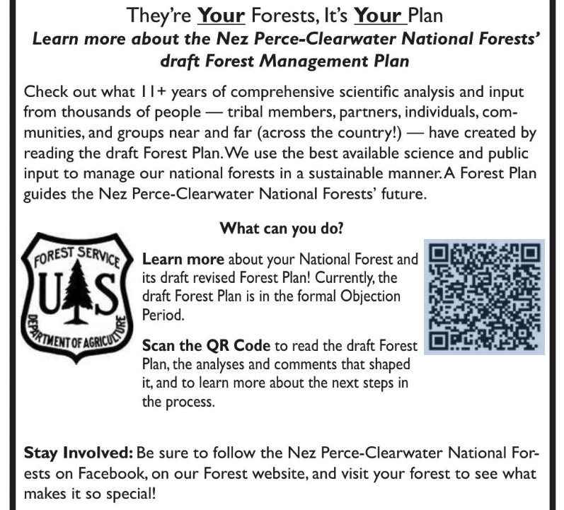
Here’s a little more (added to this) on the Nez Perce-Clearwater revised forest plan.  Mostly I wanted to share this graphic of how they are “reaching out” to the public.  They ask an important question:  “What can you do?”  The obvious meaning seems to be what can you do about the forest plan, and the answer for most people is “nothing.”  They say that the plan is in the objection period, but don’t tell us that the only people who can participate are those who have already done so.  They invite us to “learn more,” about this nearly-done deal, which they misleading label as a “draft Forest Management Plan.”  (At the draft EIS stage, the Planning Rule refers to it as the “proposed plan,” and at the objection stage it is just the “plan.)   While they have must have included similar outreach at earlier stages in the process, for those encountering this for the first time, it’s almost disingenuous.

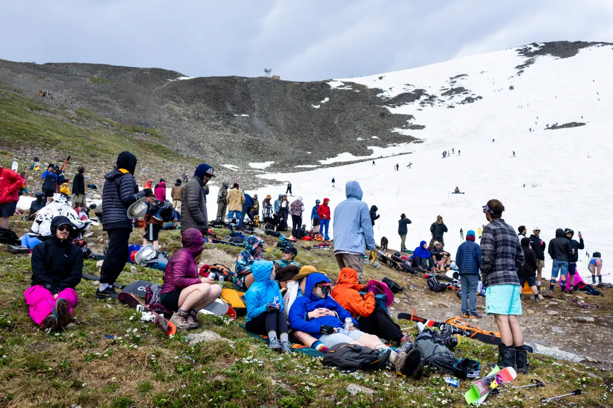
But while I’m at it , there was also another article recently that focused on the State Line Trail, which runs through the Hoodoo Recommended Wilderness Area in the Great Burn between Idaho and Montana.  (I’ve been there but haven’t been directly involved in the planning, so know only what I read.)

“It used to be a marquee backcountry ride for mountain bikers, too. That ended in 2012 when the Nez Perce-Clearwater National Forest, which controls the Idaho side of the trail, approved a new travel management plan that barred bicycles from its portion of the trail. On the Montana side, the Lolo National Forest has long allowed bicycles on the trail.”

A new revised forest plan for the Nez Perce-Clearwater could change that, by determining that bicycles are an appropriate use in the portions of Idaho around the trail, which would mirror access on the Montana side. If the changes in the plan are finalized, possibly later this year, that would set the stage for the Nez Perce-Clearwater to revisit and alter its 2012 travel plan to formally re-allow bicycles on the trail.”

The rationale behind these changes, according to the forest supervisor, don’t seem to include consistency (more on that later):  “We have these types of very primitive, amazing, out in the middle of nowhere experiences that you can get to no matter what your matter of conveyance is.”  No apparent agency recognition that the conveyance is part of the experience for those who encounter it, and for some it makes it feel unpleasantly more like “somewhere.”

One of the supporters added, “It’s a small segment of the sport that this is going to appeal to,” he said. “It’s not that close to Missoula. It’s hard. The trail’s in deteriorating condition. But this opportunity is, for certain people, something they really, really want.” That small segment of certain people (who apparently want to deteriorate the trail even more) must be pretty special to get this kind of personalized attention.

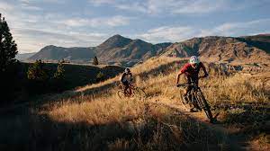
“Some mountain bikers are drawn to remote, rugged, and challenging backcountry trail experiences on wild and raw landscapes,” a group of supporters commented. “These are places where it is uncommon to see other trail users, and where riding requires a high level of physical fitness and technical skill — in many cases it involves pushing a bike instead of riding at all.”  That would be like hiking, wouldn’t it?  So, it’s not like closing the area to this use would exclude these physically fit people from these wild and raw landscapes.  I’ll admit that I don’t understand the rationale of wanting to experience a “wild and raw landscape” on a machine, which (to me) reduces the rawness and wildness of the experience.

The aura of personal opinion and politics behind these wilderness debates is why I focus my energy on other things.  Here there is also talk about snowmobiles and mountain goats, and why mountain goats are treated differently in adjacent national forests.

As for the effects of snowmobiles on mountain goats, the Idaho Department of Fish and Game blamed them for disappearance from one part of this area, but the founder of the Backcountry Sled Patriots says otherwise (citing other research).  The Lolo National Forest cited the negative effect of motorized over-snow machines as reason for designating them a species of conservation concern.  The Nez Perce-Clearwater is not concerned about mountain goats.  The Forest Service minimizes the importance of the areas at issue to mountain goats (though they apparently used to be some places they are not found now).

About the Lolo, Marten, the regional forester, who determines which species are SCC, wrote:

“Compared to other ungulates, the species appears particularly sensitive to human disturbance. Motorized and non-motorized recreation, as well as aerial vehicles, are well documented to affect the species, particularly during winter and kid-rearing season, with impacts ranging from permanent or seasonal (displacement), to changes in behavior and productivity.”

The regional director for ecosystem planning said that she didn’t see the different listing decisions as being in conflict with each other. Rather, she said, they reflect that mountains goats are doing better overall on one forest than the other.  This may be technically/legally possible since SCC are based on persistence in an individual forest plan area.  However, it doesn’t make a lot of sense to me to manage one national forest to increase the risk to, and to contribute to SCC designation on, another forest.  Moreover, the Planning Handbook states that “species of conservation concern in adjoining National Forest System plan areas” should be considered by the regional forester in making this designation.  This all has kind of an arbitrary ring to it.

As for consistent management across national forest boundaries, The Nez Perce-Clearwater plans to change the shape of the Hoodoo RWA to remove the key snowmobile areas from it, so that boundary between the national forests becomes a boundary for the RWA.  The Forest Service points out that the plan revision process in the hands of forest supervisors, not the regional office.  The forest supervisors disclaim any obligation for consistency, and even suggest that travel planning may produce a different result, and “forest plans and travel management plans are continually updated and amended” so they could change again.  That doesn’t square well with history.  The every-third-of-a-century Forest plan revision should be the time to get it right.  Even if the regional forester doesn’t want to say what the plans must do, that person could simply order them to be consistent along this boundary.

Udall: We Need to Keep Climbers in Wilderness So They Can Advocate for Wilderness

Image from https://www.boulderclimbers.org/news/fixedanchorsinwilderness-bolts


Op-ed linked here.

Here are some excerpts:

As a United States senator, I sponsored and helped to pass new Wilderness protections for Colorado’s James Peak Wilderness, Indian Peaks Wilderness, and Rocky Mountain National Park. These bills became law thanks to a united coalition of advocates for conservation and recreation. In my experience, the two cannot be separated. The time we spend outside is what defines every conservationist I know.

Protecting Wilderness requires careful management that allows primitive recreation activities that are compatible with preserving Wilderness characteristics. Over the last decades, the management of fixed anchors in Wilderness areas has been ad hoc. It’s varied from area to area, often causing confusion and conflict. The Protecting America’s Rock Climbing Act (PARC Act) would clarify for the land agencies, the public, and climbers where fixed anchors are appropriate, when they can be replaced, and where they are banned.

By resolving the ongoing debate over fixed anchors, our public land managers can devote their priceless time to the serious, existential, and quickly progressing impacts to America’s Wilderness Preservation System. For example, air pollution and climate change don’t respect boundaries on a map. In fact, 96 percent of national parks “are plagued with significant air pollution problems.”

If we’re going to take a proactive approach to protecting America’s last pockets of Wilderness, we need a new generation of advocates to lead the way. Supporting sustainable climbing access to America’s Wilderness areas will help ensure that climbers—long-standing wilderness champions—are part of that coalition.

Here’s what I think: saying advocates for conservation and recreation “cannot be separated” is one of those generalized expressions that glosses over the fact that certain forms of recreation on the Pyramid of Pristinity are often kicked out or never allowed in Wilderness.  Also, that even those activities allowed can have serious environmental impacts. But maybe that’s still conservation? By definition?

The fact is that our “public land managers” “priceless time” will probably not be spent on cleaning up air pollution nor reducing “climate change.”  I heard one of my colleagues say “perhaps the best things federal lands could do for climate change is to not allow recreation of any kind because of the transportation and fuel impacts” and I’m not sure it was tongue-in-cheek.

His last argument is fairly pragmatic.. although I’m not sure what a “proactive approach to protecting” means… more Wilderness, or fewer things allowed, or protecting via reducing pollution and decarbonizing? What do they need climbers for, and why stop with them?