Hair on Fire (or Not) About Wildfires: Wild Earth Guardians Blast From the Past

I’ve been thinking about the need to adjust “acres burned” for fire for resource benefits.  Because folks actually use the total acres in climate studies.  If suppression tactics have been changing, then that would need to be integrated into a model (it seems to me) relating weather and climate variables to acres burned. But then are all acres burned “bad”? Maybe we should decide what is meant by “bad” first, and then see if there has been a change in “bad” acres associated with anthropogenic climate change. I’m not saying AGW isn’t a factor; I’m just saying we would understand the complex interactions among fuels, weather, suppression strategies and tactics, ignitions and so on much better if we focused on problematic fires and not counts or acres.

Anyway, if we go back in time, we can see the view that fire suppression itself is a bad thing. Check out this blast from the past- only 10 years ago, a press release from Wild Earth Guardians., posted by Matthew.

As we saw a previous post, suppression folks are doing pretty well in the SW at managing for resource benefits. WEG also mentioned “breathless reporters gave statistics of ever increasing acreages of devastated forestland.” Maybe it’s not as scary as portrayed. Maybe the AGW signal is small compared to other factors. Maybe the FS and WEG are in agreement on this. Like prescribed fire, though, to have social license to manage for resource benefit the FS needs to have a good track record, preferably locally. To do that perhaps sometimes fires need lots of resources. I’m not going to second-guess playing it safe.

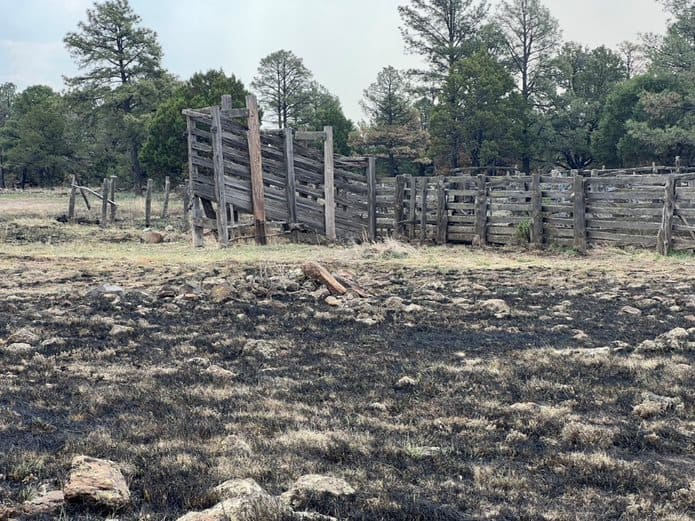
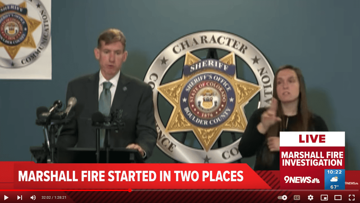
New Mexico experienced several expensive fires early this summer, the largest was the Silver Fire covering nearly 217 square miles in the Black Range. Fire costs in the U.S. have topped $1 billion so far this year; less than last year’s $1.9 billion, but the fire season is not over. The Thompson Ridge fire alone cost $16,326,136 before it was declared contained. Rising plumes of smoke could be seen on the horizon of Santa Fe and Albuquerque and breathless reporters gave statistics of ever increasing acreages of devastated forestland.

But, the numbers tell a different story. The four major fires in New Mexico this summer covered a total of 184,024 acres or nearly 288 square miles, but just 16% of that area burned at high severity. In all 213,289 acres have burned to date in New Mexico. While there is still a chance for late season fires, the total burned area for 2013 is significantly less than the 372,497 acres burned in 2012.

“Once the smoke cleared, the environmental benefits of the 2013 fire season were obvious,” Said Bryan Bird, Wild Places Director for WildEarth Guardians. “Though flooding is always a risk, these fires do more to clear fuels and reduce fire hazard than we could do with mechanical treatments and a large chunk of the federal budget.”

Burn Area Emergency Response (BAER) teams take action immediately after fires to analyze the area within the burn perimeter and take action to minimize immediate damage from flooding, which can have severe consequences downstream. The BAER teams measure fire severity to analyze the loss of organic matter from the forest. In areas of low fire severity ground litter is charred or consumed, but tree canopies remain mostly unburned and the top layer of soil organic matter remains unharmed. Areas of moderate severity have a higher percentage of both crown and soil organic matter consumed. Areas of high severity have lost all or most of tree canopy organic matter and soil organic matter is wholly consumed.

The numbers reported by the BAER teams for the 2013 fire season in New Mexico put into perspective the burn results. Of all acres within fire boundaries over 10,000 acres this summer, 59% (109,290 acres) were ranked as unburned or low severity. Another 24% (44,880 acres) was moderate severity. Finally, just 16% (29,125 acres) burned at high severity.

The Joroso Fire, located in the Pecos Wilderness, burned primarily in mature Spruce Fir stands with high levels of wind blown material. These conditions create an environment where high severity burns are much more likely than the other fires, so it is instructive to remove it from summary statistics. When removing this fire from the analysis the overall numbers demonstrate even less severe effects on the vegetation: 61% remained unburned or burned at low intensity, 25% burned at moderate severity, and only 13% burned at high severity.

Fire fighting in the United Sates has become a very costly endeavor. While most fires are extinguished quickly, it is the very small portion of wildfires that are not immediately controlled and result in significant financial burdens to states and the federal government. Already this year the Forest Service has exhausted its fire-fighting budget and has had to tap other budget line items. And yet, it is not clear that committing such resources is necessary or beneficial when human life and property are not immediately at risk.

“Fire is an essential process in western forests and we cannot eliminate it. Resources need to be reserved for protecting lives, not supporting huge operations in the backcountry.” Said Bird. “We can fire proof communities, but we cannot fire proof the forest.”

Some Info from the NICC Wildland Fire Summary and Statistics Annual Report 2022

Here’s the 2022 NICC Wildland Fire Summary and Statistics Annual Report.
If you want to look at their tables, it helps to know their abbreviations.. so here’s a map.

This one raises some questions about more starts and average acres, maybe to be answered later.

It looks like annual wildfire acres burned is not necessarily jumping up from year to year. Also, 2022 had above average number of fires and below average acres, which might be due to the fire suppression folks doing good work. There may be elements of weather and resource “good luck,” as well. As far as I know, all these acres include WFU acres.

Since each region is different, this one shows more (above average count) of wildfires in the Southeast, and more acres burned in Alaska.

Later in the report is a great deal of information on the management of fires and resources that might be of interest to other TSW readers.

Not All Acres Burned Are Bad Nor Due to Climate Change- White House Factsheet Misses Region 3 WFU Successes

Wooden Corral sustains no damage from the Pass Fire
Firefighters strategically used fire to reduce the existing fuel load as the Pass Fire approached the area, which saved the wooden corral structure.

So, wildfires used to be bad. Enter Smokey Bear.  But we wised up and discovered that we need to live with fire, and if we don’t want to have destructive wildfires, we need to manage fuels on landscapes including using prescribed fire and wildland fire use (see photo above). But as far as I can tell, if we’re not careful, we mix up WFU acres with “true” wildfire acres, and then use the total in statements about wildfires and climate.  And if we do, we’re back where we started, assuming all wildfires are bad. Let’s not do that.

Or we could use numbers of wildfires like the EPA..


Is number of wildfires an indicator of climate change? Seems like before you made that claim you would have to separate human ignitions from lightning..

We hear that (1) wildfires are caused by (anthropogenic contributions to) climate change.  And yet we know that not to be true, in a plain English sense of causality, as wildfires have long predated humans.  If we pushed back, we might hear (2) “wildfires are made more likely due several factors, one being an increased frequency in some weather conditions conducive to wildfires and those that make firefighting more difficult, some or all of which is due to anthropogenic climate change (AGW).” So how does 2, which I think most of us agree on, mutate into 1? Sloppy public affairs folks?

Here’s what the White House said on June 8

More than 100 million Americans are under Air Quality Index Alerts due to smoke drift from historic wildfire activity throughout Canada, which is facing one of its worst wildfire seasons on record.  There are over 425 active wildfires in Canada and nearly 10 million acres have burned, 17 times the 20-year average.  Since January 1, 2023, 19,574 wildfires have burned 616,486 acres across the United States.  Most current large fire activity in the United States is concentrated in the Southwest.

These latest events are another stark reminder of how the climate crisis is disrupting communities across the country. That’s why from day one President Biden recognized climate change as one of the four crises facing our nation, and why he made historic investments to tackle the climate crisis and strengthen community resilience.

So I suppose you can pivot from the Canadian fires to climate change but the US story is not exactly pivotable.    And here’s what NIFC said on June 22, 2023 about the US.

Since January 1, 22,052 wildfires have burned 636,031 acres across the United States. These numbers are below the 10-year average of 25,006 wildfires and 1,478,575 acres burned.(my bold)

But to further complicate things, some of these fires here (and in Canada) are being managed for resource benefits.. or whatever the current terminology is.. (thanks to the Hotshot Wakeup for info on the Pass Fire) so more acres (without destroying things of ecological or human value) are actually a good thing. That’s what our folks have trained for, and what we all want done. As far as I know.

The largest fire is the Pass Fire in NM that shows 55, 683 acres as of today.

The overall strategy on the Pass Fire is to allow the low to moderate intensity of the fire to play its natural role on the landscape as firefighters take appropriate actions to keep the fire within the designated planned boundaries while protecting private land, infrastructure, and natural resources. The Gila National Forest is a fire-adapted ecosystem. It is dependent on fire to play a natural role in restoring the landscape to more natural conditions while preventing the occurrence of extreme fires in the future.

So for this fire, the largest one currently on the board, lots of acres are a good thing, attributed to good management and possibly to some good luck with weather conditions.

NIFC on the 22nd had this one, the Pulp Road fire, at 15,642, I think it’s at 16K or more now.
This fire was an escaped prescribed fire by the North Carolina Forest Service. Escapes tend to be caused by other things than AGW, but perhaps AGW could play a role.. we’ll have to see what the investigation discovers. Anyway, for this one acreage over the target is a bad thing, but dubiously attributed to climate change.

The next largest is the 10,279 Wilbur Fire on the Coconino

The Wilbur Fire is being managed with multiple strategies to meet suppression and resource objectives. Those objectives include the release of nutrients back into the soil and the reduction of hazardous fuel accumulations. Objectives also include protecting critical infrastructure, watersheds, wildlife habitat and culturally sensitive areas from future catastrophic wildfires.

Again, more acres here are good.  I wonder if there’s a place where WFU acres are tracked separately from total acres, or how difficult that is to do. Wouldn’t it be great if we had a table that included:

Prescribed fire acres

Wildfire Use Acres

Unintentional Wildfire Acres

The sum of the above two (WUA plus UWA)  would be the total wildfire acres.

Then the Unintentional Wildfire Acres (or True Wildfire Acres) could be broken down by

Lightning

Human  with subcategories that included:

Escaped prescribed fires

Escaped WFU fires.

Arson

Accidents by individuals

Equipment (powerlines etc.)

Or maybe that table already exists somewhere?

For now, it’s June, the season’s off to a slow start here in the US, and let’s celebrate the folks who are successfully using managed wildfire!

Canadian Wildfire Framings: Climate Apocalypse, the Tim Hart Act and Bad Luck

It’s complex, that’s what this paper says, talking about Western Canada https://iopscience.iop.org/article/10.1088/1748-9326/ac7345

It’s interesting to take one set of facts -there are wildfires in Canada, the smoke is going toward the East Coast, and people who aren’t used to wildfire smoke were breathing it-, and see how those facts can be framed differently. There are different fires in Canada, in extremely different parts of the country, that are being managed differently, from full suppression to big boxes or what we might call wildland fire use, ignited by different sources. This tends to get lost in some of the reporting.

(Some) Legacy Coastal Media and Some Politicians- Wildfire Smoke, the Scent of Apocalypse

If you read the NYTimes or the WaPo, it’s the harbinger of apocalyptic climate change.  Perhaps because the WaPo hired a bunch of climate reporters, it’s not surprising that any story could be seen through the climate lens.

I’m not saying that climate and weather don’t affect wildfires.  I’m just saying that it’s difficult to tease apart the contributions of various climate change elements (different greenhouse gases, land use changes) from natural variability and a host of other factors (ignitions, fire policy) and the history of vegetation that has developed through time. I’m OK with saying “it’s complex, and we don’t really know, but from what we know, the sum of human impacts on climate have affected the situation.”  It’s complicated. But to some politicians, it’s simple- and the answer- to quit fossil fuels:

So that’s one framing.

The Hotshot Wakeup- It’s Complicated And You Need Suppression Folks- So Treat Them Decently and Support the Tim Hart Act

Let’s take a great the Hotshot Wakeup podcast from last week, titled “How Did the Canadian Wildfires Start? A Rational Response in a Sea of Conspiracy. What’s Really Happening?”

Tim does a terrific job of talking to people on the ground in Canada, and also trying to explain to people who aren’t familiar with the wildland fire world how things work.  You can tell why he thinks the way he does because he gives his rationale.  He also discusses some of the “out there” ideas that are floating around and, perhaps most importantly, doesn’t seem to have a specific axe to grind about causality (or would that be a pulaski?). He’s another one who looks at the situation and says “it’s complicated.”

He seems to come to the eminently practical suggestion that no matter what the different causes (ignitions, climate, past fire suppression), we are going to need wildland firefighters and they are not being paid or treated well and may walk off the job if Congress doesn’t get its act together.  He suggests we all call our representatives and support the Tim Hart Act. NFFE has a link you can use to make it easy.  I’d like to understand who is against it and why.  Which goes back to the need for some Smokey Wire legislative contributors.

Anyway, I contacted my Congressperson’s office as a Smokey Wire reporter and asked whether they were supporting the Tim Hart Act, and if not, why not. They said their legislative team was reviewing it and did email me afterwards to say (sadly I’m not kidding)  “I talked to our legislative team about the bill, and they said our office is not supportive as it’s a massive increase in expenditures for something that could be carried out at a state level.” I wrote back and said how can the state fund Federal firefighters?” and I haven’t heard back yet.  I believe in fiscal responsibility, but the very same Congress just approved the IRA and BIL which the Admin seems to be sometimes using as a slush fund for their pet priorities (e.g., mapping intactness of BLM). After this depressing experience, I feel that filling out the NFFE form  or calling would be helpful.  It doesn’t matter is anthropogenic climate change is responsible for 5% or 40%, we need firefighters and they deserve to be treated decently.

Cliff Maas the Meteorologist- Smoke- Bad Luck Plus Some Climate Change?
in the Wall Street Journal. I like how he mentions plants and seasonal drying. I don’t know how true this is of the areas involved.. would like to hear more local Canadian observations on the plants. The below is long, but in case you don’t get the Wall Street Journal..

The recent wildfires occurred in the boreal forests of northern Quebec. Fire isn’t rare in that region. The ecology of these forests relies on fire for the release of seeds and forest health. Many of the major boreal fires occur during a narrow temporal window from mid-April through early June, just after the winter snow has melted and before grasses and other small plants grow, reducing flammability. During this short window, the dead vegetation from the previous year can dry out sufficiently to burn if there is an ignition source such as lightning or errant human activity.

Many of the great Quebec fires have occurred during the spring, such as the May 2010 fire that spread massive amounts of smoke into New England and the May 1870 Saguenay fire, which spread smoke as far as the British Isles. Large boreal forest fires during the spring in Canada are neither unusual nor a sign of climate change.

The fires this month began on June 2, as hundreds of lightning strikes ignited vegetation dried by nearly a week of unusually warm weather. The weather prior to the warm spell wasn’t unusually dry, with the Canadian drought monitor showing normal moisture conditions and temperatures near or below normal.

Starting on May 27, an area of high pressure built over south-central Canada, warming and drying the area for several days into early June. With the light surface fuels, such as grasses ready to burn, all that was needed to start a fire was an ignition source, which occurred in early June with a lightning storm associated with low pressure.

The lightning ignited numerous fires and the low-pressure center’s circulation produced high winds that stoked the fires, resulting in rapid uncontrolled growth. Even worse, as the low center pushed south and intensified east of New York, it produced persistent strong winds from the northwest, moving the Quebec smoke into the New York metropolitan area.

It was the perfect storm for smoke in New York, with several independent elements occurring in exactly the right sequence. It’s difficult to find any plausible evidence for a significant climate-change connection to the recent New York smoke event. The preceding weather conditions over Quebec for the months prior to the wildfire event were near normal. There is no evidence that the strong high pressure over southern Canada that produced the warming was associated with climate change, as some media headlines claim. In fact, there is a deep literature in the peer-reviewed research that demonstrates no amplification of high- and low-pressure areas with a warming planet.

The long-term trend in Quebec has been for both precipitation and temperature to increase. Temperatures have warmed about 2 degrees Fahrenheit over the past half-century. Even assuming that this warming is entirely human-induced, it represents only a small proportion of the excessive heat during the event, in which Quebec temperatures climbed to 20 to 25 degrees above normal. The number of wildfires in Quebec is decreasing; there is no upward trend in area burned, which would be expected if global warming was dominant.

**********************
The Hotshot Wakeup also has a new post on arson in the Canada wildfires titled “Alberta Premier Says She’s Bringing in Arson Investigators From Outside the Province.-175 fires in Alberta still have unknown causes. Very Interesting Indeed.”

But if we read what Google searches come up with on the Alberta arson question (or at least mine does), we get interesting anti-arsonist-explanation sentiment..
“There’s a certain logic to trying to distract from the terror of wildfires and the changing climate that helps set the conditions for them. For many individuals, perhaps the truth is so unimaginable, unsettling and unavoidable, they refuse to accept the complex origins of the new reality. ”
And pretty much call the interest in arson “disinformation”.
The facts will come out as to how many, if any, were started by arson, so we’ll see. It’s interesting to note the fact to spin ratio… But why is it so hard for many to say “it’s complicated” instead of “it’s climate”? Is that in itself “disinformation”?

Marshall Fire Update: Two Ignition Sources, Buried Fire and Power Line, Coal Seam Not Ruled Out

Later today the Boulder County Sheriff’s Department will post their analysis on their website.
Here’s a good story on it from the Colorado Sun.

It’s an interesting story of how homeowners burned material, put it out and buried it, and the wind came up a week later and blew the soil off and it started dry grass on fire. In dry areas with grasslands, dry grass is a natural feature for part of the year. Mountain View Fire determined that the reidents’ plan to extinguish it was reasonable and responsible. The Forest Service investigators and the Missoula Fire Lab were both mentioned as helping in the investigation.

We were talking about continuous improvement with regard to the NWFP; in this case, Boulder changed their rules to focus on water putting out fires.

So if we were to build a model of why this fire happened, we’d have:

Ignitions
Suppression Forces Stretched Thin by Several Ignitions, Covid
Wind- spread fire, plus air resources couldn’t be used.
Fuels- In many places with dry grass, grasses are eaten in the summer when they are green by grazing animals which reduces surface fuels. In fact, one one TV show I watched that day, the fire stopped at a rancher’s grazed area.

In our part of the country, these conditions are fairly common in the fall and winter and our county’s strategy is robust initial attack.
Originally coverage of this was all about climate change.

You might want to go back to my previous post on the Marshall Fire.

OK, so after unusually wet spring (is that AGW also?) precipitation below average and temperatures above average.  But of course averages are averages because.. some observations are higher and some are lower.  I would have said “the dry conditions we experienced (not the wet ones that encouraged plant growth?) are predicted to become more likely under AGW.”  That is very different from being a “result” of climate change.  Also there is a difference between the same conditions that used to happen, happening more frequently (we know how to adapt, and have to just do those things more often) and things that never happened before happening (where we need to respond differently). I’m not sure that distinction is often made.


I recommend Roger Pielke, Jrs. somewhat wonky but very thoughtful take on causality as it relates to the Marshall Fire.

Common narratives possibly contradicted by this example:

Current thinking: Cows are bad. And yet, they reduce grassy fuels and convert them to food.
Current thinking: Individual cars should be replaced by public transportation. And yet, people amazingly evacuated themselves and their animals quickly using.. individual vehicles.
Current thinking: Let’s build and maintain lots more power lines in dry places. And yet, maybe we should get better at maintaining the ones we have?
Current thinking: High density housing is best. And yet, house proximity caused fire transfer as in this Denver Post story.

Maybe communities in dry fire-prone ecosystems need to develop their own visions of how best to live with fire.

SUPERIOR – Too many houses built too close together on the tinder-dry high plains between Denver and Boulder led to the record Marshall firestorm losses topping $1 billion, insurance industry researchers found this week as they sifted through ashes and charred ruins.
….
“Conflagration happens when you get that proximity,” Roy Wright, chief executive of the insurance institute, said Thursday as his team began their investigation.

Spacing closer than 12 feet favors fire, researchers have established, and gaps between homes of 50 feet or more are advisable, Wright said. “Dispersion is one way to eliminate the domino effect” and with greater spacing “you would not have had so many structures lost.”

Re-making Colorado suburbs to endure worsening fires also will require clearing buffers at least five feet wide and “impeccably” bare, Wright said, along with screens on vents and retro-fitting with non-flammable roofing, siding and vegetation. Well-watered green lawns are less likely to burn than native grasses, he said.

And the mulch that residents increasingly use to help plants endure as temperatures rise “is like spreading match sticks around your home.”

From that story:

The question is what hardening would entail. A fire safety push for lower-density housing would collide with a push by some planners and developers toward higher-density “mixed-use” communities. Population growth in Colorado and other parts of the arid West has led some planners to encourage housing “units” clustered tightly like integrated circuits and surrounded by native vegetation that requires less water than lawns and parks.

Closer spacing and vegetation management for fire protection could clash with water conservation and other long-term objectives, said Molly Mowery, director of the Community Wildfire Planning Center, a nonprofit that guides town officials.

Looking at limits on growth opens “a huge can of worms,” Mowery said, anticipating that boosting fire resilience will require balancing climate warming preparedness measures. “There’s not going to be a solution that satisfies everything.”

State Farm and California Insurance-E&E News Story

When I first read about California and State Farm wanting to get out of the market, it was couched as being about climate change and wildfire.  Well, being a native Californian, I thought of downtown San Fran and LA, and Palm Desert and Barstow, and thought “huh, can’t be about wildfire.”  I guess insurance companies want to use climate models to set rates.. I’d guess they’d prefer RCP 8.5 as well.  I wouldn’t blame them.  1. Scientists tell us, 2. It’s good for business, 3. Let’s go with it!

Anyway, I thought this story was more holistic about the many factors involved, which not surprisingly, has to do with state regulation. The story is from E&E news and isn’t paywalled.

For property insurers, Prop 103 has made it almost impossible to set premiums based on computer models that project future risks including climate impacts, said Mark Sektnan, vice president for state government relations at the American Property Casualty Insurance Association. That’s because Prop 103 requires modeling used by insurers to be made public, which modeling companies want to avoid, Sektnan said.

Instead, insurers are setting rates based on their losses over the preceding 20 years.

“It’s a little bit like driving your car using the rearview mirror when your windshield is right there in front of you,” Sektnan said.

When insurers analyze the past 20 years to set rates, they are not fully capturing recent increases in California’s wildfire risk as climate-driven hotter temperatures have made the state’s forests and grasslands drier and more combustible, experts say.

For example, in the 20 years from 2003 through 2022, wildfires burned an average of 1 million acres a year in California, according to an E&E News analysis of data from the state Department of Forestry and Fire Protection.

But in the six years from 2017 through 2022, California wildfires burned an average of 1.8 million acres a year and destroyed or damaged nearly 51,000 structures in total.

“The problem in California is that the risk is changing pretty quickly, especially if you think over two decades. Two decades is just not fit for the problem,” Wara said.

Nancy Watkins, a California-based principal at Milliman insurance consultants, said the retrospective method “is an extremely simple rate-making model that in practice has totally failed to anticipate the growing risk in California due to factors like housing growth in high-risk areas, vegetation build up, the effect of climate change on longer fire seasons, hotter temperatures, drier air.”

“None of that is factored into a backward-looking formula,” Watkins added.

I don’t know what “making modeling public” entails versus having insurance regulators review the models, but it seems like an area that could lead to a potential lack of trust.

Three national forests in Colorado receive nearly $47 million for wildfire barriers: Colorado Sun

I’ve got more on NEPA and the debt ceiling but everyone’s probably tired of that.. so here’s a nice article by reporter Shannon Mullane of the Colorado Sun on Colorado getting $ for PODs and fuel breaks.

On May 4, Secretary of Agriculture Tom Vilsack visited Durango, roughly an hour west of Pagosa Springs, to announce a total of $63 million for fuel breaks from the $1 trillion Bipartisan Infrastructure Law, passed in 2021, and the $700 billion Inflation Reduction Act of 2022, which reflect a historic amount of investment, he said. The funds will go to Colorado, Montana, Oregon, South Dakota and Wyoming.

According to the story, if there is 63 mill total and Colorado is getting 46.7 mill. that’s about 74% of the $ that are supposed to go to five states.  Maybe the other states got more of the other BIL and IRA funding? Sure, we’re special (and Secretary Vilsack’s son was hired from the State government to be BLM Director) but are we that special?

The article discusses PODs and how they’re developed. There’s also a discussion of the importance of protecting municipal water supplies.

That’s what the San Juan Headwaters Forest Health Partnership, a collection of land managers, government officials and community partners working across sectors and jurisdictions, was discussing during a 2018 tour along Fourmile Road.

Members of the incident management team develop a plan of attack in response to the Plumtaw fire, which started May 17, 2022, north of Pagosa Springs in Archuleta County. (U.S. Forest Service, Contributed)

The group mapped out vegetation types, terrain and the locations of roads, rivers and rocky turf — the same process used throughout San Juan National Forest and some nearby lands to identify areas where crews would have the best chance of containing a potential fire, called potential operational delineations, or PODs.

“You get all the fire experts in a room and say, ‘Hey, we don’t have a fire now, but if we hypothetically had fires all over this landscape, piece by piece, where would you start?’” Lawhon said.

****

On the first anniversary of the fire, the fuel break project was an important “invisible success,” said Guinn, who helped put together a documentary about the fire for the headwaters partnership. The fact that a community group identified it as a way to protect municipal water supply — and that the Forest Service jumped in to partner on the project — was significant, she said.

“This fire could have turned into something that was a much more challenging event for our community down the line,” Guinn said. “But because we had done some pre-planning, and a variety of other factors came together, we were able to be prepared as a community and help our emergency responders help us.”

With the influx of funding, other fire mitigation and fuel break projects are set to start as soon as this summer, said the Forest Service’s Lawhon. From Dolores to Pagosa Springs, no watersheds that the San Juan National Forest works in are owned by a single entity. The POD units, which have been mapped across the region, break the landscape into manageable chunks and help agencies work across complex jurisdictional boundaries.

It’s a whole-system approach that could make a significant difference in how effectively communities prepare for an increasingly long and intense wildfire season, Lawhon said.

“You have to do this cross-boundary, multipartner approach, or you won’t be successful,” he said.

It’s interesting to think about where we read about PODs and where not.. is everyone delineating them across the country? And for Jon, do they/should they require plan amendments?

Questions for Legal Folks on the Fire Retardant Order

Here’s (5-26-2023) a link to the order.. the FS has to work with the EPA and apparently needs to check in with the judge regularly as to how it’s progressing.

Some people have asked questions, to which I do not know the answer. I know that there are highly knowledgeable people (including a/the plaintiff) so hopefully we can get all our questions answered.

1. This is a Forest Service case, so it doesn’t seem to apply to BLM or other federal lands (?). Is it the airplane or the landowner that controls? So States with airplanes/retardant don’t need permits? Or perhaps they will also be incorporated somehow in the new permitting process (if they want to be?). And shared resources over interlocking ownerships (common in many places) sounds like the Nightmare on Checkerboard Street.

2. The ruling only applies to some states (Oregon, California, Montana, Idaho, Wyoming, Colorado, Nevada, Arizona, New Mexico, and Alaska) also,apparently not Washington nor Utah, and none of the Eastern, Midwestern or Southern states. It seems like this would be very difficult for the FS to keep track of. Perhaps this is an example of lawsuits don’t always lead to coherent policy outcomes.

3. Since some of these releases are accidental, will the EPA just estimate how many accidents have been happening and permit that.. or require some kind of compensatory mitigation? Will the proposed Fed/State regulatory approach be subject to rulemaking and public comment? Or is that all unknown at this point?

4. Mr. Wuerthner’s declaration seems important. Is this the “usual suspect” Wuerthner? Does someone have a copy of his declaration? It might be interesting.

Here are a few paragraphs about the injunction:

FSEEE has not offered sufficient evidence on the hardships to the parties and has failed to demonstrate that the public interest would not be disserved by a permanent injunction. The USFS explains that the 213 recorded intrusions only occurred where it was necessary “to protect human life or public safety (23intrusions) or due to accident (190 intrusions).” (Doc. 12 at 9.) Although the injunction would presumably allow the USFS to continue to aerially deploy fire retardant, it is unclear how the agency would proceed or if the agency could completely avoid future CWA violations. Thus, the requested injunction could conceivably result in greater harm from wildfires—including to human life and property and to the environment—by preventing the USFS from effectively utilizing one of its fire fighting tools.

Although FSEEE claims that fire retardant is an ineffective tool in fighting wildfires, (Doc. 24 at 9), this fact is disputed, (see Docs. 8-1, 8-2). Additionally, although FSEEE has presented possible solutions that would allow continued use of retardant while reducing accidental discharges, such as a 600-foot buffer requirement, (Doc. 24 at 10), it has failed to demonstrate that such solutions would
actually be effective from either parties’ perspective. Moreover, FSEEE has not addressed how the injunction would be enforced, which would itself create a significant burden for both parties.

And of course both the FS and EPA have many other things on their plates- and tell us they are overwhelmed by work and are having trouble hiring people.. in the FS’s case actually fighting fires, spending IRA and BIL money, and battling the climate emergency while writing MOG rules and plan revisions.I’ve described the EPA lack of capacity and the bipartisan bill here. This would be an idea place for the separation of powers to kick in, IMHO.

Fire Retardant Case/Legislation Update

I am trying to catch up and Nick Smith linked to this this morning; maybe someone else has a better status report?

Based on this article.. apparently the US is going to settle while being willing to “work with Congress on legislation”? I’m sure Andy knows more about the former but maybe can’t talk about it.

Inside EPA, which broke the news of the Forest Service’s decision to settle the citizen suit, is reporting that the head of the Forest Service now “is willing to work with Congress on legislation to allow the service to continue airborne sprays of firefighting chemicals” without the need for a multitude of Federal and State permits.

But apparently the Admin doesn’t support the existing House bill (I still hear, as previously reported, that it’s USDA and the FS are in one place and CEQ in another). It will be interesting to see what comes of this.

For those who want to know how my FOIAs of discussions between the Department and the White House (CEQ) on this topic are going.. well..so far USDA is winning the FOIA race with CEQ, but have nothing in my hands yet.

Big Jack East Hazardous Fuel Project on the Tahoe NF- Before and After Sliders and Some NEPA Stuff

These don’t slide but the ones on the website do.


I’m trying to catch up after being gone for two weeks, so if there’s something you think worthy of discussion, please post under the New Topics tab above.

Awhile back I posted some photos of fuel treatments from Oregon that were strictly not before and after on the same piece of ground.

Thanks to Nick Smith, here’s a link to a National Forest Foundation piece, which is cool because of the before and after photos of the Big Jack East Project south of the town of Truckee on the Tahoe National Forest. The project is 2000 acres.

and the fact that there is a slide feature.

Some interesting features of the decision..

It was an EA. The EA itself was 132 pages.

They have a 78 page response to comments. As far as I can tell (but they might be documented elsewhere), there were no objections.

They also have a specific document in a table that arrays “opposing science”, the name of the reference, and the response. It’s 55 pages.  In this case, the scientific papers cited are very repetitive in their claims, and often referred to places outside the Sierra Nevada.   I think they put an explanation in the wrong column for Opposing view 47 but I still thought it was a pretty good explanation. Perhaps the FS has a general place where folks post cited research and responses so the wheel doesn’t have to be reinvented?