Happy Earth Day!

P9193955-web P9193966-web P9193951-web

26 years after “protected” forests burned, in Yosemite National Park, this is what we now have. Chances are, it will burn again, before conifer trees can become established enough to resist the next inevitable wildfire. You might notice that even the manzanita is having trouble surviving. I doubt that John Muir intended this on public lands. This landscape is probably the future of parts of the Rim Fire, within Yosemite National Park.

Update From the Yosemite “Laboratory”

Here is a stitched-together panorama from the Foresta area of Yosemite National Park. I’ll have to pair it up with my historical version, one of these days. Restoration processes seem to be minimal, as re-burns continue to ravage the landscape, killing more old growth forests and eliminating more seed sources. Even the brush is dying off, due to a lack of organic matter in some of those granitic soils. With the 200-400 year old trees gone, we have to remember that these stand replacement fires, in this elevational band of the Sierra Nevada, weren’t very common before the 1800’s.

Foresta-panorama-crop-webYes, it IS important that we learn our lessons from the “Whatever Happens” management style of the Park Service. Indeed, we should really be looking closely at the 40,000+ acres of old growth mortality from the Rim Fire, too! Re-burns could start impacting the Rim Fire area, beginning this fire season.

The Forest Service as Noah

High-elevation headwater streams that provide refuge for native bull trout and cutthroat trout would remain cold enough even under the worst warming scenarios to protect and support them. These streams, in places like Central Idaho’s White Cloud Mountains, can carry these native trout through the global warming bottleneck – when many species will disappear – that scientists say the world faces even if nations are able to stop the rise in greenhouse gases. “They are like Noah’s ark for bull trout and cutthroat,” Isaak said.

In February, Isaak and Young briefed forest officials and others working collaboratively across Idaho to restore the health of forest ecosystems while providing jobs for rural communities. The briefing gave local land managers like those on the Boise National Forest a chance to see how their plans fit into these “climate shields.” “There were a few areas in the Lowman District and in the upper Boise,” said David Olson, a Boise National Forest spokesman.

Said Isaak: “The hope is that the information provides a strategic tool that can be used to make more efficient local investments in stream restoration and protection projects, so that the broadest possible distributions of cutthroat trout and bull trout remain later this century.”

Isaak’s Noah’s ark approach won’t just help aquatic species, but also can help managers determine what other habitat will remain viable as warmer winters, earlier runoff and increased wildfire accelerate with warming temperatures. Wolverine biologists are looking at many of the same areas, Young said. Pika, lynx and other mammals that depend on cool summers or good snowpack may find refuge in Idaho’s high country.

This story describes a concrete step towards being strategic about climate change by identifying areas that should be used to build the ‘ark.’  Unfortunately, it doesn’t make the connection to national forest plans, where strategic choices about management priorities need to be made.  It will be interesting to see how the Nez Perce-Clearwater forest plan revision incorporates this strategy.

New possible planning tool for the birds

The study analyzed 308 species of birds that live on lands managed by the Bureau of Land Management and U.S. Forest Service, the two largest public land managers in the western United States. Drawing on 1.7 million crowdsourced checklists submitted to the Cornell Lab’s eBird project, the researchers modeled where each species occurred in each week of the year across the nation. They then overlaid those results on a map of land management compiled by Jocelyn Aycrigg of the National Gap Analysis Program at the University of Idaho, a coauthor of the study. The map showed not only which lands were managed by the agencies, but what levels of formal biodiversity protection the lands had.

“It can get overwhelming thinking you need to do everything for every bird,” said Ken Rosenberg, a conservation scientist at the Cornell Lab and coauthor of the study. “This can really help hone in on what’s important for your piece of land—so you know what are the main species you can concentrate on.”

The study’s focus on so-called multiple-use lands (places that are neither set aside as wilderness nor completely open to development) highlights a strategic opportunity for conservation, Rosenberg said. It’s difficult to set aside new parcels of land, but adjusting priorities on existing lands can have a huge positive effect.

Read more at: http://phys.org/news/2015-01-bird-watchers-federal-agencies-priorities.html#jCp

This sounds like some good science the Forest Service should use to meet the viability requirements of the new planning rule where the Forest Service can not maintain a viable population of species in a plan area:

“… the responsible official shall:  (ii) Include plan components, including standards or guidelines, to maintain or restore ecological conditions within the plan area to contribute to maintaining a viable population of the species within its range. In providing such plan components, the responsible official shall coordinate to the extent practicable with other Federal, State, Tribal, and private land managers having management authority over lands relevant to that population. (36 CFR 219.(b)(2))


Rocky Barker on Crapo’s Collaborative

From the Idaho Statesman, here is a link, and below is a quote.

YEARS IN THE MAKING

Despite that, the Wilderness Society, an organization established to protect wilderness and wild values, has spent eight years at the table working on an agenda to restore the forests, wildlife, rivers and rural economy of the region. Working under the guidance of Idaho Republican Sen. Mike Crapo, this collaborative has helped the U.S. Forest Service rebuild its ability to actively manage its resources, including selling timber.

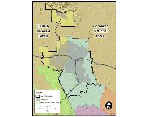
One project sponsored by the collaborative in the Selway and Middle Fork of the Clearwater River watersheds has attracted $16 million of federal and matching funding, created and maintained more than 650 direct and indirect jobs and generated $19 million in payroll. It has led to the treatment of 61,000 acres of forest and the harvest of 40 million board feet.

It wasn’t long ago when zero timber was sold on the Clearwater and Nez Perce Forests. This year, 60 million board feet of timber, enough to build 6,000 homes, will be sold from the forest. Even conservationists believe that 100 million board feet can be cut from the roaded areas as a part of a restoration program.

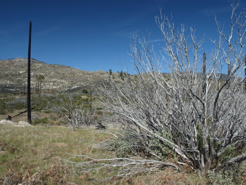
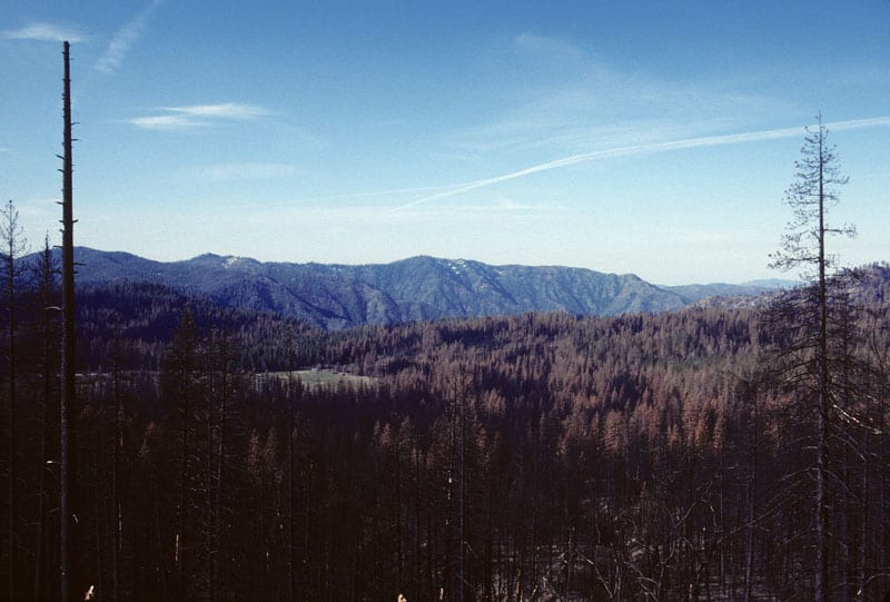
That seems pretty good – except when compared to the past. The Clearwater Forest alone cut more than twice that annually in the 1980s. For residents of towns such as Orofino and Kooskia, it’s hard to accept that won’t happen again, especially as they watch fires burn large swaths of the backcountry.

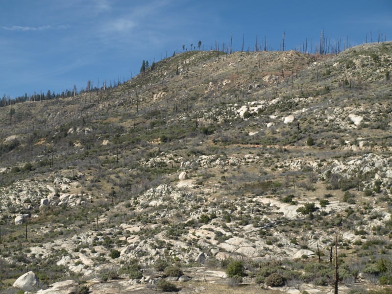
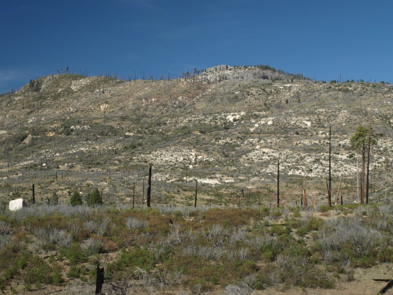
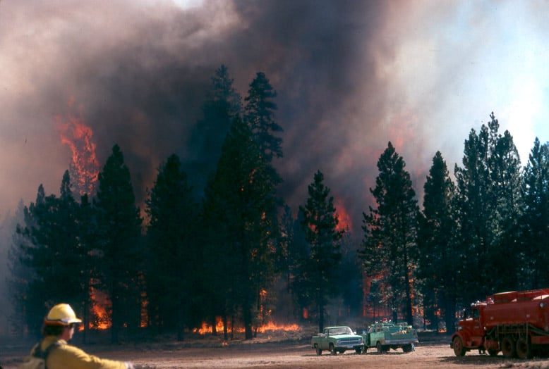
The collaborative is possible because the parties aren’t fighting over timber harvest in roadless lands. Fire is the agent of change on the backcountry, but would be intolerable in much of the front country.

For conservationists, the five-year project has meant removal of 66 miles of sediment-bleeding roads and rehabilitation of 63 miles of streams. The project has improved 16,000 acres of wildlife habitat.

WORKING MODEL

The success of the collaboration has given the Forest Service a new strategy for success. Today collaboratives are working in Montana and Oregon, among other places. The Forest Service has shortened the time it takes to complete environmental reviews. In Region 1, which includes Idaho, the agency has won 18 of the 22 lawsuits that other environmental groups have filed in recent years to stop the logging.

All of this success means the collaborative will continue, regardless of whether its diverse members can put together a wilderness bill. But all sides – conservationists, local officials and timber companies – want more.

Crapo’s defining achievement is the Owyhee Public Land Management Act, a locally written compromise between ranchers, county officials and environmentalists that created six new Idaho wilderness areas in the South Idaho desert.

Without a comprehensive bill like Crapo’s, the commitment and funding necessary for the full-scale restoration that both sides want for the Clearwater is unlikely.

Local officials such as Idaho County Commissioner Skip Brandt are pushing reforms to the Forest Service’s environmental-review process that will reduce the costs and barriers to the projects so they can generate more money for the region.

His goal is a “robust timber sale program that is consistent and sustainable.”

BRANCHING OUT

The devils are in the details, but these efforts come as similar reforms are being studied nationwide. Whatever happens, it will take buy-in from groups such as the Wilderness Society, Trout Unlimited and the Nature Conservancy to get them through Congress and signed by the president. Brandt’s panel of local officials and timber companies presented their ideas last week to the entire collaborative group, and they are all still talking.

For the Wilderness Society and others, there won’t be a bill without wilderness. They point to the jobs they have helped create as proof they have earned the trust of the collaborative. They want it to get behind designating wildernesss in the Great Burn near the Montana border north of Lolo Pass and other areas.

In the past, Brandt, who has expressed support for state takeover of federal lands, has been unwilling to say he could support wilderness as a part of the package. But last week he told me he’d changed his thinking.

“We have agreed to say yes to their wilderness and wild and scenic rivers if they agree to substantial changes to the Forest Service process,” Brandt said.

That shows the progress this collaborative has made.

Hermosa Creek- Model Place-Based Legislation?

This is from the Denver Post editorial board:

There is no small amount of satisfaction to be had in last month’s federal approval of a locally crafted protection measure for the lovely area of Southwest Colorado known as Hermosa Creek.

We feel the need to pinch ourselves in disbelief that Congress could have found a way to approve something so constructive, with bipartisan support.

The best part about the Hermosa Creek protection act was that it was the product of robust local participation and debate.

Mountain bikers, conservationists, anglers, business owners, grazing permit holders and others hashed out a detailed plan that required some compromise, but was predicated on common goals.

Bravo.

The plan was like a custom-tailored suit that should serve as a template for other communities around the nation looking to preserve and protect special areas.

It was heartening from a national standpoint as well. In recent years, Congress has gotten so polarized that it has had difficulty coming to agreement on any land protection bills. Just about the only way to address such matters was to look to the president to use his powers under the Antiquities Act to declare national monuments.

And as beneficial as that process can be, a consensus-driven effort with local support is far better.

That’s what Colorado got with the Hermosa measure, which protects more than 100,000 acres of the creek’s watershed in the San Juan National Forest, just north of Durango.

The bill designates more than 70,000 acres as a special management area, which maintains historic uses such as mountain biking and grazing.

Another 38,000 acres will be set aside as wilderness and managed in accordance with the Wilderness Act of 1964. Hunting and fishing are allowed, but roads and mineral development are not.

The attention to detail that went into this plan, its respect for various uses and the ability to compromise displayed by those who crafted the measure are admirable and should be emulated.

Maybe someone could investigate how the bill handles NEPA for grazing?

4FRI Update.. Compost

Thanks to Craig Rawlings of the Forest Business Network..here’s the link.

The Oman-based Good Earth this week announced a partnership with Flagstaff-based Roots Composting to combine household waste from Williams with mountains of sawdust and wood chips from thinning projects to produce rich, organic soil suitable for gardens and farmland throughout the region.

The partnership to produce rich, organic, bagged topsoil could provide a way to get the thinning effort jump-started, given the huge quantities of brush and small trees that dominate the approved thinning projects in the Flagstaff area ready to cut.

The more comprehensive effort that includes larger trees and other products will mostly await construction of new mills in Williams and elsewhere capable of producing biofuel, furniture, oriented strandboard and other products from the small trees that pose a huge fire danger to the whole region.

Roots Composting Chief Executive Officer Kevin Ordean said, “We want to change the way that people think about waste and we want to produce as much high-quality soil as we possibly can for a region that needs it desperately.”

Good Earth Power Spoils Division Director Martin Gillard said, “This partnership will redefine the role that biomass plays in assuring forest health and in improving environmental quality throughout the region.”

The soils project would end up reducing the emission of planet-warming, greenhouse gases, added Gillard.

Currently, many organic household wastes go to landfills, where they decompose and produce large amounts of methane. This gas traps heat in the atmosphere 21 times more efficiently than carbon dioxide.

However, the soil-making operation will combine biomass from thinning projects with the household waste, add oxygen and therefore greatly reduce the production of methane as the material decomposes. The mix will essentially ferment for three to four months before workers bag it at the Williams facility.

“We are hoping to have products ready for the spring markets,” said Gillard.

Good Earth Chief Executive Officer Jason Rosamond said, “Using the outputs of forest restoration to benefit soil and air quality provide alternative energy sources and create sustainable economic growth.”

The announcement comes on the heels of a previous Good Earth press release announcing plans to build a mill in Williams that can handle the small trees that not only fuel intense, ground-sterilizing wildfires, but provide a fuel ladder for fires to climb up into the tops of the remaining old-growth trees.

4FRI DEIS Released!

4friHere’re the FS documents, below is a press release from
4FRI.

The 4FRI Stakeholder Group is in the process of reviewing this draft decision. We have worked closely with the U.S. Forest Service in this planning effort, which began in 2012. It is the largest Environmental Impact Statement for forest restoration in the country,” stated Diane Vosick, current co-chair of the 4FRI stakeholder group and Director of Policy and Partnerships for the Ecological Restoration Institute at Northern Arizona University, adding “while we are currently undergoing review of the decision details, we are unified in our support of restoring our northern Arizona National Forests.”

“This plan will help guarantee a supply of wood for the businesses who are investing in wood manufacturing, as well as create much-needed jobs,” said Steve Gatewood, the other co-chair of the stakeholder group and a longstanding member of the Greater Flagstaff Forest Partnership. “It is the first of at least two large plans that will eventually encompass 2.4 million acres of northern Arizona forests.”

The 4FRI landscape has been broken into two planning areas: this first plan encompasses much of the Coconino and South Kaibab forests (nearly one million acres), and the second plan, currently in the pre-planning stages, will incorporate 1.4 million acres of eastern Arizona pine forests on the Apache-Sitgreaves and the Tonto.

This draft decision summarizes the types of treatments that are intended to restore forests to a condition that protects communities and watersheds from unnatural catastrophic fire events; improve forest health; enhance wildlife habitat; and restore the beneficial role of managed and natural low-intensity ground fires. For more information on 4FRI, please visit www.4fri.org.

Throwback Thursday, Yosemite-style

I’ve found my hoard of old A-Rock Fire photos, from 1990! I will be preparing a bigger repeat photography article, after I finish selecting and scanning. Like several other fires this summer, the A-Rock Fire started in the Merced River canyon, burning northward. I really believe that this is the model of what will happen to the Rim Fire, if we do nothing to reduce those dead and dying fuels. Active management opponents never want to talk about the devastation of re-burns, as an aspect of their “natural and beneficial” wildfires. Most of those snags have “vaporized” since this 1989 wildfire. Indeed, this example should be considered when deciding post-fire treatments for both the Rim Fire and the King Fire, too.

It should be relatively easy to find this spot, to do some repeat photography, along the Big Oak Flat Road.

Above-Foresta-web

Urgent Action Needed to Save Sierra Forests

This viewpoint shows more of the reasons why the desire to have larger and more intense wildfires, in the Sierra Nevada, is the wrong way to go.

In this picture below, fire crews were run out of this stand, and back into the “safety zone”, on this fire I worked on, back in 1988.

campbell_fire1-web


http://www.sacbee.com/2014/09/28/6737076/viewpoints-urgent-action-needed.html

Air quality the past two weeks has been several times worse than some of the most polluted cities in the world due to smoke from the King fire. Last year’s Rim fire emitted greenhouse gases equivalent to 2.3 million vehicles for a year.

Also, the lost habitat and recreational opportunities from major fires like these are significant. It is not an exaggeration to say that virtually all Californians are affected when these “megafires” occur.

The report points out that wildfires are getting larger and burning at higher intensity than ever before. The Rim fire burned at nearly 40 percent high intensity – meaning virtually no living vegetation is left – covering almost 100,000 acres. More acres have burned in the first 4½ years of this decade than in seven decades of the last century.

What can we do about it?

The main bottleneck in treating more acres is in implementation. The Forest Service is unwilling to increase the size of its Region 5 timber management staffs. They use some of the usual excuses, some of which are beyond their control but, not all of those issues are really significant, looking at the big picture. Yes, it is pretty difficult to implement extremely-complex plans when you are constantly training new temporary employees, hired right off the street.