For a forester, every day is Earth Day!
The Smokey Wire : National Forest News and Views
Community Sourced, Shared and Supported
I ran across this excellent article from Eric Holst, Senior Director of the Environmental Defense Fund’s “working lands program”.
Here’s the link: https://www.edf.org/blog/2014/02/18/after-rim-fire-surprising-role-salvage-logging
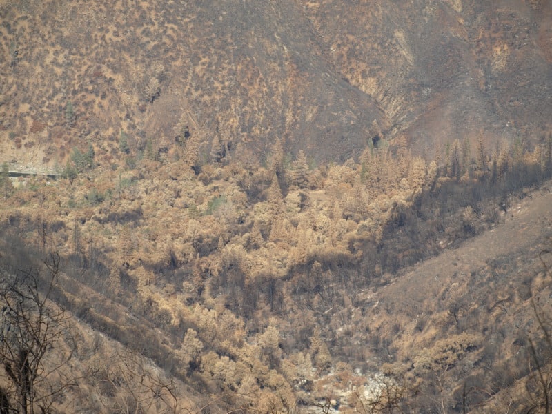
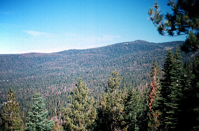
This picture is a view looking down into the Tuolumne River Canyon, from the “Rim of the World” overlook. Down there is where the fire started. I’d bet the spin on this wildfire would be VERY different if it was ignited by lightning.
Holst is showing some excellent judgement in looking at the bigger picture of the realities of the Rim Fire, seeing that “letting nature take its course” isn’t the way to go on every burned acre.
The Forest Service recently proposed to conduct salvage logging – removal of dead trees – on about 30,000 of the 98,049 acres of high intensity burned area and remove hazard trees along 148 miles of high use road in the burn perimeter. While it may seem counterintuitive for a conservationist to do so, I support this effort. In the high intensity areas, the Rim Fire burned so hot that it not only killed every tree but the top inch or two of soil with critical soil microfauna, and seed stocks were also sterilized. Fire of this intensity has been relatively rare in the moist middle elevations on western slopes of the Sierra Nevada and the native forests are not adapted to bounce back from this type of fire.
There are also some “interesting” comments, and a hint of “eco-bickering”. In those comments is also a return of the “Chapparalian”, using his actual name (instead of one of his many pseudonyms and even fake names). There are also some other interesting names commenting about these issues. John Buckley, a local leader of an environmental group comments with an open mind and a dose of reality. Others continue to spout the misguided idea that leaving the Rim Fire alone is the only way to go. Some commenters talked about the reality that we have plenty of BBW habitat, protected within the National Park. One reality not covered is that re-burns cause extensive damage that is very difficult to recover from, especially in areas left to “recover on their own”.
I still see that post-fire management is essential to getting big trees back on the land. We already have site-specific evidence that forests didn’t return when post-fire management was excluded, 40 years ago. We ended up with old growth brushfields, and a few stunted trees. Those old brushfields burned at moderate intensity. We have a big variety of landscapes, with differing burn intensities and site-specific conditions. This partial comment is spot-on, regarding these facts
It is interesting to see how many comments Eric’s post attracted from authors who are vehement that absolutely nothing except ‘let nature takes its course’ on National Forest lands. Since we have 100,000 acres of National Park land for that experiment, it would be more interesting to apply some other options on the National Forest lands. In the climate change debate, we continue to witness the rapid expansion of vocal people so sure of their own story that they refuse to even consider the possibility that it is worth learning more about the changing earth. Hopefully, this fate will not befall the response to the Rim Fire.
It seems pretty clear to me that a few open-minded people from both sides are seeing the realities of the Rim Fire, and its future.
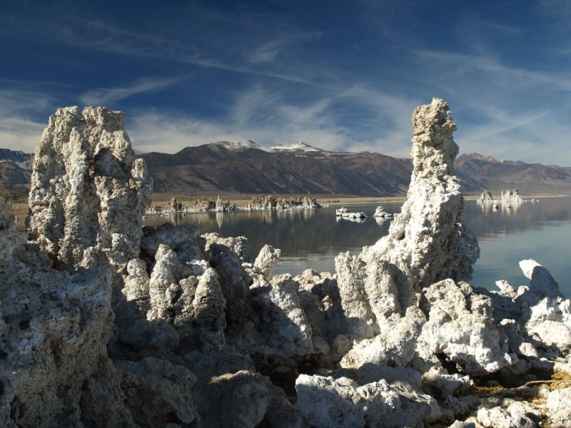
I recently took a trip with my brother, as he wanted to try out my old digital camera. There is an abundance of “protected areas” here (including Wild Willies Hot Springs), and timber projects have been gone for about 20 years, now. Below is the Mono Lake Tufa Preserve, a fee-area which accepts the Park Service passes. There is a nice boardwalk down to the lake shore, paved parking and bathrooms.
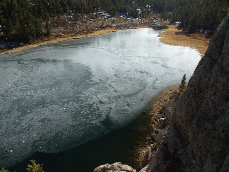
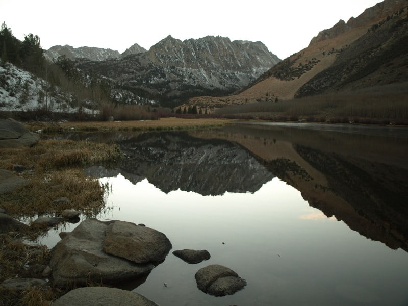
Turning off Highway 395, at Tom’s Place, there is easy access to the John Muir Wilderness. We took a short hike and found this really nice overlook to one of the many lakes close to the trailhead. Despite the lack of snow, there is no lack of cold, making persistent ice on the lake. This watershed extends up to 13,700 feet.
I have visited North Lake, before, back in the mid-80’s, during a three-day ski mountaineering trip. This road has easy access to Paiute Pass and the nearly-14,000 foot Mount Humpreys, west of Bishop. This road has three forks, each of which provide access to the Sierra Crest (and hydro locations).
More of my adventure, including Yosemite National Park, at www.facebook.com/LarryHarrellFotoware
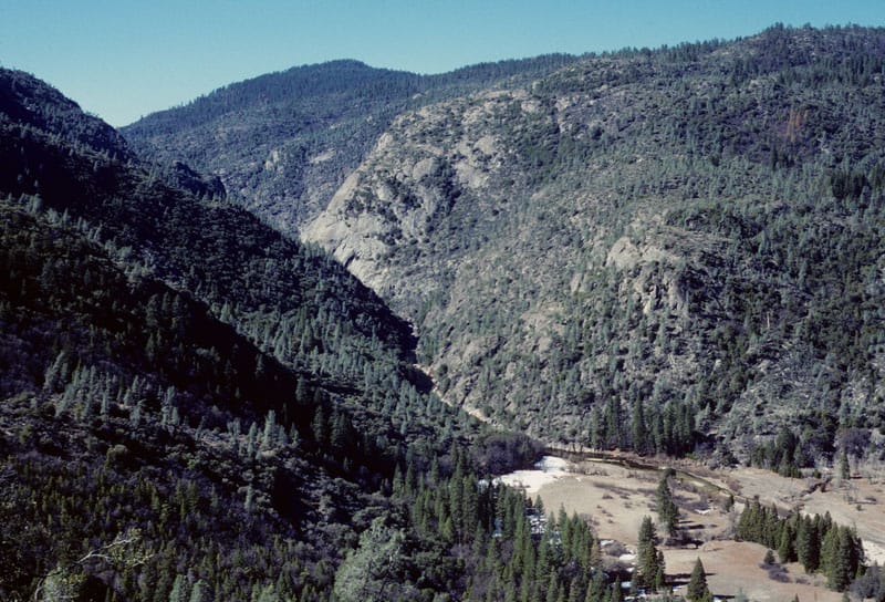
I’ve been digging through my old Kodachrome slides, and I found this view of the Tuolumne River and Poopenaut Valley, within Yosemite National Park. This area burned in the Rim Fire, and it is representative of what lies below, in the Stanislaus National Forest. Of course, little of this would even be worth salvaging, even it is wasn’t in the National Park. You might notice the abundance of digger pines, even on the north-facing slopes. This is the beginning of an impressive canyon, and it becomes a Wild and Scenic River, when you reach the Park boundary. Of course, very little fuels work could have been done, within this awesome canyon. However, fuelbreaks could have been installed all along the edge of this canyon, knowing that there would eventually be an ignition, within the canyon. Lightning fires happen all the time in this portion of the Sierra Nevada. I really want to get in here and re-visit these spots, for some repeat photography.
While I am waiting for a delivery, so I can complete the pieces of art for an upcoming show, I dug up this old picture of a dogwood tree, in South Carolina. Indeed, some parts of the South seem like jungle, especially when you include the kudzu and greenbriar. I was on assignment, back in 2003, to inspect forest inventory plots (in advance of thinning projects) on the Sumter National Forest. I also did plots, myself, when all inspections were completed. I made a species list, and it included 40 different harwdood species, including 20 different oaks, and only 3 conifers.

I had to dredge up all that 25 year old Dendrology information on trees I had never seen before. Luckily, I didn’t have to split out some of those species, including hickories. It was a challenge I welcomed, and was schooled by a patient detailer who I clicked with, right away. Yes, they still use “metes and bounds”, down there. Being from the west coast, there was some culture shock but, “Southern Hospitality” definitely isn’t a myth! However, “Barbecue” is quite a different concept there, and good pizza and Mexican food is hard to find.
Well we’re discussing the same old things here for the most part, but one thing you would not have wanted to miss are these amazing photos on Bob Berwyn’s blog. His comment on Twitter reminded me..
This is a guest post by Travis Bushman.. thanks for being so generous with your (furloughed) time to share these with us!
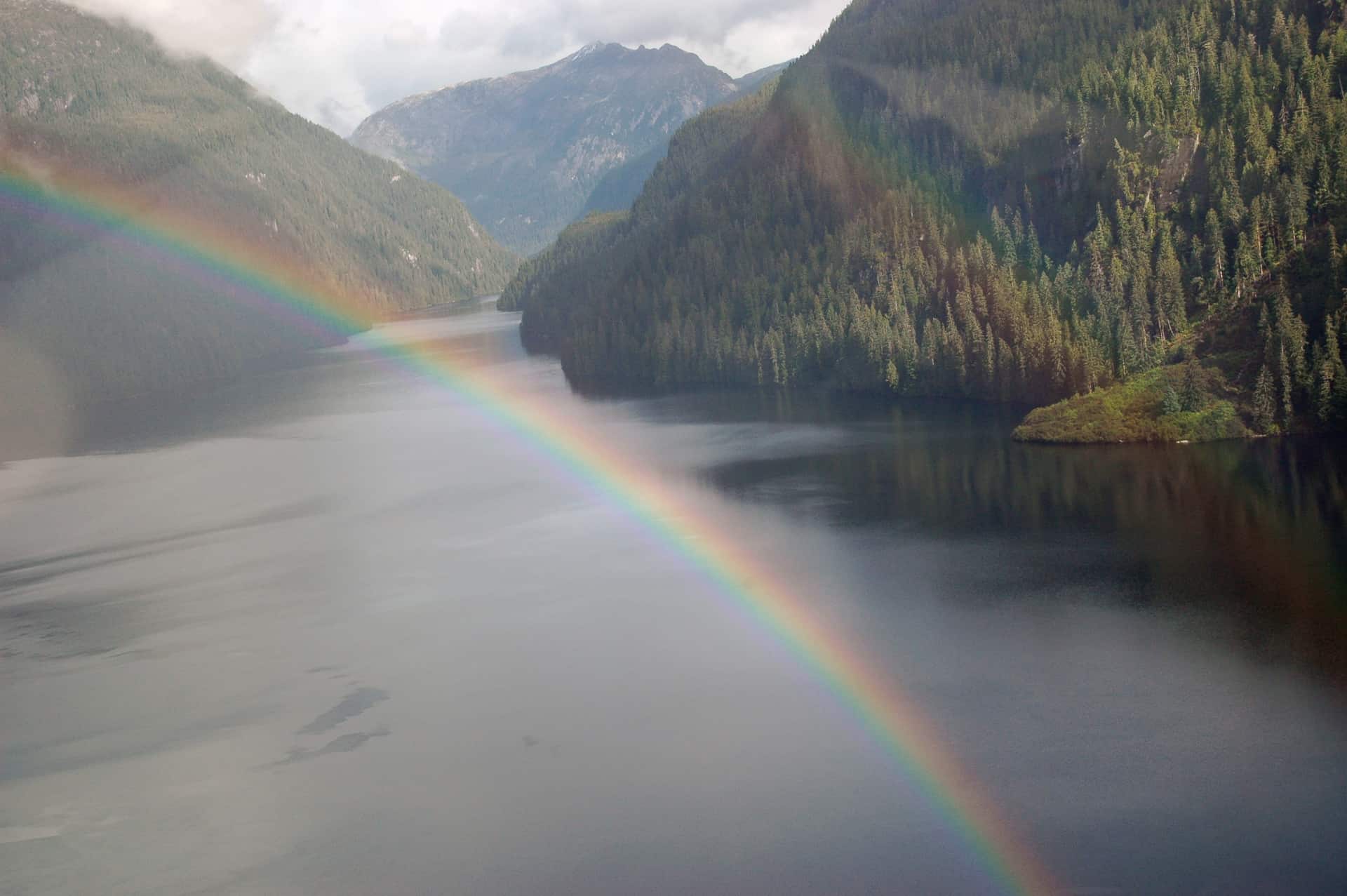
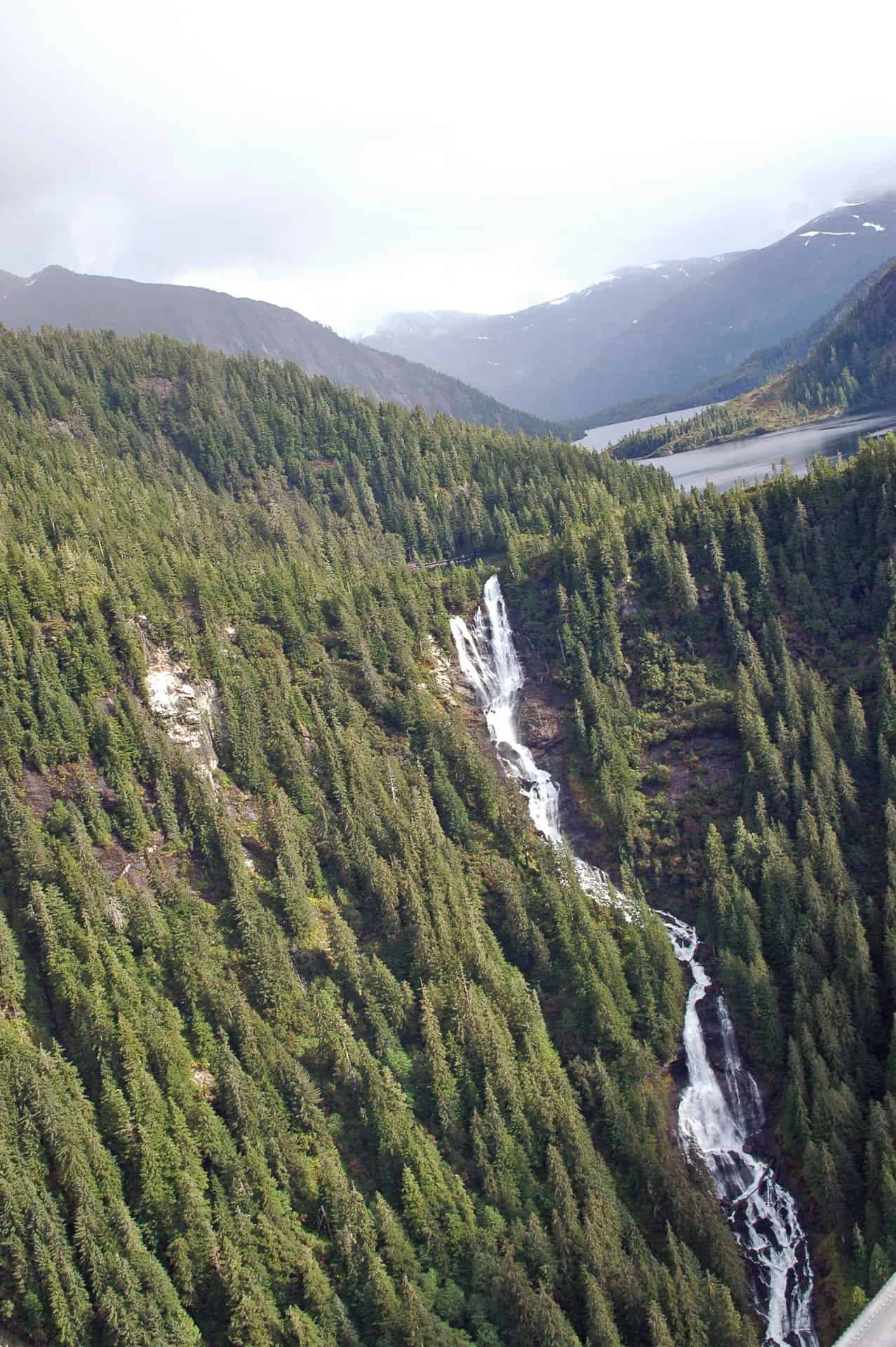
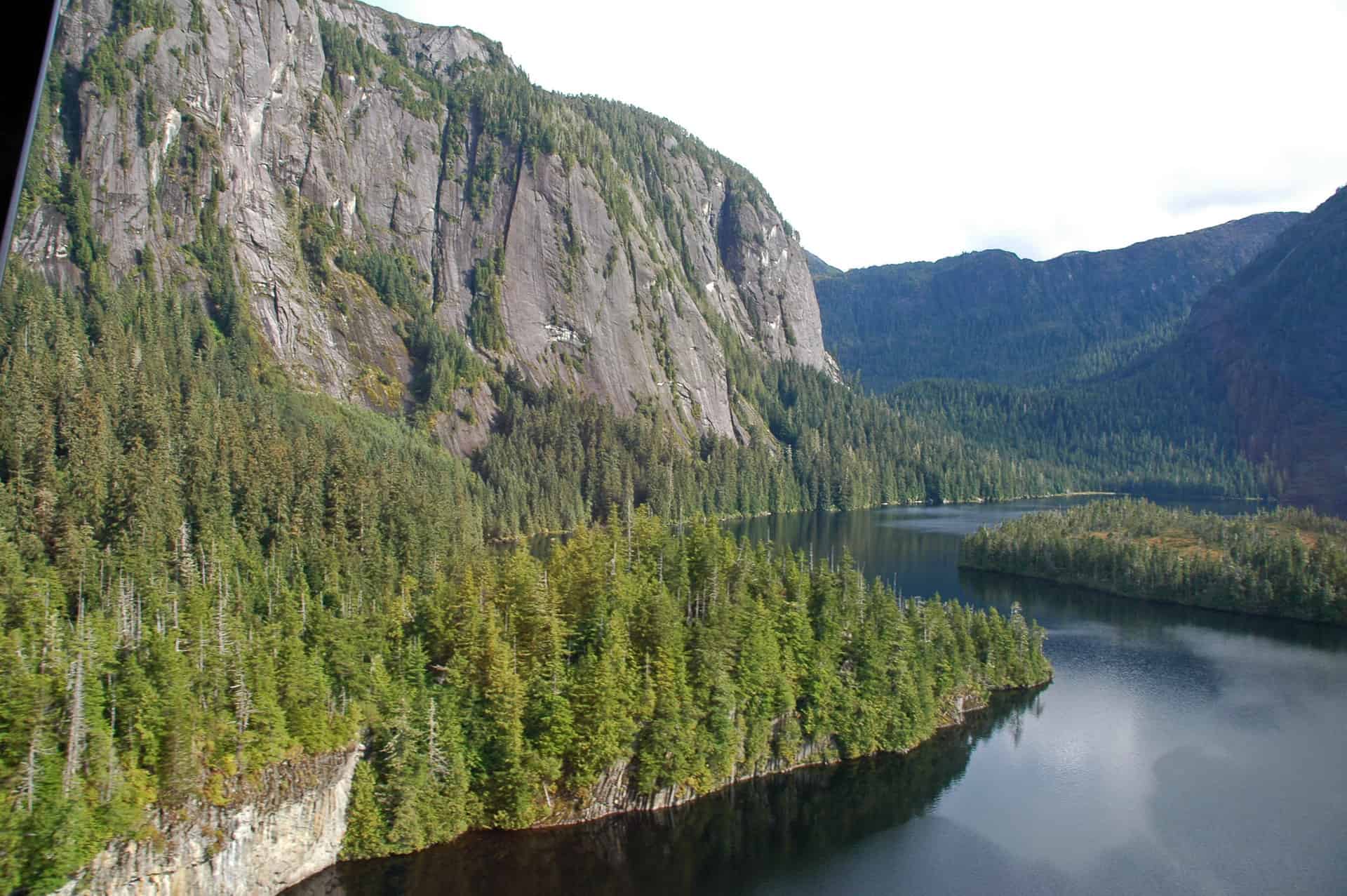
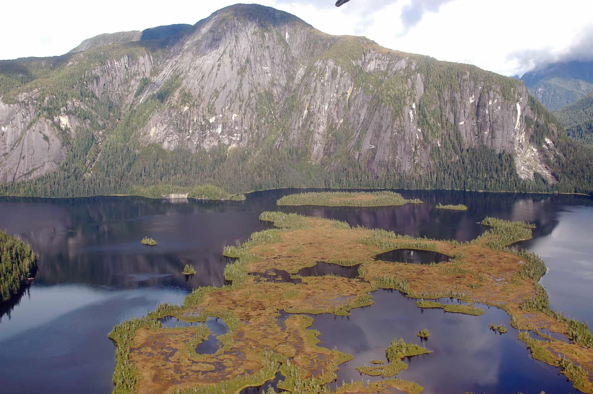
This is partially a meditation on the challenge of developed recreation on the Tongass, and partially an excuse to post some spectacular aerial photos of Misty Fiords.
The week before the furlough hit, I had a chance to get out of my third-floor office at the SO and get into the field — both to provide an extra pair of hands to the Ketchikan district recreation staff and to gain an understanding of the challenge they face in maintaining the Tongass’ developed recreation infrastructure.
Our day’s work plan involved making end-of-season visits to a number of recreation cabins in Misty Fiords National Monument. We’d be cleaning out garbage, hauling skiffs out of the lakes, inspecting facility conditions and documenting any urgent maintenance problems that would need attention before the winter hits. On any other district of any other national forest, this would likely involve two people getting a pickup truck out of the motor pool and spending the day driving around forest roads.
Not on the Tongass.
Rather, the three of us drove down to the docks and boarded a contract DHC-2 Beaver floatplane, which proceeded to hopscotch across the 2.3-million-acre monument, setting us down at eight lakeside rental cabins in breathtaking, almost-inaccessible settings. There is no way into any of these cabins except by floatplane or helicopter. Many of them are in designated wilderness and must be maintained without power tools. Cabin maintenance crews even split logs with a maul and wedge to provide fuel for those cabins which have wood stoves.
We returned after a full day in the monument with 13 full garbage bags, 11 empty propane cylinders and a couple broken fishing poles all loaded in the floats — and I brought back a new appreciation for the hard work of the cabin crews, whose numbers continue to dwindle.
That, and it hit home just how much it costs to do anything in Misty Fiords. This one trip to eight cabins — out of the ~150 the forest operates — cost about $3,000 just for the flight. Or, put in another way, we expended 125 nights of rental fees from a single cabin. That’s the cost of doing business in the 17-million-acre maze of islands and fjords that is the Tongass, and it’s an increasing challenge in an era of declining budgets.
I took this shot while flying with a Forest Service buddy in 1989.
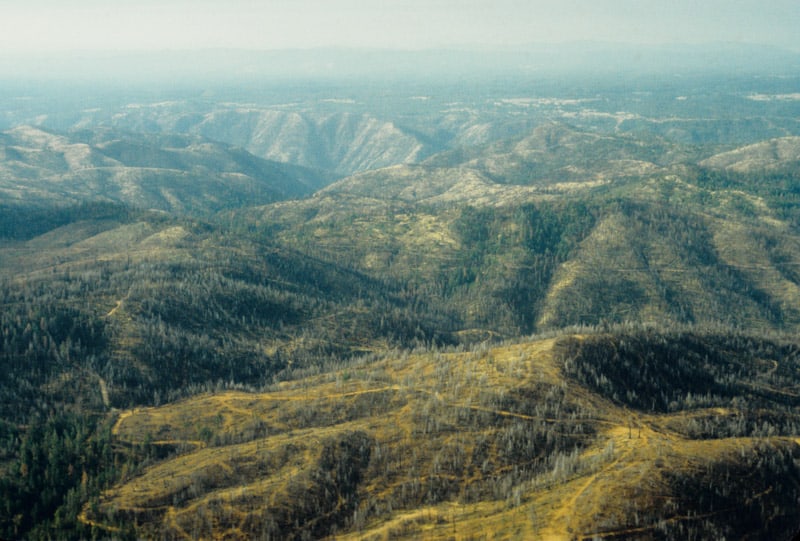
I am pretty sure that this is Forest Service land, near the Groveland Ranger District office. When I worked there in 1990, the Timber Management Officer was still angry at the less-than-aggressive post-fire salvage efforts that allowed so many “brain dead” trees to die and add to the fuel loading. I’m sure that all those dead trees had some green needles on them as salvage logging was proceeding. As you can clearly see in the photo, there are PLENTY of snags left in this HUGE wildfire zone. This isn’t even where the fire burned hot. The subsequent bark beetle bloom spread northward, chewing up forests more than 100 miles away. On the Eldorado, our Ranger District harvested 300 million board feet, between 1989 and 1992, of dead and dying timber from the severe bark beetle infestation. We were lucky, able to slide our EIS into place before the litigators could gather their case together. The Tahoe National Forest was too slow, and lost 2 years worth of salvage logging opportunities, turning merchantable dead trees into future wildfire fuels.
The Lake Tahoe Basin Management Unit was also hard hit, and slow to react. Here is a 1990 view of the north end of the Lake Tahoe Basin. My first two summers in the Forest Service were spent at the top of that mountain as the Martis Peak fire lookout. Of course, there are a LOT more dying trees up there than just the brown trees. So many of those trees became unmerchantable before they could be salvaged, as the public and eco-groups hoped that “nature” would take care of the problem. Since fire suppression in the Tahoe Basin is ensured, most of those dead trees are now horizontal, and perfectly preserved as fuels for the next big, destructive, erosion-causing, lake-polluting disaster.
Derek tipped me off about the new BAER fire severity maps, yesterday, and I was happy to see that the efforts to thin plantations has resulted in lower fire intensities. Here is the link to both high and low resolution maps. It is not surprising that fire intensities outside of this thinning project I worked on were much higher, and I doubt that there was much survival in the unthinned plantations. Those plantations were the within the 1971 Granite Fire, and is yet another example of forest re-burn. This part of the fire has terrain that is relatively gentle, compared to the rest of the burned areas. To me, it is pretty clear that fuels modifications reduced fire intensities.
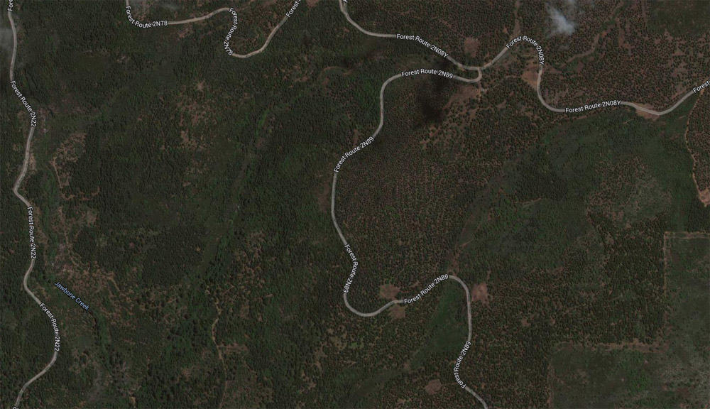
This photo below shows a boundary between burn intensities. The area east of road 2N89 was thinned and burned much cooler than the untreated areas to the west. The areas in between the plantations had moderate to high burn intensities, due to the thick manzanita and whitethorn. Those areas were left to “recover on their own”. The SPI lands did not fare as well, as they didn’t thin their plantations.
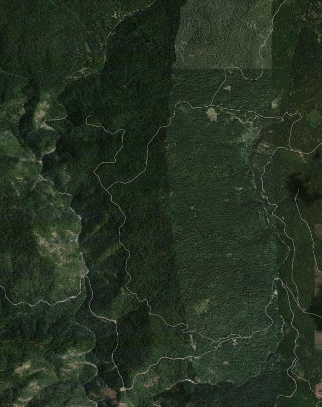
The highest burn intensities occurred in the old growth, near the Clavey River. Activists have long-cherished the areas around this river, and I am assuming that these were protected as spotted owl/goshawk PACs. As you can see, this area has very thick old growth, and it shows on the map as high intensity. This same scenario is one that Wildlife Biologists have been worrying about for many years, now. These wildlife areas have huge fuel-loading issues and choked understories. Prescribed fires cannot be safely accomplished in such areas, without some sort of fuels modifications. Last year, I worked in one unit (within an owl PAC) on the Eldorado where we were cutting trees between 10″ and 15″ dbh, so that it could be safely burned, within prescription.
Nearly all of the Groveland Ranger District’s old growth is now gone, due to wildfires in the last 50 years. What could we have done differently, in the last 20 years?
While browsing for historical fire maps, I ran across this interesting study of Yosemite wildfire issues. I scanned some of the study and felt it would be useful information.
I didn’t know that there are fewer individual and less severe wildfires in the early season, due to snowpack’s effect on thunderstorm development. The Forest Service land, where I took this 1990 picture of the A-Rock Fire, has burned 13 times in the last 100 years. Why did this particular wildfire kill so much old growth, when previous uncontrolled fires did not?

You can also see the fire’s “twin”, across the canyon. It also has suffered a re-burn, although it was the Park Service who let a fire get out of hand, on that incident too. The A-Rock re-burned when a prescribed fire was lit, and lost, within an hour of ignition. The Meadow Fire burned for weeks, costing $17 million, closing the Park during the height of tourist season. The Forest Service portion of the A-Rock Fire hasn’t re-burned, yet.