After the Caldor Fire seriously impacted the ski area, Sierra At Tahoe is open again. As you can see, it was a high intensity portion of the fire, with the previous forest being highly flammable and loaded with decades of heavy dead fuels. After several droughts, the area did not have any salvage operations. The area is also known to have nesting pairs of goshawks around.
As you can see, snow sports people will be enjoying a new experience of skiing and boarding, without so many trees ‘hindering their personal snow freedoms’. *smirk*
We haven’t posted much about recreation lately, and always welcome news and opinion from those with a recreation interest.
The Forest Service Retirees organization, (NAFSR) has a Recreation Committee and they organized a panel presentation at the Lake Tahoe Retirees’ Reunion.
Powerpoints are posted here. Particularly of interest is that there is a new effort called “Reimagining Recreation” within the Forest Service. My understanding (which could be wrong) is that they are working on it, and it will be developed with stakeholders via some sort of public process.
Taking a step back, I was not a fan of Sustainable Recreation. It had an aura (granted, my opinion only) of “we’ll never have enough money, so we need to figure out what to shut down” with an undertone of “it would be better for the environment if people just stayed home anyway.” The energy seemed kind of negative from where I sat. It’s ironic that due to the winds of Fate, just when you think you know what’s going to happen, (no money forever) huge infusions come along. It must be an enormous cultural/philosophical shift for current employees.
So I am enthused about this new process. Anyone who knows more about it, please post in the comments.
Here are a few slides from the Reimagining Recreation powerpoint but the whole deck of slides are here.
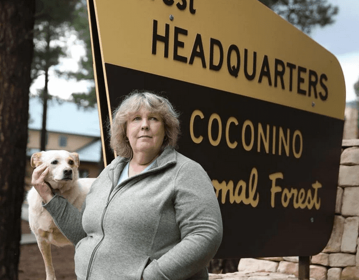
Laura Jo West stands outside the Coconino National Forest headquarters, where she served as forest supervisor for more than seven years. Jake Bacon, Arizona Daily Sun
Many thanks to an Anonymous for sending this piece in! So many interesting facets.
Tribes, political issues, ski areas, how politically hot topics are managed internally by the Forest Service, the difficulty of developing collaborative relationships with shifting people, how the line officer is uniquely responsible relative to others on the forest, due to the line/staff structure. Questions.. would we feel differently were environmental interests pushing someone out of their responsibilities rather than a for-profit permittee? Would we feel the same way about, say, a rare-earth mining operation or a wind energy facility exerting political power? What does consultation actually mean if it doesn’t mean “we can’t go ahead without your sign-off”? If the same decision had been made during the last Admin, would the coverage have been different? The Forest Service is in the Executive Branch, so clearly elected officials get to decide ultimately. Which can be extremely frustrating for employees who have sunk their hearts, souls and extra hours into a project or a relationship.
Because the article is so long, and interesting, and with no paywall, I’ll only post one excerpt. Check it out for yourself. And thanks again, Anonymous!
“The new agreement
Presented with the chance to create consensus and collaboration around a sacred site that had long been the “epicenter” of controversy, West had no illusions about the difficulty of the work ahead.
“It was going to be messy, it was going to be hard, we were probably going to have fights in various places along the way,” she said. “It was going to be a challenge. But I think it was the right challenge.”
For these reasons, West wasn’t willing to unilaterally promise a timeline for approving the new MOA. As recommended by federal directives, she went in with an “open mind” and wanted to develop a timeline through the consultation process.
“I wasn’t promising anyone, including the tribes, an outcome because I didn’t know what was going to develop,” she said. “It was a completely wide open, kind of scary place. But I thought, ‘That’s OK, we’re going to travel it together.’”
From Jocks’ perspective, West “saw an opening and took it.” Her efforts seemed “sincere” when he met with her about a new MOA.
“She wanted to do the right thing,” he said. “She understood there were limitations, but wanted to do what she could.”
But West’s approach of elevating tribal consultation soon caught the attention of Mountain Capital Partners (MCP), which owns Snowbowl. She said her refusal to offer a definite timeline was unacceptable to MCP and Snowbowl executives.
“I told them it could take at least a year and a half, maybe even two, to get a new MOA down because we’re opening up a conversation with tribes,” she said. “They said, ‘No, it only takes three months.’”
Snowbowl put forth the MOA timeline built around “minimum legal requirements,” but this did not satisfy West.
“We have the discretion to do so much better than that,” she said.
What happened next was somewhat expected, West said: Snowbowl complained. In January and February this year, MCP, the largest ski area collective in the Southwest, scheduled meetings with Forest Service Chief Randy Moore. In a Feb. 17 phone call with West’s superior, quoted in a grievance letter provided to the Arizona Daily Sun by West, regional forester Michiko Martin informed West that MCP stated it did not “believe [West is] a neutral and trusted agent. They believe that you are orchestrating a master plan to upend them.”
West was accused of being “pro-tribe” and “biased toward tribes” and otherwise “deliberately stalling to prevent MCP from implementing approved projects.”
“I asked regional forester Martin if MCP provided any evidence for their allegations,” West wrote in her grievance letter. “She replied they had not.”
While West expected that Snowbowl would complain, she did not expect how these complaints would be received by the Forest Service. On March 17, right after the conclusion of the meetings between MCP and Moore, West received a letter from Martin informing her that her authority to address the expiration of the Snowbowl MOA was rescinded “effective immediately,” and re-delegated to Steve Hattenbach, supervisor of the Cibola National Forest in New Mexico.
West said she was shocked that in one fell swoop, the Forest Service chose to accommodate MCP rather than defer to her judgment, despite the fact that she was a devoted employee and agency leader with 33 years of experience.
When asked to estimate the reason behind this decision, West speculated that it could have something to do with the influence of the National Ski Area Association (NSAA), whose board overlaps with MCP leadership.
“I was told by my boss that [the NSAA] lobby on behalf of the Forest Service for additional funding for recreation, infrastructure and things like that,” West said. “It was made clear to me in a conversation I had with my boss that it was a relationship the agency wanted to protect.””
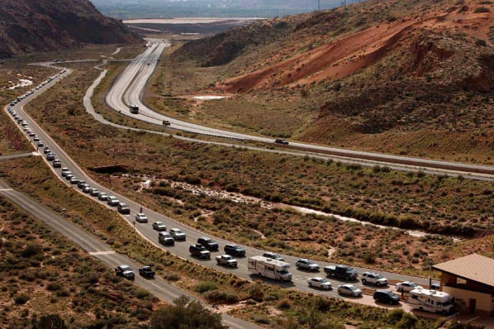
Lineup to get into Arches -Salt Lake City Tribune photo
Super article by Kyle Dunphey of the Deseret News. A bipartisan bill (cosponsors Manchin and Barasso) from an easterner and a westerner. The story has links to the bill summary, who’s for and who’s “agin”, and the below summary of ten key takeaways from the 155-page bill.
So National Parks count as “protected” areas under 30 x 30. But NPS employees and the National Parks Conservation Association are worried about too many people causing environmental degradation. The logical thing is to think.. maybe they shouldn’t count at some point, then, or some places within a larger park shouldn’t count as “protected”. Perhaps Parks should become certified to a “protected from humans certification” like the recreation equivalent of FSC or SFI before they can count toward “protection” goals, with third party verification? Anyway, here’s the story.
More parking
“Lot Full” signs are in high demand at Arches National Park, where increasing visitation has resulted in frequent park closures and popular trailheads overflowing with tourists.
One of the provisions in the bill is to increase parking, mainly for land managed by the Forest Service and Department of the Interior.
But due to a deferred maintenance backlog, which refers to projects that have been postponed due to budget constraints, the bill allows agencies to partner with the private sector “and lease non-federal land for parking opportunities.”
Parking is a hot debate, at least for National Park advocates, who worry that more parking will lead to more visitors that could result in more environmental degradation, search and rescue calls, wildfire risk and traffic.
“We could totally build a five-story parking garage but do you want to add that many people to the trail? What would that do to the experience while you’re hiking if you’re shoulder to shoulder and you’re waiting hours to get a picture under the arch,” ranger Melissa Hulls, visitor and resource protection supervisor at Arches, told the Deseret News in September.
Target shooting
The Forest Service and the Bureau of Land Management will be required to maintain at least one designated shooting range for each district under the bill. The ranges will not require a fee.
The bill piggybacks on former Interior Secretary Ryan Zinke’s wish to see more shooting ranges in national monuments. But some environmental groups warn that more target shooting could lead to increased wildfire risk and vandalism.
‘Long distance’ biking
Under the bill, federal land management agencies — specifically the National Park Service, the U.S. Fish and Wildlife Service, the Bureau of Land Management, the Bureau of Reclamation and the Forest Service — need to identify at least 10 long distance bike trails, defined as a system with at least 80 miles on federal land.
Agencies will also need to identify 10 additional areas for trail development. For existing trails, the agencies need to “publish and distribute maps, install signage, and issue promotional materials.”
Broadband infrastructure
In a push to expand internet access on public land and rural communities, the BLM and Forest Service would be directed to identify “high priority” recreation sites that lack broadband.
The agencies would then estimate the cost to develop broadband infrastructure, and if necessary, partner with the Rural Utilities Service under the Department of Agriculture.
The National Parks and Conservation Association, however, says the provision raises concerns, and agencies need to first understand “the extensive use of and impacts to natural and cultural resources to build and maintain broadband at recreation sites within the National Park system.”
Defining ‘peak season’
Moab locals can confirm — the busy season is growing, inching into traditionally slow parts of the year.
In an effort to “better understand visitor trends” the Department of the Interior would be directed to examine the impact seasonal closures have on local tax revenue, while looking for opportunities to extend the time certain public lands are open.
“This section directs the agencies to make efforts to minimize seasonal closures on lands where such closures prevent recreational activities that provide economic benefits,” the bill reads.
Hotels and housing for gateway communities
Moab locals can also confirm that finding housing in the southern Utah gateway, whether as a renter or buyer, is a monumental task. Housing shortages in mountain towns and park-adjacent communities are driving locals out and resulting in labor shortages.
Under Manchin and Barrasso’s bill, the Department of the Interior will identify solutions to housing shortages, working with local governments, housing authorities, trade associations and nonprofits.
The bill also instructs the department to “provide financial and technical assistance to gateway communities to establish, operate, or expand infrastructure to accommodate visitation including hotels and restaurants.”
Climbing on Forest Service land
A brief provision in the bill says the Forest Service will “issue guidance” on climbing management in designated wilderness areas.
The bill is not entirely clear on what that “guidance” will be, but gives the agency 18 months to develop a plan that will consider the Wilderness Act of 1964 and the “appropriateness” of recreational climbing, placement and maintenance of fixed anchors and the use of other climbing equipment.
New digital tools
Several provisions in the bill seek to improve access to real-time data, permits and reservations. Consider this:
The National Parks and Federal Land Pass would be available in digital format.
Through a pilot program, the public could obtain real-time visitation data on federal land.
Land agencies would experiment with new, more intuitive, ways to tally visitor data.
Tourists who reserved visitation to public lands that require reservations or permits, could notify agencies of certain days they will not use — those days are then granted to guide companies and the unguided public.
Modernize campgrounds
Again turning to the public-private partnership model, the bill requires agencies to develop a pilot program to modernize campgrounds and buildings on Forest Service and BLM land.
Agreements with private companies would not last more than 30 years, and within three years of obtaining land use authorization, the company is required to spend at least $2 million on improvements.
Filming and photographing public lands
Buried at the end of the bill is a provision that would “modernize film and photography permitting on public lands to account for changing technology and social media.”
Production crews of less than eight people would not have to obtain a permit. Any filming or photography “that is merely incidental to an otherwise authorized or allowable activity” will not need a permit, either.
As always, readers are invited to link to their own organizations’ bill analysis.
Photo by Rick Hutton borrowed from our friends at TRCP.
In the spirit of “catching people doing something right” here’s the announcement: and a special shout out to Rep. Moore of Utah who spearheaded this bipartisan, and dare I say common-sensical and much-needed effort. Sometimes agencies need a little push to coordinate in a way that seems obvious to citizens.
“America is home to some of the most beautiful natural wonders in the world, and it is essential that we have up-to-date information on how to best access our public lands,” Rep. Moore said. “The MAPLand Act will digitize tens of thousands of records so fishers, hikers, hunters, bikers, and those who spend time enjoying our outdoors have all the information they need to have great experiences and make fond memories.”
If enacted, H.R. 3113 specifically would require the U.S. Department of the Interior, the U.S. Forest Service, and the U.S. Army Corps of Engineers to jointly develop and adopt interagency standards to ensure compatibility and interoperability among federal databases for the collection and dissemination of outdoor recreation data related to federal lands, according to the congressional record bill summary.
Under the bill, the entities must digitize and publish geographic information system mapping data that includes federal interests, including easements and rights-of-way, in private land; status information as to whether roads and trails are open or closed; the dates on which roads and trails are seasonally opened and closed; the types of vehicles that are allowed on each segment of roads and trails; the boundaries of areas where hunting or recreational shooting is regulated or closed; and the boundaries of any portion of a body of water that is closed to entry, is closed to watercraft, or has horsepower limitations for watercraft, the summary says.
“I’m thrilled that the House has passed our MAPLand Act… which will modernize and formalize data sharing across public land agencies, to support our natural resource workforce, our communities and outdoor recreation activities,” said Rep. Neguse.
SEC. 4. DIGITIZATION AND PUBLICATION OF EASEMENTS.
    (a) In General.--Not later than 4 years after the date of enactment
of this Act, each of the Secretaries, to the maximum extent
practicable, shall digitize and publish on the applicable agency
website geographic information system mapping data that specifies, with
respect to the relevant Secretary, all Federal interests in private
land, including easements (other than flowage easements), reservations,
and rights-of-way--
        (1) to which the Federal Government does not have a fee title
    interest; and
        (2) that may be used to provide public recreational access to
    the Federal land.
    (b) Public Comment.--The Secretaries shall develop a process to
allow members of the public to submit questions or comments regarding
the information described in subsection (a).
SEC. 5. DATA CONSOLIDATION AND PUBLICATION OF ROUTE AND AREA DATA FOR
PUBLIC RECREATIONAL USE.
    (a) In General.--Beginning not later than 5 years after the date of
enactment of this Act, each of the Secretaries, to the maximum extent
practicable, shall make publicly available on the website of the
Department of the Interior, the Forest Service, and the Corps of
Engineers, as applicable, geographic information system data with
respect to the following:
        (1) Status information with respect to whether roads and trails
    on the Federal land are open or closed.
        (2) The dates on which roads and trails on the Federal land are
    seasonally closed.
        (3) The classes of vehicles and types of recreational uses that
    are allowed on each segment of roads and trails on the Federal
    land, including the permissibility of--
            (A) off-highway vehicles;
            (B) motorcycles;
            (C) nonmotorized bicycles;
            (D) electric bicycles;
            (E) passenger vehicles;
            (F) nonmechanized transportation; and
            (G) over-snow vehicles.
        (4) The boundaries of areas where hunting or recreational
    shooting (including archery, firearm discharge, and target
    shooting) is permanently restricted or prohibited on the Federal
    land.
    (b) Updates.--
        (1) In general.--The Secretaries, to the maximum extent
    practicable, shall update the data described in subsection (a) not
    less frequently than twice per year.
        (2) Public comment.--The Secretaries shall develop a process to
    allow members of the public to submit questions or comments
    regarding the information described in subsection (a).
    (c) Effect.--Geographic information system data made publicly
available under subsection (a) shall not disclose information regarding
the nature, location, character, or ownership of historic,
paleontological, or archaeological resources, consistent with
applicable law.
*************************
Harkening back to the “dispersed camping” discussion.. the bill seems to be about roads and trails and shooting.. but it seems like the maps could possibly include dispersed camping as well if the agencies want to; or drone policies, or ???.
I actually took this headline from an article about the status of the Salmon-Challis forest plan revision, but it pretty much describes planning in the Forest Service as a whole. With the exception of a batch of mostly Region 3 forests nearing the end of their planning journey, not much is happening. There are no signs of any new forests moving into the pipeline as the aforementioned revisions are completed.
The national status chart (source of this graphic – the last column shows the age of the plan) was updated April 1 (was there an inside joke here?). It doesn’t include where each forest is in the process, so I checked each of their planning web pages and produced the summary below (roughly in order of where they are from the end to the beginning).
Carson – Currently reviewing objections, final plan projected in spring 2022
Cibola – Currently reviewing objections, final plan projected in 2022
Santa Fe – Currently reviewing objections, final plan TBD
Nantahala-Pisgah – Currently reviewing objections, final plan TBD
Tonto – 60-day objection period began March 25, final plan TBD
Nez Perce-Clearwater – FEIS/draft ROD projected Fall 2021 (yes, that is the projection on the web page)
Ashley – FEIS/draft ROD projected October 2022
Grand Mesa Uncompahgre and Gunnison – FEIS/draft ROD projected late 2022 or early 2023
Gila – FEIS/draft ROD TBD
Lincoln – FEIS/draft ROD TBD
Sierra/Sequoia – FEIS/draft ROD TBD
Manti-La Sal – DEIS/draft plan TBD
Salmon-Challis – Notice of initiation 2018, NOI TBD
Malheur/Wallowa-Whitman/Umatilla – FEIS/draft ROD withdrawn in 2019, draft plan/NOI TBD
Black Hills – Currently in Assessment phase, NOI TBD
There is more information available in these charts, but they have not been updated for over a year (note the individual charts for each “service group,” the national “new planning model.” I used it to check out the forests that, at least at one time, appeared ready to start revision. From this list of forests that should have been “in revision” or “pre-revision” sometime this year, the only references to plan revision I found on any of the web pages have been quoted below. So there’s going to be a big gap in completed revisions.
In revision 2021: Shasta-Trinity, Mendocino, Six Rivers, Klamath, Rogue River-Siskiyou
In revision 2022: Cimarron Comanche, Bridger-Teton, Midewin, Humboldt-Toiyabe
Pre-revision in 2022: Fremont-Winema, Umpqua, Siuslaw, Willamette, Lolo, Caribou-Targhee, Curlew, NFs inTexas, NFs in Florida, Kistachie, Wayne, Allegheny
Bridger-Teton, – “unlikely that BTNF will receive funding to begin Forest Plan Revision until 2022.”
Humboldt-Toiyabe – “Work on Forest Plan revision has been suspended as resources and personnel are devoted to travel management, environmental analysis of grazing, fire and fuels management, and implementation of the American Recovery and Reinvestment Act.”
There is also this note from the Wayne explaining why they have stopped revising their forest plan.
Meanwhile the Bitterroot National Forest is doing some planning of another kind that is fairly unusual (but may be becoming more common), recently releasing a draft climbing management plan. Issues being addressed include the placing of permanent anchors (including in wilderness areas) and the need to buffer nesting raptors. However, “Work on a final NEPA-approved climbing plan will have to wait until the agency’s Washington office completes a set of national directives focused on climbing. Those could come as soon as this summer.“
It’s always interesting to think about how much the Forest Service and nearby communities have changed in the last 50 years. Here’s a story from the Colorado Sun by Jason Blevins on the Rainbow Family Gathering, how it’s managed, and what people think about it.
The Rainbow Gathering has not said where in Colorado they plan to land for the late-June, early-July festival. But in fire-fearing mountain communities already cracking down on camping and crowds, opposition to the event is mounting, with a focus on how tens of thousands of people camping together in the woods could spark a wildfire. (This post on Reddit — Take Action Against the Rainbow Gathering — spurred 670+ comments in less than 24 hours. You can guess the tone of those comments.)
>>>>
The loose structure makes it hard for federal land managers and local communities to address impacts and plan for the pending party of hippies. The Forest Service, citing online chatter and posts, suspects the group could be planning to gather in Grand County in June and July.
“The original 1972 gathering occurred up there so I think there is some potential desire to come back to Grand County for their 50th,” said Reid Armstrong with the Arapaho and Roosevelt national forests.
Rainbow Family members arrive in the Routt National Forest north of Steamboat Springs, on July 1, 2006. (AP Photo/Ed Andrieski)
Without a leadership structure, the Forest Service has not been able to enforce its rules requiring a permit for gatherings of more than 75 people on public land. The agency typically writes tickets for illegal camping during big Rainbow rallies but, obviously, rangers don’t pen 10,000-plus citations at every gathering. The Rainbow group has since the 1970s argued that it has a right to assemble on public lands.
The National Forest has a national incident team that follows the Rainbow Family’s annual gatherings, which typically peak over the July 4th holiday. (Last year’s gathering was in the Carson National Forest near Taos, New Mexico.) That team — mostly Forest Service law enforcement officers — works with local communities and local police.
While the specific location won’t be known until the Rainbow Family sends a scouting party to find a spot that provides open spaces near a water supply, the Forest Service and Grand County law enforcement are aware of the possible gathering.
“We bring, historically, a lot of resources to help protect the local community and help reduce the impact on the community and natural resources,” Armstrong said.
Bureau of Land Management Police search a Rainbow Family member as he arrives at the North Routt Fire Station near Steamboat Springs, Colo., on Friday, June 30, 2006, where Federal Magistrate setup court to handle tickets given to Rainbow Family members for trespassing and other offenses. As many as 20,000 are expected to gather in the Routt National Forest for their annual Rainbow Family gathering. (Ed Andrieski, AP Photo)
One upside for the Rainbow Gathering impact: The Forest Service knows it’s coming, unlike major wildfires like Cameron Peak and East Troublesome, the two largest wildfires in Colorado history that raged through portions of the Arapaho National Forest in 2020.
“So we can plan for it and prepare for it,” Armstrong said. “The impacts, however, can be the same. Slightly different, but the extent of the natural resource impacts can be similar, which is why we bring in an incident management team.”
…
The Forest Service reported about 500 members of the group remained after everyone left to fill in 200 trenches that had been used as toilets and to plant shrubs and grasses damaged during the gathering.
“The damage really is minimal and our assessment is no long-term or irreparable damage was done,” Forest Service spokesman Matt Glasgow told the Rocky Mountain News after the event.
The New York Times wrote about the first gathering near Strawberry Lake above Granby in July 1972. The event, which was on both private and Forest Service land, was billed as a religious festival and about 3,000 people walked more than 7 miles up to the remote location. Colorado’s Gov. John Love promised to prevent the gathering, but the blockade collapsed as thousands of “young people hiked across the mountains to get there,” reads the article.
The U.S. Department of Agriculture’s Forest Service is announcing that internal guidance on how future e-bike use is managed on national forests and grasslands has been finalized. The updated guidance clarifies existing policy and provides guidelines to local Forest Service employees that may be considering expanding e-bike access at site-specific locations.
The Forest Service currently allows e-bikes on all Forest Service roads that are already open to motorized vehicles, as well on 60,000 miles of motorized trails, which represent 38% of all trails the agency manages. Today’s finalized guidance allows e-bikes to continue to operate on currently-authorized roads and trails, and lays out a process to evaluate future requests for expanded access. The updated guidance also outlines the required environmental analysis and public input required before making future decisions to expand local e-bike access.
“National forests and grasslands are a place for all people to recreate, relax and refresh,” said Forest Service Chief Randy Moore. “The additional guidance will help our district rangers and forest supervisors better serve their communities with a policy that allows managers to make locally based decisions to address e-bike use. This growing recreational activity is another opportunity to responsibly share the experience of the outdoors with other recreationists.”
The Forest Service manages nearly 160,000 miles of trails in 42 states and Puerto Rico for a variety of activities. E-biking is one of many legitimate recreational activities, such as horseback riding, snowmobiling, mountain biking, cross-country skiing, hiking and backpacking, that the agency manages under its multiple use mission. The clarified guidance will support local Forest Service decision-makers as they consider opportunities to expand access for this emerging user group.
Other land management agencies, including the U.S. Department of the Interior’s Bureau of Land Management and National Park Service, allow for e-bike use on 18,000 miles and 16,000 miles of trails, respectively.
Here’s a post by Toner Mitchell. I always like to share stories of people working together to solve problems rather than enemizing and castigating. But who is working with recreationists to reduce their impact? And, when is tolerance a good thing (e.g. seeing cows)? Here’s a link to this story on the TU website.
In New Mexico’s Jemez Mountains, TU and ranchers are working together to keep streams healthy and improve range productivity.
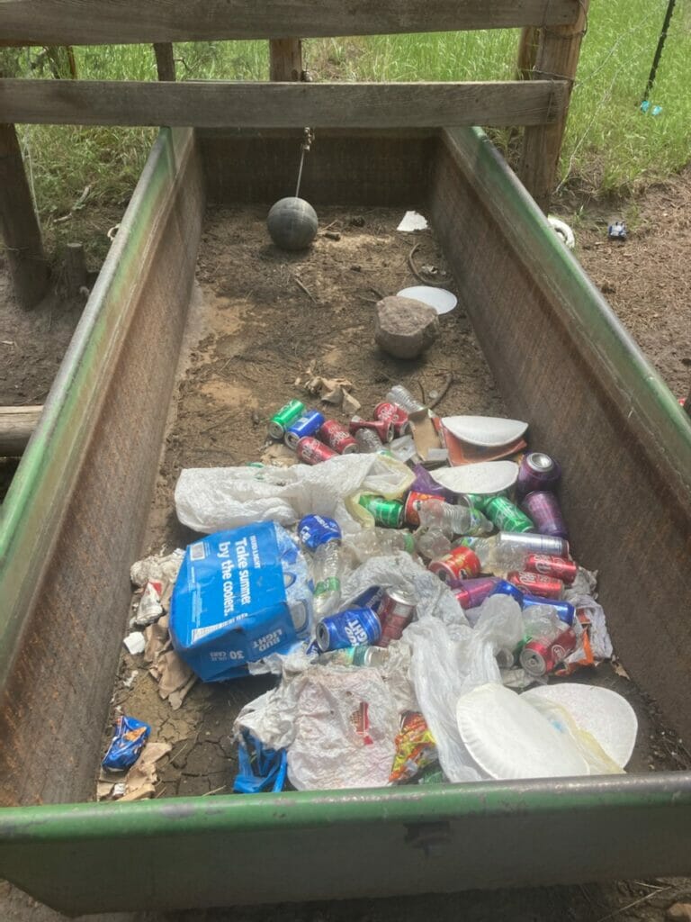
On our way to inspect his grazing allotment, Manuel Lucero and I pull over next to a tree where some campers have left their trash in a neat and organized pile of boxes and tied up plastic sacks.
Lucero notes this as a common occurrence after most summer weekends, especially on this one dirt road, perhaps the busiest thoroughfare connecting Albuquerque to its playgrounds in the Jemez Mountains.
“They actually believe they’re being responsible,” he says. “Someone else is supposed to pick up after them, and they’re trying to make it easy. Tonight, the bears will drag all this down to the creek, and the trash will eventually float into our ditches and fields.”
Manuel Lucero working on well to provide off-stream watering.
In the years I’ve known Manuel, I’ve never seen him without his black cowboy hat on. He takes guilty pleasure in watching the TV series “Yellowstone” and in dropping the occasional irreverent joke. As president of the San Diego Grazing Association, however, this rancher in his thirties is dead serious.
Manuel runs cattle on about 96,000 acres of the Santa Fe National Forest, and he embraces the responsibility of stewarding so much land.
Some of the land he grazes provides habitat for native Rio Grande cutthroat trout and several listed wildlife species, as well as water for small farming communities downstream. With these realities in mind, Trout Unlimited reached out to Manuel’s grazing association in 2015 to explore the possibility of simultaneously improving riparian habitat and range productivity.
Healthy riparian habitat means happy trout streams. And in the Jemez mountains, a recreational haven serving three of New Mexico’s largest cities, healthy riparian habitat increasingly means happy ranchers, who try to avoid conflict with other public land users when possible.
Since their partnership began, TU and the San Diego Grazing Association have joined forces on fence repairs and renovations of water lines and drinkers. We’ve shared expenses on a mobile corral, a water storage tank, and battery-powered chainsaws to clear fallen timber from fences during fire season.
Through these and other actions, this partnership has succeeded in distributing grazing pressure more evenly across the San Diego and neighboring Cebolla-San Antonio allotments.
Drinker drained by weekend campers and filled with trash; empty drinkers push cows to the creeks.
In 2021, we teamed up with the Forest Service and The Nature Conservancy on an effort to increase grazing efficiency and to discourage cows from loitering in riparian areas. The project, which included approximately $87,000.00 in funding from TNC’s Rio Grande Water Fund, entailed the drilling of two canyon-rim wells on the Cebolla-San Antonio allotment.
The wells will gravity-feed a network of drinking lines and enable the utilization of certain upland pastures with lots of clumpy tall grass. The grass in these pastures is decadent, a result of being left almost completely unbitten by elk and cattle.
With drinking capacity provided by the new wells, these under-used pastures will absorb more pressure (and manure), while enabling heavily grazed meadows to receive some rest.
Ten miles up the road, Manuel and I are parked at the upper end of a long meadow next to a fenced enclosure surrounding a locked well house with a sheet metal roof.
The well supplies drinking troughs across the Virgin, Stable, and Holiday mesas that rise above us to the south—it is essentially the nerve center of much of the San Diego allotment.
Having grazed for their allotted days, the cows have left the meadow for the mesa tops. From Memorial Day until school starts is the season of the weekender, when residents of Albuquerque seek relief from the urban heat and bustle.
Manuel points out thicker stands of forest where RVs can’t penetrate. The grass there has grown about a foot since being eaten. Elsewhere across the camping footprint, the only grass that grows is smashed into dusty ground.
“But if one cow shows up here this weekend, I’ll hear about it on Monday,” Lucero says. “I get it, campers don’t want to see cows, but cows don’t like people either. Cows are smart, but they’re also dumb. They’d rather be up top, but with people all over the mountain they get confused. Let’s be honest, people are everywhere.”
He’s not exaggerating. Scanning the sloping meadow, we see occupied, often illegal, campsites almost any place one can park a car; in ranching parlance, it’s quite a few “head” of people.
Manuel notes the irony in how, come evening, the whole canyon will smell like grilling beef and hot dogs and how the same people bashing his cows will leave their fire rings full of beer cans.
Already this summer, an RV owner broke the lock off the wellhouse and plugged into its power source; campers drained one of his troughs and used it as a trash bin; and on any given year, hikers will invariably bathe in the troughs, oblivious to the repellant effect soap and lotion have on thirsty cows and wildlife.
People cut fences to make way for ATVs. They do donuts in the pastures.
One fine individual used a Sawzall to cut a door in a water tank critical to minimizing cattle presence in riparian areas of the Rio Cebolla. Purchased jointly by TU and the San Diego Grazing Association, this tank was rendered into a suitable dwelling for the vandal and his small herd of goats, and useless for the purpose of watering cattle and wildlife.
Vandalized water tank paid for by TU and rancher partners. Functional watering systems help keep cows out of important riparian ecosystems.
As Manuel talks, I’m impressed by a patience seeping through his frustration, a seeming acceptance of adversity as a part of the ranching life that can drive one toward improvement.
Manuel, his father Mariano, brother Michael, and the members of the association all share common ancestors who settled in the Jemez country in the late 1700s. Back then, everyone was a rancher, a farmer, a hunter, a gatherer and, most important, a neighbor or friend to native Pueblo people already occupying the valley.
Back then the land was definitely public, but in an existential sense. Multiple use was not only a matter of cooperation, but of life and death.
As part of our commitment to protecting and restoring the Rio Grande cutthroat, itself a cultural icon, TU will continue building partnerships with ranchers and other stakeholders in the Rio Grande watershed. Honoring deep-rooted practices will be key to sustaining adaptive stewardship. As Manuel Lucero says, “Our people wouldn’t have lasted this long if we couldn’t find ways of understanding different ways of living.”
Sweetwater Lake, located in remote northeastern Garfield County in the Flat Tops Wilderness Area, is set to become Colorado’s first state park on federal land after it was acquired by the U.S. Forest Service in August 2021.
“Colorado’s first state park on federal land.” This came across as an oxymoron, but why not?
This land acquisition followed a common pattern, where a non-profit conservancy (The Conservation Fund) acquired private property until the federal government had the funds (Land and Water Conservation Fund) to purchase it and add it to a national forest (White River). (From Colorado Parks & Wildlife, linked below.)
This Land and Water Conservation Fund purchase followed the acquisition of the property in 2020 by The Conservation Fund, which was made possible by a loan from Great Outdoors Colorado and local fundraising efforts such as the “Save the Lake” Campaign organized by Eagle Valley Land Trust.
A little less common (to me any way), the Conservation Fund is also continuing to fund management, according the Eagle Valley Land Trust:
“We’re also excited to announce our Sweetwater Lake Stewardship and Equity Fund, which will assist the Eagle Valley Land Trust and our agency partners in activating the property for public use and enhancing opportunities for underserved communities to enjoy the space for years to come.”
There is an existing Forest Service campground on adjacent land. The Forest Service had this to say in the formal announcement from Governor Polis:
“Sweetwater Lake has tremendous ecological and cultural values and outstanding opportunities for recreation. This partnership allows the White River National Forest to incorporate the local expertise of the Eagle Valley Land Trust and the recreation management and wildlife expertise of Colorado Parks and Wildlife to best serve visitors to the area,” said Rocky Mountain Regional Forester Frank Beum.
“Colorado Parks and Wildlife is excited to modernize facilities and provide updated and sustainable recreational services through this partnership. Our main priority is to conserve the unique character of the area while improving access to this incredible property,” said Colorado Parks and Wildlife Director Dan Prenzlow.
None of this said much about the State’s authority and responsibility, but I don’t know why they couldn’t lease the site and manage it as a permittee. I don’t know if any other states have done anything like this, but as questions continue to come up about how to manage growing outdoor recreation this might be an option in some other places.