Utah’s High Elevation Mortality

P9066744-web

This picture is located within the Cedar Breaks National Monument, where conifer mortality is quite excessive. There is really not much that can be done with this situation, other than spending lots of money to fell, pile and burn. Within the Dixie National Forest, this mortality dominates the upper elevations. Even at this altitude of over 10,000 feet, the land is very dry for 9 months, except for seasonal lightning storms. Like some of our public lands, we need a triage system to deal with such overwhelming mortality and fuels build-ups. In this example, we are too late to employ a market-based solution, which would do more non-commercial work.

I have seen this area over many years, and have watched as forests die and rot, with catastrophic wildfire being the “end game”. Anyone venture a guess at what will grow here, in the future?

www.facebook.com/LarryHarrellFotoware

Judge Agrees With Forest Service On Thinning On North Kaibab

blackjack7

blackjack3

The above are photos of 1) what the stand is desired to look like, and 2) what stands look like when not enough 16 inchers have been removed. At least that is my interpretation of the photos in the EA here. If I misinterpreted, please feel free to point it out.

Here is the link and below is an excerpt:

The area in question is about 39 square miles located near Jacob Lake, or north of the 40,000 acres accidentally burned in 2006’s prescribed-burn-turned-wildfire on the North Kaibab Ranger District, called the Warm fire.

It’s a defeat for the Sierra Club and Center for Biological Diversity, which have raised objections over the age and size of trees to be thinned since 1998.

Those groups asserted that the scale of thinning the Forest Service had proposed on the Kaibab Plateau is not beneficial to the northern goshawk, a bird the forest service considers a “sensitive” species (not federally listed as threatened or endangered), and submitted data to support that view.

The Forest Service weighed that data, then set it aside in favor of what its own expert had said about how dense or sparse the forest could be in areas where the goshawk live.

The plans allow for logging of ponderosa pines 16 inches and larger in diameter (with no upper size limits), though the Forest Service says it will only account for fewer than 2 percent of the trees to be cut.

The matter is potentially significant because the conservation groups have raised objections to similar plans for a handful of other thinning projects on national forests elsewhere in northern Arizona, including closer to Flagstaff.

“It makes no sense for the Forest Service to continue to push to log these old growth and large trees, when we have so little remaining. This is not a restoration project. It is a squandering of these biologically significant large trees — critical and missing components in many of our forests,” stated Sandy Bahr, of the Sierra Club.

The district forester lauded the decision.

“Thanks to the hard work and perseverance of our employees, and support from our local communities, we can move forward to help protect the habitat and the forest from high intensity wildfire,” stated North Kaibab District Ranger Randall Walker.

Note from Sharon:
1) I am curious whether this is the same project as in this story here” Group Sues to Stop Thinning Project near the Grand Canyon.”

And only a small percentage of the forest’s old-growth trees will be removed, he added.
I anticipate that some critics of my decision may mischaracterize this project with claims that it will significantly reduce old growth habitat,” Short wrote in the assessment. “Alternative 1 would reduce old growth by up to 105 acres within the 26,916 acre Jacob-Ryan project area. This equates to approximately 0.4 percent change in old growth allocation.”

Loggers would cull old-growth trees only where it would be necessary to promote restoration goals, according to the agency.

However the same story also says…

Under the proposal, about 700 acres of mature and old-growth ponderosa pines would be harvested.

39 square miles? 700 acres? 105 acres? This seems very confusing.

I sure think it would be interesting if, for each project that goes to litigation, the unit would develop a standard video package that shows 1) what the area currently looks like, 2) explains why they are doing what they are doing, 3) show how they would do the marking, and then 4) show what nearby areas look like after that treatment. There was some of that done in this EA, but I think a video showing what trees would be removed and why would be clearer. It would be helpful for folks on this blog, and other members of the public and the media to understand and compare. It would also be interesting to know how much the FS, OGC and DOJ spent defending this one (39 square miles, or 150 or 700 acres, whatever..) compared to the 150 acre and 600 acre projects we’ve talked about on this blog before. We could even then generate a litigation cost per acre..

Here’s a letter to the editor by the ranger describing the project and the FS side..Good work by the FS, OGC and DOJ on the case, and the District for the EA and getting the word out.

Group Hails Forest Cooperation

View 88

I saw a local article about our part of the Collaborative Forest Landscape Restoration Program.

For the first time in many years, loggers and conservation groups are working together and the results have been stunning, according to Katherine Evatt, president of the Pine Grove-based Foothill Conservancy.

The Amador Calaveras Consensus Group has been working in the Stanislaus and Eldorado national forests on projects that are part of a larger national program called Collaborative Forest Landscape Restoration.

The goal is to restore forests for people, water and wildlife, and a report released in December shows some of those goals are being met.

The ACCG Cornerstone Project is one of 23 national projects that split $40 million in 2012. According to the fiscal year-end report for the project, the two forests spent more than $658,000 in CFLRA funds this year, matched by more than $433,000 of other Forest Service funds. There was more than $67,700 in ACCG in-kind partner contributions and more than $1 million in leverage funds from ACCG members. Additional funds included a $196,000 grant from the Coca-Cola Company as well as $283,000 worth of in-service work under stewardship contracts.

The article is here

Restoration by the Numbers.. What Are They?

One more post before I leave..also if you sent me something to post and I forgot, please email [email protected] and I will get to it after my Solstice break.

___________________________________________________________________________________________________________________________________________________

If this article is correct…

Forest Service Failing to Create Jobs, Stimulate Economy in Forest Management Practices

Crystal Feldman House Natural Resources Committee

During the height of this year’s record-breaking fire season, the Subcommittee on National Parks, Forests and Public Lands held a legislative hearing on bills to address forest health and reduce the risk of catastrophic forest fire. Following a Forest Service report on the need for restoration on 65-82 million acres of National Forest land, the Forest Service testified that it had restored 3.7 million acres in 2011. Restoration is the process of assisting recovery of an ecosystem that has been degraded, damaged, or destroyed. Following the hearing, we submitted a series of questions to get further detail on what methods the agency used to “restore” these lands.

In its response, the Forest Service explained that of those 3.7 million acres, over 1.4 million – nearly 40% of the total – were “restored” through a combination of prescribed fire (fire intentionally set and monitored by the agency) and wildland-use fire (fire allowed to burn to achieve resource objectives). Meanwhile, commercial harvest was only allowed on 195,477 acres – 5% of the total work for 2011 and only .1% of the 193 million acres managed by the Forest Service.

______________________________________________________________________________________________________________________________________________________

The .1 % seems to answer one of Derek’s questions. in the People’s Database.but does it agree with the below? It would be nice to see a table that shows prescribed fire, fire use, non-commercial and commercial thinnings and mechanical treatments by acre (like how many acres were touched by different treatments in a given year). Of course, if it’s a service contract, wood might still go to mills, not sure how that is considered in the numbers either..

Like this:

x acres commercial harvest fuels reduction thinning followed by prescribed burning
y acres commercial harvest fuels reduction thinning alone
z acres prescribed burning only forest in WUI
a acres prescribed burning only grasslands and shrublands
b acres prescribed burning only forest outside WUI
c acres fuels reduction could have gone to mill but we don’t know for sure
etc.

Also A little birdie told me that some of the figures in the report below are not accurate.

http://www.nature.org/ourinitiatives/habitats/forests/newsroom/us-forest-service-program-reports-welcome-christmas-news.xml

U.S. Forest Service Program Reports Welcome Christmas News

Third Year of Collaborative Forest Landscape Restoration Program Reveals Big Benefits for People, Water, and Wildlife

http://www.nature.org/ourinitiatives/habitats/forests/newsroom/us-forest-service-program-reports-welcome-christmas-news.xml

Arlington, Virginia | December 19, 2012

An annual report was released today on the performance of a U.S. Forest Service program, called Collaborative Forest Landscape Restoration (CFLR), revealing impressive returns for forests, jobs, water, and wildlife. The three-year old program invested $40 million in forest restoration at 23 forested landscapes across the country in 2012.

As identified in the report, the 23 landscapes cumulatively provided the following 2012 results:

• Created and maintained 4,574 full- and part-time jobs;
• Generated nearly $320 million in labor income;
• Reduced the risk of megafire on 612,000 acres;
• Enhanced clean water supplies by remediating 6,000 miles of eroding roads;
• Sold 95.1 million cubic feet of timber;
• Improved 537,000 acres of wildlife habitat;
• Restored nearly 400 miles of fish habitat.

In addition to these on-the-ground results, CFLR also highlighted the opportunity to leverage matching investments in forest restoration. All told, CFLR leveraged an additional $45.4 million dollars towards collaborative actions in 2012.

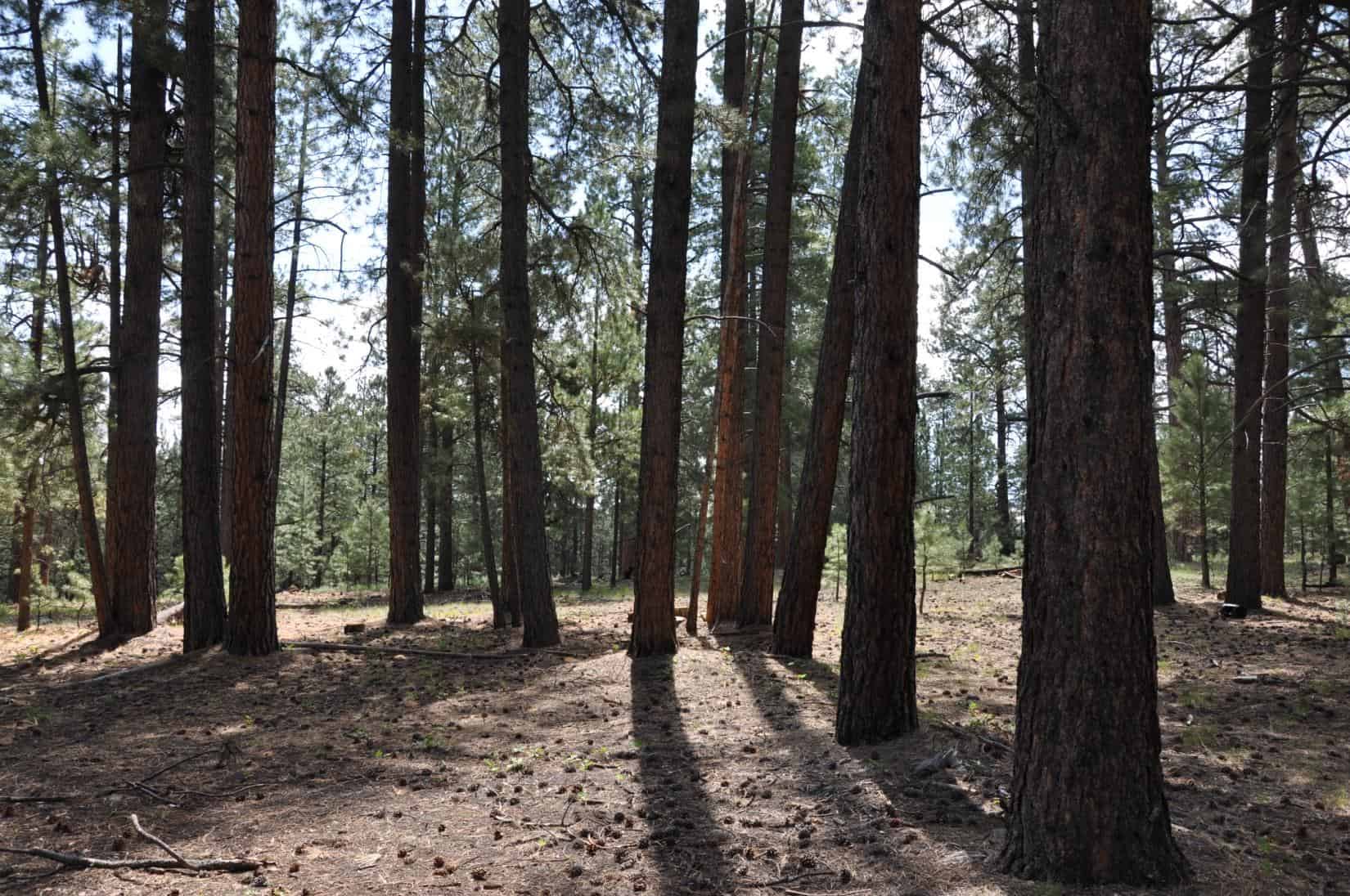
Beyond the beauty they offer, forests are critical to life and livelihood across the nation. Americans forests cover one-third of the United States; store and filter half the nation’s water supply; provide jobs to more than a million wood products workers; absorb nearly 20% of U.S. carbon emissions; offer 650 million acres of recreational lands that generate well over $13 billion a year in economic activity; and provide habitat for thousands of species across the country.

Observers say the program is bucking the larger downward funding trend because restoration of National Forests is the new ‘zone of agreement’ where traditional adversaries in the timber industry, conservation, and local county governments are working to advance common goals. .

The collaborative results of the report were heralded by companies, community groups, and conservation organizations around the nation.

“The Collaborative Forest Landscape Restoration program is bringing communities from around the country together to create jobs, to restore forest and watershed health, and to reduce the costs of wildfire suppression at impressive scales,” offered Laura McCarthy of The Nature Conservancy. “The program and its many supporters are charting a successful path forward for National Forest management.”

“This is an outstanding program because it simultaneously helps forests, water, and jobs,” said Kelsey Delaney of the Society of American Foresters.

“Collaborative Forest Landscape Restoration projects are cost efficient, mostly because of their long time frame and larger scale,” added Scott Brennan of The Wilderness Society. “Selected projects are assured funding as long as appropriations are available until 2019, which provided certainty for businesses their banks and other investors, time for workers to be trained and become skilled, and for product markets to be developed and expanded.”

“Collaborative Forest Landscape Restoration has shown that the critical importance of healthy and thriving forests can be a unifying force,” said Rebecca Turner of American Forests. “Our organization is proud to be collaborating with such a diverse collective of partners on a program that received bipartisan support from Congress to improve the health of our forests, as well as creating needed jobs.”

Dylan Kruse of Sustainable Northwest said, “Collaborative Forest Landscape Restoration is about boots on the ground, creating jobs in rural communities. Now is the time to invest in rural communities and restore the health of our National Forests. CFLR does exactly that.”

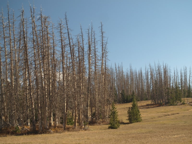
CFLR is particularly valuable now, on the heels of the nation recording its third-largest wildfire year. A century of suppressing natural wildfires has resulted in unhealthy forests choked with small trees and brush that can lead to destructive megafires. Over the last 50 years the United States has had only 6 years with more than 8 million acres burned— all have occurred in the last 8 years (including 2012).

The conditions of our forests are further enflamed by pest and diseases, as well as climate change. All told, The Nature Conservancy estimates 120 million acres of America’s forests – an area bigger than the state of California – are in immediate need of restoration due to this “perfect storm” of threats.

The 23 sites to receive investment in 2012 were:
• Ozark Highlands Ecosystem Restoration, Arkansas, $959,000
• Shortleaf-Bluestem Community Project, Arkansas and Oklahoma, $342,000
• Four Forest Restoration Initiative, Arizona, $2 million
• Amador-Calaveras Consensus Group Cornerstone Project, California, $730,000
• Burney-Hat Creek Basins Project, California, $605,000
• Dinkey Landscape Restoration Project, California, $829,900
• Front Range Landscape Restoration Initiative, Colorado, $1 million
• Uncompahgre Plateau, Colorado, $446,000
• Accelerating Longleaf Pine Restoration, Florida, $1.17 million
• Kootenai Valley Resource Initiative, Idaho, $324,000
• Selway-Middle Fork Clearwater, Idaho, $1 million
• Weiser-Little Salmon Headwaters Project, Idaho, $2.45 million
• Longleaf Pine Ecosystem Restoration and Hazardous Fuels Reduction, Mississippi, $2.71 million
• Pine-Oak Woodlands Restoration Project, Missouri, $617,000
• Southwestern Crown of the Continent, Montana, $1.03 million
• Southwest Jemez Mountains, New Mexico, $392,000
• Zuni Mountain Project, New Mexico, $400,000
• Grandfather Restoration Project, North Carolina, $605,000
• Deschutes Collaborative Forest, Oregon, $500,000
• Lakeview Stewardship Project, Oregon, $3.5 million
• Southern Blues Restoration Coalition, Oregon, $2.5 million
• Northeast Washington Forest Vision 2020, Washington, $968,000
• Tapash Sustainable Forest Collaborative, Washington, $1.63 million

The CFLR annual report was produced by the CFLR Coalition, which is comprised of 145 member organizations that include private businesses, communities, counties, tribes, water suppliers, associations, and non-governmental organizations.

Copies of the 2012 CFLRP Annual Report can be requested from Jon Schwedler of the CFLR Coalition at [email protected].

Information on CFLRP can be found at the U.S. Forest Service’s website: http://www.fs.fed.us/restoration/CFLR/

Report:“National Forest Health Restoration: An Economic Assessment of Forest Restoration on Oregon’s Eastside National Forests.”

report

Thanks to Terry Seyden for this one.
In the interests of transparency, I’d like to try to establish some background information on these kinds of reports.

Who wanted it: This report was done at the behest of Governor Kitzhaber.
Who produced and funded it: “The report was assembled with funding and guidance from conservation groups, government agencies, academic institutions and business trade associations.”

Here is the link to an article about it (including a link to the document and a four page summary).

Below is an excerpt from the story.

The report looks at doubling the number of acres of east-side national forestland that undergo restoration – such as selective harvest, thinning and underbrush removal – from 129,000 annually to 250,000. Doing so, the report states, could create an additional 2,300 jobs in eastern and south central Oregon. The study says every $1 million invested in restoration generates $5.7 million in economic returns.

The work brings timber to struggling mills, provides jobs, and restores fire resiliency to the forest, the report states. Because of fire suppression, historic practices and passive management, some dry-side federal forests are choked with as many as 1,000 trees per acre, where historically about 75-100 trees per acre were typical. Some 80 percent of the 11.4 million acres of east-side forests under U.S. Forest Service management are at moderate to high risk of devastating crown fires.

The report highlights the importance of local collaboratives – in which government, industry and conservation interests work together to plan and implement restoration jobs.

“Fuel Treatments Can Address Wildfire Severity”

The Sierra Nevada Adaptive Management Project (SNAMP) is a joint effort by the University of California, state and federal agencies, and the public formed in 2004 to assess how treatments designed by the USDA Forest Service to prevent severe wildfires affect fire risk, sensitive wildlife populations, forest health and water resources. SNAMP is in year five of an ambitious 7-year experiment to evaluate the effectiveness of management strategies to modify fire behavior across the landscape.

SNAMP has examined real-world fires and developed computer models to evaluate wildfire severity and environmental impacts in response to fuel-reduction treatments looking 30 years to the future. In its Northern Sierra project covering roughly 30,000 acres, SNAMP evaluated three different treatment scenarios. In each case, fuels were reduced across approximately one-third of the study area, and all treatments showed substantial reductions in high-intensity wildfire across the landscape, not just treated areas for 20 years after implementation.

This is from California Forests Magazine, and this issue is full of articles about severe wildfires. The whole article is here. The picture is one of mine from the Lassen National Forest’s 1987 Lost Fire.

Pine Regeneration: Bridge Fire, Bryce Canyon National Park

The 2009 Bridge Fire was started by lightning, and burned in both the Dixie National Forest and Bryce Canyon National Park. Since the fire didn’t closely approach structures, the fire was allowed to burn to the road, and in some places, to the rim.

Mortality was pretty severe but, there were still some green trees scattered about. It is hard to say if there has been a good cone year, since the fire. I didn’t see a single live new tree in this particular area.

I did see this dwarf Oregon grape but, it really wasn’t a surprise, since I had seen them growing among the hoodoos.

I also saw some manzanita and ceanothus becoming re-established, along with other desert brush species.

As the years go on, the odds for having a pine forest soon are worsening. At 9000 feet in elevation, this is a pretty harsh environment for any tree. I posted most of these pictures in high resolution, so you can see the vegetation easily, if you click on them. You cannot judge pine regeneration after only a few years but, in this case, pine regeneration looks very poor.

To see the pictures from my Bryce Canyon and Zion National Park adventures, go see my Facebook page, please. These include the Peekaboo trail in Bryce Canyon, and “The Narrows” in Zion National Park.

www.facebook.com/LarryHarrellFotoware

Indian Valley Meadow Restoration

Indian Valley, part of the Amador Ranger District, Eldorado National Forest, is being restored as a high elevation meadow, after decades of misuse. Grazing has ceased but, its impacts still linger. In the past, willows were removed and water was channeled away, causing increased erosion of these shallow and fragile soils. The water table has been lowered and the meadow hasn’t been able to support the vegetation that it used to.

Concentrating runoff by channeling the water causes increased erosion, especially when we have rain on snow events. There were significant impacts from the winter of 1996. This project aims to get the water to spread out, linger, and re-charge the water-holding capacity of up to 500 acres.

A system of catchment ponds, compacted soil plugs, and native plant re-vegetation will cause snowmelt runoff to spread out and slow the erosive power of concentrated water. This project has a history of being de-funded and handed off but, all things came together when Coca Cola offered up some cash, which led to some additional matching funds and collaboration. The Ranger District had to jump through all the NEPA hoops, as surveys had to be completed for endangered willow flycatchers, frogs and toads. The one impact they could not remedy is a historic road, which travels across the meadow. Relocation was made impossible, due to archaeological sites. Removal or closure would be politically impossible.

The willows have made a great comeback, since grazing ended. However, you can clearly see that the foreground vegetation is quite sparse. Raising the water table a few feet will lead to meadow restoration. The numerous braided side channels would re-charge the water table. There appears to be one of the historic man-made channels in this picture.

Here is what appears to be one of the natural side channels, which no longer is supplied with water, due to lowered water table, erosion, and channeling of the water. This restoration project appears to be a win-win situation for everyone.

Here is a non-Forest Service link to the project:

http://www.americanrivers.org/newsroom/blog/lhunt-20120920-indian-valley-meadow-restoration.html

Sequoia National Monument.. So Few Trees, So Much Planning and Litigation

Trail of 100 Giants, Forest Service photo

Thanks to Terry Seyden for this link.

Perhaps the Californians on this blog can help me. I can’t understand this story…

This is about the Sequoia National Monument- which has probably had more planning investment per acre than any other unit of the National Forest System.

Although the monument designation bans commercial logging, that didn’t stop the Forest Service from issuing a plan in 2004 that would have allowed enough timber cutting in the monument to fill more than 2,000 logging trucks a year — all in the name of reducing the risk of wildfire.

Although the new plan reduces the size of trees that can be felled, it allows the cutting of some young sequoias, no larger than a foot in diameter, and other trees as big as 20 inches in diameter to reduce fuel loads and promote ecological restoration. Any young sequoia trees that were felled would not be sold, the agency said. But other conifers and trees could be. The diameter limit would also not apply to trees considered a hazard along roads or in public areas.

I don’t understand how there can be a ban on commercial logging and trees can be sold.

The Forest Service’s long policy of fire suppression has been blamed for the decline of the sequoia groves. In the nearby Sequoia and Kings Canyon National Parks, managers primarily use prescribed burns to create sequoia-friendly conditions.
Conservationists want the Forest Service to adopt the U.S. Park Service approach. But Elliott said that “fire alone is not going to fit the bill. Mechanical treatments are appropriate.” The many private holdings and small communities scattered across the forest demand more aggressive fuel reduction, he added.
Sequoia ForestKeeper has argued that the agency used the hazard tree provision to cut down commercially valuable old non-sequoias in 2005, when it removed about 200 trees near the popular Trail of 100 Giants and sold 67 of them as timber. Judging by the number of rings on the stump, Marderosian said one of the felled trees was 320 years old.
According to documents released Tuesday, mechanical tree thinning would be allowed on about 23% of the monument acreage. But Sierra Club staff attorney Kristin Henry said other provisions in the plan could potentially open the door to tree cutting on much more land.
“I’m just a little bit skeptical,” Henry said. “It seems as though this plan is geared to a lot of logging.”

Hmm they sold 67 non-sequoias identified as hazards in 2005.. it seems a bit of a micro-scale to me to be much of an issue. Again, there must be more to this story… maybe Californians can help provide some background. I’m also curious exactly what the judge said in this case and why.

FYI, in Colorado, we do cut trees (more than 67) and the State temporarily stopped doing prescribed fire, which these folks advocate because of the dangers.

Note: in browsing for a photo I found this neat picture gallery here of sequoia groves on the Sequoia National Forest.

Thinning in the Sierra Nevada

I tried my hand at some “digital thinning”, with a picture of the Stanislaus National Forest, above the Mokelumne River. I couldn’t really remove as many of the bigger trees as I should, without sacrificing photorealism. I did “enhance” some of the oaks, which is a keystone of the new paradigm of ecosystem wildlife values. I am sure there are some home habitats of ESA birds, here. There would also be some pockets of undisturbed forest, and maybe some bigger openings around the oaks.

Below is the original picture

I think we can all say that there is, indeed, some excess trees to thin out, in this stand.

www.facebook.com/LarryHarrellFotoware