From the Mouths of Wilderness Advocates

wildAn alert reader found this piece, which I thought was well worth a read. Here is the link and below is an excerpt.

Politicians, environmental groups and laws don’t protect wilderness, voters do.

* If the voters of the political entity with jurisdiction over the wilderness area are educated to personally understand the wilderness values involved, then and only then, will their representatives support Wilderness proposals.

* Neither Democrats nor Republicans are intrinsically pro–wilderness or anti–wilderness.

* The citizens and legislators who happen to live near a wilderness area should have no more say about it than the neighbors of the statue of liberty would have a special voice on what happens to it.

* Most legislators, public and civic officials and people near a wilderness tend to favor its commercialization, commodification and development.

* Once you identify the legislators to target, you know the voters you must educate: the voters who elect the politicians who sit on or chair the legislative committees with jurisdiction over your issue.

* Administrative agencies do what their political overseers tell them, so focus your lobbying on their political leaders.

* Campaigns for Wilderness in rural counties are won in urban areas. Most of the energy, concern and money in a campaign come from large cities. The focus of any campaign should be where the population of the controlling political entity is, not where the resource happens to be located.

It’s an interesting, and inaccurate, characterization of folks around wilderness areas in the New West who want all kinds of things, including wilderness. and I find the idea that federal property rights trump local needs as a bit.. well… colonialist. If it quacks like a duck… (eek.. I think I’m channeling Dave Skinner (!))

However, as a person who looked at endless tables of “things not allowed” in roadless compared to wilderness, I’ve gotta wonder whether “wilderness acres” is a target for someone or some organizations regardless of how much they’ve moved the needle from “very restrictive roadless land allocation” to “wilderness.” I think it would be helpful for everyone involved in the discussion to be reading off the same table of comparative restrictions. One of my wonky former coworkers, who is way more knowledgeable than I, pointed out that a specific part of the Colorado roadless regulation was more restrictive than wilderness. But how many people actually know what’s in and what’s out, comparatively? In my experience, very few.

And if it is all about Congress placing a stamp of approval on it, and wilderness being “more permanent”, then probably place-based bills for other things are the way to go, equally. IMHO. One more thing.. I am in no way dissing The Wilderness Society.. the people there I have worked with have been respectful and reasoned.
Merry Packers of Yesteryear

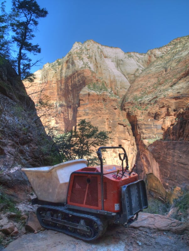
A good friend who worked in the Forest Service before the 1964 Wilderness Act asked me if I had heard of a Merry Packer. I had not heard of them. He then described this motorized contraption that ferried equipment up trails in remote areas. The full picture is here.

My friend Tom commented about their use:

“Look!”
I looked. It was hard not to. We had just broke camp and started down the trail when the morning fog boiling up out of the canyon burst a hole a couple of miles away across the gorge, and in that hole, perfectly framed in corpuscular rays, sparkled a waterfall. It was quite a sight… and possibly my last!
 
Landers stumbled on a raised root in the trail just as he pointed with his right hand at the waterfall. His left hand on the throttle squeezed involuntarily as he struggled for balance. The little engine revved, kicking the mechanical mule in the ass just as we came out of a switchback. We came WAY out. I was up front, leaning back on the handles, supposedly steering, hopping and tiptoeing over rocks and roots, my feet on the ground only now and then.
 
We were having way too much fun again with this thing, and, way out here in the Douglas fir forests of the Wind River District above the Columbia River Gorge, no one was looking….and we were getting paid, too! Without having to carry gear, we moved fast, almost effortlessly, and we cleared a lot of trail……until Landers spotted that waterfall. I was lifted in the air about two feet before going over the edge, followed by all of our stuff – chainsaws, axes, sleeping bags, raingear, food, canteens and mosquito nets. Only a sleeping bag landed on me as I tumbled. Thank God that machine missed me. Landers fell on his face in the trail, laughing.
 
 The adults in the Forest Service had declared us the Trail Crew, showed us how to start this thing, then sent us into the wilds. Its called a Merry Packer. They’re like those deer carriers, but motorized. Are they still around?”

I hadn’t seen one in all my years in the Forest Service. I’m sure they were used a lot, in trail construction, before the restrictions on “motorized use”. On a recent trip to Zion, I saw, maybe, its replacement, in this more modern world. I’m sure that they had to fly this machine up to this strategic spot on the East Rim Trail.

P9034648_tonemapped-web


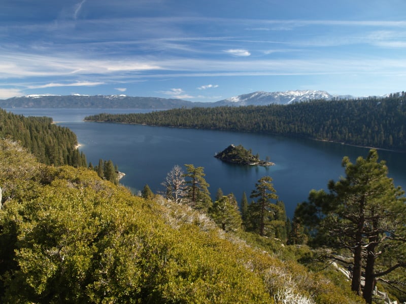
The Tahoe Basin

Lake Tahoe would probably be a National Park, by now, if the Comstock Lode had never been found. There was clearcutting right down to the lakshore, for mining timbers, in the silver mines. Incline Village was named for the switchback road that transported logs to a flume that went all the way down to the Washoe Lake area, thousands of feet below.

Today, there is very little “logging” next to all that blue Tahoe lake water. Newspapers especially like to describe the basin as “pristine”, apparently not knowing the actual meaning of the word.

P9123090-web

Much of the Lake Tahoe Basin is “de facto” Wilderness, with very little management happening, even when wildfires occur. Residents seem to be in denial about wildfire issues, not remembering the last drought that decimated their forests. However, it is easy enough to see the results of the last bark beetle infestation, in the form of accumulated fuels far beyond what is “natural”. Many areas of forest mortality were left “to recover”, on their own. Well, sometimes “recovery” takes decades or even centuries, as long as humans don’t intervene. That might also include multiple wildfires, opening the ground to accelerated erosion and having clarity-declining sediments flowing into Lake Tahoe.

P9123100-web

Ironically, the lake’s level isn’t all that far down, thanks to the lobbying of lakeshore land owners, putting pressure on water regulators. That can only go so far, as Reno area interests need more water to keep growing and thriving. We’ll just have to see how the battle goes, as the Truckee River drops further and further.

How the sue and settle process really works

This 6-page opinion includes a discussion of how courts decide whether to approve a consent decree.

The case also demonstrates the ability of intervenors to influence the outcome.  In this case environmental groups intervened in a lawsuit by motorized users over a travel plan decision.  Because of the intervenors, the court refused to approve the part of the consent decree that would have vacated that travel plan and allowed motorized use to continue while the Forest Service reconsidered the travel plan.  The intervenors kept the plaintiffs from getting what they really wanted.  (But the plaintiffs or the Forest Service could now reject the consent decree and continue the lawsuit.)

The court poses a hypothetical at the end:  “This analysis would change, however, if upon reconsideration the Forest Service finds flaws in the 2011 Travel Plan requiring changes. At that point, a strong argument could be made that the Plan cannot remain intact and should be vacated, reinstating the 1987 Forest Plan management scheme.”  The problem with this result would be that this travel plan is necessary to accomplish the 1987 forest plan direction to protect wilderness character, and reverting to the no-action alternative would be inconsistent with the forest plan.  That creates an equally strong argument the other way (in my opinion).

Rocky Barker on Crapo’s Collaborative

From the Idaho Statesman, here is a link, and below is a quote.

YEARS IN THE MAKING

Despite that, the Wilderness Society, an organization established to protect wilderness and wild values, has spent eight years at the table working on an agenda to restore the forests, wildlife, rivers and rural economy of the region. Working under the guidance of Idaho Republican Sen. Mike Crapo, this collaborative has helped the U.S. Forest Service rebuild its ability to actively manage its resources, including selling timber.

One project sponsored by the collaborative in the Selway and Middle Fork of the Clearwater River watersheds has attracted $16 million of federal and matching funding, created and maintained more than 650 direct and indirect jobs and generated $19 million in payroll. It has led to the treatment of 61,000 acres of forest and the harvest of 40 million board feet.

It wasn’t long ago when zero timber was sold on the Clearwater and Nez Perce Forests. This year, 60 million board feet of timber, enough to build 6,000 homes, will be sold from the forest. Even conservationists believe that 100 million board feet can be cut from the roaded areas as a part of a restoration program.

That seems pretty good – except when compared to the past. The Clearwater Forest alone cut more than twice that annually in the 1980s. For residents of towns such as Orofino and Kooskia, it’s hard to accept that won’t happen again, especially as they watch fires burn large swaths of the backcountry.

The collaborative is possible because the parties aren’t fighting over timber harvest in roadless lands. Fire is the agent of change on the backcountry, but would be intolerable in much of the front country.

For conservationists, the five-year project has meant removal of 66 miles of sediment-bleeding roads and rehabilitation of 63 miles of streams. The project has improved 16,000 acres of wildlife habitat.

WORKING MODEL

The success of the collaboration has given the Forest Service a new strategy for success. Today collaboratives are working in Montana and Oregon, among other places. The Forest Service has shortened the time it takes to complete environmental reviews. In Region 1, which includes Idaho, the agency has won 18 of the 22 lawsuits that other environmental groups have filed in recent years to stop the logging.

All of this success means the collaborative will continue, regardless of whether its diverse members can put together a wilderness bill. But all sides – conservationists, local officials and timber companies – want more.

Crapo’s defining achievement is the Owyhee Public Land Management Act, a locally written compromise between ranchers, county officials and environmentalists that created six new Idaho wilderness areas in the South Idaho desert.

Without a comprehensive bill like Crapo’s, the commitment and funding necessary for the full-scale restoration that both sides want for the Clearwater is unlikely.

Local officials such as Idaho County Commissioner Skip Brandt are pushing reforms to the Forest Service’s environmental-review process that will reduce the costs and barriers to the projects so they can generate more money for the region.

His goal is a “robust timber sale program that is consistent and sustainable.”

BRANCHING OUT

The devils are in the details, but these efforts come as similar reforms are being studied nationwide. Whatever happens, it will take buy-in from groups such as the Wilderness Society, Trout Unlimited and the Nature Conservancy to get them through Congress and signed by the president. Brandt’s panel of local officials and timber companies presented their ideas last week to the entire collaborative group, and they are all still talking.

For the Wilderness Society and others, there won’t be a bill without wilderness. They point to the jobs they have helped create as proof they have earned the trust of the collaborative. They want it to get behind designating wildernesss in the Great Burn near the Montana border north of Lolo Pass and other areas.

In the past, Brandt, who has expressed support for state takeover of federal lands, has been unwilling to say he could support wilderness as a part of the package. But last week he told me he’d changed his thinking.

“We have agreed to say yes to their wilderness and wild and scenic rivers if they agree to substantial changes to the Forest Service process,” Brandt said.

That shows the progress this collaborative has made.

Grand Canyon Fire Recovery

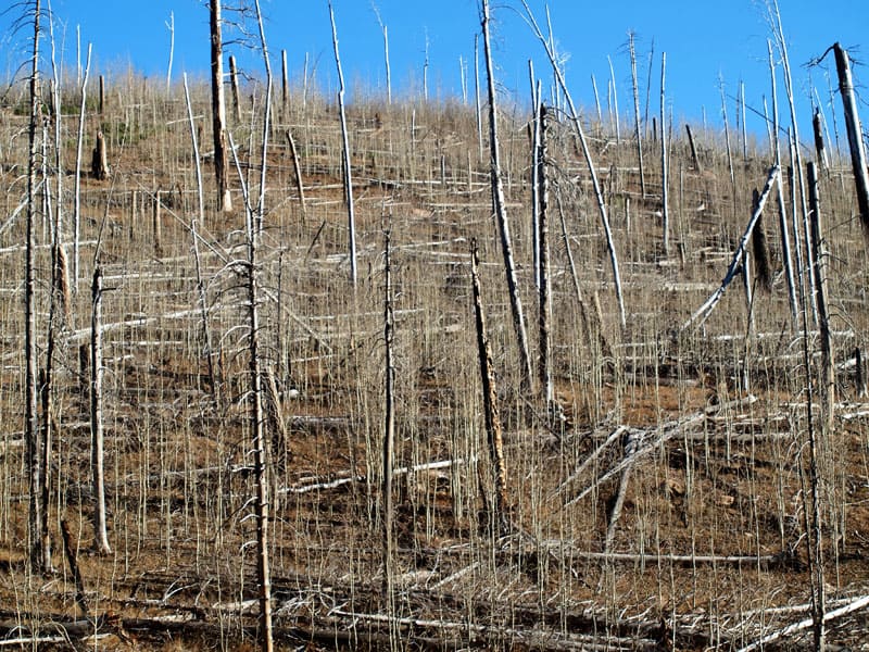
This is an interesting picture from the North Rim of Grand Canyon National Park. The fire burned and killed off all the pines but, the underground mass of aspen roots and shoots survived. I wonder how a pine component could “naturally” come back, or, did Indian burning favor old growth pines? Certainly, the higher pine forests of the Kaibab Plateau are overstocked and at risk, today.

OLYMPUS DIGITAL CAMERA

More Rim Fire Pictures

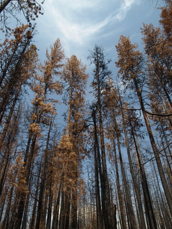
All too often, once a firestorm goes cold, a fickle public thinks the disaster is over with, as the skies clear of smoke. In the situation of the Rim Fire, the public hasn’t had much chance to see the real damages within the fire’s perimeter. All back roads have been closed since the fire was ignited. Besides Highway 120, only Evergreen Road has been opened to the public, within the Stanislaus National Forest.

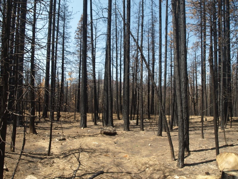
From my April trip to Yosemite, and Evergreen Road, this unthinned stand burned pretty hot. This would have been a good one where merchantable logs could be traded for small tree removal and biomass. Notice the lack of organic matter in the soil.

P9202313-web

Sometimes people say there is no proof that thinning mitigates fire behavior. It’s pretty clear to me that this stand was too dense and primed for a devastating crown fire. I’m guessing that its proximity to Yosemite National Park and Camp Mather, as well as the views from Evergreen Road have made this area into a “Park buffer”. Now, it becomes a “scenic burn zone”, for at least the next few decades.

P9202306-web

There is some private land along Evergreen Road, which seem to have done OK, at least in this view. Those mountains are within Yosemite National Park. Sadly, the media likes to talk about “reduced burn intensities, due to different management techniques”, within Yosemite National Park. Only a very tiny percentage of the National Park lands within the Rim Fire have had ANY kind of management. Much of the southeastern boundary of the fire butts up against the Big Meadow Fire, generally along the Tioga Pass Road (Highway 120). Additionally, much of the burned Yosemite lands are higher in elevation, as well as having larger trees with thicker bark. You can also see that there will be no lack of snags for the blackbacked woodpecker. Can anyone say, with scientific sincerity, that over-providing six years of BBW habitat will result in a significant bump in birds populations? The question is really a moot point, since the Yosemite acreage, alone, does just that.

P9202301-web

People have, and will continue to compare the Yosemite portion of the Rim Fire to the Stanislaus National Forest portion, pointing at management techniques and burn intensities. IMHO, very little of those comparisons are really valid. Apples versus oranges. Most of the Forest Service portion of the fire is re-burn, and there is no valid Yosemite comparison (other than the 2007 Big Meadow Fire). It has been a few months since I have been up there, and I expect that there are plenty of bark beetles flying, and the trees around here have no defense against them, with this persistent drought. Everything is in motion and “whatever happens” is happening.

Gila Wilderness Area’s 90th Birthday- by Char Miller

Looking into the Gila Wilderness in New Mexico. | Photo: Avelino Maestas/Flickr/Creative Commons License

I was out of town and have a bit of a backup of posts and will be be posting them this week. This from Char Miller on Wilderness:

Link here..

Excerpt below:

The two men met in Colorado in 1919, shortly after Carhart achieved what Leopold then was dreaming about. Assigned to develop a plan for the development of roads into and cabins surrounding Trappers Lake in Colorado’s White River National Forest, Carhart took one look at the unsullied high-country site and reported to his supervisor that the best and highest use of the lake and its beguiling environs was no use at all. Strikingly, his advice and plan was accepted, and Trapper’s Lake is today considered the “Cradle of Wilderness.” So when Leopold came calling, he and Carhart had a meeting of the mind.

From their conversation emerged a set of ideas that eventually became enshrined in the Wilderness Act. Carhart, for example, drafted a memorandum distilling the essence of their shared vision, a perspective driven by a sense of how imperiled these lands were and how democratic their preservation would be. “There is a limit to the number of lakes in existence; there is a limit to the mountainous areas of the world,” Carhart affirmed in 1919, and “there are portions of natural scenic beauty which are God-made.” Such divine terrain, primitive and uncluttered, “of a right should be the property of all people.”

Two years later, Leopold published what amounted to a declaration of first principles, and did so in his profession’s lead publication, the Journal of Forestry: “By ‘wilderness,’ I mean a continuous stretch of country preserved in its natural state, open to lawful hunting and fishing, big enough to absorb a two weeks’ pack trip, and kept devoid of roads, artificial trails, cottages, or other works of man.”

Even in the 1920s, not many places would meet all these qualifications, but the upper watershed of the Gila River did. Its typography — mountain ranges and box canyons — had isolated it from development, leaving it in a “semi-virgin state,” Leopold confirmed in his article. Its relatively pristine character made it perfect for his purposes: The Gila was the “last typical wilderness in the southwestern mountains. Highest use demands its preservation.” With the support of Forest Service chief, William B. Greeley, and regional forester Frank Pooler, he submitted a proposal to designate the vast region a wilderness, and to that end on June 3, 1924 the Forest Service set aside 755,000 acres.

For all its virtues, one of this landed legacy’s core assumptions, the notion that wilderness is absent of and an antidote to civilization, a place devoid of human impress, must be critiqued. The conceit emerged in the late 19th-century in response to the industrial revolution and rapid urbanization, when writers such as John Muir asserted that the call of the wild, of open space, would be a tonic for those living in cramped, dense cities. This understandable aspiration only makes sense however in the context of other historic forces that had emptied these lands of the people who once lived within them. The Gila wildlands Leopold encountered were absent of people as a direct result of the Mexican-American War and the Gadsden Purchase of 1853. To manifest its control over the region, the U.S. Army ultimately defeated the Apache who had made use of the Gila, relocating them to distant reservations.

Even with their forced removal, evidence remained that what would become a “wilderness” had supported complex social life dating back 11,000 years to the Paleoindian peoples who occupied the Gila highlands. And forward in time to include the Cochise and Mogollon cultures that later settled the region. When the latter disappeared sometime in the 13th-century it left behind a built environment that included cliff dwellings and pueblos, and a material culture rich in pottery. The Apaches, who arrived in the 1600s, held this ground for several centuries. To declare this land wild, then, was to erase these people and their ancient histories, an erasure the Gila designation set in motion and that has been replicated wherever wilderness has been proclaimed.

Leopold did not wrestle with this conundrum, though he recognized that wilderness was a social construct and a lived reality. He knew too that its physical presence was in decline. “Wilderness is a resource that can shrink but not grow,” he observed in Sand County Almanac. “The creation of new wilderness in the full sense of the word is impossible,” and it follows that “any wilderness program is a rear-guard action, through which retreats are reduced to a minimum.” To hold this line required a new form of activist, “a militant minority of wilderness-minded citizens” scattered across the country and who are available “for action at a pinch.”

Energizing this avant-garde is also cause for celebration, on this or any other day.

Rim Fire Terrain Effects

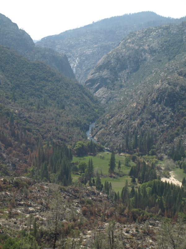
Below is a picture of the Tuolumne River and Poopenaut Valley, just a mile or so below Hetch Hetchy’s O’Shaughnessy Dam. As you can see, the area burned rather lightly. What might be the reason for this area to survive, almost unscathed? I think there is a “micro-climate” at play, here. Most of this is Yosemite National Park.

P9202324-web

Certainly, there are plenty of fuels, and California is in a historic drought. Firefighters did not “heroically” save this area from the flames. No management was done to make this area more resilient. Comparing this area to scorched places downstream, I think I have the answer. Farther downstream, the fires were enhanced by the nearly constant breeze, flowing down during the night and morning, and flowing up, with the heat of the day. Cold air sinks and warm air rises. This spot is pretty unique along the Tuolumne River. As the canyon turns from a glacier-sculpted valley into a V-shaped gorge, the cold air from higher elevations runs into this bottleneck, pooling up in this last valley, going downstream. Temperature inversions stay longer and stabilize the breezes, reducing fire behaviors.

One thing I did notice in this area was that many single digger pines were “selectively burned” as individuals. Those long slender needles were good at catching the small embers.