Inside the Firestorm

This is for those who insist that we don’t need to use forest management to reduce the risk of catastrophic loss to wildfire. Several people have expressed unscientific views on this site to the effect that ‘Wildfire is climate driven and no amount of controlled burns and or thinning can have any impact on total acreage burned since it is all due to global warming (drought and high winds)’ Hopefully this will bring them to their senses and open their minds to the possibility that they are flat out wrong.

Several of us have tried to explain that global warming only makes the need for managing stand density even more important. We have also tried to explain that what many see as climate driven firestorms are instead micro climate created by the fire. Hence the need to use the appropriate forest management tools to reduce the risk of an ignition spreading at a rate that will create its own weather and to provide opportunities for crown fires to return to the ground in order to allow the fire to be controlled as is appropriate for the specific situation.

I have rightly or wrongly gotten the impression that some here don’t really respect the research done on wildfire for at least the last 80 years. My reason for saying this is the applause they afford to people who come up with conclusions contrary to the science but don’t bother to reconcile their suppositions/theories, based on cherry picked incidents, with the established and well replicated science.

So here is an article that should give you a better understanding of and respect for the work behind the real science and how it corroborates what some of us have repeatedly stated here and elsewhere so, obviously, the principles described here are not new – They are just getting a whole lot more attention as technology has advanced to the point where tools are now available to make precise measurements on what has only been repeatedly observed before. This is a pretty intense read and well worth reading in its entirety.

1) ‘“It looked,” says Kingsmill, “like a nuclear bomb.”
Undaunted, Kingsmill and the pilot decided to do what no research aircraft had done: Fly directly through the plume.’

2) ‘For decades, scientists have focused on the ways that topography and fuels, such as the trees, grass or houses consumed by flames, shape fire behavior, in part because these things can be studied even when a fire isn’t burning. But this line of inquiry has offered only partial answers to why certain blazes, like the Pioneer Fire, lash out in dangerous and unexpected ways — a problem magnified by severe drought, heat and decades of fire suppression.’

3) ‘“The plume is orders of magnitude harder to study than the stuff on the ground,” says Brian Potter, a meteorologist with the Pacific Wildland Fire Sciences Laboratory in Seattle who sometimes works with Clements. Indeed, it took a global conflagration much darker than any forest fire to even begin laying the foundations of this work. Kingsmill’s observation about the bomb, it turns out, isn’t far off.’
–> Here the article dives off into the beginning of fire study as it began in the early ’40’s in preparation for the British bombing of Hamburg, Germany on July 27, 1943 when ‘42,000 people died, and another 37,000 were injured’

4) ‘these old experiments, finished by 1970, are still a key source of knowledge about extreme fire behaviors. Until recently, technology was simply too limited to reveal much more about the specific mechanisms by which a fire plume might feed a firestorm, let alone how beasts like fire tornadoes and fireballs form.’

5) ‘His instrument towers, deployed in carefully controlled fires, provided yet more unprecedented and precise measurements: how winds accelerate and draft into an advancing flame front, the heat and turbulence above the flames, and the speed of the rising hot air.’

6) ‘Clements wanted to capture the whole phenomenon — to look inside the opaque mass of an entire fire plume from a distance, and see all of its parts swirling at once. In 2011, he found his lens: a technology called Doppler lidar.’

7) ‘The team’s insight about the Bald and Eiler fires has implications for predicting smoke and air quality — a constant concern for communities near large fires. It also impacted the fires themselves. Even though both fires existed in the same atmospheric environment of pressures and winds, and burned across similar terrain, they were spreading in opposite directions that day — Bald to the south, and Eiler to the north. This denser current of cold air and smoke was actually pulling the Bald Fire in the opposite direction of what was predicted based on wind alone.’

8) ‘Coen works at the National Center for Atmospheric Research in Boulder, Colorado, where she studies fire’s inner workings. In September 1998, she spent several hours aboard a Hercules C-130 aircraft as it circled over Glacier National Park. The McDonald Creek Fire was marching up a steep slope at roughly three feet per second. Its smoke obscured the advancing flames, but infrared video cameras mounted outside the plane recorded what was happening underneath. It was only later, as Coen looked through individual frames of that video, that she noticed something strange: At one point, a jet of flame seemed to shoot ahead of the fire. It lasted only a second or two, but left a trail of newly ignited vegetation in front of the fire. Not until Coen calculated the size of the pixels and the time between frames could she appreciate its true significance.
The jet had surged 100 yards ahead of the fire’s front, advancing 100 mph — “like a flamethrower,” she says. It was 10 times faster than the local wind — generated, somehow, by the fire’s own internal tumult.
Coen called it the “finger of death,” and for her it brought to mind the unconfirmed reports of fireballs that occasionally circulated among firefighters.
She had never seen such a thing, but as she examined footage of other fires, she was surprised to find fire jets again and again.’

9) ‘Finney’s slow-motion videos show that these rolling eddies exist in pairs within the fire. They roll in opposite directions, coupled like interlocking gears. Their combined motion periodically pushes down on the advancing front of the fire, causing flames to lick downward and forward, ahead of the fire.
Finney believes that these forward flame-licks are scaled-down versions of the “fingers of death” that Coen has seen in wildfires — possibly even related to the fireballs said to have shot out of buildings during the 1943 Hamburg firestorm.
Coen has actually documented similar flame-rollers in real wildfires using infrared video. But she believes that the finger of death also requires another factor. As bushes and trees are heated by an approaching fire, their decomposing cellulose releases hydrogen, methane, carbon monoxide and other flammable gases in a process called pyrolysis.
Coen and Shankar Mahalingam, a fluid-dynamics engineer at the University of Alabama in Huntsville, believe that rolling currents can mix these flammable gases with oxygen-rich air. “The dangerous situation is when the fire is going up on a hill,” says Mahalingam. “Maybe there are pyrolysis products that have accumulated” in front of the fire and mixed with fire-boosting oxygen. As the flame licks forward into this invisible tinderbox, it ignites a blowtorch. … These same buoyant gases also supply the momentum that drives a fire whirl to spin once it is triggered. And on a much larger scale, they are what pushes a fire plume ever higher in the sky, powering the in-drafts that keep the fire burning below.’

10) ‘what drew Potter’s interest was the water. Concentrations of water vapor rose 10 to 20 times higher than the surrounding air.
Water is a major product of combustion, second only to carbon dioxide. It forms as oxygen binds to the hydrogen atoms in wood, gasoline or just about any other fuel — creating hydrogen oxide, otherwise known as H2O. Burning four pounds of perfectly dry wood releases a pound or two of water. …
And yet water vapor fuels the strongest updrafts in nature, says Potter, from thunderstorms to tornadoes to hurricanes. As moist air rises during these storms, the water vapor condenses into cloud droplets, releasing a small amount of heat that keeps the air slightly warmer than its surroundings, so it continues to rise. “Water,” he says, “is the difference between a weak updraft and a really powerful updraft.”’

11) ‘He believes that water was pivotal in fueling the firestorm that swept through the suburbs of Canberra, the Australian capital, on Jan. 18, 2003.
The fire consumed 200,000 acres of drought-stricken territory that day, isolating the city under a glowing haze of Halloween orange. Remote infrared scans suggest that during a single 10-minute period, it released heat equivalent to 22,000 tons of TNT — 50 percent more than the energy unleashed by the atomic bomb dropped on Hiroshima.’

12) ‘When N2UW flew through the plume of the Pioneer Fire in 2016, its instruments registered updrafts of 80 to 100 miles per hour. Yet at that elevation, 8,000 feet above the flames, the interior of the plume was only 3 to 6 degrees Fahrenheit warmer than the surrounding air, meaning that its buoyant stampede through the atmosphere was powered by a density difference of just about 1 percent.
In other words, given the right atmospheric conditions, a few degrees of warmth and extra buoyancy could spell the difference between a plume that pushes 40,000 feet up, into the stratosphere, powering a vicious blaze on the ground — as Pioneer did — and one whose smoke never escapes the top of the boundary layer at 3,000 feet, leaving the fire stunted, like a weather-beaten dwarf tree gasping for life at timberline.’

13) ‘Clements’s trained eye began to pick out some basic structures: a 40 mph downdraft next to a 60 mph updraft signified a turbulent eddy on the edge of the plume. Hot air pushing up past cooler, stationary air had set in motion a tumbling, horizontal vortex — the sort of thing that could easily have accounted for the plane’s brief freefall. Those blotchy radar pictures may finally allow us to see through wildfire’s impulsive, chaotic veneer’

Yes, professional wildfire researchers, the in air observations of pilots of spotters and retardant dropping planes and the on the ground observations of fire crews that point the researchers in various directions all deserve our respect. They actually put their lives on the line as opposed to those who disdain their commitment and repeatedly validated science.

Contact the author if you want references or check back in some previous postings on this site for some related references. I post this without references because it jives with the known and validated science that I have critically studied since I first started my forestry education in 1963.
Monument Designation Trumps 12 Year Process for Trail in Bears Ears

Ravell Call, Deseret News
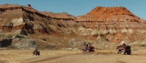
San Juan ATV Safari riders navigate the Piute Pass trail south of Hanksville and west of Blanding, Utah.

Two weeks too late
I think that this is a sad story. I understand both sides of “not wanting more ATV trails” and “wanting to connect existing trails” and especially “getting ATV’s off other roads.” I get that “if there are hundreds of miles already within the monument, what’s six more?” and “if there are already hundreds of miles, why do you need six more?”. In short, I get how people can disagree about this specific trail. But really, they’ve been working on this six miles for 12 years and they missed the window by two weeks? Can federal land management get any sillier? If it were up to me, I would take existing projects and have a separate process for determining whether to “grandfather” them in or not. This article by Amy Joi O’Donoghue of the Deseret News is worth a read in its entirety..be ready to laugh, cry or both.

The new Bears Ears National Monument is already impacting land use in the region after a judge said an 12-year-old proposal to build an off-road trail is contrary to the presidential proclamation.

A judge with the Interior Board of Land Appeals ruled this week that no work can begin on the 6.4 mile ATV loop the Bureau of Land Management approved for the Indian Creek area until an appeal brought by environmental groups is settled.

The loop, sought by San Juan County since 2005, was approved by the BLM in December, just a little under two weeks before then-President Barack Obama made the 1.35 million-acre monument designation in southeast Utah.

Judge Silvia M. Riechel noted the proclamation states that any additional roads or trails designated for motorized use are restricted to those necessary for public safety or protection of objects covered by the proclamation.

Even though the BLM approved the trail prior to the monument designation, Riechel said the agency’s decision was not yet in effect because of an automatic 30-day appeal period.

“This is an exciting victory for wilderness, and is the first time an administrative body or court has addressed the legal effect of the Bears Ears National Monument proclamation, which calls for careful consideration and analysis when managing the spectacular and irreplaceable resources within its boundaries,” wrote Kya Marienfeld in a blog posted by the Southern Utah Wilderness Alliance.

Apparently there’s a 30 day wait period for ordinary BLM decisions, but not for extraordinary decisions like Monument designations.

Nobody knows at this point what kind of restrictions are actually going to be employed on the monument. It’s all up in the air,” Rampton said.

He added that the delay, too, marks another setback in what has been a long, drawn out battle.

“The plaintiffs in the case, the environmental groups, just don’t want ATVs anywhere. They certainly don’t want ATVs in any area that has wilderness characteristics. That is what their primary objective is, to keep ATVs out of the public lands to the greatest degree possible. They are very dogged and determined, and they are having some success,” Rampton said.

The environmental groups successfully argued that granting a delay in the construction of the trail prevents unnecessary environmental degradation to lands that would remain damaged long after the appeal is resolved.

The decision concluded that public interest was best served by preventing environmental degradation and preserving the status quo.

The BLM had argued that the 65-inch wide trail did serve a public safety purpose by routing ATVs off an existing trail frequently traveled by full-sized vehicles.

It’s also interesting that “the BLM argued” and apparently the BLM was on the side of the trail.. yet the BLM supported the Monument designation also. Perhaps the court case was unable to shift gears that fast? It would certainly appear that elements of the BLM (and the Justice Department) did in fact support something (at least until mid-December) that was contrary to the designation.

It’s About Science- You’re Kiddin’ Me (Bears Ears)

We all know that “science” is good and “politics” is bad, right? That’s if we don’t read in disciplines like sociology of science, or science policy studies (not “science”?).

As I noted recently, when journals that don’t usually talk about natural resource stuff start publishing things, there is usually some kind of political angle. Again, because “scientists” think a certain way (even if there were a poll of all scientists) that doesn’t make it “science.”

Of all things, Science has an op-ed (this one is an op-ed without cites) “Science and politics collide over Bears Ears and other national monuments.”


What’s the value of a national monument designation, aside from protection?

Frankly, it’s about money. Utah, like many states, has struggled to fund its own paleontology program. The state’s Bureau of Land Management office currently has just one paleontologist and two law enforcement officers. The national monument designation comes with a mandate for more funding for law enforcement, which means more eyes on the ground to keep fossil thieves at bay and more money for education “so that people know there are fossils out there,” Gay says.

If the question is “what is the best use of public resources for the BLM?” does anyone really think that that’s a “science” question? And as economists tell me, if it is a science question, wouldn’t economic and social sciences be involved? Does anyone who visits the BLM and FS lands out there not know there are fossils out there?

I did think it was interesting that the Monument Designation “comes a mandate for more funding for law enforcement”- hadn’t heard that before.

Do scientists think the land set aside in the Bears Ears National Monument is big enough to protect its treasures?
Not surprisingly, Obama’s order was a compromise. There’s a large region, called Red Canyon, that was dropped from the final monument boundary—it, too, contains a trove of Triassic fossils, Gay says. But mining companies are interested in its uranium deposits, and pushed successfully to exclude the canyon in the monument. Red Canyon has an existing mine, the Daneros Uranium Mine, which produces a concentrated form of uranium (known as yellow cake) to make fuel rods for power plants. The national monument designation would prohibit new mining operations, and the mine’s owner, Energy Fuels, is seeking to expand the mine from its current 2 hectares to about 19 hectares.

So scientists need the extra 17 hectares or about 42 acres of fossils out of 1,351,849 acres currently in the Monument?

But perhaps my favorite part is this history:

In July 2016, Representative Rob Bishop (R–UT), who is also the chairman of the House of Representatives Committee on Natural Resources, and Representative Jason Chaffetz (R–UT) rolled out their Utah Public Lands Initiative, which included plans for what is now Bears Ears National Monument. However, the proposal, which promoted fossil fuel development in parts of the region and allowed motorized recreation, met with stiff opposition from both environmental and tribal groups, as well as from the Bureau of Land Management and the U.S. Forest Service. Bishop and Chaffetz tried unsuccessfully to win House approval for their plan before President Obama made the announcement.

Apparently not ALL tribal groups (based on our own information here and other news stories) but what a surprise! The FS and BLM (executive branch agencies) supported the President’s designation!!

Sorry, Science, I’m a scientist, too, and I don’t agree 1) that land use determination are science questions, although they should be informed by scientific data, nor 2) with the values espoused in this article.

Whitebark pine still waiting on ESA

Whitebark pine are being killed by a disease, white pine blister rust, as well an insect, the mountain pine beetle, according to the Fish and Wildlife Service.

Meanwhile, other species of trees have crowded out whitebark pine due to fire suppression efforts over the past century, the agency said.

The Wildwest Institute and the Alliance for the Wild Rockies couldn’t convince the 9th Circuit Court of Appeals that whitebark pine should be a priority for protection under the Endangered Species Act.  The Fish and Wildlife Service found whitebark pine to be warranted for listing but precluded by higher priorities.  The priority system the agency uses for considering additional species made whitebark pine a priority for listing, but the court held that the Service doesn’t have to follow its own priorities.  Whitebark pine remains a candidate species.

A conservation plan puts science ahead of politics

This story about the Pima County Arizona conservation planning effort isn’t directly about national forests, though there should have been (and probably was) coordination with the Coronado National Forest.  And my point here isn’t about the success of a conservation plan driven by the need to protect at-risk species (arguably an ESA success story).  It’s about the role of scientists in the process (Sharon).

“County leaders stated from the outset that their primary goal was to conserve biological diversity through a scientifically defendable process, not to come up with a plan that everybody could agree on,” wrote the late urban planning specialist Judith Layzer in her 2008 book Natural Experiments, which analyzed more than a half-dozen regional land-conservation efforts.

The scientists and county staff discussed the plan in public sessions, but county officials made it clear that their work would not be derailed by complaints from developers and other critics. The scientists established standards for identifying biologically valuable lands and used computer models, observation records and the judgment of local naturalists and recognized experts to come up with a biological preserve map.

In contrast, in other multi-species plans, scientists, politicians, agency staffers, developers and moderate conservationists collectively determined which lands to save, thus bringing political and economic considerations into the science.

Looking back this spring, Huckelberry, a former county transportation chief, says he was simply applying the best practices from his previous job, highway planning, to land conservation. Typically, both a technical committee and a citizens’ committee review big road projects, he says: “The whole purpose of a technical advisory committee is not to play with the numbers, not to slant the analysis. We felt the political side could potentially be used to manipulate the scientific side, and felt that would bias the entire process.”

After the science team created a map of the proposed preserve system, a separate steering committee of 84 people, including developers, environmentalists and neighborhood leaders, haggled over its details. By then, though, the plan’s broad vision was already solidly in place.

Bringing this back to the Forest Service, this is similar to how a team of biologists developed the Lynx Conservation Assessment and Strategy, which was then followed by forest plan amendments that “haggled over the details.”  The Forest Service doesn’t like some of things it can’t do, but there haven’t been challenges to the science.  The grizzly bear conservation strategies seem to be more like the alternative process, where what the land managers want is infused into the discussions of the science.  (The Yellowstone strategy was already voided by a court once because of scientific issues.)

Are Trump’s climate censors at the door of forest planning?

In conjunction with publishing its notice of intent to prepare an EIS and draft forest plan, the Gila National Forest revealed a bit of the thinking going on on at least one national forest about whether they should continue to address climate change in the forest planning process.

Throughout the assessment process, the Forest team took a close look at the significant effects of climate change on the Gila. According to Schulz, directives from U.S. President Donald Trump to other agencies to release no evidence of climate change they find have not been represented in the assessment report.

“The documents still do talk about climate change,” he said. “You will see that. We will just see how this all works moving forward. There are a lot of aspects we will still be talking about using some aspects of terminology, like ‘drought.’ There is clearly strong local interest in managing the effects of climate change.”

So maybe they would address climate change without saying the words?  At least they’re moving forward, for now.  It’s actually hard to imagine major backsliding in forest planning since the planning rule requires the use of the best available scientific information, and I think the Forest Service has been a leader in trying to apply climate change science.  The point about local interest is important, too.  If nothing else, if someone brings it up, the agency can’t arbitrarily dismiss it.

Fewer openings, fewer moose

Logging, intentional fires planned in Superior National Forest to improve moose habitat.” Good article that describes well what’s happened: cutbacks on logging = fewer openings = fewer moose. Treatments proposed on 8,000 acres out of a 115,000-acre management area.

Gives opponents only a mention and no quotes:

“Not everyone is happy. The Sierra Club and a retired Forest Service forester say the 26 miles of temporary logging roads proposed are too much, and that they will be adopted by ATV users and encourage the spread of invasive species while disrupting threatened animals such as wolves and lynx.”

But implementing the project requires the roads, I reckon.

Mind the Gap: Monument Review Via the New York Times

By WillMcC – Own work, CC BY-SA 3.0, https://commons.wikimedia.org/w/index.php?curid=4379199

It’s interesting to see how folks outside the Interior West see things, as per this New York Times story. I think there are some gaps which we can try to fill in as this unfolds.

Mr. Trump, signing the order at the Interior Department, described the designations as a “massive federal land grab” and ordered the agency to review and reverse some of them.

“It’s time to end these abuses and return control to the people, the people of Utah, the people of all of the states, the people of the United States,” the president said…

Notice that this quote specifically states “Utah”. We can see that the President’s interest could be more about the larger. more controversial and recent (December 28, 2016) ones. You can see that in this Denver Post story also, in which Zinke met with Colorado, Wyoming and Nevada governors. Also you can read about a Governor asking President Obama not to designate in this story, and asking President Trump to rescind in this story.

It was in the news at the end of the Obama administration after President Barack Obama created several national monuments, setting aside millions of acres on land and sea. At the time, some Republicans in Congress said they wanted to reform the act, which they said encouraged federal government overreach, a claim that has dogged the law since it was adopted.

It’s interesting that the writer said simply “Republicans”.. I bet they were from the area. An R from, say, Florida is unlikely to care much. The write could have said “local and state elected officials, mostly Republican, from Utah and other western states, have questioned these large designations.” Otherwise it sounds like a partisan issue, which it is not, or not entirely, at the local scale.

The president can make national monuments only from land already controlled by the federal government, and the act generally does not change how the land is used, said Lisa Dale, the associate director of the Yale Center for Environmental Law and Policy. If leases for mining, ranching, drilling or logging already exist on land to be made into a national monument, they can continue, but new leases probably won’t be allowed, she said.

It’s interesting that the Times asks Lisa Dale, from a university in Connecticut (yes, I graduated from there but a long time ago), instead of someone from the Interior West. Both of the experts chosen by the Times are on the coasts, including our sometime contributor Char Miller.

Who could be hurt by possible changes?

Most Americans support protection of public lands. According to a 2016 study from Harvard’s Kennedy School of Government, more than 93 percent of respondents said that historical sites, public lands and national parks should be protected for current and future generations.

Char Miller, an environmental historian at Pomona College, said that if national monuments were diminished by the review process, it would actually hurt the people opponents of the law are claiming to protect.

Some designations are controversial, as was Mr. Obama’s designation of the Bears Ears National Monument in Utah in December. Republicans argued that it would hurt the local economy, but Mr. Miller said wilderness areas can bring in tourists who support local businesses.

But public lands are already “protected” from many things.. not sure how that KSG study is relevant, except to paint a picture. Miller makes an interesting claim here that local people would be hurt by removing the designation. If the land is managed the same way as before, then how will they be hurt? By the lack of monument status on lands they already work and recreate on? Or the lack of money to their communities in the future by the designation? And it’s only been in place since December for Bears Ears, so how far down the path are they?

I don’t think that these quotes are fair to the complexity of the issue that is easy to unearth just by reading Stiles’ piece.

At three of the national monuments Mr. Obama created or expanded — Bears Ears, Katahdin Woods and Waters National Monument in Maine, and Papahanaumokuakea Marine National Monument in Hawaii — special effort was made to include Indian tribes in the designation process and continuing management of these areas.

Ms. Dale said that reducing these monuments or changing them “would have a chilling effect on tribal federal relations when it comes to protecting landscapes.”

People already involve Tribes in BLM and FS planning (on those same acres). Conceivably, they could be involved to the same extent without Monument status. If there is some problem with the standard way of working with Tribes, it seems to me that it should be fixed for all FS and BLM plans, and not require a designation status. It’s also possible that different Tribes feel differently about the details and the process.. and if so, some might feel “chilled” and others, not so much.

Who would it help?

If existing national monuments are reduced in size, it could benefit extractive industries like oil and gas, mining, logging, as well as ranching, Mr. Miller said, because the government could grant more leases on federal land. Given the Trump administration’s recent actions — including lifting the moratorium on drilling on federal lands and the obligation to limit methane emissions on public lands — officials might be eyeing new fossil fuel leases on previously protected land, though Mr. Zinke said he was not predisposed to make any such recommendation about the monument land.

Mr. Zinke said that he has heard claims that some monument designations have ended in “lost wages, lost jobs and reduced public access.” But he added that he believed “some jobs probably have been created by recreational opportunities.”

Some of the opposition to the national monuments may be ideological. Western ranchers and sportsmen have long complained about what they see as federal land grabs that limit their access to millions of acres of public territory. However, a majority of Americans in Western states, home to vast tracts of federal land, support maintaining public land.

(my italics)

This last bit was a bit of a stretch IMHO. Ideological? Ranchers and sportsman have “limited access”?
What was missing from this story- the gaps? The views of people like Stiles. Questions about designation and the outdoor industry. Questions about the process of designation and how that compares to other land use planning exercises on federal land, in terms of public comment and environmental review. Designation’s potential impacts on motorized and mechanized recreation. Questions about the costs to the feds, and where the bucks for more planning and visitors’ centers and so on is going to come from- and what they won’t be doing instead. But we can take these up in later posts.

I’m glad they interviewed Zinke.

“No one loves their public lands more than I,” Mr. Zinke said. “You can love them as much, but not more than I do.”

Understanding the Legalities of National Monument Designation

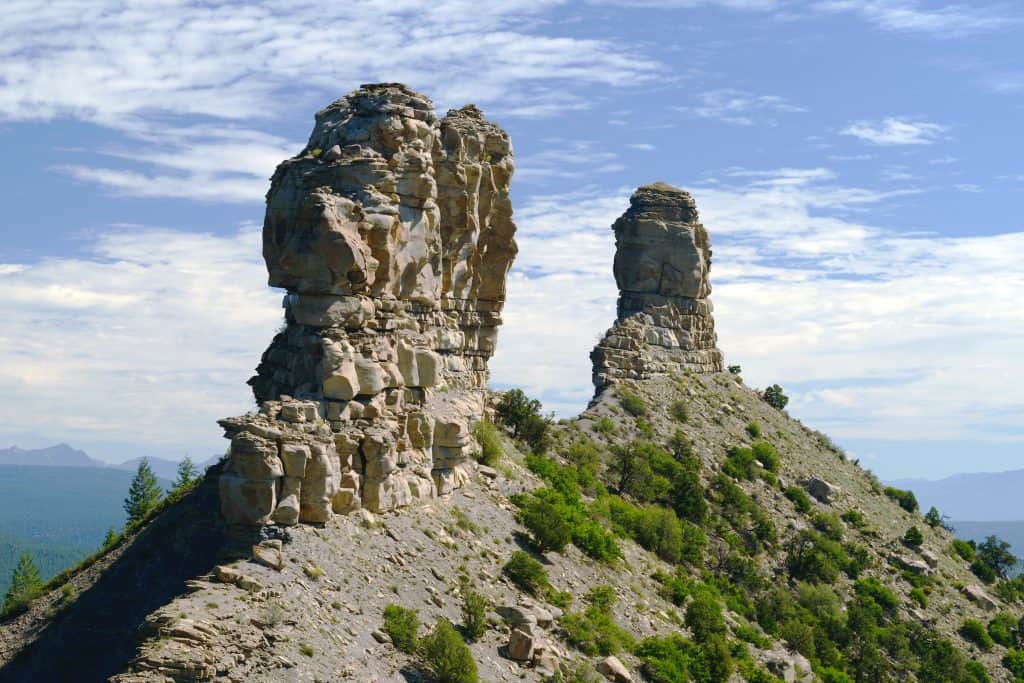
Chimney Rock National Monument, San Juan National Forest, Colorado

I thought this was interesting in an NPR story here..

“More recently, with most large public lands protection bills stalled in Congress, presidents from Bill Clinton to George W. Bush and Barack Obama have used the act as a tool to protect sweeping amounts of federal land mostly in the West.

President Obama’s late hour designation of the Bears Ears National Monument in Utah, for instance, protects more than a million acres — even though the Antiquities Act specifies that monuments designated by a president “in all cases shall be confined to the smallest area compatible.”

It’s this perceived overreach that partly spurred Trump to sign his executive order.

But if, after the review, Trump also decides to bypass Congress and act by executive order to shrink or even nullify any of the monuments, a court challenge is all but guaranteed.

“The Antiquities Act expressly authorizes the President to create a national monument, but it does not authorize a later President to revoke or modify a national monument,” says Prof. Carl Tobias of the University of Richmond School of Law.”

Here’s what Char Miller said about the Antiquities Act here:

What makes the act (16 USC 431-433) so profound is that it grants the president discretionary power to set aside portions of our public lands as national monuments so as to protect those “historic landmarks, historic and prehistoric structures, and other objects of historic or scientific interest that are situated upon the lands owned or controlled by the Government of the United States….”

Its chief proponents in the late 19th century were historians, scientists, and archaeologists infuriated by the routine pillaging of ancient ruins across the southwest; the rampant desecration of sacred sites.

I’m with the idea that something like Chimney Rock fits this designation and Bears Ears not so much. But my legal question is 1) if someone takes the clause “shall be confined to the smallest area compatible” and makes the case that the designation is illegal itself as violating the Antiquities Act, could it still be “revoked” through the courts, just not through the executive branch(?). Legally, it would not be “revoking”, I guess. It does seem a little odd that one President can do something (at the last hour of his administration) that cannot be undone later by the executive branch. It’s kind of like transferring the decision authority from the executive to the judicial branch. I wonder how many other laws work that way? I’d be interested to see what our readers more familiar with the legal system have to say about this.

Introduction to the Landscape of Fire Sciences

From Olson et al.

Jon asked an excellent question in our previous discussion: “who counts as a wildfire expert?”. It seems to me that with the recent March for “Science” it’s probably a good time to dig deeper into some aspects of how the science business works in reality. So a simple question, like “who is a wildfire expert” is a great entry into looking at the landscape of scientific disciplines.

So let’s start thinking about different pieces of the wildfire puzzle. One piece is obviously suppression, as in large groups of people and equipment who manage wildfires. Well, there’s the behavioral psychology of groups, there are the modelers who work on the models wildland firefighters use, there are people who test those models through experience (but may not publish on the results themselves). There are people who make observations (the fire went to the ground in that strip). Within that bunch of sciences, I don’t know all the subfields but I’d like to hear from someone who can explain it. Here are a few from the Missoula Fire Science Laboratory:

Physical Fire ProcessesThe factors that determine fire behavior (fuel, weather, and topography) do so through the requirements for combustion (fuel, heat, and oxygen).
Fuel DynamicsResearch on fuel dynamics helps managers describe live and dead fuels that burn during wildland fires.
Smoke Emissions & DispersionScientists use field observations, satellite data, and models to describe smoke’s chemical composition, its movement within a fire’s heat plume, and its movement through the layers of the atmosphere.
Fire EcologyThis research contributes to improved conservation, restoration of burned areas, and reduction of fire hazard.
Fire & Fuel Management StrategiesHistorical patterns of wildland fire are combined with information about climate and vegetation to predict fire occurrence and vegetation patterns.
Science Synthesis & DeliveryScientific publications form the foundation for science delivery.


Here’s a list of interesting pubs from the Joint Fire Science Program, you can see the variety of kinds of studies.

Given these approaches to fire science, only one of which is fire ecology, we can then review the backgrounds of the researchers in the PNAS study. I have looked at them all and produced the attached document here that describes their backgrounds.  We can see that most have a background in fire ecology, but not so much in fuel and fire modeling.  Could seeing things through the lens of “ecology” affect the way their perspectives? It being a focus on “natural” processes and maintaining them? More on this in the next post.