Creekside Ruminations on Climate Change from Bark Beetle Country

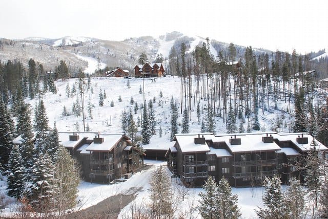
A couple of weeks ago, I was on a field trip on part of the old Routt National Forest, when I had to take a climate change conference call. Since cell phone coverage was spotty, we targeted a good spot and I was dropped off for a couple of hours and sat at creekside while on the calls.

Looking at the dead trees on the hills, it became clearer to me some of the disconnects between climate change as talked about or written about in scientific journals, and as currently lived.

1. People are already dealing with climate change every day as part of their work.
People are felling hazard trees, doing WUI fuels treatments, looking for biomass opportunities, etc. Climate change is just another change agent that affects our work.

2. We may never know how much of what we observe is due to climate change (take bark beetles; 100% climate change? 75% climate change plus the age of trees 25% ?). But we still have to deal with the changes, regardless of their source. So it probably doesn’t make sense to have a separate pot of funds for climate change adaptation or resilience- otherwise we might spend out time in tedious disagreements about whose problem is more climate-induced.

3. We will be dealing with these issues collaboratively, locally (for the most part) using an all lands approach, and involving regulators and communities early and often.

We can’t or shouldn’t get to the point where the community and the FS are in one place, but the regulators have a different worldview.

4. Climate change will include opportunities as well as hazards and difficulties.

For example, at the Steamboat Ski Area, we visited a site where dead trees provided an opportunity for a children’s outdoor ski run.

5. It could be argued that the complex structure of direction in the Forest Service does not make us as flexible and adaptive as we need to be. Changes due to climate change and other factors can occur more quickly, and in different spatial/temporal configurations, than the current structure can easily respond to.

For example, the ranger district or forest is the right scale for many decisions. But not for bark beetles. Should it be dealt with by the current three forests? An interior west scale group? What would be the governance of such a group?
We have the incident command model for fires.. but if something is large, but not a month by month kind of emergency, do we have an organizational structure to deal with it?

6. Safety of our employees and the public need to come first.
I don’t know at the end of the day how many climate change issues will have real safety hazards such as bark beetle and other sources of dead trees. The urgency requires new ways of working together in a timely way. Environmental groups, industry groups, local communities, regulators- we all need to be able to speed up from our bureaucratic and legal natural rate of speed to an emergency rate of speed.

7. If ecosystems are too complex to predict (“more complex than we think, more complex than we can think”), let’s use scenarios and not specific predictions, and pick “no-regrets” strategies. I wonder sometimes if we are overthinking and overanalyzing climate changes and I think we should consider the opportunity costs of what we could to to “protect reconnect and restore” in the Trout Unlimited strategy versus “assess, predict and model.” Note that while common sense and decision theory under uncertainty have always argued for “no regrets” strategies, now at least some water scientists agree.

I would ask us to think about that climate change may be a stressor to our organizational and social systems as well as the environment. It requires us to work together faster, and better than we have in the past. I often wonder if climate science funding were divided half to social scientists (with one quarter to business and public administration schools), what would the “best available science” look like?

I’d be curious about others’ ruminations on these topics…
Alternative to Litigation- Western Watersheds and Ruby Pipeline

Here’s a link to a piece describing this …

But with El Paso’s commitment, “we agreed not to try to delay or litigate Ruby Pipeline,” said Jon Marvel, executive director of the Western Watersheds Project. His group is one on three plaintiffs in a federal lawsuit challenging the U.S. Fish and Wildlife Service’s refusal to declare the greater sage grouse a threatened or endangered species.

Marvel expects the Western Watersheds fund to eventually be used to buy grazing permits from willing ranchers, but the organization first wants Congress to approve legislation to allow federal agencies to permanently retire grazing permits in such cases.

“It’s unprecedented to have the support of industry to work for the retirement of public grazing permits,” Marvel said, emphasizing that the fund would only buy permits from willing sellers.

Idaho Roadless Litigation- Principle vs. Protection? Colonialism vs. Common Sense?

Here is an article from the Idaho State Journal on TU and ICL filing a friend of the court brief in the Idaho Roadless litigation.

My problem with the Sierra Club/Wilderness Society position is that they are so philosophically committed to the concept of roadless area protection requiring a national solution that I don’t really believe they can be objective about the solutions proposed in a state’s rule.

Just compare the Chris Wood quote

“The Idaho rule is a demonstration of what can happen when common sense is applied to a common problem for the common good,” Wood said.

To the Craig Gehrke quote:

“We just don’t think a state approach is going to lead to good, consistent management, any more than having a state-by-state system for running the national parks,” said Craig Gehrke, regional director for the Wilderness Society. “Simply put, we have less protection with the Idaho rule than under the Clinton rule.”

Certainly one view is that everything of importance should be decided nationally.. however, that’s not my view. Nor, more importantly, T.U.’s. Is it about the principle or the protection?

P.S. photos of Idaho Roadless for this blog entry would be appreciated.

New Posts on FS Planning Blog

Next week July 29th and 30th is the Roundtable in DC. Here is the agenda. Info on webcasting does not yet seem to be available; I will post when I find out.

If you have ideas you might want to respond to these new blog posts on the official blog by next Thursday or Friday (and crosspost them here if you want). Here’s the note we received on the new blog posts.

We’ve posted the approaches to Monitoring and Evaluation, Resilience,
People and the Environment, and Recreation we are considering for the
proposed planning rule to the Planning Rule blog at
http://blogs.usda.gov/usdablogs/planningrule/ and to the Planning Rule
website at http://fs.usda.gov/planningrule.

All-Lands & Planning

Plum Creek/Lolo NF checkerboard

Without further details and language, I’m unsure of what to make of the USFS’s draft planning rule framework.  I’m anxious to see the draft language and learn more next week at the 4th Roundtable.  But I can’t help feeling somewhat positive about the agency’s apparent willingness to adopt an “all-lands approach” to planning. 

It’s impossible to fully exorcize the cynic out of me, so I realize that this might amount to nothing more than some recasting of ecosystem management.  But the Stuart Smalley in me says that this could be an important turn for the agency. (yes, I need my daily affirmation). 

Just a few years ago, during the 2005/08 regulations, several national forests revised plans without even acknowledging their broader landscape and ecological context.  

I found this incredibly frustrating.  How, for example, could national forests in western Montana not even mention the word “Plum Creek” in a revised plan?  How could the agency simply ignore the largest private landowner in the state and its real estate subdivision plans on adjacent checkerboard sections?  Such context would be provided during NEPA-analyzed projects supposedly, but I remain unconvinced, and still think a forest plan should situate a national forest in its broader landscape.   

In was within this context that Char Miller and I wrote the following essay (NIE Miller article (2)) (a few years ago actually, with the essay “in press” forever).  I lied, bribed, harassed, cajoled asked Char to provide the historical context and to set the stage for a few pretty general observations of my own.  Here is our abstract:

 The U.S. Forest Service (USFS) identified the loss of open space as a core threat to the health of national forests.  Widely acknowledged are the ecological interconnections between public and private lands.  But there is also an important historical and political relationship between national forest management and private land development.  There is ample historical precedent for the USFS to consider what is happening outside its jurisdiction and respond accordingly on national forests.  We expect national forests to become more politically contested in the future, as a result of the fragmentation taking place on private lands.  If the agency fails to consider the larger landscape when making decisions, we also expect a growing number of interests to challenge it politically and legally.  There are several policy tools and strategies that can be used to deal with the private land development problem, and we focus on a few approaches that have not received as much attention. 

I expect federal lands to become more politically contested in the future, as more private lands get developed.  A compensation principle will be hard to miss.  But an all-lands mindset might cut in numerous political directions.  Take grazing-lease decisions, for instance, and the debate over “cows versus condos.”  Will the demise of public-lands ranching lead to further land fragmentation as ranchers are forced to sell and subdivide their adjacent private property?  Debate notwithstanding, it is reasonable to ask the Forest Service to consider the environmental impacts of their leasing decisions at a landscape level, with possible threats to private land included. 

My take is that the USFS is on solid historical footing; and that embracing an all-lands approach will pay political dividends in the future as well.

Collaboration and Fire Impacts in Northern Arizona- from Derek Weidensee

Derek wrote in to say:

Just wanted to share a couple links to a couple news stories in today’s “Arizona Daily” in Flagstaff AZ. The first is a flood resulting from the Schultz fire of a couple weeks ago. The second is an OP-ED by a member of the Greater Flagstaff forest partnership voicing his frustration at the lack of “collaboration” between moderate enviros (GFFP) and more radical enviros at the Center for Biological Diversity. The CBD appealed and stalled a collaborative effort between the GFFP and the USFS to thin 12,000 acres that covered the Schultz fire. It doesn’t have much to do with planning-but it does have a lot to do with the frustrations of collaborative planning. And I think its represents a schism that is developing, and may develop much more in the future, between moderate greens and radical greens.

Cumulative Effects Analysis – A Guest Post by Courtney Schultz

Attached is a piece I wrote that came out of my dissertation research on how the Forest Service handles cumulative effects analysis, particularly when it involves resources that see effects over long temporal and broad geographic scales. This article came out in Bioscience this month and is a short piece that focuses especially on the limitations of how we do the analysis for wildlife species. My intention was to look at the requirement and at current practice and provide a critical assessment of where/how it falls short, where it works, and what are impediments to and opportunities for improvement. I’d be interested to hear what you all think. Having worked as a PMF (Presidential Management Fellow) for the last year, a question that looms large for me and that I would like to have addressed more is: What could practitioners (from district to regional offices) do to improve analysis with the resources available? I touch on this to some extent, but I’d like to keep exploring it. I look forward to hearing any of your thoughts and feedback.

Courtney Schultz is currently a Presidential Management Fellow with the U.S. Forest Service. She completed her Ph.D. at the University of Montana in the College of Forestry and Conservation and this fall will begin work as an assistant professor of forest and natural resource policy at Colorado State University.

More 21st Century Problems

Following up on last weekend’s post.. on 21st Century Problems. Here’s two from this weekend’s news.

Are campgrounds for the public or for making a profit? By Pete Zimowsky here.

And Illegal pot grows damaging forest land by Tiffany Revelle here.

Why are topics like climate change and ecological restoration more likely to garner funding than the fundamentals of providing campgrounds and keeping federal land safe for the public and not a trashbin for criminals?

Forest Role Reversal- Guest Post from Derek Weidensee

The much maligned, much despised, and much misunderstood Clearcut is being seen in a new light these days. The driving force behind the new image is wildfire and the Mountain Pine Beetle (MPB) epidemic that has killed off millions of acres of lodgepole pine primarily in Montana and Colorado. The public never understood the ecology or the silviculture behind a clearcut and thus presumed it only represented the most efficient and therefore greedy method to extract timber. Well, that attitude is changing. Nothing explains the ecology behind a clearcut to the public better than a MPB epidemic or a wildfire. Suddenly they get why foresters did them.
Across millions of acres of MPB killed watersheds, the only “green islands” in a sea of red are the young trees of regenerated clearcuts We know the MPB doesn’t attack these young trees. If you’ll look at my previous “clearcuts don’t burn” posting on the sosf blog, you’ll also see that 80% of regenerated lodgepole clearcuts don’t burn in wildfires. The “green islands” in a sea of black is a striking contrast.
For Google Earth proof of the “green islands”in both settings, type in the following Latitude and Longitudes in the “fly to” box.

(Technical note from Sharon for Google Earth newbies: I think how this works is that you need to download Google Earth to your computer. Then when you click on the Google Earth icon, a screen will come up with a box that says “fly to”. You type the coordinates Derek says into the box and the area will come up. If you are like me and haven’t been paying attention to current technologies, you will be very impressed!)

46 18 56.14N, 112 25 39.47W is a green island in a sea of red north of Butte MT. For a good view of the Green islands in a sea of black type in the following locations:48 25 35.01N, 114 49 44.43W is the Brush Creek fire west of Whitefish MT. 45 41 34.44N, 113 45 13.15W is the Rat creek fire west of Wisdom MT. Perhaps my favorite is 48 48 22.39N, 115 11 12.55W south of Eureka MT. Use the “clockface” on the toolbar to see pre fire photos.

Beware a fickle public. The public’s perception of forest policy is really based upon aesthetics. 20 years ago they say a raw clearcut in a sea of green and decried them. Today they see a green regenerated clearcut in a sea of red or black and they wonder why they didn’t do more of them. The green islands are taking on a “forest role reversal” in the public’s mind. They’re also taking on a role reversal in forest structure that will impact wildlife. I’d like to further discuss this “forest role reversal” as it applies to the public and to wildlife.

Forest role reversal and wildlife: The photo at the top of this post just about sums it up. Last summer I was driving through a 10 year old burn north of Sula Montana when I spooked the herd of Elk in the picture. They were running into a 28 year old regenerated clearcut (so said a nearby sign). The clearing in the foreground they were grazing on was a mature forest that burned and was then salvage logged. It dawned on me that the clearcut that had survived the fire was now the hiding and thermal cover, and the burned old growth is now the forage. 10 years ago the roles were reversed.

Throughout millions of acres of MPB mortality in Montana and Colorado, the only hiding and thermal cover will be the regenerated clearcuts. I know there’s still spruce up high and fir down low, but many watersheds are almost pure stands of lodgepole. Furthermore, and contrary to public perception, very little of the “forested acreage”(I didn’t use total) was logged on National Forests in the impacted forests. Only 3% of the White River forest in Colorado was logged in 50 years. Only 7% of the helena, 5% of the Beaverhead-Deerlodge, and 7% of the Gallatin in Montana were logged in 50 years. Even in watersheds with a “timber emphasis”, seldom was more than 20% logged. The green islands are sprinkled about in “not to exceed 40 acre”(thankyou Mr. Bolle) lifeboats in a sea of red, black, and soon to be gray deadfall.

Furthermore, what will the “quality” of the forage be? I know the burned forests will have good quality forage. I know the forage will be heavy in the MPB deadfall but how “accessible” will it be? I read a tidbit in a USFS EIS for a Colorado salvage sale which says the deadfall will “restrict access to” and “make unavailable” the forage. Are there studies that show how much the deadfall will inhibit use? Perhaps salvage logging next to a “green island” would be very beneficial to Elk. Perhaps I could convince Judge Molloy of this. Nevertheless, habitat effectiveness tables will have to be redrawn across the west.

Forest role reversal and the public: Considering the disdain the public has for clearcuts-the following may be a reach. As crazy as it sounds, I think in the next 20 years the public will be choosing the green islands over the gray deadfall for more of their outdoor recreation. Case in point is Breckenridge Colorado. The USFS is proposing to salvage log 5000 acres around the town in a 600′ firebreak.. Because of deadfall, in 10 years the citizens won’t even want to try and walk past that firebreak. When I MPB salvage logged in the late 70’s, we literally had to cut our way in. It was easier to walk across the sale balancing on deadfall without ever touching the ground.

However, just west of town is a row of nice 25 year old “green islands” from the last MPB salvage effort in the 80’s. They were much derided then. I mentioned to the Mayor that he should urge the USFS to “pre-commercially”thin the regenerated lodgepole. This elevates the fire hazard for ten years of course, but then we know the MPB fire hazard isn’t gonna be really bad for 10-15 years until all the deadfall hits the ground. Too bad the USFS has prohibited pre-commercial thinning because of the Lynx Amendment. With thinning, those clearcuts could look like this area.

It’s a 35 year old clearcut thinned 15 years ago. Looks like a park doesn’t it. The below area is a 46 year old clearcut. You wouldn’t even know it if you were driving by would you.

Perhaps the biggest role reversal of all is that it’s starting to look like all that clearcutting was a good idea after all. The biggest missing ecosystem component for these forests wasn’t the old growth, it was the early seral. It was missing age diversity.

Derek Weidensee has been a licensed land surveyor for the last 20 years in Rapid City, South Dakota. Before that he spent 10 years as a logger, five of those in Montana and Idaho.