Place-Based Forest Bills & Agreements


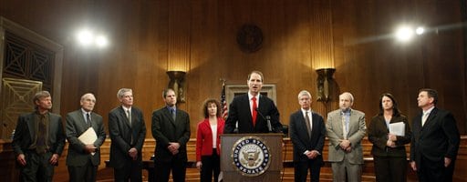
Senator Wyden of Oregon

This is my introductory post related to an important emerging trend: the increasing interest in “place-based” (national forest-specific) legislation and the use of formalized agreements/MOUs between the USFS and various collaborative groups.  We’ve had some discussion of Senator Tester’s Forest Jobs and Recreation Act already (here’s my perspective on it).  Another controversial bill is Senator Wyden’s S. 2895, the Oregon Eastside Forests Restoration, Old Growth Protection, and Jobs Act of 2009. 

While these bills receive national attention, there are place-based initiatives happening on other national forests as well, including the Lewis and Clark, Colville, Clearwater and Nez Perce, Fremont-Winema, Tongass, and federal forests in Arizona, among others.  Each initiative is different in significant ways.  But all are searching for more durable, bottom-up, and pro-active solutions to national forest management.  Some negotiations, like that on Idaho’s Clearwater and Nez Perce, may result in proposed legislation.  But others, including arrangements on the Colville and Fremont-Winema, aren’t based on forest specific laws but instead operate through formalized agreements and protocols with the USFS.

Here is a list of such initiatives that I’ve been looking at lately:

Bills and Legislation
S. 1470 Forest Jobs & Recreation Act (Senator Tester/Montana Bill)
S. 2895 Oregon Eastside Forests Restoration, Old Growth Protection, and Jobs Act of 2009 (Senator Wyden Bill)
Pub. L. No. 111-11, Forest Landscape Restoration Act
Rocky Mountain Front Heritage Act (unsponsored proposal) (Lewis & Clark National Forest, Montana)
Agreements
Northeast Washington Forestry Coalition Blueprint (Colville National Forest)
Lakeview Stewardship Group (Fremont-Winema National Forest, Oregon)
Misc/In Development
Clearwater Basin Collaborative (Clearwater and Nez Perce National Forests, Idaho)
Others at various stages of development (e.g., Arizona’s Four Forests Restoration Initiative, Tongass Futures Roundtable, etc.)

I’ve chosen this sample because it includes two controversial bills and two well-established MOUs that share some similar goals and purposes, but go about things differently.  I’ve also included the proposed Rocky Mountain Front Heritage Act because it provides a specific proposal focused on travel management and other resource management issues, like weeds.  My analysis also includes the Forest Landscape Restoration Act (Pub. L. No. 111-11).  I included this Act because it shares some similar goals and purposes as found in the aforementioned bills and MOUs, and because some initiatives hope to use funds already authorized in the law.   Also included in parts of the analysis are some proposals that are still in the drafting stage.  In these cases, no final agreements have been made, but in some situations there are preliminary areas of agreement that are of relevance.  This list is not exhaustive, and there are others I hope to learn from as well, like the restoration efforts in Alabama, the Four Forests Restoration Initiative in Arizona, and the tumultuous life of the Tongass Futures Roundtable. 

What I hope to do in this series of posts is to make some initial observations that are of general relevance to national forest management, and in some cases of particular relevance to the new forest planning rule.   I believe these cases offer a lot of lessons, from the bottom-up.  I also hope that our sophisticated cast of contributors and readers can help raise questions, and in so doing help sharpen my analysis of this issue. 

Martin Nie

Science or “Scienciness” Situation 4- When Scientists Speak for Nature

This is Science Policy “Situations that Shout Watch Out” Number 4
Back to the Hanson paper.
Ecologists are apparently saying (either they are saying this, or the statement is so global about ecologists as to be incorrect) that high intensity fire must be “facilitated”

There is strong consensus among ecologists that high-intensity fire, and resulting snag forest habitat, is something that must be preserved and facilitated, not prevented or destroyed

The Hanson goes on to say a lot about wildlife, plant and bird diversity.

But what about these watershed scientists with USGS?

In addition, surface water flowing from burned areas may carry increased levels of sediment, organic debris, and chemicals that may contribute to significant degradation of municipal water supplies and aquatic habitats.

Or this study at PNW.

With less productive soils, Bormann said, a forest will not grow as quickly nor reabsorb as much carbon as before a burn—a process critical to mitigating the accumulation of atmospheric carbon, which traps heat in the atmosphere and can, thus, raise temperatures.

So some scientists say that “high intensity fires are good for some plants and animals”. Other scientists say “bad things can happen to good soil and aquatic habitat from high intensity fires.”(actually we don’t have to read about that, we can observe it directly).
Other scientists measure the differences in soils.

All these different positive and negative impacts happen from the same event- high intensity fire. Given that array of possible impacts, how do we decide how to manage vegetation and fire?

1) Back to the Basics. Work on keeping hydrologic function and soil- no matter what some plants will grow and some animals will eat them. Vegetation is a blanket that will grow if we maintain soil and water. This is a good strategy even under climate change. This empowers hydrologists, soil scientists, fish bios and aquatic ecologists. You could call it restoring and protecting hydrologic function.

2) Natural (pre European or ?) is best for vegetation and animals. First, we would have to figure it out. Then we would have to invest in efforts to manage for that, and live with negative impacts on other resources. Of course, this idea may not even be possible given changed conditions due to climate change. Like the concept of HRV, this empowers various kinds of ecologist. You could call it trying to retain some previous composition and structure.

3) Think about a given situation (which is never only about one thing- it might be about protecting communities AND watersheds) and work with people to figure out the right thing to do- informed by 1 and 2.

My point is that 1, 2 and 3 are not science questions- although 1 and 2 empower different groups of scientists to be the experts. 1, 2 and 3 are ideas about how land should be managed and priorities set. Questions like “who wins and who loses, among people and different components of the environment, what are the best investments in protection and restoration” are ultimately values choices. Even within environmental choices (losing endangered trout habitat versus potentially reduced species richness for plants), it can’t, ultimately, be a science question.

Scientists don’t know “what’s best for Nature” because Nature does not speak about what She wants. Fish here and birds there? Soils where trees can or can’t grow? We have feelings that we want natural conditions (fish in streams, good water quality) and that is wonderful. But when it comes to trade-offs, we can’t punt to scientists but have to work out what we want most, and what we don’t like but can live with.

Next Situation that Shouts Watch Out: redefining English words
Previous Situations that Shout Watch Out 1-3 and 5

Imagining A Changing Forest


A desired condition is not a picture.  It’s a movie.

This is a map of four seral stages for the Pagosa Springs district of the San Juan National Forest.  Young stands of trees (class 1) are very rare.  So are the purple areas representing the oldest stands of trees (class 4).  Most of the map shows middle-aged stands (red and green).  Think about how this information might be used in forest planning.  For instance, the purple areas might be important habitat for late-seral stage wildlife species, they might be mapped as ecological reserves, or they might have some unique social values we want to protect.

Here is a simulation of what could happen to these stands of trees over time due to fire, insects and disease.  Each interval in the movie is a 10-year increment.   It is based on work by Kevin McGarigal of the University of Massachusetts and Bill Romme now at CSU, for the San Juan Forest Plan Revision using a GIS-based simulator called RMLANDS.  It formed an understanding of the historical range of variability of vegetation for the DEIS.

The stand size and distribution is most dependent upon fire interval and fire size, randomly simulated based on historical data.  Over time, the tree conditions seem to float across the landscape like shifting sand.  There are some places where topography seems to influence the disturbances to allow persistence of older trees, but even these areas are eventually affected by the random events.

The smaller the scale, the larger the variation.  If you look at a particular place, there is more change over time in the color of the place.  The larger the scale, there is more likelihood that you’ll find the color you are looking for somewhere.

When planning for forests influenced by disturbance, landscape ecologists advise us that it’s important to think of time and space.   It calls for a discussion beyond static desired conditions.  Instead, a discussion is needed on the disturbance processes, if anything should be or can be done to shape those processes, and what we should do with the conditions that might result.  This is a very different type of forest plan than we have done in the past.

Putting Your Dot on the Map

They are “remembered landscapes.”

Nearly every weekend when I was growing up, my parents, my two sisters, our large family dog, and I would get in the car and head to my grandparents’ house in St. Maries, Idaho.  The trip was usually pretty boring for a kid, but we always got excited when we got to the White Pine Scenic Drive in the St. Joe National Forest.  The highway carved through the forest creating a tunnel effect, and in the middle was a sign along the highway that said “cool spring.”  Even the dog somehow knew when we were getting close to cool spring.  We’d stop, get a drink, walk into the woods a bit, and marvel at the dense trees with moss growing everywhere.  Down the road was the tallest white pine tree in the world, but that was just a boring statistic to a kid.   The statistics didn’t matter, but the place was special.

Today the sign is gone, cool spring is gone, and the trail has been expanded for motorized use.  White pine is incredibly susceptible to blister rust and many trees have died.  The large tree has fallen over.  My dad and my niece got their picture taken by the incredibly huge roots.  It doesn’t matter that the forest has changed, but the place will always be special.

When I was working in the Black Hills, I once talked to a county commissioner on the Wyoming side.  She told me that when she was growing up, her dad loaded up the Studebaker and headed up a road that isn’t even recognized as a road today.  They would reach a large meadow and have a picnic lunch.  Today, that meadow is overgrown with dense small trees, and probably needs to be thinned.  The place is special, but her experience is gone.

In Colorado, Monarch Pass feels like it’s on top of the world.  From the top, you can see an expanse of trees that seems to go forever.  For folks that have traveled on U.S. 50 from the east, this is their continental divide experience.

In the San Juan Mountains of Southwest Colorado, you can go on a hike from the desert to a meadow with a stream running through it, and look up at snow capped peaks as high as you can imagine.  It’s unreal that you can see desert and tundra at the same time.

Social scientists often group participants in a forest planning process as members of a “community of place” or “community of interest.”  I don’t have a direct economic or social stake in how forests in Idaho are managed.  I don’t even live in Idaho any more, but I am still connected to a “place” in a forest along a 12-mile stretch of highway.

Before 1976, the Forest Service conducted “unit planning” with units roughly the size of ranger districts.  In part to increase the working circle of potential timber harvest to assure a continuous supply, NFMA established Forest Plans.  But Forests often were too big for the community of place.  Then, the scale of planning grew even bigger.  The St. Joe and White Pine Drive were administratively split between the Clearwater and the new monolithic Idaho Panhandle National Forests.   The area around cool spring fell on the Clearwater side.  The old Forest Plan put White Pine Drive in a scenic corridor management area, but the area was too small to show on the forest plan map.  The Clearwater has now combined with the Nez Perce to complete one large planning effort.

The area in the Black Hills fell into an inventoried roadless area subject to the 2000 roadless rule.  Monarch Pass was designated in the Westwide Energy Corridor EIS as an important corridor.  The multi-state decision doesn’t mention how the corridor entirely covers the Monarch Pass Ski Area.

Forest planners have discovered that place matters.  The Medicine Bow-Routt-Thunder Basin has done three plans.  The Pike-San Isabel-Cimarron-Comanche will do two.  There are some excellent examples of place-based planning in the Beaverhead-Deerlodge, Chugach, and GMUG forest planning processes, where forests are subdivided into “places” for planning.  These were discussed in a 2003 workshop in Portland.    The authors note:

“Place-based planning” refers to land and natural resource planning efforts that bring together diverse human values, uses, experiences, and activities tied to specific geographic locations. Although planning efforts have always focused on specific places through land use zoning frameworks, place-based planning is different from other types of approaches. For example, whereas land use zoning segregates dominant uses from one another on the landscape, place-based planning takes a more holistic approach, focusing on identifying current uses, values, and meanings. In addition, place-based approaches tend to take a longitudinal perspective, exploring desired future conditions for the landscape. This approach enables participants to identify a variety of uses that might occur concurrently rather than designating one primary use for the upcoming 10 to 20 years.

Some commentators are concerned that place-based planning and the new emphasis on collaboration are putting National groups at a disadvantage.  Ohio University political science professor Nancy Manring wrote a paper in 2004 about the 2005 planning rule provision that replaced the appeals process with an objection process.   She observed:

McCloskey (2000), Coggins (2001), Foster (2002), Hibbard and Madsen (2003) and Kenney (2000) all have argued that collaboratives may maximize community-based interests at the expense of national stakeholders and values. As Weber (1999, p. 482) cautioned, “The danger is that such communities will develop a sense of themselves apart from and to the detriment of the nation.” No doubt, it will be easier for communities to develop a separate sense of themselves if representatives of national interests and values are not physically present at the negotiating table. The potential tensions between local and national values – between the communities of place and the communities of interest – are thrown into sharp relief by the realities of collaborative planning without the traditional appeals process as a safeguard. “

At the beginning of the planning process for the San Juan Forest Plan Revision, participants at public meetings were given sticky dots to place on a map.  There was even a parallel process on the web, where you could put a computerized dot on the map.  The idea was that participants could identify their special places, and where resource conflicts might occur.  These sticky dots were used in drawing the the forest plan map.  The Plan will use geographic areas as big as ranger districts, and within the areas, there are subdivisions displayed by using eight development “themes.”  A final Plan is expected next year.

Science or “Scienciness” : Sleight of Science

Situations that Shout Watch Out #5 (I am coming back to 4, but this seemed timely)

#5 Sleight of Science

This is a more sophisticated polemic technique than those previously discussed. This tactic sets up what someone (the “victim”) plans to do and then rounds up a set of science to suggest that it won’t work, or that it has undesirable consequences. The beauty of this rhetorical device is that the article does not accurately characterize what the person or agency (“victim”) is doing. Since most people not involved (the “marks”) won’t actually know the difference, it is a neat “sleight of science” approach.

Let’s look at the arguments in this paper, on the previous topic for “Science or Scienciness”, fuels treatments for community wildfire protection as described in the previous entry. So far this seems to be a good topic for deconstructing some of these “sciency” arguments.

Not to pick on this paper, either, and most of the statements made in the paper are generally accepted by scientists and practitioners.
This is from the argument on pages 21 and 22 of the paper.
First statement- within 1.5 miles, treatments are most useful to communities. Generally agreed.
Second statement- building roads and treating fuels far from communities are less useful to communities. Generally agreed.
Third statement- Cohen’s 130 foot band plus Firewise . Generally agreed that this is useful, but for various reasons not sufficient.
Fourth statement- Do it around communities.

Overall, it is going to be much less expensive, more
effective and less damaging to focus fire-hazard reduction
efforts around communities and homes than it
would be to try to make a wholesale modification of
forest structure over large landscap
es

Surprise twist. No one is proposing wholesale treatments, or not doing it around communities, in the policy the paper is discussing! We seem to be in violent agreement.

We can have a great discussion (and have had) with scientists specifically about 1/2 mile or 1 mile to 1 and 1/2 mile- I bet the writers of HFRA had the same discussion – as the same numbers are found in HFRA. But “far” would probably not invoke pictures of a mile or half mile.

Some have advocated a system of landscape- scale fuel breaks. Some science supports this concept (Finney’s work). But that is not a part of the policy this paper was intended to refute.

Addressing NFMA Timber Requirements Through the Restoration Lens

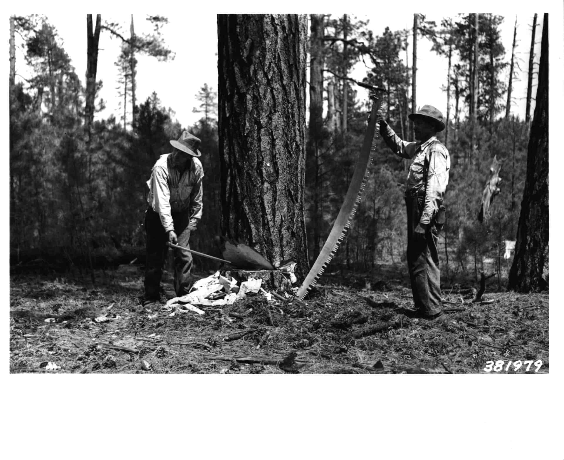
Arizona Lumber and Timber Company, Coconino National Forest, 1939, photo by Walter H. Shaffer

Sometimes language can get in the way.   Foresters are becoming aware that their traditional language for cutting trees confuses the public, and reduced their ability to explain what they are trying to accomplish.  This is especially true today when trying to reduce the chances of unwanted fire behavior, by “restoring” tree stands to conditions that were less dense.

In 2008, former associate chief Sally Collins coauthored a paper with Hutch Brown about the importance of rephrasing the purpose and need statement for vegetation projects, eliminating the use of traditional silvicultural terminology and replacing it with the language of a new collaborative process.  They pointed out that the technical language is difficult for lay audiences to understand, and because it originated in a timber culture, the language can cause confusion about a restoration project’s true purpose.  For collaboration to work and succeed, a new kind of language is needed that clearly communicates the intended restoration purpose.

In pointing out the problems with silvicultural terms such as “commercial” or “pre-commercial thinning”, “crown spacing”, “ladder fuels”, and “conifer competition”,  Collins and Brown point out: “Whereas Forest Service professionals and many interested groups are familiar with terms like these, others are not. Sustainable restoration efforts require broad public involvement and support, yet relatively few people are likely to engage in a project when they do not understand the terms used to describe it.

The same criticism of timber project descriptions also holds true for planning under NFMA.  Perhaps there is a way to be faithful with the act, but translate the terminology in ways that explain the ecological purpose of the projects.

Here are some of the possibilities:

NFMA Requirement1982 TerminologyPossible New Terminology
Determine forest management systems, harvesting levels, and procedures, and the availability of lands and their suitability for resource managementMultiple-use prescription for each management areaAgree on a theme for an area – what is the degree of human influence on natural processes like fire and insect and disease outbreaks?;What are acceptable changes and rates of changes to the forest?What are acceptable types of burning of the forest?
Identify lands not suited for timber productionLands suitable or not suitable for timber productionIdentify areas where trees can or cannot be removed and sold
Insure that cut designed to regenerate an even-aged stand will be used (for clearcuts only where its optimal) where such cuts are consistent with soil, watershed, fish, wildlife, recreation, esthetic resources, and regeneration of the timber resourceEven-aged silviculture and even-aged standsIdentify landscapes where we prefer trees at the same age
Insure timber will be harvested only where there is assurance that such lands can be adequately restocked within five years after harvestRestocking lands within 5 years after final harvestProvide small 6-inch trees within 5 years after a stand of large trees has been removed

Science or “Scienciness”- Situations that Shout Watch Out 1-3

In this series of posts, I will use as an example a recent paper The Myth of “Catastrophic” Wildfire: A New Ecological Paradigm of Forest Health. An article in New West brought this to my attention. I’ll use it as an example to describe situations that, from a science policy perspective, shout “watch out.” I expect that through the dialogue on the planning rule, there will be opportunities to address specific knowledge claims by scientists, and, for some, to investigate the logic path for the links (as we say in administrative appeals) between facts found and conclusions drawn.

Situation 1. High Hype Factor. In general, traditional scientific papers do not use words like “myth” “new” or “paradigm” in the title, or even words with “quotation marks around them”; if it sounds like it has been lifted from the pages of the scientific equivalent of the National Enquirer, it is probably a sign that the scientists involved are making an argument for some policy choice, not objectively evaluating evidence. Scientists can’t control the press office of their organization or university in terms of hype; but they shouldn’t be adding to the problem by overstating their contributions.

Of course, it is totally OK to make an argument for a policy choice; but you should be clear with the reader what your role is- you are not attempting to do an objective synthesis of science, you as a person with science credentials, are engaging in a polemic.

Situation 2. Lack of Peer Review. The need for and utility of peer review has been stated and restated. Even the problems of peer review have their own body of literature. For a scientific paper, peer review may be necessary but it is not sufficient to guarantee quality, for a variety of reasons. Many of these have been discussed with regard to the climate science literature. Some have argued that posting on the internet with opportunity for comments is an excellent supplement to peer review.

Situation 3. When Scientists Frame the Issue. This is a situation that occurs more frequently than desirable, and is actually the source of unnecessary tension between scientists and managers. Here is the way this dysfunctional cycle operates. First, there is a pot of money, to be distributed through a competitive process with a panel of other scientists. A scientist writes a proposal with a certain framing (e.g., fire protection of people and their communities is the same as protecting houses). Since none of the communities involved are at the table, and the framing sounds plausible to the other scientists, the proposal is funded. Then the scientist does the work. When they hear about the research results, managers then ignore the results, or only partially use them, because the results aren’t relevant to their framing of the issue. The last step of the cycle is that the managers are accused of “not using the best available science.” I have seen this cycle play out many times.

The scientific evidence is clear that the only effective way to protect structures from fire is to reduce the ignitability of the structure itself (e.g., fireproof roofing, leaf gutter guards) and the immediate surroundings within about 100 feet from each home, e.g., through thinning of brush and small trees adjacent to the homes (www.firelab.org–see studies by U.S. Forest Service fire scientist Dr. Jack Cohen)

In this case, the difference in framing is as simple as it’s not about the structures- it’s about the fact that people don’t want fire running through their communities. It is about all kinds of community infrastructure, stop signs and power poles, landscaping, fences, gardens, trees and benches in parks, people and pets and livestock having safe exits from encroaching fires. It is about firefighter safety and about conditions for different suppression tactics. That’s why fire breaks of some kinds around communities (not just structures) will always be popular in the real world. Of course, people don’t actually fireproof their homes either in the real world. “How can we best keep wildfires from damaging communities and endangering people” would be a more complex, but more real framing of the question. Note that one scientific discipline can’t provide the answer to this framing- there are elements of fire science, community design, fire suppression practice, sociology, political science and economics.

Next post: Situation 4. When Scientists Speak For Nature.

Lessons from the Northwest about Commitment to Adaptive Management

Diagram from Dept of Interior Adaptive Management Technical Guide

Adaptive management could be a component of a new planning rule.  In previous posts we’ve discussed the need for adaptive governance.  We’ve discussed the legal challenges.   In a previous discussion thread, Martin points out what some consider a flaw in the 2005/2008 planning rule, where we “simultaneously deep six NEPA (at plan level) while forwarding some ill-defined adaptive management/EMS framework.”   But is it possible to make the commitment to adaptive management?  Does the Forest Service have the management and science capacity? 

It’s worth considering the experiences in the Pacific Northwest.  In a previous thread, Andy provided a link to a paper by Forrest Fleischman.  Here’s part of Fleischman’s analysis:

Examination of existing literature on the implementation of adaptive management by the USDA Forest Service in the Pacific Northwest offers a few key lessons, however it also raises many interesting questions that cannot be answered with existing data. All of the literature indicates that the designation of areas devoted to adaptive management was not a successful strategy for promoting adaptive management. It appears that only one adaptive management area actually implemented anything that could be called adaptive management, and in that one case, the administrative designation does not appear to have been an important causal factor – instead, it appears that the designation occurred because of innovative research that was already occurring at the site.” p. 17

Here is a presentation from a 2005 conference from Forest Service research scientist Bernard Bormann on adaptive management in the Northwest Forest Plan.  Here and here are some additional publications.

In his presentation, Bormann says that adaptive management is harder than they first thought because adaptive management was never considered a “core business”, and most adaptive management areas are now idle. There are institutional barriers including lack of leadership, low budgets, and lack of learning structures. One idea he has is that the next generation of plans might contain “learning objectives.”  

There are many compelling reasons for the Forest Service to move from an “event driven” planning model (where large plan revision efforts occur every 15 years) to a more “continuous” planning model.  NFMA itself says that the planning rule should “insure research on and (based on continous monitoring and assessment in the field) evaluation of the effects of each management system to the end that it will not produce substantial and permanent impairment of the productivity of the land.” 16 USC 1604(g)(3)(C)    What will it take to successfully implement this requirement?


Considering the Science Of Land Use Planning

submitted by Dave Loomis

Rational Planning

After World War II, the University of Chicago’s newly created Program in Education and Research in Planning was enormously influential in setting the direction of planning theory. Keynesian economists, pushed the faculty to define and systematize core areas of knowledge in planning, perceived essential to practice. It was the search for this core for the profession that led to the development of a generic model for planning in capitalist democracy and incorporation of ideas from various social scientific disciplines, including economics and political science. The rational planning model, became a guide in the profession and beyond as an approach to problem solving in the public sphere ;

1. Ends reduction and elaboration;
2. Design of courses of action;
3. Comparative evaluation of consequences;
4. Choice among alternatives;
5. Implementation of the chosen alternative.

The five steps were later simply described as “Desires, Design, Deduction, Decision, and Deeds. Reproduced, more or less, in countless presentations since, these steps describe a problem-solving framework for complex human enterprises. The model is both self-evident due to simplicity and unachievable due to its demands on resources and expertise. Chicago planners recognized complexities, including the elusiveness of the aim of serving the public interest and politics’ resistance to scientific analysis.
Even before publication, the rational planning model had its critics. It has suffered battering from countless quarters since. Yet, for about 20 years it remained the most widely subscribed planning theory. To this day, its logic can be found in the justifications and methodological outlines given in the introductions to most plans. It remains a major underpinning of planning school curricula. Moreover, theoretical and methodological work detailing and extending the model continues. This includes efforts to compare alternative rules for aggregating individual preferences, examination of the implications of risk and uncertainty, and consideration of the impact of new and faster computers on our abilities to ascertain public preferences and completion of the necessary calculations.

By drawing on Keynesian economics and policy studies in political science, the rational planning modelled to the incorporation of numerous social scientific concepts into planning offices. It highlighted planning’s role in correcting market failures related to externalities, public goods, inequity, transaction costs, market power, and the nonexistence of markets. Justifications for planning included reduction of nuisance and congestion, protection of resources, reduction of taxes or of public costs, provision of a stable business environment, and the improvement of environmental quality and livability. Planning borrowed the tools and language of cost-benefit analysis and operations research, including notions of decision criteria, multiple objectives, constraints, shadow pricing, willingness-to-pay, optimization, and minimization.

Criticisms and Extensions of Rational Planning
The incrementalist critique of rational planning gained wide circulation by the early 1960s. Political scientist Charles Lindblom (1959) suggested that comprehensive or .synoptic. planning, as he called it. was unachievable and out of step with political realities. He argued that political leaders cannot agree on goals in advance, as the rational model requires. They prefer to choose policies and goals at the same time. He thought that the rational model’s preoccupation with the comparison of all possible alternatives and their comprehensive assessment on all measures of performance exceeds human abilities. The relationship between science and policy choice was oblique at best. The real measure of “good policy” is whether policymakers agree on it. Lindblom’s alternative, incrementalism, calls for the simultaneous selection of goals and policies, consideration of alternatives only marginally different from the status quo, examination of simplified, limited comparisons among the alternatives, and the preference for results of social experimentation over theory as the basis of analysis.

If Lindblom’s late ’50s critique had shown a chink in the armor of rational planning, the social unrest of the 1960s brought a full frontal assault. Alan Altshuler’s (1965) doctoral dissertation examined the experience of land and transportation planning in the Minneapolis-St. Paul region. He found that planners were seldom able to achieve their objective I scientific aspirations. Their claims to comprehensiveness were not backed up by reality. Decision-makers often ignored their recommendations in favor of the wishes of politically connected stakeholders. Organizers of citizen input to planning processes railed against the often-futile nature of public participation.

The rational planning model gradually lost ground. Indeed, in the late 1970s, it was common to talk about a “crisis in planning theory” resulting from the loss of a center to the field.

A series of new directions emerged, focusing on planners’ facilitative roles in shaping decisions emerged. Often referred to as social learning theories, these contributions emphasized planners’ roles in bringing stakeholders together, gathering and sharing information, and helping social structures to learn from their experiences. Citizens and civic leaders, not planners, had to be at the core of planning if plans were to be implemented. The planner, acting as catalyst and boundary spanner strives to create a self-correcting decision structure capable of learning from its own errors.

By the late 1970s, planners recognized that the completeness with which they had embraced notions of science in their work had exacerbated their isolation from political decision-makers. Planning theorists began drawing from political philosophers who questioned mainstream social science.

Communicative planning theory asserted that through communicative strategies complementing their technical work, planners can alert citizens to the issues of the day, arm them with technical and political information, and otherwise encourage community-based planning actions. It would then be necessary for them to work in the midst of the wide variety of views expressed by diverse interest groups to formulate new consensus policies that might be widely supported.

Much recent activity has surrounded identifying better ways for planners to present arguments so that they will be persuasive in political and multicultural environments. One promising direction proposes that the often-quantitative orientation of urban planners matches poorly with the needs of decision-makers who are often moved by stories that convey human behaviors in terms they can understand. Storytelling is a proposed serious planning method that can accomplish what statistical analysis may never do. Other theorists are drawing on turn of the century American pragmatist philosophers to suggest that the emphasis on deductive reasoning in our statistical training is out of step with the more pragmatic. problem-solving orientation of most public decision makers.