Retaining Snag Habitat

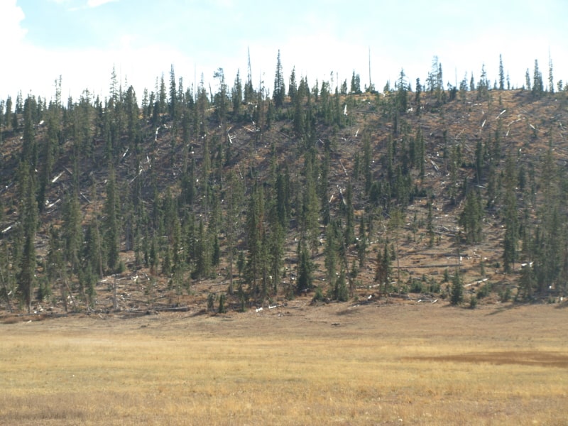
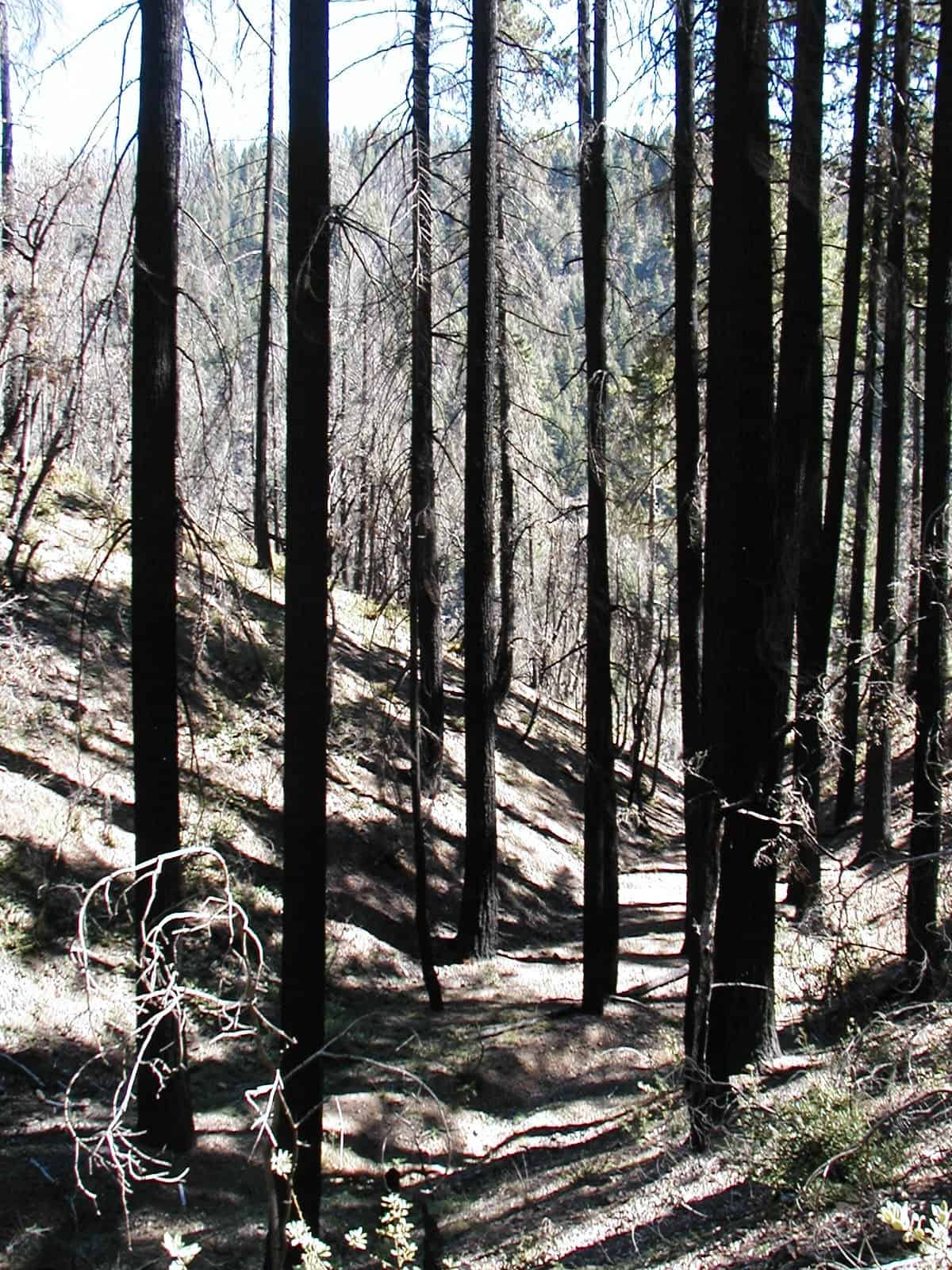
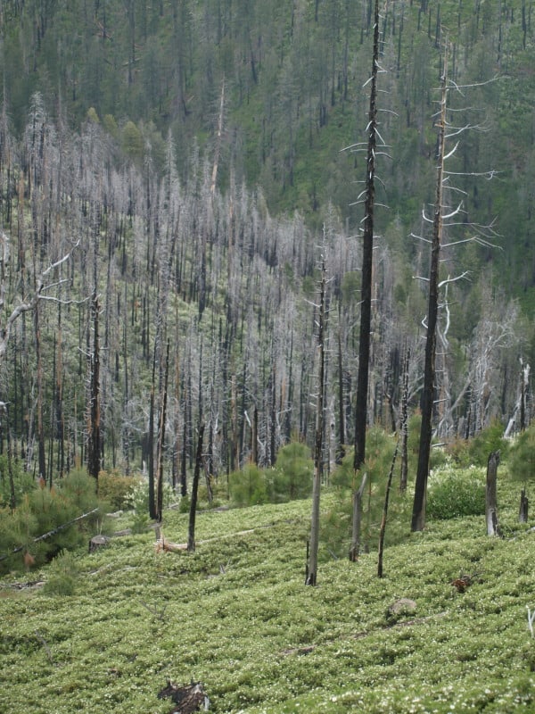
Here is a view of some other cutting units within the Power Fire. Above the road were tractor units, and a narrow stretch below the road, due to stream buffers, was helicopter yarded. Again, you see ample snag “recruitment”, years after salvage logging. Remember, we were also salvaging some trees with poor live/dead crown ratios. I do know that the marking was aggressive, as I did much of the inevitable follow-up marking, during the summer season.

What is really interesting about the tractor unit is how well the logger’s “alternate method” worked. My logger had a processor/loader, an excavator with a grapple attachment, a dozer and two skidders. The excavator would go out on the skid trails and grab/bundle the logs to orient them where the skidder can “grab-and-go”. Their crew was very experienced and efficient, not making messes they would have to clean up.

www.facebook.com/LarryHarrellFotoware

The Power Fire, and the Blackbacked Woodpecker

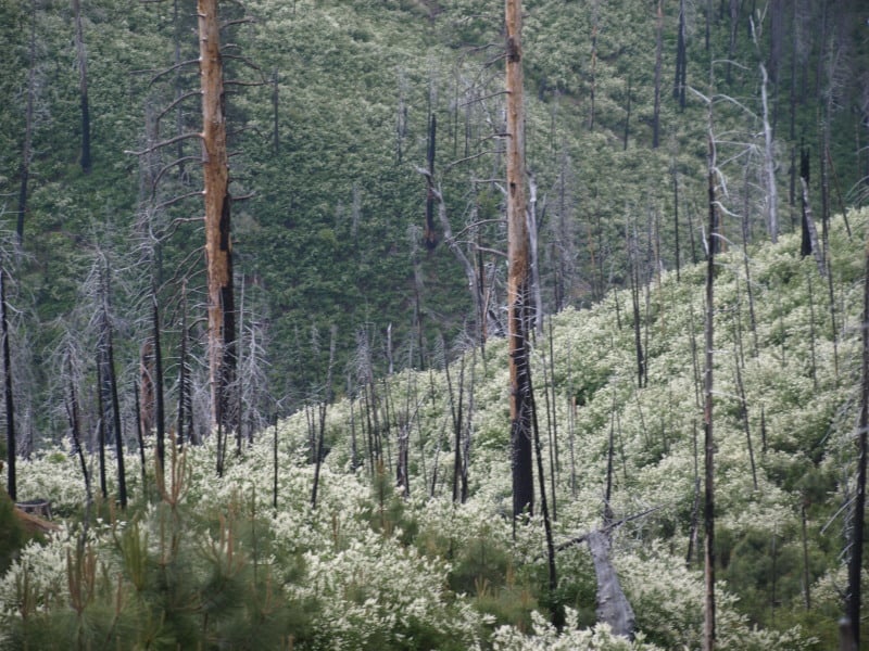
This helicopter unit experienced significant dieback, even as the fallers returned multiple times. The marking guidelines allowed for cutting trees with low crown ratios, and with the Forest Service getting projects together so quickly (six months!), the bark beetles hadn’t run their course, yet. In addition to the snag specifications in the project’s plans, you can clearly see that there are a great many more snags now, than the plans required. Also important in this is that snag of certain sizes had to be cut and flown out, as part of the fuels treatment (a HUGE expenditure!)  The Power Fire salvage project was halted by the Ninth Circuit Court, due to the new salvage marking guidelines, and a perceived need for more blackbacked woodpecker analysis. The cutting unit below was completed, though.

Also seen in the foreground is that nasty bear clover, which will dominate, until it is shaded out, or killed with herbicides. It is great to have this smelly carpet (AKA mountain misery) under a nice canopy but, in this case, it will hinder all trees from germinating and growing. Their roots can go 12 feet deep. Even the deerbrush is kept at bay by the bear clover.

www.facebook.com/LarryHarrellFotoware

The Power Fire, Six Years Later

This wildfire, on the Amador Ranger District, of the Eldorado National Forest. was sparked by crews cutting hazard trees along powerlines. I was a Sale Administrator, detailed to help salvage timber and accomplish contract work over 55% of the burned area. New marking guidelines, ordered by the courts, were first used on this project. While the plans survived a lower court challenge, the infamous Ninth Circuit Court decided that the new guidelines were “confusing” and more analysis regarding the blackbacked woodpecker was needed.

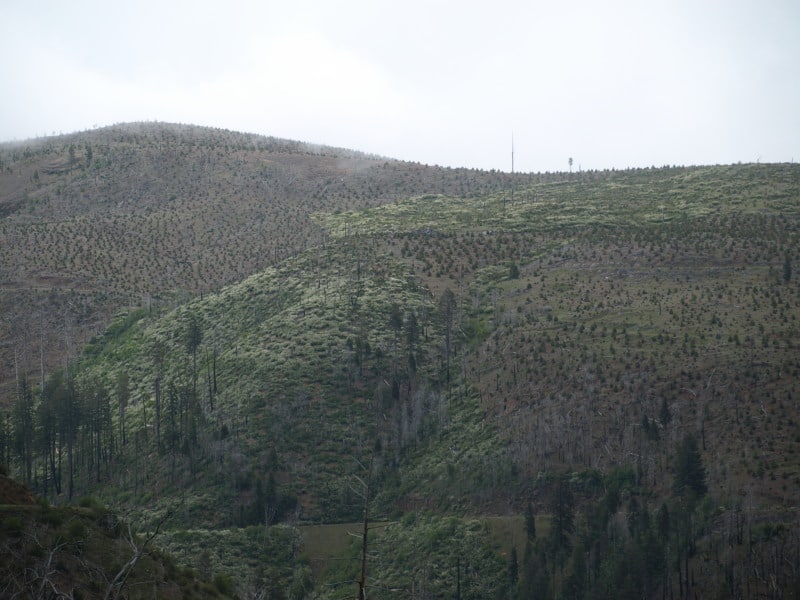
Here is what one of the cutting units looks like today. Choked with deerbrush, with not much in the way of conifers established.

This picture shows the striking contrast of Forest Service, versus private timberlands. You can clearly see the property lines and the section corner. What you cannot see is the accelerated erosion that came off the private lands, impacting the road at the bottom of the picture. Between the deerbrush and the the thick bear clover, conifers have little chance to recover, and a re-burn might be in the future for this patch of Federal land. The upper tract of Federal land seems to have no standing snags left, due to blowdown. The rest of the area seems to be choked with snags that died since harvesting was completed. At least SOME of the fuels for a future wildfire have been significantly reduced.

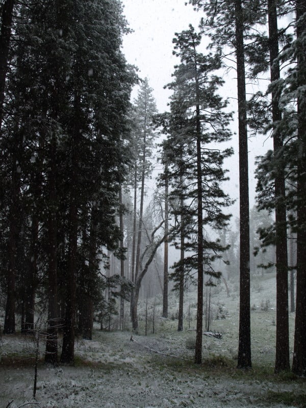
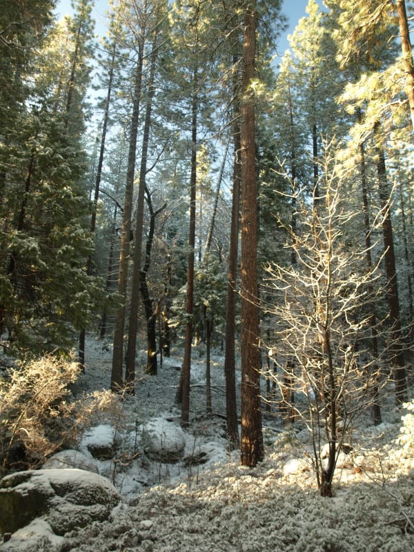
This area has a history of Indian occupation, and the forest still shows it. The bear clover re-grew and covered the bare soil within 6 months. Today, people would be hard-pressed to find ANY logging damage, on this side of the fire area. What really amazed me is that this project has ALREADY suffered a re-burn. The fuels reduction definitely saved the remaining old growth from burning to a crisp. This forest has its resilience back, has a better species composition, and seems ready for a regular program of prescribed fire.

As you can see, the light and the weather didn’t cooperate. I’m sure I will be going back to capture some more images, and to compare them to the photos I took six years ago.

Alternative Reality Check?

In looking over a Record of Decision, I found some new and old stuff, regarding NEPA alternatives.

The first one is being called “The Environmentally Preferable Alternative”, which seeks to dispel the calls to remove discretion from Forest Service bigwigs.

“NEPA implementing regulations require agencies to specify “the alternative or alternatives which were considered to be environmentally preferable” [40 CFR 1502.2(b)]. Forest Service policy further defines the environmentally preferable alternative as “…an alternative that best meets the goals of Section 101 of NEPA…” (FSH 1909.15). Section 101 of NEPA describes national environmental policy, calling on Federal, state, and local governments and the public to “…create and maintain conditions under which man and nature can exist in productive harmony.” Section 101 further defines this policy in six broad goals:

• Fulfill the responsibilities of each generation as trustee of the environment for succeeding generations
• Assure for all Americans safe, healthful, productive, and esthetically and culturally pleasing surroundings
• Attain the widest range of beneficial uses of the environment without degradation, risk to health or safety, or other undesirable and unintended consequences
• Preserve important historic, cultural, and natural aspects of our national heritage, and maintain wherever possible, an environment which supports diversity and variety of individual choiceRecord of Decision for the Wallowa-Whitman National Forest Travel Management Plan FEIS Record of Decision 13
• Achieve a balance between population and resource use which will permit high standards of living and a wide sharing of life’s amenities
• Enhance the quality of renewable resources and approach the maximum attainable recycling of depletable resources

Based on the description of the alternatives considered in detail in the FEIS and this record of decision, I believe that the selected alternative best meets the goals of Section 101 of the National Environmental Policy Act and is therefore the environmentally preferable alternative for this proposed Federal action.”

This appears to be the justification for his decision that this is the best alternative for the land, overall, balancing the impacts with the benefits. I’m wondering if the Federal lawyers have had input on such statements, and if the Forest Service folks have had training in how to make their statements as legally-supportable, as possible. I know that my experience in contract documents had me choosing my wording very carefully. Overall, I welcome the transparency and the willingness of Forest Supervisors to do their jobs, (and I hope they do it well).

“The no action alternative serves as the baseline used to compare the effects of the proposed action and alternatives. No new management activities are proposed. Current biological and physical processes would be allowed to continue on their present trajectories along with associated risks and benefits. None of the management activities described in the proposed action or the other action alternatives would be implemented to accomplish project goals. Commercial thinning, fuels treatments for activity and natural fuels, and prescription burning would not be authorized. There would be no temporary road construction or treatment of fuels in riparian habitat conservation areas. Hardwood restoration and road decommissioning activities would not be authorized. There would be no amendment to the forest plan to allow specific treatments needed to increase stand health and resilience in the planning area. For the no action alternative, current management plans would continue to guide management of the project area. Other approved projects would continue in the project area. In addition, other public uses, such as recreation, hunting, and firewood gathering would continue as permitted.”

This is a VERY tiny paragraph explaining what happens if nothing is done at all. The social and economic losses need to be studied and presented, as well as a projection of the next 30 years for the probable outcomes. Judges, and the public, needs to know what ALL is at stake, including the full ecological costs of doing nothing, within the framework of today’s realities.
Before and After- Utah Style

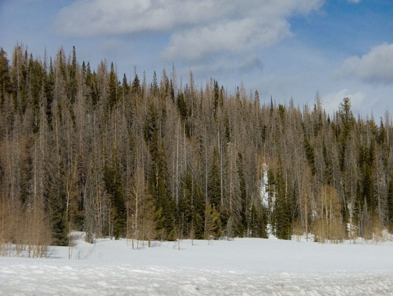
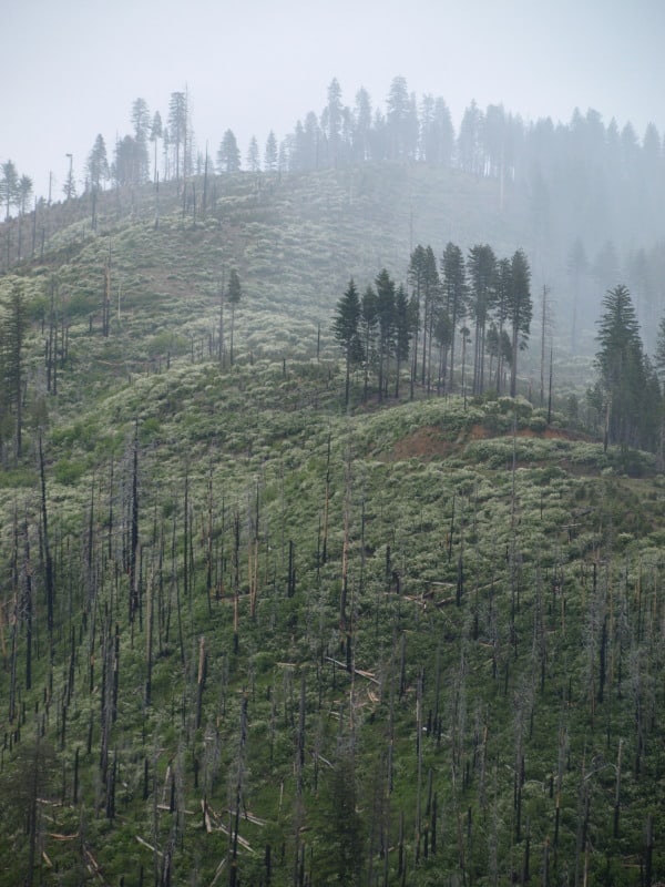
In driving between Cedar City and Bryce Canyon, I was struck at the severe mortality from bark beetles. Here is what I saw the first time. The entire area had severe bark beetle mortality, with surviving aspen trees. I really doubt that any green trees were cut, as the bark beetles were still busily chewing and doing their thing.

The next time I drove through, I saw where snags had been felled and removed, resulting in this scene. I’m guessing that they skidded the logs over the snow, or used a helicopter. My bet is on over-the-snow skidding. This area is right at the summit, where the intersection to Cedar Breaks is. There are homes on the other side of the ridge. I like what they did here.

www.facebook.com/LarryHarrellFotoware

Sequoia National Forest Plan Set for Updating

The Sequoia suffers from many blockades to sensible forest management and protection. With the only mill within more than 100 miles away, teetering on the brink of bankruptcy, and being hamstrung by unreasonable diameters limits for harvestable timber, as well as having the Giant Sequoia National Monument to manage, they face a very long uphill battle to update their 24 year old Forest Plan.

http://www.recorderonline.com/news/usda-52174-plan-vilsack.html

Also opposing them is the Sierra Club, who continue to portray the Forest Service as loggers of ancient Giant Sequoias. They wish that all 300,000+ acres of the Giant Sequoia National Monument be free of all logging projects, despite there being only about 10,000 acres of already protected Giant Sequoia groves within the Monument. The McNally Fire nearly killed the world’s second largest tree, when it was allowed to burn for weeks. The Sierra Club is quite happy to let their followers think that the Forest Service will cut the sequoias down, and that clearcuts and the cutting  of big trees will happen. The Sierra Club wants the Monument to be “un-managed”, just like the adjacent Sequoia National Park. They also don’t realize that the Park Service doesn’t follow the same rules on prescribed fires that the Forest Service does. You cannot solely use prescribed fires to manage the fuels build-ups of 80 years, on hundreds of thousands of acres. Besides, the California Board of Air Resources don’t have enough burn days, when prescribed fires would be “in prescription”. The Park Service is well known for losing their management fires, which can be set during high temperatures and dry conditions.

This may be one of the most contentious new Forest Plans under the new Planning Rule. I wonder how much it will change when the only lumber mill in southern California goes bankrupt.

Biscuit “Scenic” Pictures

This is an example of a “protected” nesting site for a northern spotted owl. It was never logged and will not be habitat for many decades, especially if a reburn occurs. It sure doesn’t look “natural and beneficial”, to me, OR the owls and goshawks.

Here are the kind of snags (the large orange-marked one) that were selected to be “saved”, within Biscuit cutting units. Of course, only 4% of the 500,000 acres of the Biscuit were salvaged, so there certainly is no lack of snags in the huge burn.

Here is a cutting unit where mortality was close to 100%, in unlogged old growth. Instead of thinning a green stand, we ended up “thinning” snags.

Here is some erosion, in a small gully. I wonder what the “cumulative impacts” of hundreds of similar gullies have upon salmon populations, and other aquatic organisms. Surely, some of these gullies experienced accelerated erosion in the 5+ years since I took this picture.

www.facebook.com/LarryHarrellFotoware

Sumter Hardwood Forest

I spent about six months in “the Piedmont” of South Carolina, doing stand exams. Most units were plantations, reforested from the old cotton fields. Some of the units were bottomland areas, with lots of interesting biodiversity. I discovered 41 different hardwoods species, with 20 of them being oaks. I did pretty well identifying the trees, despite having taken Dendrology 25 years beforehand. This oak was really unusual. with a branch being longer than the tree was tall. I paced the 55 foot distance of this limb that grew its way to the road opening.

CFLR Project News- Amador/Calaveras

Here is the blog for the local (to me) project. It is unclear how much the Pacific Rivers decision will affect it. I’m sure they will find ways to spend the money but, I doubt any logs will get sold. It is awful hard to make a log truck load out of  10 to 16 foot long small logs. The money won’t go very far if it only results in service contracts. This is their stated mission: “The Amador-Calaveras Consensus Group is a community-based organization that works to create fire-safe communities, healthy forests and watersheds, and sustainable local economies.”

http://acconsensus.wordpress.com/

Southwest Oregon Rainforest

During a wet April, I was doing stand exams in old plantations in southwest Oregon. No, those days of wearing “tin pants” and “corks” are not over with! On my one day off that wet week, I woke up early on Sunday morning and was out the door before any of my co-workers even got out of bed. I found plenty to shoot, exploring the area around the south fork of the Coquille River, east of Powers.

http://www.facebook.com/pages/Larry-Harrell-Fotoware/145797075533465