Happy Earth Day!

P9193955-web P9193966-web P9193951-web

26 years after “protected” forests burned, in Yosemite National Park, this is what we now have. Chances are, it will burn again, before conifer trees can become established enough to resist the next inevitable wildfire. You might notice that even the manzanita is having trouble surviving. I doubt that John Muir intended this on public lands. This landscape is probably the future of parts of the Rim Fire, within Yosemite National Park.

Update From the Yosemite “Laboratory”

Here is a stitched-together panorama from the Foresta area of Yosemite National Park. I’ll have to pair it up with my historical version, one of these days. Restoration processes seem to be minimal, as re-burns continue to ravage the landscape, killing more old growth forests and eliminating more seed sources. Even the brush is dying off, due to a lack of organic matter in some of those granitic soils. With the 200-400 year old trees gone, we have to remember that these stand replacement fires, in this elevational band of the Sierra Nevada, weren’t very common before the 1800’s.

Foresta-panorama-crop-webYes, it IS important that we learn our lessons from the “Whatever Happens” management style of the Park Service. Indeed, we should really be looking closely at the 40,000+ acres of old growth mortality from the Rim Fire, too! Re-burns could start impacting the Rim Fire area, beginning this fire season.

The Tahoe Basin

Lake Tahoe would probably be a National Park, by now, if the Comstock Lode had never been found. There was clearcutting right down to the lakshore, for mining timbers, in the silver mines. Incline Village was named for the switchback road that transported logs to a flume that went all the way down to the Washoe Lake area, thousands of feet below.

Today, there is very little “logging” next to all that blue Tahoe lake water. Newspapers especially like to describe the basin as “pristine”, apparently not knowing the actual meaning of the word.

P9123090-web

Much of the Lake Tahoe Basin is “de facto” Wilderness, with very little management happening, even when wildfires occur. Residents seem to be in denial about wildfire issues, not remembering the last drought that decimated their forests. However, it is easy enough to see the results of the last bark beetle infestation, in the form of accumulated fuels far beyond what is “natural”. Many areas of forest mortality were left “to recover”, on their own. Well, sometimes “recovery” takes decades or even centuries, as long as humans don’t intervene. That might also include multiple wildfires, opening the ground to accelerated erosion and having clarity-declining sediments flowing into Lake Tahoe.

P9123100-web

Ironically, the lake’s level isn’t all that far down, thanks to the lobbying of lakeshore land owners, putting pressure on water regulators. That can only go so far, as Reno area interests need more water to keep growing and thriving. We’ll just have to see how the battle goes, as the Truckee River drops further and further.

Dry Sierra Winter

I recently drove over California’s Carson Pass and spent a day in the Lake Tahoe Basin. The weather was good, so I decided to save some money and camp out (!) for two nights (and spending $42 for a night in Reno).

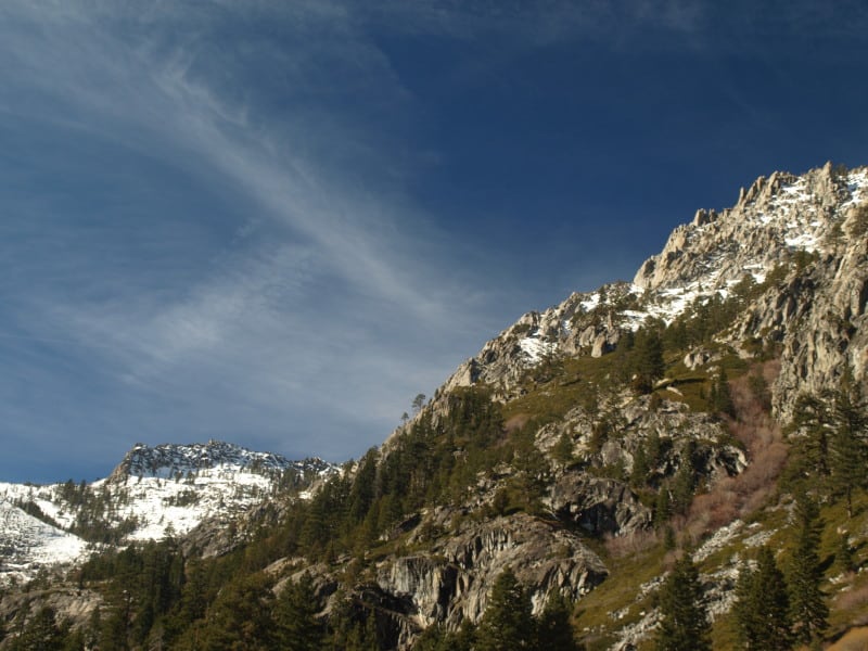
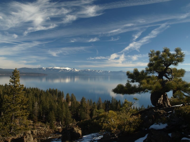
My day at Tahoe began encased in ice, as moist and cold air flowed down the canyon I was camping in. I quickly gathered my frozen gear and stuffed it into the car, making my way to Truckee, and precious morning coffee. From there, I drove down Highway 89, which was very familiar to me, as I used to bicycle, hitch hike and drive it, many times a week, when I lived there, in the 80’s. I continued along the west shore of Lake Tahoe, to reach my first planned stop at Eagle Rock. I had last climbed it in the mid 80’s, and I didn’t know there were now two trails to the top. It was still a bit icy on top but the amazing views sure hadn’t changed. Eagle Rock is a post-glacial volcanic plug, where Blackwood Canyon meets Lake Tahoe.

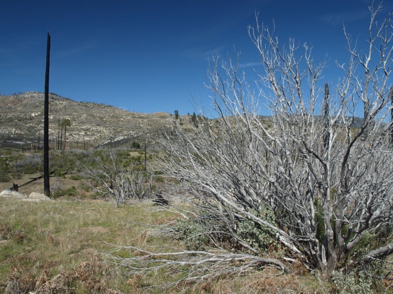
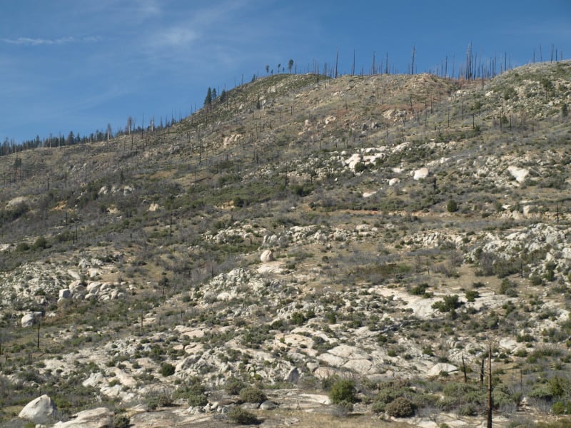
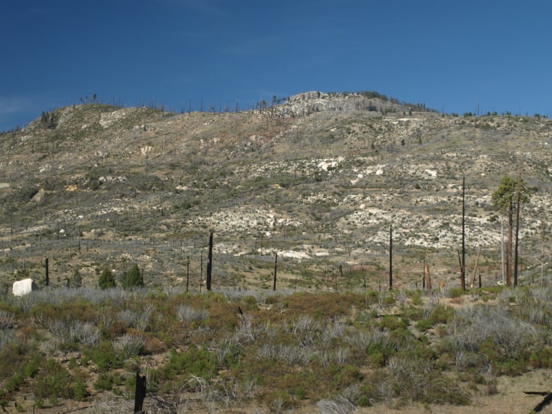
It appears that the bark beetles haven’t yet arrived in Tahoe yet but, they sure are knocking on the door. I did see bug patches in the southern part of the Eldorado. I heard about one landowner who had 42 bug trees on their property.

P9123021-web

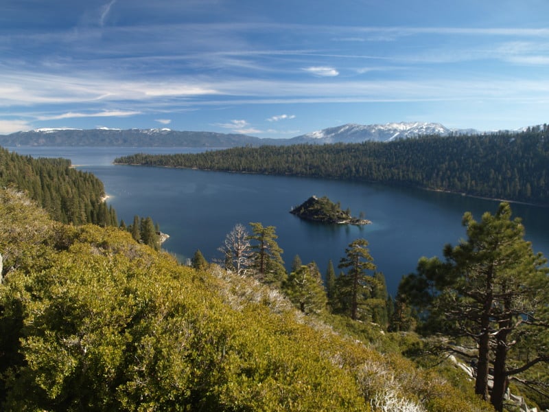
I later visited the famous Emerald Bay, and you will see pictures of that in another post.

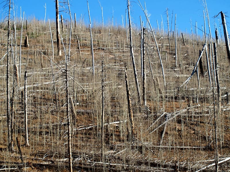
Along Highway 88, on the Eldorado National Forest, they have this interesting project being worked on, during the winter. I’m guessing that units have to find other ways to spend their timber bucks since litigation has returned diameter limits to the old unreasonable sizes imposed in 2000. It looks like this project is a highway strip, intended to be a quasi-fuelbreak. It does appear that some trees up to 9″ dbh were taken out, for spacing. There are going to be a ton of tiny piles to burn, and the California Air Resources Board has not been kind to the Forest Service in granting waivers on No-Burn days. And, yes, the piles are covered with burnable material that will keep the pile dry, so ignition will be easy.

P9102965-web

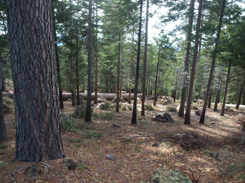
Can we start calling these things “Big Thin Lies”? It is what people see, and they think all forests look like these cleanly thinned and piled forests.

Grand Canyon Fire Recovery

This is an interesting picture from the North Rim of Grand Canyon National Park. The fire burned and killed off all the pines but, the underground mass of aspen roots and shoots survived. I wonder how a pine component could “naturally” come back, or, did Indian burning favor old growth pines? Certainly, the higher pine forests of the Kaibab Plateau are overstocked and at risk, today.

OLYMPUS DIGITAL CAMERA

Rim Fire Update

Apparently, enough of the hazard trees within the Rim Fire on the Stanislaus NF have been cut so that the travel ban has finally been lifted, after more than a year. I heard one report that says that the litigation has failed at the District Court level, losing their pleas to stop the logging three times. The article below includes the Appeals Court but, I doubt that an appeal has been seen in court yet. It seems too soon after the District Court decision for the appeal to be decided.

http://www.calforests.org/rim-fire-update-final-motion-halt-restoration-forestry-rim-fire-denied/

P9232907-web


Since the Rim Fire tore through the area and devoured over 250, 000 square miles of National, State and private forested land, the community has come together to put together a solution with positive environmental, economical and social sense. The whole effort to restore forests has been very successful due to cooperation of a diverse group of individuals, organizations and government agencies.

(Edit: Thanks to Matt for pointing out the acres/square miles error. That should be 250,000 acres.)

With a monster storm approaching California, we should be seeing some catastrophic erosion coming from the Rim and King Fire areas. Of course, very little can be done to prevent erosion on the steep slopes of the canyons with high burn intensity. Standing snags tend to channel water, while branches and twigs on the ground can hold back a surprising amount of soil. This flood event would have been great to document through repeat photography but, it appears that opportunity will be lost, too.

Bark beetle activity has also spiked where I live, northwest of the Rim Fire.

Throwback Thursday, Yosemite-style

I’ve found my hoard of old A-Rock Fire photos, from 1990! I will be preparing a bigger repeat photography article, after I finish selecting and scanning. Like several other fires this summer, the A-Rock Fire started in the Merced River canyon, burning northward. I really believe that this is the model of what will happen to the Rim Fire, if we do nothing to reduce those dead and dying fuels. Active management opponents never want to talk about the devastation of re-burns, as an aspect of their “natural and beneficial” wildfires. Most of those snags have “vaporized” since this 1989 wildfire. Indeed, this example should be considered when deciding post-fire treatments for both the Rim Fire and the King Fire, too.

It should be relatively easy to find this spot, to do some repeat photography, along the Big Oak Flat Road.

Above-Foresta-web

Urgent Action Needed to Save Sierra Forests

This viewpoint shows more of the reasons why the desire to have larger and more intense wildfires, in the Sierra Nevada, is the wrong way to go.

In this picture below, fire crews were run out of this stand, and back into the “safety zone”, on this fire I worked on, back in 1988.

campbell_fire1-web


http://www.sacbee.com/2014/09/28/6737076/viewpoints-urgent-action-needed.html

Air quality the past two weeks has been several times worse than some of the most polluted cities in the world due to smoke from the King fire. Last year’s Rim fire emitted greenhouse gases equivalent to 2.3 million vehicles for a year.

Also, the lost habitat and recreational opportunities from major fires like these are significant. It is not an exaggeration to say that virtually all Californians are affected when these “megafires” occur.

The report points out that wildfires are getting larger and burning at higher intensity than ever before. The Rim fire burned at nearly 40 percent high intensity – meaning virtually no living vegetation is left – covering almost 100,000 acres. More acres have burned in the first 4½ years of this decade than in seven decades of the last century.

What can we do about it?

The main bottleneck in treating more acres is in implementation. The Forest Service is unwilling to increase the size of its Region 5 timber management staffs. They use some of the usual excuses, some of which are beyond their control but, not all of those issues are really significant, looking at the big picture. Yes, it is pretty difficult to implement extremely-complex plans when you are constantly training new temporary employees, hired right off the street.

UC Berkeley Gets it Right, and Gets it Wrong

A Cal-Berkeley fire scientist shows his unawareness of current Forest Service policy but, his other ideas favor active management of our Sierra Nevada National Forests.

Canopy2-web

The situation is compounded by the gridlock between environmentalists and commercial foresters. The former favor thinning, but they want all logging plans to leave the larger trees, particularly those with trunks over 30 inches in diameter. But the timber companies maintain it is necessary to take a significant number of bigger trees to fund thinning and restoration programs.

Stephens generally favors the enviro position. Landscape-scale wildfire damage is driven by vast acreages of small-diameter, closely-packed trees, he says. By leaving the larger trees, the essential character of a natural forest can be maintained, even accelerated. And he thinks markets can be found for products produced from thinned, scrawny trees.

http://alumni.berkeley.edu/california-magazine/just-in/2014-09-26/brush-flame-king-fire-narrowly-misses-proving-fire-prevention

Of course, there has been a ban on the cutting of trees larger than 30″ dbh, since 1993. Ditto for clearcutting! These are two big hot-button issues for most “conservationists” but, there are still people out there who want timber sales banned, altogether. There are others who would love to go back to the Clinton rules of the Sierra Nevada Framework, which would shutdown much of Region 5’s timber management programs. A 22″ dbh tree, underneath a 36″ dbh tree cannot be considered “scrawny”.  Generally, most of the thinned trees are in the 10-18″ dbh size, averaging about 15″ dbh.

The Next Rim Fire?

P9256059-web

http://www.news10.net/story/news/local/eldorado-hills/2014/09/18/king-fire-burns-27930-acres-el-dorado-county-thursday/15816425/

The King Fire is experiencing growth like we saw in the Rim Fire, last year. There are important similarities but there is also a main difference. The fuels are much thicker in this more northern landscape. The fire behavior was so extreme that even the airtankers could not fly their missions. The south fork of the American River features a canyon that is steep, and over 2000 feet deep. The fire has been fought aggressively along Highway 50, with 1000’s of homes nestled into un-firesafe neighborhoods. Like most people, they seem to prefer their shade over fire safety. The fire has now burned about 50,000 acres in one 24 hour period and there is only 5% containment. A weak cold front approaches and will increase the winds, even more than they have been in the last two days. After the cold front blows through, there might be a change in the wind direction, too. There seems to be a new gap in the Sierra Nevada, where old growth is being incinerated. A drive up to south Tahoe along Highway 50 shows the now-interconnected wildfires in recent history. The Wrights Fire, the Pilliken Fire, the Cleveland Fire, the Freds Fire and now, the King Fire. Change has been very harsh upon the Highway 50 corridor.

When will Congress do “something” that is effective against wildfires?