The New York Times on Rich People Buying Large Acreages in the West

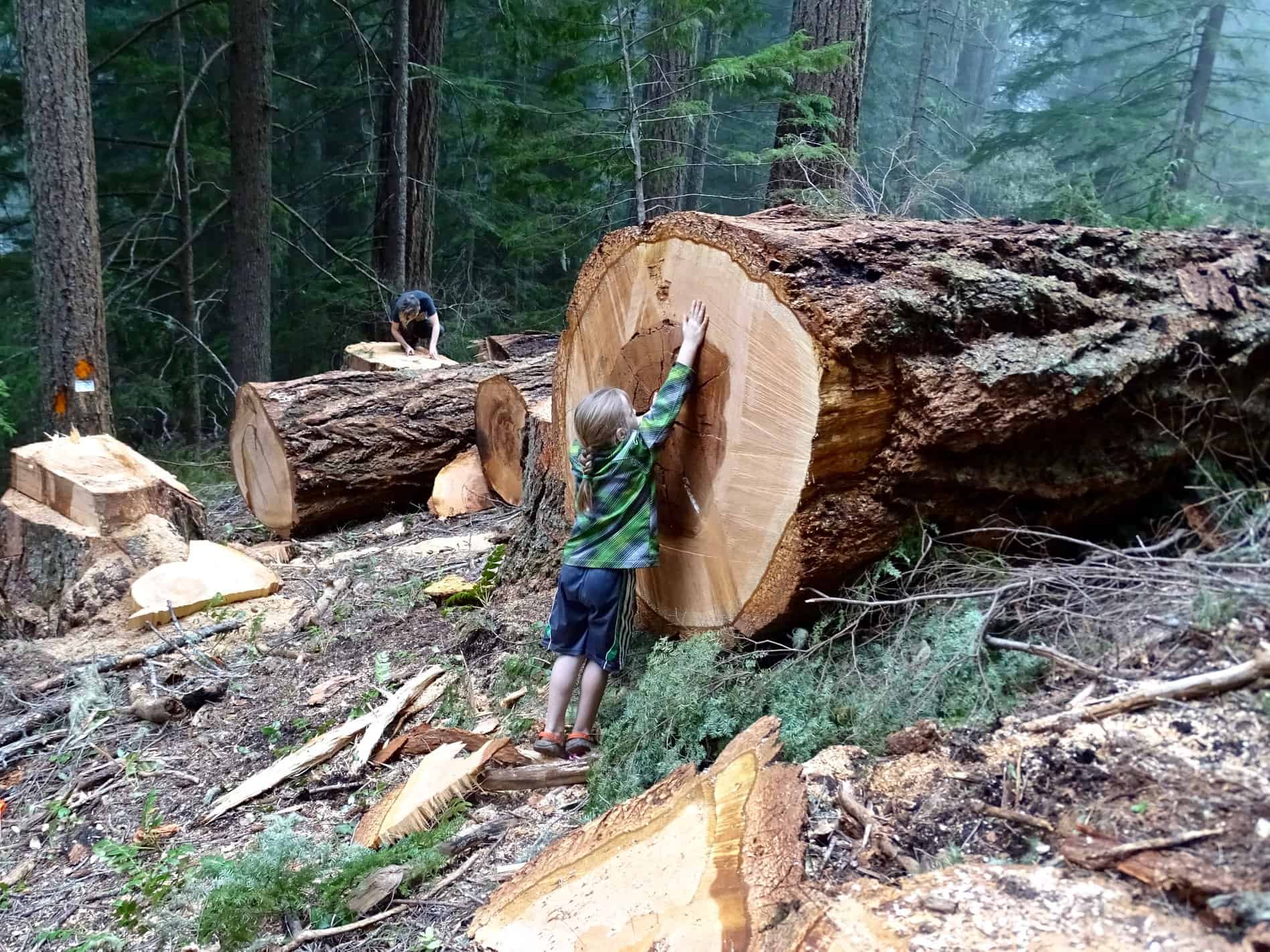
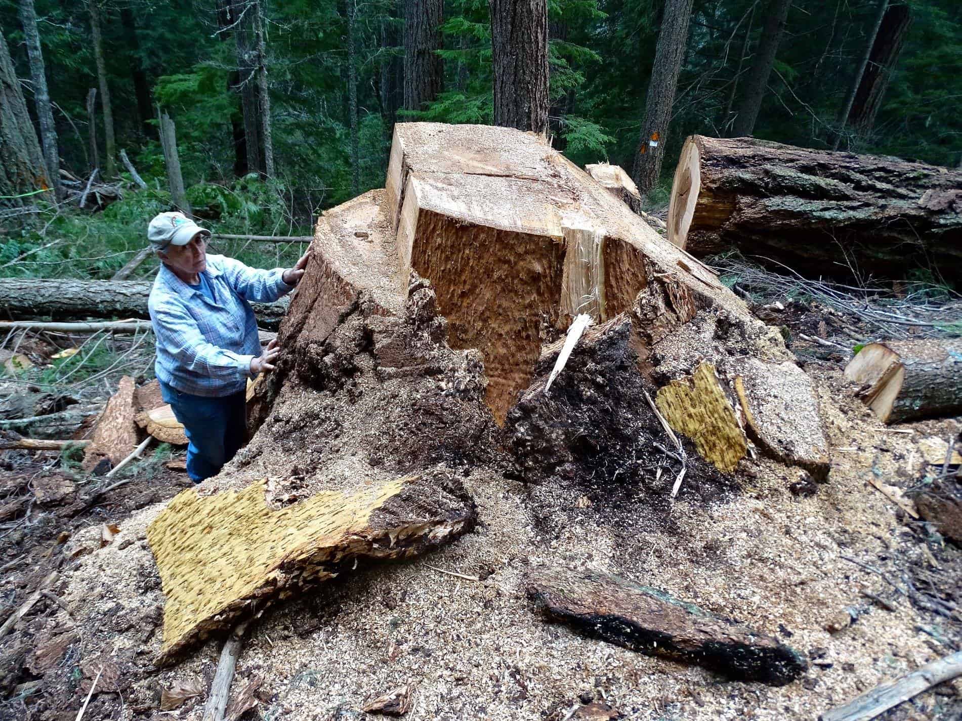
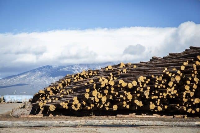
Logs taken from the Trinchera Ranch wait to be processed at Blanca Forestry Products, a sawmill outside of Blanca, Colorado on Wednesday, Dec. 19, 2018. The mill employs some 70 people. Nathaniel Minor/CPR News[/captions] This is the mill billionaire Louis Bacon, owner of the 172,000 acre Trinchera Ranch in Colorado, built to process material from the ranch. Here’s a link to the story.

The New York Times did a story here on rich people buying up and blocking off land in the Interior West. This is not news to us, but they have some interesting perspectives. Here is the story.

Some of the new owners have been welcomed. The cable magnate, John Malone, for instance, has been praised by the Nature Conservancy for his family’s conservation efforts, and other buyers have helped to clean up trails and restore pristine acres.

The arrival of this new class of landholders comes as the region is experiencing the fastest population boom in the country, which is driving up housing prices and the cost of living and leaving many residents fearful of losing their culture and economic stability.

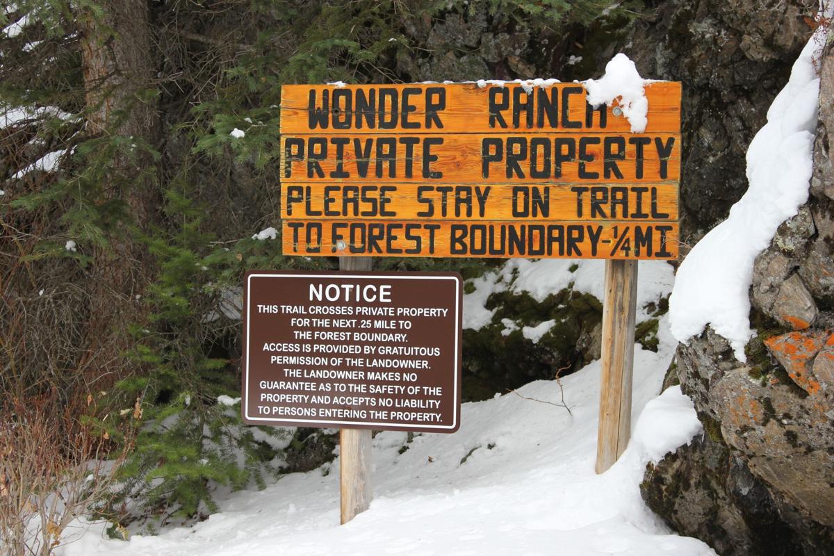
In Idaho, Rocky Barker, a retired columnist for The Idaho Statesman, has called the conflict a “clash between two American dreams,” pitting the nation’s respect for private property rights against the notion of a beauty-rich public estate set aside for the enjoyment of all.

The clash, he said, is part of a larger transformation of the region — from an economy rooted in extraction to one based on recreation; from a working class culture to a more moneyed one. “Big landowners,” he said, “are just another new force.”

In the intermountain West, the purchases come amid a population boom that has exacerbated local concerns about the loss of space and culture. Last year, Idaho and Nevada were the fastest growing states in the nation, followed closely by Utah, Arizona and Colorado.

These new buyers have become a symbol of a bigger problem: The gentrification of the interior West.

In 2018, more than 20,000 Californians arrived in Idaho; home prices around Boise also jumped 17 percent. This has meant not just new subdivisions and microbreweries, but also packed schools, crowded ski trails and heightened anxiety among teachers, plumbers and others, who are finding that they can no longer afford a first home.

Many landowners are engaged in conservation and have entered into easements that limit future development on their parcels, and also provide them with significant tax breaks.

But setting aside land for conservation has not always staved off criticism.

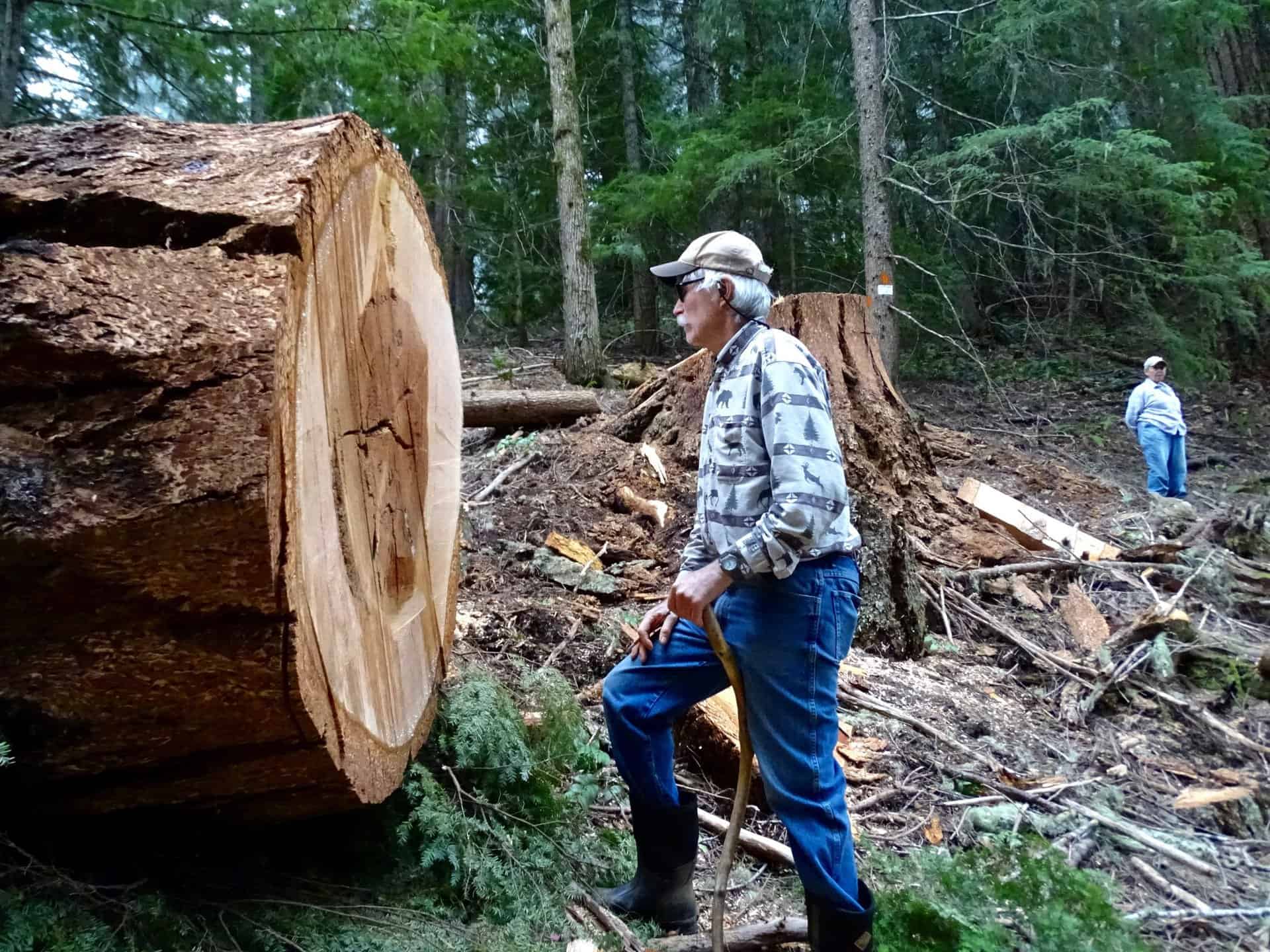
In Idaho, the Wilks brothers did more than gate a few roads. They also revoked road-use contracts that propped up the region’s multimillion-dollar snowmobile industry, shut down hunting on their land and told timber companies to pull crews from the area. About 100 people lost their jobs.

No one claimed that those actions were illegal, but they heightened fears that local residents were losing control of the region. A 2017 video of a roadside argument between an armed Wilks guard and a local ATV rider traveled quickly around the state.

What is interesting to me about this is

(1) the idea that rich people buying private land and blocking access is bad (timber, snowmobiles and ATVs), but efforts to block the same activities on public lands (e.g. a certain National Monument) are good, because it’s good for the environment and ATVers tear up the landscape and so on.

(2) Maybe “rich people ownership” is good for the environment as the property won’t be recreated upon by lots of people nor subdivided?

(3) Also, perhaps part of the reason some in San Juan County are not fans of Monumentizing Bears Ears has to do with not wanting gentrification nor a “more moneyed culture.” Here’s a link to two points of view on urban gentrification (is it saving or ruining LA). Do the arguments sound familiar?

Utah vs. Nevada

In a discussion of “privatization,” Brian Hawthorne suggested here that, “It might be worthwhile discussing our perceived distinctions between what Utah’s HB 148 contemplates vs the “small tract sales” made pursuant to the SNPLMA.” That would require some knowledge of what both of these things are.

This summary of Utah’s H.B. 148 is from a review by an attorney from the conservative Federalist Society.

Recent legislation passed in the State of Utah has demanded that the federal government extinguish title to certain public lands that the federal government currently holds. The State of Utah claims that the federal government made promises to it (at statehood when the federal government obtained the lands) that the federal ownership would be of limited duration and that the bulk of those lands would be timely disposed of by the federal government into private ownership or otherwise returned to the State.

On March 23, 2012, Governor Gary Herbert of the State of Utah signed into Utah law the “Transfer of Public Lands Act and Related Study,” (“TPLA”) also commonly referred to House Bill 148 (“H.B. 148”). This legislation demands that the federal government “extinguish” its title to an estimated more than 20 million (or by some reports even more than 30 million ) acres of federal public lands in the State of Utah by December 31, 2014. It also calls for the transfer of such acreage to the State and establishes procedures for the development of a management regime for this increased state portfolio of land holdings resulting from the transfer.

This is from the Southern Utah Wilderness Association, described by another poster here as “unwilling … to compromise with any other interest group.”

HB 148 requires, among other things, the federal government to transfer title of federal public lands in Utah to the state before January 1, 2015.  These public lands include lands managed by the Bureau of Land Management, Forest Service, U.S. Fish and Wildlife Service, and National Park Service.

  • They include, among others, sensitive sites such as Grand Staircase-Escalante National Monument, Glen Canyon National Recreation Area, and all national wildlife refuges in the state.
  • This would also include the overwhelming majority of remarkable red rock lands surrounding Moab, the San Rafael Swell, and Grand Gulch.
  • The Legislature has indicated that some of these lands would be sold outright to the highest bidder while others would be kept in state ownership but opened to oil and gas drilling, off-road vehicle use and extractive industries.
  • The bill does not require the transfer of national parks, wilderness areas, or certain national monuments and national historic sites.

Here is a summary of the Southern Nevada Public Land Management Act (from this OIG Report).

Las Vegas, one of the fastest growing cities in the United States, is landlocked by federal lands. Over the past decade, the population has increased by more than 60,000 people per year. To accommodate this rapid growth and expedite the disposal of federal land, Congress enacted SNPLMA in 1998 (Public Law 105-263, 31 USC 6901). SNPLMA allows BLM to sell federal land (about 27,000 acres) primarily through public auctions, establish a special U.S. Treasury interest-bearing account, and use the resulting receipts for educational and environmental purposes and capital improvements. In addition, SNPLMA directed BLM to transfer ownership of about 5,200 acres of land in the McCarran Airport Cooperative Management Area (CMA) to Clark County to help the County enforce regulations concerning airport noise within the CMA. BLM is entitled to 85 percent of any receipts from the sale, lease, or other conveyance of CMA lands.

I’m afraid I don’t see much similarity. The justifications are at opposite ends of the scale from a localized problem to a disagreement about overall management policies. The difference in the affected area is huge.  There are benefits returning to the American public from the Las Vegas land sale proceeds.  Perhaps it’s a slippery slope (next Los Angeles, Salt Lake City, Missoula …?), but H.B. 148 represents the bottom of that slope.

Montana County rains on land deal

It is a time-tested and popular model.  A private landowner is willing to sell land or conservation easements to the government.  A third party conservation group steps in to provide bridge funding and/or ownership until the government can fund the purchase.  In this case, involving the Rocky Mountain Elk Foundation as the intermediary:

“The project, which was in its very early stages, would provide some valuable new access points in the area as well as protection from development along a stretch of Sheep Creek, a tributary of the Smith River, he said. In addition to the 4,000 acres purchased and then resold to the Forest Service, the checkerboard pattern of land ownership would mean access to an additional 7,000 acres of public land.”

While Meagher County (pronounced “mar”) doesn’t have any authority to influence the deal, it is attempting to do so by issuing a resolution opposing it, citing “potential loss of tax revenue, issues with federal land ownership and management, and the question of whether a land swap could open access without expanding federal land ownership.”  The resolution says, “that the commission respects private property rights and supports tourism but continues to oppose expanded federal ownership.”  (Funny that they don’t mention elk hunting/hunters, which has to be a key benefit.)  Their opposition may affect how the project competes for funding, and whether RMEF wants to stay involved.

The Forest Service, to its credit, is looking out for the “greatest good” and not bowing to nimbyism or political ideology.

“We acknowledge Meagher County’s resolution and recognize their position regarding the Holmstrom Sheep Creek proposal,” said Lisa Stoeffler, acting forest supervisor. “We appreciate that our working relationship with the commission allows for open discussions, especially related to increased recreational public lands access and the improvement of crucial fish and wildlife habitat conservation areas within the county. The Forest plans to submit two project requests for LWCF funding, one of which will include Holmstrom Sheep Creek. In our request packet, we will fully disclose the Commission’s resolution regarding the project.”

These have normally been seen as “white hat” projects in the past, but under this Administration, the Forest Service may find out that white is the new black.

Lone Rock Timber Receives Threat

From the News-Review, Roseburg, OR:

Lone Rock Timber Management Company has asked the Douglas County Sheriff’s Office for additional patrols in response to a threat made against the company by conservationists, according to the sheriff’s call logs.

The call, made just before 6 p.m. Thursday, said a group of conservationists are upset that Lone Rock is logging in the Susan Creek area, land managed by the Bureau of Land Management, and are threatening to burn Lone Rock “to the ground.”

Lone Rock requests extra police presence in wake of threats

Doesn’t mention the name of the group.

[ADDITIONAL INFORMATION BELOW, POSTED BY MK]

Posted on Facebook on May 7, 2018 by Francis Eatherington:

“Yesterday we hiked into the BLM forest that Lone Rock Timber had threatened to cut down for a new road, and we found it just cut down. Very sad. All the big trees were horizontal on the ground. We counted the rings on some stumps and found them to be 400 years old. On the hike in we went past LRT’s 19-acre plantation they had just cut and yarded, and we could see about an acre of tiny trees they had left to cut at the top of their unit. Even though it was clearcut 40-years ago, this time LRT insisted they had to cut this 70’-wide road through BLM land to get a mechanical harvester into that little acre they had left. They couldn’t cut it manually like they did before. This is an obvious scam by Lone Rock – they will get far more timber from our public old growth forest then they will access from their land. Not only are the old-growth trees gone, a new road bulldozed across this ancient forest will be a horrible scar, spreading it’s edge-effect far into the remaining old growth forest.”

Posted on Facebook on May 7, 2018 by Doug Heiken:

“The reason that Lone Rock Timber gave for needing access through this stand of ancient trees, was they needed to get a mechanical harvester (tree killing robot) into the area so they could log a stand of small trees on their own land. However, before the road even got built Lone Rock was able to log all but about 1 acre of their land. Which means these ancient trees fell just so they could bring their robot in to fell an acre of second growth. This is SO wrong! I smell a scam. The timber industry is to blame and BLM is complicit.”

[ADDITIONAL INFORMATION BELOW, POSTED BY SF]

Here seens a fair-minded piece that looks at (and talks to) both sides (and explains the O&C rights of way). But be careful, as there are a couple of interesting stories and you only get five free ones.

In this case they claim that BLM has embarked on a ‘back-room deal with Lone Rock Timber to log ancient forests,’ when the truth of the matter is that Lone Rock Timber has the legal right under our reciprocal right-of-way agreement with the BLM to construct the road to gain access to our property,” Luther said, adding some of the trees in the posted photos are outside of the proposed logging area.

If I lived in the area, I would be tempted to go see for myself (and share the photos here).

Montana’s Public Lands/Water Access Association

Thanks to Andy Stahl posted something that I did not want to get overlooked because it was a comment in this previous post. It’s the existence of a not-for-profit in Montana, the Public Land Water Access Association with the mission:

“to maintain, restore, and perpetuate public access to the boundaries of all Montana public land and waters.” This presumably includes county, state and federal.

Check out the kind of work they’re doing.. it’s pretty impressive. Does anyone know of similar groups in other states? Seems like they have a good format and approach already figured out that could be copied.

Personnel, politics and public access to public lands


Yes, it looks like Forest Service employees should be concerned about how Trump might affect their careers.  Here’s an example about offending private landowners who block access to national forests.  (And, without any facts beyond earlier stories, I’ll suggest that you not think of these as long-term rural residents, but more likely some recent, possibly seasonal transplants, with money and political connections.)

Here’s one version of the story from a private property rights promoter:

Such cooperation, however, changed under the Obama administration as the Forest Service took a more strident approach in asserting claims to “traditional public access” routes. The dramatic change is reflected in a posting by Yellowstone District Ranger Alex Sienkiewicz who publicly advocated “NEVER ask permission to access the National Forest Service through a traditional route shown on our maps EVEN if that route crosses private land. NEVER ASK PERMISSION; NEVER SIGN IN. … By asking permission, one undermines public access rights and plays into their lawyers’ trap of establishing a history of permissive access.”

According to Sienkiewicz and access advocates, traditional public access is sufficient to establish a legal right, known as a prescriptive easement, to cross private property. Centuries of legal practice, however, have required that individuals or agencies wanting to establish prescriptive easements must prove that access was continuous, open, notorious, and hostile to the owner. In other words, the access must be without expressed permission by the landowner, a burden of proof that has been difficult, to say the least.

This doesn’t sound like the complete story.  The federal government does try to protect its existing legal interests, and that includes historic access that may not have been formalized, which it tries to negotiate.  I doubt if it often pursues litigation, but does sometimes end up in court to defend public access, as in this case involving access to the Lee Metcalf Wilderness on the Indian Creek trail, cited by the author of the op-ed above as a good example of negotiation (at least until it apparently went bad).  The Forest Service met its “difficult” burden of proof in this case.  There is a risk that asking permission now could undo the historic rights that already exist, but I don’t think it’s large, and I am a little skeptical that the Forest Service would “post” statements like that above except in cases where a particular landowner had made it clear that they were declaring war on public access, such as in this example.

Here’s another version of the same story from a recreation outfitter:

Recently, the U.S. Forest Service removed District Ranger Alex Sienkiewicz from his position in the Yellowstone Ranger District pending an internal investigation into his efforts to defend historical Forest Service trails and easements along the Crazy Mountains.

When legal access to public land does exist, I believe Montanans fully expect the Forest Service to defend and maintain that access for Montanans. As with so many of these issues involving political pressure on public agencies, a look behind the curtain reveals a very troubling story. According to media reports, U.S. Sen. Steve Daines, and Congressman Pete Sessions from Houston, Texas, both contacted Agricultural Secretary Sonny Perdue regarding Sienkiewicz’s efforts to protect legal, established accesses to landlocked public lands. According to Mary Erickson, forest supervisor, “the reassignment was made after allegations from an assortment of landowners in the Big Timber area were raised to the level of the Secretary of Agriculture, Sonny Perdue, and Sen. Steve Daines.“

Here’s the background on the Crazy Mountains access.

Blocking and posting no trespassing signs at the head of Trail 115/136 prompted Yellowstone District ranger Alex Sienkiewicz to organize a trail clearing and marking trip this past summer. Prior to that the agency traded letters with the Langhuses’ Livingston attorney, Joe Swindlehurst, who has denied there is an old forest trail at that location.

It’s not a stretch to see this as politicians ordering a personnel move to keep public lands from public hands.  Dangerous on both counts.


Forest planning for federal land ownership

The Superior National Forest has received a notice of intent to sue over a land exchange that would allow development of a mine on the former national forest lands. The notice involves federally listed wolves and lynx. My question was whether the exchange is consistent with the forest plan as required by NFMA.

The Superior National Forest Plan contains very useful direction for land exchanges. It includes priorities for acquiring land (one of which is “Land needed for habitat for federally listed endangered, threatened, proposed, or candidate species or for Regional Forester Sensitive Species,” but that was not invoked by the ROD for this exchange). The plan also includes criteria for conveying land out of federal ownership, and it determines whether lands in each forest plan management area are suitable for conveyance.

The Record of Decision for this exchange first finds that a mine in this location would be inconsistent with the forest plan direction for the area. It then addresses the criteria for acquisition and conveyance (which are guidelines in the forest plan) and finds that the exchange would be consistent with the forest plan. The lands in the federal parcel to be conveyed are in the “General Forest and General Forest-Longer Rotation Management Areas” where conveyance is allowed. They also contain a lake, and there is a forest plan guideline to retain ownership of lakes. However the guideline is defined to allow deviation as long as the purpose of the guideline is met, and the exchange would produce a net gain in national forest water frontage.  The ROD also considers the mining project and land exchange in relation to Forest Plan direction related to larger areas on the landscape, including lynx analysis units.  (The ROD mistakenly cites the 2012 Planning Rule consistency provisions, which do not apply to plans developed under prior planning regulations, but the result should be the same.)

The plan components in the Superior Plan seem to have provided for a relatively smooth project planning process. Other forest plans I’ve seen provide much less guidance for land adjustments. It is important for a forest plan to recognize areas that provide important values by including plan components to retain and acquire such areas (which may then be supported by more detailed land adjustment planning). This may be especially important in planning for wildlife habitat connectivity in mixed ownerships.

Howdy, Folks

I’m just going to drop this here. A side by side comparison of the land that some serial litigators insist is clear evidence of Forest Service salvage clearcutting in the Rim Fire. The caption reads, “Post-fire clearcutting on the Stanislaus National Forest in the Rim fire area, eliminated the wildlife-rich snag habitat and left only stump fields.” Where is the “wildlife-rich snag habitat” in that burned-over plantation on private land? The picture on the right is before logging started, from Google Maps.

Yes, the story is still up on their website, in all its slanderous glory.

Have a nice day!

Spi-comparison

Wolf Creek Land Swap Resurfaces

exchangeA

This is one of those projects (people in the Forest Service probably know of these) that goes on and on.. when I used to be involved I called it “reasonable access for unreasonable people.” My perspective, though, is that while the proponent may have gotten more reasonable, the other side does not necessarily feel the same way. But I like how honest the people who don’t want it are.. see the italicized last line of the quote. This is one of those that has been done and redone, by many people with much legal advice.

Here’s the link (I think visiting the Denver Post website crashed my browser, so apologies in advance if that happens to you. I would criticize them, but I’m just glad we still have their press presence.)

Dallas said the intent of the Forest Service when it approved the controversial 1986 land swap that gave McCombs the island of private land along the Continental Divide “was to create a village.”

When asked if the agency would approve the land swap today, Dallas said: “I don’t know how to answer that. I’ve been asked that many times. It was what it was. We can’t change that.”

The agency’s reviews of land exchanges that create islands of private land surrounded by public lands “has gotten much more … intense,” he said.

“Any sort of land exchange is generally controversial unless they are pretty small and simple ones, unless they have a really good identified reason like we have now,” Dallas said. “Land exchanges have gotten much more comprehensive; how we look at them, how we consider them. The public interest determination is looked at extremely closely.”

After the agency issued its draft environmental impact statement in 2012 supporting the land exchange, the agency harvested 893 letters commenting on the land exchange and more than 120 attended public meetings in August 2012.

“The proposal for the Village at Wolf Creek has been rife with controversy and strong feelings for a very long time and I’m certainly not so naïve that my decision will settle the controversy and strong feelings,” said Dallas, expressing confidence that his team’s process was thorough and transparent.

The Forest Service will field public comments on the decision for 45 days. If land advocacy groups file objections — which is likely — the agency can extend the comment period for another 75 days.

“We are going to hit it from every side,” Sandler said. “Really we will be looking at this with a microscope to find the inadequacies in this decision.”

Here’s some more info for those who are interested..

UC Berkeley Gets it Right, and Gets it Wrong

A Cal-Berkeley fire scientist shows his unawareness of current Forest Service policy but, his other ideas favor active management of our Sierra Nevada National Forests.

Canopy2-web

The situation is compounded by the gridlock between environmentalists and commercial foresters. The former favor thinning, but they want all logging plans to leave the larger trees, particularly those with trunks over 30 inches in diameter. But the timber companies maintain it is necessary to take a significant number of bigger trees to fund thinning and restoration programs.

Stephens generally favors the enviro position. Landscape-scale wildfire damage is driven by vast acreages of small-diameter, closely-packed trees, he says. By leaving the larger trees, the essential character of a natural forest can be maintained, even accelerated. And he thinks markets can be found for products produced from thinned, scrawny trees.

http://alumni.berkeley.edu/california-magazine/just-in/2014-09-26/brush-flame-king-fire-narrowly-misses-proving-fire-prevention

Of course, there has been a ban on the cutting of trees larger than 30″ dbh, since 1993. Ditto for clearcutting! These are two big hot-button issues for most “conservationists” but, there are still people out there who want timber sales banned, altogether. There are others who would love to go back to the Clinton rules of the Sierra Nevada Framework, which would shutdown much of Region 5’s timber management programs. A 22″ dbh tree, underneath a 36″ dbh tree cannot be considered “scrawny”.  Generally, most of the thinned trees are in the 10-18″ dbh size, averaging about 15″ dbh.