Here’s an informative Storymap about the road system in the areas burned by wildfires (176,000+ acres) on the Willamette National Forest in 2020. It explains the damage and dangers from falling trees and looks at the recovery and rehabilitation of roads.

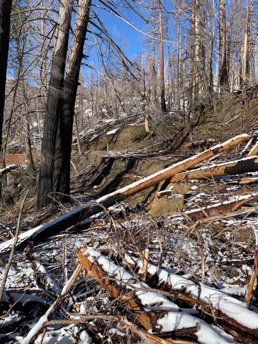
One page in the Storymap has links to photos at various points in the burned area, such as this one:
Thanks to Mike Archer for the link in his free WIldfire News of the Day email today.
Related links:
Danger Tree Removal Along Roads
https://www.fs.usda.gov/detailfull/willamette/fire/?cid=fseprd936134&width=full
2020 Fire Affected Road System Risk Reduction – planning docs
https://www.fs.usda.gov/project/?project=61749
Emily Dolhansky has this photo of the “roadside hazard treatment that never was” in her Twitter feed. https://twitter.com/emilydolhansky/status/1615540343512104961
You gotta love these ESRI supported Storymaps, wish we had that capability during my GIS years, would have saved a lot of paper, ink, production cost, time etc when producing these types of analysis and presentation documents.
In the dozen years or so I spent on the Willamette NF, half that was doing Road Maintenance work in the RDs shown in the Storymap. One of the management practices I found “Entertaining” was the uncut buffers left along many Forest roads, I guess to “Hide” the hundreds of acres of up slope clearcuts, which weren’t really hidden. Had this buffer been cut down to the roads, we wouldn’t have had to spend as much time removing downed trees, and now having to clean up this mess created by fires along these Forest roads.
Yep, that practice was pretty common. We called them ‘the big green lies’. If you looked beyond the buffer strip of old growth, you could see the even-aged management of the times. It does still exist in Region 5.
However, many of those buffers have had fuels projects that cut, pile and burn. It’s been a priority for many RDs, these days. It looks nice, too, in this example.
https://www.google.com/maps/@38.3364188,-120.2274126,576m/data=!3m1!1e3?hl=en
The last RD I worked on has been very busy, since I’ve been gone.
https://www.google.com/maps/@38.5127525,-120.4774589,1150m/data=!3m1!1e3?hl=en