Another kind of access challenge

Sometimes the threat to national forest access results from undeveloped private land adjacent to a national forest becoming a subdivision, and here’s an example of that.

In a recent development (described on a subscription-only site) an Aug. 28 hearing has been set in a lawsuit filed by developer Easter Mountain Ranch LLC (EMR) against Cochise County, Arizona.  The county board had denied approval of a tentative subdivision plat for J6 Ranch, a 278-home gated community planned for the northern foothills of the Whetstone Mountains.  The land to be subdivided abuts the Coronado National Forest.  The issue in the case boils down to a requirement by the county for the developer to “provide multi-purpose (vehicle, pedestrian, equestrian, etc.) legal access to federal lands.”  The proposed subdivision would provide a road that dead-ends at the boundary of the national forest where roads are not allowed.

While the lawsuit about whether the developer met this requirement may hinge on the meaning of “access to,” the question I have is what is the Forest Service position and what has their involvement been.  They are not mentioned here.  It seems likely that the county position was an effort to coordinate with the Forest Service, and what exactly that meant should have been on the table for all parties to understand.  But where was the Forest Service?  (There’s nothing on the EMR or J6 Ranch on the Coronado website.)

Then I wonder about what kind of public access will be allowed through a “gated community.”

Personnel, politics and public access to public lands


Yes, it looks like Forest Service employees should be concerned about how Trump might affect their careers.  Here’s an example about offending private landowners who block access to national forests.  (And, without any facts beyond earlier stories, I’ll suggest that you not think of these as long-term rural residents, but more likely some recent, possibly seasonal transplants, with money and political connections.)

Here’s one version of the story from a private property rights promoter:

Such cooperation, however, changed under the Obama administration as the Forest Service took a more strident approach in asserting claims to “traditional public access” routes. The dramatic change is reflected in a posting by Yellowstone District Ranger Alex Sienkiewicz who publicly advocated “NEVER ask permission to access the National Forest Service through a traditional route shown on our maps EVEN if that route crosses private land. NEVER ASK PERMISSION; NEVER SIGN IN. … By asking permission, one undermines public access rights and plays into their lawyers’ trap of establishing a history of permissive access.”

According to Sienkiewicz and access advocates, traditional public access is sufficient to establish a legal right, known as a prescriptive easement, to cross private property. Centuries of legal practice, however, have required that individuals or agencies wanting to establish prescriptive easements must prove that access was continuous, open, notorious, and hostile to the owner. In other words, the access must be without expressed permission by the landowner, a burden of proof that has been difficult, to say the least.

This doesn’t sound like the complete story.  The federal government does try to protect its existing legal interests, and that includes historic access that may not have been formalized, which it tries to negotiate.  I doubt if it often pursues litigation, but does sometimes end up in court to defend public access, as in this case involving access to the Lee Metcalf Wilderness on the Indian Creek trail, cited by the author of the op-ed above as a good example of negotiation (at least until it apparently went bad).  The Forest Service met its “difficult” burden of proof in this case.  There is a risk that asking permission now could undo the historic rights that already exist, but I don’t think it’s large, and I am a little skeptical that the Forest Service would “post” statements like that above except in cases where a particular landowner had made it clear that they were declaring war on public access, such as in this example.

Here’s another version of the same story from a recreation outfitter:

Recently, the U.S. Forest Service removed District Ranger Alex Sienkiewicz from his position in the Yellowstone Ranger District pending an internal investigation into his efforts to defend historical Forest Service trails and easements along the Crazy Mountains.

When legal access to public land does exist, I believe Montanans fully expect the Forest Service to defend and maintain that access for Montanans. As with so many of these issues involving political pressure on public agencies, a look behind the curtain reveals a very troubling story. According to media reports, U.S. Sen. Steve Daines, and Congressman Pete Sessions from Houston, Texas, both contacted Agricultural Secretary Sonny Perdue regarding Sienkiewicz’s efforts to protect legal, established accesses to landlocked public lands. According to Mary Erickson, forest supervisor, “the reassignment was made after allegations from an assortment of landowners in the Big Timber area were raised to the level of the Secretary of Agriculture, Sonny Perdue, and Sen. Steve Daines.“

Here’s the background on the Crazy Mountains access.

Blocking and posting no trespassing signs at the head of Trail 115/136 prompted Yellowstone District ranger Alex Sienkiewicz to organize a trail clearing and marking trip this past summer. Prior to that the agency traded letters with the Langhuses’ Livingston attorney, Joe Swindlehurst, who has denied there is an old forest trail at that location.

It’s not a stretch to see this as politicians ordering a personnel move to keep public lands from public hands.  Dangerous on both counts.


Humans sparked 84 percent of US wildfires, increased fire season over two decades

How should we deal with the new math on forest fires?

If this article published in the February Proceedings of the National Academy of Sciences is not a fluke then it would seem to me that our expanding population dictates the need for more forest management not less. The less desireable alternative would be to severely restrict access to our federal forests. The main conclusion of the article is that humans sparked 84 percent of US wildfires and caused nearly half of the acreage lost to wildfire. This number excludes intentionally set controlled burns.

From the above, I would deduce that human initiated fires caused proportionally less acreage loss because they were closer to civilization and to forest access points and therefore closer to and more easily accessed by suppression resources. The fact that nearly half of the wildfire acres lost occur in these areas suggests that we would get more bang for our tax dollars if we increased and focused federal sustainable forest management around high traffic areas easily accessible to humans.

Knowing that humans who cause wildfires are, by definition, either careless or malicious, we might deduce that they are generally not inclined to put great effort into getting to their ignition set points. This would lead us to consider that human caused fires might prove to be in less difficult terrain areas with high human traffic. Fires like the Rim fire being the exception. That, if true, would suggest that forest management for risk reduction on these sites could be done at lower costs per acre than other less accessible forest acreage. Focusing forest management efforts on these high benefit to cost areas would have the biggest bang per tax dollar expended in order to lower the total cost of federal wildfire control. If my thinking is correct, this should play a large part in setting the priorities as to where we should: 1) apply controlled burns to reduce ground and other low fuels, 2) utilize commercial thinnings to reduce ladder and proximity fuels or 3) use commercial regeneration harvests to create greater variation in tree heights between stands in order to provide fire breaks for crown fires when appropriate for the site and species. The net effect would be positive for all species including endangered and threatened species. There would still be plenty of lightning caused wildfire, controlled burn hotspots/breakouts and a significantly reduced acreage of human caused fires to satisfy those who don’t mind national ashtrays. Reducing the number and size of human caused fires would also free resources to attack lightning fires earlier and harder when allowing the fire to burn was not an option.

Pertinent Quotes:

  1. “After analyzing two decades’ worth of U.S. government agency wildfire records spanning 1992-2012, the researchers found that human-ignited wildfires accounted for 84 percent of all wildfires, tripling the length of the average fire season and accounting for nearly half of the total acreage burned.” Italics added
  2. “”These findings do not discount the ongoing role of climate change, but instead suggest we should be most concerned about where it overlaps with human impact,” said Balch. “Climate change is making our fields, forests and grasslands drier and hotter for longer periods, creating a greater window of opportunity for human-related ignitions to start wildfires.”” Italics added
  3. “”Not all fire is bad, but humans are intentionally and unintentionally adding ignitions to the landscape in areas and seasons when natural ignitions are sparse,” … “We can’t easily control how dry fuels get, or lightning, but we do have some control over human started ignitions.””
Remember the “Shovel Brigade?” Court unsettles settlement.

This was the Bundy gang of the 90s.  The Forest Service decided that it would not rebuild a washed out road along the Jarbridge River in Nevada to avoid impacting the now federally threatened bull trout.  The locals threatened to rebuild it themselves.  The issue in court became “who owns the road.”

Under the Bush Administration, the Forest Service agreed to not challenge the county’s ownership – a substantive concession that a federal district court has just reversed.  The judge said, “Without evidence that Elko County owns the right-of-way, the consent decree gives land of the United States to Elko County without following proper procedural requirements.”

This is how the discretion of federal agencies to settle lawsuits may be limited.

On the question of whether a “road” existed prior to establishment of a national forest, the court required “a demonstration of more than random or merely occasional use.”

Massive Crater Lake Wilderness Area Fantasy

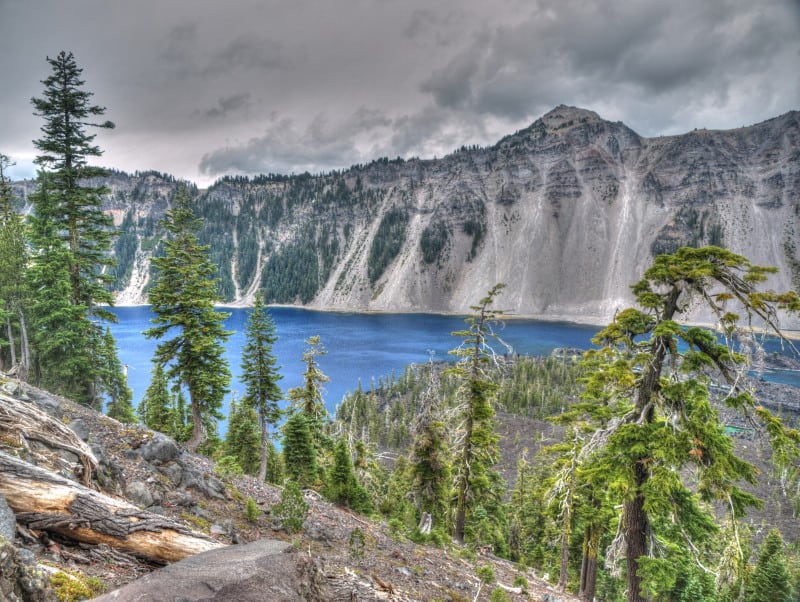
Oregon Wild has proposed a massive half million acre Wilderness Area, partly to “protect” Crater Lake. The Klamath County Commissioners are saying no, with fears that summer fires would affect public health, and that those unhealthy forests need active management.

P9159024_tonemapped-web

Here is a map of what Oregon Wild wants done.

Some better things coming from the Blues (Mtns.)

Since I criticized the FS there in a couple of previous posts, here’s a couple of things I think they’ve done right.

It’s important that the public understand the relationship between forest planning and travel management planning, and this explanation from the Wallowa-Whitman is reasonably clear.  I think it should work about as well as it can if the Subpart A (roads analysis) precedes forest plan revision, and Subpart B (designation of roads open to motorized vehicles) follows it.

A little further back, I faulted the FS for not being honest about the legality of the local ordinance that sought to regulate the federal government.  That came up again at this Malheur meeting, and the FS set the record straight: “Our attorneys do not believe the Grant County ordinance is legal,” Beverlin said.

Beaverhead-Deerlodge Forest Plan NEPA not site-specific enough

The Ninth Circuit Court of Appeals reversed the decision in the Beaverhead-Deerlodge (B-D) National Forest’s revised forest plan to designate areas for use by winter motorized vehicles. It found that the forest plan EIS failed to provide analysis that was site-specific enough to make an informed decision, as required by NEPA, and that the planning process did not comply with the “minimization” requirements of Executive Order 11644 for off-road vehicles, including evaluation of specific areas open to motorized vehicles.

This was a rare loss at the forest plan level on a NEPA issue.  While courts often accept more general NEPA analysis for programmatic decisions, this court recognized that the essence of forest plans is land allocation decisions.  Here it was important to know where winter range was in order to consider how the plan affected it or to propose alternatives for it.  The court stated that, “Without data on the location of the big game winter range, the public was severely limited in its ability to participate in the decision-making process.”  This principle should be applicable to other wildlife issues in plan revisions.

The holding on motorized use may also be precedent-setting.  It found that the plan ‘designated’ ‘areas open to snowmobile use.’  That made it subject to the executive order and to the Travel Management Rule (TMR) the FS adopted to implement the executive order.  The court stated, “What is required is that the Forest Service document how it evaluated and applied the data on an area by-area basis with the objective of minimizing impacts as specified in the TMR.”  It held that the Forest Service had instead deferred that level of analysis to subsequent travel planning.  The B-D plan had more site-specific direction for motorized use than many plans would have, but this holding could arguably apply to any forest plan components that identify areas in which motorized use would be allowed (especially where it is already occurring without prior compliance with the TMR).  This opinion blurs the distinction between forest planning and travel planning that the Forest Service has tried to maintain.

Neighbors and Idaho Rivers United File Suit on Forest Service Road Use by State

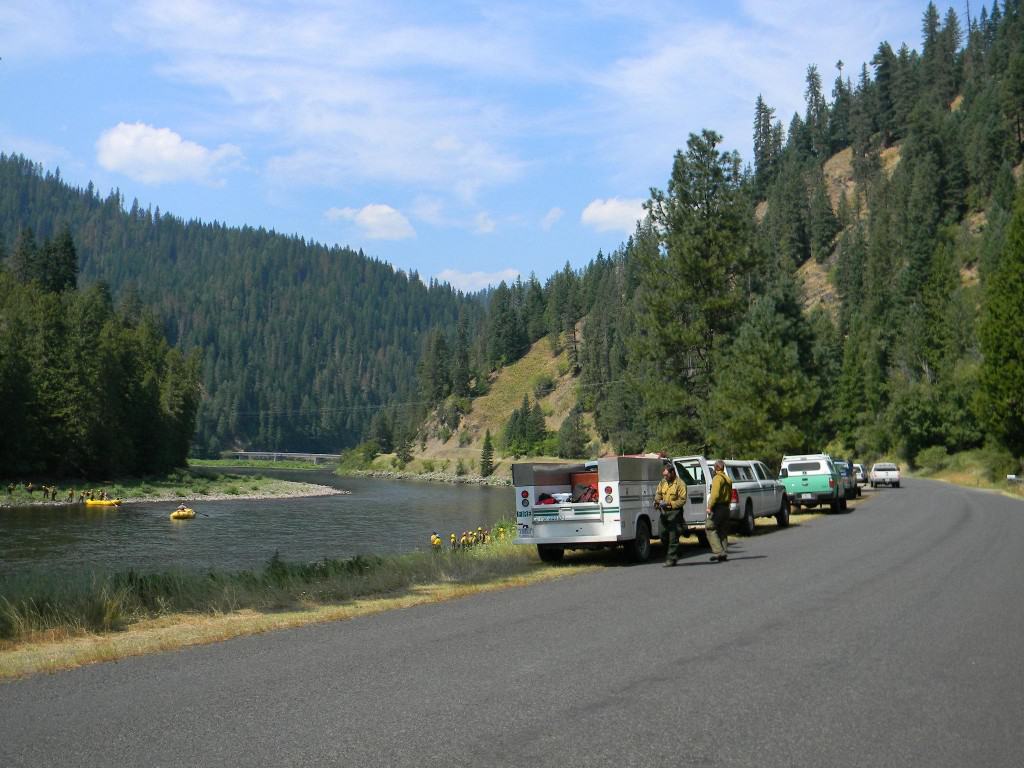
Couldn't find a photo of the area, this is from the Johnson Bar fire which is somewhere close.
Couldn’t find a photo of the area, this is from the Johnson Bar fire which is somewhere close.

Here are some links to this lawsuit.. Idaho Rivers news release here

Here’s the AP story, below is an excerpt:

Sharla Arledge, spokeswoman for the Idaho Department of Lands, said the Selway Fire Salvage Timber Harvest was scheduled for April 24 but was postponed after the state agency couldn’t reach an agreement with the Wrights when they expressed concerns about the plan. Arledge said the department is considering its options.

Department officials estimate the sale on about 167 acres would produce nearly 7 million board feet of timber and bring in about $1.7 million to the endowment fund that supports Idaho’s public schools.

The lightning-caused Johnson Bar Fire burned more than 20 square miles last summer and fall, mostly on Forest Service land but also on state endowment land. The department said there is no Wild and Scenic easement on state lands in the area where the logging is planned.

Specifically, the lawsuit seeks to reverse the determination by District Ranger Joe Hudson that Forest Road 652 is public. If it’s not public, that means the Department of Lands would have to obtain a special use permit from the Forest Service, according to the federal agency’s regulations, the lawsuit said.

Issuing such a permit, the lawsuit noted, would require the Forest Service to conduct an analysis of impacts on the scenic river corridor as required by the National Environmental Policy Act and the Wild and Scenic Rivers Act.

The lawsuit contends that the road is maintained by the Wrights to their home, but then becomes a dirt track that’s not maintained. The lawsuit also said that a 2007 road access guide for the Nez Perce National Forest doesn’t list 652 as open for motor vehicle use.

“This case is really about process,” said Laird Lucas, an attorney at Advocates for the West who is representing Idaho Rivers United. “It’s about holding the Forest Service accountable to its own laws and regulations.”

Really, it’s about process? Because it sounds like it might be about people living in WSR corridor (conceivably with some environmental impacts) that don’t want logging and log trucks around. I wonder whether the folks could just write a check to the Idaho schools for the $1.7 mill and end up saving themselves and the USG money.

The headline on Court Newshouse here is “greens fight clearcutting in Idaho.”

Usettling Forest Service settlement

The continuing judicial story of the South Canyon Road on the Jarbridge River (where the first battle was fought with shovels).

Legal arguments center on an 1866 law that established so-called RS 2477 roads by granting states and counties the right of way to build highways on federal lands…  The government denies such a right of way exists. But under political pressure, the Forest Service signed a settlement agreement in 2003 with assurances it no longer would challenge the county’s claim.

The Wilderness Society and Great Old Broads for Wilderness sued to block the deal, saying U.S. officials lacked the authority to cede control of the road and shirked their responsibility to protect the bull trout. The 9th Circuit Court of Appeals agreed and tossed the agreement out in 2005, before the agency signed a similar deal in 2011 and conservationists sued again.