Urgent Action Needed to Save Sierra Forests

This viewpoint shows more of the reasons why the desire to have larger and more intense wildfires, in the Sierra Nevada, is the wrong way to go.

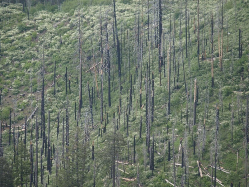
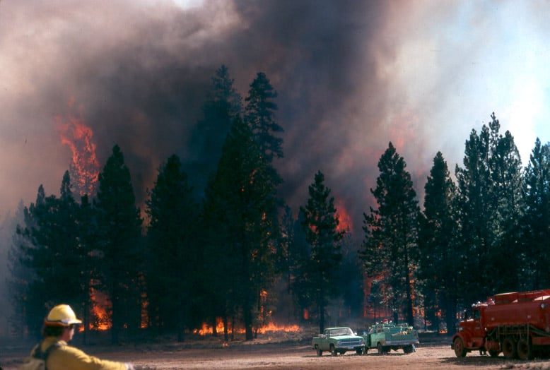
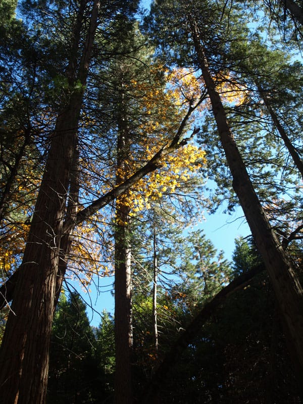
In this picture below, fire crews were run out of this stand, and back into the “safety zone”, on this fire I worked on, back in 1988.

campbell_fire1-web


http://www.sacbee.com/2014/09/28/6737076/viewpoints-urgent-action-needed.html

Air quality the past two weeks has been several times worse than some of the most polluted cities in the world due to smoke from the King fire. Last year’s Rim fire emitted greenhouse gases equivalent to 2.3 million vehicles for a year.

Also, the lost habitat and recreational opportunities from major fires like these are significant. It is not an exaggeration to say that virtually all Californians are affected when these “megafires” occur.

The report points out that wildfires are getting larger and burning at higher intensity than ever before. The Rim fire burned at nearly 40 percent high intensity – meaning virtually no living vegetation is left – covering almost 100,000 acres. More acres have burned in the first 4½ years of this decade than in seven decades of the last century.

What can we do about it?

The main bottleneck in treating more acres is in implementation. The Forest Service is unwilling to increase the size of its Region 5 timber management staffs. They use some of the usual excuses, some of which are beyond their control but, not all of those issues are really significant, looking at the big picture. Yes, it is pretty difficult to implement extremely-complex plans when you are constantly training new temporary employees, hired right off the street.
UC Berkeley Gets it Right, and Gets it Wrong

A Cal-Berkeley fire scientist shows his unawareness of current Forest Service policy but, his other ideas favor active management of our Sierra Nevada National Forests.

Canopy2-web

The situation is compounded by the gridlock between environmentalists and commercial foresters. The former favor thinning, but they want all logging plans to leave the larger trees, particularly those with trunks over 30 inches in diameter. But the timber companies maintain it is necessary to take a significant number of bigger trees to fund thinning and restoration programs.

Stephens generally favors the enviro position. Landscape-scale wildfire damage is driven by vast acreages of small-diameter, closely-packed trees, he says. By leaving the larger trees, the essential character of a natural forest can be maintained, even accelerated. And he thinks markets can be found for products produced from thinned, scrawny trees.

http://alumni.berkeley.edu/california-magazine/just-in/2014-09-26/brush-flame-king-fire-narrowly-misses-proving-fire-prevention

Of course, there has been a ban on the cutting of trees larger than 30″ dbh, since 1993. Ditto for clearcutting! These are two big hot-button issues for most “conservationists” but, there are still people out there who want timber sales banned, altogether. There are others who would love to go back to the Clinton rules of the Sierra Nevada Framework, which would shutdown much of Region 5’s timber management programs. A 22″ dbh tree, underneath a 36″ dbh tree cannot be considered “scrawny”.  Generally, most of the thinned trees are in the 10-18″ dbh size, averaging about 15″ dbh.

The Next Rim Fire?

P9256059-web

http://www.news10.net/story/news/local/eldorado-hills/2014/09/18/king-fire-burns-27930-acres-el-dorado-county-thursday/15816425/

The King Fire is experiencing growth like we saw in the Rim Fire, last year. There are important similarities but there is also a main difference. The fuels are much thicker in this more northern landscape. The fire behavior was so extreme that even the airtankers could not fly their missions. The south fork of the American River features a canyon that is steep, and over 2000 feet deep. The fire has been fought aggressively along Highway 50, with 1000’s of homes nestled into un-firesafe neighborhoods. Like most people, they seem to prefer their shade over fire safety. The fire has now burned about 50,000 acres in one 24 hour period and there is only 5% containment. A weak cold front approaches and will increase the winds, even more than they have been in the last two days. After the cold front blows through, there might be a change in the wind direction, too. There seems to be a new gap in the Sierra Nevada, where old growth is being incinerated. A drive up to south Tahoe along Highway 50 shows the now-interconnected wildfires in recent history. The Wrights Fire, the Pilliken Fire, the Cleveland Fire, the Freds Fire and now, the King Fire. Change has been very harsh upon the Highway 50 corridor.

When will Congress do “something” that is effective against wildfires?

No TRO for the Rim Fire Salvage!

As I predicted, there will be no TRO for the Rim Fire, from District Court. Once the sales are sold, restoration work can begin. Let’s hope that SPI has an army of fallers, ready and waiting. I also hope that they will leave the plantation salvage for last. *smirk*

P9202316-web

Sonora, CA –A Federal Judge in Fresno has denied a temporary restraining order regarding the lawsuit filed against the Rim Fire Recovery Record of Decision.

Forest Service Spokesperson Wyn Hornbuckle says, “We are pleased with the court’s decision.” He would not comment further.

As reported earlier this month, three environmental groups including the Center for Biological Diversity were seeking an injunction to halt logging within the 37 occupied California spotted owl territories within the burned area. The Chair of the Yosemite Stanislaus Solutions (YSS) group and President of Sierra Resource Management, Mike Albrecht, worked with local environmental groups and the Forest Service to hammer out a compromise on the Rim Fire Record of Decision. He applauds the Judge’s decision.

http://www.mymotherlode.com/news/local/223061/logging-injunction-denied.html

Rim Fire Logging Lawsuit

Yes, we all knew it was coming but there is one surprise. (See the 3rd plaintiff)

Again, owls will “occupy” almost ANY landscape, as long as there is prey there. If the nest stands were cooked, then they will have to find, and build, new nests. Owls are notoriously lazy in building nests, and often will use abandoned goshawk nests (and vice versa). One question I’ve wondered about for a long time is; Why do PACs retain their “protected” status when nesting habitats (the reason the land is protected) are destroyed? The loss of spotted owl (AND goshawk) nests is merely another part of the “whatever happens” strategy, so loved by the plaintiffs.

P9202313-web

“The complaint issued by the Earth Island Institute, the Center for Biological Diversity, and the California Chaparral Institute seeks an injunction to halt logging within the 37 occupied California spotted owl territories within the burned area. That would prevent logging in about 40% of the Rim Fire areas already approved by the decision for tree removal.”

http://www.mymotherlode.com/news/local/221678/rim-fire-logging-lawsuit.html

Local planning and forest planning

I think this article was an offshoot of the recent surge in discussion of transferring federal land to Montana (and other western states).  (A number of the articles linked in the sidebar are about that.)

This article ends up making an important point, but also shows how people can take that point and run the wrong way with it.  The important point is that a local land use plan is essential for having a discussion with the Forest Service about how a forest plan may affect local land use (and vice versa).  NFMA requires the the Forest Service planning process be “coordinated with the land and resource management planning processes of State and local governments and other Federal agencies.”  The 2012 planning rule requires the forest supervisor to “review the planning and land use policies” of other governments.

Here are the problems.  A local consultant states that, “federal land management must be consistent with local plans to the greatest extent possible.”  There is no such requirement; coordinating the process does not mean consistency with the results.  A county commissioner says, “more tangible issues, like whether a forest road gets maintained or how energy exploration and wilderness designations get decided, are what residents really care about.”  Local land use plans have no jurisdiction over federal lands and should not be addressing management activities that occur there.  Putting that kind of thing in a local plan does not bring it within the NFMA coordination requirement.  On the other hand, there may be need of coordinated planning of connected infrastructure like roads (or where subdivisions occur in relation to NFS management).

I’d like to think that whatever it takes to get local planning to occur is a good thing.  But I think that circulating the idea that local land use plans can govern federal land use will do more harm than good.


Preparing For Rim Fire Logging Litigation

The battle has begun!

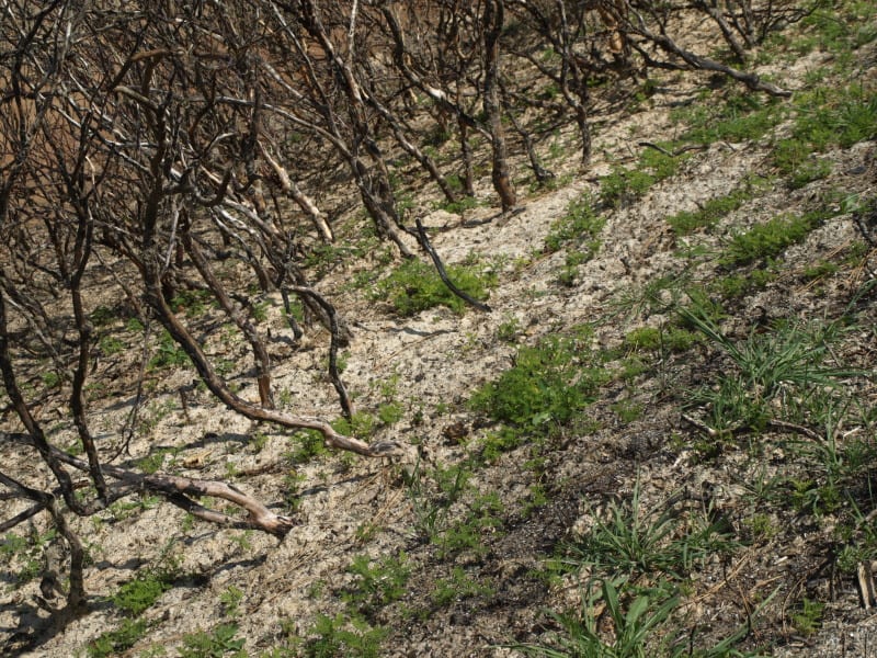
The picture below was taken in April, within the Rim Fire, and shows how quickly the bearclover returns, after a fire. Even the manzanita and deer brush have difficulty when the bearclover is so entrenched. California Indians knew that old growth pine and bearclover were the best of their available land management outcomes. Those landscapes had great advantages for humans living in the mid elevations of the Sierra Nevada.

http://www.mymotherlode.com/news/local/221325/preparing-rim-fire-logging-litigation.html

P9202274-web

Deputy Stanislaus National Forest Supervisor Scott Tangenberg spoke before the Tuolumne County Supervisors this morning, and said the Forest Service has been contacted by several individuals, or groups, that will likely file litigation later this week.

Well, we all knew that was coming and who was opposing the project. While on the Rim Fire tour, and at the SAF meeting, it was funny to see the Forest Service tiptoeing their way around “those who shall not be named”. *smirk*

The Rim Fire: Landscape View

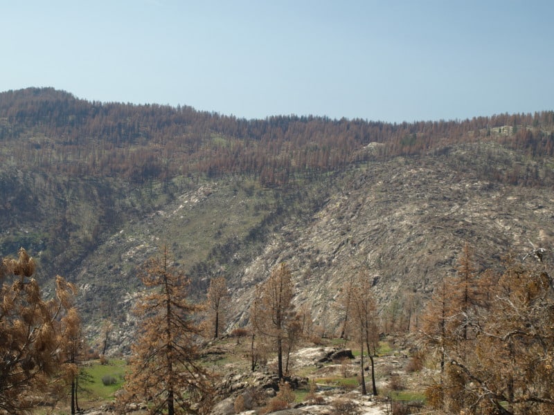
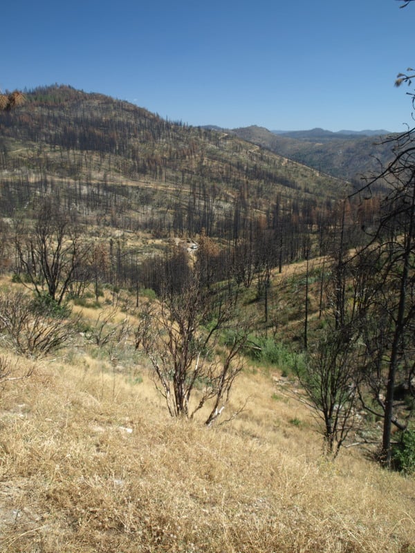
Here is a view of the Granite Creek watershed, and a peek at the Tuolumne River canyon, too. The Rim Fire burned all the way to those most-distant ridgetops. For scale, you can see a vehicle in the middle of the picture. That road is the Cherry Oil Road, which connects Cherry Lake with Highway 120. That greenish tint is the vast growth of bearclover, easily reclaiming their “territory”. Bearclover is one of the reasons why clearcutting has been banned in Sierra Nevada National Forests since 1993.

P9232905-web

Throwback Thursday Hits NCFP!

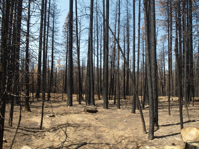
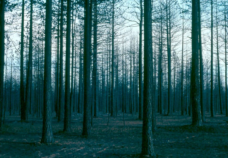
After the “Siege of 1987”, and 43 wildfires on the Hat Creek Ranger District, in three days, the Lost Fire burned up this forest up on the Hat Creek Rim. Even without terrain effects, this fire raged through the forest incinerating everything in its path. There is an eerie beauty in this picture, reminiscent of an Ansel Adams monochrome image.

high-intensity-burn-web

Today, those forests are growing back, after a big reforestation program, and it appears, a subsequent thinning. Here is a Google Maps view of that area today.

https://www.google.com/maps/@40.8027893,-121.4002792,862m/data=!3m1!1e3?hl=en

Already this summer, there has been 3 large wildfires on this Ranger District. It is mostly a dry “eastside pine” forest, requiring trees to be thinned and crowns separated. It appears that the Forest Service is finally seeing that early thinning is key to restoring forests. In the past, it always appeared that they were “gambling” on waiting for the trees to get bigger (and more profitable), before managing their plantations.

In Idaho, Tracing What Remains After the Flames

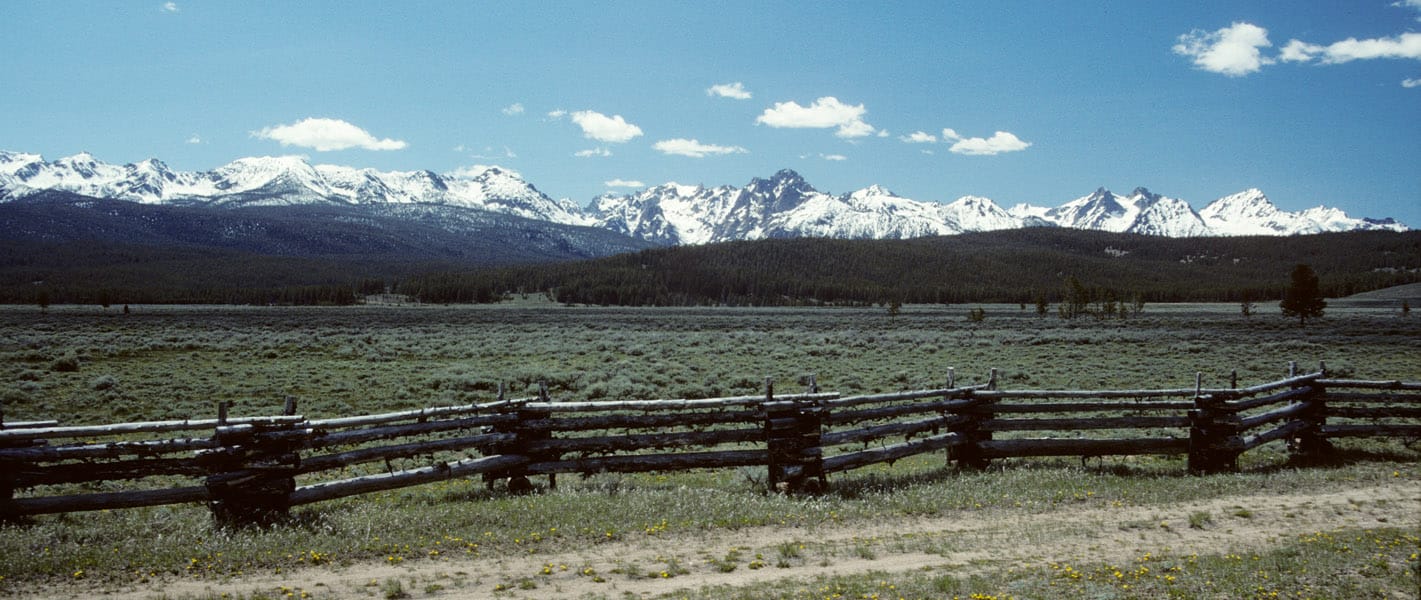
Dick Boyd sent me this article featuring the Sawtooth National Recreation Area. The Stanley area is one of my favorite spots, with hot springs, jagged peaks, pristine lakes, spacious meadows and abundant wildlife.

http://www.nytimes.com/2014/08/17/travel/in-idaho-tracing-what-remains-after-the-flames.html?emc=edit_th_20140816&nl=todaysheadlines&nlid=66809837

Sawtooth-panorama-fence-web

As we neared Stanley, Idaho, a hamlet carved by creeks and framed by mountains with spiky peaks that reminded me of a punk rocker’s hair, the landscape surrounding the winding highway on which we’d climbed 7,000 feet gave way from rugged canyon to flat expanse of grass speckled by lodgepole pine and aspen. We were on the northern edges of the Sawtooth National Recreation Area, three hours from Boise, when scars from an old fire came into view.

My daughter, Flora, and I had been playing a makeshift game in which we pointed out the nature surrounding us, the sort of mindless thing you do to entertain a 5-year-old on a road trip. I see a deer, I see a birdie, I see snow, I see a purple flower, we called out.

“I see trees,” I said, pointing to a cluster of an unrecognizable species to our left, their crooked branches denuded by flames that had torched them.

“Those are not trees,” Flora retorted. “Trees have leaves!”

This article reminded me of the time I spent working on the Boise National Forest, after the massive 1994 Rabbit Creek Fire took 2 months to burn before the Sawtooths and fall rains finally extinguished it. The public rarely sees any of the 150,000 burned acres, as it isn’t visible from the highways. I stumbled upon this vintage video that shows how devastating such fires can be, as storms deposit moderate rains upon highly hydrophobic soils.

It is not always easy to display the damages that occur when soils cannot absorb even moderate rainfall. As the storms and high winds came in, that day, Forest Service employees were called in, due to the danger. Oddly enough, they forgot about me. I weathered the storm, not knowing what was happening. The next day, I patrolled the roads, finding a plugged culvert, with excessive soil movement. I pulled out my trusty shovel and diverted all the water into the roadside ditch, getting it to flow down and through the next downhill culvert.