Urgent Action Needed to Save Sierra Forests

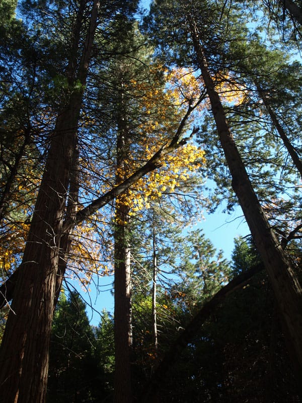
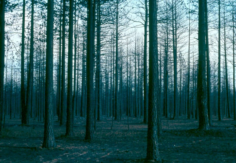
This viewpoint shows more of the reasons why the desire to have larger and more intense wildfires, in the Sierra Nevada, is the wrong way to go.

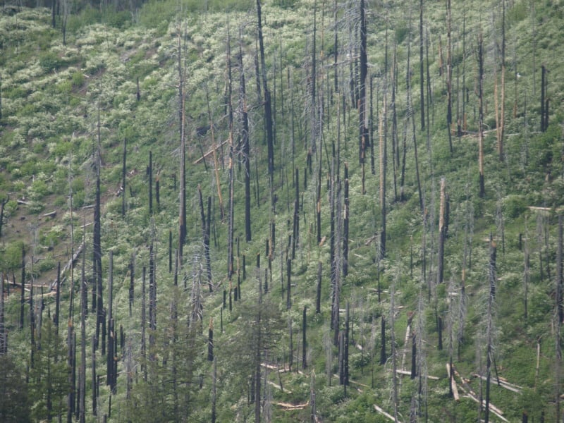
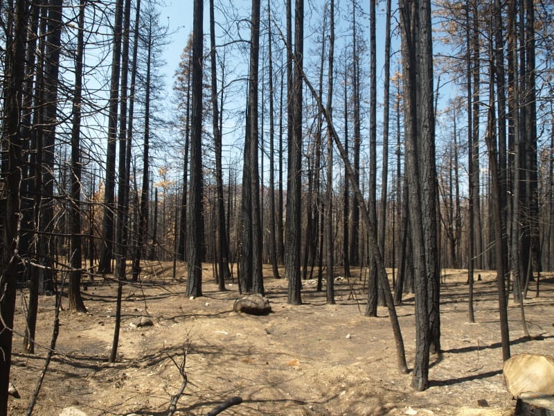
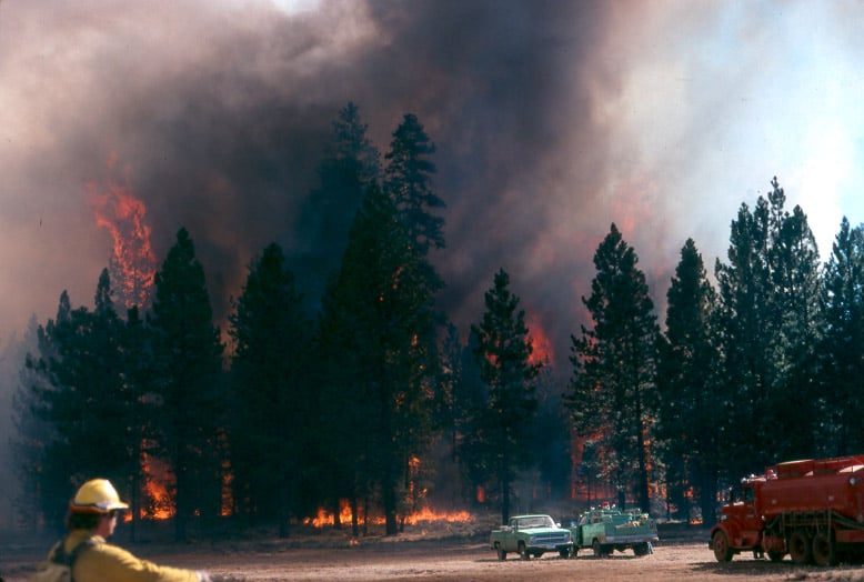
In this picture below, fire crews were run out of this stand, and back into the “safety zone”, on this fire I worked on, back in 1988.

campbell_fire1-web


http://www.sacbee.com/2014/09/28/6737076/viewpoints-urgent-action-needed.html

Air quality the past two weeks has been several times worse than some of the most polluted cities in the world due to smoke from the King fire. Last year’s Rim fire emitted greenhouse gases equivalent to 2.3 million vehicles for a year.

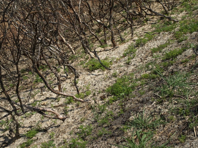
Also, the lost habitat and recreational opportunities from major fires like these are significant. It is not an exaggeration to say that virtually all Californians are affected when these “megafires” occur.

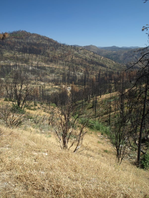
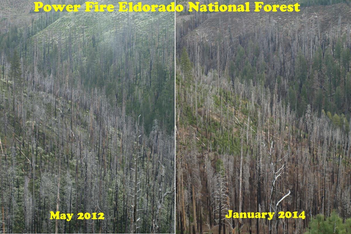
The report points out that wildfires are getting larger and burning at higher intensity than ever before. The Rim fire burned at nearly 40 percent high intensity – meaning virtually no living vegetation is left – covering almost 100,000 acres. More acres have burned in the first 4½ years of this decade than in seven decades of the last century.

What can we do about it?

The main bottleneck in treating more acres is in implementation. The Forest Service is unwilling to increase the size of its Region 5 timber management staffs. They use some of the usual excuses, some of which are beyond their control but, not all of those issues are really significant, looking at the big picture. Yes, it is pretty difficult to implement extremely-complex plans when you are constantly training new temporary employees, hired right off the street.

UC Berkeley Gets it Right, and Gets it Wrong

A Cal-Berkeley fire scientist shows his unawareness of current Forest Service policy but, his other ideas favor active management of our Sierra Nevada National Forests.

Canopy2-web

The situation is compounded by the gridlock between environmentalists and commercial foresters. The former favor thinning, but they want all logging plans to leave the larger trees, particularly those with trunks over 30 inches in diameter. But the timber companies maintain it is necessary to take a significant number of bigger trees to fund thinning and restoration programs.

Stephens generally favors the enviro position. Landscape-scale wildfire damage is driven by vast acreages of small-diameter, closely-packed trees, he says. By leaving the larger trees, the essential character of a natural forest can be maintained, even accelerated. And he thinks markets can be found for products produced from thinned, scrawny trees.

http://alumni.berkeley.edu/california-magazine/just-in/2014-09-26/brush-flame-king-fire-narrowly-misses-proving-fire-prevention

Of course, there has been a ban on the cutting of trees larger than 30″ dbh, since 1993. Ditto for clearcutting! These are two big hot-button issues for most “conservationists” but, there are still people out there who want timber sales banned, altogether. There are others who would love to go back to the Clinton rules of the Sierra Nevada Framework, which would shutdown much of Region 5’s timber management programs. A 22″ dbh tree, underneath a 36″ dbh tree cannot be considered “scrawny”.  Generally, most of the thinned trees are in the 10-18″ dbh size, averaging about 15″ dbh.

The Next Rim Fire?

P9256059-web

http://www.news10.net/story/news/local/eldorado-hills/2014/09/18/king-fire-burns-27930-acres-el-dorado-county-thursday/15816425/

The King Fire is experiencing growth like we saw in the Rim Fire, last year. There are important similarities but there is also a main difference. The fuels are much thicker in this more northern landscape. The fire behavior was so extreme that even the airtankers could not fly their missions. The south fork of the American River features a canyon that is steep, and over 2000 feet deep. The fire has been fought aggressively along Highway 50, with 1000’s of homes nestled into un-firesafe neighborhoods. Like most people, they seem to prefer their shade over fire safety. The fire has now burned about 50,000 acres in one 24 hour period and there is only 5% containment. A weak cold front approaches and will increase the winds, even more than they have been in the last two days. After the cold front blows through, there might be a change in the wind direction, too. There seems to be a new gap in the Sierra Nevada, where old growth is being incinerated. A drive up to south Tahoe along Highway 50 shows the now-interconnected wildfires in recent history. The Wrights Fire, the Pilliken Fire, the Cleveland Fire, the Freds Fire and now, the King Fire. Change has been very harsh upon the Highway 50 corridor.

When will Congress do “something” that is effective against wildfires?

More Photos From Scotland

Thanks be to Gaia, my camera with photos arrived today shortly after I posted the previous post. In honor of the vote tomorrow, here are a smattering of photos.I think you can click on them if you want to see them more clearly.

clearcut along road (see reflection in bus window)

log truck
Log trucks.

Maes howe with cows
Note that the Maeshowe site, a World Heritage Site, is right next door to a pasture of cows.

P1020297 Dogs n’ livestock..something we have here…

Sound familiar?
Sound familiar?
Log deck to be loaded on a barge.
For my Druid and Wiccan friends, here is a Rowan tree (Sorbus)

Here is a link to some Rowanlore.

Good luck to all tomorrow and may there be a peaceful reconciliation thereafter!

Principle or Practice? Landscapes of the Scottish Islands

scotland 1

First, thanks and apologies to Larry Harrell for being the contact for the blog while I was on vacation. Also an apology for getting back to this late. I returned to a crush of full time graduate school classes, and have just now had time to look at the blog.

My travel in the islands of western Scotland was for pilgrimage. I have to recommend it for folks interested in forests, because of the uniqueness of being somewhere where the conifer forests are (mostly) introduced. Tourism, (relatively intensive) forest management, and grazing seem to live together in relative harmony.

Vast numbers of tourists walk through sheep droppings and around sheep to see historical sites and views, and drive by plantations and clearcuts on the main roads. Big clearcuts, with no screening vegetation (I may get some photos of this later).

That is not to say there isn’t controversy about the non-native tree species. What I though was interesting in observing these landscapes was that a piece of land right now (say a recent clearcut) could be interpreted using different stories. For example, a clearcut could be either “a bad practice leading to a bad outcome” if you don’t like non native-forestry. Or a “bad practice leading to a good outcome” if you convert the clearcut area back to native vegetation. Or just a “practice that uses the land to provide incomes for people.” Those are all stories that we interpolate between us and the specific piece of ground in a specific vegetative situation, and some judgment calls can only be made knowing what occurred in the past or might occur in the future. Aesthetically, these forests would be beautiful if they were native. But they’re not. So some see beauty and others see human destruction. Is that in some sense, “reality” or in some sense “choice”?

If you think they are too dense for some species of wildlife, then you can talk about what densities would be better. But if you don’t like exotic species based on principle, then it doesn’t matter. But sheep are exotic to the Islands too.

So if “humans making a living on the land” is bad because it changes things from the “natural” way, then that seems like it would be true of farming, forestry or tourism.

If it’s a question of specific practices damaging specific environmental values, then that seems more amenable to discussion and compromise.

Here is a photo of a display at Glencoe National Park:

glencoe

It seems to me that most of us (even on this blog) are somewhere in the middle, and if so, there should be areas of compromise.

Rim Fire Logging Lawsuit

Yes, we all knew it was coming but there is one surprise. (See the 3rd plaintiff)

Again, owls will “occupy” almost ANY landscape, as long as there is prey there. If the nest stands were cooked, then they will have to find, and build, new nests. Owls are notoriously lazy in building nests, and often will use abandoned goshawk nests (and vice versa). One question I’ve wondered about for a long time is; Why do PACs retain their “protected” status when nesting habitats (the reason the land is protected) are destroyed? The loss of spotted owl (AND goshawk) nests is merely another part of the “whatever happens” strategy, so loved by the plaintiffs.

P9202313-web

“The complaint issued by the Earth Island Institute, the Center for Biological Diversity, and the California Chaparral Institute seeks an injunction to halt logging within the 37 occupied California spotted owl territories within the burned area. That would prevent logging in about 40% of the Rim Fire areas already approved by the decision for tree removal.”

http://www.mymotherlode.com/news/local/221678/rim-fire-logging-lawsuit.html

Preparing For Rim Fire Logging Litigation

The battle has begun!

The picture below was taken in April, within the Rim Fire, and shows how quickly the bearclover returns, after a fire. Even the manzanita and deer brush have difficulty when the bearclover is so entrenched. California Indians knew that old growth pine and bearclover were the best of their available land management outcomes. Those landscapes had great advantages for humans living in the mid elevations of the Sierra Nevada.

http://www.mymotherlode.com/news/local/221325/preparing-rim-fire-logging-litigation.html

P9202274-web

Deputy Stanislaus National Forest Supervisor Scott Tangenberg spoke before the Tuolumne County Supervisors this morning, and said the Forest Service has been contacted by several individuals, or groups, that will likely file litigation later this week.

Well, we all knew that was coming and who was opposing the project. While on the Rim Fire tour, and at the SAF meeting, it was funny to see the Forest Service tiptoeing their way around “those who shall not be named”. *smirk*

The Rim Fire: Landscape View

Here is a view of the Granite Creek watershed, and a peek at the Tuolumne River canyon, too. The Rim Fire burned all the way to those most-distant ridgetops. For scale, you can see a vehicle in the middle of the picture. That road is the Cherry Oil Road, which connects Cherry Lake with Highway 120. That greenish tint is the vast growth of bearclover, easily reclaiming their “territory”. Bearclover is one of the reasons why clearcutting has been banned in Sierra Nevada National Forests since 1993.

P9232905-web

Throwback Thursday Hits NCFP!

After the “Siege of 1987”, and 43 wildfires on the Hat Creek Ranger District, in three days, the Lost Fire burned up this forest up on the Hat Creek Rim. Even without terrain effects, this fire raged through the forest incinerating everything in its path. There is an eerie beauty in this picture, reminiscent of an Ansel Adams monochrome image.

high-intensity-burn-web

Today, those forests are growing back, after a big reforestation program, and it appears, a subsequent thinning. Here is a Google Maps view of that area today.

https://www.google.com/maps/@40.8027893,-121.4002792,862m/data=!3m1!1e3?hl=en

Already this summer, there has been 3 large wildfires on this Ranger District. It is mostly a dry “eastside pine” forest, requiring trees to be thinned and crowns separated. It appears that the Forest Service is finally seeing that early thinning is key to restoring forests. In the past, it always appeared that they were “gambling” on waiting for the trees to get bigger (and more profitable), before managing their plantations.

Repeat Photography: Part Deux

It’s kind of a challenge to assemble pictures shot in different years, from different spots, and from different cameras. This is an excellent way to view and monitor trends, showing the public what happens over time to our National Forests. Sometimes, you have to look hard to see the differences. In any future repeat photography projects, I will be using very high resolution, to be able to zoom in really far.

East-Panther-Power-Fire-web

One of the reasons why you don’t see much “recovery” is that the Eldorado National Forest has finally completed their EIS for using herbicides in selected spots, almost 10 years since the fire burned. This is part of the East Bay’s water supply. Sierra Pacific replanted their ground in less than 2 years. So, the blackbacked woodpeckers should be long gone, as their preferred habitat only lasts for an average of 6 years. As these snags fall over, the risk of intense soil damages from re-burn rises dramatically. Somewhere, I have some earlier pictures of this area which may, or may not line up well with this angle. I’ll keep searching through my files to find more views to practice with.