UC Berkeley Gets it Right, and Gets it Wrong

A Cal-Berkeley fire scientist shows his unawareness of current Forest Service policy but, his other ideas favor active management of our Sierra Nevada National Forests.

Canopy2-web

The situation is compounded by the gridlock between environmentalists and commercial foresters. The former favor thinning, but they want all logging plans to leave the larger trees, particularly those with trunks over 30 inches in diameter. But the timber companies maintain it is necessary to take a significant number of bigger trees to fund thinning and restoration programs.

Stephens generally favors the enviro position. Landscape-scale wildfire damage is driven by vast acreages of small-diameter, closely-packed trees, he says. By leaving the larger trees, the essential character of a natural forest can be maintained, even accelerated. And he thinks markets can be found for products produced from thinned, scrawny trees.

http://alumni.berkeley.edu/california-magazine/just-in/2014-09-26/brush-flame-king-fire-narrowly-misses-proving-fire-prevention

Of course, there has been a ban on the cutting of trees larger than 30″ dbh, since 1993. Ditto for clearcutting! These are two big hot-button issues for most “conservationists” but, there are still people out there who want timber sales banned, altogether. There are others who would love to go back to the Clinton rules of the Sierra Nevada Framework, which would shutdown much of Region 5’s timber management programs. A 22″ dbh tree, underneath a 36″ dbh tree cannot be considered “scrawny”.  Generally, most of the thinned trees are in the 10-18″ dbh size, averaging about 15″ dbh.
Local planning and forest planning

I think this article was an offshoot of the recent surge in discussion of transferring federal land to Montana (and other western states).  (A number of the articles linked in the sidebar are about that.)

This article ends up making an important point, but also shows how people can take that point and run the wrong way with it.  The important point is that a local land use plan is essential for having a discussion with the Forest Service about how a forest plan may affect local land use (and vice versa).  NFMA requires the the Forest Service planning process be “coordinated with the land and resource management planning processes of State and local governments and other Federal agencies.”  The 2012 planning rule requires the forest supervisor to “review the planning and land use policies” of other governments.

Here are the problems.  A local consultant states that, “federal land management must be consistent with local plans to the greatest extent possible.”  There is no such requirement; coordinating the process does not mean consistency with the results.  A county commissioner says, “more tangible issues, like whether a forest road gets maintained or how energy exploration and wilderness designations get decided, are what residents really care about.”  Local land use plans have no jurisdiction over federal lands and should not be addressing management activities that occur there.  Putting that kind of thing in a local plan does not bring it within the NFMA coordination requirement.  On the other hand, there may be need of coordinated planning of connected infrastructure like roads (or where subdivisions occur in relation to NFS management).

I’d like to think that whatever it takes to get local planning to occur is a good thing.  But I think that circulating the idea that local land use plans can govern federal land use will do more harm than good.


Preparing For Rim Fire Logging Litigation

The battle has begun!

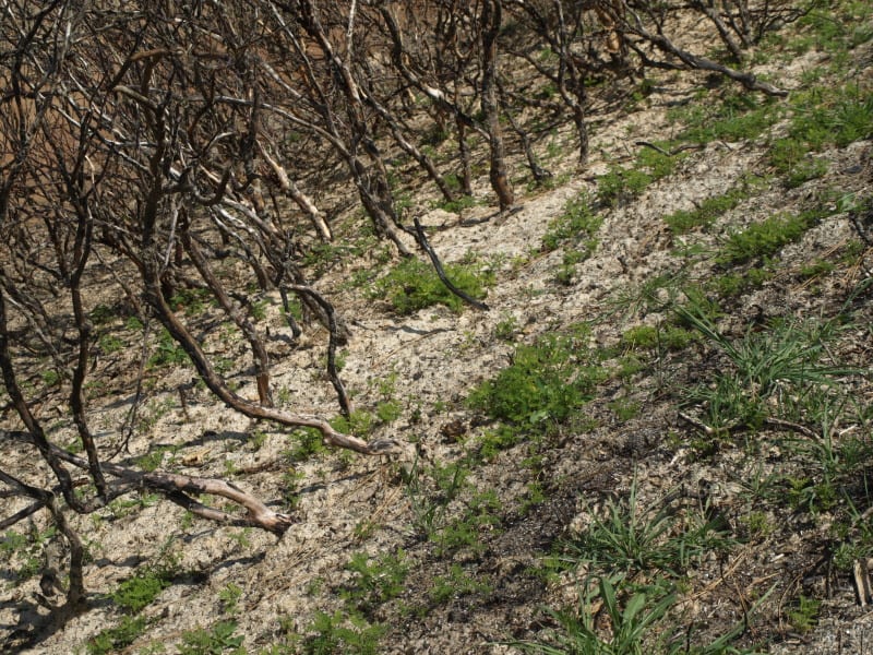
The picture below was taken in April, within the Rim Fire, and shows how quickly the bearclover returns, after a fire. Even the manzanita and deer brush have difficulty when the bearclover is so entrenched. California Indians knew that old growth pine and bearclover were the best of their available land management outcomes. Those landscapes had great advantages for humans living in the mid elevations of the Sierra Nevada.

http://www.mymotherlode.com/news/local/221325/preparing-rim-fire-logging-litigation.html

P9202274-web

Deputy Stanislaus National Forest Supervisor Scott Tangenberg spoke before the Tuolumne County Supervisors this morning, and said the Forest Service has been contacted by several individuals, or groups, that will likely file litigation later this week.

Well, we all knew that was coming and who was opposing the project. While on the Rim Fire tour, and at the SAF meeting, it was funny to see the Forest Service tiptoeing their way around “those who shall not be named”. *smirk*

BP makes the FS look bad

An interesting story of “all lands” planning (or not).  BP has filed a lawsuit against a large residential development adjacent to its forested property, and also adjacent to a national forest.

“Along two miles of Cainhoy Road, the plantation’s eastern border is shared by the 250,000-acre Francis Marion National Forest, which is home to numerous threatened and endangered species as well as miles of hiking, biking, and canoeing trails. Perhaps the single most important forest management tool that BP and the Forest Service have is prescribed burning.”

“There is still time for everyone – the developers, the city, BP, the Forest Service, and the local community – to agree on an outcome that benefits the region for decades to come.”

The Francis Marion is revising its forest plan by the way.  Should it write off ecological integrity in this area?

It will be interesting to see what BP’s arguments are in court.  Perhaps the Forest Service will at least submit an amicus brief explaining how its national resources will be affected by this development.

The Rim Fire: Landscape View

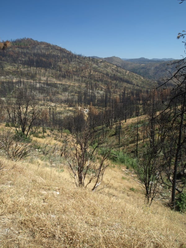
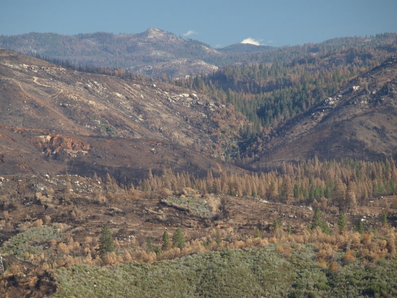
Here is a view of the Granite Creek watershed, and a peek at the Tuolumne River canyon, too. The Rim Fire burned all the way to those most-distant ridgetops. For scale, you can see a vehicle in the middle of the picture. That road is the Cherry Oil Road, which connects Cherry Lake with Highway 120. That greenish tint is the vast growth of bearclover, easily reclaiming their “territory”. Bearclover is one of the reasons why clearcutting has been banned in Sierra Nevada National Forests since 1993.

P9232905-web

Repeat Photography: Part Deux

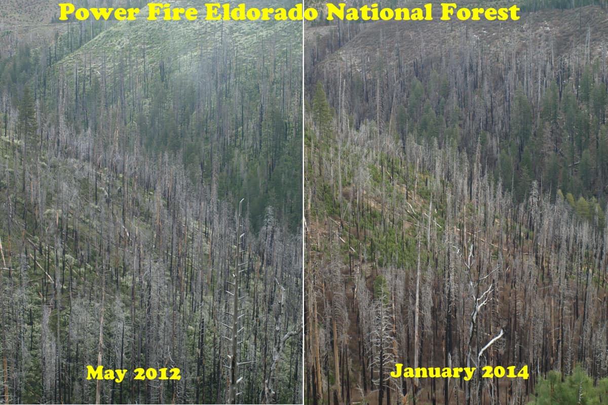
It’s kind of a challenge to assemble pictures shot in different years, from different spots, and from different cameras. This is an excellent way to view and monitor trends, showing the public what happens over time to our National Forests. Sometimes, you have to look hard to see the differences. In any future repeat photography projects, I will be using very high resolution, to be able to zoom in really far.

East-Panther-Power-Fire-web

One of the reasons why you don’t see much “recovery” is that the Eldorado National Forest has finally completed their EIS for using herbicides in selected spots, almost 10 years since the fire burned. This is part of the East Bay’s water supply. Sierra Pacific replanted their ground in less than 2 years. So, the blackbacked woodpeckers should be long gone, as their preferred habitat only lasts for an average of 6 years. As these snags fall over, the risk of intense soil damages from re-burn rises dramatically. Somewhere, I have some earlier pictures of this area which may, or may not line up well with this angle. I’ll keep searching through my files to find more views to practice with.


Thinning Contract is Monumental Task (4FRI!)

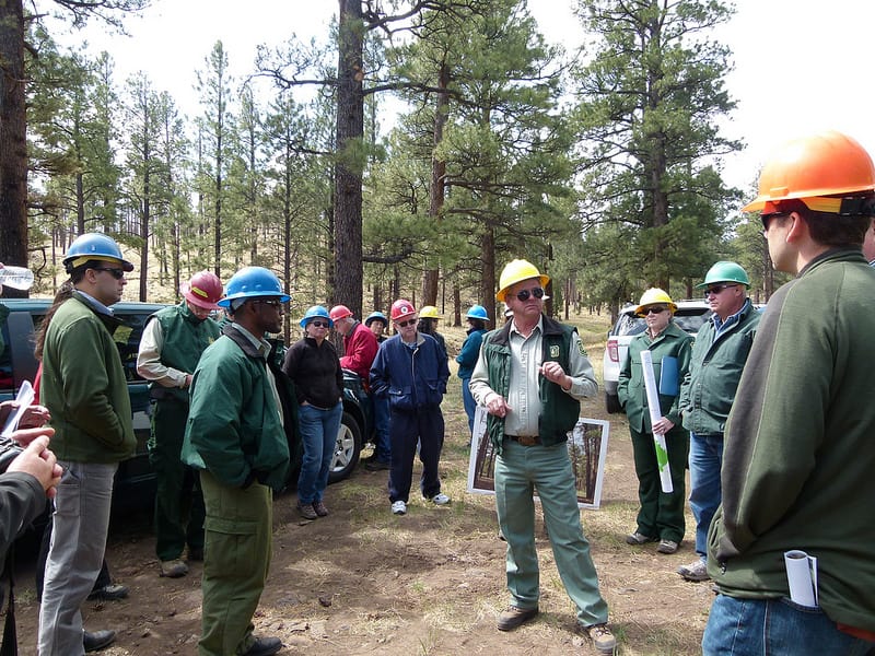
Forest Service photo of 4FRI

Thanks to Craig Rawlings and Forest Business Network for this one..Also thanks to Apache Sitgreaves for easy access to photos on Flickr.
Check out their site here .. the albums are interestin, including a couple on fires and post-fire flooding.

Here’s the link and below are some quotes.

However, Horner said, “It’s a really monumental task to build an infrastructure to cover the acres we need to do. Rather than saying, ‘Let’s get out there and start moving a few acres,’ we’re trying to build the infrastructure so we can do 40,000 acres a year in the next two or three years. We’ll need 300 trucks a day. You don’t snap your fingers and have trucks show up. It’s the chicken and the egg thing. What we’re striving for is to build that infrastructure for us to leap off and hit those acres at a level that if we achieve it, is going to snap a lot of people’s necks.”

But that means not only marshaling 80,000 truck-trips annually on forest roads, but financing a network of mills and biofuel operations to handle the huge quantities of wood from small trees growing in thickets four to 20 times the natural densities.

In the short term, Good Earth will rely heavily on selling saw timber, processed through existing mills. That means selling the wood from trees 14 to 18 inches in diameter will generate the profits needed to remove the massive amount of even smaller trees and brush.

“Ultimately, there needs to be a big processing facility to deal with a low value product. A lot of the basic elements are in place — there are some existing logging companies and a lot of trucking resources, also markets that do exist.”

….

The revelation that most of the initial contracts will depend on finding existing mills and the profits from the larger trees touches on one of the most controversial elements of the Forest Service’s effort to implement the 4FRI approach, originally developed by a coalition of loggers, environmentalists, forest researchers and local officials. That stakeholder group broke decades of deadlock and finger-pointing by agreeing to focus on trees smaller than 16 inches in diameter. The group wanted the Forest Service to accept a flat diameter cap, but the Forest Service decided it needed more flexibility — including an ability to take larger trees. While agreeing the 4FRI approach should leave as many large trees as possible, the environmental assessment will consider the impact of taking larger trees both to achieve certain goals like creating more meadows and to help the contractor turn a profit on the contract.

“There hasn’t been any analysis that says were going to cut any old trees,” said Fleishman, having earlier suggested 18 inches would represent the upper size limit of trees cut under the contract. “This is the largest environmental impact statement in the history of the Forest Service, and we should have it out in September” which is nearly a year behind earlier schedules. “The focus is going to be in the middle size tree — and the 15-18 inch diameters are the bulk of that. If we start cutting large, old trees — we’ll be in court so fast” as a result of legal challenges by environmental groups that supported the original concept with a 16-inch diameter cap. “This is a social issue,” he concluded.

Horner said Good Earth ultimately wants to use the millions of tons of biomass from the forest to produce energy — including jet fuel. But it won’t have the technology of the plants to do that for some years. “Their core business is creating energy from waste. But this will take years. The technology is not yet perfected for commercial production levels. So it comes back in the short term to saw lumber — solid wood products like poles and posts, really common things that have established markets. On the biomass side, it means grinding up trees and brush to create products that are really common — mulch, compost” and things like decorative bark for landscaping.

Arizona remains well positioned to feed such wood materials into many regional markets. “We’re optimistic we’re going to break the code. One of the most important things is to add as much value (to the wood products) as close to home as possible. Pine lumber continues to be a very valuable resource, so we’re looking at that as well. How do we make good quality wood out of what would otherwise be low quality.”

New Aerial Photos of the Rim Fire

Google Maps now has updated photos that include the Rim Fire. Now, we can explore the whole of the burned areas to see all of the damages and realities of last year’s epic firestorm.

P9132051-web

.

Here is where the fire started, ignited by an escaped illegal campfire. The bottom of this deep canyon has to be the worst place for a fire to start. It’s no wonder that crews stayed safe by backing off.

http://www.google.com/maps/@37.8374451,-120.0467671,900m/data=!3m1!1e3?hl=en

.

While there has been talk about the forests within Yosemite National Park, a public assessment has been impossible, in the National Forest, due to closures. Here is an example of the plantations I worked on, back in 2000, completed just a few years ago. What it looks like to me is that the 40 year old brushfields caused most of the mortality within the plantations. A wider look shows some plantations didn’t survive, burning moderately. When you give a wildfire a running start, nothing can stand in the way of it.

http://www.google.com/maps/@38.0001244,-119.9503067,1796m/data=!3m1!1e3?hl=en

.

There is also a remarkable view of Sierra Pacific Industries’ partly-finished salvage logging. Zoom into this view and take a look at their latest work, including feller-bunchers. Comments?

http://www.google.com/maps/@37.9489062,-119.976156,3594m/data=!3m1!1e3?hl=en

More Rim Fire Pictures

All too often, once a firestorm goes cold, a fickle public thinks the disaster is over with, as the skies clear of smoke. In the situation of the Rim Fire, the public hasn’t had much chance to see the real damages within the fire’s perimeter. All back roads have been closed since the fire was ignited. Besides Highway 120, only Evergreen Road has been opened to the public, within the Stanislaus National Forest.

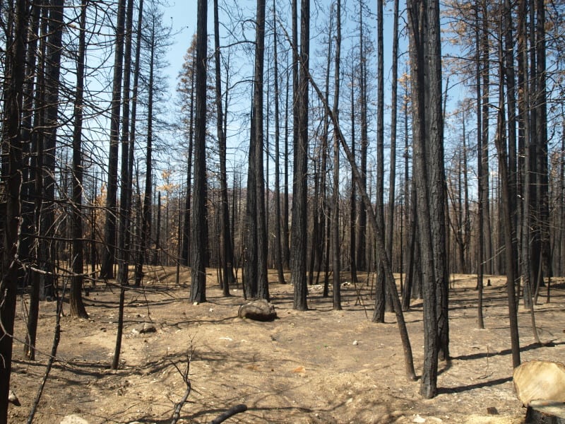
From my April trip to Yosemite, and Evergreen Road, this unthinned stand burned pretty hot. This would have been a good one where merchantable logs could be traded for small tree removal and biomass. Notice the lack of organic matter in the soil.

P9202313-web

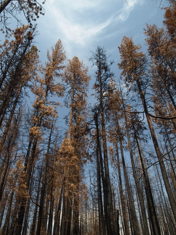
Sometimes people say there is no proof that thinning mitigates fire behavior. It’s pretty clear to me that this stand was too dense and primed for a devastating crown fire. I’m guessing that its proximity to Yosemite National Park and Camp Mather, as well as the views from Evergreen Road have made this area into a “Park buffer”. Now, it becomes a “scenic burn zone”, for at least the next few decades.

P9202306-web

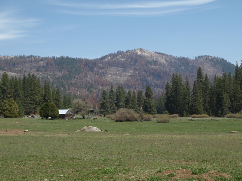
There is some private land along Evergreen Road, which seem to have done OK, at least in this view. Those mountains are within Yosemite National Park. Sadly, the media likes to talk about “reduced burn intensities, due to different management techniques”, within Yosemite National Park. Only a very tiny percentage of the National Park lands within the Rim Fire have had ANY kind of management. Much of the southeastern boundary of the fire butts up against the Big Meadow Fire, generally along the Tioga Pass Road (Highway 120). Additionally, much of the burned Yosemite lands are higher in elevation, as well as having larger trees with thicker bark. You can also see that there will be no lack of snags for the blackbacked woodpecker. Can anyone say, with scientific sincerity, that over-providing six years of BBW habitat will result in a significant bump in birds populations? The question is really a moot point, since the Yosemite acreage, alone, does just that.

P9202301-web

People have, and will continue to compare the Yosemite portion of the Rim Fire to the Stanislaus National Forest portion, pointing at management techniques and burn intensities. IMHO, very little of those comparisons are really valid. Apples versus oranges. Most of the Forest Service portion of the fire is re-burn, and there is no valid Yosemite comparison (other than the 2007 Big Meadow Fire). It has been a few months since I have been up there, and I expect that there are plenty of bark beetles flying, and the trees around here have no defense against them, with this persistent drought. Everything is in motion and “whatever happens” is happening.

Forest Supervisor speaks out on behalf of public lands

Kudos to the Forest Supervisor on the Cleveland National Forest for engaging in the local planning process and pointing out the threats to the national forest of increased housing density on its borders.  This is one way the Forest Service can attempt to both protect its resources and manage its costs, but it’s not something I’ve seen very often.  (In fact, I once saw a forest supervisor retract similar comments for political reasons.)

The Forest Conservation Initiative was a voter-approved initiative which required that private lands within the Cleveland National Forest in San Diego County have a minimum lot size of 40 acres. The FCI was originally approved in 1993 and expired in 2010.  An unusual history maybe, but it’s not unusual for local governments to allow increased development density (by either re-zoning or lack of zoning).  The responsibility of the Forest Service to speak up for our national resources exists regardless.