Bats and bighorns and bears (oh my?)

Two of these were originally posted as comments related to other posts and the third I would have, but Sharon intimated that they might not get noticed there, so here they are at the top end of a post.

BATS

We were discussing how the wolverine is most affected by climate change, and yet ESA requires mitigation of other less harmful activities that we have more control over. The effect of an introduced disease on bats also came up there.  A federal judge has just overturned a decision by the U.S. Fish and Wildlife Service to protect northern long-eared bats as threatened rather than endangered under the Endangered Species Act.  Here’s the Center for Biodiversity’s read-out of the judge’s opinion (there’s a link to the opinion, but I haven’t read it):

The Service argued that since the species was primarily threatened by disease, there was no need to protect its habitat.  But the court rightly noted that, in combination with disease, habitat destruction and other threats can cumulatively affect the bats, and thus are cause for concern.

It’s a point of contention these days whether climate change should be a factor in listing decisions when there is little likelihood of reducing its effects, but the law says it’s important to address and potentially mitigate other actions that may harm the species.

BIGHORNS

The Bridger-Teton National Forest is considering a restocking request for returning domestic sheep to two vacated allotments in the Wyoming Range.  It hinges on changing the forest plan to deemphasize protections for the Darby Mountain bighorn sheep herd. This would purportedly be consistent with the State of Wyoming’s bighorn plans.  The Forest is proposing to do a “focused amendment” to their forest plan,  but …

Bighorn advocates and conservationists who have watchdogged the restocking conversations wanted the Forest Service to instead deal with the issue in its forest plan (revision). The years-long revision process was supposedly coming up, though O’Connor said it’s now indefinitely on hold. Wyoming Wild Sheep Foundation Director Steve Kilpatrick said the Darby Mountain Herd deserves the longer, closer look.

I’m not sure the Forest is going to be able to do a “focused amendment” for this issue, since bighorn sheep should be a species of conservation concern under the 2012 Planning Rule, which warrants greater attention. Maybe this is a case where the inability to revise a forest plan is going to cause some problems. Then there is the question of why these allotments were vacant. The permittees were “bought out” through the efforts of the National Wildlife Federation (to protect bighorns?). Would they need to be paid back?
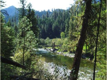
GRIZZLY BEARS

The discussion of reintroducing wolves to Colorado brought up the experience with grizzly bears in the Selway-Bitterroot Wilderness in Montana and Idaho.  A reintroduction proposal was rejected in 2001, but at least two bears have been documented there in recent years.  Here is the recent news about that.  The Fish and Wildlife Service has written to the Forest Service that bears that have made it there are fully protected by the Endangered Species Act (not an experimental population). All four of these forests are revising or will soon revise their forest plans and will have to provide conditions to support grizzly bear recovery.  The Nez Perce-Clearwater is farthest along but has been avoiding doing that.

Grand Canyon development proposal resurfaces on the Kaibab

We’ve discussed the use of land exchanges that would facilitate the growth of urban areas by giving them more private land in logical growth areas using the example of Las Vegas.  At a different scale, the town of Tusayan appears to be an inholding in the Kaibab National Forest, which limits its growth opportunities.  They have been looking at a proposal to develop a nearby separate inholding (which the town owns a part of).   It would require a special use permit to for roads and utilities to cross national forest lands.  It has been controversial (attracting unwanted attention according to the town; the 2nd Twitter link works), and the town has just approved a revised proposal, which will be submitted to the Forest Service.  The Kaibab National Forest rejected the last proposal in 2016 as inconsistent with the requirements for a special use permit.  Here is a part of the rationale that relates to the forest plan:

CFR 251.54(e)(l)(ii) requires that the proposed use must be consistent, or can be made consistent, with the Kaibab Forest Plan. The Forest Plan envisions management at a landscape­ scale by taking an “all-lands approach,” and specifies strategies to achieve the desired conditions and objectives in the Plan, including working closely with partners and across administrative boundaries to meet common objectives. The development that would be enabled by authorization of the proposed use of NFS lands could substantially and adversely affect Tribal lands and the Grand Canyon National Park.

36 CFR 251.54(e)(l)(v) provides that the proposed use must not unreasonably interfere with the use of adjacent non-National Forest System lands. The FS received written comments from the National Park Service (NPS) through the Principal Deputy Assistant Secretary of the Interior for Fish Wildlife and Parks which pointed out that potential impacts to the Outstanding Universal Value of the Grand Canyon National Park (GCNP), either from the roads that would be authorized by easement or the reasonably foreseeable development on the two private properties that would be enabled by the roads and other facilities, are of concern. The GCNP also raised concerns in a meeting regarding impacts on infrastructure that they share with the Town of Tusayan. The NPS was concerned that any activity that would result in significant increases in visitation or occupation near the Park would affect the Park’s capacity to absorb the additional use.

The first rationale is an interesting “all-lands” interpretation of its forest plan to encompass the objectives of the National Park Service and tribal lands.  The second rationale stands on its own, but it also explains what those interests are.  It’s not obvious that the recent modifications in the proposal are going to address these concerns, so I expect we’ll be seeing more about this.  (Here is the CBD take on the original proposal.)

Helena project clears the 9th Circuit, except for some “WUI”

Fine specimen of a real antique Morse code telegraph machine.Copyright: Photowitch | Dreamstime.com

The Ninth Circuit Court of Appeals has upheld the Telegraph Vegetation Project on the Helena-Lewis and Clark National Forest, except for one question about the location of the Wildland Urban Interface (WUI).  The case was previously described on this blog here.  That description included this allegation by plaintiffs:

Agency used non-federal definition of the Wildland Urban Interface 


“While the lynx amendment allows logging in the Wildland Urban Interface, it also defines the Wildlife Urban Interface to be within one mile of communities,” Garrity explained. “But the Forest Service used a new definition provided by local counties and then remapped the Wildland Urban Interface to include areas over five miles away from communities.”

The court remanded the decision for 50 acres of the 5000-acre plus area to be treated, and left the record of decision in place while the Forest Service completes its reevaluation:

“The Forest Service has acknowledged that it erred in calculating the wildland-urban interface for the project area. The Forest Service estimates that, once it has corrected its error, 50 acres of forest that it had planned to treat may no longer be eligible for treatment. If that estimate proves correct, the Forest Service represents that it will not treat those 50 acres. We grant the government’s request for a voluntary remand to allow the Forest Service to undertake the necessary reevaluation.”

I have been interested in how WUI is identified, by whom, and using what process under what authority – especially the role of non-federal parties.  WUI is generally  identified based on the Healthy Forest Restoration Act of 2003 (HFRA).  Areas identified using that process qualify for streamlined projects in accordance with HFRA, and may be eligible for particular funding.  However (in accordance with HFRA), WUI projects are still subject to requirements of the governing forest plan.  Management direction for lynx is part of the forest plan, and this article (like plaintiffs) suggests it imposes greater restrictions on part of this project:

“In the second portion of the court’s order, the Forest Service proposed logging and thinning in areas defined as the “wildland-urban interface,” which is where houses or cabins meet the forest. Regulations related to lynx allow the removal of some trees and vegetation in lynx habitat if it falls within the wildland-urban interface and if the agency shows it is part of a wildfire mitigation project. The alliance inspected the area and reported only a handful of houses. The Forest Service conceded in court documents that it erred in calculating the size of the wild-land urban interface based on discrepancies between what qualifies.”

However, this actually indicates that the problem was in the definition of “community” (based the on number of houses), rather than the distance from one.  In fact, the Northern Rockies Lynx Management Direction refers to WUI “as defined by HFRA.”  Those definitions and criteria for “WUI” and “at risk community” are summarized by the Forest Service here.  Although which communities are to be included (they can self-identify) are mostly listed in the Federal Register, that doesn’t address their boundaries.  The district court opinion upheld the Forest Service WUI designation, stating that, “The Powell County Plan does not begin with the HFRA definition; it creates its own, “and “the Court is not persuaded by Council’s attempt to discredit the map provided by the Forest Service in the Telegraph Project EIS” based on that county plan. Yet it sounds like the map may have been wrong in this case.  This all reminds me of my take-home from my Forest Service days that “WUIs are fuzzy.”

Here’s why this might be important to planning.  I agree with the idea that forest plans (like the lynx direction) should identify areas with differences in long-term management that result from a wildland-urban influence.  However, if the WUI definition refers to another source (HFRA and a local plan), instead of being specifically defined in the plan itself through criteria and/or a map, there may be confusion about where and how the plan applies (as seems to be the case here).  (Yes I’m criticizing the lynx strategy for doing that; they didn’t take my advice.)  In addition, if external decisions about WUI locations change, the Forest Service may have to publicly consider whether to adopt that change in its forest plan (that situation wasn’t addressed in this case).  I’m also contrasting “decisions” with new “information” that affects how an existing decision applies (e.g. someone building a new house), which must be considered in a planning context but doesn’t necessarily trigger a plan amendment.  (A court has held that even changes in something like criteria for maps of lynx habitat must be considered in a public planning process when forest plan direction is tied to it.)

(The other issue addressed by the 9th Circuit in its short opinion was the ESA consultation process for grizzly bears.  The court approved a consultation process that tiered to forest plan decisions and consultation, which lead to streamlined project consultation.  The value of forest plan consultation has been questioned, but that value is evident here.)


Nez Perce-Clearwater plan revision alternatives

On a recent thread about getting land management decision “right,” I criticized an agency strategy of not identifying a preferred alternative in a draft EIS , using an example from BLM travel planning.  I said I was seeing more or this in land management planning, and here is an example from the Nez Perce-Clearwater forest plan revision.

A preferred alternative is not identified in the DEIS. Any individual component of any alternative analyzed in the DEIS may be combined into a preferred alternative. A preferred alternative will be identified with the release of the Final Environmental Impact Statement and Draft Record of Decision in 2021.

The link is to the DEIS Executive Summary, and here is their range of alternatives:

Four action alternatives were developed based on internal and external input, including collaboration on alternative development. All alternatives analyzed in the draft environmental impact statement met a minimum bar of being ecologically, socially, and economically sustainable per the 2012 planning rule. Furthermore, each alternative contributes to rural prosperity and other Department of Agriculture Strategic Goals. Alternative themes and the thought process behind their development are described below:

Alternative W

Resources and land allocation on the Nez Perce-Clearwater are not mutually exclusive. It may be possible to have high levels of timber harvest; sustain rural economies; recover fish and wildlife species listed within the Endangered Species Act; provide clean air and clean water; and provide habitat for viable populations of wildlife species all at the same time. For instance, areas evaluated for recommended wilderness are independent from most areas that provide for timber harvest due to the Idaho Roadless Rule. As such, it is possible to recommend all or nearly all Idaho Roadless Rule areas for recommended wilderness and have a very high level of timber outputs. Alternative W is a “have it most” alternative. The intent is to couple items that may otherwise be viewed as being mutually exclusive. This alternative has higher levels of recommended wilderness coupled with a higher timber output and a faster rate of movement towards forest vegetation desired conditions. Forest vegetation desired conditions would be minimally met within thirty years. Areas not selected as recommended wilderness allow for motorized use, including within Idaho Roadless Rule areas. Wild and Scenic Rivers found suitable stem from a collaborative approach that looks at rivers outside the wilderness.

Alternative X

Alternative X responds to a number of state and local plans, which call for few or no areas of recommended wilderness fewer or no suitable wild and scenic rivers and higher timber outputs. In this alternative zero areas are recommended as wilderness. The Comprehensive Water Plan is used as a surrogate to continue to protect key tributaries to the North and South Fork Clearwater Rivers while not pursuing Wild and Scenic River Suitable status on any river. Forest vegetation would be within the lower bound of the desired conditions within twenty years. Alternative X has the highest timber output, including a departure from the Sustained Yield Limit (SYL) for a period of two decades at 241-261 million board feet annually.

Alternative Y

Alternative Y provides for intermediate level of recommended wilderness and moves towards forest vegetative desired conditions in fifty years. Historic snowmobiling areas in the Great Burn are removed from consideration as recommended wilderness resulting in a boundary change, but within the areas moving forward as recommended wilderness we do not authorize any uses that may preclude designation as wilderness in the future. This alternative also looks at the major rivers not designated in the Wild and Scenic Rivers Act as suitable for inclusion in the Wild and Scenic River system. The major rivers not designated include the North Fork Clearwater and South Fork Clearwater.

Alternative Z

Alternative Z responds to requests to have an alternative in which natural processes dominate over anthropogenic influence. In this alternative a proposal for recommended wilderness that was brought forward by a group of national and state wilderness advocacy groups was mostly carried forward. Additionally, rivers were viewed as part of a larger system and major tributaries to the Nez PerceClearwater’s largest rivers will be analyzed as being suitable for inclusion in the wild and scenic rivers system. Areas in Idaho Roadless Rule Areas will not be opened up for additional motorized use and most current motorized use would not be impacted. Reliance on natural process would warrant a slower movement towards forest vegetation desired conditions within an anticipated one-hundred-years or longer. Timber outputs would also be lower and near a lower threshold needed to provide for economic sustainability and sustain rural economies. Additional plan components related to snag guidelines, live tree retention, fisher habitat, and elk security are included that limit uncertainty regarding how and where these features will be located on the landscape.

According to the forest supervisor in this article, “Emphasized in this planning process is the alternatives were put together as building blocks, Probert said, so pieces could potentially be mixed and matched to provide better combinations.”

My question is does it facilitate public comments, or more generally facilitate the process, to not identify a preferred alternative? This range of alternatives seems reasonable.  It is based primarily on varying how “designated areas” would be identified and recommended (wilderness and wild and scenic rivers) and managed (inventoried roadless areas, including addressing motorized and mechanized recreation), and how actively or passively the vegetation would be managed.  I’ve suggested something along these lines, and maybe if all the alternatives are truly reasonable and focused on the most relevant issues, it would be possible for an agency to not have a preferred alternative.   But is it a problem that the final preferred alternative doesn’t look much like any of the alternatives offered for public comments?  Still, I’m skeptical that the Nez Perce-Clearwater doesn’t care, and if they do, the law requires that they tell the public.

Now what happens when a new species on a national forest is listed under ESA?

Once upon a time, when a new species was listed under ESA, the Forest Service was required to reinitiate consultation on its forest plan regarding the effects of the plan on the species.  Projects were often held up while this was occurring.  As a result of the Cottonwood litigation, involving a new designation of critical habitat for Canada lynx, the law was recently changed so that neither new critical habitat nor listings require new consultation on existing forest plans (as discussed here).

The candy darter (CBD photo) was listed as endangered in late 2018 and it is found on the Monongahela National Forest.  The Center for Biological Diversity provided this news release regarding a proposed timber sale in a watershed where the species is found and where critical habitat for it is being considered:

The U.S. Forest Service this week announced it will withdraw a 2,400-acre logging project in West Virginia’s Monongahela National Forest following objections raised by conservation groups about harm to an endangered fish.

The project would likely have caused significant erosion and sent sediment into rivers and streams, threatening the rare fish and other animals.

“Friends of Blackwater and all of our supporters are very pleased that the Monongahela National Forest supervisor has withdrawn the Big Rock Timber Project proposal,” said Judy Rodd, director of Friends of Blackwater. “Hopefully this is a step toward fully protecting the candy darter, a tiny jewel of a fish found in the timbering proposal area, near the world-famous Cranberry Glades.”

The Forest Service announcement said the project would have been the first of its kind to require formal consultation under the Endangered Species Act for the brightly colored candy darter, which was listed as endangered in November 2018. The Fish and Wildlife Service would have had to calculate how many, if any, candy darters could be killed or harmed by the proposed project. The Fish and Wildlife Service also plans to include portions of the logging project area in its final designation of the fish’s critical habitat. Those issues contributed to the decision to pull the project.

Presumably the Monongahela has come to a full stop on projects that may affect the darter, while they figure out a strategy for consulting with the Fish and Wildlife Service.  This is pretty close to the same result that would have occurred without the “Cottonwood fix.”  This is a situation where consultation on a forest plan has proven beneficial.  It should result in a species conservation strategy that “fully protects” the species’ habitat on the forest that the FWS supports and that can be included in the forest plan.  The FWS may then rely on the forest plan decisions and their biological opinion for analysis of its overall effects, which would simplify and streamline the consultation process for projects.

Post-Cottonwood, they could now choose instead to proceed on an individual project-by-project basis, but why?

(PS – This looks like an example where the administrative objection process prevented the Forest Service from losing a lawsuit.)

Failed planning for power lines on the Coconino

(Modoc National Forest photo)

The Coconino National Forest Plan was revised in 2018.  They have just announced that a proposed powerline requires a forest plan amendment because, “The proposed power line and associated roads would not comply with the following forest plan guidance after all reasonable stipulations to minimize impacts are applied: ‘Management activities and permitted uses should be designed and implemented to maintain or move toward the desired SIOs.'” “SIOs” are “Scenic Integrity Objectives, which are forest plan components.  It also appears to conflict with several plan guidelines for special uses (though the letter doesn’t directly acknowledge that).  Nobody saw this coming during the recent plan revision?  Did the forest plan include things that really weren’t that important?  (Scenery doesn’t seem to often rise to the level of litigation.)  Is this just more “energy dominance” from the Trump administration?  The scoping letter doesn’t attempt to answer these kinds of questions.

This article includes a link to the scoping documents.  From the map, it looks like the power lines are needed as a shortcut, and is often the case, conservation lands are the easiest target.  All of the action alternatives would violate the forest plan.  A compliant alternative seems like an obvious omission.  (And there is a requirement for special use permits that locations off of the national forest be not feasible.)  While the Forest discusses burying  the line, it’s not clear that they are considering an alternative that would bury all of it in areas where it is not consistent with the scenery objectives, or whether doing so would meet them.  Of course we can’t actually tell exactly where it would violate those objectives because the scoping letter doesn’t distinguish between the areas where the objectives are “high” or “moderate,” but maybe it’s the entire route.  While the amendment would be “project specific,” meaning it wouldn’t affect future projects, does that make any sense if the landscape would no longer meet the objectives in the forest plan?  ( Some of the scenery management science is not intuitive to me.)  At least they included the amendment in scoping for the project (some have popped that out at the last minute).

This summary dismissal of the forest plan unfortunately suggests a lack of respect given to forest plans and the effort put into them.  I don’t know anything about the scenery here, or who looks at it, but if it was important enough to put into a forest plan a couple of years ago, it seems like it should be important enough to take a little more seriously now.

Forest planning end-of-year update

In keeping with its long tradition, the Forest Service has provided gifts to the public of work to do over the holidays on forest plans.  (At least there’s no government shutdown to complicate the math this year.)

The Tonto National Forest on December 13 released a draft revised land management plan and draft environmental impact statement for public review and comment.   The comment period ends March 12.

Environmental groups took issue with the December 20 release of the Nez Perce-Clearwater National Forest draft forest plan revision and environmental impact statement, writing to the forest supervisor that it effectively removes about two weeks from the 90-day comment period.

While the draft revised  Nantahala and Pisgah National Forest Plan was also scheduled to come out in December, it is now expected in February.

Meanwhile, the Bitterroot National Forest may have given up on revising its 32 year old forest plan.  It started a 30-day comment period on December 17 for a proposed plan amendment to address elk management.  (Oddly, the scoping letter indicates that they seem to think they can change elk management without the substantive requirements for other species being “directly related.”)

Happy new decade of forest planning!


Condition-based project in Georgia

We’ve discussed “condition-based” NEPA analysis and its legal implications – mostly thinking about timber management.  Here’s the Foothills Landscape Project, affecting 157,000 acres on the Chatahoochee-Oconee National Forest.  It raises the usual concerns about  NEPA sufficiency (it’s an EA, which was a key factor in the Tongass case injunction).  Here’s how it works, according to the EA:

The locations and timing of treatments would continue to be selected and prioritized using a systematic process that evaluates restoration needs, determines appropriate treatments to address those needs (through use of decision matrices) and balances implementation of those activities with operational feasibility, agency capacity, and social considerations, to the extent possible.

But apparently no further consideration of environmental impacts.  Here’s a statement that caught my eye, because the whole point of NEPA (as stated in many court opinions) is to analyze effects before you take action, whereas it sure looks like their intent is to act and then see what the effects are:

If, as a result of monitoring, the effects of activities require management or maintenance treatments that fall outside of the treatment toolbox options assessed within this EA and the forthcoming decision, additional analyses could be warranted.

I’ve also got NFMA concerns if what they are doing is establishing new long-term management direction (which should be in a forest plan) without going through the forest planning process.  How are “project design” requirements different from forest plan standards?

But what was new to me was the application to developed recreation sites, as described here:

On the recreation side, the project looks to make strides to improve the visitors’ experiences by enhancing existing trails and campsites that are used heavily while closing those that are not rarely used and no longer sustainable.
“We don’t have any specific proposals in any specific campground, but we are going to look at the conditions in areas that make sense … “We don’t have a lot of hard proposals, but basically we just want to make investments in areas that have high resource protection and high visitors’ satisfaction,” Grambley said. “We’re proposing reroutes to properly layout trails because we realize that a lot of our trails go straight up a ridgeline and we don’t want that because it causes erosion and it’s not fun to hike quite honestly. So we want to make the trails more sustainable and more-friendly layouts.”

These sound like the kinds of priorities that a forest plan should establish.  But when we want to implement them?  Just trust us to know what “makes sense.”


Winter motorized recreation planning – behind the curve again?

credit

The trend continues – technology makes it easier for more people to get farther into the less trammeled  parts of public lands.  Good planning would project future changes in technology over the life of a plan and – plan for it.  I haven’t researched this question directly, but my impression is that winter travel planning (required by Forest Service regulations) mostly responds to the current state of technology.  I’ve even seen statements like, “we don’t need to worry about closing these areas,” or at least “we don’t need to worry about people complaining if we close these areas,” because people can’t get to them.  What happens when that is no longer true?  NEPA requires consideration of new information relevant to environmental impacts, which may lead to changing a decision.

“Snowbikes” – I imagine there are some national forests that ought to be thinking about going back to the drawing board on their winter travel management plans (and maybe forest plans).  Especially where there are snow-dependent species like lynx and wolverine that are listed under ESA (where new information must be consulted on) or at risk of being listed (and regulatory mechanisms are a consideration).

“After Polaris bought Timbersled in 2015, that’s when things took off,”

“The snowbike market is in its infancy right now, but it’s exploding,”

“It’s a riot,”  “You can make your own line wherever you want to go.”


“They’re so agile,”  “You’re able to get into places you never would get into with a snowmobile.”

“It’s just like riding a dirt bike in the woods,”

“For those who have never ridden a snow bike, the best analogy I can think of is this; it is like riding a Jet Ski on sand dunes. There is a freedom unlike anything else I have ever done.”


Tony Erba on The Challenges of “Getting it Right” in Land Management Decisions

This is a guest post from Tony Erba, in our series “What is “getting it right” in land management decisions, and how can stakeholders and the FS facilitate that?” I’ve asked a couple of people for guest posts, but anyone, anonymous or  not, is welcome to submit one.  I wonder whether others have similar experiences of the FS doing its best and things falling apart. Do you have insight into the causes? What could the FS or stakeholders have done differently? On a broader level, is the idea that the FS can somehow make peace among long-term mistrusting factions if they just “did it right” an unreasonable expectation? If it is, what should the FS do?  I’d have a tendency to put my forest at the bottom of the revision list and start a “possibly building trust” effort with small projects.  What would you do?

My one personal experience that addresses your questions was with the southern Utah plan revision effort. We had developed topical working groups around five particular topics:  timber, grazing, dispersed recreation, roadless areas, and I cannot remember the fifth one.  I was the planning team representative for the roadless group (each topical working group had a broad spectrum of perspectives, selected by our 3rd party facilitator and collaboration sponsor so each group was balanced). I felt the roadless group did an effective job of asking questions over five meetings (about a month apart) about the history of roadless areas, the current policy (2001 Roadless Rule), and the wilderness evaluation process described under the 1982 planning rule. Much confusion existed (as you can imagine) and I put in a lot of hours to bring information to the group so we all could have a common information base to work with.

The conversations were robust and it appeared that the group was making progress to find a middle ground that all could live with (i.e., a “right” answer).  But, at the end, when each member of the group was asked if they could support a “middle ground” approach on how the soon-to-be revised plan would treat roadless areas (as well as recommend any wilderness areas), I was stunned to hear each person fall back into their “camp” and advocate for their position as it was at the beginning of the group’s engagement. Five meetings of discovery ended with the FS holding the bag in making a decision on what to do rather than leveraging the group’s knowledge and learning that was gained through the group’s meetings.

The other groups fared a bit better, but not much. I think we tried to overcome decades of mistrust (especially with the environmental history and conscience of Utah) with an open and transparent collaborative process, thinking that if we did it “right”, others would recognize that effort and contribute meaningfully to move beyond the conflict. Perhaps that was too idealistic on our part, but we were committed to expand the public conversation beyond what was required for an EIS’s public involvement requirements under NEPA. In doing so, we unearthed deeper levels of mistrust and skepticism, resulting in an outcome really no different than if we had done just the minimum. However, I do think we did move the needle a bit with bringing people together who normally do not seek each other and had them learn a little about the other person. In the end, our failure hopefully resulted in a success in another place in Utah at a later time, but since I moved to DC in 2004 for my EMC job, I did not witness whether this success actually occurred.