Humans sparked 84 percent of US wildfires, increased fire season over two decades

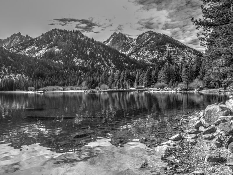
How should we deal with the new math on forest fires?

If this article published in the February Proceedings of the National Academy of Sciences is not a fluke then it would seem to me that our expanding population dictates the need for more forest management not less. The less desireable alternative would be to severely restrict access to our federal forests. The main conclusion of the article is that humans sparked 84 percent of US wildfires and caused nearly half of the acreage lost to wildfire. This number excludes intentionally set controlled burns.

From the above, I would deduce that human initiated fires caused proportionally less acreage loss because they were closer to civilization and to forest access points and therefore closer to and more easily accessed by suppression resources. The fact that nearly half of the wildfire acres lost occur in these areas suggests that we would get more bang for our tax dollars if we increased and focused federal sustainable forest management around high traffic areas easily accessible to humans.

Knowing that humans who cause wildfires are, by definition, either careless or malicious, we might deduce that they are generally not inclined to put great effort into getting to their ignition set points. This would lead us to consider that human caused fires might prove to be in less difficult terrain areas with high human traffic. Fires like the Rim fire being the exception. That, if true, would suggest that forest management for risk reduction on these sites could be done at lower costs per acre than other less accessible forest acreage. Focusing forest management efforts on these high benefit to cost areas would have the biggest bang per tax dollar expended in order to lower the total cost of federal wildfire control. If my thinking is correct, this should play a large part in setting the priorities as to where we should: 1) apply controlled burns to reduce ground and other low fuels, 2) utilize commercial thinnings to reduce ladder and proximity fuels or 3) use commercial regeneration harvests to create greater variation in tree heights between stands in order to provide fire breaks for crown fires when appropriate for the site and species. The net effect would be positive for all species including endangered and threatened species. There would still be plenty of lightning caused wildfire, controlled burn hotspots/breakouts and a significantly reduced acreage of human caused fires to satisfy those who don’t mind national ashtrays. Reducing the number and size of human caused fires would also free resources to attack lightning fires earlier and harder when allowing the fire to burn was not an option.

Pertinent Quotes:

  1. “After analyzing two decades’ worth of U.S. government agency wildfire records spanning 1992-2012, the researchers found that human-ignited wildfires accounted for 84 percent of all wildfires, tripling the length of the average fire season and accounting for nearly half of the total acreage burned.” Italics added
  2. “”These findings do not discount the ongoing role of climate change, but instead suggest we should be most concerned about where it overlaps with human impact,” said Balch. “Climate change is making our fields, forests and grasslands drier and hotter for longer periods, creating a greater window of opportunity for human-related ignitions to start wildfires.”” Italics added
  3. “”Not all fire is bad, but humans are intentionally and unintentionally adding ignitions to the landscape in areas and seasons when natural ignitions are sparse,” … “We can’t easily control how dry fuels get, or lightning, but we do have some control over human started ignitions.””

Places Worth Protecting

Twin Lakes, near Bridgeport, California, hasn’t been intensely developed, solely because of its remote location. There are clusters of private cabins. The terrain would make for an outrageous ski area but, it is too far out of the way to be successful. So, the best use of this land is to preserve it.

p9252095_tonemapped-web

My Instagram: www.instagram.com/larryharrellfotoware/

Nez Perce Clearwater salvage project enjoined

The Idaho District Court enjoined the Johnson Bar Salvage Project on May 12, finding  violations of NEPA and the Wild and Scenic Rivers Act.  During the time between the release of the DEIS in March of 2015, and the publication of the FEIS in October of 2015, timber harvesting activities on burned state and private lands had occurred or were underway, and additional wildfires had burned or continued to burn, near the project area.

The court found that the Forest had failed to take a hard look at the effects of these events on sediment and visual quality, and should have prepared a supplemental EIS to address the new information.  The main flaw was failing to undertake a quantitative effects analysis of the new sediment sources comparable to what had been done for the original baseline.  There were also conflicting statements in the fisheries evaluation, and evidence that road decommissioning would not reduce sediment as claimed.  There was no support in the record for conclusory statements in the ROD about a lack of cumulative effects.  The urgency of the salvage harvest was not given great weight in the balancing of interests that supported the injunction because the project was scheduled over five years.

This sounds like a case where shortcuts were taken to try to complete a project that was overtaken by events.  Haste makes waste.

The Wild and Scenic River holding involved an out-of-date river plan, but may have some implications for vaguely written forest plans (in relation to rivers, diversity or other requirements):

The Forest Service cannot effectively analyze, nor can the public and Court crosscheck, the Forest Service’s analysis, without a River Plan that delineates objective standards, or predetermined criteria, for describing, assessing, and protecting the Wild and Scenic values of the Rivers. Without objective, predetermined criteria, the public is left to trust the Forest Service’s “word” that it considered all relevant factors necessary to protecting the Middle Fork Clearwater and Selway Rivers’ Wild and Scenic values and that the Project will not affect or have minimal impact upon the Wild and Scenic values.”

Massive Crater Lake Wilderness Area Fantasy

Oregon Wild has proposed a massive half million acre Wilderness Area, partly to “protect” Crater Lake. The Klamath County Commissioners are saying no, with fears that summer fires would affect public health, and that those unhealthy forests need active management.

P9159024_tonemapped-web

Here is a map of what Oregon Wild wants done.

Phenotypic Plasticity!

I was on a camping trip last week and one of the stops was at Crater Lake National Park. Within the park are “The Pinnacles”, where I saw this interesting tree, standing out, because of its color. It almost looks like one of those fake tree cell towers. I’m guessing that this is a red fir, on the edge of its elevation range. Of course, we’re all happy about phenotypic plasticity when we look at someone we find attractive.

Crater-Lake-blue-tree-web

Also on that trip, I visited Subway Cave, on my old Ranger District at Hat Creek, on the Lassen NF. It is a lava tube where two roof collapses allow you to walk in one way and walk out the other end. A very nice place to stop for lunch.

P9128659_tonemapped-web

When forest planning is a matter of life and death

In July, Glenn Martin was tragically killed by a stray bullet while camping at Rainbow Falls in the Pike National Forest. Martin was roasting marshmallows with his grandkids when a bullet hit him.”  The Arapaho-Roosevelt National Forest has responded to increasing conflicts caused by urban sprawl and more shooters by proposing a forest plan amendment.

From the Arapaho-Roosevelt NF website:

Currently, the 1997 Forest Plan does not provide direction on how rec. sport shooting (RSS) should be managed. Due to increasing residential development, increased public participation in RSS and associated health and safety issues; the FS is considering amending the Forest Plan to include direction for managing RSS. This direction may include: (1)Developing Forest Plan goals, objectives, or desired conditions for RSS; (2) Identifying areas that are appropriate for dispersed recreational shooting; (3) Identifying areas suitable as designated shooting areas; and (4) Identifying areas where RSS would be prohibited for health and safety reasons. Lawful hunting activities would not be impacted.

I don’t remember this coming up in forest plans anywhere before, and the Forest should be commended for recognizing it as a land allocation issue.  Other national forests should take note when revising their plans.  (And/or is this yet another reason the Forest Service must “participate in planning efforts of … local governments” (36 CFR 219.4(a)(1)(iv) to discourage housing in inappropriate areas?)


Dixie National Forest, Southwest Utah

Several years ago, I rolled into Cedar City after a long drive from California. Apparently, there were no rooms available, due to a Shakespeare Festival. So, I decided to drive up towards Cedar Breaks National Monument and Dixie National Forest, in the dark. I took a well-used gravel road and found some open space, under a bright moon. I didn’t sleep very well but, I woke up to these many hundreds of acres of golden and orangish aspen stands. The morning light’s “Golden Hour” was fully in force. Now, don’t think that the Dixie is uniform or monoculture. The diversity here is tremendous, often with rainshadows and geologic differences happening within only miles of each other.

P9066575_tonemapped-web

I wandered around a bit, greedily snagging all the colorful views, until I saw other campers starting to rise. I almost forgot that it was hunting season! Be careful, out there in the woods.

P9066557_tonemapped-web

Climate Change Update

I shot this picture from the top of Mammoth Mountain Ski Area, along the Sierra Crest. At the end of July, there should be a lot more snow and ice (including small glaciers) in this view of north-facing slopes. The view behind me was obscured, for three afternoons, by a Fresno area wildfire, with smoke drifting up over the crest. I’m sure that the groundwater levels are extremely low, as well.

P9288472_tonemapped-web

Water levels at Mono Lake also continue to drop, exposing more of the famous Tufa formations, created by the fluctuating lake levels, over tens of thousands of years.

P9288543_tonemapped-web

Recreation on public lands not so big an economic generator

freeThanks to Ron Roizen for finding this op-ed in the Salt Lake Tribune.

Here’s a link and below is an excerpt ..

The sweeping landscapes and unparalleled vistas found on public land in Utah provide outstanding recreational experiences for both Utahns and those who visit our state. According to the Outdoor Industry Association, annual trip-related expenditures in Utah total over $12 billion, supporting an estimated 122,000 jobs and providing $3.6 billion in income. Make no mistake about it, outdoor recreation is big business in Utah.

But these numbers hide an important dichotomy: many, if not most, trip-related expenditures do not occur in the places people actually recreate.

As an example, my wife and I recently spent a week touring southeastern Utah, thoroughly enjoying our visits to Monument Valley, Hovenweep and Natural Bridges National Monuments, and the San Rafael Swell. We brought a week’s worth of food and beverage with us (purchased in northern Utah) and spent most of our nights at dispersed, no fee campsites.

Sharon’s note: From my perspective as an FS retiree, this is a reason that IMHO folks should have to pay for a dispersed camping sticker with the proceeds going to supporting management of dispersed camping recreation. $60 a year for one agency or 100 for both (FS/BLM).