Travel planning vs RS-2477

In 1866, the Mining Act included this provision (now known as RS-2477):  “the right of way for the construction of highways over public lands, not reserved for public uses, is hereby granted.”  What this means and how it is applied has become an issue with local governments in recent years where federal land managers have wanted to reduce roads or limit access.  It generally means that if a road predates the establishment of a National Forest, the Forest Service can not interfere with valid uses.  The process requires a quiet title action in federal claims court.

Here is a recent battle brewing in Colorado, where one county is actively seeking jurisdiction over 17 roads and trails in three counties, one of the trails being targeted for closure to motorized uses through the San Juan National Forest Travel Plan.  Another county wants nothing to do with it.  Montezuma County believes it has maps that prove its case, but the Forest Service disagrees. Here is their response:

If the information relying on maps is the only county proof that the roads and trails qualify for RS2477 status, then “the basis for the resolution is insufficient,” Padilla wrote.

He said the Forest Service is not against evaluating RS2477 assertions, but that the county bears the burden of proof.

“I know the county believes the converse is true, but that is not supported by current law, policy or regulation,” Padilla stated.

The national forest sees the county’s RS2477 resolution as nonbinding.

Routes currently designated as nonmotorized or are closed for public use will continue to be managed that way until the county validates their assertions through a legally recognized process, Padilla said.

“This means that violators would continue to receive citations,” he said.

Padilla added that there are current cases to support this position, including one in San Juan County, Utah, that involved county commissioner Phil Lyman, who received a ticket for driving an ATV on a nonmotorized route during a protest ride.

Where Dolores County disagrees is whether the Forest Service will “fight it,” which affects the cost side of the ledger for the counties.  I’m not aware that DOJ has ever conceded a RS-2477 case where the land management agency disputed the existence of the right-of-way.  But under this Administration, maybe Dolores County is wrong in thinking they should not “deceive ourselves that routes will just be given to us.”

Federal lands, “Utah-style”

Three Republicans running for election this year discussed weakening the Antiquities Act and Endangered Species Act, dropping the filibuster rule in the U.S. Senate and rewriting federal public lands policy to require state approval of new regulations.

“It’s not that lawmakers in the East — and for me that’s everything east of Denver — it’s not that they’re evil, they’re just stupid,” he (Bishop) said, drawing chuckles from some in the audience. “When we talk about public lands to Easterners, they just don’t have the same concept. They think everything is Yellowstone.”

I would say they might think everything “should be” Yellowstone, and who’s to say they are wrong.  It’s their land too.  Maybe Bishop is the one who is stupid.

“”It’s going to take an educational effort, not just a political effort” to push back against what he called radical environmental groups, he (Romney) added, referencing decisions such as Trump’s national monuments order, which has been challenged in court by Native American groups, environmental groups and others.  “There are some in the environmental lawsuit industry that may not care very much about the underlying facts,” he (Romney) said. “They’re just going to file lawsuit after lawsuit after lawsuit because that’s how they get paid.”

The underlying facts are what the lawsuits are based on.  And apparently “radical” means “willing to go to court.”

Rural New Mexico for wilderness?


Grant County New Mexico ranchers have sued the Forest Service over grazing rights and the county commissioners are considering suing over a travel plan.  However, they have recently aimed their fire in another direction, at the Air Force, apparently to protect the Gila National Forest from planned overflights.

The Air Force is in the early stages — what lead airspace analyst Alan Shafer called “the end of the beginning” — of developing an environmental impact statement, as required by the National Environmental Policy Act, for three alternative areas in which to fly the F-16s. One of those alternatives is located over a vaguely defined swath of airspace over the Gila National Forest, near Grant County communities as well as over sections of the Gila and Aldo Wilderness areas.

When area residents discovered this alternative was being considered, hundreds quickly took up a call against the possibility. Shafer said so many Grant County residents commented, in fact, that their numbers overshadow those from anywhere else in the state — whether those commenters live near identified alternatives or not.

“We have, probably by a factor of ten, more comments from this area than any other,” Shafer told the large crowd on Thursday, which filled one of the ballrooms at the Grant County Veterans Memorial Business and Conference Center. “I understand what you’re saying and how important the Gila National Forest and wilderness area are to you.

It sounds like the Air Force was successful at getting a wide range of national forest interests to come together and fight a common enemy.  (Or maybe the “airspace analyst” just wasn’t very good at reading the crowd’s interests.)  Interestingly, there was nothing on the Gila National Forest website about it, including any indication of their role or whether they would take a position.

Getting recreational shooting off of national forests

That’s at least part of the solution in the Arapaho-Roosevelt National Forest’s proposal to amend its forest plan to provide “new rules to govern recreational shooting on national forest land.”  The effort is being managed by the Northern Front Range Recreational Sport Shooting Management Partnership, a collaborative effort started in 2013 that also includes Colorado Parks and Wildlife and four counties.

The purpose, from the partnership website:

to develop possible management strategies for this activity on the Arapaho and Roosevelt National Forests. This includes not only identifying areas of the Forests that may or may not be suitable for recreational sport shooting, but also identifying locations that would be conducive to building developed shooting ranges open to the public on public lands.

Proposed closures would not apply to lawful hunting activities on National Forest System lands. In addition, proposed closures would likely not take effect until developed shooting ranges were constructed in the vicinity.

The forest supervisor said the partnership’s approach to the safety concerns is to have the counties build shooting ranges to give people more controlled places to shoot, in exchange for closures of Forest Service land.   One of the alternatives being considered is 100% closure of national forest lands.  One member of the public opined that it must be a joke, but I think it’s fair to consider whether recreational shooting is compatible with other uses of a national forest.  At least outside of areas designated for that use (and maybe areas designated for that use should be under a special use permit like other exclusive uses).

Previously discussed on this blog here.

Wyoming Public Lands Initiative and the Bridger-Teton National Forest

“In early 2016 the Wyoming County Commissioners Association (WCCA) organized the Wyoming Public Lands Initiative (WPLI).  The WPLI is a collaborative, county-led process intended to designate WSAs as wilderness, multiple use, or other management.  The result will be one state-wide legislative lands package that is broadly supported by public lands stakeholders in Wyoming.”

It always makes me a little nervous when a local “collaborative” (or local government) feels empowered to dictate federal land policies (especially where, as in this case, there is a county plan that purports to “guide … the management of public lands” – implicitly federal lands).  On the other hand, it’s always helpful to land managers if those with opposing views can work out and recommend something they all agree on.   With wilderness designation decisions there is the added layer of Congress having to take a national look before approving a decision.  In this case there are also national conservation groups represented in the collaborative, as well as local ones.  But there is also a lawsuit by other conservation groups, and apparently someone on the other side ran to the local Congresswoman who is meddling, so the county commissioners are asking for a “time-out.”  Here’s the latest.

Maybe they should just sell this national forest land?

Steve Sanders addressed the board on the issue of the landfill nearing capacity. Sanders stated the landfill is expected to meet capacity sometime in the summer 2018. The plan for expansion has been on the books for a number of years. The expansion will cap in 5-7 years and then will require Gila County to have a new site to continue to collect municipal solid waste to dispose of for the northern part of the county. They have already started discussions with the Forest Service to acquire land around the Buckhead Mesa Landfill as it’s on a special use permit from the Tonto National Forest.

When someone argues that the Forest Service isn’t complying with the Multiple-Use Sustained Yield Act because a particular use excludes others, show them this example.  I suppose you could camp here … or how about a shooting range?

Headwaters: Lessons from the Timber Transition


Lessons from the Timber Transition

“Performance is shaped more by current challenges and opportunities in the regional economy affecting all types of communities than it is by changes in the timber industry alone.”

“Counties doing better than average leveraged natural amenities; took an active, collaborative approach to planning; embraced adaptability; and took advantage of access to metropolitan markets.”

In Search of Common Ground II – It Takes Two: Forest Management and Social Management

Here are two current articles that get some things wrong but if we ignore those items and focus on the big picture that they present rather than on the details, I believe that we will find that we have more in common than we thought.

Between the two articles we see the full picture for PRIORITIZED actions to begin the long battle ahead to recover from national ashtrays, lost lives, lost homes and infrastructure, significantly decreased health of both humans and forests. It is a two pronged battle that includes both sound forest management and social management.

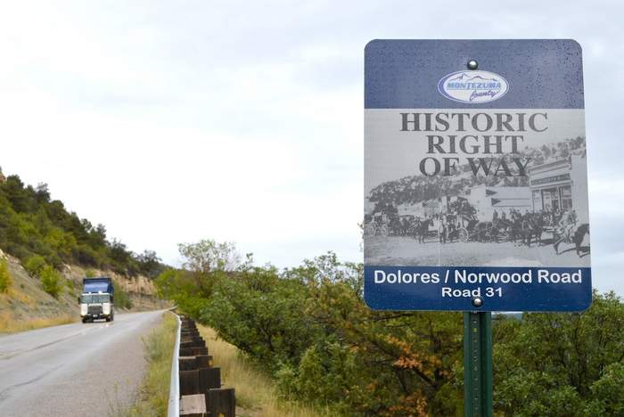
A) Using Forests to Fight Climate Change – California takes a small step in the right direction.

“The state’s proposed Forest Carbon Plan aims to double efforts to thin out young trees and clear brush in parts of the forest, including by controlled burning. This temporarily lowers carbon-carrying capacity. But the remaining trees draw a greater share of the available moisture, so they grow and thrive, restoring the forest’s capacity to pull carbon from the air. Healthy trees are also better able to fend off bark beetles. The landscape is rendered less combustible. Even in the event of a fire, fewer trees are consumed.

The need for such planning is increasingly urgent. Already, since 2010, drought and beetles have killed more than 100 million trees in California, most of them in 2016 alone, and wildfires have scorched hundreds of thousands of acres.

California’s plan envisions treating 35,000 acres of forest a year by 2020, and 60,000 by 2030 — financed from the proceeds of the state’s emissions-permit auctions. That’s only a small share of the total acreage that could benefit, an estimated half a million acres in all, so it will be important to prioritize areas at greatest risk of fire or drought.

The strategy also aims to ensure that carbon in woody material removed from the forests is locked away in the form of solid lumber, burned as biofuel in vehicles that would otherwise run on fossil fuels, or used in compost or animal feed.”

B) Why are California’s homes burning? It isn’t natural disaster it’s bad planning

This Op-ed by Richard Halsey (director of the California Chaparral Institute who sometimes posts on NCFP) is well written and, though I would disagree on some statements in his post, I present those that I do agree on in an attempt to show that there are specific components that are middle ground that we all should be able to agree on and focus on rather than focusing on what won’t work. Once we change our emphasis, hostility between opposing sides should decrease and progress should increase.

“Large, high-intensity wildfires are an inevitable and natural part of life in California. The destruction of our communities is not. But many of the political leaders we elect and planning agencies we depend upon to create safe communities have failed us. They have allowed developers to build in harm’s way, and left firefighters holding the bag. ”

“others blame firefighters for creating dense stands of chaparral in fire suppression efforts—when that’s the only way chaparral naturally grows, dense and impenetrable.”

“”we need to recognize that fire disasters aren’t natural, they’re social. And they require social solutions.”” (quote from University of Colorado geographer Gregory Simon)
–> Pay attention to the statement “fire disasters aren’t natural, they’re social”. My first reaction was “not true” but in the context of the Op Ed, I think that the author is making an appropriate distinction between the words “Catastrophic” and “Disaster” by reserving “Disaster” for those situations where the catastrophe falls mainly on humans.

“We also need to examine the best practices of other fire-prone regions. Communities in Australia often install external, under-eave/rooftop sprinklers, which have proven quite effective in protecting structures during wildfires. (Australians understand that wet homes do not ignite.) Such systems should be standard in all new developments in high fire hazard zones. It is likely they would have protected many of the homes consumed in Ventura’s Thomas fire this week.”

“As we do with earthquakes and floods, our goal should be to reduce the damage when wildfires arrive, not pretend we can prevent them from happening at all. That mindset starts at the planning department, not the fire station.”

C) Relevant Prior Posts with included references:

1) Finding Common Ground
IN SEARCH OF COMMON GROUND
Frustration: Will It Lead to Change?

2) Wildfire
Fuels management can be a big help in dealing with wildfires
Air Pollution from Wildfires compared to that from Prescribed burns
Inside the Firestorm
The Impact of Sound Forest Management Practices on Wildfire Smoke and Human Health
Humans sparked 84 percent of US wildfires, increased fire season over two decades
More on Wildfire and Sound Forest Management
Scientific Basis for Changing Forest Structure to Modify Wildfire Behavior and Severity
Articles of Interest on Fire
The Role of Sound Forest Management in Reducing Wildfire Risk
15 Minute TED Talk: “Forest Service ecologist proposes ways to help curb rising ‘Era of Megafires’”

Local plans for federal lands – the latest

This is a continuation of the “sagebrush rebellion” in the form of local government plans that purport to exert local control over federal land management.  They are being peddled to rural counties by Karen Budd-Falen, an attorney with a history of promoting private property rights (who some expect to be the new director of the BLM).  Since she certainly knows what she is talking about, she must also know that there is no legal basis for some of the expectations she is generating.  It’s just another way of stirring up local sentiment against federal land management.

A new local plan was just adopted in Oregon:

Earlier this month, Crook County leaders passed a plan designed to give county residents more say in how local public lands are managed by the federal government. However, discussions over how the plan will be implemented and what it will mean for the county’s oft-contentious relationship with its local public land managers are just getting started.

In addition to articulating county priorities for how federal land should be managed with regard to mining, agriculture and recreation, the plan states that the county expects state and federal agencies to meet with county officials on an ongoing basis.

Still, Michael Blumm, professor of law at Lewis & Clark College in Portland, said federal agencies don’t have any obligation to follow the county priorities set out in the plan, which range from mandating no reduction to grazing allotments on federal land, to ensuring that roads providing access to public lands stay open year-round.  “It’s a political move,” he said. “It’s not legally enforceable.”

And another is being discussed in Montana:

A controversial land-use attorney drew more than 100 protesters and as many supporters to Hamilton Middle School Saturday, but the topic of her talk with county residents was interpreted differently by people attending the event.

Budd-Falen’s talk centered around having a more detailed county land-use plan that would be used to strengthen its own management desires carried out by federal agencies, including the Forest Service. She said that federal policymakers in Washington, D.C., were out of touch, and local governments could help guide more micro-level policies.

While Budd-Falen never spoke about public land transfer, state Sen. Jennifer Fielder, R-Thompson Falls, gave a presentation about her efforts to support federal land transfer to states. 

Actually Ravalli County has already has a “natural resource use plan” it developed in 2012, and Commissioners changed their minds about asking Budd-Fallon to speak about adding “teeth” to it (she was invited instead by a local state representative).  Maybe their experience with that plan has helped them understand that its greatest value is probably in helping them articulate their interests rather than as something to beat up the Forest Service with.