Grand Canyon development proposal resurfaces on the Kaibab

We’ve discussed the use of land exchanges that would facilitate the growth of urban areas by giving them more private land in logical growth areas using the example of Las Vegas.  At a different scale, the town of Tusayan appears to be an inholding in the Kaibab National Forest, which limits its growth opportunities.  They have been looking at a proposal to develop a nearby separate inholding (which the town owns a part of).   It would require a special use permit to for roads and utilities to cross national forest lands.  It has been controversial (attracting unwanted attention according to the town; the 2nd Twitter link works), and the town has just approved a revised proposal, which will be submitted to the Forest Service.  The Kaibab National Forest rejected the last proposal in 2016 as inconsistent with the requirements for a special use permit.  Here is a part of the rationale that relates to the forest plan:

CFR 251.54(e)(l)(ii) requires that the proposed use must be consistent, or can be made consistent, with the Kaibab Forest Plan. The Forest Plan envisions management at a landscape­ scale by taking an “all-lands approach,” and specifies strategies to achieve the desired conditions and objectives in the Plan, including working closely with partners and across administrative boundaries to meet common objectives. The development that would be enabled by authorization of the proposed use of NFS lands could substantially and adversely affect Tribal lands and the Grand Canyon National Park.

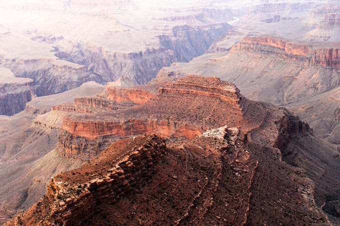
36 CFR 251.54(e)(l)(v) provides that the proposed use must not unreasonably interfere with the use of adjacent non-National Forest System lands. The FS received written comments from the National Park Service (NPS) through the Principal Deputy Assistant Secretary of the Interior for Fish Wildlife and Parks which pointed out that potential impacts to the Outstanding Universal Value of the Grand Canyon National Park (GCNP), either from the roads that would be authorized by easement or the reasonably foreseeable development on the two private properties that would be enabled by the roads and other facilities, are of concern. The GCNP also raised concerns in a meeting regarding impacts on infrastructure that they share with the Town of Tusayan. The NPS was concerned that any activity that would result in significant increases in visitation or occupation near the Park would affect the Park’s capacity to absorb the additional use.

The first rationale is an interesting “all-lands” interpretation of its forest plan to encompass the objectives of the National Park Service and tribal lands.  The second rationale stands on its own, but it also explains what those interests are.  It’s not obvious that the recent modifications in the proposal are going to address these concerns, so I expect we’ll be seeing more about this.  (Here is the CBD take on the original proposal.)

Helena project clears the 9th Circuit, except for some “WUI”

Fine specimen of a real antique Morse code telegraph machine.Copyright: Photowitch | Dreamstime.com

The Ninth Circuit Court of Appeals has upheld the Telegraph Vegetation Project on the Helena-Lewis and Clark National Forest, except for one question about the location of the Wildland Urban Interface (WUI).  The case was previously described on this blog here.  That description included this allegation by plaintiffs:

Agency used non-federal definition of the Wildland Urban Interface 


“While the lynx amendment allows logging in the Wildland Urban Interface, it also defines the Wildlife Urban Interface to be within one mile of communities,” Garrity explained. “But the Forest Service used a new definition provided by local counties and then remapped the Wildland Urban Interface to include areas over five miles away from communities.”

The court remanded the decision for 50 acres of the 5000-acre plus area to be treated, and left the record of decision in place while the Forest Service completes its reevaluation:

“The Forest Service has acknowledged that it erred in calculating the wildland-urban interface for the project area. The Forest Service estimates that, once it has corrected its error, 50 acres of forest that it had planned to treat may no longer be eligible for treatment. If that estimate proves correct, the Forest Service represents that it will not treat those 50 acres. We grant the government’s request for a voluntary remand to allow the Forest Service to undertake the necessary reevaluation.”

I have been interested in how WUI is identified, by whom, and using what process under what authority – especially the role of non-federal parties.  WUI is generally  identified based on the Healthy Forest Restoration Act of 2003 (HFRA).  Areas identified using that process qualify for streamlined projects in accordance with HFRA, and may be eligible for particular funding.  However (in accordance with HFRA), WUI projects are still subject to requirements of the governing forest plan.  Management direction for lynx is part of the forest plan, and this article (like plaintiffs) suggests it imposes greater restrictions on part of this project:

“In the second portion of the court’s order, the Forest Service proposed logging and thinning in areas defined as the “wildland-urban interface,” which is where houses or cabins meet the forest. Regulations related to lynx allow the removal of some trees and vegetation in lynx habitat if it falls within the wildland-urban interface and if the agency shows it is part of a wildfire mitigation project. The alliance inspected the area and reported only a handful of houses. The Forest Service conceded in court documents that it erred in calculating the size of the wild-land urban interface based on discrepancies between what qualifies.”

However, this actually indicates that the problem was in the definition of “community” (based the on number of houses), rather than the distance from one.  In fact, the Northern Rockies Lynx Management Direction refers to WUI “as defined by HFRA.”  Those definitions and criteria for “WUI” and “at risk community” are summarized by the Forest Service here.  Although which communities are to be included (they can self-identify) are mostly listed in the Federal Register, that doesn’t address their boundaries.  The district court opinion upheld the Forest Service WUI designation, stating that, “The Powell County Plan does not begin with the HFRA definition; it creates its own, “and “the Court is not persuaded by Council’s attempt to discredit the map provided by the Forest Service in the Telegraph Project EIS” based on that county plan. Yet it sounds like the map may have been wrong in this case.  This all reminds me of my take-home from my Forest Service days that “WUIs are fuzzy.”

Here’s why this might be important to planning.  I agree with the idea that forest plans (like the lynx direction) should identify areas with differences in long-term management that result from a wildland-urban influence.  However, if the WUI definition refers to another source (HFRA and a local plan), instead of being specifically defined in the plan itself through criteria and/or a map, there may be confusion about where and how the plan applies (as seems to be the case here).  (Yes I’m criticizing the lynx strategy for doing that; they didn’t take my advice.)  In addition, if external decisions about WUI locations change, the Forest Service may have to publicly consider whether to adopt that change in its forest plan (that situation wasn’t addressed in this case).  I’m also contrasting “decisions” with new “information” that affects how an existing decision applies (e.g. someone building a new house), which must be considered in a planning context but doesn’t necessarily trigger a plan amendment.  (A court has held that even changes in something like criteria for maps of lynx habitat must be considered in a public planning process when forest plan direction is tied to it.)

(The other issue addressed by the 9th Circuit in its short opinion was the ESA consultation process for grizzly bears.  The court approved a consultation process that tiered to forest plan decisions and consultation, which lead to streamlined project consultation.  The value of forest plan consultation has been questioned, but that value is evident here.)


Forest Service tries again on Blue Mountains plan revision

The revision of the three national forest plans encompassing the Blue Mountains of eastern Oregon and Washington is becoming a poster child for failing to finish forest planning.

Northwest Regional Forester Glenn Casamassa announced in March 2019 the Forest Service was scrapping the proposed Blue Mountains Forest Plan Revision, which includes the Umatilla, Wallowa-Whitman and Malheur. A final draft of the plans had been released in June 2018. It was not the first time the Blue Mountain Forest Plan had been paused.A draft version of the plans was completed in 2014, and received so much backlash that local forest supervisors decided to develop new plan alternatives.

So they’re trying something new:

The Blues Intergovernmental Council has been formed to help frame the process of developing a new methodology for forest planning for the Wallowa-Whitman, Malheur and Umatilla national forests. A series of meetings between county commissioners and key Forest Service personnel have been held across the Blue Mountain region over the past year to help kickstart a framework for cross-jurisdiction work.

“The underlying intent is to ensure that we can develop plans for the three national forests that would provide the opportunity for durable relationships with our communities and to make an important difference on the landscape for the long term,” said Eric Watrud, the forest supervisor on the Umatilla National Forest.  Watrud said the council includes state and county representatives in Oregon and Washington, four treaty tribes and regulatory agencies, in addition to the Forest Service.

“The attempt here is to create just a more open, inclusive approach where the Forest Service is working closely with our communities in order to make sure that we are developing a plan that is gonna stand the test of time,” he said. “We have the responsibility of stewarding the management of these three national forests, which are a national and local treasure. And so there’s a tremendous amount of interest, and our intent is to make sure that we’re incorporating that feedback, incorporating those ideas and local suggestions in order to make sure that we accomplish that goal.”

A better process for local input – that’s ok. But this is obviously “inclusive” of only “local” “communities.”  I assume this is only part of the story (as suggested by the forest supervisor’s careful reference to “a national and local treasure”), but I hope they aren’t (maybe again) setting up expectations that won’t be met.

Missoula Forest Collaboration Roundtable

Montana Public Radio collected some interesting perspectives.

What collaboration looks like to what some would consider a “far-right politician:”

“We were thrilled to have the Rocky Mountain Elk Foundation with us today, that is exclusively focused on habitat restoration for elk and sportsmen. We want to continue to have all voices at the table,” Gianforte said…  I think all voices needed to be at the table in these collaboratives, but you have to participate in good faith,” he said. “There have been instances here in Montana where a collaborative worked literally for years to put a project together, and yet people who were at the table still sued. We have to prevent that sort of bad behavior.”

Is it “collaboration” when your participation means you can’t sue over the outcome?

What this idea of collaboration looks like to what some would consider an “extreme environmental group” (Alliance for the Wild Rockies):

“He wants to have all voices that agree with him at the table,” Michael Garrity says.  Garrity says he had no advance notice about Thursday’s roundtable. The Alliance is frequently at odds with — and in court fighting against — timber interests over forest policy.  Garrity said Friday that not only did he not receive an invitation, no one from what he called the environmental community got one either. And without that perspective, he says this week’s roundtable was simply an echo chamber. “It’s not going to be a good dialog unless they invite groups that oppose some logging by the Forest Service.”

My emphasis, especially on the “some,” not all logging.  (The Rocky Mountain Elk Foundation does not oppose logging, though some elk hunters and groups do.)

What collaboration and litigation look like to the Forest Service:

“Different people see it in different ways; including different courts,” (USDA Undersecretary) Hubbard said. “The idea is for us to come together and agree on what kind of treatments make some sense, what satisfies most of the interest out there in one way or another, and then be able to implement that and have the courts support that with some consistent rulings.”

(My emphasis.)  The implication is that courts are just another form of public opinion.  And that it’s ok to exclude some of the interest out there, like “groups that oppose some logging.”  (And my usual gripe – the scope of project collaboration should include not just the “kind of treatments,” but which areas should be treated.)

(And there’s some discussion of categorical exclusions and the Good Neighbor Authority, too.)

Forest Service not sued on timber project

I couldn’t find the project files for the Gatton’s Park fuels treatment project in the Upper Mimbres Valley on the Gila National Forest, but it seemed like it has a lot of features that make it a good example of how to not get sued –

The Nature Conservancy received an initial Collaborative Forest Restoration Program grant for planning the project from 2012 through 2014; when the National Environmental Policy Act process was finished, the Grant Soil and Water Conservation District was awarded an additional grant and took over implementation of the plan beginning in January 2018.

In addition to local residents and logging businesses, the county government, the Forest Service, firefighters, conservationists and wildlife habitat advocates are also seeing the benefit of working together.

So far, thinning has reduced fuels from 50 tons per acre down to 15 tons in treated parts of the 1,500-acre project area and reduced fuels by half in other treated parts of the project area — something that will give residents on the edge of the Gila Forest in the Gatton’s Park development, in particular, a better chance of surviving a wildfire without catastrophic damage. The border of forest land and developed land is known as a “wildland urban interface.”

Partido emphasized the difference between a regular timber contract and the current project. Both attain forest management goals, especially in the area of fire prevention, but the Collaborative Forest Restoration Program is more efficient. “There hasn’t been a timber sale in these parts since the 1950s,” Partido said.

Part of the silvicultural prescription provided by the Forest Service — the tree plan — also takes into account habitats for the threatened Mexican spotted owls in the Gila. Trees over certain diameters are left in place — as are trees with holes where owls might nest.

What happens to the trees that are cut? The two contractors are either bringing the logs to sawmills and making poles and other products out of them or turning them into wood chips — piles of which are regularly offered to anyone who wants to come pick them up, for free. “Some of the ponderosa logs will be brought to the Celebration campground and other campgrounds for people to use,” Carver said.

Bark Beetle Epidemic in Calaveras County


The bark beetles started their invasion when I used to live there, in Mark Twain’s famous Calaveras County. Now it looks like it has reached epidemic levels, requiring emergency action, from multiple agencies.

http://www.calaverasenterprise.com/news/article_fbc896b8-7d6f-11e9-94ea-7b4b381822a0.html

Even with recent wet winters, tree mortality will remain a pressing issue as long as bark beetle infestations and drought conditions continue, said Brady McElroy, a hazard tree specialist in the Calaveras Ranger District of the Stanislaus National Forest.

“By no means is the issue going away,” McElroy said. “What the Forest Service has to focus on are the high priority areas, the immediate hazards to homes, roads and highways.”

In the long-term, McElroy said the Forest Service hopes to increase the pace and scale of thinning projects to restore overstocked forests that have been allowed for by a century of fire suppression.

“Our forests are overstocked, which increases competition (and) stressors on the trees, (and consequently) their ability to defend against bark beetle,” McElroy said. “The ongoing goal is to thin forests to a healthy kind of pre-European settlement stand to where they’re a little more resilient. We’re focusing on high-priority areas in the wildland-urban interface … We know what happens when these overstocked forests catch fire – we lose them.”

Diana Fredlund, a public affairs officer with the Stanislaus National Forest, said that although federal budget decreases have impacted the scale of the work for the Forest Service, the agency has been able to collaborate with private, county, state and other federal agencies and contractors for tree removal projects.

“We do what we can with what we have,” Fredlund said.

The Forest Service offers its own tree mortality program for homeowners with properties adjacent to Forest Service land. Property owners can fill out a Hazard Tree Evaluation Request Form to be considered for hazard tree abatement.

Supreme Court may reinterpret tribal treaty rights on national forests

Here’s a pending Supreme Court case, Herrera v. Wyoming, that hasn’t shown up in the Forest Service litigation summaries.  The federal government is defending the right of a Native American to hunt on the Bighorn National Forest without complying with state hunting laws.  If they lose, tribal treaty rights, as currently understood, could be severely diminished.  The hearing is scheduled for January 8.

When the native tribes ceded their lands to the federal government, the language in the treaties typically preserved their rights to various uses and activities on indigenous lands that were not included within the new reservation, for which the treaties used the terms “open and unclaimed” or “unoccupied” lands.  Much of that land is now part of national forests.  Here is how the Forest Service interprets the language referring to those lands:

The term applied to public domain lands held by the United States that had not been fenced or claimed through a land settlement act. Today, “open and unclaimed lands” applies to lands remaining in the public domain (for the purposes of hunting, gathering foods, and grazing livestock or trapping). The courts have ruled that National Forest System lands reserved from the public domain are open, unclaimed, or unoccupied land, and as such the term applies to
reserved treaty rights on National Forest System land.

In the case currently pending before the Supreme Court the State of Wyoming has argued that this is not true (they also argue that the lands became “occupied” when Wyoming became a state):

The parties further dispute whether the Bighorn National Forest should be considered “unoccupied lands” for treaty purposes. Herrera and the federal government emphasize that the proclamation of a national forest meant the land could no longer be settled, which they argue was the historical standard for occupation. Yet Wyoming argues that physical presence should not be the test, especially given the West’s expansiveness. According to Wyoming, the federal government’s proprietary power over its own lands, including its decisions to exclude hunters, demonstrates that the land was effectively occupied when it became a national forest.

Courts have held that the federal government has a substantive duty to protect ‘to the fullest extent possible’ the tribal treaty rights, and the resources on which those rights depend.   If Wyoming were to win their argument, treaty rights to accustomed tribal uses of national forests would no longer exist.  Because the federal government is defending the tribal interests in this case, one might think that the Forest Service would continue to protect these rights even without the treaty obligation.  However, in the past they have disagreed with tribes on issues such as campground fees and desired salmon populations.

Collaborative flops

Salmo-Priest Wilderness, Colville National Forest.

The Colville National Forest released a draft Record of Decision for its revised forest plan on September 8. During the planning process, a collaborative group, the Northeast Washington Forestry Coalition submitted a proposal to designate more than 200,000 acres of new wilderness, to be offset by increased logging on other parts of the Forest and building new trails for mountain bikers, motorcyclists and ATV riders, who would lose access to some trails if Congress approved new wilderness. The revised plan proposed by the Forest includes only 60,000 acres of wilderness recommendations.

I guess that’s good news if you think that local collaboratives have too much influence on national forest decisions and/or if you are a proponent of logging. But wait!  It turns out that the most influence was wielded by the local governments, and the local timber company isn’t happy about that.

Russ Vaagen, vice president of Vaagen Brothers Lumber Co. and NEWFC board president, formally objected to the draft plan in a Nov. 6 letter. In the letter, he said the Forest Service’s decision was “skewed” by special interest groups. “The Colville National Forest belongs to all citizens of Washington and the United States,” he wrote. “Ferry, Stevens and Pend Oreille county commissioners represent just a tiny fraction of these citizens.” Later in the letter he said it’s unavoidable that locals will have “personal, financial interests” in what happens to federal land, but that those interests should “have no bearing on federal land management issues.”

This sort of left my head spinning. Maybe it’s because they didn’t get the increased logging either (I don’t know if that’s true)? Or maybe it’s that the “collaborative” part should win out over merely “local.” Or did the “local” actually use an end-run to obtain a top-down approach from an administration hostile to new wilderness?

I’ll go out on a limb here and suggest that since decisions to designate wilderness are inherently and legally political, this may legitimize and enhance the value of a local collaborative approach. Of course all is not lost on the Colville; the collaborative approach could count for something when the collaborative makes an end-run around the Forest Service to obtain wilderness legislation, since it can undercut an agency position that the Forest Service is doing what the public wants.

In another wilderness squabble involving an end-run by local governments to reduce wilderness protection, three counties in Wyoming have chosen to bypass a statewide collaborative process and support federal legislation that would eliminate wilderness study areas without designating any new wilderness.

Titled the “Restoring Public Input and Access to Public Lands Act of 2018,” HR 6939 would remove wilderness study designation and associated protections from approximately 400,000 federal acres in Lincoln, Big Horn and Sweetwater counties (see the bill below). The three counties declined to participate in a years-long consensus-based investigation of the wildlands. Saying the wilderness-study designation “prevents access, locks up land and resources, restricts grazing rights, and hinders good rangeland and resource management,” Cheney introduced her measure Sept. 27. It marked the third time she bypassed the Wyoming Public Lands Initiative sponsored by the Wyoming County Commissioners Association. Across the state, 777,766 acres of BLM and Forest Service property are protected by wilderness study designation. WPLI sought a single statewide wilderness bill to resolve study-area status. A majority of commissioners in the three counties, however, responded to Cheney’s early 2018 call for legislation before the WPLI process played out.

I’m cheering for the collaboratives here, too.

Federal Lands, Local Communities and the Imperial Gaze

Last year about this time I attended my 40 year alumni reunion for Yale School of Forestry and Environmental Studies. It probably won’t surprise any readers that I was the only person in my class from the Interior West. Most of the graduates I ran into had spent a career in non-profit conservation organizations. Some like me, had gotten Ph.D.’s but had gone on to careers in FS R&D, universities or environmental NGO’s.

I was reminded of this by our discussion this week which included the idea that “everyone’s voice should count equally in federal land management and local people should have no particular extra voice.”

Some of my alumna friends were unpleasantly surprised that when Katahdin Woods and Waters became a National Monument (having been donated), the Trump administration could weigh in on how the land was to be managed. It seemed to me, that of course, if you donate land to the federal government, then federal agencies, under elected officials in the executive branch, folks in the legislative branch, and the judicial branch will have a say in how it’s managed. What veterans of this blog might call the “usual suspects.”

Based on the public meetings for that Monument, some people want to continue logging, have ATV’s, etc., in parts of the monument and others don’t. But one thing that seems clear about this National Monument is that the Park Service is targeting people in Maine for public meetings. They have a planning page here, and here is an announcement . It seems like Mainers- residents, interest groups, elected officials- have a special place in determining what goes on in this National Monument. If, as an SES EPA leader once told me (in Delta, Colorado) an apartment dweller in New York should have equal voice in what goes on on the GMUG National Forest, why shouldn’t it work symmetrically in all directions? For example, someone in Montana might think it is environmentally destructive vis a vis climate change to allow ferries out to Ellis Island in New York. It’s not hard to think that this idea (it’s everyone’s business equally) applies to Easterners about the West and not so much to Westerners about federal lands in the East.

It seemed in my conversations with my fellow alums about federal management in the Interior West, that to some easterners, western landscapes are iconic in a way that their own are not, or the local inhabitants are not to be trusted in a way that theirs are. Yes, there could be a partisan influence here, but I don’t think that that’s all of it..the West has always had a unique spot in the American psyche. Against that scenic backdrops have always been inhabitants reduced in agency due to the predominance of federal lands. It’s almost as if there is a kind of “domestic imperial gaze” reflecting a power and privilege disconnect between the coasts (and their dominant media and narrative) and those of us living out here. (Thanks to Iliff School of Theology for getting me up to speed in these concepts- here’s what gaze currently means in academic world via Wikipedia including examples).

One way to counter these forces is to support our local and regional media outlets. Are there other ideas?