“Up-To-Date Science” Needed to Solve ESA/Fire/Jobs Issues: Chad Oliver

The essay that forms the second part of this post — which he terms “Notes” — was written by Chad Oliver after a recent field trip to Montana to document and discuss grizzly bear habitat management with Jim Petersen for Evergreen Magazine: https://evergreenmagazine.com/this-is-very-promising/

I have been a friend and occasional collaborator with Jim for more than 30 years, since the early 90s. At that time he was interviewing me for an article regarding the Clinton Plan and first introduced me to Oliver’s work — largely because we were both clearly predicting that catastrophic wildfires would certainly follow if the Plan were adopted. The Clinton scientists and their followers were promising something entirely different: a utopia in which people were not present, but giant trees, flocks of owls, and streams filled with fish were everywhere and people who lived in cities and towns were pleased with that knowledge.

People who have read or contributed to this blog for a while know that I have a strong bias against forest management acronyms, anonymous trolls, and the use of computer models for long-term planning. The Clinton Plan was built on Norm Johnson’s FOR-PLAN computer model and featured the “old-growth” promotions of Jerry Franklin. By combining the two men’s skills with ESA “critical habitat” definitions for a wide variety of species (mostly spotted owls and fish to begin with), some LSRs, WSOs, WTFs, FMPs, and the support of key politicians, the media, and skilled lawyers, they were able to transform the public forests of the western US in just a few years.

I knew Norm fairly well at the time, when he was a professor and I was a middle-aged student at OSU. We were both in the College of Forestry and had previously participated in constructing a management plan for OSU Research Forests, where I headed cultural resources management as a part-time employee. During the beginning “Gang of Four” FEMAT phase of the Clinton Plan, he even hired me to do research, but we soon parted ways when it became obvious that his computer printouts and my historical documentation didn’t match.

A forest ecology class I had taken featured a visiting scientist, a well-known Franklin acolyte, that lectured on old-growth “biodiversity” theories and spent time making us memorize the phrase: “non-declining, even-flow, naturally functioning ecosystem.” This was a wordy way to describe a “climax forest” or, as Franklin called it, a “healthy forest.” When I pointed out that such an environment had never existed on earth I was ignored. When I later presented research to prove my point, I was canceled from academia.

According to Jerry, a “healthy forest” had large, very old trees, a “multi-layered canopy” of various tree and shrub species, lots of every kind of animal that is going extinct because of logging, big, dead standing trees scattered everywhere, and large chunks of wood (CWD and/or LWD on printouts) on the forest floor, and everything in equilibrium: trees growing at the same rate they were dying and populations of all old-growth ecosystem-dependent animals high, and stable. Man was presented as a pathogen in such an environment and had to be removed and his tools and roads abandoned in order for “Nature” to become “healed.”

This is actually a fairly accurate description of what students were being told, and current public forest management policies are largely based on this vision. Why such a condition was, and still is, seen as desirable — much less attainable — is a matter of history and philosophy, where an ideal environment is one in which “man is a visitor who does not remain or leave a trace.” Why this perspective persists in the face of decades of documented failure, wildfires, dead animals, rural poverty, burned homes, and polluted air remains a mystery.

This condition of passively managed federal lands and the predictable wildfires and rural unemployment that follows is based on what Oliver terms “out-of-date” science. His research, first published in book form in 1990, had shown that forests were dynamic: that fires, wind, shade, bugs, diseases, floods, and landslides created constant disturbances that resulted in different combinations of plants, animals, and forest structures over time.

My research showed that people were one of the principal disturbances involved in this process. Where Jerry states that a “climax forest” is a desirable management objective, Chad shows that such a condition has never existed and never can; where Jerry claims a healthy forest is characterized by big, dead, and dying trees, my research shows that a healthy forest is characterized by the presence of healthy people. Chad’s and my research are in agreement, our predictions have proven accurate, and we used traditional scientific methods and not computer models to arrive at these conclusions.

For thousands of years people had gathered and used wood as their principal cooking and heating fuel, primary construction materials, and for tools, carvings, weapons, and other uses. Villages, campgrounds, and travel routes along ridgelines and waterways had little or no wood, and seasonal broadcast burning of oak savannahs, berry patches, and tarweed fields over millions of acres removed any fine fuels or dry wood in those areas. Until recent times, local people have always managed the forests they lived in or near and wildlife has always adapted, migrated, or evolved.

Which was another thing that has concerned both me and Oliver — and Petersen — the terrible effect such a plan would have on the rural families, communities, and industries that had been working and living in and near the public lands. The local people and actual experts who have always managed the environment they lived in and near, until now. At the end of his Notes he cites and links this source: https://www.nature.com/articles/d41586-024-01411-y

*******************************

Applying up-to-date Science to Solve the Forest Endangered Species/Fire/Forest Livelihoods Issues:  Notes from a field trip hosted by the Evergreen Foundation 

By Chad Oliver,

Pinchot Professor Emeritus, Yale University.

[email protected] May 20, 2024

The ongoing rural community issue, spotted owl issue of the 1990’s, the forest fire issue of the 2000’s, and the current grizzly bear issue are all the result of applying the same, out-of-date science.

A dramatic change in the world’s scientific understanding of forests occurred between 1980 and 2020.  A book, Forest Stand Dynamics  (1st edition 1990) synthesized these changes. This book has been cited in over 4,000 scientific articles worldwide, indicating the overall acceptance of the new understanding.

Change in understanding of Forests:

Old theory:  The out-of-date theory assumed forests grew to a stable, natural condition known as a “Climax.” With less communication and travel, natural disturbances were rarely noticed; and so all disturbances were considered unnatural and should be prevented.

If a disturbance occurred, it destroyed the “natural condition.”  The forest supposedly regrew as some plant species entered soon after the disturbance and “prepared the way” for later arriving species–which prepared for still later-arriving species in a relay-fashion until species that could replace themselves formed a “stable, climax, natural” condition (Figure below). Since this climax was natural, it was assumed to harbor all species.  So, all species could survive as long as the forest was not disturbed.

Consequences of early “pristine forest” scientific theory:

A vocal “environmentalist” public emerged that wished to protect the forests and species. They mistakenly followed the outdated “pristine forest” theory and promoted no manipulation of forests. The environmental movement was joined by opportunists who collected money to stridently lobby to “save the forests.”

Just as COVID could not be cured by drinking bleach, the forest issues were not resolved—and will not be resolved–as long as incorrect, out-of-date science is applied to forests.

Assuming that the “pristine” forest was harmed by human intervention, people adhering to the old understanding who wanted forest values tried to exclude people from forests and vilified those people who lived or worked in forests.

New Understanding:  Beginning about 30 years ago, scientists realized that forests were much more dynamic.  Natural disturbances were a natural part of forests and indigenous people had also manipulated them for thousands of years. Trees within a forest competed with each other for resources—sunlight, moisture, nutrients—rather than mutualistically “helping” each other. The resulting pattern of forest growth can be shown in the figure below.

Forests can generally be divided into “stands”—each stand is a contiguous area of similar species, soils, and disturbance history and so has a relatively uniform structure–distribution of vegetation sizes, spacings, ages, species, etc.

Forest stands pass through similar structural stages in many parts of the world :

1) Stand initiation stage (Open structure): Following a disturbance that destroys all trees in the previous stand, a dense diversity of woody and nonwoody herbs, shrubs, and trees invades. This structure supports many grazing and browsing species and their predators, since the green, edible vegetation is accessible near the ground.

2) Stem exclusion (Dense structure)After a few years or decades (depending on the soil and type of disturbance) the newly invaded plants occupy all of the soil, light, and moisture “growing space” within the stand.  Then, new plants are excluded for a few to many decades, after which the existing plants “lose their grip on the site’s growing space.”  (Some species can live in the shade and remain small as other trees grow, giving the impression that they are younger and continuously invading the stand (Figure below). This appearance helped give rise to the out-of-date theory described earlier.

Forests in this structure cast heavy shade and so contain few herbs and shrubs close to the forest floor.  Consequently, few animal and plant species live in it.  In addition, the young trees are often crowded and susceptible to insect outbreaks, falling over, and/or burning up.

3) Understory reinitiation (Understory structure):  New species that can live in shade invade the stand as the older trees age, “lose their grip on the site,” and sometimes die. The new species often do not grow much, but do supply some browse and hiding cover for more animals than in the “stem exclusion stage.”

4) “Complex stage” (Old growth structure):  Eventually, some overstory trees die through windthrow, diseases, etc. and younger trees grow into the upper canopy, producing a stand of a large diversity of tree heights, ages, species, and containing dead standing and fallen trees.  A variety of specialized animals such as owls and flying squirrels live in this structure.

This structure, too, can be fire-prone and so is often found in fire-protected topographies.

5) Unevenage stands:  Partial disturbances are not as common as once thought,but kill various amounts and sizes of trees.  A common Uneven aged structure is the “savannah,” where a few large trees are standing.  These favor woodpeckers, other birds, and some grazing animals; although the presence of large trees where predators can hide and attack grazers can hinder some animals.

The new scientific understanding means that not all of a forest provides habitat for all species.  Consequently, at least some amount of each structure is needed to provide all species–and so all values–from the forest; an excess of one structure can create problems (e.g., fires in the dense forests) and reduce the area and thus benefits of other structures. Also, some parts of an area will always change from one structure to another through growth or natural disturbances, so other parts of the forest need to replace the structures being lost if all structures—and species and other functions–are to be maintained.

The forest problems of threatened species and impoverished rural people have been caused or exacerbated by applying the outdated science to several issues even though more scientifically up-to-date solutions were known, available, and feasible.

1) Spotted owl issue: The spotted owl was recognized as an endangered species that lived in the Pacific Northwestern United States in the older structures of complex, late understory, and closed-canopy stands with a history of partial disturbances.  Many, but not all, stands of old growth structure had been harvested before its threat of extinction was recognized. These harvested stands were temporarily in the open structure, but most had grown to the more long-lasting, dense (stem exclusion) structure.

The major issues were;

a) keeping the spotted owl from becoming extinct (as well as other possibly endangered species that used its habitat); and,

b) ensuring wellbeing of the rural infrastructure—woods workers, loggers, millworkers, and the dependent infrastructure of teachers, shopkeepers, law enforcement, etc.

Two distinct alternative solutions were available to President Clinton:

  1. Stop logging in large forest areas.  The result would keep the current spotted owl habitat, except for that lost by windthrow; but would not increase the habitat nor sustain the rural people;
  2. Stop logging in complex and understory forest structures, but remove (a.k.a. thin) some trees in the dense (stem exclusion) structure both to accelerate growth toward future “complex” structures for spotted owls and associated species and to maintain timber supply and productive jobs to sustain rural communities.

The first alternative was chosen by President Clinton despite a U.S. court ruling that the choice was biased and therefore illegal. (President Clinton’s scientific team had excluded scientists knowledgeable about the new scientific paradigm.)  As predicted, the rural communities became impoverished with the associated social strife (suicides, families breaking up, children becoming delinquent, etc.).

2) Healthy forest/forest fire issue:  A report in the 1990’s to the U.S. Congress concerning “Forest Health” warned that the forest fires were likely to increase unless thinned because of the large areas of “dense” (stem exclusion) forests. Several alterative actions and their consequences were presented.

The report was prepared by a panel of University forestry professors and other professionals. It was delivered as a three-volume printed report and in oral hearings of the U.S.Congressional Agriculture Committee.

The committee suggested thinning the forests to reduce the stress on the densely growing trees, reduce the fire danger, provide primary employment to rural communities, provide wood, and make the forests safer for forest residents and visitors.

Environmental groups objected, with some advocating to let the forests burn because, “burning forests are natural.”

The lack of aggressively thinning the dense stands led to large forest fires with loss of homes in the subsequent decades (2000 to 2020).

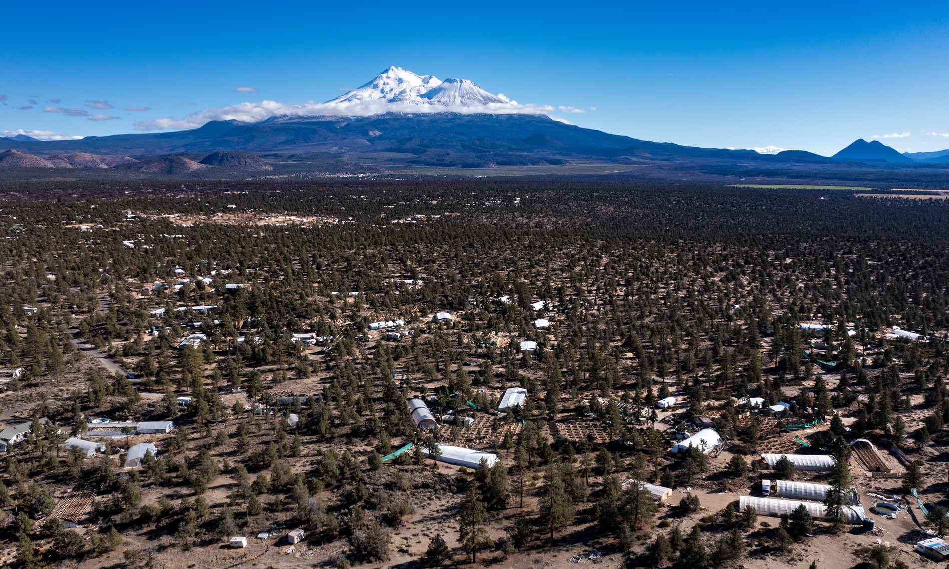
3) Recent environmental guides on some Montana forests stipulate that grizzly bear populations need to be much higher.

Currently, these lands contain a large amount of dense (stem exclusion) structure and very little open (stand initiation) and savannah structures because of two actions:

  1. past logging and uncontrollable fires that created large openings that grew to dense stands;
  2. exclusion of low intensity fires that would have thinned the dense forests to create more savannah structures.  Bears live in openings and savannah structures where they can feed on vaccinium berries, clover, and other tuber species.

There is currently an effort to determine if thinning the dense forests can increase grizzly bears in these forests by allowing the greater sunlight to provide more herbs as food for the bears.

4) The recent beginning of a focus on the value of rural people.  During the past few decades, rural forestry people were discounted or vilified.  (See book:  Broken Land, Broken Trust;  see also movie “Fern Gully.”)

Recently, however, the issue may be starting to shift to respecting and appreciating these people’s value.  See:  Editorial in Nature, 15 May, 2024:  “Forestry social science is failing the needs of the people who need it most.”

Rich nations’ fixation on forests as climate offsets has resulted in the needs of those who live in or make a living from these resources being ignored. A broader view and more collaboration between disciplines is required.


“Green Glacier” Encroaches on Prairies

This isn’t a USFS planning topic, but interesting nonetheless. According to an NPR story yesterday and on other dates, a “blanket of shrublands and dense juniper [eastern red cedar] woods gobbling up grassland leads to wildfires with towering flames that dwarf those generated in prairie fires.” In part, this is due to eliminating Indigenous fire-based land management.

Trees And Shrubs Are Burying Prairies Of The Great Plains

The Quest for Clear Definitions of Co-Management Continues: Grist and E&E News Stories in Conversation

Here’s a link to the story.  Note that it is part of the Climate Desk collaboration, described here.

The reporter starts out with the Yocha Dehe Wintun Nation, who did not want a wind turbine project in a specific place.

That’s what happened earlier this month when the Biden administration expanded a national monument to include Molok Luyuk, joining the mountain ridge to the nearby Berryessa Snow Mountain National Monument, nearly 350,000 acres of coastal range in Northern California. Tribes are now working on a co-stewardship agreement for the Molok Luyuk area, but not for the whole national monument.

But the tribes that have a relationship with Molok Luyuk aren’t done with their advocacy. They’ve protected the area from energy development, but they still have little say in how the land is managed. While the federal government has pushed co-stewardship agreements over the years, national monuments are still considered property of the federal government.

Melissa Hovey is the manager at Berryessa Snow Mountain National Monument, and she said that co-management happens between BLM and the Forest Service. These federal agencies can enter into co-stewardship agreements with tribes, but they can’t delegate management without congressional approval.

“Co-management means decision-making authority,” she said. “Co-stewardship means one entity still has the decision-making authority.”

You would think that “co-stewardship” and “co-management” would be simple terms to define, but there are numerous federal documents that have used the two terms interchangeably over the years. Co-stewardship is a broad term that describes agreements made between federal agencies and tribal nations to hash out shared interests in the management of federal lands. Co-management refers to a stronger tribal presence and decision-making power.

Congressional action is not the only way to gain co-management powers. The Bears Ears Inter-Tribal Coalition in Utah has one of the most successful stories of tribes gaining co-management status—they were given “true co-management” by an Intergovernmental Cooperative Agreement.

In 2022, the federal government agreed to co-manage Bears Ears National Monument with the Hopi Tribe, Navajo Nation, Ute Mountain Ute Tribe, Ute Indian Tribe of the Uintah and Ouray Reservation, and the Pueblo of Zuni. For the first time ever, tribal nations worked with federal agencies to draft a resource-management plan that would dictate how a national monument should be run.

I’m still a little confused, if Hovey says  “co-management means decision-making authority” and Bears Ears has co-management (without Congressional action?) .. meanwhile we see this from E&E News yesterday..

Native Americans and conservation advocates on Monday rolled out a campaign urging the Biden administration to adopt a strategy that emphasizes tribal management of the Bears Ears National Monument.

The Bears Ears Inter-Tribal Coalition — composed of leaders of the Navajo Nation, Ute Indian Tribe, Zuni Tribe, Hopi Tribe and the Ute Mountain Ute Tribe — and outdoor retailer Patagonia pledge to press for adoption of a management plan that stresses resource protection along with the use of Indigenous knowledge to steward the 1.35 million-acre monument in southeastern Utah.

“Bears Ears holds deep spiritual and cultural significance, and is rich in ancestral history,” said Craig Andrews, who serves as co-chair of Bears Ears Inter-Tribal Coalition and vice chair of the Hopi Tribe. “Protecting Bears Ears ensures that future generations can continue to connect with our history and cultural identity.”

The group is urging the Biden administration to adopt a version of the management plan known as Alternative E, one of five options being weighed by the Bureau of Land Management and the Agriculture Department’s Forest Service. In a draft of the plans published in March, both agencies identified that version of the management plan as their “preferred option,” although a final selection has yet to be made.

***************

So if Tribes have decision-making authority, why do they need a campaign to adopt the strategy? In fact, why did they need five alternatives?  They could have had “current conditions” and “preferred by Tribes” and save much money and time of agency employees and the public.  Also I’m a little leery of Patagonia having a strong presence in this.. getting rid of OHVs opens up more country for those who buy their stuff.  That is,  the folks who can afford to buy their stuff.  It looks like the spinoff charitable organization from Patagonia helps fund many groups we are familiar with.

Anyway, back to the Grist article.

****************************

Patrick Gonzales-Rogers is a professor at the Yale School of Environment where he specializes in tribal sovereignty and natural resources. He is also the former director of the Bears Ears Inter-Tribal Coalition.

Co-management allows tribes to exercise sovereignty, according to Gonzales-Rogers. “It allows them to be more assertive,” he added. And when that happens, tribes can bring in religious and spiritual practices to utilize traditional knowledge, wisdom that had been minimized by federal agencies in the past.

Gonzales-Rogers is hopeful that, exponentially, these choices will compound, “and may even have a nexus to say something like landback,” a reference to a movement that is not only rooted in a mass return of land to Indigenous nations and peoples, but also tribes having sovereignty to steward the land that was taken from them.

Gonzales-Rogers thinks the two terms have not been very well-defined over the years, but said co-stewardship agreements might be a good way to start building to co-management.

This is confusing, because the FS and BLM are already required, as far as I know, to use traditional knowledge in decision-making on all lands, and maybe co-stewardship as well.  Is sovereignty like being pregnant, you either are or you aren’t? Or are there degrees of sovereignty? It seems to me that we won’t know what “sovereignty” really means for a place that’s co-managed until an Admin disagrees with a Tribe about management.

And the more tribes have autonomy over their ancestral lands, the better it is for conservation goals. According to a recent study, equal partnerships between tribes and governments are the best way to protect public lands—the more tribal autonomy, the better the land is taken care of.

The reporter asserts that based on an international study. Some international studies say the same thing about local people.. Not to be unduly skeptical, but the study involved lots of different places and the authors’ own view of what is more autonomy and what is more conservation.  And I just think about the Izembeck Road, the Utah oil train and so on, as Wuerthner described in a previous post:

What I call an Indian Iron Curtain exists among the media and conservation organizations. Like the old Soviet Union Iron Curtain, which attempted to promote Communism and censored anything contradicting the notion that Communism was anything but a perfect social and political system. The Indian Iron Curtain exists to promote tribal people as somehow exemplary conservationists.

Who is doing this in the media? For example, who funds the Climate Desk Collaboration? Here’s a story about how it started from Yale Climate Connections. Since I’m an alum, I thought they might let me know who funds YCC. No such luck, donor privacy invoked. But back to the Climate Desk.

To help fund The Climate Desk, including hiring freelance writers, the partners have so far secured a $100,000 grant from the Park Foundation. Other money has come from the Surdna Foundation, which has supported Mother Jones in the past.

Grant money has come without any expectations of control over editorial content, the partners said.

I’m sure that’s true, but it seems to me that funding reporters at Grist is likely to produce different copy than for example, funding reporters at the National Review.

E&E News on Implementation of BLM Rule- Doubling Down on Things People Were Wary Of

Many thanks to a TSW reader who supplied this Scott Streater story in E&E News, which is quite comprehensive.  In addition to an oligarchy vibe, I now get a “separation of powers” vibe about this regulation and its implementation.  It seems like kind of a sharp stick in the eye to the Governors and others who did not support these elements of the proposed rule; in fact, in Streater’s reporting, they “doubled down” on policies people disagreed with.  Feature or bug? I’m so not a politician.   Anyway, in the interests of fair use, I excerpted the two areas of most interest (to me). Feel free to excerpt other sections in the comments.

Stone-Manning and others promised the rule will be implemented in a deliberate fashion when it goes into effect on June 10. This will include a “preliminary suite of implementation guidance” developed by “interdisciplinary and intra-organizational teams” to help guide staff, said Brian St. George, BLM’s deputy assistant director of resources and planning.

***************

But Thursday’s webinar also provided key details about some of the policy and regulatory changes associated with the rule’s overarching goal to elevate conservation as a formal use of BLM lands, on par with energy development, mining, recreation and livestock grazing.

But let’s not forget that BLM “conservation” is not the same as USDA “conservation”.

And it underscored just how much work will be required. The webinar included a chart outlining the work of three “implementation teams” that will assist staff in executing key components of the rule, including conservation leasing, land health standards and the designation of “areas of critical environmental concern,” which the new rule makes an agency priority. For example, a “Restoration and Mitigation Team” has been working for months to develop procedures for one of the most contentious provisions in the rule — the creation of a restoration and mitigation leasing system that energy developers, mining companies and others will be able to use as as part of doing mitigation to offset project impacts on other lands.

I don’t know if this means “other” BLM lands, federal lands, or any lands.

The team is developing a “lease application worksheet” for staff, according to the slide, as well as instruction memorandums to field offices set to be issued soon detailing what project applications should be prioritized for restoration leasing.  Critics have argued that environmental groups, among others, could purchase the leases and lock up public lands from energy development and mining for years. While the rule allows for nongovernmental groups to buy these leases and pay to conduct restoration work on the land, this should not be interpreted by staff as conveying “exclusive rights to the use of the public lands” under a 10-year lease, said Deblyn Mead, a BLM national mitigation specialist.

I just don’t get it.  If they are paying for good things to happen, and that doesn’t preclude other things from happening, then they don’t really need leases.  I don’t see that the BLM has had trouble administering outside money to do good things, while maintaining the option of allowing other things on site.

What’s more, criticism by congressional Republicans that private entities or individuals associated with “foreign adversaries” such as Russia could purchase a restoration or mitigation lease is unfounded, said Mark Ames, a BLM realty specialist. “Foreign persons may not be granted a restoration lease,” Ames said.

I don’t want to be overly skeptical here, but when organizations, including “conservation groups” aren’t required to show who is funding them (as in the various c3s and c4s I’ve been following) how is anyone to know? Take Hans Wyss for example; for sure, Switzerland is not Russia, but he is a foreign national who seems to be funding many some ENGO’s.

Temporary ACEC protections

BLM doubled down on a potentially contentious aspect of the rule that would allow the agency to implement “temporary management” procedures for some parcels nominated for designation as areas of critical environmental concern, or ACECs, that would block energy development and other uses on sensitive rangelands, potentially for years at a time.

Brenda Lincoln-Wojtanik, a senior planning and environmental analyst, outlined to staff the process of applying these temporary measures to nominated parcels. BLM state directors are authorized under federal law to implement these temporary management measures on nominated parcels, with few restrictions. Directors can take this step before parcels go through the lengthy land-use revision process required before the designation of an ACEC — which are managed primarily to protect their environmental, cultural, historic or scientific values, restricting activities that conflict with that priority.

To qualify for these temporary management measures, the nominated parcels must be determined to have “relevant and important values,” and that “special management attention” is needed to protect the resource values.

As a former bureaucratic writer, I could probably write such such a rationalization for any BLM acre as requested :).

The Information Bulletin sent to staff late Thursday says the new rule establishes “a presumption” that all potential ACECs that meet these three requirements “will be designated” as such. It also includes a chart stating that BLM staff should “immediately” begin to consider ACEC nominations “and implement interim management as appropriate.”
The temporary management measures would be lifted once BLM makes a determination about the ACEC as part of a larger resource management plan (RMP).
But some land-use plans can wait decades to be revised.

I don’t get it, I thought this Admin was all about NEPA, public involvement and addressing the views of marginalized communities (which RMPs do and this does not). Another idea, if RMPs are too hard to do.. maybe change those regs?  Ask Congress for help amending the statute? I don’t actually see “three” requirements in the story, I just see “values” and “attention”??

House Natural Resources Chair Bruce Westerman (R-Ark.) highlighted this aspect of the rule on the House floor last month prior to the approval of H.R. 3397, which would require BLM to withdraw the rule. Even though this has been used by BLM only a handful of times in the past 25 years,  it’s an option that the bureau may use more frequently now. “If we decide that we’re going to evaluate that nomination and we find that it meets all three criteria, we are required then to protect those values” through temporarily protective measures, or the start of a new resource management process to evaluate the ACEC nomination, Lincoln-Wojtanik said.

In addition to vibes of oligarchy, separation of powers issues, I get a strong vibe of hornswogglery with this one.

Monday Roundup: FS OG Policy, Mining Law, Public Lands Rule, Illegal Cannabis and Giant Sequoias

Illegal cannabis greenhouses dot the landscape in the shadow of Mount Shasta in Siskiyou county, northern California. Photograph: Brian van der Brug/Getty

******************

I’ve received a few positive emails about our managed fire discussion so I’ll be continuing that in other posts. But for now, a few other interesting stories.

TRCP Preps Us for Release of FS Old Growth Policy

TRCP, who was no doubt involved in deciding, gives us an inkling that it will be a Good Thing with this op-ed in the Bend Bulletin:

Fortunately, the Forest Service’s proposed action on old growth demonstrates that the agency is listening and that it recognizes active restoration is critical to maintaining older forests in many places on the landscape. Grounded in the latest scientific research, the proposal aims to provide guidance for consistently maintaining and managing older forests while complementing wildfire risk reduction efforts. Initiatives such as the Wildfire Crisis Strategy advocate for proactive stewardship through selective thinning, prescribed burns, Tribal co-stewardship agreements, and other tools. Implemented effectively, a policy that enhances the health of Central Oregon’s old growth ponderosas coupled with existing strategies such as the Wildfire Crisis Strategy can enhance the pace and scale of managing healthy forest stands, benefiting wildlife habitat while reducing fire risk to communities.

Some Pieces of the “Public Lands Rule” to be Implemented in a More “Deliberate” Fashion Than Others

This sounds quite interesting, so thanks to Nick Smith.  I’d like to see the rest of the piece, so maybe someone who has access to E&E News could send.  FWIW, The Smokey Wire was not invited to the internal online webinar that E&E News was.   It feels kind of creepy that reporters for an outlet regular people can’t afford (and that isn’t available in my local public libraries) have unique access to information provided by the Admin.  I get a weird oligarchy vibe from all this. Here’s the summary Nick posted:

Bureau of Land Management Director Tracy Stone-Manning and other officials Thursday outlined to staffers next steps and a timeline for implementing the sweeping new public lands rule, acknowledging that it could take years to fully incorporate all the rule’s provisions. Stone-Manning and others promised the rule will be implemented in a deliberate fashion when it goes into effect on June 10. This will include a “preliminary suite of implementation guidance” developed by “interdisciplinary and intra-organizational teams” to help guide staff, said Brian St. George, BLM’s deputy assistant director of resources and planning. The rule kicks off major changes in how BLM approaches oversight of the 245 million acres it manages. Highlights include involving Native American tribes and Alaska Native corporations as “co-leads” in project reviews, such as environmental impact statements, and proactively protecting parcels that have been nominated, but not approved, for conservation, agency officials said during the internal online webinar late Thursday that E&E News was able to listen to. (Subscription Required)

Couldn’t someone nominate all BLM lands for conservation? Where does that leave renewable energy, strategic minerals, and new transmission lines?

***********

I do see a pattern of media getting out ahead of any direct contact between the actual text and the public.  Problem is, media campaigns themselves make some of us more skeptical than we would be with a straightforward public announcement with all the details for those of us more knowledgeable (than reporters) to peruse.  Maybe that’s just me, and it’s now a standard way of doing business.

***********

Bipartisan Bill on Mining Passed in House Goes to Senate

This is a very detailed story with no paywall.

The bipartisan support for blocking the Rosemont decision follows the passage of the Inflation Reduction Act in 2022, which incentivized mining companies to take advantage of the Advanced Manufacturing Production Credit to develop mining projects for critical minerals included in the law. Many of the critical minerals designated by the Biden administration, such as zinc, manganese and lithium, are integral to electric vehicle batteries and the transition toward a carbon-free economy.

“Everything from lithium-ion batteries to satellites relies on critical minerals, and we should be responsibly mining those right here in the U.S.,” Sen. Catherine Cortez Masto (D-Nev.), who introduced the Senate bill with Sen. Jim Risch (R-Idaho), said in a press release. “My legislation will undo the damage of the misguided Rosemont decision and protect thousands of jobs across the West.”

There were 509 active mining plans of operation and another 806 active mining notices on federal lands in 2023, according to Steve Feldgus, deputy assistant secretary of land and minerals management at the Department of the Interior.

The Center for Biological Diversity and Save the Scenic Santa Ritas, nonprofit organizations working in Arizona, led the effort to sue the U.S. Forest Service over its decision to allow the Rosemont Copper Company to use federal lands to dump mining waste. The Tohono O’odham Nation, Pascua Yaqui Tribe, and Hopi Tribe, among others, consider the area to be sacred, ancestral land, prompting conservation groups to file suit and prevent further development.

***********

“What we correctly argued and the court, we think, got it right, was that if you’re going to assert rights against the United States … the agency has to check and the company has to prove that it actually has the rights under the [1872] Mining Law,” said Roger Flynn, an environmental attorney who litigated on behalf of conservation groups against the United States Forest Service in the Rosemont decision.

Before the 2022 Rosemont decision, as a legal precedent, the Forest Service often did not require proof of valid mining claims. According to Flynn, who teaches courses on mining law at the University of Colorado, the agency has historically greenlit dozens of mining projects on federal land because of its interpretation of the 1872 Mining Law.

“I think the [1872] Mining Law automatically gives rights to these companies, the agencies do not have the discretion to say no. The Rosemont mine changed that,” Flynn said. “And that’s what has caused the industry to go to their supporters and basically take away the few guardrails that actually exist in the Mining Law.”

On the other hand, this also came across my desk this morning..from the University of Michigan “Copper can’t be mined fast enough to electrify the US”.    Seems like after the election might be a good time for a bipartisan reality check on all this. Right now it seems like decarbonization pathways are chosen by political forces we don’t know about, without an open public review of assumptions and alternatives.   As I’ve said before, if the US has parties with different perspectives and decarb is a long-term project, doesn’t it have to have bipartisan public support?One could argue that the IRA/BIL is that, but those are about sending out more money (easy for pols) not so much about getting things done (because someone is not going to like it). Clarity about the hard choices we face seems important to me, but not to the marketers of various erstwhile solutions.

Copper can’t be mined fast enough to electrify the US

Copper can’t be mined fast enough to electrify the US

Some Pieces of the “Public Lands Rule” to be Implemented in a More “Deliberate” Fashion Than Others

This sounds quite interesting, so thanks to Nick Smith.  I’d like to see the rest of the piece, so maybe someone who has access to E&E News could send.  FWIW, The Smokey Wire was not invited to the internal online webinar that E&E News was.   It feels kind of creepy that reporters for an outlet regular people can’t afford (and that isn’t available in my local public libraries) have unique access to information provided by the Admin.  I get a weird oligarchy vibe from all this. Here’s the summary Nick posted:

Bureau of Land Management Director Tracy Stone-Manning and other officials Thursday outlined to staffers next steps and a timeline for implementing the sweeping new public lands rule, acknowledging that it could take years to fully incorporate all the rule’s provisions. Stone-Manning and others promised the rule will be implemented in a deliberate fashion when it goes into effect on June 10. This will include a “preliminary suite of implementation guidance” developed by “interdisciplinary and intra-organizational teams” to help guide staff, said Brian St. George, BLM’s deputy assistant director of resources and planning. The rule kicks off major changes in how BLM approaches oversight of the 245 million acres it manages. Highlights include involving Native American tribes and Alaska Native corporations as “co-leads” in project reviews, such as environmental impact statements, and proactively protecting parcels that have been nominated, but not approved, for conservation, agency officials said during the internal online webinar late Thursday that E&E News was able to listen to. (Subscription Required)

Couldn’t someone nominate all BLM lands for conservation? Where does that leave renewable energy, strategic minerals, and new transmission lines?


Environmental and Human Trafficking Impacts of Illegal Cannabis Grows in Shasta County, California or Legalizing Provides Cover for Illegal Operations

Policies made with the best of intentions can have unintended consequences.  Proponents (whether driven by self-interest or ideology) tend to assume away and downplay them.  Some are downright surprises to anyone; some are easily foreseen or experienced by other government entities who have tried that policy.  What’s interesting about this Guardian article is that it’s not really clear how much of this is federal land, possibly due to the fact that the reporter is located in London, and so our detailed land ownership patterns are unnecessary detail (and relatively unimportant for the Guardian’s audience, I guess):

The wilderness around Mount Shasta is protected by law, sheltering spotted owls, Pacific fishers and rare plants such as the Shasta owl’s clover. The Medicine Lake Volcano, 30 miles from Mount Shasta, is an important drinking water resource for the state that captures snowmelt from the surrounding area.

“We’ve gone down there on the ground and there’s really no wildlife. You’re lucky to find a lizard,” says Rick Dean, the community development director for Siskiyou’s environmental health division. Along with helping local people rebuild from the region’s enormous wildfires, Dean is spending ever more of his time on the consequences of illegal cannabis production.

****************

Illegal production continues on federal land and forest ecosystems, sometimes with links to organised crime groups. There are fines for illicit growers but most amount to a few hundred dollars, which authorities say is little deterrent. By contrast, commercial growers in the legal market are obliged to follow restrictions covering the use of pesticides and chemicals, with dispensaries testing cannabis products before they go on sale.

Standing on a hill looking over the makeshift greenhouses and partially buried rubbish, local sheriff Jeremiah LaRue says authorities do not have enough resources to clear the illicit operations. Pickup trucks can be seen patrolling the site. “There’s a lot of concern about environmental damage. We see the labour trafficking of the people that come in here and work; water use concerns; and the marijuana is essentially being cultivated with pesticides that are not supposed to be on the plant.

“The marijuana goes to anywhere … to licensed facilities. We’ve tracked it to other states. It’s a public health issue,” he says.

While his team do issue fines after raids, they largely go unpaid. When a growing site is abandoned or cleared, Siskiyou county estimates the cleanup costs to be about $30,000 an acre, with workers routinely finding illegal pesticide that could be fatal to people who breathe it in.

“The idea was that [legalisation] would combat the illegal side of things,” says LaRue. “This exploded around the same time as legalisation. All the costs associated with doing it legally are way more than to do it illegally. It’s not about whether the plant is bad. If this was corn, or strawberries, or cherries, whatever, it would still be wrong.”

Giant Sequoias Have Bark Beetles Too

Considering it seemed to start during the drought, it could be that the trees were so weakened by a lack of water and the extreme heat (associated with climate change), that the beetles were able to take advantage, similar to what happened in conifer forests across the Sierra Nevada. It can take sequoias multiple years to recover once rain returns.

An image of trees at different stages of damage.
As beetle attacks progress, trees tend to die from the top down.
(Nate Stephenson/U.S. Geological Survey)

Fire could also be playing a role, according to Brigham. There seems to be a correlation between beetle attacks and severe fire scars at the base of the trees. While sequoias need fire to survive, extreme fires like those that we’ve seen in recent years, can damage their roots and trunks, compromising their ability to transport nutrients to the demanding, full green crown several hundred feet off the ground.

Federal Lands Litigation – update through May 31, 2024

To start your week (and month) off right …

FOREST SERVICE

Court decision in Murray v. United States (Court of Claims)

On June 5, 2023, the Court of Federal Claims dismissed this breach of contract claim involving an authorization by the Umatilla National Forest for snowmobile use in the parking lot of the Spout Springs ski area (the plaintiffs). The record indicated that “material interference” by snowmobiling with the contract began at least by 2013, so the lawsuit was not filed within the statute of limitations, and the case was dismissed.  (This case was introduced here, and someone inquired about the results, so I included it in this update.)

New lawsuit

On May 14, the Alliance for the Wild Rockies filed a lawsuit in U.S. District Court for the Eastern District of Washington seeking to stop the Sxwutn-Kaniksu Connections Trail Project, which calls for logging and burning on more than 36,000 acres over 20 years on the Colville National Forest.   The Forest partnered with the Kalispel Tribe of Indians, whose reservation adjoins the Forest.   The Forest Service has offered three timber sales that are part of the project, according to the complaint.  The plaintiff’s problems with the Project are described here.  We discussed this here.

Court decision in Patagonia Area Resource Alliance v. U. S. Forest Service (9th Cir.)

On May 15, the appeals court affirmed the district court’s denial of a preliminary injunction regarding two mines on the Coronado National Forest.  The court found that plaintiffs were unlikely to succeed on the merits of claims related to the cumulative effects of the Sunnyside and Flux Canyon projects on the Mexican spotted owl and groundwater.

New lawsuit:  Standing Trees v. U. S. Forest Service (D. New Hampshire)

On May 16, Standing Trees filed a lawsuit asking the court to halt the Tarleton and Peabody West integrated resource projects on the White Mountain National Forest.  The plaintiff alleges that the Forest Service failed to take the hard look at alternatives and effects as required by NEPA before approving nearly 3,000 acres of commercial logging based on an EA, and that the projects violated the forest plan.  Plaintiffs are concerned about  water quality, carbon storage, biodiversity, endangered species, mature and old growth forests, and flood resiliency.  (Here is additional background.)

  • Sawtooth NF ditch diversion ownership

Court decision in Hansen v. U.S.A. (D. Idaho)

Court decision in Mizer v. U.S.A (D. Idaho)

On May 20, the district court dismissed two cases with claims of ditch easement ownership by private parties who sought to prevent the Forest Service from subjecting the ditches on national forest lands to Endangered Species Act requirements.

Court decision in Friends of the Inyo v. U. S. Forest Service (9th Cir.)

On May 21, the circuit court reversed a district court holding and enjoined exploratory drilling on the Inyo National Forest.  The court found, based on Forest Service mineral regulations, that associated monitoring and restoration was part of the project.  Since that would continue for more than one year, a categorical exclusion for drilling projects was not available.  Neither was a CE that would have covered the restoration component, but not the drilling.  The court ultimately found that the Forest Service regulation establishing categorical exclusions “unambiguously prohibits combining CEs to approve a proposed action where no single CE could cover the proposed action alone.”  Plaintiffs were concerned about the bi-state sage-grouse and water for the endangered Owens tui chub. (The article includes a link to the opinion, which we also discussed here.)

Court transfer in Center for Biological Diversity v. U. S. Forest Service (now S.D. West Virginia)

On May 21, the federal district court for the District of Columbia granted the government’s request to transfer this case (introduced here) to the Southern District of West Virginia, holding that, “The final factor—the local interest in deciding local controversies at home—is ‘perhaps [the] most important factor’ (citing another case).  Moreover, “Just because a case “involves federal laws and could result in a decision with ‘national implications,’ these implications do not outweigh the significant interest of [local] residents” (citing another case).  (This is why we don’t see many national forest decisions litigated in the D. C. court.)

New lawsuit

The Center for Biological Diversity has filed a second lawsuit against the Tonto National Forest’s management of the Salt River herd of wild horses.  The first (discussed here) was dismissed with the expectation that it would be refiled after an intergovernmental agreement was renewed.

Notice of Intent to Sue under ESA

The Center for Biological Diversity has notified the Forest Service and Fish and Wildlife Service of its intent to sue them regarding (1) U.S. Fish and Wildlife Service’s December 29, 2023, Biological Opinion for the Reinitiation for Ongoing Livestock Management on the Sacramento and Dry Canyon Allotments, and (2) U.S. Forest Service’s reliance on this Biological Opinion on the Lincoln National Forest.  Riparian areas in the Sacramento Mountains are critical habitat for the endangered New Mexico meadow jumping mouse and Mexican spotted owl.  This is the third such notice involving these areas.

BLM

New lawsuit:  Western Energy Alliance v. Haaland (D. Wyoming)

On May 15, six oil and gas associations sued to overturn the BLM’s regulation that would raise royalty rates and toughen protection and cleanup requirements on public land.  They claim procedural violations in adopting the regulation and substantive violation of the Federal Land Management and Policy Act’s “obligations” to promote oil and gas development.   Additional background is here.

Post-litigation agency decision (and lawsuit promised)

On May 16, the BLM issued its final supplemental environmental impact statement and proposed amendment to its Buffalo Field Office land use plan, selecting a “no future coal leasing alternative” for the Powder River Basin in Wyoming and Montana.  The BLM was required by a 2022 court order to reevaluate its land use plan after local conservation groups successfully argued it had not fully considered environmental, climate and human health impacts. The area is the largest coal producer in the U. S., and existing leases would continue for decades.

Magistrate’s recommendation in Klamath-Siskiyou Wildlands Center v. U. S. Bureau of Land Management (D. Oregon)

On May 24, the magistrate judge found that the BLM should have prepared an EIS for the “Integrated Vegetation Management for Resilient Land Program” (875,290 acres in southwestern Oregon). This was in part the result of the uncertainty about effects associated with the flexibility incorporated into the decision.

The judge also found that the “commercial logging portions” of the IVM Program violated FLPMA because they are inconsistent with the governing resource management plan.  The plan includes a standard that directs the BLM to apply logging treatments within late-successional reserves only if they do not preclude or delay the development of northern spotted owl nesting or roosting habitat by 20 years or more.  The BLM had tried to claim that the standard didn’t apply because this project promoted forest health.  The magistrate found that it “clearly applies to any proposed actions in the LSRs, irrespective of BLM’s stated purpose.”

The immediate effect is on the 830-acre Late Mungers commercial thinning project.  The scope of relief is to be determined later.   (The article includes a link to the magistrate’s findings and recommendations, which we also discussed here.)

ENDANGERED SPECIES

On May 29, the U. S. Fish and Wildlife Service designated critical habitat for the coastal distinct population segment of Pacific marten.  It includes federal lands in southwestern Oregon and northwestern California, but land owned by timber company Green Diamond Resources was ultimately excluded from the designation in exchange for the company’s agreement to perform monitoring and create a reserve. Yurok and Karuk tribal land was also excluded.  This follows a lawsuit from the Center for Biological Diversity over delaying the decision.  The article includes a link to the Federal Register notice.

OTHER

Court decision by the Oregon Court of Appeals

The state appeals court overturned a decision by the Oregon Land Use Board of Appeals that had approved a destination resort (on private land).  The court found that Deschutes County officials did not properly take into account the effects of water use on off-reservation treaty fishing rights of several Native American tribes.

New lawsuit

On May 14, WildEarth Guardians and Western Watersheds Project filed a complaint in the Montana federal district court focusing on livestock grazing permitted by the U. S. Fish and Wildlife Service in Red Rock Lakes National Wildlife Refuge in Montana.  The complaint alleges that the FWS “continues to renew commercial grazing permits that rely on a nearly three-decade-old environmental analysis.”  Concerns include effects on grizzly bears and Arctic grayling.  (A lawsuit against the FWS decision to not list the grayling as threatened or endangered is pending – described here.)

New lawsuit:  Defenders of Wildlife v. U. S. Fish and Wildlife Service (E.D. North Carolina)

On May 20, Defenders of Wildlife and the Sierra Club challenged a decision by the U. S. Fish and Wildlife Service to allow an experimental algaecide treatment using a toxic-to-birds product at Mattamuskeet National Wildlife Refuge in North Carolina.  The complaint alleges a violation of the National Wildlife Refuge System Improvement Act and several violations of NEPA.  It also included several claims that the promulgation of the 2020 (Trump Administration) changes to the CEQ NEPA regulations (which were in effect when this decision was made, but have since been replaced) violated the APA.

SWERI’s Independent Analysis of Managed Wildfire

This map demonstrates the fireline effectiveness of the 2022 Midnight Fire. The coral color is the 2022 Midnight Fire perimeter;brown is the 2019 Francisquito managed fire perimeter; and red is the 2018 Alamosa prescribed fire perimeter. The analysis shows that when the Midnight Fire ran into the previous burn areas, they contributed to a high degree of suppression effectiveness.

************************************************

A helpful TSW reader has sent me more information that addresses some of the questions we’ve raised directly, rather than floundering around, as I have been doing.  So a big shout-out to SWERI for this paper ! As a person who supports MF, is a big pre-planning and POD fan,  (gasp for me) even supports putting fire stuff in forest plans (making forest plans more useful) and agrees with the approach in this paper, but also wants to help all of us understand each other better, I made a few comments as if I were an MF skeptic living in a potentially-impacted community.

Analysis of managed wildfires demonstrates that destructive outcomes are rare. The 2021 Tamarack Fire in California was a lightning-caused fire for which the initial decision was not to engage directly due to firefighter safety concerns, not as a managed wildfire, and which resulted in structure loss and prompted scrutiny of management responses to natural ignitions. Recent research demonstrates that from 2009 to 2020, there were 32 fires with characteristics like the Tamarack Fire, of which only 6 were managed wildfires. Most structure losses from wildfire are due to human ignitions on private lands that spread into adjacent areas under extreme weather conditions. Managed wildfires that result in negative outcomes are rare, yet fire managers are incentivized to suppress natural ignitions to minimize short-term risk rather than use them under favorable conditions to maximize long-term risk reduction.

So this paper says that fire managers are not sufficiently incentivized to do MF.  Other folks have told me the same thing. At the same time, some people are worried that the FS is over-incentivized to do it based on  fuel reduction targets. I suppose both can be true in different places at different times? How can we (or can we) reconcile these two observations or points of view?

Current policy, the 2009 Guidance for Implementation of Federal Wildland Fire Management Policy, is effective and allows for using managed wildfire when an existing, approved land, resource, or fire management plan is in place,

I’d like more details on what any plans should contain.. any old forest plan might not do it.  This paper, of course, is not the place to go into details.  Perhaps that is to be found somewhere else? I’d go so far as to say “put the fire part of plans in an easily accessible place on the Forest website.” Perhaps forest plans nowadays do have their material sorted by topic (say fire or grazing) as well as by plan component (desired conditions, standards, etc.)?

but myriad factors can frustrate its use. 1) There is inconsistent terminology and multiple terms for “managed wildfire.” The approach can entail engaging fire at locations deemed safer and more effective for suppression or engaging fire to achieve natural resource or risk management objectives after analyzing risk to firefighters and local landscape values. Inconsistent terminology creates confusion when current policy (i.e.,2009 Guidance) allows for all fires to be managed for different objectives and strategies depending on the context. 2) Operational concerns also pose challenges. Fire managers may worry there are insufficient resources,

This seems like a legitimate concern to me, especially projecting into unknown future time periods with unknown numbers of starts elsewhere.

leadership backing, and political or public support for implementing managed wildfire. 3) Risk aversion and uncertainty, when combined with a high degree of autonomy in local decision making and the perception that managed wildfire is risky, have resulted in hesitance to use managed wildfire approaches despite current policy.
In many cases, managed wildfire is a lower risk option when considering its potential to reduce future fire risk,

I think this could be one of the understanding gaps, how different folks talk about risk. It seems to me (and to the federal budget) that there are other options to reduce future fire risk, aka prescribed fire and/or mechanical treatment plus prescribed fire. At least everyone has been doing these projects assiduously saying they reduce wildfire risk.  But maybe there won’t be funding. We also don’t know if some equally or better conditions for MF will occur next year, or some other year, before the future WF risk.  And of course in the wrong conditions a WF could be worse.  Predicting the future is tough for anyone, even with super-sophisticated models.

but when faced with a risky decision, decision-makers often take the risk-averse option of fully suppressing a fire. Rather than sharing risk across boundaries, fire managers who do opt to take a managed wildfire approach are often left carrying the burden of potential bad outcomes, which are uncommon.

Hmm. Some would say people who lose their homes and businesses or get killed or injured and, say FEMA (aka taxpayers) are “left carrying the burden.”

Managed wildfire often comes down to the willingness of individuals to take on the risk because the 2009 Guidance has not been codified into law. 4) Building public and political understanding of, and support for, managed wildfire strategies, especially in the pre-season before a fire starts, can facilitate its use. 5) Existing performance metrics and financial structures may also disincentivize using managed wildfire, and regional and local planning may be outdated or not explicitly demarcate alternative fire management strategies for different land or resource objectives, which can lead to additional confusion in implementing policy on the ground.

I don’t think MF is a big thing in my county planning (partly forested, partly FS). Maybe what they meant is that all communities have not decided MF is a good idea, and hence it isn’t in plans?

There are several facilitating factors that lead to decisions to use managed wildfire. 1) Discussions of fire management options in the pre-season (e.g., creating Potential Operational Delineations (PODs) of the most effective containment opportunities and pairing those with quantitative wildfire risk assessments) can help identify and document strategic response zones where managed wildfire may prove beneficial under the right conditions. 2) The characteristics of individuals, incident management teams, or organizations with experience using risk-informed decision support systems (DSSs) and the characteristics of the DSSs themselves can facilitate decision making to allow for managed wildfire use. 3) Many other facilitators such as existing collaborative relationships, personal ethic to use managed wildfire, favorable conditions, reduced exposure, minimal values at risk, agency support, cost savings, and many others also encourage use of this approach.

I would use “support” and not “ethic.” Yes I can be pedantic, without being an actual pedant.
“ethic- a set of moral principles, especially ones relating to or affirming a specified group, field, or form of conduct.”

Recommendations

Consistent terminology that better aligns with the existing 2009 Guidance should be identified, and the 2009 Guidance should be fully used. The 2009 Guidance already provides the appropriate sophistication and flexibility to respond to unplanned ignitions, both human and natural, but is not fully realized due to the barriers previously described. Once common language that adequately incorporates managed wildfire into the broader context of all wildfire management has been identified and vetted, the National Wildland Fire Coordinating Group Incident Status Summary database (ICS 209) categories for documenting and tracking wildfire should be reviewed and potentially updated to reflect this terminology. New terminology will allow for more realistic tracking, communication, and articulation of incident decision-making that highlights that wildfire response is a combination of strategy actions.

Duh. I still like FWB, for fire with benefits…

Framing should emphasize that all fires are addressed with a risk-informed, strategic approach. Expanding managed wildfire use has long-term health, safety, and risk reduction benefits. More awareness, socialization, outreach on the benefits, and communication of the complexities of fire decision making are necessary to facilitate the use of managed wildfire. Indigenous perspectives and cultural burning must be part of the conversation. Learning from success stories is invaluable for demonstrating the potential of managed wildfire to reduce future fire risk. Training programs must adapt to accommodate more nuanced framing and communication of approaches.

Leadership must share risk with fire managers and provide support, resources, and incentives for using managed wildfire. Fire managers need commitment and support to use managed wildfire from all levels of leadership and the necessary resources and incentives. Risk sharing and co-managing risk at all levels will help reduce risk aversion for individual fire managers who bear the greatest costs for the few bad outcomes. Leadership should acknowledge the reality of risk reduction, not elimination, in fire response. Leadership direction to use DSSs at all levels is also critical, otherwise using these tools often comes down to an individual’s willingness, rather than as a standard procedure.

Again, I think using “risk sharing” this way is confusing to me. Co-managing with whom exactly?- it sounds mostly internal.

The use of risk-informed, science-based DSSs before and during incidents is critical to increasing the use of managed wildfire, and these DSSs should be better integrated into land, resource, and fire management plans to fully realize the 2009 Guidance. More agile and risk-informed DSSs that deploy resources during windows of opportunity, prioritize resources in areas that have the highest probability of success, are identified through spatial pre-season fire planning, and are incorporated into land, resource, and fire management plans are critical to success. PODs are a collaborative, strategic spatial fire planning framework and DSS that pair local knowledge and expertise with advanced spatial analytics to pre-identify areas on the landscape where there is a high likelihood of containing a fire (e.g., roads, rivers, ridges). The collaborative development of PODs in the pre-season with diverse partners and across jurisdictions11 can inform fuel treatments to improve POD boundaries using strategic fuel breaks and/or as anchors for prescribed fire implementation.12 During fires, it is important to use pre-identified information and strategic approaches to prioritize resources in areas that are most likely to support safe and effective response. Using pre-identified control features that have been vetted by fire management professionals and partners can hasten situational awareness, conserve scarce resources, reduce future fire risk of high-severity wildfire, and incentivize line officers and incoming Incident Management Teams to consider indirect, “big box” strategies (i.e., managed wildfire) when it is safe and effective. Utilizing the Risk Management Assistance (RMA) Dashboard and engaging in the Incident Strategic Alignment Process (ISAP) will facilitate risk-informed decisions and the development of a spatial and temporal strategy using the best available science throughout an

Point being, I agree with all the ideas in here and still have a few questions about the way the info is conveyed.

Incident Strategic Alignment Process And Wildfire Decisions

We’ve been talking about the factors that suppression folks take into account when they talk about what I’ll call for now “wildfire with benefits” since I’m not sure that everyone agrees on the appropriate expression. Mike mentioned checklists and WFDSS (pronounced Wiffids, I think, please correct), and there is also the Incident Strategic Alignment Process. There’s a story map here about ISAP that was a bit buried in the previous TSW post about the San Juan. There are some good videos in the story map about how fire managers make decisions.

Folks I’ve spoken with say that they do fire pre-planning, and they do involve the public. There also seems to be more concern on some forests than on other forests, which may relate to a more generic trust or distrust of forest leadership. I’m wondering whether this is a typical Forest Service decentralization thing, that different places have different ways of doing things, some relationships are better than others, and as Mike says “there’s no “one size fits all.” Forests may well diverge in the way they do fire planning, the extent to which it is covered in the forest plan and so on. Do fire teams also diverge in the way they approach things? It could get really confusing to the public. Then there’s communication between the teams and forest leadership, and among teams, forest leadership and communities. And communities may view risk differently than the FS.

And yet forests like the San Juan have a track record of excellence. So it can be done. How to make that happen everywhere?

Maybe a national review with recommendations would be helpful.

Oregon Court Derails BLM’s Ambitious Landscape Logging Plan

This Oregon magistrate judge’s decision (“findings and recommendations” that must be confirmed by full judge before they are effective) is sure to delight Jon and infuriate Sharon. The case challenges BLM’s proposal to “treat” 684,185 acres on the Medford District. Plaintiffs prevailed on most of their FLPMA and NEPA claims.

I recommend reading the full decision. It is not long and well-written. Here are a few highlights:

BLM’s argument, at its core, is that because its actions are not intended to aid the development of habitat, its actions do not need to comply with the standard that requires BLM’s actions aid the development of habitat That reasoning is
circular. If the prohibition on treatments that preclude or delay habitat development by 20 years or more only applies to treatments intended to accelerate habitat development, it would render the direction superfluous.

In simply electing its chosen alternative without fully exploring the conflicting research on the issue through a formal EIS, BLM effectively reduces its findings to only the
positive outcomes, while discounting the coinciding negative possibility that treatments would exacerbate forest fires.

BLM adopted an intentionally non-specific approach in the EA to allow the plans to proceed flexibly under a “programmatic”
framework. By design, the Program has an inherently high degree of uncertainty about the proximate environmental impacts of the approved program of work.

BLM tiers to a global EIS that omits any site-specific analysis and explicitly pushes review to later implementation-level projects. Yet, when faced with a later implementation-level project, like the Late Mungers Project, BLM relies on a DNA, a non-NEPA document which cannot substitute for NEPA analysis, to conclude no further NEPA analysis is required. In this way, site-specific analysis is never completed, and it breeds problems for public participation, transparency, and establishing any sort of concrete certainty as to impacts.

As to relief, the court notes the parties agree on the non-commercial treatments and asks them to seek a resolution of the commercial logging aspects in light of the court’s opinion.

Example of Fire Suppression or Expansion Concerns: Guest Post by Frank Carroll

This is a guest post from Frank Carroll.  I think it’s a good illustration of specific concerns that people (including some TSW readers) have about a specific fire.

*************************

Here’s a current example of FS letting burn and expanding the burn policy on the Santa Fe National Forest, Coyote Ranger District. Their aim appears to be to drag the fire into the Encino Vista project area. www.wildfirepros.com
Below is yesterday’s (5/28) thermal hotspot map from #firemappers superimposed on a map of the region.  Forest Road 77 is the yellow road at the southern perimeter of the fire, so it seems that the “low-intensity burn” cited may be the apparent firing activity to the south of 77.  This firing activity comes within about a mile of Route 96 (the area’s main road) and the Encino Vista Project area.
         blue line – Chama Canyon Wilderness boundary
grey area at bottom right – private land
red circle with white flame – location of May 19 fire start
pink line at bottom left – north boundary of Encino Vista Project area

Encino Vista project is just south of this map. It appears the FS is burning south into the teeth of the dominant SW wind to reach their project area and use “emergency fire suppression” appropriated dollars to perform a prescribed fire on a huge scale. Note the red dots with a white center to the south. These are very recent drone strikes.

We’re being played by unilateral decision-making on the fate of public resources. If this thing blows up and escapes, it’s going to decimate a beautiful Southwestern Region PIPO Forest.

**************************************