The Power Fire, Six Years Later

This wildfire, on the Amador Ranger District, of the Eldorado National Forest. was sparked by crews cutting hazard trees along powerlines. I was a Sale Administrator, detailed to help salvage timber and accomplish contract work over 55% of the burned area. New marking guidelines, ordered by the courts, were first used on this project. While the plans survived a lower court challenge, the infamous Ninth Circuit Court decided that the new guidelines were “confusing” and more analysis regarding the blackbacked woodpecker was needed.

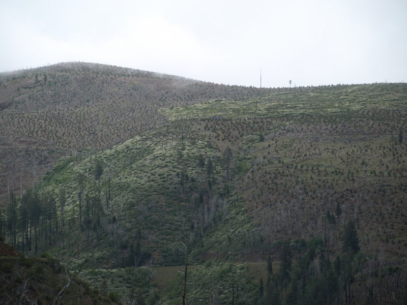
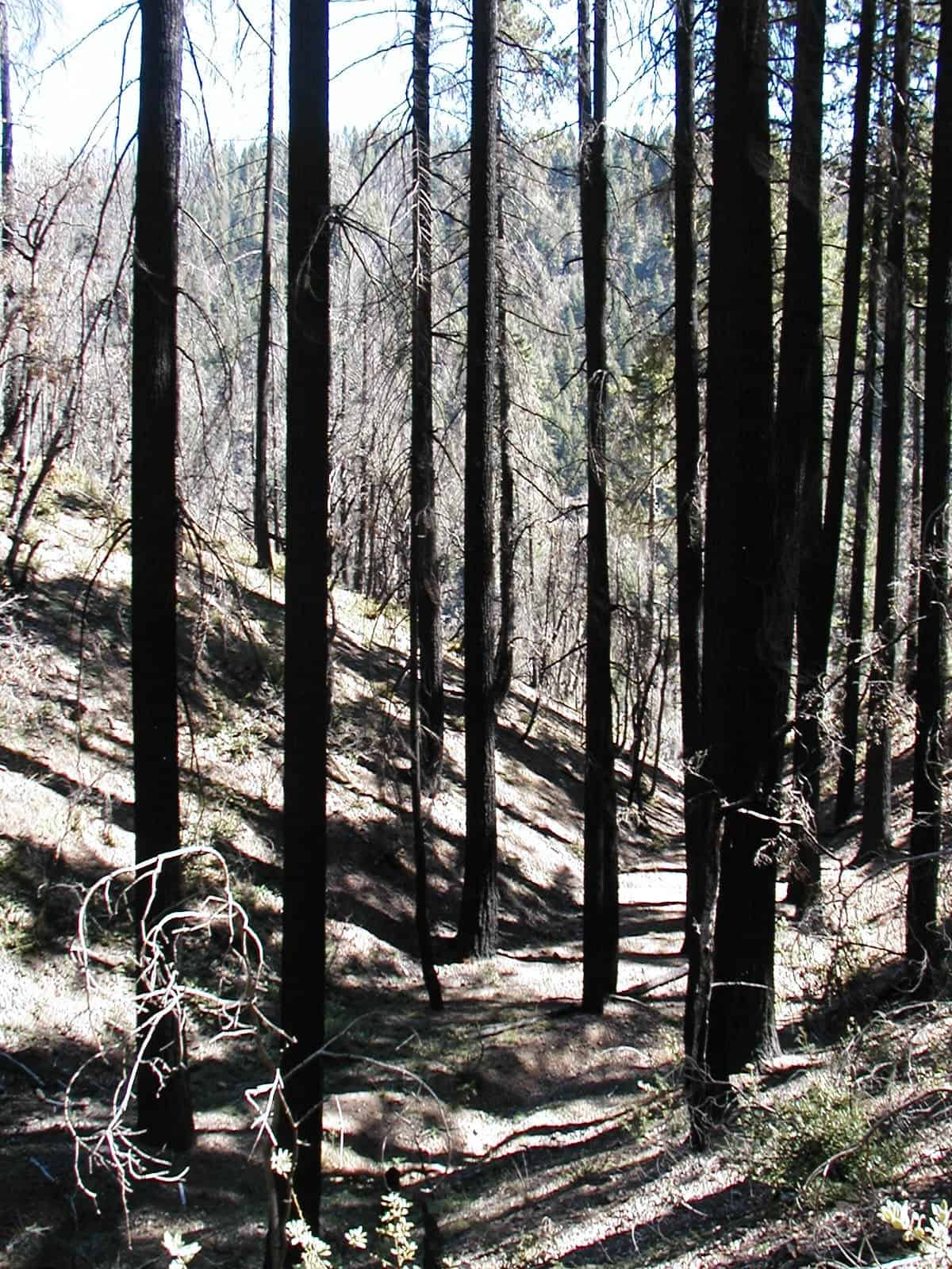
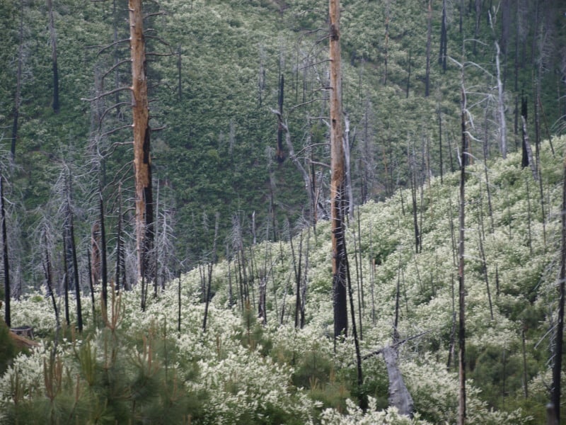
Here is what one of the cutting units looks like today. Choked with deerbrush, with not much in the way of conifers established.

This picture shows the striking contrast of Forest Service, versus private timberlands. You can clearly see the property lines and the section corner. What you cannot see is the accelerated erosion that came off the private lands, impacting the road at the bottom of the picture. Between the deerbrush and the the thick bear clover, conifers have little chance to recover, and a re-burn might be in the future for this patch of Federal land. The upper tract of Federal land seems to have no standing snags left, due to blowdown. The rest of the area seems to be choked with snags that died since harvesting was completed. At least SOME of the fuels for a future wildfire have been significantly reduced.

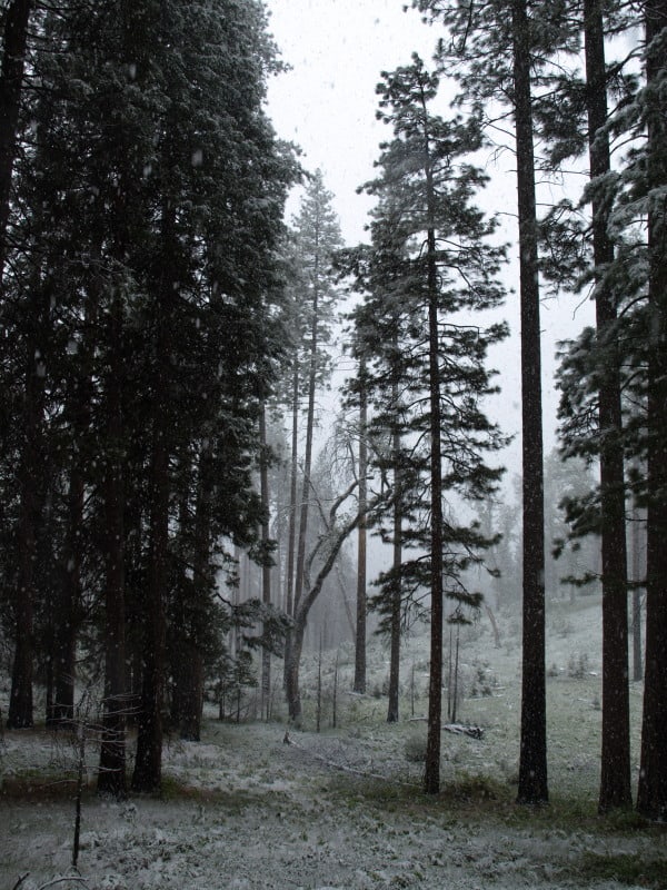
This area has a history of Indian occupation, and the forest still shows it. The bear clover re-grew and covered the bare soil within 6 months. Today, people would be hard-pressed to find ANY logging damage, on this side of the fire area. What really amazed me is that this project has ALREADY suffered a re-burn. The fuels reduction definitely saved the remaining old growth from burning to a crisp. This forest has its resilience back, has a better species composition, and seems ready for a regular program of prescribed fire.

As you can see, the light and the weather didn’t cooperate. I’m sure I will be going back to capture some more images, and to compare them to the photos I took six years ago.

Before and After- Utah Style

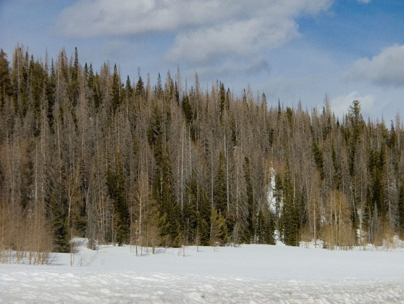
In driving between Cedar City and Bryce Canyon, I was struck at the severe mortality from bark beetles. Here is what I saw the first time. The entire area had severe bark beetle mortality, with surviving aspen trees. I really doubt that any green trees were cut, as the bark beetles were still busily chewing and doing their thing.

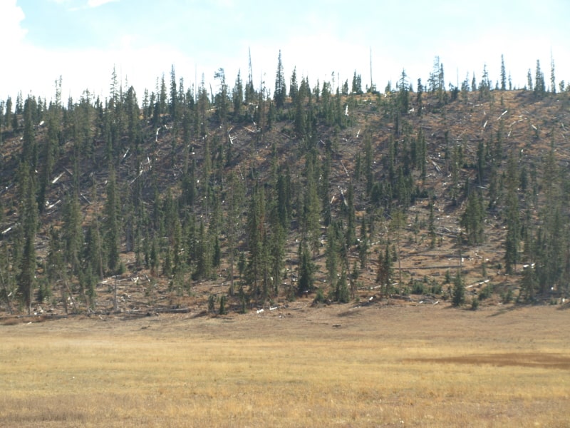
The next time I drove through, I saw where snags had been felled and removed, resulting in this scene. I’m guessing that they skidded the logs over the snow, or used a helicopter. My bet is on over-the-snow skidding. This area is right at the summit, where the intersection to Cedar Breaks is. There are homes on the other side of the ridge. I like what they did here.

www.facebook.com/LarryHarrellFotoware

Sequoia National Forest Plan Set for Updating

The Sequoia suffers from many blockades to sensible forest management and protection. With the only mill within more than 100 miles away, teetering on the brink of bankruptcy, and being hamstrung by unreasonable diameters limits for harvestable timber, as well as having the Giant Sequoia National Monument to manage, they face a very long uphill battle to update their 24 year old Forest Plan.

http://www.recorderonline.com/news/usda-52174-plan-vilsack.html

Also opposing them is the Sierra Club, who continue to portray the Forest Service as loggers of ancient Giant Sequoias. They wish that all 300,000+ acres of the Giant Sequoia National Monument be free of all logging projects, despite there being only about 10,000 acres of already protected Giant Sequoia groves within the Monument. The McNally Fire nearly killed the world’s second largest tree, when it was allowed to burn for weeks. The Sierra Club is quite happy to let their followers think that the Forest Service will cut the sequoias down, and that clearcuts and the cutting  of big trees will happen. The Sierra Club wants the Monument to be “un-managed”, just like the adjacent Sequoia National Park. They also don’t realize that the Park Service doesn’t follow the same rules on prescribed fires that the Forest Service does. You cannot solely use prescribed fires to manage the fuels build-ups of 80 years, on hundreds of thousands of acres. Besides, the California Board of Air Resources don’t have enough burn days, when prescribed fires would be “in prescription”. The Park Service is well known for losing their management fires, which can be set during high temperatures and dry conditions.

This may be one of the most contentious new Forest Plans under the new Planning Rule. I wonder how much it will change when the only lumber mill in southern California goes bankrupt.

Biscuit “Scenic” Pictures

This is an example of a “protected” nesting site for a northern spotted owl. It was never logged and will not be habitat for many decades, especially if a reburn occurs. It sure doesn’t look “natural and beneficial”, to me, OR the owls and goshawks.

Here are the kind of snags (the large orange-marked one) that were selected to be “saved”, within Biscuit cutting units. Of course, only 4% of the 500,000 acres of the Biscuit were salvaged, so there certainly is no lack of snags in the huge burn.

Here is a cutting unit where mortality was close to 100%, in unlogged old growth. Instead of thinning a green stand, we ended up “thinning” snags.

Here is some erosion, in a small gully. I wonder what the “cumulative impacts” of hundreds of similar gullies have upon salmon populations, and other aquatic organisms. Surely, some of these gullies experienced accelerated erosion in the 5+ years since I took this picture.

www.facebook.com/LarryHarrellFotoware

CFLR Project News- Amador/Calaveras

Here is the blog for the local (to me) project. It is unclear how much the Pacific Rivers decision will affect it. I’m sure they will find ways to spend the money but, I doubt any logs will get sold. It is awful hard to make a log truck load out of  10 to 16 foot long small logs. The money won’t go very far if it only results in service contracts. This is their stated mission: “The Amador-Calaveras Consensus Group is a community-based organization that works to create fire-safe communities, healthy forests and watersheds, and sustainable local economies.”

http://acconsensus.wordpress.com/

New study challenges forest restoration and fire management in western dry forests

(Below is a press release from the researchers. A copy of the study is available here. – mk)

New research shows that western dry forests were not uniform, open forests, as commonly thought, before widespread logging and grazing, but included both dense and open forests, as well as large high-intensity fires previously considered rare in these forests. The study used detailed analysis of records from land surveys, conducted in the late-1800s, to reconstruct forest structure over very large dry-forest landscapes, often dominated by ponderosa pine forests. The area analyzed included about 4.1 million acres on the Mogollon Plateau and Black Mesa in northern Arizona, in the Blue Mountains in northeastern Oregon, and in the Colorado Front Range.

The reconstructions, which are based on about 13,000 first-hand descriptions of forests from early land surveyors along section-lines, supplemented by data for about 28,000 trees, do not support the common idea that dry forests historically consisted of uniform park-like stands of large, old trees. Previous studies that found this were hampered by the limitations inherent in tree-ring reconstructions from small, isolated field plots that may be unrepresentative of larger landscapes.

“The land surveys provide us with an unprecedented spatially extensive and detailed view of these dry-forest landscapes before widespread alteration” said Dr. William Baker, a co-author of the study and a professor in the Program in Ecology at the University of Wyoming. “And, what we see from this is that these forests were highly variable, with dense areas, open areas, recently burned areas, young forests, and areas of old-growth forests, often in a complex mosaic.”

The study also does not support the idea that frequent low-intensity fires historically prevented high-intensity fires in dry forests.

“Moderate- and high-severity fires were much more common in ponderosa pine and other dry forests than previously believed ” said Mark Williams, senior author of the study and recent PhD graduate of the University of Wyoming’s Program in Ecology.

“While higher-severity fires have been documented in at least parts of the Front Range of Colorado, they were not believed to play a major role in the historical dynamics of southwestern dry forests .”

Some large modern wildfires, such as Arizona’s Rodeo-Chediski fire of 2002 and the Wallow fire of 2011 that have been commonly perceived as unnatural or catastrophic fires actually were similar to fires that occurred historically in these dry forests.

The findings suggest that national programs that seek to uniformly reduce the density of these forests and lower the intensity of fires will not restore these forests, but instead alter them further, with negative consequences for wildlife. Special-concern species whose habitat includes dense forest patches, such as spotted owls, or whose habitat includes recently burned forests, such as black-backed woodpeckers, are likely to be adversely affected by current fuel-reduction programs.

The findings of the study suggest that if the goal is to perpetuate native fish and wildlife in western dry forests, it is appropriate to restore and manage for variability in forest density and fire intensity, including areas of dense forests and high-intensity fire.

Key findings:

•  Only 23-40% of the study areas fit the common idea that dry forests were open, park-like and composed of large trees.

•  Frequent low-intensity fires did not prevent high-intensity fires, as 38-97% of the study landscapes had evidence of intense fires that killed trees over large areas of dry forests.

•  The rate of higher-severity fires in dry forests over the past few decades is lower than that which occurred historically, regardless of fire suppression impacts.

The study was published online last week in the international scientific journal, Global Ecology and Biogeography. The published article can be accessed online here. The title is: Spatially extensive reconstructions show variable-severity fire and heterogeneous structure in historical western United States dry forests.

The authors are Dr. Mark A. Williams and Dr. William L. Baker, who are scientists in the Program in Ecology and Department of Geography at the University of Wyoming.  Dr. Mark A. Williams is a 2010 PhD graduate, and Dr. William L. Baker is a professor, both in the Program in Ecology and Department of Geography. In Dr. Williams’s PhD, he developed and applied new scientific methods for reconstructing historical structure and fire across large land areas in dry western forests. Dr. Baker teaches and researches fire ecology and landscape ecology at the University of Wyoming and is author of a 2009 book on “Fire Ecology in Rocky Mountain Landscapes.”

Contact Information:
Dr. Mark A. Williams, Program in Ecology and Department of Geography, Dept. 3371, 1000 E. University Ave., University of Wyoming, Laramie, WY 82071. Email: [email protected].

Dr. William L. Baker, Program in Ecology and Department of Geography, Dept. 3371, 1000 E. University Ave., University of Wyoming, Laramie, WY 82071. Phone: 307-766- 2925, Email: [email protected].
Save the “big” trees!

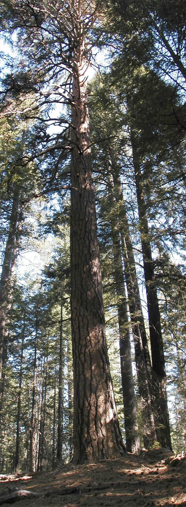
Some people consider a 24″ diameter tree to be “big”. This one transcends “big”. I didn’t measure the diameter or height of this tree but, my estimates are 70″ dbh and 230 feet tall. The Mendocino National Forest has excellent growing conditions, and can grow huge trees faster than most National Forests. This picture, stitched together from three vertical shots, is available free for limited uses. Enjoy!

Warm Lake Fire Study Excerpts- and Science Policy Situations that Shout Watch Out #6 and #7

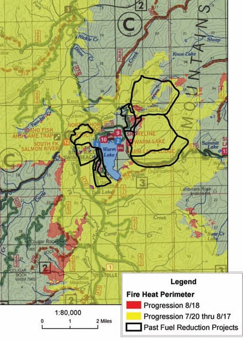
The WISE blog here has some interesting excerpts from this paper by Graham, Jain and Loseke on the Warm Lake Fire. It also has a link to the complete paper. This paper was mentioned yesterday in testimony before the House Agriculture Committee at a Wyoming Field Hearing.

Interestingly, in this blog, Ted Zukowski reasserts the knowledge claim that 150 feet is the “science” of protecting homes. Sorry, Ted, people want to protect communities, not homes, and they want firefighters to work around those communities, as I said on this blog here. Perhaps that should be Science-policy Situation that shouts Watch Out #6 – when advocacy groups assert what “the science” says, and number 7- when anyone claims “the science is settled.”