A nice Forest Service person sent me this video. Worth watching especially if you’re curious about what it means when the news reports tell that the West Fork Fire is in spruce beetle stands.
I rate it two antennae up!
For those of you who aren’t interested in the biology of the insect (but there are very cool shots of them) you can skip to about 12 minutes in. I gave an extra point for the use of the term “inexorable” which I like, but had to subtract it when they used “resiliency” (resilience is a fine noun and I don’t like making up new words unnecessarily.)
Derek might be interested that even the young trees are getting hit as the outbreak is so intense (14:50 or so)
I also liked the Forest Health Mantra shot at 16:00 in.
Here’s the link.
Thanks for posting the video Sharon, I just finished watching it.
The portion of the video that I found to be of most interest, and perhaps most relevant to many of the discussions/debates on this blog, took place at 11:45 and continued to the 14:15 mark.
In that part of the video, Tom Eager a Forest Service entomologist who narrates the entire video, asks the question:
Seems to me that much of what Tom Eager points out above discounts the notion we often hear that 1) these outbreaks are “un-natural” 2) that these outbreaks never occurred in the past and 3) that these outbreaks are destroying the forest.
Matt: I guess you skimmed over the part where he says “we simply don’t know.” Everything that follows is mostly speculation. Personally, I would speculate that the principal disturbance factors for these trees has been fire and people, not bugs. The fact that they “co-evolved” has little or nothing to do with it. The bugs are opportunists with a limited diet — similar to koala bears maybe. That is not the same thing as “symbiosis.” That doesn’t mean that “outbreaks” are “natural” (i.e., “normal”), or that the forests aren’t being “destroyed” (i.e., “most of the trees are being killed”). These conclusions are based entirely on personal value statements and informed speculation, Matt, not facts. The fact is, we simply don’t know.
Matthew
Regarding your conclusion: “Seems to me that much of what Tom Eager points out above discounts the notion we often hear that 1) these outbreaks are “un-natural” 2) that these outbreaks never occurred in the past and 3) that these outbreaks are destroying the forest”
I doubt that you heard items 1 and 2 from a forester that knows anything about beetles. We take courses on these rascals in college.
As to #3, how can you come to the conclusion that these outbreaks are not destroying the forest. The video made the destruction impossible to deny. In addition, you appear to have missed the part where Tom said that ‘Forest Management could have reduced the impact of the spruce beetle devastation in Colorado’ and the part where he said that ‘it would take a very long time for them to come back naturally’
The video made me think about Derek’s “temporal diversity”, which I think might be more “desirable” than the spruce monoculture. And, where does “climate change” enter into this? Is this the time to “wait and see what happens”? I think that has already been decided. I’m pretty sure it is too late to do much about the situation, other than controlled burning on an impossibly massive scale. Letting it burn all at once is also undesirable, as we are seeing on the West Fork Fire.
“Diversity across the landscape” – the forest health mantra: too late for these stands but certainly achievable in other stands, in other timber types, and in other regions. Achievable through management: judicious harvesting, diversified regeneration/reforestation techniques, and prescribed fire. All while serving the economic and social needs of society. A worthy goal but perhaps unreachable in today’s polarized world.
Well said, Mac. In some cases, decisions made 20 years ago has sealed some forest’s ultimate fate. Lake Tahoe is an excellent example of not acting promptly to conditions of extreme mortality. Yes, those dead trees are still there but, they are now horizontal, guaranteeing that soil and erosion damages will occur when it does burn. Of course, massive human presence should accelerate the timeline there. Of course, the Forest Service will be blamed, for not “doing something”. They actually did do “something”, using helicopter salvage projects but, most trees lost commercial value before they could be harvested. One sure thing is that those trees won’t “turn into soil”. Dry conditions preserve those fuels very well. When fires erupt, will safety issues cause more inaction? When eco-groups even litigate biomass usage from post-fire landscapes (Angora Fire), should we expect complete inaction in the face of expected catastrophic wildfires? Sure, firefighters will react when fires erupt but, little is being done before those inevitable fires. Firefighter safety WILL be an issue, and the Angora Fire will seem like a BBQ.
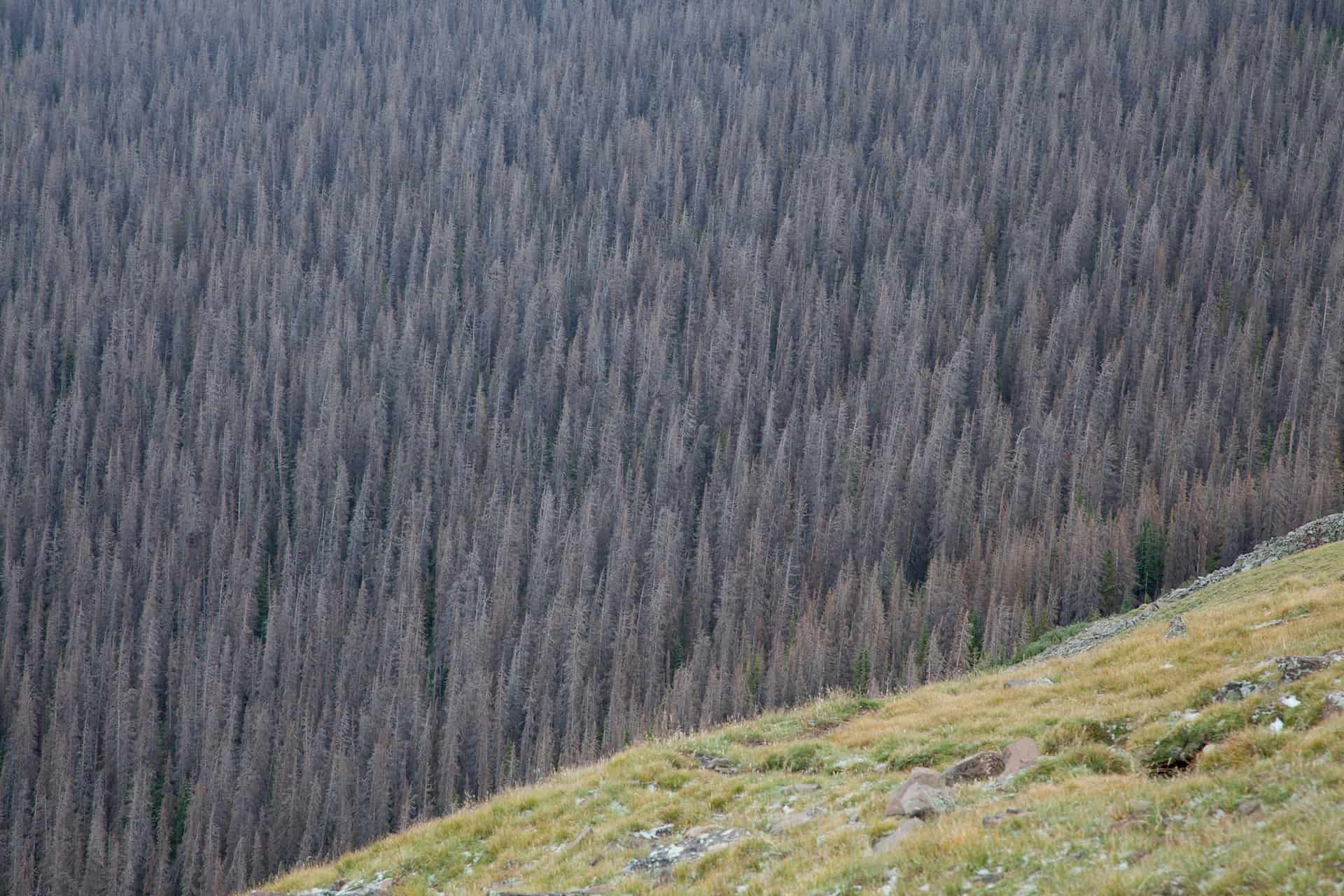
And, BTW, that picture is superb. I’m sure that I would match that perfect composition.
Ya Sharon…nothin breaks my heart more than seeing the “pole sized” trees in regen clearcuts getting killed by the beetle. Stuff from the 60’s. From what I hear, around 5″ dbh is the cutoff…under that and they survive…and I’ve seen plenty of that. However, an EA on the adjacent Gunnison NF I was looking at the other day said they expect that “most” of the 3-4″ trees will also be killed. But hey, at least they logged what would have died anyway so some “I’ve taken it all for granted since I was a little baby boomer” could build their dream home.
As with most inland west forests, only 10% (or was it 15%) of the Rio Grande had been logged in the last 50 years. (Only 3% of the White River NF!). As with most of the West, in “unlogged” parts of the forest like 95% is “mature.” Very little natural early seral…until now. Mother nature wields an awfull big axe. Where it was logged was in “hot pockets” where the terrain was suitable. For example, there might be a pocket of 30,000 acres that were designated for “timber production,” where 25% of the acres were logged. That would be surrounded by 300,000 of beetle killed roadless. It would be interesting to know how these pockets survive the beetle epidemic. There’s no doubt the “shelterwood prep” areas, where 30% was removed, will all die…but the “regen” they prompted will have a better chance of surviving. It would have been interesting if they would have had a chance to log 50% of the pocket…to see how that would have faired.
The EA also stated that regen will be sluggish on the killed forest,as 95% of the cone bearing trees will be dead, and 60% some percent of the present regen will get squashed by the deadfall. The EA also stated that the epidemic will mean that the primary prey of the Lynx, the snowshoe hare, will be, “Significantly less abundant in the future.” The salvage sale would log something like 6000 acres, avoiding damage to existing regen, with planting afterwards. Wouldn’t it be something, if this project, combined with past “surviving” regen, would become a hot spot for snowshoe hare VS. the beetle killed forest. Pure speculation.
And who said this wasn’t “natural” Mathew. It’s said that 60% of Colorado burned in the last half of the 18th century. Was there global warming then? (well, perhaps some as we were coming out of the Little Ice Age). Why do you think there is so much aspen? The endless forest of green we’ve seen across the West for the last 100 years was a product of man, not nature. These epidemics are the best thing for the public to see. The public’s perception of forest policy has more to do with aesthetics than science. ASk any Mad Men…it’s simple images that motivate them. The “pink slime syndrome.” When they see these beetle killed forests, their first thought is “why didn’t we, or why don’t we, use this wood if it was gonna die anyway or burn soon.” Nothing explains a clearcut to the public better than an epidemic or a wildfire. I can’t wait for the spruce beetle to march its way into Aspen Colorado. They’re already doing “patch clearcuts (group selection)” within sight of downtown in order to promote “age diversity.”
It doesn’t have anything to do with “ecosystem health.” WE all know that the first rule of ecology is “the ecosystem can do no harm to itself.” A volcano could cover 250,000 acres with lava, and scientists would still call it a “functioning ecosystem.” The trouble with you enviros, is you have divorced ecosystem health from social health. Ecosystem health makes the public feel good about themselves while thinking of it, but social health is what drives policy. The wildfires in Colorado are certainly good for the health of the ecosytem…but I think there have been a lot of converts in the last few years that say it’s bad for the social well being. I’m gonna guess, that within five years, there’s going to be a thriving timber industry along the Front Range of Colorado. Perhaps the OSB guys who lost out on the 4FRI, could set up shop in Colorado. And Mark Udall will be the guy to invite them.
Jeesh I drone on.
Another thing mentioned in the EIS’s was
Thanks, Derek, for your ramblings! I certainly learned a thing or three.
I especially liked this: “The wildfires in Colorado are certainly good for the health of the ecosy(s)tem…but I think there have been a lot of converts in the last few years that say it’s bad for the social well being.”…. Although I do fear the soils damages from intense wildfire.
Thank you Larry. In one of those old “hot pockets” of timber harvest on the Gunnison NF, the USFS is proposing a salvage timber sale that would crank out 70-100 MMBF. Not bad for a forest that averaged 5 MMBF/year during the “age of aquarius” in the early 2000’s. More in line with the get-out-the-cut days of the 80’s where they produced 35MMBF. The sale proposes to do the final removal cut on units that had received “shelterwood prep” cuts(they’re skipping the 2nd step…since the overstory is dead). Anyone who has seen a “spruce/fir” prep cut 20 years after knows there’s a lot of regeneration in the understory. In 20 years, If you looked at a map of “radio collared Lynx locations,” you just might find a cluster in this salvage sale VS the surrounding roadless. I also gets a feelin the public will be taking their picnic’s here instead of the roadless.
Let’s hope it doesn’t burn first. The West Fork fire has burned through two proposed salvage sales on the adjacent Rio Grande. Those were 50MMBF and 30MMBF sales. Not bad for a forest that produced 3 MMBF in the age of aquarius. One can only speculate on how these hot pockets (I need a better term) would have fared if the beautiful people wouldn’t have stopped forest management for 20 years.
Sharon
Thank you for this wonderful post
This is the best video I have seen regarding spruce beetles and their effects on spruce forests. Eager has obviously done his homework and his field work, and knows how to construct a short video report of his thoughts and findings for a general audience. If I were to argue one point in the presentation, it would be his stated assumption that he is witnessing a “rotation” (while clearly acknowledging there is no information to support that idea), thus leading to his theory of a “symbiotic” relationship between the bugs and the trees. My best guess — based on several decades of personal research and observation — is that current outbreaks may well be unprecedented; at least for the past 12,000 years. Anyone with any contrary evidence?
I tend to agree with you Bob. There was a 250,000 acre outbreak on the White River Forest (Colo.) in the 40’s. I don’t know how much fire suppresion had to do with it. I know that high elevation (10,000 feet)spruce/fir forests don’t like to burn, but in the timber sale I speak of above they listed “overstory stand age” for the individual units. In an area of roughly 20,000 acres, there were three distinct age groups, 50 years apart. But the youngest was 180 years old…I’m not aware there was fire suppresion 100 years ago. Of course, this is in an area of timber harvest, that’s surrounded by roadless, and we know it’s roadless because the timber wasn’t worth cutting (LOL), so who knows what the fire history is in the adjacent area. The one thing I do know…is the amount of “mature forests” is also most likely “unprecedented” for the last 12,000 years.
Derek: Here is a possible answer to the varying age groups, from Leiberg’s 1899 report on SW Oregon forests (p. 277):
“The largest burns directly chargeable to the Indian occupancy are in Ts. 30 and 31 S., Rs. 8 and 9 E. In addition to being the largest, they are likewise the most ancient. The burns cover upward of 60,000 acres, all but 1,000 or 1,100 acres being in a solid block. This tract appears to have been systematically burned by the Indians during the past three centuries [ca. 1600 to 1855]. Remains of three forests are distinctly traceable in the charred fragments of timber which here and there litter the ground.”
Leiberg includes a lot of maps, photographs, tables, and field observations and measurements in his report, and the majority of his observations appear very reliable. A partial reason for his reliability is that he was able to observe and communicate with Klamath Indians that were still practicing, or could recall, traditional uses of fire in that region.
Bob, could you convert township and range to towns, drainages, or highways we might be familiar with?
Sure! This is a 90,000+-acre square block (12 miles x 12 miles) in the eastern Cascades, about 10 miles east of Crater Lake, bordered on the west by Highway 97, north of the town of Klamath Falls and north of the town of Chiloquin about 10 miles. Mostly lodgepole country with a lot of marsh.
Back in 1993, I worked on the Lone Pine Fire Salvage project, with some of the work being done over the snow. My loggers did very well in going the extra mile to be gentle on the land. I often “wrote them up” when they did excellent work. Somewhere in my old slides are photos of the landscape as work proceeded. Here is a Google Maps view of the same area as it looks now.
https://maps.google.com/maps?hl=en&ll=37.551314,-106.820669&spn=0.02909,0.066047&t=h&z=15
Notice the New Age plantation thinning being done in 20 year old stands. One of my sales was south of the 44 Road. Most of that was harvested with “shears” (cat-mounted “snippers” that required driving to each tree). The rock outcrop in the lower right corner was a photo point back then. I returned to this site in 2007 and took additional pictures, for comparison. At some point, I will run across the old slide, and I will scan it.
On a side note, my dear Grandma was a school teacher in Chiloquin, at one time, maybe in the 40’s.
Ah.. I worked there in the 80’s selecting trees. I recall many mosquitoes.
While wandering around the “digital landscape”, I saw that this project on the Fremont-Winema NF I worked on is nearly completed.
https://maps.google.com/maps?hl=en&ll=42.646579,-121.698571&spn=0.006747,0.016512&t=h&z=17
This view shows what kinds of trees are being harvested and thinned. This particular landing looks like the biomass hasn’t been transported yet but, other landings are pretty clean. Take a look at the surrounding treated forest. These stands are mostly P. pine, with invasive lodgepoles that are very common. Yes, there are diameter limits at about 22″ dbh. As you can see, canopy cover is retained, with fuels properly reduced. The nearby Lone Pine Fire showed people that high intensity wildfires are not good for neglected stands.
I would not call them “invasive” lodgepoles. I would say “with successful adaptation strategies” even “opportunistic” has a bit of a negative air.
Utilizing the Google Maps (or equivalent) always seems to add impact to actual locations. The are 2D and 3D options there, too.
Here is an example of the pre-fire landscape in the West Fork Fire. I’m pretty sure this is Wilderness but, it is an example of thick, unbroken spruce forest that is burning.
https://maps.google.com/maps?hl=en&ll=37.551314,-106.820669&spn=0.02909,0.066047&t=h&z=15
Zooming in shows the subtle mortality, and these images are at least one year old.
Larry, I think you can see the lines for wilderness if you Google Earth this file from Colorado Roadless…
click on google on far right.
The maps of roadless may not have been updated for the Final Rule, but the Google Earth maps were developed for the public comment period and show Wilderness also, which shouldn’t have changed since then.
This is the Link from Hell but it got me there…
http://www.fs.usda.gov/wps/portal/fsinternet/!ut/p/c4/04_SB8K8xLLM9MSSzPy8xBz9CP0os3gjAwhwtDDw9_AI8zPyhQoY6BdkOyoCAGixyPg!/?ss=119930&navtype=BROWSEBYSUBJECT&cid=stelprdb5299419&navid=111000000000000&pnavid=null&position=Not%20Yet%20Determined.Html&ttype=detail&pname=Roadless-%20Colorado%20Roadless%20Rule
or you can go to the Colorado Roadless Rule site here http://www.fs.usda.gov/roadmain/roadless/coloradoroadlessrules
and click on Google Earth under “related links”. It is pretty fun playing with all the overlays..
Here is a link on the Spruce Beetle including references to how forest management can reduce their impact
Dealing with the Spruce Beetle
Here is a real good source on dealing with the Spruce Beetle:
– http://www.uaf.edu/files/ces/publications-db/catalog/anr/PMC-10067.pdf – This reference explains that management to control stand density improves the forest health (tree vigor) making the trees less susceptible to being killed. In addition, it notes that management of tree species diversity in a stand reduces the probability of an outbreak (putting more distance between spruce trees).
Some other quick finds from a google search:
– http://csfs.colostate.edu/pages/spruce-bark-beetle.html
– 1954 Research Pub – http://digitalcommons.usu.edu/cgi/viewcontent.cgi?article=1192&context=barkbeetles