Steve posted about this Pew piece yesterday, so I thought I’d take a closer look. He quoted:
The USFS can better incorporate climate change-ready practices in four ways.
1) Use the best available science.
2) Identify specific climate change-ready management tools.
3) Monitor and adapt to changing conditions.
4) Engaging communities and Tribes.
I think the FS is already doing all those things.. so wondered if Pew had any different views. Let’s look at #1. Use the “best available science.”
New management approaches adopted by the Forest Service should encourage the continual incorporation of sound scientific and climate-informed information, as well as collaboration among the agency, Tribes, governments, and stakeholders in the design and development of new research projects to address identified knowledge gaps.
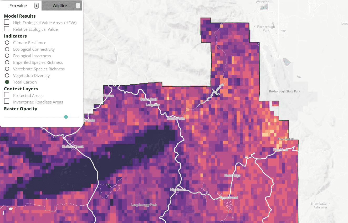
To support this management approach, The Pew Charitable Trusts and Conservation Science Partners (CSP) have released new research that can be used to help inform management decisions with climate change effects in mind, an approach known as climate-ready management. This publicly available data can be viewed with a user-friendly, interactive web map. Designed with input from USFS, the research identifies:
- Areas of relatively high ecological value (HEVAs), such as places with high biodiversity, resilience to climate change, and significant carbon storage. Such prime locations would contribute most to sustaining forest health if managed with conservation as a priority.
- Areas where proactive forest management projects would mitigate the risk of large, severe wildfires, which would help to protect communities, ecologically valuable areas, and the provision of ecosystem services.
Together, this data can improve return on investment by identifying places where the right management or the right activities will provide the greatest set of benefits across multiple considerations.
It seems to me that these data would have been improved by “collaboration among the agency, Tribes, governments, and stakeholders in the design and development of new research projects to address identified knowledge gaps.” Perhaps the HEVA mapping effort is putting the cart before the horse? In fact, it seems like the “right management” and the “right activities” to provide the “greatest set of benefits” is exactly what the forest planning effort is designed to do.. via throwing different approaches, data, observation, and kinds of knowledge around and discussing it. And maybe jointly, as Pew suggests, investigating new lines of research. Perhaps Pew could fund some co-designed, co-produced research in support of each forest’s collaborative groups- so take those less privileged forests (no CFLRP) and provide that capability to them? Similar to the Blue Mountain Forest Partners.. and no need to schedule a plan revision. Pew could help forests develop their own research and monitoring with stakeholders.
**********************
How Useful is This Mapping Exercise? Open Ground-truthing Exercise
I encourage everyone to play with the mapping tool and the indicators for their own area. Here’s the link. Please comment on what you found for your own area. Check out their Protected Areas and IRA “context” layers, if I read them correctly in my area, they look a little odd.
Anyway, you can check out this spring report from Pew on how protecting high value forest in Colorado can secure over $1.2 billion annually in ecosystem services. It sounds like each NF has had such a report developed. Maybe recent revision forests can weigh in on whether there were any new insights derived from this way of looking at the forests.
Pew seems to suffer from a degree of plan-olatry:
Updating these plans will also benefit local communities. NFS lands received a record 168 million visits in 2020, an increase of 18 million from the previous year. These visitors contribute approximately $12.5 billion to the U.S. economy each year and support about 154,000 full- and part-time jobs. But this growth in visits also carries challenges, particularly for the wildlife that live in these places. Revising forest plans can help balance where and when tourism and recreation activities are occurring and ensure that infrastructure, such as functional trailhead facilities, supports human visitors and healthy wildlife habitat.
********************
The rest of the recommendations sound like things the FS is already doing..
2) Identify specific climate change-ready management tools.
Using the best available science, the Forest Service should identify specific strategies to help ecosystems and species resist or adapt to the impacts of climate change and related stressors. Such strategies include:
- Directing managers to prioritize HEVAs—after considering other important social and economic considerations—for strong conservation-oriented management. (not to speak of Tribes, resource professionals, and community involvement)
- Promoting connectivity by retaining or restoring migration corridors for species such as mule deer. (the FS works with state wildlife agencies on that)
- Replacing or removing culverts to allow aquatic species to move throughout streams.(hydrologists and fish bios do this regularly)
- Restoring forests to their historic mix of young, mature, and old forest types where today’s conditions differ. (NRV, but with litigation from some ENGOs when it involves tree-cutting)
3) Monitor and adapt to changing conditions.
To understand the impact of management choices and trends of ecological conditions, the agency should develop more robust monitoring policies that regularly measure key indicators, such as annual rainfall and population of key species. Monitoring is critical and when science indicates a needed change, the USFS must pivot to incorporate a new management direction in a timely manner. Updated forest plans can serve as the starting point for this adaptive management approach.
(Like I said above, Pew could fund this by helping stakeholders ( a la Blue Mountain Forest Partners) develop research and monitoring; the adaptation by the FS can occur organically with that jointly developed information.)
4) Engaging communities and Tribes.
During the development of management plans, project design, and monitoring programs, the USFS must reflect the needs and desires of communities and Tribes that have a connection to national forests. Such meaningful engagement at every step of these processes will increase the quality and durability of the results.
(I think the FS already does this.. but communities and Tribes can disagree among themselves and with each other. Pew could model this by with involving communities and Tribes in developing ideas and measures for areas they want specially protected perhaps for HEVA 2.0.)
*************************************