Rim Fire Images

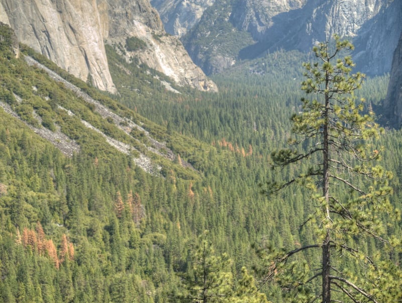
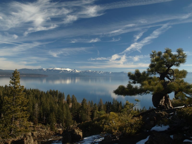
The media does like to sensationalize events like the Rim Fire, often implying that the lands have been “destroyed”. The Rim Fire is so huge and burned across so many differing kinds of vegetation that you cannot summarize too much. Even my own “sampling” from the access roads doesn’t cover very much of the impacts and effects of a 250,000 acre wildfire.

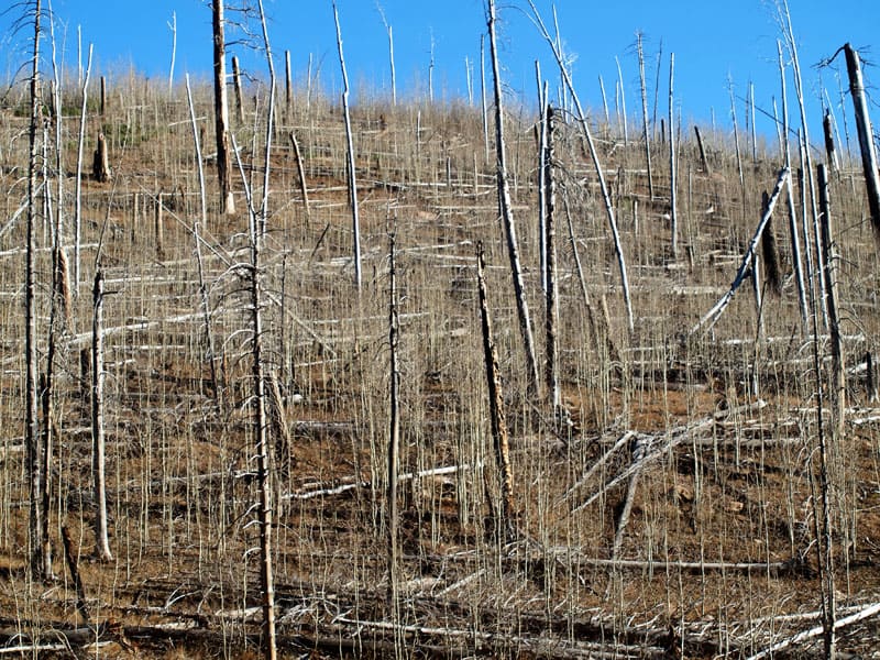
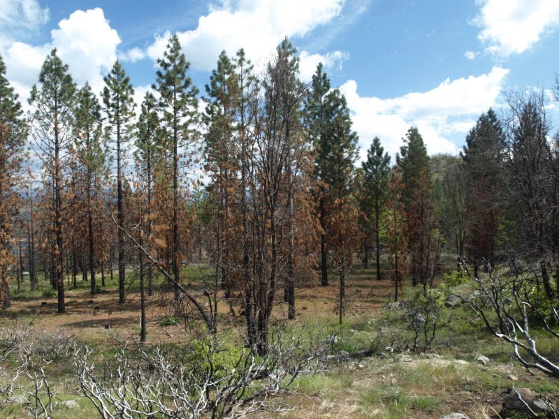
Much of the wildfire burned in plantations generated from previous wildfires. Here is an example of one of those plantations that wasn’t thinned. I can see why it wasn’t but, maybe a “pre-commercial thinning” kind of task could have been included into one of the other commercial plantation thinning projects that I worked on, back in 2000.

P9206850-web

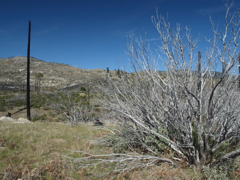
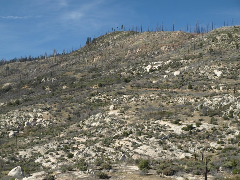
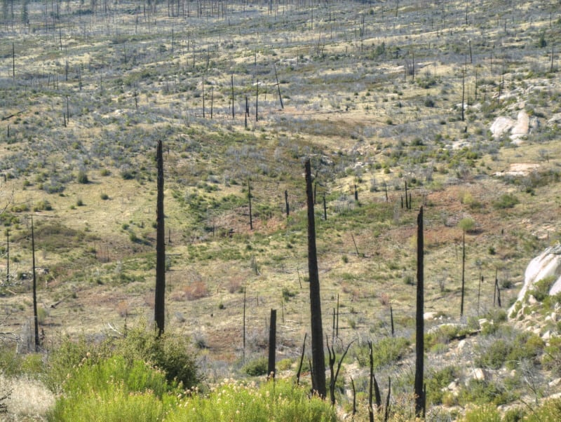
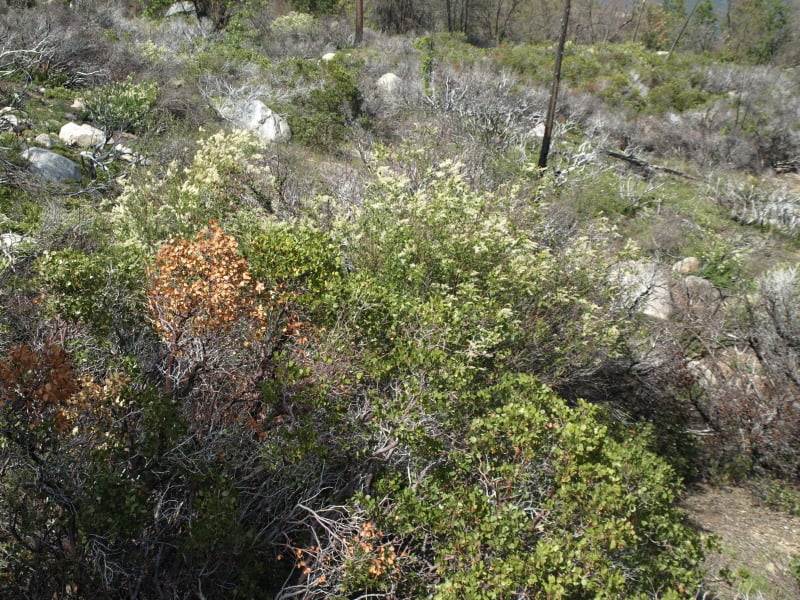
In the same area were blocks of land that were left for “Mother Nature”, after the early 70’s Granite Fire. Here is what a 40 year old brushfield looks like. Those blocks are choked with deer brush, whitethorn and manzanita, with very few conifers, and fewer oaks than the “natural stands” (as they called the unburned portions).

P9206847-web

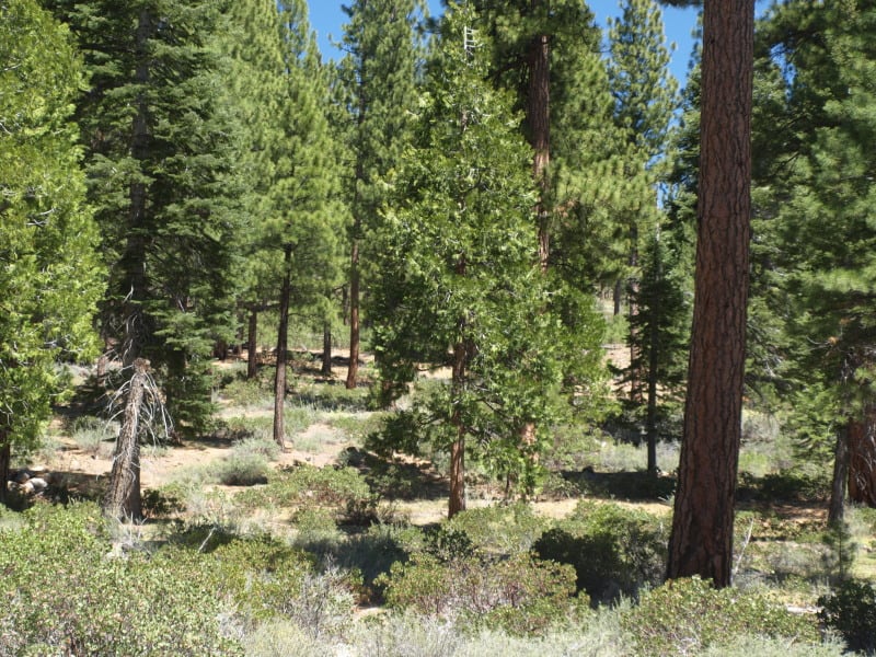
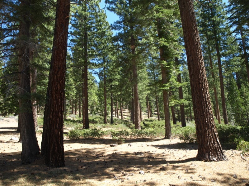
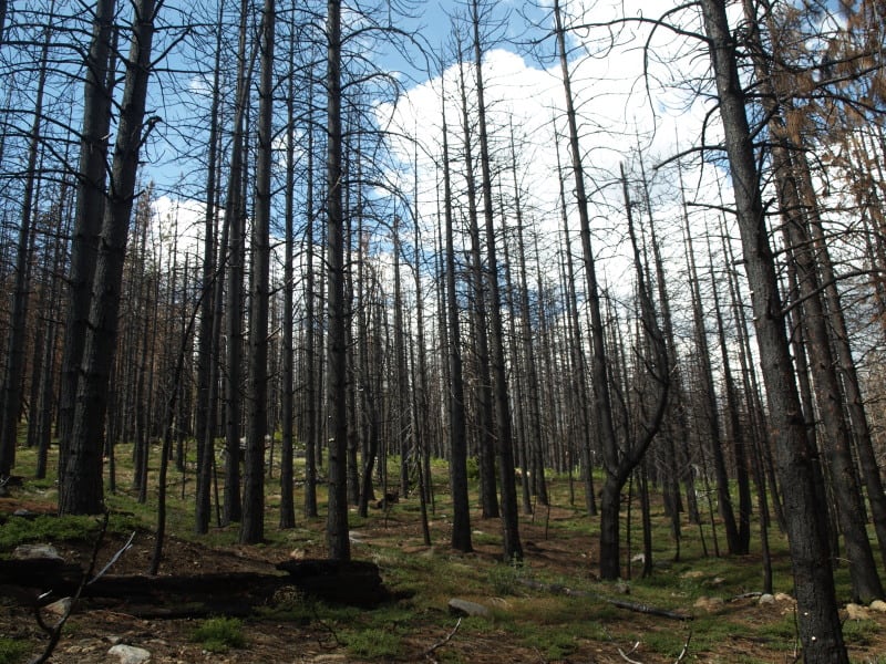
As you can see, sometimes there is a fine line between a total plantation loss and one that has survived a wildfire. This is one of the thinned plantations, near Cherry Lake.

P9206842-web

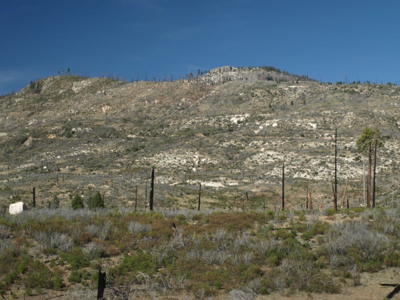
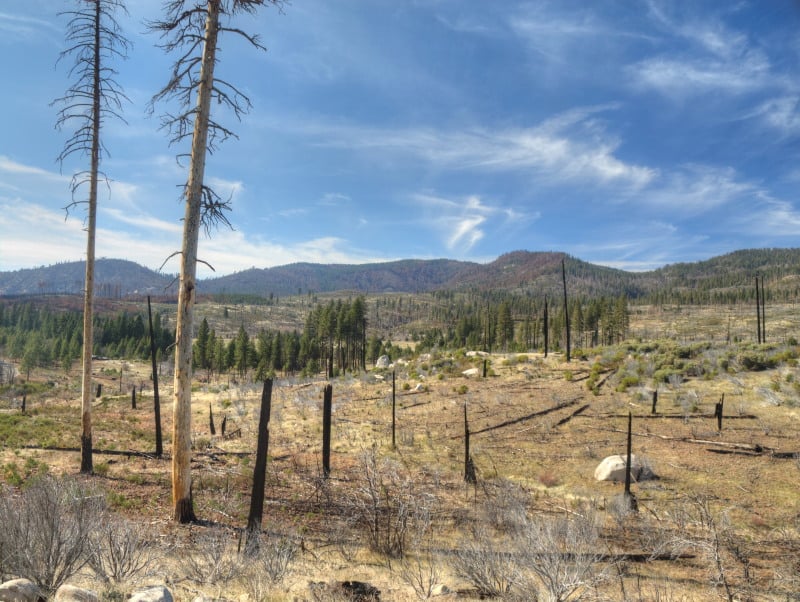
Here is another example of an “old growth” brushfield. While this one didn’t burn much, there are many examples of them burning at moderate to high intensities. Looking at Google Maps, I can find examples where the flames from the brushfields were pushed into the thinned plantations. The Forest Service should be treating those old brushfields with prescribed fire, instead of “whatever happens”.

P9206833-web

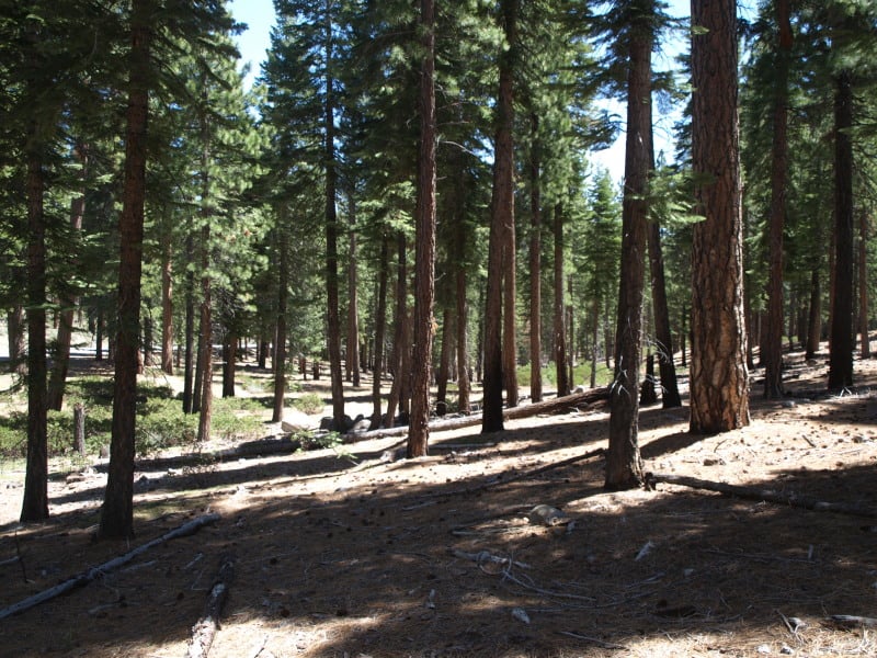
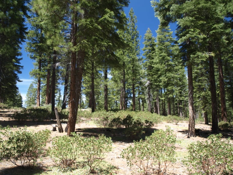
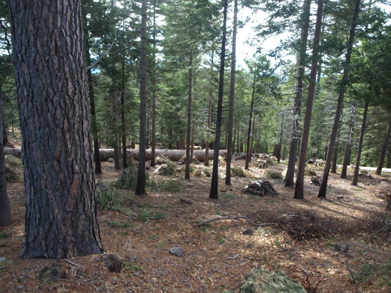
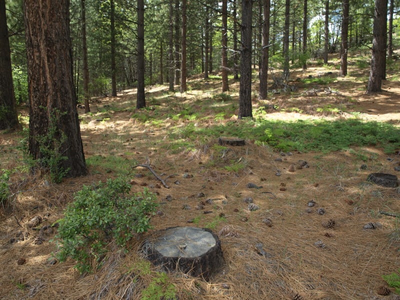
This unburned stand, within the fire perimeter, is a good example of the work we did back in 2000. I don’t really know of any other reason why this large patch, near Cherry Lake, didn’t burn

P9206819-web

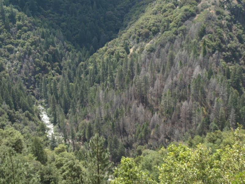
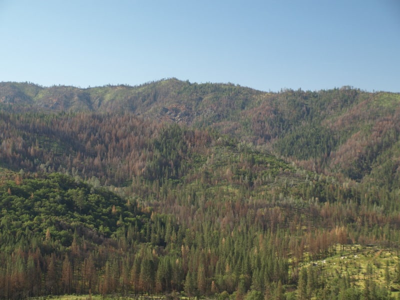
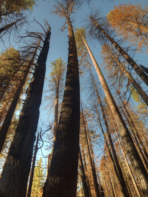
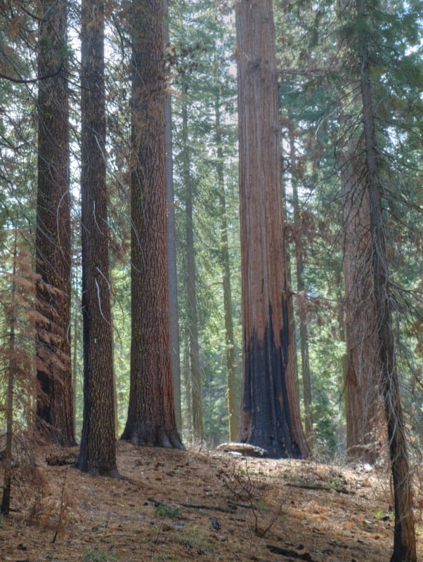
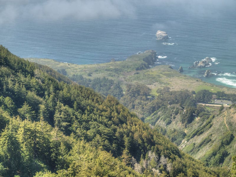
The Clavey River, long-cherished by the local eco-community, acted like a conduit for the Rim Fire, as it burned so many acres in just one day. However, you can see that the intensity and damage is rather minimal. There is a fork in the river, down there, and the main fork of the fire went up that way, finding more conifers to burn. (It also found the big block of Sierra Pacific Industries lands.) I found it very interesting that the isolated pockets of Douglas-firs had very high mortality, but only a low-to-moderate intensity.P9206804-web

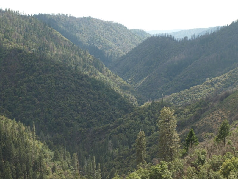
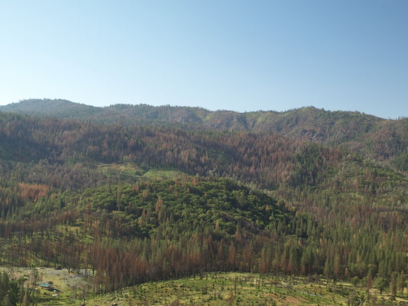
Here is one of those pockets, alongside the Clavey River. In the past, this kind of pocket would be thrown into a large helicopter salvage project.

P9206800-web

Service Contract Re-visited

In my last adventure, I decided to pass through an area of the Tahoe National Forest, where I worked in 1996 and 1997. During that time, I worked on fire salvage, blowdown salvage, insect salvage and roadside hazard tree projects. There was also this Service Contract, which reduced fuels without cutting trees over 9.9″ dbh. The logger had three varied types of cutting machines, each of them with their strengths and limitations. He was a crusty old guy, who didn’t like the Federal “oversight” of his work.

P9306380-web

I usually liked to change these loggers’ perception of what inspectors do. He wasn’t used to getting “written up” for doing good work but, he was still quite wary of me. I once caught him damaging the bark of a leave tree with his machine, then getting off it, and applying some dirt to the wound (to hide it). As he was getting back to his seat, he saw me. I gave him the “naughty, naughty” hand signal, and walked over there. I waited to see how he would react to getting caught. Surprisingly, he kind of hung his head, and was quiet, for once. So, I told him that there is an acceptable level of “damage” in this kind of work and he wasn’t anywhere near close to it, yet. I think our relationship changed, a little, after that agreement.

P9306391-web

One of the keys to success was the ability to do a cool prescribed burn. All too often, fuels are still too thick and the burn is a bit hotter than the residual trees can stand. In this case, the firefighters did well in achieving a nice, cool and effective burn. On the west-facing slopes, the brush has grown back, somewhat. That is to be expected, and will continue, until it is shaded out.

P9306396-web

As far as resilience to fire and drought, it is pretty clear that the spacing is very good. The brush looks like it can be burned safely, on a regular basis. The pines also seem to be quite healthy and vigorous. Keep in mind, this area along Highway 89, in the eastside pine zone, is in a rainshadow east of the Sierra Nevada Crest. There are some western junipers up on the ridgetop, and the Nevada desert is 15 miles away.

P9306381-web

The Rim Fire Salvage Seems Done

My last expedition included another trip to Yosemite, and the Rim Fire. I DO think that there are enough dead trees for the owls to “enjoy” in their respite from breeding. Then again, maybe this new “Circle of Life” will provide more food, in the form of baby owls, to larger predators?

P9036671-web

You might also notice the ongoing beetle kills, which will increase when spring and summer come into play. This next picture shows the little bit of harvesting that was done along Highway 120. You can see the drainage where the Highway sits, and you can also see how wide the hazard tree units are. The barren area in the foreground is/was chaparral.

P9036665-web

I am glad that the Forest Service “took my advice” about getting the work done before there was any chance to appeal to a more liberal….errr….. higher court. However, is THIS what we want our salvaged wildfires to look like? This area should be ready for re-burn in a few short years. Also, be reminded that two of the plantation salvage projects did not sell, despite the prompt action by the Forest Service. My guess is that SPI was low-balling the Forest Service to get those smaller trees at less than “base rates”. That means that the prices remain the same (rock bottom) but, some of the non-commercial treatments would be dropped. It appears that the Forest Service wasn’t willing to go as low as SPI wanted. So, those perfectly good salvage trees will be left, “for wildlife”, it appears.

Happy Earth Day!

P9193955-web P9193966-web P9193951-web

26 years after “protected” forests burned, in Yosemite National Park, this is what we now have. Chances are, it will burn again, before conifer trees can become established enough to resist the next inevitable wildfire. You might notice that even the manzanita is having trouble surviving. I doubt that John Muir intended this on public lands. This landscape is probably the future of parts of the Rim Fire, within Yosemite National Park.

Update From the Yosemite “Laboratory”

Here is a stitched-together panorama from the Foresta area of Yosemite National Park. I’ll have to pair it up with my historical version, one of these days. Restoration processes seem to be minimal, as re-burns continue to ravage the landscape, killing more old growth forests and eliminating more seed sources. Even the brush is dying off, due to a lack of organic matter in some of those granitic soils. With the 200-400 year old trees gone, we have to remember that these stand replacement fires, in this elevational band of the Sierra Nevada, weren’t very common before the 1800’s.

Foresta-panorama-crop-webYes, it IS important that we learn our lessons from the “Whatever Happens” management style of the Park Service. Indeed, we should really be looking closely at the 40,000+ acres of old growth mortality from the Rim Fire, too! Re-burns could start impacting the Rim Fire area, beginning this fire season.

Yosemite Visit

I recently spent three days in the Yosemite National Park area, shooting each day, in different locations. Yes, I did find a marvelous group of dispersed camping sites (free!) within the Rim Fire perimeter. Of course, they were there before the fire but, those spots still look great. Yes, there are also patches of high-intensity burn along Hardin Flat Road (the old highway) that have been salvage logged, too.

One of the places I went to, inside the park, was a large patch of high-intensity burn, all around Hodgdon Meadow. The campground wasn’t really impacted much by the fire. All around the fringe of the large meadow were green and healthy trees. They should be a good source of seeds, and it looks like most sugar pines had an excellent “cone year”. The problem will be the inevitable re-burns, with heavy fuels from trees like these:

OLYMPUS DIGITAL CAMERA

Yes, there are some tufts of green up there but, will the trees be able to fight off drought and bugs, with damaged cambium? Probably not. Yosemite has become a giant incubation “Motherland” for bark beetles, who don’t stay inside the lines on the map. However, I would recommend Hodgdon Meadow Campground (right near the Highway 120 Entrance Station) for your visit to Yosemite. There is something very primitive to camping under such giant trees (non-Sequoias).

Speaking of Giant Sequoias, I dropped into the Tuolumne Grove, to see how the Rim Fire impacted the area. I knew that firefighters had set up sprinklers, and I could tell by looking at the Google Maps view that there wasn’t much intensity there. This area (pictured below) was about as scorched as much as I could find, along the trails. Certainly, nothing to worry about. I’ll bet there is more insect mortality in the area than fire mortality. I’m sure that some will say they wished it had burned a little more intensely. Most of the grove didn’t burn nearly as well as in this picture.

P9204060_tonemapped-web

I went to Foresta, to view last year’s re-burn and the progress of “recovery” of the Yosemite side. Here are some views of that situation:

P9193965_tonemapped-web

Nine years after the re-burn, and 25 years after the original A-Rock Fire, this area remains desolate. Even brush is having a hard time growing, in soils with very little organic matter. The soils dry out and growth stops, during the hot summers.

P9193947_tonemapped-web

Looking westward, you can see last year’s re-burn, mostly on the Forest Service lands outside the Park. I worked on the original A-Rock salvage project, way back in 1991. I still have some Kodachrome slides from those days, up on that long ridge. The snags in this view probably survived the A-Rock Fire but not the Big Meadow Fire.

Yes, I did go into Yosemite Valley and found some uncrowded hiking along the Merced River.

P9214119_tonemapped-web

I did see some significant pine beetle patches, in Yosemite Valley. It seems like a “normal” level of bark beetles, considering the horrible drought, and all.

P9214227_tonemapped-web

There is a lot more to see over on my Facebook page www.facebook.com/LarryHarrellFotoware

Los Padres National Forest

While on an overnighter in Big Sur, I was amazed at how big some of these sycamores were. Even the old growth redwoods look pretty small, compared to these giant hardwoods. The leaves are about as big as your hand, so there your frame of reference. These trees are actually within the Pfeiffer Big Sur State Park.

OLYMPUS DIGITAL CAMERA

While there are some recreation facilities along Highway 1, they are fee areas. In many of those places, there are wide spots in the road, where it is easy enough to just walk in, without paying the fee. However, “dispersed camping” is not allowed, along the highway, on Forest Service lands. I did some Google Maps researching and found this old road off the State Highway. It was rough and steep but, I somehow found this gem of a spot to camp at, far above the coastline. You can see some drought stress in these forests, as well, with some of those redwood trees a bit yellowish. The oaks are also looking quite ragged, maybe reaching the end of their lifespans.

OLYMPUS DIGITAL CAMERA

After finding this spot, it freed me up to go explore further southward, almost to San Simeon. I wanted to spend more time near Jade Cove but, I really wanted to be back up in camp, before the fog came in. Yes, the sunset was quite nice.

Plaskett-fog-sunset-HDR-web

www.facebook.com/LarryHarrellFotoware

Dry Sierra Winter

I recently drove over California’s Carson Pass and spent a day in the Lake Tahoe Basin. The weather was good, so I decided to save some money and camp out (!) for two nights (and spending $42 for a night in Reno).

My day at Tahoe began encased in ice, as moist and cold air flowed down the canyon I was camping in. I quickly gathered my frozen gear and stuffed it into the car, making my way to Truckee, and precious morning coffee. From there, I drove down Highway 89, which was very familiar to me, as I used to bicycle, hitch hike and drive it, many times a week, when I lived there, in the 80’s. I continued along the west shore of Lake Tahoe, to reach my first planned stop at Eagle Rock. I had last climbed it in the mid 80’s, and I didn’t know there were now two trails to the top. It was still a bit icy on top but the amazing views sure hadn’t changed. Eagle Rock is a post-glacial volcanic plug, where Blackwood Canyon meets Lake Tahoe.

It appears that the bark beetles haven’t yet arrived in Tahoe yet but, they sure are knocking on the door. I did see bug patches in the southern part of the Eldorado. I heard about one landowner who had 42 bug trees on their property.

P9123021-web

I later visited the famous Emerald Bay, and you will see pictures of that in another post.

Along Highway 88, on the Eldorado National Forest, they have this interesting project being worked on, during the winter. I’m guessing that units have to find other ways to spend their timber bucks since litigation has returned diameter limits to the old unreasonable sizes imposed in 2000. It looks like this project is a highway strip, intended to be a quasi-fuelbreak. It does appear that some trees up to 9″ dbh were taken out, for spacing. There are going to be a ton of tiny piles to burn, and the California Air Resources Board has not been kind to the Forest Service in granting waivers on No-Burn days. And, yes, the piles are covered with burnable material that will keep the pile dry, so ignition will be easy.

P9102965-web

Can we start calling these things “Big Thin Lies”? It is what people see, and they think all forests look like these cleanly thinned and piled forests.

Grand Canyon Fire Recovery

This is an interesting picture from the North Rim of Grand Canyon National Park. The fire burned and killed off all the pines but, the underground mass of aspen roots and shoots survived. I wonder how a pine component could “naturally” come back, or, did Indian burning favor old growth pines? Certainly, the higher pine forests of the Kaibab Plateau are overstocked and at risk, today.

OLYMPUS DIGITAL CAMERA