When should national forest old growth be logged?

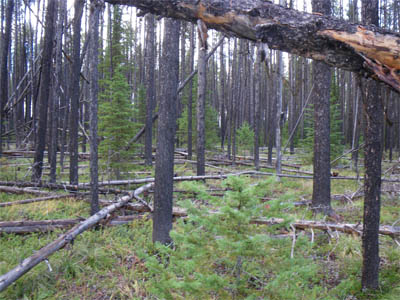
Joyce Kilmer Memorial Forest, North Carolina


Old growth logging projects on national forests are almost sure to generate objections, but most likely they are in an area that was “allocated” to timber production in the forest plan.  (Otherwise timber harvest would have to be for non-timber reasons, and there aren’t many of those to log old growth.)  This thoughtful article examines the issue on the Nantahala-Pisgah National Forest as it continues to develop its forest plan revision.

Williams and other conservationists argue that this stand of older trees and others like it are exceptional and should be conserved. The Forest Service currently says they are not sufficiently exceptional to be conserved.

If a forest plan has been revised under the 2012 Planning Rule, we would know how much old growth is needed for ecological integrity, and old growth could be logged where there is “enough” old growth on a forest based on its natural range of variation (and where not prohibited by the forest plan).  But there are only two plans completed under these requirements.  Both have desired conditions based on what they determined to be the NRV (which is not an easy thing to do because of lack of reliable historical records).  The Flathead also prohibits destruction of old growth characteristics and limits removal of old trees to certain circumstances.  The Francis Marion includes this standard:

S37. Stands meeting the criteria for old growth as defined in the Region 8 old growth Guidance will be identified during project level analyses. Consider the contribution of existing old growth communities to the future network of small and medium-sized areas of old growth conditions including the full diversity of ecosystems across the landscape.

That is similar to the current Nantahala-Pisgah forest plan:

Steverson Moffat, the National Environmental Policy Act planning team leader of the Nantahala National Forest, told CPP that the current Pisgah-Nantahala national forest land and resource management plan requires that the forest designate large, medium and small patches of old growth to form a network that represents landscapes found in the Southern Appalachians that are well dispersed and interconnected.

A big problem with this approach is that this strategic and programmatic “designation” (of a “future network”) would probably occur outside of the forest planning process and maybe out of the public eye (unless the forest plan is amended each time it occurs).  And unless a “network” has been fully described, there is no way to tell whether a particular proposed project area is necessary to comply with the forest plan.  Which leads to that debate on a project-by-project basis, like we have here on the Nantahala-Pisgah.

On a 26-acre stand near Brushy Mountain slated for harvest, the Forest Service said the site meets the minimal operational definition for old growth defined in a Forest Service document known as the Region 8 Old Growth Guide. Even so, the stand won’t be protected since it “is already well-represented and protected in existing old-growth designations.”

How were those “designations” made?  When that occurred, did the public know that it would mean these other areas would be subject to future logging, and did they have an opportunity to object then?

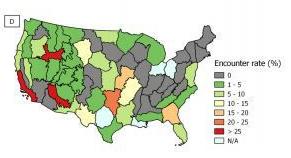
“Only one-half of 1 percent of the forest is old growth in the Southeast,” Buzz Williams of the Chattooga Conservancy told Carolina Public Press. “That is the reason within itself to leave it alone.”

“There is not a need to create (early successional habitat) right on top of old growth.”

The Forest Service disagreed. In an official response to the objections, the Forest Service wrote that while the Forest Service “should provide and restore old growth on the landscape,” this spot and others within the project are either not old growth or unique enough to protect.

I get that old growth should be allowed to “move” across a landscape over time, but that timeframe is even slower than the one for forest planning (note: humor).  There would be little administrative risk in designating which areas would be preserved in a forest plan and which would not (subject to amendments in cases where designated areas are destroyed by natural events).  Better yet, except on national forests that have an abundance of existing old growth (where would this be?), require an ecological reason to log old trees.

This is a debate that should be settled in forest plan revisions not passed on for objections to future projects.  An attorney for the Southern Environmental Law Center agrees:

“The question of protecting old-growth forests is very much a planning-based question — in terms of the big picture of the management of the National Forest and restoring its ecological integrity,” Burnette said.

“In light of broad-based community support for protecting old growth, it’s perplexing that the (Forest Service) would want to rush out ahead of the process during a time when the question of protecting old-growth forests in the future is being considered in the revision of the forest plan.”

Ninth Circuit bails out Flathead timber project

Beaver Creek Project Area – Forest Service, USDA

The Beaver Creek Landscape Restoration Project on the Flathead National Forest was presented here when the district court upheld the decision (Friends of the Wild Swan v. Kehr).  The Ninth Circuit affirmed the district court on May 10 on three claims that the project was inconsistent with the forest plan.  Two of the claims involved road density requirements for grizzly bears where the court found the project would “result in a net gain towards” objectives for one subunit and that roads would be properly reclaimed in another.

Here is the court’s holding on the third claim (emphasis added):

Finally, appellants argue that the Forest Service violated NFMA and NEPA by failing to demonstrate compliance with the Forest Plan’s road density standards for elk habitat in the Beaver Creek Project area. While this argument has significant force, we ultimately conclude that the Forest Service demonstrated compliance with the Forest Plan. The Forest Plan contains a standard that requires “[a]reas with `moist sites'” to be managed “with open road densities that average 1 mile or less per square mile” during the elk use period. Moist sites are defined as sites “found at the heads of drainages, bordering streams or marshy meadows, or occupying moist swales or benches.” The Forest Service admits that the Project’s Environmental Assessment (“EA”) did not expressly provide a specific determination about road density in areas near elk moist sites. Indeed, the Forest Service did not identify specific locations of elk moist sites. Ultimately, we conclude that the Project satisfies the Forest Plan based on the fact that a large portion of the Beaver Creek subunit has an open road density of less than one mile per square mile and the Forest Service’s explanation in the EA that “moist sites occur primarily . . . in roadless and wilderness areas[.]” While the Forest Service could have done a better job demonstrating its compliance with the elk habitat road density standards by mapping moist sites and showing that open road densities near those moist sites will meet the Forest Plan’s standard, we nevertheless conclude that the Forest Service did just enough to comply with the Forest Plan, NFMA, and NEPA.

The lesson here is “don’t try this at home, folks.”  This particular circuit panel (1 Clinton, 1 Bush and 1 Obama via Sarah Palin, if you wondered) went out of its way to construct a rationale for compliance which basically said there was a low probability of noncompliance, or the amount of noncompliance would be small.  NFMA  does not say that projects must be “probably or mostly consistent” with the forest plan.  If the forest plan says certain kinds of areas must meet certain requirements (and the Forest Service wants a successful project), the project documentation must do what the Ninth Circuit said here:  identify where those areas are and show how those requirements will be met in those locations.  (And imagine doing that if you don’t know where the locations are.)

A big timber project gets a big lawsuit

(Clear-cutting in the Tongass Forest, Alaska | by musicwood)


Over the years, the Forest Service has dreamed of being able to do “big gulp” projects, or in contemporary terms, “landscape scale” projects. These essentially amount to doing one EIS for a large area and a long time period before the actual locations and treatments have been determined. There are many of these in progress now across the country, and the approach is being tested (again) in court in Alaska on the Tongass National Forest. This Earthjustice news release includes a link to the complaint (filed May 7), which includes the following:

The Prince of Wales Landscape Level Analysis Project (the Project) in the Tongass National Forest includes extensive old-growth and second-growth logging. The project area is roughly 2.3 million acres. The project area contains about 1.8 million acres of national forest land. The Project authorizes logging of up to 656 million board feet (mmbf) of timber. The U.S. Forest Service (Forest Service) estimates that this logging would occur on over 42,000 acres. The Forest Service estimates about 164 miles of roads associated with the logging would be constructed as part of the Project. The Record of Decision authorizes implementation of the Project to take place over a span of fifteen years.

The Forest Service has authorized this Project using an approach that has been soundly rejected by the courts. The agency authorized the Project before identifying specific locations for logging or road construction. As a result, the FEIS does not adequately describe the direct, indirect, or cumulative impacts of the Project on the human environment or on subsistence uses.

In the 1980’s, the Forest Service lost at least two court decisions for failure to provide adequate site-specific information and analysis in the environmental impact statements (EISs) for Tongass timber sales. City of Tenakee Springs v. Block, 778 F.2d 1402 (9th Cir. 1985); City of Tenakee Springs v. Courtright, No. J86-024-CIV, 1987 WL 90272 (D. Alaska June 26, 1987). In subsequent Tongass timber sale EISs, the Forest Service began including comprehensive, detailed quantitative and qualitative descriptions of the logging and road access plans for each harvest unit proposed for sale. When it did so, the courts upheld the adequacy of the site-specific information. Stein v. Barton, 740 F. Supp. 743, 748-49 (D. Alaska 1990).

The FEIS’s Response to Comments states that “it is not possible to determine all of the direct, indirect, or cumulative impacts to wildlife habitat or connectivity that could result from this project before implementation.” Implementation of a particular part of the project has begun, apparently with no project-specific NEPA planned to determine those effects. Plaintiffs necessarily are challenging the entire project decision for violation of NEPA (and ANILCA) procedures.

There is a related NFMA issue that results from the Tongass forest plan imposing data requirements on projects that are hard to meet at this large scale, making the project inconsistent with the forest plan.  While this involves specific language in the Tongass plan, all forest plans explicitly or implicitly require certain analysis prior to projects.  The bigger the area, the harder that is to do.  And the trend of recent plan revision documents is to put off decisions about things like ecological integrity until project planning.  If successful, this could create an imposing analytical burden for large-scale projects like this one.

They are still going to have to do a site-specific NEPA analysis somewhere. The end result of all this may be that the Forest Service will create another level of planning and NEPA for “timber programs.” Just like the old days, except now added to the existing current plan and project level processes.

Downgrading wildlife in land management plans

Siskiyou Mountains Salmander, Plethodon stormi, (c) 2005 William Flaxington


The Center for Biological Diversity has notified the U. S. Fish and Wildlife Service of its intent to sue for failure to respond to its petition to list the Siskiyou Mountains salamander as a threatened or endangered species. The species is found primarily on BLM lands, but also on the Rogue River-Siskiyou and Klamath National Forests.   Prior listings were avoided largely because of provisions in the Northwest Forest Plan to protect the species:

Conservation groups first petitioned for protection of the salamander under the Endangered Species Act in 2004. To prevent the species’ listing, the Bureau of Land Management (“BLM”) and U.S. Fish and Wildlife Service signed a conservation agreement in 2007, intended to protect habitat for 110 high-priority salamander sites on federal lands in the Applegate River watershed. In 2008 the Fish and Wildlife Service denied protection for the salamander based on this conservation agreement and old-growth forest protections provided by the Northwest Forest Plan.

Here’s what’s changed (from the 2018 listing petition):

The Western Oregon Plan Revision (WOPR) which replaces the Northwest Forest Plan, has the express purpose of substantially increasing logging on BLM lands with the range of the salamander and elsewhere (USBLM 2016, p. 20). The WOPR was originally proposed in 2008 and abandoned by the BLM in 2012 after years of litigation. In August 2016 the BLM issued a final Environmental Impact Statement implementing the WOPR (USBLM 2016).

The WOPR presents a substantial new threat to Siskiyou Mountains salamanders in Oregon because it will allow increased timber harvest in late-successional areas, decrease optimal salamander habitat, increase habitat fragmentation, eliminate requirements to conduct predisturbance surveys in salamander habitat, and allow logging of previously identified known, occupied salamander sites. The WOPR removes protections for salamander populations formerly included in species protection buffers on BLM lands. Although some of the reserves on BLM lands have been enlarged in the WOPR, timber harvest emphasis areas will often be subject to more intensive logging, and logging of known, occupied Siskiyou Mountains salamander sites is allowed.

This demonstrates again the value of including regulatory mechanisms as protective measures in forest plans: they can keep species from being listed under ESA. There is already a pending lawsuit against the new WOPR (now officially called the Resource Management Plans for Western Oregon), and the Forest Service should keep this in mind when it revises its forest plans that are now governed by the Northwest Forest Plan (especially the “survey and manage” requirement).

The trend seems to be in the other direction, however (see also greater sage grouse). And when a species is listed, regulatory mechanisms are needed in forest plans to contribute to their recovery and delisting. Yet the Forest Service is removing such mechanisms from forest plans for grizzly bears, lynx and bull trout (Flathead National Forest), Indiana bats (Daniel Boone National Forest: to “provide flexibility to implement forest management activities”), and black-footed ferrets (Thunder Basin National Grassland:  “greater emphasis on control and active management of prairie dog colonies to address significant concerns related to health, safety, and economic impacts on neighboring landowners”).   Since plant and animal diversity was one of the main reasons for NFMA it shouldn’t be a big surprise to see these kinds of retrograde actions ending up in court.


When Do Old Forest Plans “Need” To Be Revised?


The Circle of Life- Plan Revision Style without the Litigation Loop

Recently I was asked to speak to students at neighboring Colorado College, a liberal arts school in Colorado Springs. They asked me questions about why a neighboring forest was still operating with a 1984 plan and is only now starting plan revision. I agree with Susan Jane Brown that “you can’t live with an outdated plan forever”  comment here. That is true, but where should we be between 15 years, 35 years and forever.  I notice that no ecosystems have unraveled the PSICC with its 1984 plan, that is 35 years old now.  If we think about the 2012 Rule, and that this is now 2019, and relatively few plans have actually finished being revised (Flathead? El Yunque? Francis Marion?), perhaps the plan revision process has gotten so cumbersome that it is even more unlikely that forests will revise every 15 years.  And if we use the “latest science” in project decisions, it’s a bit awkward to be roped into keeping plan decisions for 20-30 years. That was the idea behind the concept of a forest plan as a loose-leaf notebook of the most current decisions,  rather than a process that is so lengthy that conditions change while the process is ongoing.

The Smokey Wire was originally started to have public conversations when the 2012 Rule was being developed, and Andy Stahl presented the KISS rule linked here. Clearly you can make plan revision more or less complicated (the Rule and Directives are a certain level of complicated, and then forests can do their own processes on top of that). Then ultimately case law will come about that may require even more complicated analysis.

The following is only my opinion, so I welcome discussion and others’ views.

What do current NFMA plans do? They develop desired conditions, objectives, standards and guidelines, and management areas.  Desired conditions IMHO tend to be either rainbows and unicorns, or detailed vegetation conditions designed to replicate the past with the idea of “natural range of variation.”  Objectives are always a function of budget and over 15 years tend to change, but they may be useful guidance. Still, wouldn’t it be better for the Forest to sit down with their program of work and budget through time and involve stakeholders?  Management areas- tends to be about making more areas Wilderness,  and as we’ve discussed before, that is essentially a political decision- except for how you manage them in the interim. I’ve been at public meetings about plan revisions in which this is basically all people care about.. who in the recreation sector is allowed to continue doing what where.  Many members of the public could care less about DCs, objectives, standards and guidelines.

If there is a specific reason that the “old plan” isn’t working, you can amendment it surgically and remove that reason.  Transportation planning? New endangered species? Oil and gas leasing decision? Wildland fire use? New standards?

So here are my reasons not to revise, or at least not to get in line early on a new Rule.

  1. There is not a pressing reason. No one is knocking on your door. You don’t have enough $$ in your budget to do what is crying out to be done.
  2. It’s a lot of work and uses much time that could be used for other potentially more useful/important to stakeholder activities (although planning is funded separately, it tends to draw in everyone else to the effort, and many of those dragged in lack enthusiasm for planning.)
  3. The 82 Rule had so much case law behind it that you could be relatively sure of what you were doing.  Do you want to be the forest that is in litigation for years while case law is being made? And do you want to go back and redo that EIS two or more times?
  4. Some Forests used some energy on the 2005 Rule, and found that opening the can of worms of revision (e.g., some groups say you need to analyze an alternative that takes all the cattle off the grassland and get a free roaming herd of bison- will a judge agree that that’s reasonable?) only got (some) stakeholders excited about shutting down activities, and others dismayed by the first groups efforts to shut down their activities (you can think about mountain bikes here). There is lots of emotions released on both sides and to what end? You are most likely to end up somewhere in the middle and the groups may have made some serious enemies of each other in the meantime. If you are basically at some kind of equilibrium, why disrupt it?  What situation would be bad enough to require disruption?
  5. Related to #4, no matter what you do, some people are going to hate it.  If you are a big contentious forest, you will have threats of litigation.  You’ll attract media attention. Of course, part of that is the cost of doing business, but do you have to do it ( a plan)? After all that, will the forest, the employees or the stakeholders be better off in any way?

Forest Planning update – Custer Gallatin releases draft

There might be a few folks who signed onto this list because they wanted to follow the “new century of forest planning.”  Forest plan revisions are finally/still happening.  The Custer Gallatin became I believe the 7th forest plan to reach the draft stage under the 2012 Planning Rule.  (It’s got some wilderness issues!)  The Forest Service revision schedule hasn’t been updated since last June, but here it is. The Chugach National Forest was the 6th draft.  There are a number of draft plans that were expected to be out about now, but I haven’t seen anything.  Two revised plans are complete.  There’s been a noticeable slowdown in forest planning recently: there was only 1 new start in 2018, and 2 in 2017.

Northern Region Regional Forester talks about bikes in recommended wilderness

I’ve excerpted the portion of the Regional Forester’s objection decision on the revised forest plan that addresses this issue, dated August 15, 2018 (p. 46).  It upholds the Flathead Forest Supervisor’s decision to designate recommended wilderness as not suitable for mountain bikes.  I’ve highlighted the language in the regulation that addresses the question about whether the only concern should be physical impacts.  The objection decision also indicates that the decision to recommend wilderness or not took into account existing mountain biking.  It also addresses the alleged bias towards this solution in the Northern Region.  This probably pretty much summarizes the current state of the debate from the Forest Service perspective.

Some objectors requested that bicycle use (mechanized transport) be allowed in recommended wilderness, along with chainsaws (motorized equipment) for the development and maintenance of trails, as long as these uses do not preclude wilderness designation.

The areas recommended as additions to the National Wilderness Preservation System are allocated to management area 1b. This management area has plan direction in the form of desired conditions, standards, guidelines, and suitability to “provide for…management of areas recommended for wilderness designation to protect and maintain the ecological and social characteristics that provide the basis for their suitability for wilderness designation” as required at 36 CFR 219.10(b)(iv).

The suitability component MA1b-SUIT-06 indicates, “Mechanized transport and motorized use are not suitable in recommended wilderness areas” as a constraint on these uses to help achieve desired condition MA1b-DC-1 that states, “Recommended wilderness areas preserve opportunities for inclusion in the National Wilderness Preservation System. The Forest maintains and protects the ecological and social characteristics that provide the basis for wilderness recommendation” (revised plan, p. 9).

As one of the key issues identified from the public scoping comments, the draft EIS analyzed a range of alternatives for managing mechanized transport and motorized use in recommended areas. Alternative C included the suitability component MA1b-SUIT-06 and alternative B did not. The intent of varying the direction was to assess how this plan component would help the Forest achieve the desired conditions for recommended wilderness. After considering the analysis and the public comment on the draft EIS, Forest Supervisor Weber found the MA1b-SUIT-06 component analyzed in alternative C was the appropriate first step in ensuring the protection and maintenance of the areas he decided to recommend in the draft decision (draft ROD p. 19).Therefore, he modified alternative B to include MA1b-SUIT-06.

The intent of suitability component MA1b-SUIT-06 is to not establish or authorize continued uses that would affect the wilderness characteristics of these areas over time (draft ROD pp. 18-19). By deliberate design, the areas being recommended for wilderness in alternative B modified do not currently have significant mechanized transport use occurring. Per public comment on the draft EIS, boundary adjustments were made in the final EIS to remove areas from recommended wilderness that currently allow mechanized transport and over-snow motorized vehicle use (FEIS, pp. 27-28). As there is some over-snow motor vehicle use allowed in one recommended wilderness area (Slippery Bill-Puzzle) (FEIS, section 3.15.3; appendix 8, p. 8-261), Forest Supervisor Weber has endeavored to accommodate this desired recreation opportunity by changing the desired recreation opportunity spectrum in another area of the forest for potential site-specific designation of additional snowmobile areas 2. With these changes between draft and final EIS, the decision maker found that the eight areas recommended represent high-quality areas on the Forest capable of maintaining their unique social and ecological characteristics, while considering the tradeoffs regarding public desires for other uses of the land.

At the resolution meeting, some expressed a concern regarding an “unwritten rule” in the Northern Region that precluded Forest Supervisor Weber from exercising his discretion to choose the appropriate management of recommended wilderness on the Forest. Although previous Northern Region staff drafted guidance for management of recommended wilderness during land management planning, this was prior to the 2012 planning rule and associated implementing directives. I would like to assure objectors and interested parties that I allowed and encouraged Forest Supervisor Weber the discretion to determine management direction for the Forest per the forest-specific conditions, public engagement, law, regulation, policy, and the direction in FSH 1909.12, chapter 70. As a result, per the discretion described in the Agency’s direction at FSH 1909.12 chapter 74.1, option 2, Forest Supervisor Weber did analyze allowing existing uses to continue (DEIS, p. 26). However, as indicated in the draft ROD, he found the best strategy to protect the wilderness characteristics was to eliminate existing uses per chapter 74.1, option 4.

Mountain bikes in existing wilderness (redux)

I try to not get too involved in the wilderness debates (there seem to be enough people there already).  But I follow planning, and this started out to be a post on the status of wilderness recommendations on the Salmon-Challis National Forest, as part of their forest plan revision process, but there was also this:

“Two places in particular really stand out,” he said. “One is the north side of the Pioneer Mountains. The southern half is in the Sawtooth National Forest and is already recommended for wilderness, and the area around Borah Peak in the Lost River Range. Those two areas we find to have exceptional wilderness character, a lot of scenic values, great wildlife habitat, opportunities for solitude and other things that fit the definition of wilderness character. These areas have been managed as wilderness areas since 1979.”

I wanted to find out what happened in 1979, because this suggests a policy of excluding mountain bikes to protect potential wilderness areas outside of Region 1 (the Salmon-Challis is in Region 4).  Instead I found a recent law review article discussing the bigger issue including a couple of questions that have been key in recent posts.  It includes the history of the Forest Service policy:

  • In 1966, the Forest Service wrote formal regulations to implement the Wilderness Act, and defined “mechanical transport” to mean a cart, sled, or other wheeled vehicle that is “powered by a non-living power source.

  • The Forest Service later reversed course by issuing a declaration banning bicycles in 1977…

  • The Forest Service flipped one last time in 1984, after various groups, including the Sierra Club and Wilderness Society, successfully convinced the agency to remove the reference to bicycles in the discretionary 1981 regulation.

There is also a good discussion of the legislative intent behind the term “mechanized transport.”  The author buys into the interpretation of a previous author liked by the Sustainable Trails Coalition, “Legislative history informs the mechanical transport issue and reveals that Congress “meant to prohibit mechanical transport, even if not motorized, that (1) required the installation of infrastructure like roads, rail tracks, or docks, or (2) was large enough to have a significant physical or visual impact on the Wilderness landscape.”  But she adds, “Even if the term “mechanical transport” in the Wilderness Act does not include bicycles as a matter of law, the management agencies have the discretion to ban them, as they explicitly have.”  (This includes BLM and the Park Service.)  She favors local discretion.

Wilderness decisions are acutely emotional and political, and what it feels like we’re witnessing is how emotions and politics shift over time, sometimes in response to technology.  I personally would rather not see mountain bikes in wilderness because it makes wilderness smaller by making more remote areas more full of people, which is not a wilderness value.  But maybe people like me are dying out.  But I’m not convinced that bikes (large numbers over time) don’t have “a significant physical or visible impact” either, on at least most trails.

So I don’t know why the Salmon-Challis potential wilderness areas may have excluded bikes since 1979.  But here is the status of planning for wilderness:

“There are groups out there like The Wilderness Society looking at us as the last best place to designate more wilderness area,” Mark said. “I’ve already got two-thirds of the forest as wilderness. I’ve got local folks, range permittees, outfitter guides and others asking ‘Well Chuck, how much more wilderness do you need?’ That’s a good question and I don’t necessarily have an answer.”

I don’t like the implication that he thinks 2/3 is necessarily a lot (especially if there are going to be more people using wilderness areas someday because they can ride their bikes there).

The Wayne Gretzky approach to fuel reduction

The hockey star is known for saying you have to “skate to where the puck will be.”  That seems to be what the Forest Service is trying to do by putting thinning treatments where fire risk is high, but research again suggests that the hockey analogy doesn’t work in forests.  Maybe it’s because the “field of play” is so much larger and the entity delivering the puck isn’t on your team (and doesn’t play by any rules).  This article plays off of the recent executive order to treat 8.45 million acres of land and cut 4.4 million board feet of timber, “which is about 80 percent more than was cut on U.S. Forest Service lands in 2017.”

“The Hazardous Fuels Reduction Program received a lot of financial investment and resources over the past 15 years,” Barnett told the Missoulian. “We treat quite a lot of landscapes each year. And less than 10 percent of that had even (been) burned by a subsequent fire. So that raises more broad general questions over the efficacy of fuel treatments to change regional fire patterns.”

“Even if federal land management agencies were able to increase their treatments and meet the President’s goal of treating 8.45 million acres, it would still equate to less than 2 percent of all federal lands,” Pohl said. “It is unlikely these locations will be among the hundreds of millions of acres that burn during the effective lifespan of a fuel reduction treatment, typically 10-20 years.”

And if the goal is protecting homes rather than changing regional fire patterns,

“Research shows that home loss is primarily determined by two factors: the vegetation in the immediate area around the home, and the way the home is designed and constructed,”

You could read this to say that if they treated 2% a year for 10-20 years, there would be a higher encounter rate than historically that might be a better justification, but it doesn’t sound like that is the way they are interpreting it.  The map does suggest that southern California and a couple of other places might be looked at differently, and considered a priority for funding.

The author went off script a bit to say that logging is a good strategy to “improve forest health,” but maybe that’s the semantic problem of “logging” vs “thinning.”  I’m also wondering if an order to produce board feet doesn’t tend to favor logging (of bigger trees) over thinning?

Forest Plan Participation 101


Adam Romanowitz, Photographer

Some tips from a participant in the Manti-LaSal forest plan revision process, which includes developing a “conservation alternative” that “will emphasize the long term health of the forest.”

I’m afraid I’m pretty cynical about the payoff from this approach, but I’d be interested in stories from anyone who feels they had some success.  Part of the problem comes from the fact that the Forest Service creates its own structure for the alternatives it develops (such as the choice of management areas, what the different kinds of plan components should look like, how the plan document will be organized), and an outside alternative that doesn’t line up with this would be difficult for the planning team to document and evaluate.  Then of course there is the, “I am the professional” bias that resists outside ideas, the “don’t take away my power” bias that resists any actual obligations (standards) in the plan, and the “no-change” inertia bias that defines “reasonable alternatives” as those that aren’t much different from the current plan.  At best, it seems like there might be a few surprises that the Forest Service actually likes and tries to use.  Tell me I’m wrong.

It looks like Mary is already encountering some bias:

For instance, the Moab Sun News’ article on the public meeting reported that forest service grazing manager Tina Marian said people won’t see a lot of grazing changes in the new plan that aren’t already being implemented on the ground. She shouldn’t predetermine that outcome. The conservation alternative will recommend changes to how grazing is implemented in the forest (which is a part of Moab’s watershed), like reducing the rate of cattle grazing.

It’s not possible to tell where exactly the Manti-LaSal is in the revision process from their website, but there was a comment period on the “Draft Assessment Report” in June of 2017.  I think the best time to influence alternatives is probably when the Forest must “Review relevant information from the assessment and monitoring to identify a preliminary need to change the existing plan and to inform the development  of plan components and other plan content” (36 CFR §219.7(c)(2)(i)).  Any reasonable alternative would have to be traced back to that information, and if there are disagreements at that point it’s not likely that later suggestions would be well received.

In the example above, what did the assessment say about the effects of cattle grazing? The Forest seems to take the position that “historic” grazing was a problem, but “… (C)urrent grazing practices are not having as large an effect on stream stability, as evidenced by the many greenline transects rated as stable in 2016.”  But then there’s this proof of bias in the Assessment (I’m not familiar with these “directives,” and unfortunately, “Shamo” isn’t in the “Literature Cited”):

Livestock grazing has occurred on the Forest for over 150 years and will continue as part of the Forest’s directives to provide a sustained yield and support local communities (Shamo 2014, USFS 2014).

They’ve got some other interesting issues on the Manti-LaSal:

The alternative will ensure that pinyon and juniper communities are not removed on thousands of acres for the purposes of growing grass for cattle and artificial populations of elk.

It will require the forest to remove the non-native mountain goats that are tearing up the rare alpine area above 11,000 feet in the Manti-La Sal Mountains. It will not allow honeybee apiaries, which would devastate native bees.

And that’s where part of the Bears Ears National Monument is/was.  There was a lawsuit on the goats, and there are several on Bears Ears.