Good news for wildlife on two national forests

Here are two different kinds of success stories about restoring wildlife species that have been missing from national forests.


Grizzly bears – Lolo National Forest.

Current efforts on the Lolo National Forest demonstrate one way that forest plans can improve conditions for at-risk species; in this case the plan is contributing to conservation of the federally threatened grizzly bear. Grizzly bears have been sighted in recent years in this part of the Forest, but none are females or considered to be residents.

In 2011, the forest plan was amended to include what is commonly referred to as the Access Amendment (similar amendments also applied to the Kootenai and Idaho Panhandle national forests, prior to the revision of their forest plans).  The amendment established “standards” for motorized road and trail density in grizzly bear management units (BMUs, there is one on the Lolo).  In many cases, the current conditions did not meet these standards, so in the terminology of the 2012 Planning Rule, these would be desired conditions or objectives to be achieved.  In addition, their achievement was assumed in the biological opinion on the effects of the forest plan on grizzly bears prepared by the Fish and Wildlife Service, and failure to achieve them would likely trigger the need to reinitiate consultation on the forest plan (which had happened on the Flathead National Forest).  So there is a little added incentive, but here is what they are doing now.

The Forest has completed the “BMU 22 Compliance Environmental Assessment.”  In it they have proposed to formally close some roads that are effectively closed already and 21 trail miles currently open to motorized use.  In response to public comments, they are also considering an alternative that would close fewer trails, and instead close some roads currently open to motorized use.  In addition to other closures included with some prior vegetation management projects both alternatives “would bring the Forest into compliance with the Forest Plan motorized access management standards for the Cabinet-Yaak grizzly bear recovery zone.”

Brown-headed nuthatch – Mark Twain National Forest

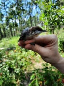
The nuthatch is not at-risk range-wide, but they have not been found in Missouri for at least a century.  The species requires shortleaf pine and oak woodland forests, which have been greatly reduced from historic levels.  The loss of these forests has prompted an ecosystem restoration effort across Missouri, Arkansas and Oklahoma (notably using the Collaborative Forest Landscape Restoration Program).  Restoration of such forests is a desired outcome of the Mark Twain forest plan.  Curiously, there is no mention of the brown-headed nuthatch in the 2005 forest plan, although it does address other species using the same habitat:

Objective 1.4a Improve open woodland conditions on at least 10,500 acres to provide habitat for summer tanager, northern bobwhite, Bachman’s sparrow, and eastern red bat.

The EIS states that the nuthatch is a Management Indicator Species for forest plan monitoring, but that doesn’t seem to be in the plan itself.  Of course, a species that is absent from a national forest would not make a good MIS.  In any case, it looks like there was no interest by the Mark Twain in reestablishing a species that was not present on the forest under that rules applicable to forest planning in 2005.

However, Forest Service, state and university researchers came to the rescue of the species, determining that sufficient woodlands now exist in Missouri to support a population of Brown-headed Nuthatches, that populations in Arkansas were robust enough to supply birds to Missouri, but that nuthatches are not likely to make the return on their own because of the distance and habitat fragmentation.  The Mark Twain National Forest site was chosen for the release of 100 birds because it is the largest area of open pine woodlands in the state.

Under the 2012 Planning Rule, the Forest Service would probably argue that this species is not “known to occur” in the plan area, so the requirement to provide ecological conditions for it (as a species of conservation concern) would not apply.  However, the separate requirement for ecological integrity requires “species composition and diversity” to occur within the natural range of variation.  That should make the Forest Service more proactive in reestablishing species that historically occurred there.  (The forest plan also omits the listed red-cockaded woodpecker, which also uses these habitats, is also absent, but must be conserved and recovered.)

(For a look at how the natural range of variation might work under the 2012 Planning Rule see Table A-2, “Desired conditions for natural community types.”)

Rim Fire, logging and spotted owls

Here is some timely recent research on what happens to spotted owls after a fire, in particular the Rim Fire which comes up often on this blog (thank you, Larry).  That discussion has often dealt with the effects of post-fire salvage logging, such as the discussion here.  This research discusses the effect of the condition of the forest before the fire on its value to owls after the fire.

This is important because of the argument by some that fires are bigger threat to the owls than cutting down trees to reduce fire risk.  I’ve only looked at this overview and the linked abstract, but it seemed like enough to generate some discussion.  In particular, it contrasts the pre-fire management of Yosemite National Park and the adjacent Stanislaus National Forest.

From the abstract:

Spotted owls persisted and nested within the fire perimeter throughout the four post-fire years of our study at rates similar to what we observed in areas of Yosemite that were unaffected by the fire…  Prior to the fire, spotted owls selected for areas of high canopy cover relative to the rest of the landscape; after the fire, even though territory centers shifted substantially from pre-fire locations, pre-fire canopy cover remained a stronger predictor of spotted owl presence than post-fire canopy cover, or any other pre- or post-fire habitat variables we assessed.

So removing canopy cover, which seems to be one of the goals of fuel reduction, would not benefit the owls even if it reduces fire risk, and it would adversely affect them whether there is a fire or not.

From the lead author:

California Spotted Owls can tolerate forest fire, but Schofield cautions that not all fires are created equal. Yosemite’s forests have not been commercially logged since the early 1900s and fire suppression efforts since the 1970s have been kept to a minimum. This results in a forest structure and fire regime that is distinct from what is found outside of the park.

“In Yosemite there is a diversity of forest habitat” explains Schofield, “This means the Rim Fire burned with a diversity of severities creating a range of post-fire habitat for owls to choose from.” The study notes that in portions of the adjacent Stanislaus National Forest that were also burned by the Rim Fire, burn severity was more homogenous likely due to the contrasting logging and fire management regime on the National Forest.


Stanislaus spotted owl plan amendment

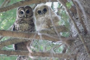
Photo of female and juvenile California spotted owl courtesy of University of California Cooperative Extension (http://ucanr.org/sites/spottedowl/).

We recently looked at the Biological Assessment of Northwest Forests, and the options for proceeding with revising forest plans currently governed by the Northwest Forest Plan. Some of those options involved amendments to existing plans prior to plan revision. I voiced support for amendments that would provide the ecological conditions needed for at-risk species. I thought this might be an example to look at for how that might go.

The Stanislaus National Forest is not in the area covered by this assessment. Its forest plan was originally completed in 1991, but it was amended by the Sierra Nevada Forest Plan Amendment (or Framework) in 2004, which is roughly analogous to the Northwest Forest Plan in that it had its origins in the work done to protect the California spotted owl (it has its own complicated political and legal history). Now the Stanislaus is proposing an amendment for a part of the Forest in conjunction with what it calls the Social and Ecological Resilience Across the Landscape (SERAL) project.

The Forest has identified a need to change the forest plan based on new information about the California spotted owl, as published in 2019 by the Forest Service in the “Conservation Strategy for the California Spotted Owl in the Sierra Nevada.”

In order to fully adopt and implement the management direction described in the Conservation Strategy and increase landscape resiliency as guided by NRV the Stanislaus National Forest’s forest LRMP must be amended. The proposed forest plan amendments would allow the SERAL project’s proposed landscape restoration treatments to best meet the purpose and need of the project and implement the guiding principles of the 2019 California Spotted Owl Conservation Strategy. The proposed amendments include standards and guidelines which will provide some immediate stability for individual owls while allowing forest management the ability to conduct treatments designed to help develop resilient habitat conditions that provide CSO conservation in the long term.

Unfortunately, the CSO Conservation Strategy was apparently written for a narrower purpose than its name implies:

The California spotted owl (Strix occidentalis occidentalis) Conservation Strategy is a strategic framework for active conservation of the California spotted owl on National Forest System lands in the Sierra Nevada.

It appears to be something less than a scientific strategy. By limiting the focus to “active conservation” it has failed to address the central debate about managing spotted owl habitat regarding when active management should even be used. Passive management is one obvious alternative to this amendment that the Forest is going to have to address in its amendment process. But I looked at some of the proposed changes in the forest plan.

The current plan designates spotted owl Protected Activity Centers (PACs) as management areas in the forest plan (which could be changed only by amending the forest plan). This proposed amendment would replace current management areas with guidelines to designate PACs later “in advance of any management activities that would reduce CSO nesting and roosting habitat quality.” The guidelines include criteria for delineating and changing PAC boundaries.

My opinion: This is not a coarse filter management strategy based on vegetation because it depends on actual owl presence based on surveys, or one might call it “condition-based.”  If owl presence is the kind of thing that changes frequently, this may be a reason to not designate permanent management areas at the plan level.  However, this creates the risk of cutting the public out of the part of the process that actually determines the locations for management.  The plan is no longer saying, “here is where we’ll manage for owls,” but instead, “we’ll manage for owls where we think we need to manage for owls, trust us.”  The criteria must be explicit and objective enough to fully evaluate at the plan level, and the decisions about whether and how to apply them at the project level must include the public. Given the importance that surveying would take on, there is no excuse for these being guidelines rather than standards. It seems to me that the certainty of owl protection, and therefore the viability of the species, is going to be reduced.

There are a lot of new plan components in the amendment, and the CSO Conservation Strategy is page-referenced for most of them. That’s how any conservation strategy should be used, so maybe this is a good example of that. Except that it strikes me that this “conservation strategy” may have actually been written as a “drop-in” amendment to be used this way (which makes that kind of cross-referencing a lot easier). This is similar to what would happen if plan amendments were developed that could be later “dropped in” to forest plan revisions. The problem is that if the “conservation strategy” is already a management-influenced document and not a science document, there would still need to be a reference to the actual scientific basis for these conservation recommendations that are being adopted.

Anyway, this project/amendment will be worth watching as it applies the 2012 Planning Rule diversity requirements to California spotted owls. And it may be setting some precedents for what could happen regarding how to plan for management of spotted owl habitat on other national forests.

PERCs Take on Strategies for Eastern Washington Wolves

At one of the WGA (Western Governors’s Assocation) Working Lands meetings, I remember a speaker saying “some people think of ranchers as the enemy, what if we thought of them as partners?”. A number of years ago, I worked with environmental lawyers and others on the regulations around releasing genetically engineered organisms into the environment. It seemed like people who have worked in the polluting chemicals kinds of environmental issues wouldn’t think of Monsanto as a partner. The act of regulating industries should be more or less arms-length (you have to understand their processes, or you can’t be good regulators). But maybe natural resources-related environmental conflicts call for a different, more inclusive, and less adversarial approach. We see that with fisheries management, the sage grouse initiative, and so on.

I was thinking of #EnvironmentWithoutEnemies when I read this summary of a report by PERC. The whole summary and report can be found here. I bolder a few of my favorite statements.

The governor’s letter demonstrates the difficulty of managing the political pressures associated with wolf recovery. Wolf populations have been steadily increasing and are not dispersing across the state as initially expected, creating a high-conflict zone where wolves and ranchers are both heavily concentrated. The weaknesses in the state’s approach to managing this conflict are being magnified, and there is a need to adjust the existing management strategy.

Additionally, as WDFW begins planning for post-recovery, there is an opportunity to examine the current strategy and determine what changes should be made to protect the livelihood of ranchers while ensuring that wolves continue on their path to full recovery and delisting throughout the state.

Ensuring there continues to be a healthy ranching economy is a matter of fairness, economic strength, and environmental sustainability. The counties most affected by the return of wolves have some of the highest unemployment rates in the state, nearly double the state average. Ranchers, range riders, and hunters are also good partners in caring for the land and in funding wildlife stewardship. Successful wolf management that protects the livelihoods of ranchers and farmers while helping wolf populations grow is economically, morally and environmentally responsible.

Based on the history of wolf recovery in Washington and other western states, the best path would combine (1) improved non-lethal management approaches, (2) more rapid lethal removal of problem packs, and (3) expanded compensation programs designed by ranchers and others in the community where conflict is occurring. Some of these tactics are already being used but are not as effective as they could be for a variety of reasons. Additionally, since wolves have not dispersed across the state, the state should delist the species in Eastern Washington, as the federal government has, and focus its recovery efforts on other regions where wolf recovery is proceeding more slowly. The state can also pilot post-recovery strategies in Northeast Washington where the density of the wolf population is at a level that justifies delisting. Those pilot strategies should be developed primarily by the interested parties representing ranchers, conservation groups, and others in the affected communities. The state will always act as a backstop to any agreement, but it should encourage and be guided by a collaborative solution. Doing so would encourage groups to engage cooperatively rather than appealing primarily to the agency or to judges to intervene, which would increase conflict, mistrust and animosity. There is no quick solution, but as the experiences of other western states demonstrate, wolf recovery can be successful while providing ranchers with fairness and adequate levels of protection.

Range of variation webinar (and more)

This is a topic that at least Sharon and I like to debate (though for some reason she didn’t weigh in here).  The Western Environmental Law Center is offering this hour and half webinar on July 17.  As far as I know, it’s open to the public.

PNW Forest Collaboratives Workshop Series Part 3: Historical Range of Variability (HRV): Uses and Various Approaches
 
Range of Variability (ROV) concepts – including Natural (NRV), Historic (HRV), Current (CRV), and Future (FRV) – are frequently used by the US Forest Service to help define land management goals. Nathan Poage, Forest Service Ecologist, joins us to provide an introduction to ROV terminology and examples of how the Malheur, Umatilla, and Wallowa-Whitman National Forests in the Blue Mountains have applied ROV concepts during project planning when addressing key requirements of the Eastside Screens. The discussion will include overviews of tools commonly used to conduct ROV analyses. Q&A will follow the presentation.
This webinar will be on Friday, July 17 from 10-11:30am Pacific Time.
Registration is required for this event. Register today by clicking this link.
Note that it also involves the Eastside Screens.  I don’t think I can make it, but I’d be interested in hearing about it.  I also wanted to point out that this is about how to apply these concepts to projects developed under antiquated forest plans that don’t include the concepts.  It was this kind of thinking that drove development of the requirement to do this instead as part of revising forest plans under the 2012 Planning Rule.  Natural Range of Variation (NRV) embraced by the Planning Rule is a required desired condition for ecosystems, which should not change over time, and therefore should not be redecided for each project.  I’d be interested in knowing how, once ROV is determined for a particular project here, it is then documented and used for future projects in the same ecosystem.
But maybe there would be more interest in this one:
PNW Forest Collaboratives Workshop Series Part 2: Collaborative Administrative and Judicial Review Opportunities
In this follow-up webinar to NEPA 101, WELC attorney Susan Jane Brown will give a presentation on and answer your questions about collaborative administrative and judicial review opportunities, and dig deeper into the administrative review process for the Forest Service, judicial review of agency decisions, and how collaborative groups can engage in these processes.
This webinar will be on Thursday, July 9 from 10-11:30am Pacific Time.
Registration is required for this event. Register today by clicking this link.

Make forest plans great again (for wildlife)


I often point out how the Forest Service is shirking its responsibility to adopt forest plans that provide ecological conditions needed for diversity and viability of at-risk species.  Most recently, I listed some examples from the recently released Rio Grande revised forest plan.  Here is one guideline (there weren’t really any relevant standards):

EPC-G-1: To avoid or minimize adverse effects to listed species and their habitat, management actions should be designed with attention to threatened, endangered, proposed, or candidate species and their habitats. 

This says essentially nothing.

An important purpose of identifying and planning for at-risk species is to reduce the chance that they would need to be listed under the Endangered Species Act.  If this were a private landowner, conservation measures for at-risk (but not yet listed) species would be discretionary.  However, they could choose to sign a Candidate Conservation Agreement with Assurances (CCAA) with the listing agency to adopt conservation measures that would reduce the likelihood of listing in exchange for a commitment that the listing agency would not require anything more if the species did become listed.

Here is an example of one such enhancement of survival permit for Chinook Forest Partners, LLC Candidate Conservation Agreement with Assurances for Fisher in Oregon (until recently, a candidate for listing).  From the NEPA document (CE):

Activities that are covered by this CCAA and the associated section 10(a)(1)(A) permit are on-going and commonly practiced forest land management activities. These include timber harvest and hauling, site preparation and reforestation, and road maintenance and construction. Additionally, there may be some collection of minor forest products, fire suppression, and recreation (including legal hunting and trapping).

Goals and objectives for fisher include: improving our understanding of fisher distribution, densities, and habitat use, especially on non-federal lands where information is more lacking; conserving active fisher den sites to increase the survival of young; increasing public participation and support for fisher recovery and reintroduction by providing long-term assurances; and, monitoring potential future reintroduced fishers as they disperse from their release sites to determine success rates and provide information for improving success rates.

And here is what the private landowner committed to do in the CCAA to achieve those objectives for fisher (note: some are saying that this still isn’t good enough).  Given that the Forest Service is obligated by NFMA to provided ecological conditions for a viable population of at-risk species on national forests, why shouldn’t they be making at least this kind of commitment in their forest plans for public lands?  (This could make them adequate regulatory mechanisms to reduce the likelihood of listing under the ESA criteria.)

  • Specifically, CFP/CFM shall not conduct or authorize any of the activities described in the forest management activities in Section 4 (including but not limited to timber felling, pre-commercial thinning, reforestation, salvage of trees, prescribed burning, and brush control) within 0.25 miles of a den site, because those activities could result in disturbance or harm to denning fishers. CFM shall not authorize helicopter or fixed wing application of herbicide or fertilizer within 0.25 miles of an occupied den site between 15 March and 30 September until CFM is informed by USFWS or its agent the denning female has vacated the den site.
  • Provide protection of denning female fishers by restricting trapping and nuisance animal control activities on enrolled lands within 2.5 miles of den sites.
  • Report to USFWS, and ODFW or mutually agreed upon designated agents, within 48 hours upon finding any potentially occupied den sites or any dead, sick, or captured fishers on enrolled lands.
  • Cover all man-made structures on enrolled lands that pose an entrapment risk to fishers (e.g. large water troughs, old rail cars, or other containers from which fishers cannot escape) or place a device within the structure (e.g., wooden pole to allow fishers to climb out) to prevent mortality of fishers from drowning, starvation or dehydration
  • Where suitable habitat exists and where agreed upon by CFP and USFWS, allow the release of translocated fishers on enrolled lands
  • CFP will seek to have all of its timberlands third party certified to the Sustainable Forestry Initiative® (SFI),
  • CFP will take fisher habitat characteristics into consideration when assessing parcels for transfer or sale into permanent or semi-permanent conservation status.
  • Subject to safety, operability, fire hazard considerations, and salvage of timber following fire, windthrow or other natural or man-caused casualty, CFM will conserve existing and future standing deadwood, and, where available, focus leave tree retention on damaged, decayed, or deformed trees that are likely to provide or promote decay processes and structures beneficial to fisher or their prey.
  • CFM meets or exceeds the Forest Practices Act (FPA) live tree and snag retention, and down woody debris. For clearcut harvests greater than 25 acres, FPA requires that at least 2 snags or 2 green trees 30 feet tall and at least 11 inches DBH, at least 50% are conifer, plus at least 2 down logs or down trees at least 50% of which must be conifers that are at 6 least 6 feet long with a total volume of 10 cubic feet must be retained. CFM commits to retaining a minimum of 3 snags or green trees per acre on clearcuts larger than 25 acres, and these trees/snags will be retained for the life of the CCAA.
  • Trees >32” DBH will be retained the greatest extent possible, provided they do not pose safety hazards
  • CFM will instruct logging contractor to avoid whenever possible, driving machinery over, or otherwise damaging large down woody debris, thereby maintaining the integrity of stumps and logs that may be used by fishers and their prey.
  • CFM will seek to leave down woody debris and other structures important to fishers and their prey distributed throughout the unit instead of piling them into slash piles, will attempt to avoid mechanical damage or disturbance, and will locate skid trails around them where safety and operability considerations permit.
  • For slash piles documented as being used by fishers for denning on the enrolled lands, CFM shall not burn or otherwise mechanically alter such slash piles for a period of 5 years after the last year of known occupancy and use by a denning fisher.
  • CFM will avoid the use of rodenticides on lands enrolled in the permit area.
  • CFM will prohibit lessees from recreational trapping.

Private land conservation easements benefit national forest wildlife

In 2009, the owner of a golf course in Georgia donated a conservation easement to a non-profit land trust.  The easement included roughly 57 acres of primarily bottomland forests and wetlands along the Savannah River that would not be developed.  That land is directly across the river from the Sumter National Forest, 700 feet away.

To obtain a tax deduction for the conservation easement, it has to be “exclusively for conservation purposes” based on one or more of the criteria in the Internal Revenue Code.  They include:

(ii) the protection of a relatively natural habitat of fish, wildlife, or plants, or similar ecosystem,

(iii) the preservation of open space (including farmland and forest land) where such preservation is–

(I) for the scenic enjoyment of the general public, or

(II) pursuant to a clearly delineated Federal, State, or local governmental conservation policy,

and will yield a significant public benefit,

These issues were recently litigated by the IRS for this easement in the 11th Circuit Court of Appeals, which found the donation to be eligible as both habitat (ii) and scenic open space (iii)(I).  IRS Treasury Regulations elaborate on these requirements with regard to habitat by including “natural areas which are included in, or which contribute to, the ecological viability of a local, state, or national park, nature preserve, wildlife refuge, wilderness area, or other similar conservation area.”  However, the court accepted expert testimony from the IRS that the easement did not support the forest’s ecological viability.

There is no mention of testimony from the Forest Service. The 2012 Planning Rule stresses that, planning for ecological integrity must take into account “conditions in the broader landscape that may influence the sustainability of resources and ecosystems within the plan area” (36 CFR §219.8(a)(1)(iii)).  In addition, where a national forest plan area can not maintain a viable population of a species of conservation concern, “the responsible official shall coordinate to the extent practicable with other Federal, State, Tribal, and private land managers having management authority over lands relevant to that population” (36 CFR §219.9(b)(2)(ii))).

The also court determined, regarding open space (iii)(II), that, “There is no qualifying federal, state, or local government conservation policy that applies to this land…” In fact, the Forest Service Open Space Conservation Strategy includes this vision: “Private and public open spaces will complement each other across the landscape to provide ecosystem services, wildlife habitat, recreation opportunities, and sustainable products.”

In this case, private land adjacent to a national forest was conserved, but there is no evidence that the Forest Service was even paying attention.  The Forest Service needs to be more alert to these opportunities that would benefit national forest resources as well as contribute to greater national conservation needs.  Maybe if the Forest Service promoted its conservation policies better, they would facilitate more donated easements and protect more habitat for wildlife species that also use national forests.

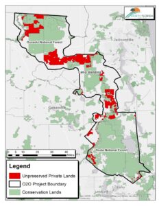
Along somewhat the same lines, conservationists in Florida are striving to conserve the Ocala to Osceola Wildlife Conservation Corridor, which would connect the two national forests of those names across 50 miles of multiple other ownerships (including a military base).  Here is a presentation by the U. S. Natural Resources Conservation Service, which uses funding from the federal Farm Bill Resource Conservation Partnership Program to purchase conservation easements and create wildlife habitat on private lands within the corridor.  (This is the kind of “governmental conservation policy” that should also support federal tax deductions for donated conservation easements.)

The federally endangered red-cockaded woodpecker is an excellent example of a species that the Forest Service needs to coordinate management with others for, and here’s a bit of the success story about that in the O2O Corridor.

A red-cockaded woodpecker (RCW) captured at Camp Blanding in Clay County is evidence that a project led by North Florida Land Trust to preserve land within the Ocala to Osceola (O2O) wildlife corridor is working.  The bird captured at Camp Blanding was the first time this endangered species had moved between one of the national forests and the military installation since they began banding and recording the birds over 25 years ago.

“USDA Forest Service” is listed as a “partner” by NRCS, and the “National Forest Service” by the North Florida Land Trust.  The latter gives me a sense of how deeply the Forest Service has not been involved, and I sure can’t find anything about this effort on either national forest website or using a national search.  It’s too bad the Forest Service isn’t providing more leadership (and getting more of the credit) for conserving its important wildlife resources.

The latest on forest plan revisions (and wildlife)

In the past couple of months the Forest Service has increased its family of forest plans revised under the 2012 Planning Rule to six.  The Chugach and Rio Grande national forests have joined the Francis Marion, Flathead, El Yunque, and Inyo.  The Forest Service revision schedule is over six months old, but the Helena-Lewis and Clark National Forest may be next.

Here’s what looks like a news release from the Rio Grande.

The plan prioritizes the use of active management to foster sustainable and productive use of the forest. Compared to the 1996 plan, this new plan is less prescriptive and emphasizes flexibility and commitments to working with the public. Management direction has been updated for all plant and wildlife species.

This seems to capture the mood of the Forest Service these days.  The only commitments it has ever liked are those they have to do any way, especially if they are check-the-box kinds of procedural commitments like “working with the public.”  In their “update” for wildlife, rather than commit to protecting wildlife as required by NFMA and the Planning Rule, they infuse the plan with discretion.  Here’s some examples of what the Rio Grande seems to feel (based on the best available scientific information) would “provide the ecological conditions necessary to: contribute to the recovery of federally listed threatened and endangered species, conserve proposed and candidate species, and maintain a viable population of each species of conservation concern within the plan area” – which plan components “must” do (36 CFR §219.9(b)).

DC-SCC-2: Structure, composition, and function of coniferous forests, including late seral forests, meet the needs of associated species, including species of conservation concern. (Forestwide)

There is a series of these desired conditions for different ecosystems that all say the same thing, which is “we’ll figure out what these species need later.”  The Planning Rule requirement is for “plan components” to meet the forest plan requirement, not for project-by-project decisions about how to protect at-risk species.  Let’s see if the standards and guidelines add anything …

G-SCC-3: To maintain viability of species of conservation concern, reduce habitat fragmentation and maintain structural conditions of sagebrush ecosystems through design of management activities. Patch sizes should not be less than 5 acres. (Forestwide)

TEPC-G-1: To avoid or minimize adverse effects to listed species and their habitat, management actions should be designed with attention to threatened, endangered, proposed, or candidate species and their habitats. (Forestwide)

Wow.  Apparently any “structural conditions” will do, but they at least appear to concede that there is a minimum patch size needed for some species in sagebrush ecosystems (this is actually the kind of “specific” desired condition the Planning Rule envisioned), but conversely there is not enough science to tell them what is needed for anywhere else.  If the courts say this is good enough, then the Forest Service has essentially excised the diversity requirement for forest plans from NFMA.  (Never mind the question of “how much did the Forest Service spend on forest planning to get THIS?”)  (This is a continuation of a pattern discussed here, and may lead to some of the same kinds of problems under ESA.)

Let’s Talk About Specific CE’s in the Rissien Report: III. Pine Valley Wildlife Habitat Improvement Project

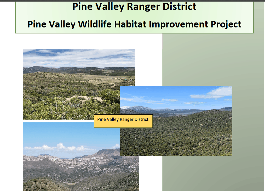
Front page of CE documentation.

This CE is particularly interesting because the scientific basis for treatment is right upfront.

The TNC analysis used a reference baseline concept referred to as Natural Range of Variability (NRV) to look at ecological departure for each ecological system on the district. The current condition of ecological systems was derived using the metric known as Unified Ecological Departure. This is a single measure that integrates concepts of: (1) ecological departure in the traditional sense, (2) high risk vegetation classes, and (3) acceptable amounts of certain unharmful or benign uncharacteristic vegetation classes. Twelve ecological systems on the
district were selected for simulations of likely future conditions under various regimes of active management.
Nine of these systems are brought forward in this analysis (Table 1 and Figure 1). A full breakdown of ecological departure by structural stage for each of the nine systems is available in Appendix 2.

How Many Acres?

320,000 acres are under review for treatments including the 250,000 acres in IRA outside of wilderness areas. Treatments would not occur in areas where vegetation is within a desired NRV or in areas where it is determined that restoration would not be successful.

Note: The TNC analysis maps show where treatments are outside NRV.

Purpose and Need

The purpose and need for the proposed project include:
 Improve and/or maintain wildlife habitat across the Pine Valley Ranger District including habitat for Threatened and Endangered species, Forest sensitive species and Forest focal species and species of concern (California condor, peregrine falcon, northern goshawk, Townsend big-eared bat, spotted bat, elk, mule deer, wild turkey, flicker, grey vireo, broad-tailed humming bird, Virginia’s warbler and brewer’s sparrow).
 Improve and/or maintain stand conditions in mature and old growth pinyon-juniper stands.
 Restore ecosystem composition and/or structure, to reduce the risks of uncharacteristic wildfire effects, and to conditions within the range of variability that would be expected to occur under natural disturbance regimes of the current climatic period (36 CFR 294.13 (b)(1)).

Note: the last bullet is language directly from the 2001 Roadless Rule.

Proposed Action

Based on findings from the Landscape Conservation Forecasting and project design features (Table 2) the Dixie NF proposes the following actions to improve wildlife habitat and select vegetation community conditions on the Pine Valley Ranger District:
1. Trend vegetation communities towards the Natural Range of Variability (NRV) as identified in the TNC Landscape Forecasting report (2014) using the most appropriate tool or suite of tools such as: mastication, harrow, seeding (rangeland drill and/or aerial), chipping, lop and scatter, cut/pile, and prescribed burning.

2. Modify existing conditions to improve wildlife habitat and reduce the threat of uncharacteristic wildfire across the landscape by manipulating vegetation age class and species diversity distribution across the project area.

There are 32 pages of detailed documentation, including design criteria. I didn’t see anything about later site-specific analysis on this one. Page numbers would have been helpful.

Again, here is the plain English of this category: 36 CFR 220.6(e)(6) “Timber stand and/or wildlife habitat improvement activities that do not include the use of herbicides or do not require more than 1 mile of low standard road construction”. This one seems to fit wildlife habitat improvement. Would you agree with the use of the category if they did the same activities in the same places, but had documentation and scoping separate for each site? Would you agree if they took some activities (say PB) and used a different category for PB? Based on this reading I don’t see any timber harvest (not pinyon or juniper).

Let’s go back to the way the news story was written: “Under this administration, there’s really only one goal and that’s measured in board-feet,” Rissien said. Uh..I wouldn’t go looking for board feet in PJ in Region 4, myself.

Here’s another quote: “Rissien and others question how the Forest Service can know that such large projects won’t have detrimental environmental effects. By using a CE, the Forest Service doesn’t have to conduct an environmental study, so the public has no information to know if the forest or wildlife is affected.” I’m just pointing out that the condensed info in these CE’s, that is the three we’ve looked at so far, is equivalent to that required in an EA. From CEQ’s guidance here:

While the regulations do not contain page limits for EA’s, the Council has generally advised agencies to keep the length of EAs to not more than approximately 10-15 pages. Some agencies expressly provide page guidelines (e.g., 10-15 pages in the case of the Army Corps). To avoid undue length, the EA may incorporate by reference background data to support its concise
discussion of the proposal and relevant issues.

What’s Going On With Elk Populations in Your Neighborhood?

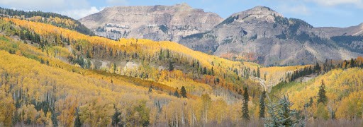
Photo of elk along the Dolores River by Jim Mimiaga.

For awhile I’ve been stockpiling elk stories from different areas. I know that many TSW readers have more direct experiences with elk than I do, so I am posting this hoping that you all will share insights from your part of the country.

Here’s one from High Country News about Northeast Oregon:

Historically, the ungulates of northeastern Oregon spent May through November up in the rugged Blue Mountains, which stretch through the Umatilla National Forest in northeastern Oregon into southeastern Washington. Only during the winter months would they travel to private lands at lower elevations. But over the past 30 years, their seasonal pattern has shifted. Now, ranchers like Green are seeing elk as early as August. Some are even reproducing on private lands, raising calves to become permanent residents. Because the state governs elk populations, landowners cannot simply go out and shoot them. Instead, they must abide by hunting laws and wildlife management objectives, which consider factors such as habitat availability and the animals’ value as game.

Sidenote:
What was interesting to me about this, is that according to the story, the current 125,000 came from an original 15 animals. At a casual glance, this does not seem to fit in with the concept that a population of at least 50 is necessary to prevent extinction, due to problems from inbreeding and genetic drift. Perhaps modelling populations quantitatively missed some goings-on in the genomes of these animals.

I also wondered why elk would want to go back to the mountains if there was plenty to eat, and otherwise favorable conditions, at lower elevations in the summer.

Here’s one from the AP about  New Mexico.

“Migration through our property is intense and is destroying our resources, water and improvements,” he said. “We estimate from past migration up to 1,000 elk.”

While the Game and Fish Department has no compensation program, spokeswoman Tristanna Bickford said Friday the agency tries to work with ranchers ahead of time in hopes of preventing damage by providing fencing to protect crops and hay stacks.

She also said that since 2018, the agency has increased the number of hunting permits by 67% for an area that includes a large swath of land from Taos Junction west to the Rio Chama and beyond.

The weather is believed to play a role in the movement of herds, according to department biologists. Elk tend to hang out in the high country during the summer and during the fall hunting season. If the mountains see heavy snowpack during the winter, they move into lower elevations where there is more private property.

Meanwhile in Colorado, in southern Colorado (not far from northern New Mexico), elk numbers are down, and people are studying why. Populations were reduced due to elk damage, similar to Oregon and New Mexico, but have yet to rebound. From a recent story  (Jan 2020) in the Durango Herald:

The decline has been attributed to high calf mortality: About half the elk calves born in Southwest Colorado die within six months, and an additional 15% die before they reach a year old.

In the absence of one clear cause such as disease – which was ruled out – wildlife officials don’t know what’s driving the deaths.

Weinmeister said CPW is trying to determine why calves have died at high rates in study areas around Montrose and Trinidad. But research has been slow because expandable radio collars put on the calves keep falling off.

“We’re getting a little better,” he said. “But it’s not happening as fast as we want.”

In the meantime, wildlife officials are looking at other possible causes of the decline.

Recently, CPW limited tags for archery hunters. Whereas tags used to be unlimited, Weinmeister now may lower or raise the number of hunting tags based on conditions on the ground.

Weinmeister said the new process reduces the number of elk killed each year by hunters and decreases the number of hunters who disrupt breeding habits.

Each year, about 13,000 hunters trek into the San Juan Mountains to hunt the Hermosa and San Juan units, which are home to an estimated 26,000 elk.

“From the hunters I talk to, most are willing to make that sacrifice,” Weinmeister said.

CPW also is looking for ways to offset the impact of habitat loss. As Colorado’s population grows and development reaches rural areas, elk lose areas to thrive. And on top of that, recreation is encroaching into the last wild places.

What’s happening with elk populations where you live?