Australia and US Wildfire, Similarities and Differences: II. How Much is Due to Anthropogenic Climate Change?

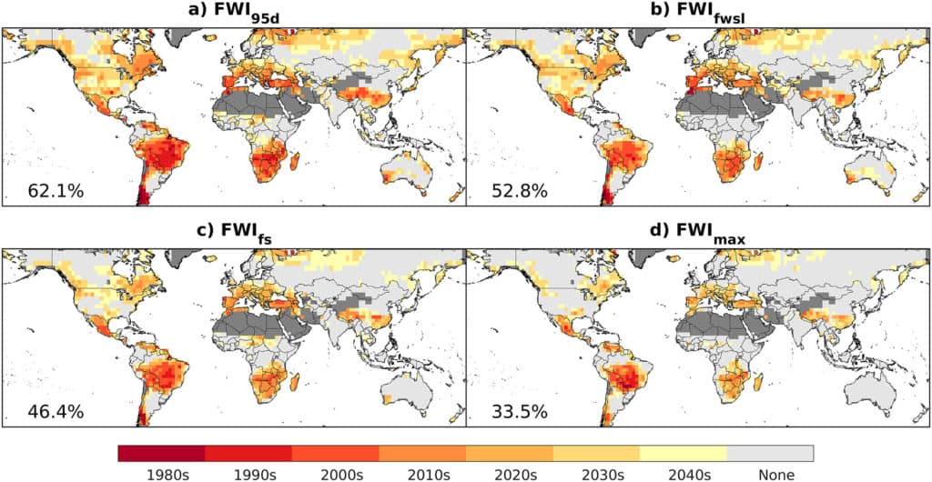
Time of emergence of anthropogenic climate change for (a) the frequency of days exceeding the 95th percentile, (b) the length of the fire weather season, (c) the peak 90‐day average FWI, and (d) annual maximum FWI. Mapped is the 17‐model median date at which the anthropogenic signal emerges based on the change exceeding the standard deviation of the baseline period. Areas of light gray highlight where the signal does not emerge for at least eight models by 2050. Unburnable lands where >80% of the area is water, snow, and ice or barren or sparsely vegetated are shown in dark gray. The percent of burnable land with emergence by 2050 is denoted in the bottom left corner of each map.

The above maps are from this paper by Abatzoglou et al.

Here’s a link to a Science Brief from the University of East Anglia about climate and wildfires. It’s kind of like a scientific rapid response team when an issue comes up, which made it easy to compare the Western US and Australia in terms of ACC.

First, here’s Australia

Climate change also affects fire weather in many other regions, although formal detection does not yet emerge from natural variability. ​Abatzoglou ​et al. (2019) suggest that the anthropogenic climate change signal will be detectable on 33-62% of the burnable land area by 2050. Other global studies agree that the effect of climate change is to increase fire weather and burned area once other factors have been controlled for (e.g. Huang ​et al.​, 2015; Flannigan ​et al.,​ 2013). ​Regional modelling studies corroborate these global findings by projecting how climate change will affect fire weather:…

Australia. Observational data suggest that fire weather extremes are already becoming more frequent and intense (Dowdy, 2018; Head ​et al.​, 2014). However, the divergence between anthropogenic and natural forcing signals is weaker, and more challenging to diagnose, than in other regions due to strong regional and inter-annual variability in the effect of the El Niño–Southern Oscillation on fire weather (Dowdy, 2018; Sharples ​et al.​ , 2016). ​Other important regional weather patterns, such as the Indian Ocean Dipole (IOD) and the Southern Annular Mode (SAM) also contribute to natural variability in fire weather, but their effects are increasingly superimposed on more favourable background fire weather conditions. ​Impacts of anthropogenic climate change on fire weather extremes and fire season length are projected to emerge above natural variability in the 2040s (Abatzoglou​ etal.,​ 2019)

Then here’s the western US:

The impact of anthropogenic climate change on fire weather is emerging above natural variability. ​Jolly et al. (2015) use observational data to show that fire weather seasons have lengthened across ~25% of the Earth’s vegetated surface, resulting in a ~20% increase in global mean fire weather season length. By 2019, models suggest that the impact of anthropogenic climate change on fire weather was detectable outside the range of natural variability in 22% of global burnable land area (Abatzoglou et al., 2019). Regional studies corroborate these global findings by identifying links between climate change and fire weather, including in the following regions with major recent wildfire outbreaks:…

Western US and Canada. Models suggest that the impacts of anthropogenic climate change on fire weather extremes and fire season length emerged in the 2010s (Abatzoglou ​et al.,​ 2019; Williams ​et al​., 2019; Abatzoglou & Williams, 2016). Yoon ​et al​. (2015) similarly predicted the occurrence of extreme fire risk would exceed natural variability in California by 2020. Kirchmeir-Young ​et al​. (2017) found that the 2016 Fort McMurray fires were 1.5 to 6 times more likely due to anthropogenic climate change, compared to natural forcing alone. Westerling ​et al. (2016) found that burned area was >10 times greater in Western US forests in 2003-2012 than in 1973-1982. The 2015 Alaskan wildfires occurred amidst fire weather conditions that were 34-60% more likely due to anthropogenic climate change (Partain ​et al.​, 2016).

Note that the claims are sometimes models and sometimes empirical. For example, the increase in burned area noted by Westerling may have had many reasons besides changes in fire weather.

If we accept the Australian claim at face value (differences due to anthropogenic climate change expected to show up in the 2040’s) then they have some time to get their prescribed burning and other programs up to speed before the additional problems due to ACC surface. In that case, it looks like they have about 20 years before they get the additional problems due to ACC. However, if climate modelers don’t understand the natural cycles or anthropogenic factors well enough, though, as seems likely, conditions could be worse sooner or later than the 2040’s. So the Aussies and us, despite the difference in model predictions both need to get on with prescribed burning, building and community design, improving suppression and all that.

As the authors state:

Nonetheless, wildfire occurrence is moderated by a range of factors including land management practises, land-use change and ignition sources.
Pet travel, flight upgrades, meeting with a conspiracy theorist: How a struggling Oregon county spent federal safety net money

The investigative reporters at the Oregonian continue to uncover some very questionable actions by politicians who want to dramatically increase industrial logging on U.S. Forest Service lands. Previous on this blog, we highlighted the fact that Douglas County spent nearly 1/2 million dollars of Secure Rural Schools money on on a pro-timber industry video and animal trapping. Below are some clips from the latest piece by Rob Davis, which was published this week:

They bought first-class and premium airfare. One paid to travel with his dog. They’ve eaten at banquet award dinners. One expensed a $200 meal at a lounge. They’ve attended governing and timber industry conferences around the country, staying in Jackson Hole, Sunriver, Skamania Lodge and Sun Valley.

These are examples of how Douglas County commissioners spent $43,000 in federal money meant to help their struggling county over the past five years. The trips were underwritten by the Secure Rural Schools program, which pays jurisdictions like Douglas County that suffered financially after endangered species listings curtailed federal logging.

The money was supposed to be spent on firefighting, wildfire planning and search and rescue efforts. Instead it was spent on behalf of leaders in a county so broke that it shut down all its libraries in 2017. Much of their federally funded travel was to lobby Congress against restrictions on federal logging.

Douglas County charged The Oregonian/OregonLive $2,000 for the records that reveal these questionable expenditures. The newsroom paid the fee. The county delivered the documents and said the request was closed, then demanded another $700 after a reporter asked questions about the spending detailed in them.

Commissioners said their expenditures were proper and that the U.S. Forest Service, which disburses the federal money, audits the spending.

The Forest Service does not perform such audits, its officials have previously said.

One commissioner, Chris Boice, traveled for two nights in November 2016 to a remote outpost in Arizona to talk about forest management policy with Doyel Shamley, a natural resources consultant who’s also a far-right conspiracy theorist. A 2014 profile of Shamley in Mother Jones described him as believing “UFO sightings are a false-flag operation by the Illuminati to accumulate more power.”….

Hundreds of pages of records obtained by The Oregonian/OregonLive show Douglas County’s commissioners have used the federal money to pay for expenses that have nothing to do with firefighting or wildfire planning….The national Secure Rural Schools program has given $3 billion to Oregon counties since Sen. Ron Wyden, D-Oregon, co-authored legislation creating it in 2000.

READ THE ENTIRE ARTICLE HERE.

U.S. Forest Service accused of climate censorship

Here’s a story published this week by E&E News, written by Marc Heller and Heather Richards.

Last August, an environmental group following a Trump administration proposal to open national forests and grasslands in Texas to oil and gas drilling noticed something odd in the Federal Register: two versions of the same notice for an environmental impact statement, appearing one day apart.

The first notice, posted Aug. 26, contained references to climate change and greenhouse gases. The second didn’t. Then the first one vanished online.

Now the group — the Center for Biological Diversity — knows why. A deputy in the Forest Service’s Washington headquarters ordered field staff in Texas to remove the references and republish the notice, an internal memo obtained by the center shows.

“The Deputy who is reviewing the NOI requested every reference to ‘climate’ and ‘greenhouse gasses’ be removed. We did,” said Robert Potts, the Forest Service’s natural resources and planning team leader in Lufkin, Texas, in a July 25 email to Forest Service and Agriculture Department officials.

In addition, Potts said, the director of the Forest Service’s Office of Sustainability and Climate Change, Cynthia West, “seemed surprised (and not surprised) about the request to remove references to climate and greenhouse gasses.”

He added, “All of her interactions with the Department have been very supportive of the work in her office (in spite of what the main stream media reports about the ‘Administration.’)”

The Forest Service lands being considered lie in eastern and northern Texas and concern two famous natural gas-bearing formations, the Haynesville Shale that extends into Louisiana and the Barnett Shale, where hydraulic fracturing was first successfully unleashed in the 1990s.

The Obama administration closed the areas to future oil and gas leasing in 2016 due to concerns about fracking raised by environmental and health groups. At the time, gas prices had already entered a prolonged depressed price environment following the fracking boom that created an oversupply of natural gas in the United States.

The analysis proposed by the Trump administration would supplement the last oil and gas consideration of these areas, completed in the mid-1990s, according to the published notice of intent.

The Forest Service estimated in a reasonably foreseeable development scenario that new leasing on forests and grasslands would result in 1,500 new wells, produce 69 million barrels of oil and 4.2 trillion cubic feet of gas, and create than more than 30 billion gallons of wastewater over the next 20 years. [emphasis added]

By removing references to climate change, the Center for Biological Diversity said, the Forest Service censored its own staff and showed a willingness to interfere with scientists’ environmental reviews. The organization obtained the email and other documents through the Freedom of Information Act, after the dual notices piqued staff members’ curiosity, the CBD said.

“The bigger concern here is the issue of meddling and censorship,” said Taylor McKinnon, senior public lands campaigner with the Center for Biological Diversity. “If it happens at this stage, it could certainly happen later in the EIS process. So we are concerned about the future of this EIS.”

The Forest Service, in a statement, said Potts’ email mischaracterized the request from a Forest Service deputy director who had reviewed the initial Federal Register notice.

“The request was editorial in nature and does not reflect any policy on use of terminology or any policy regarding emissions associated with oil and gas development or climate,” the Forest Service said.

The intent behind removing the references, the agency said, “was to clarify that the EIS takes a broad view of multiple environmental considerations surrounding the decision to be informed by the EIS.”

“Any changes in terminology made between draft and final notices were made for clarity and do not affect the integrity of the analysis or the ability to determine whether action will impact the environment,” the Forest Service said, adding that “numerous other editorial changes not related to greenhouse gasses or climate were also made between the draft and final notices for clarity and brevity.”

Although two were posted, only the second notice was considered to be published as an official document, the Forest Service said. A notice of intent for an environmental review isn’t a policy-setting document, the agency said.

Climate change is a hot-button issue at the Forest Service, where researchers say it’s contributing to increased risk of wildfires in the West. The agency has maintained references to climate change work on its website, some inherited from the Obama administration.

“To foster climate-informed, sustainable land management across the country, the Forest Service has a long history of engaging in climate change research,” the agency says on its website. “Forest Service scientists conducting research on forest and stream environments on our Experimental Forests and Ranges have recorded environmental changes in many different ecosystems across the nation. This long-term research, some of which has continued for decades, is rare and crucial for understanding how ecosystems respond to climate change.”

The agency adds, “Today, the Forest Service is working to ensure that our National Forests and Grasslands are prepared for upcoming changes in climate through adaptation (reducing vulnerability to climate change effects) and mitigation (decreasing the amount of greenhouse gases in the atmosphere).”

Although the Agriculture Department has faced criticism, too, for de-emphasizing climate change, the agency has a “climate solutions” webpage that acknowledges “real threats to U.S. agricultural production, forest resources, and rural economies.”

“These threats have significant implications,” the site says, “not just for farmers, ranchers, and forest landowners, but for all Americans.”

The Return of Smokey Bear: Human-Caused Ignitions in California

Here is a lengthy and interesting piece in the LA Times :

The California Department of Forestry and Fire Protection did not respond to repeated interview requests for this story. But the widespread shut-offs underscore the huge — and often overlooked — role that human-related ignitions play in California wildfire.

It doesn’t matter how dry the vegetation, how fierce the winds or how high the temperature; if there is no ignition, there is no wildfire.

Outside of the Sierra Nevada and the state’s northernmost tier, there is little lightning, nature’s ignition source.

That means that, in much of California, more than 90% of the wildfires are started by people or their equipment. In coastal counties from Sonoma to San Diego, almost all the starts are human related.

In 2018, the worst wildfire year in the state’s record, 1.8 million acres burned in California. Lightning torched only 117,107 acres, according to federal statistics.

Of the known causes of the state’s 20 most destructive wildfires, all are human-related. Half were started by power line or electrical problems, including the two most devastating, the Camp fire, which incinerated 18,804 buildings, and the 2017 Tubbs fire, which killed 22 people and destroyed 5,636 structures.

Other causes of the top destructive blazes include sparks from driving a trailer on the rim of a flat tire (the 2018 Carr fire in Shasta County); a hunter’s small signal fires (the 2003 Cedar fire in San Diego County); and arson (the 2003 Old fire in San Bernardino County).

Human starts aren’t just a California problem. Researchers who analyzed two decades of U.S. records found that, from 1992 to 2012, human activity was responsible for 84% of the wildfires and 44% of the area burned nationally.

The scientists also concluded that people have dramatically expanded the fire season — extending it by far more than a warming climate — because they start fires virtually year-round.

“We’ve forgotten the importance of human ignitions in the mix of this,” said Jennifer Balch, lead author of the 2017 paper, which was published in the Proceedings of the National Academy of Sciences.

“I’m not saying that climate change is not important,” added Balch, who directs the Earth Lab at the University of Colorado-Boulder.

“I’m saying we have a confluence of climate change setting the stage for warmer and drier conditions — and people are providing the ignitions for those large blazes,” she explained. “The convergence and timing is really unfortunate.”

The one hopeful aspect, she said, is that “we can actually do something about it.”

Clearly something is going on,” said Keeley, who offered two possible explanations: The state’s power distribution infrastructure is aging, and the electrical grid has expanded as development pushes farther into wildlands.

Widespread power shutdowns have not been in play long enough to ascertain if they are effective, he said.

Still, Keeley said the 2019 fire season challenges the notion that the horrific wildfire toll of recent years is the “new normal” wrought by climate change.

“People have to recognize there is a lot of serendipity. It has to be the match-up of a number of things” to create catastrophic fires, he added.

One critical match-up is timing.

It is not the number of ignitions that drives wildfire destruction. There were 8,315 fires in California in 2019 — a couple of hundred more than in the devastating 2018 season, according to the National Interagency Fire Center.

It is the conditions under which ignitions occur that matter the most. If it’s a red flag day with single-digit humidity and howling Santa Ana or Diablo winds, chances are greater that a few sparks can quickly explode into a freeway-hopping conflagration that sets entire communities ablaze.

Nez Perce-Clearwater plan revision alternatives

On a recent thread about getting land management decision “right,” I criticized an agency strategy of not identifying a preferred alternative in a draft EIS , using an example from BLM travel planning.  I said I was seeing more or this in land management planning, and here is an example from the Nez Perce-Clearwater forest plan revision.

A preferred alternative is not identified in the DEIS. Any individual component of any alternative analyzed in the DEIS may be combined into a preferred alternative. A preferred alternative will be identified with the release of the Final Environmental Impact Statement and Draft Record of Decision in 2021.

The link is to the DEIS Executive Summary, and here is their range of alternatives:

Four action alternatives were developed based on internal and external input, including collaboration on alternative development. All alternatives analyzed in the draft environmental impact statement met a minimum bar of being ecologically, socially, and economically sustainable per the 2012 planning rule. Furthermore, each alternative contributes to rural prosperity and other Department of Agriculture Strategic Goals. Alternative themes and the thought process behind their development are described below:

Alternative W

Resources and land allocation on the Nez Perce-Clearwater are not mutually exclusive. It may be possible to have high levels of timber harvest; sustain rural economies; recover fish and wildlife species listed within the Endangered Species Act; provide clean air and clean water; and provide habitat for viable populations of wildlife species all at the same time. For instance, areas evaluated for recommended wilderness are independent from most areas that provide for timber harvest due to the Idaho Roadless Rule. As such, it is possible to recommend all or nearly all Idaho Roadless Rule areas for recommended wilderness and have a very high level of timber outputs. Alternative W is a “have it most” alternative. The intent is to couple items that may otherwise be viewed as being mutually exclusive. This alternative has higher levels of recommended wilderness coupled with a higher timber output and a faster rate of movement towards forest vegetation desired conditions. Forest vegetation desired conditions would be minimally met within thirty years. Areas not selected as recommended wilderness allow for motorized use, including within Idaho Roadless Rule areas. Wild and Scenic Rivers found suitable stem from a collaborative approach that looks at rivers outside the wilderness.

Alternative X

Alternative X responds to a number of state and local plans, which call for few or no areas of recommended wilderness fewer or no suitable wild and scenic rivers and higher timber outputs. In this alternative zero areas are recommended as wilderness. The Comprehensive Water Plan is used as a surrogate to continue to protect key tributaries to the North and South Fork Clearwater Rivers while not pursuing Wild and Scenic River Suitable status on any river. Forest vegetation would be within the lower bound of the desired conditions within twenty years. Alternative X has the highest timber output, including a departure from the Sustained Yield Limit (SYL) for a period of two decades at 241-261 million board feet annually.

Alternative Y

Alternative Y provides for intermediate level of recommended wilderness and moves towards forest vegetative desired conditions in fifty years. Historic snowmobiling areas in the Great Burn are removed from consideration as recommended wilderness resulting in a boundary change, but within the areas moving forward as recommended wilderness we do not authorize any uses that may preclude designation as wilderness in the future. This alternative also looks at the major rivers not designated in the Wild and Scenic Rivers Act as suitable for inclusion in the Wild and Scenic River system. The major rivers not designated include the North Fork Clearwater and South Fork Clearwater.

Alternative Z

Alternative Z responds to requests to have an alternative in which natural processes dominate over anthropogenic influence. In this alternative a proposal for recommended wilderness that was brought forward by a group of national and state wilderness advocacy groups was mostly carried forward. Additionally, rivers were viewed as part of a larger system and major tributaries to the Nez PerceClearwater’s largest rivers will be analyzed as being suitable for inclusion in the wild and scenic rivers system. Areas in Idaho Roadless Rule Areas will not be opened up for additional motorized use and most current motorized use would not be impacted. Reliance on natural process would warrant a slower movement towards forest vegetation desired conditions within an anticipated one-hundred-years or longer. Timber outputs would also be lower and near a lower threshold needed to provide for economic sustainability and sustain rural economies. Additional plan components related to snag guidelines, live tree retention, fisher habitat, and elk security are included that limit uncertainty regarding how and where these features will be located on the landscape.

According to the forest supervisor in this article, “Emphasized in this planning process is the alternatives were put together as building blocks, Probert said, so pieces could potentially be mixed and matched to provide better combinations.”

My question is does it facilitate public comments, or more generally facilitate the process, to not identify a preferred alternative? This range of alternatives seems reasonable.  It is based primarily on varying how “designated areas” would be identified and recommended (wilderness and wild and scenic rivers) and managed (inventoried roadless areas, including addressing motorized and mechanized recreation), and how actively or passively the vegetation would be managed.  I’ve suggested something along these lines, and maybe if all the alternatives are truly reasonable and focused on the most relevant issues, it would be possible for an agency to not have a preferred alternative.   But is it a problem that the final preferred alternative doesn’t look much like any of the alternatives offered for public comments?  Still, I’m skeptical that the Nez Perce-Clearwater doesn’t care, and if they do, the law requires that they tell the public.

Climate Sciences Voyage of Discovery II. Mapping Some Areas Where Climate Scientists Disagree

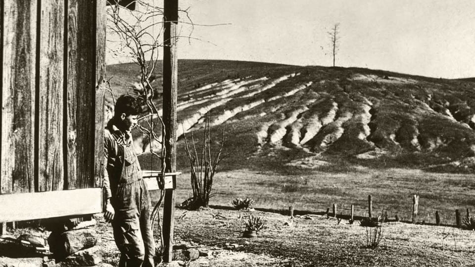
Severely eroded farmland during the Dust Bowl, circa 1930’s from “Land cover changes likely intensified Dust Bowl drought” https://news.unl.edu/newsrooms/today/article/land-cover-changes-likely-intensified-dust-bowl-drought/

When we talk about why scientists disagree about different aspects and approaches to climate science, I think it’s helpful to break it down into general areas. We’ll see how this works when we move on to scientific disagreements of various kinds. So let’s start at the 30,000 foot level.

Generally Agreed Upon:

(1) Over time, climate has influenced humans, and humans have influenced climate. I think here of overgrazing, and deforestation in the historic past. Humans have adapted to changing climates with more or less difficulty, including migration from one place to another.

(2) More recently (last 50 years or so?), scientific knowledge has produced a) evidence of greenhouse gases having a role in changing climate as well as b) other land use practices, e.g. irrigation, urbanization.

***********************************
Where Scientists Diverge:

(3) Teasing out the role of different anthropogenic factors, including greenhouse gases, in specific measures of climate change is difficult for a number of reasons. They include:
a) many other changes have occurred through the same timeframe as increasing greenhouse gases, including land use practices. Correlation is not causation, so different techniques try to remove other causes of variation. Scientists may disagree about these techniques.
b) we don’t have good climate data very far back in time, so have to use proxies, and they may not all be in agreement.
c) records from historic observations by people may be hard to blend with proxies.
d) measuring techniques have changed through time and different scientists have different methods of accounting for this.
e) there just hasn’t been enough time elapsed to detect changes (say something happens once every hundred years to twice every hundred years).

(4) Scientists go ahead and make estimates about 3) and predict the future based on those estimates. But even if we know what proportion of change is due to say, carbon, we don’t know how much carbon will be in the atmosphere in the future. So we model what might happen based on different factors, including economics and technology, that have been difficult or impossible to predict in the past. Given that, how lightly to hold these predictions is an area of disagreement. In general, disciplines with a history of prediction successes and failures tend to have more GDH (generic disciplinary humility).

(5) When it comes to predicting potentially bad impacts of climate change (floods, fires, drought, and so on), though, sometimes the study does not include the work or experience of people in the business of say, managing floods, farming, running dams, or fighting fires. So there is sometimes a disconnect between (the published and believed literature) and those communities and the scientific disciplines that support them (civil engineering, agriculture, wildfire management).

(6) Even if scientists agreed on everything else, no one knows what will happen depending on the rate of slowing of carbon to the atmosphere. Would the climate ultimately “change back”? But what about all those other natural variation and human factors? Since we don’t know, is it best to assume that adaptation will need to be ongoing, and maybe climate science funds should be directed less at exploring all the things that might go wrong, to adaptation and low-carbon technologies. (Where, or does, utility of results factor in to science funding processes?)

(6) Even if scientists agreed on 1-5, they still wouldn’t agree on policy solutions. Even if we just use the example of a carbon tax versus cap and trade, reasonable people, scientist and non-scientist could disagree. If we think of scientific studies as information packets designed to inform policy makers, collectors of information such as the IPCC are very helpful in giving policy makers a summarized packet. But they can still use scientific information outside the packet, or other information entirely. At its best (or best organized), information from various scientific disciplines could give us a target (perhaps measured in global average temperatures) and compare the feasibility of various solutions. When we get to solutions, though, it’s not difficult to think scientists might disagree- for example, bat specialists might not want the landscape covered with wind turbines. And so on.

7) Finally, some scientists say “unpredictable things could happen and be even worse than models project”. This is the idea of tipping points. I’m not sure about the utility of trying to predict the unpredictable. If we take any intervention by humans (say legalizing marijuana) certainly unpredictable things happen and some are worse than we expect. We note them and try to work on them. I think the difference with climate scientists is “because it is the climate of our planet we are thinking of, we should be super-precautionary.” I tend to think these are philosophical ideas “really unpredictable things could happen” and “we need to be careful,” and not actually “science”, although some scientists write papers about it.

*******

I don’t think that this list is exhaustive, so others are welcome to contribute.

NFS Litigation Weekly January 10, 2020

The Forest Service summaries are here:  Litigation Weekly January 10, 2020_Final Email

They have not attached any supporting documents this time, but the summaries are longer.  I’ve added a short overview here.

COURT DECISIONS

  • Idaho Conservation League and Greater Yellowstone Coalition v. U.S. Forest Service, et al. (D. Idaho)

The district court remanded the decision to the Forest Service to consider the impacts of the Kilgore Exploration Project (a 5-year mining exploration project) on the Caribou-Targhee National Forest  on groundwater and derivative impacts on stream water quality and Yellowstone cutthroat trout.  Here is the court’s opinion.

NEW CASES

  • Short et al v. Federal Highway Administration (D. N.D.)

Plaintiff landowners claim NEPA and historic preservation violations for the Little Missouri Crossing Road and Bridge project, which encroaches on and crosses the Little Missouri National Grassland of the Dakota Prairie Grassland.  (The Forest Service was named as a non-signatory cooperating agency.)

NOTICES OF INTENT

  • Sawtooth National Forest trail

Sawtooth Mountain Ranch LLC sent two 60 Day Notices of Intent to Sue pursuant the Endangered Species Act and Clean Water Act regarding the construction of the Redfish to Stanley Trail in the Sawtooth National Recreation Area near the Salmon River.  The District Court of Idaho has already denied a preliminary injunction based on other issues.

  • Forest plans in Region 3

WildEarth Guardians sent six 60-day notices of intent to sue claiming the US Fish and Wildlife Service and Forest Service failed to comply with the Endangered Species Act when they consulted on the effects of Forest Plans on the Mexican spotted Owl and designated critical habitat on the Apache-Sitgreaves, Cibola, Coconino, Coronado, and Prescott National Forests.  They state that new information also requires reinitiation of consultation on the Kaibab National Forest Plan.

(These are the same plaintiffs who brought the lawsuit against other Region 3 national forests that led to an injunction against many projects resulting from failure to monitor Mexican spotted owls, discussed here and elsewhere.  The FWS recently filed a new biological opinions intended to remove the injunctions on those forests, as described here:  “Forest management strategies now focus more on ecology and a “return to pre-settlement fire regimes, both of which have potential to benefit the spotted owl” instead of more commodity-based management including commercial timber harvest, the biological opinion states.”  The new NOI involves forests not subject to the current injunction.)

  • Idaho Panhandle timber project

Alliance for the Wild Rockies and Friends of the Clearwater sent a 60-day Notice of Intent to Sue pursuant to the Endangered Species Act for  determining that the Brebner Flat Project would have no effect on grizzly bears and Canada lynx and therefore not consulting with the Fish and Wildlife Service.

Lawsuit Challenges Forest Service’s Failure to Protect Endangered Species From Livestock on Arizona, New Mexico Waterways

A press release from the Center for Biological Diversity.

Lawsuit Challenges Trump Administration’s Failure to Protect Endangered Species From Livestock on Arizona, New Mexico Waterways

SILVER CITY, N.M.— The Center for Biological Diversity sued the Trump administration today for failing to prevent livestock from damaging southwestern rivers and streams.

The waterways are home to numerous endangered and threatened species: southwestern willow flycatchers, yellow-billed cuckoos, Gila chub, loach minnow and spikedace fish, Chiricahua leopard frogs, and narrow-headed and northern Mexican garter snakes.

Today’s lawsuit, filed in U.S. District Court in Tucson, says the U.S. Forest Service and U.S. Fish and Wildlife Service are violating the Endangered Species Act by allowing cows to trample rivers and streams on more than 30 grazing allotments in the upper Gila River watershed on Arizona’s Apache-Sitgreaves National Forest and the Gila National Forest in New Mexico.

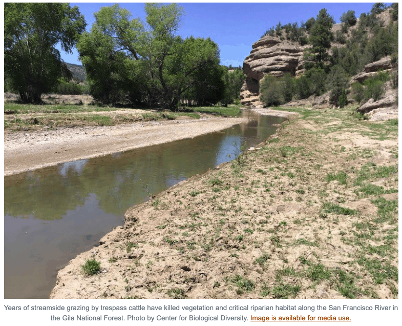
Recent surveys by the Center found severe cattle damage on all major waterways in both national forests, resulting in widespread degradation of streamside forest habitat and water quality, and imperiling several rare species.

“It shouldn’t take a lawsuit to keep livestock from trampling these fragile southwestern rivers, but the Forest Service has turned a blind eye,” said Brian Segee, an attorney at the Center. “We found cows, manure and flattened streambanks along nearly every mile of the waterways we surveyed. We hope this case will get cattle off these streams and renew the agency’s commitment to protecting endangered wildlife and our spectacular public lands.”

The rivers covered by the suit include the Gila, San Francisco, Tularosa and Blue rivers. In a historic 1998 legal settlement with the Center, the Forest Service agreed to prohibit domestic livestock grazing from hundreds of miles of southwestern streamside habitats while it conducted a long-overdue consultation with the Fish and Wildlife Service on the impacts of grazing on threatened and endangered species.

That effort and subsequent consultations have repeatedly confirmed that livestock grazing in arid southwestern landscapes destroys riparian habitat and imperils native fish, birds and other animals dependent on that habitat.

Poorly managed livestock grazing, persistent drought, dewatering, global warming and invasive species have taken an increasing toll on southwestern rivers. This has resulted in the recent federal protection of several additional threatened or endangered species that depend on southwestern riparian areas, including two species of garter snake, the cuckoo and the leopard frog.

These impacts, as well as the looming threat of a major diversion project, led American Rivers to name the Gila the nation’s most endangered river in 2019.

Australians and US Wildfire, Similarities and Differences: I. Knowledge of Traditional Burning Practices

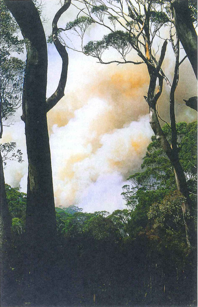
Hot fires such as this over large stretches of country can have detrimental effects on all sections of the forest depleting the seed stock and promoting germination that is too intense, destroying ground cover, and destroying canopy and the fauna that is associated with it.(from the Kelly paper)
Photo – Jiri Lochman

As the world’s attention has turned to the tragedies of the recent and ongoing Australian bushfires, it has been an opportunity for some of us to learn about bushfires, their history, and how Australians have handled them and perhaps compare their history and solutions to our own.

One theme that has been reoccurring on The Smokey Wire recently is that of looking at the written and oral histories of Native land use practices and land uses by non-Native settlers in the 19th and early 20th century. For me, it’s not about replicating the past, so much as understanding how and why Native peoples managed it and how the forests we see today were established.

I recently ran across this interesting piece by a Nyungar man named Glen Kelly in Landscope, a publication of Western Australia Department of Biodiversity, Landscape Conservation and Attractions. I couldn’t find the year it was published. In the paper is this quote from 1830:

While travelling from the Albany District to Perth in November 1830, John Lort Stokes wrote that:

“On our way we met a party of natives engaged in burning the bush, which they do in sections each year. The dexterity with which they manage so proverbially a dangerous agent as fire is indeed astonishing. Those to whom this duty is especially entrusted, and who guide or stop the running flames, are armed with large green boughs, with which, if it moves in a wrong direction, they beat it out … I can conceive no finer subject for a picture than a party of these swarthy beings engaged in kindling, moderating and directing the destructive element, which under their care seems almost to change its nature, acquiring as it were, complete docility, instead of the ungovernable fury we are accustomed to ascribe to it. Dashing through the thick underwood, amidst volumes of smoke-their dark active limbs and excited features burnished by the fierce glow of the fire-they present a spectacle which rarely falls to our lot to behold, and of which it is impossible to convey any adequate idea with words.”

Through the fog of racial bias, you can detect the author’s awe at the native peoples’ fire and land management skills.

But changes in land management have also occurred post-settlement, in fact, somewhat recently.

“that upon the cessation of Nyungar land management practices, dramatic changes occur to the land. Up until 20 or 30 years ago, Nyungar land management practices, which involved frequent cool fires over much of the country, were maintained to a large extent by the cattlemen of the south coast. They used the skills shared with them at the time of settlement, when a major part of the rural work force was Nyungar people. In the last few decades, however, we have witnessed some parts of our coastal land move from productive and vital areas to what we consider sick (mindytch) or dead country (noinch boodja). ”

Again, I don’t know the date of this piece, but Kelly was not finger pointing, but simply calling for:

We believe that the experimental non-use of fire and inappropriate use of fire that has been applied on the south­west coastal lands for the past few decades has been detrimental to the land of our origin. The fault for this does not lie at the feet of any one group or agency, but is a collective responsibility that needs to be recognised and rectified, quickly.

The whole paper is interesting as it places fire in the Nyungar cultural context.

If I had to guess, I would think that in the US, traditional burning knowledge and practices have been passed down in some places and not in others, due to the uprooting of Native people from their land and other factors. It would also be interesting to scan documents and journals from the 17 and 1800s for mention of then-current burning knowledge and practices. I wonder whether anyone has done that?

Now what happens when a new species on a national forest is listed under ESA?

Once upon a time, when a new species was listed under ESA, the Forest Service was required to reinitiate consultation on its forest plan regarding the effects of the plan on the species.  Projects were often held up while this was occurring.  As a result of the Cottonwood litigation, involving a new designation of critical habitat for Canada lynx, the law was recently changed so that neither new critical habitat nor listings require new consultation on existing forest plans (as discussed here).

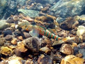
The candy darter (CBD photo) was listed as endangered in late 2018 and it is found on the Monongahela National Forest.  The Center for Biological Diversity provided this news release regarding a proposed timber sale in a watershed where the species is found and where critical habitat for it is being considered:

The U.S. Forest Service this week announced it will withdraw a 2,400-acre logging project in West Virginia’s Monongahela National Forest following objections raised by conservation groups about harm to an endangered fish.

The project would likely have caused significant erosion and sent sediment into rivers and streams, threatening the rare fish and other animals.

“Friends of Blackwater and all of our supporters are very pleased that the Monongahela National Forest supervisor has withdrawn the Big Rock Timber Project proposal,” said Judy Rodd, director of Friends of Blackwater. “Hopefully this is a step toward fully protecting the candy darter, a tiny jewel of a fish found in the timbering proposal area, near the world-famous Cranberry Glades.”

The Forest Service announcement said the project would have been the first of its kind to require formal consultation under the Endangered Species Act for the brightly colored candy darter, which was listed as endangered in November 2018. The Fish and Wildlife Service would have had to calculate how many, if any, candy darters could be killed or harmed by the proposed project. The Fish and Wildlife Service also plans to include portions of the logging project area in its final designation of the fish’s critical habitat. Those issues contributed to the decision to pull the project.

Presumably the Monongahela has come to a full stop on projects that may affect the darter, while they figure out a strategy for consulting with the Fish and Wildlife Service.  This is pretty close to the same result that would have occurred without the “Cottonwood fix.”  This is a situation where consultation on a forest plan has proven beneficial.  It should result in a species conservation strategy that “fully protects” the species’ habitat on the forest that the FWS supports and that can be included in the forest plan.  The FWS may then rely on the forest plan decisions and their biological opinion for analysis of its overall effects, which would simplify and streamline the consultation process for projects.

Post-Cottonwood, they could now choose instead to proceed on an individual project-by-project basis, but why?

(PS – This looks like an example where the administrative objection process prevented the Forest Service from losing a lawsuit.)