Repeat Photography and Salvage Logging Recovery

Camp-Creek-Clean-Salvage-web

My first attempt at assembling pictures, showing how quickly salvage impacts can “heal”. Here is the current aerial view of this specific area.

https://www.google.com/maps/@38.4831284,-120.3639833,223m/data=!3m1!1e3?hl=en

Here is a view of a re-burn that has already occurred, in the same area. Notice the lack of significant mortality, due to having salvaged the area, reducing the fuels of the inevitable future fires.

https://www.google.com/maps/@38.4770266,-120.3464336,892m/data=!3m1!1e3?hl=en

One of the biggest “purpose and needs” in the Sierra Nevada is fuels reduction after a wildfire. Otherwise, re-burns, like the Rim Fire will dominate the landscapes for an indefinite amount of decades.

Yosemite’s Re-re-Burn

The El Portal Fire, burning in Yosemite National Park and the Stanislaus National Forest, has taken a familiar path. Starting very close to where the 1989 A-Rock Fire began, it easily burned up the steep canyon slopes, out of reach of firefighters. Not too many people are making the connection between this set of fires, the A-Rock, the Big Meadow and now the El Portal Fire, and the Rim Fire re-burn (and its prior fires).

Below is what the Foresta area looked like in November. Did those green trees survive this fire? We can’t be sure until the bark beetles have decided their fate, over the next few years. The forested slopes in the background were salvaged under the original A-Rock salvage project, and you can see that it looks about as good as a burned and salvaged landscape can be. Parts of that ridge top have had 13 fires in the last 100 years. The northern third of the fire burned into areas partially burned in the Big Meadow Fire. Up there, fuels are much heavier, and some of it had made it to the ground.

Edit: The fire’s boundary has slopped over that far ridge top but, there is less fuel on that dry west-facing slope, and the fire is just smoldering at the north end. Now, with more re-burn! It will be interesting to see how intense it was, burning through the salvaged part of the A-Rock Fire.


P9132004-web

So, how long do you think it will take to turn this former pristine old growth stand back into a viable forest? Remember, this was a prime summer site for Indians, who expended a lot of time and energy to manage the ladder fuels. You can also go see the bigger picture here, at https://www.google.com/maps/@37.7045826,-119.7624808,7211m/data=!3m1!1e3?hl=en The northern end is very close to Crane Flat. Suppression costs have topped 8 million dollars. Also, how long will it take before blackbacked woodpeckers are on THIS piece of land? We need to learn from this example, or be doomed to repeat this moonscape.

P9132021-web

New Aerial Photos of the Rim Fire

Google Maps now has updated photos that include the Rim Fire. Now, we can explore the whole of the burned areas to see all of the damages and realities of last year’s epic firestorm.

P9132051-web

.

Here is where the fire started, ignited by an escaped illegal campfire. The bottom of this deep canyon has to be the worst place for a fire to start. It’s no wonder that crews stayed safe by backing off.

http://www.google.com/maps/@37.8374451,-120.0467671,900m/data=!3m1!1e3?hl=en

.

While there has been talk about the forests within Yosemite National Park, a public assessment has been impossible, in the National Forest, due to closures. Here is an example of the plantations I worked on, back in 2000, completed just a few years ago. What it looks like to me is that the 40 year old brushfields caused most of the mortality within the plantations. A wider look shows some plantations didn’t survive, burning moderately. When you give a wildfire a running start, nothing can stand in the way of it.

http://www.google.com/maps/@38.0001244,-119.9503067,1796m/data=!3m1!1e3?hl=en

.

There is also a remarkable view of Sierra Pacific Industries’ partly-finished salvage logging. Zoom into this view and take a look at their latest work, including feller-bunchers. Comments?

http://www.google.com/maps/@37.9489062,-119.976156,3594m/data=!3m1!1e3?hl=en

More Rim Fire Pictures

All too often, once a firestorm goes cold, a fickle public thinks the disaster is over with, as the skies clear of smoke. In the situation of the Rim Fire, the public hasn’t had much chance to see the real damages within the fire’s perimeter. All back roads have been closed since the fire was ignited. Besides Highway 120, only Evergreen Road has been opened to the public, within the Stanislaus National Forest.

From my April trip to Yosemite, and Evergreen Road, this unthinned stand burned pretty hot. This would have been a good one where merchantable logs could be traded for small tree removal and biomass. Notice the lack of organic matter in the soil.

P9202313-web

Sometimes people say there is no proof that thinning mitigates fire behavior. It’s pretty clear to me that this stand was too dense and primed for a devastating crown fire. I’m guessing that its proximity to Yosemite National Park and Camp Mather, as well as the views from Evergreen Road have made this area into a “Park buffer”. Now, it becomes a “scenic burn zone”, for at least the next few decades.

P9202306-web

There is some private land along Evergreen Road, which seem to have done OK, at least in this view. Those mountains are within Yosemite National Park. Sadly, the media likes to talk about “reduced burn intensities, due to different management techniques”, within Yosemite National Park. Only a very tiny percentage of the National Park lands within the Rim Fire have had ANY kind of management. Much of the southeastern boundary of the fire butts up against the Big Meadow Fire, generally along the Tioga Pass Road (Highway 120). Additionally, much of the burned Yosemite lands are higher in elevation, as well as having larger trees with thicker bark. You can also see that there will be no lack of snags for the blackbacked woodpecker. Can anyone say, with scientific sincerity, that over-providing six years of BBW habitat will result in a significant bump in birds populations? The question is really a moot point, since the Yosemite acreage, alone, does just that.

P9202301-web

People have, and will continue to compare the Yosemite portion of the Rim Fire to the Stanislaus National Forest portion, pointing at management techniques and burn intensities. IMHO, very little of those comparisons are really valid. Apples versus oranges. Most of the Forest Service portion of the fire is re-burn, and there is no valid Yosemite comparison (other than the 2007 Big Meadow Fire). It has been a few months since I have been up there, and I expect that there are plenty of bark beetles flying, and the trees around here have no defense against them, with this persistent drought. Everything is in motion and “whatever happens” is happening.

Rim Fire Terrain Effects

Below is a picture of the Tuolumne River and Poopenaut Valley, just a mile or so below Hetch Hetchy’s O’Shaughnessy Dam. As you can see, the area burned rather lightly. What might be the reason for this area to survive, almost unscathed? I think there is a “micro-climate” at play, here. Most of this is Yosemite National Park.

P9202324-web

Certainly, there are plenty of fuels, and California is in a historic drought. Firefighters did not “heroically” save this area from the flames. No management was done to make this area more resilient. Comparing this area to scorched places downstream, I think I have the answer. Farther downstream, the fires were enhanced by the nearly constant breeze, flowing down during the night and morning, and flowing up, with the heat of the day. Cold air sinks and warm air rises. This spot is pretty unique along the Tuolumne River. As the canyon turns from a glacier-sculpted valley into a V-shaped gorge, the cold air from higher elevations runs into this bottleneck, pooling up in this last valley, going downstream. Temperature inversions stay longer and stabilize the breezes, reducing fire behaviors.

One thing I did notice in this area was that many single digger pines were “selectively burned” as individuals. Those long slender needles were good at catching the small embers.

Burn Intensity in the Rim Fire

I ventured into the Rim Fire, where access is (still) very limited, and found a variety of conditions. Along Evergreen Road, on the way into the Hetch Hetchy area of Yosemite National Park, I first saw an area that had a prescribed burn accomplished, a few years ago. A “windshield survey” of that saw that there were plenty of trees surviving. I wasn’t surprised to see scattered mortality. It remains to be seen how many of these green trees already have bark beetles in them. In fact, I’m sure that some trees have changed color since I was there, in late April.

Farther up the road, near the historic Camp Mather, I saw this managed area and wondered why it didn’t survive very well. You can see that understory trees were cut, reducing the ladder fuels. Farther up the gentle slope there appears to be some survivors. All of the trees in this picture are likely candidates for bark beetles, and the green ones can support more than one generation. We are already seeing accelerated bark beetle mortality outside of the fire’s perimeter.

P9202311-web

I scanned around, looking for a reason why the stand had so much mortality. Looking across the road, down the hill, I saw the reason why. It is pretty clear that this stand hadn’t seen any management, and the hot wind from the fire pushed the crown fire across the road. Some of those trees were simply just “cooked” by the hot gases, blowing through their crowns. While I have seen these fire-resilient pines sprout some buds the next spring, few of them survive through the next summer, for multiple reasons.

P9202312-web

With over 250,000 acres burned, of course there will be a varied mosaic, with lots of examples of things we like to talk about, no matter what your point of view is. I will post more examples of what I saw in future posts.

Balanced Post-fire Treatments in the Rim Fire

I ran across this excellent article from  Eric Holst, Senior Director of the Environmental Defense Fund’s “working lands program”.

Here’s the link: https://www.edf.org/blog/2014/02/18/after-rim-fire-surprising-role-salvage-logging

P9132046-web

This picture is a view looking down into the Tuolumne River Canyon, from the “Rim of the World” overlook. Down there is where the fire started. I’d bet the spin on this wildfire would be VERY different if it was ignited by lightning.

Holst is showing some excellent judgement in looking at the bigger picture of the realities of the Rim Fire, seeing that “letting nature take its course” isn’t the way to go on every burned acre.

The Forest Service recently proposed to conduct salvage logging – removal of dead trees – on about 30,000 of the 98,049 acres of high intensity burned area and remove hazard trees along 148 miles of high use road in the burn perimeter. While it may seem counterintuitive for a conservationist to do so, I support this effort. In the high intensity areas, the Rim Fire burned so hot that it not only killed every tree but the top inch or two of soil with critical soil microfauna, and seed stocks were also sterilized. Fire of this intensity has been relatively rare in the moist middle elevations on western slopes of the Sierra Nevada and the native forests are not adapted to bounce back from this type of fire.

There are also some “interesting” comments, and a hint of “eco-bickering”. In those comments is also a return of the “Chapparalian”, using his actual name (instead of one of his many pseudonyms and even fake names). There are also some other interesting names commenting about these issues. John Buckley, a local leader of an environmental group comments with an open mind and a dose of reality. Others continue to spout the misguided idea that leaving the Rim Fire alone is the only way to go. Some commenters talked about the reality that we have plenty of BBW habitat, protected within the National Park. One reality not covered is that re-burns cause extensive damage that is very difficult to recover from, especially in areas left to “recover on their own”.

I still see that post-fire management is essential to getting big trees back on the land. We already have site-specific evidence that forests didn’t return when post-fire management was excluded, 40 years ago. We ended up with old growth brushfields, and a few stunted trees. Those old brushfields burned at moderate intensity. We have a big variety of landscapes, with differing burn intensities and site-specific conditions. This partial comment is spot-on, regarding these facts

It is interesting to see how many comments Eric’s post attracted from authors who are vehement that absolutely nothing except ‘let nature takes its course’ on National Forest lands. Since we have 100,000 acres of National Park land for that experiment, it would be more interesting to apply some other options on the National Forest lands. In the climate change debate, we continue to witness the rapid expansion of vocal people so sure of their own story that they refuse to even consider the possibility that it is worth learning more about the changing earth. Hopefully, this fate will not befall the response to the Rim Fire.

It seems pretty clear to me that a few open-minded people from both sides are seeing the realities of the Rim Fire, and its future.

Power Fire 2014

We’ve seen pictures of the Power Fire, on the Eldorado National Forest, before. I worked on salvage sales until Chad Hanson won in the Ninth Circuit Court, with issues about the black-backed woodpecker. The court decided that the issue needed more analysis, as well as deciding that the Forest Service’s brand new mortality guidelines were “confusing”. From these pictures, it is very clear to see that those mortality guidelines were way more conservative than they maybe should have been.

P9262156-web

As you can see, in this finished unit(s), there were ample snags available for birds to use, despite multiple cuttings, due to the increased bark beetle activity, during the logging. No one can say that they didn’t leave enough snags, (other than the Appeals Court). These pictures are very recent, shot last month.

P9262142-web

This picture amused me, as I put this sign up back in 2005. Plastic signs last much longer than the old cardboard ones.

P9262128-web

Here is another view of the area, chock full of snags, well beyond what the salvage plans asked for, to devote to woodpeckers and other organisms that use snags. People like Chad Hanson want more high-intensity wildfires, and more dead old growth. It is no wonder that the Sierra Club decided he was too radical, even for them.

Edit: Here is the link to a previous posting from almost 2 years ago, with pictures. https://forestpolicypub.com/2012/05/28/the-power-fire-six-years-later/

Vintage Yosemite Photo

I’ve been digging through my old Kodachrome slides, and I found this view of the Tuolumne River and Poopenaut Valley, within Yosemite National Park. This area burned in the Rim Fire, and it is representative of what lies below, in the Stanislaus National Forest. Of course, little of this would even be worth salvaging, even it is wasn’t in the National Park. You might notice the abundance of digger pines, even on the north-facing slopes. This is the beginning of an impressive canyon, and it becomes a Wild and Scenic River, when you reach the Park boundary. Of course, very little fuels work could have been done, within this awesome canyon. However, fuelbreaks could have been installed all along the edge of this canyon, knowing that there would eventually be an ignition, within the canyon. Lightning fires happen all the time in this portion of the Sierra Nevada. I really want to get in here and re-visit these spots, for some repeat photography.

Poopenaut-web

Largest “Dealbreaker” Ever?!?

This may shock some readers but, I am actually against HR 3188. I don’t support any logging in Yosemite National Park, or in the Emigrant Wilderness, other than hazard tree projects. What is also pretty amazing is that others in the House have signed on to this bill. It seems like political “suicide” to go on record, being in favor of this bill. However, I am in favor of exempting regular Forest Service lands, within the Rim Fire, from legal actions, as long as they display “due diligence” in addressing endangered species, and other environmental issues. Did McClintock not think that expedited Yosemite National Park logging would be, maybe, the largest “dealbreaker” in history?

Here is McClintock’s presentation:

 HR 3188 – Timber Fire Salvage

October 3, 2013
Mr. Chairman:
I want to thank you for holding this hearing today and for the speedy consideration of HR 3188.
It is estimated that up to one billion board feet of fire-killed timber can still be salvaged out of the forests devastated by the Yosemite Rim fire, but it requires immediate action.  As time passes, the value of this dead timber declines until after a year or so it becomes unsalvageable.
The Reading Fire in Lassen occurred more than one year ago.  The Forest Service has just gotten around to selling salvage rights last month.  In the year the Forest Service has taken to plow through endless environmental reviews, all of the trees under 18” in diameter – which is most of them – have become worthless.
After a year’s delay for bureaucratic paperwork, extreme environmental groups will often file suits to run out the clock, and the 9th Circuit Court of appeals has become infamous for blocking salvage operations.
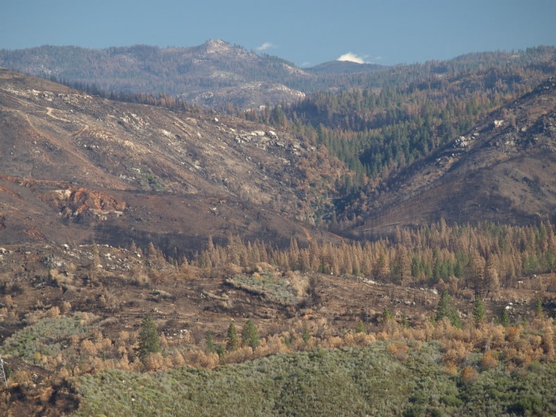
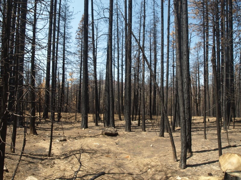
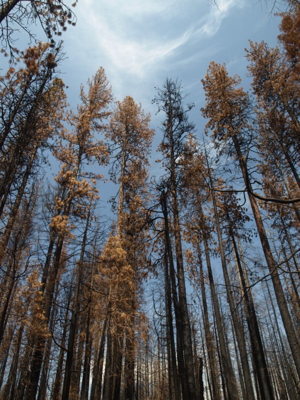
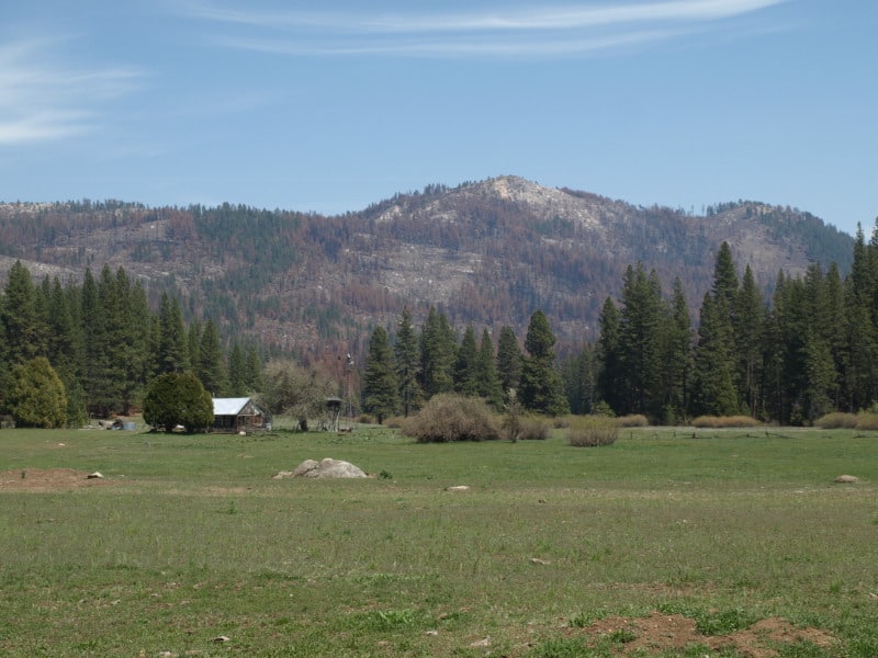
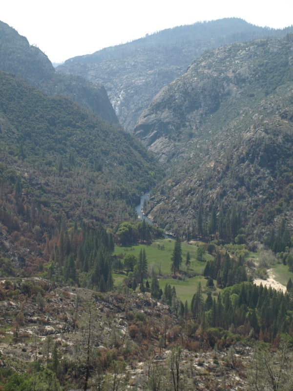
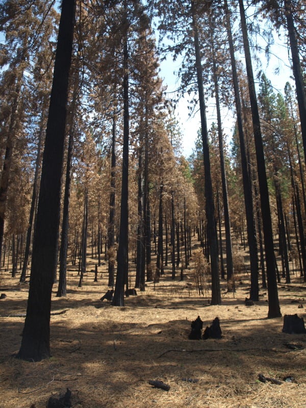
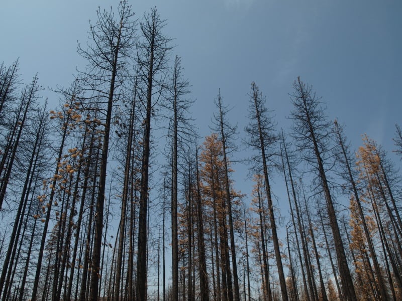
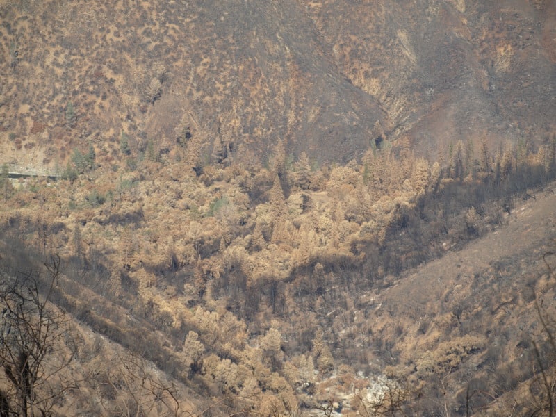
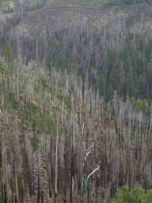
We have no time to waste in the aftermath of the Yosemite Rim Fire, which destroyed more than 400 square miles of forest in the Stanislaus National Forest and the Yosemite National Park — the largest fire ever recorded in the Sierra Nevada Mountains.
The situation is particularly urgent because of the early infestation of bark beetles which have already been observed attacking the dead trees.  As they do so, the commercial value of those trees drops by half.
Four hundred miles of roads are now in jeopardy.  If nearby trees are not removed before winter, we can expect dead trees to begin toppling, risking lives and closing access.  Although the Forest Service has expedited a salvage sale on road and utility rights of way as part of the immediate emergency measures, current law otherwise only allows a categorical exemption for just 250 acres – enough to protect just 10 miles of road.
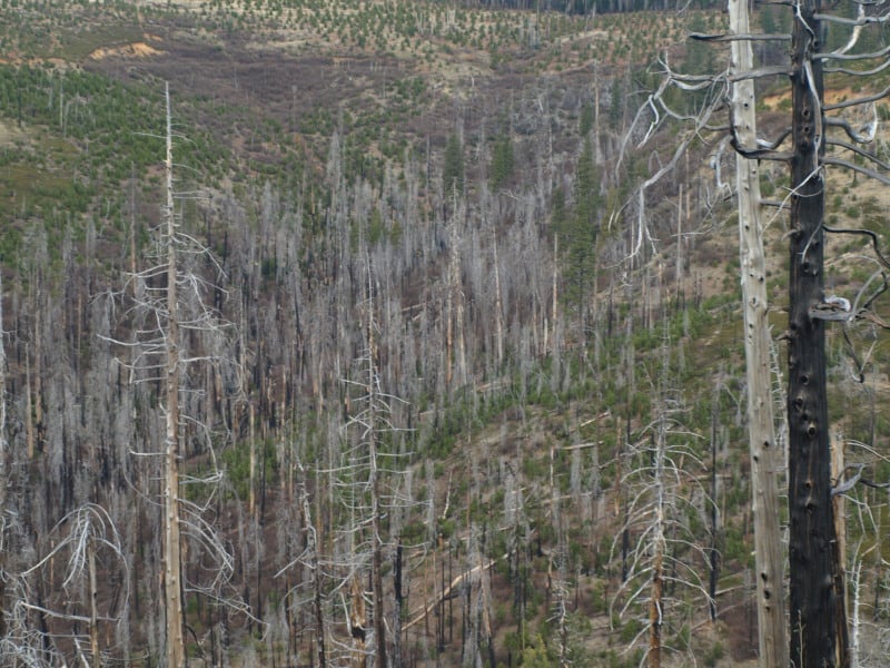
By the time the normal environmental review of salvage operations has been completed in a year, what was once forest land will have already begun converting to brush land, and by the following year reforestation will become infinitely more difficult and expensive – especially if access has been lost due to impassibility of roads.  By that time, only trees over 30 inches in diameter will be salvageable.
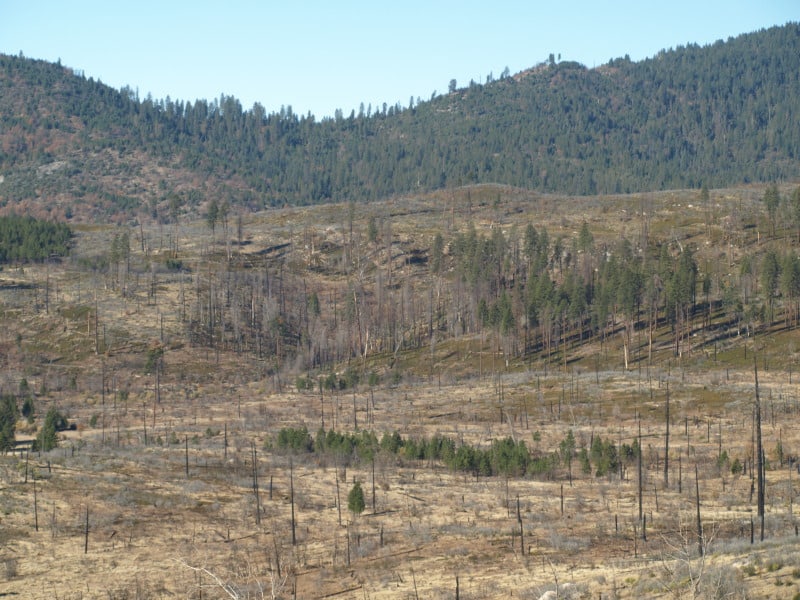
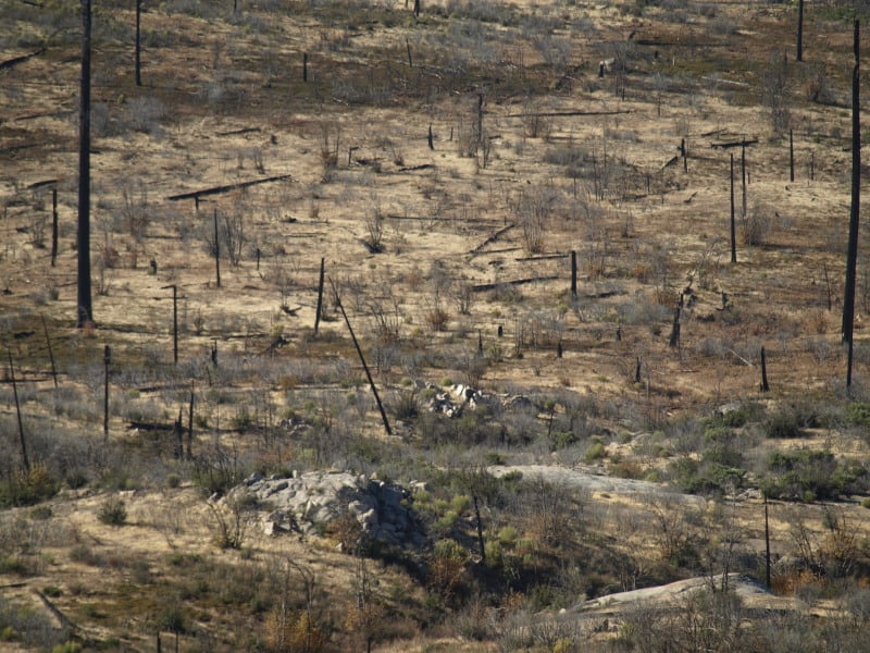
Within two years, five to eight feet of brush will have built up and the big trees will begin toppling on this tinder.  You could not possibly build a more perfect fire than that.
If we want to stop the conversion of this forestland to brush land, the dead timber has to come out.  If we take it out now, we can actually sell salvage rights, providing revenue to the treasury that could then be used for reforestation.  If we go through the normal environmental reviews and litigation, the timber will be worthless, and instead of someone paying US to remove the timber, WE will have to pay someone else to do so.  The price tag for that will be breathtaking.   We will then have to remove the accumulated brush to give seedlings a chance to survive – another very expensive proposition.
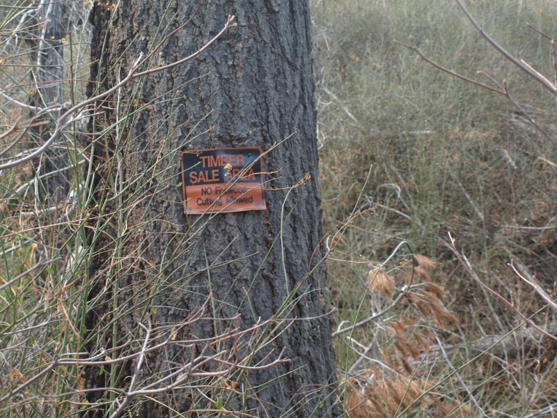
This legislation simply waives the environmental review process for salvage operations on land where the environment has already been incinerated, and allows the government to be paid for the removal of already dead timber, rather than having the government pay someone else.
There is a radical body of opinion that says, just leave it alone and the forest will grow back.
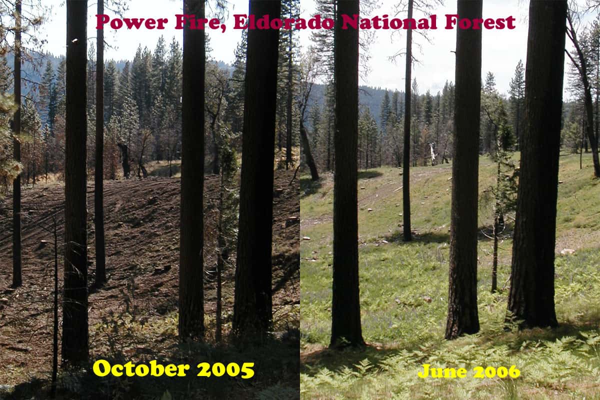
Indeed, it will, but not in our lifetimes.  Nature gives brush first claim to the land – and it will be decades before the forest is able to fight its way back to reclaim that land.
This measure has bi-partisan precedent.  It is the same approach as offered by Democratic Senator Tom Daschle a few years ago to allow salvage of beetle-killed timber in the Black Hills National Forest.
Finally, salvaging this timber would also throw an economic lifeline to communities already devastated by this fire as local mills can be brought to full employment for the first time in many years.
Time is not our friend.  We can act now and restore the forest, or we can dawdle until restoration will become cost prohibitive.