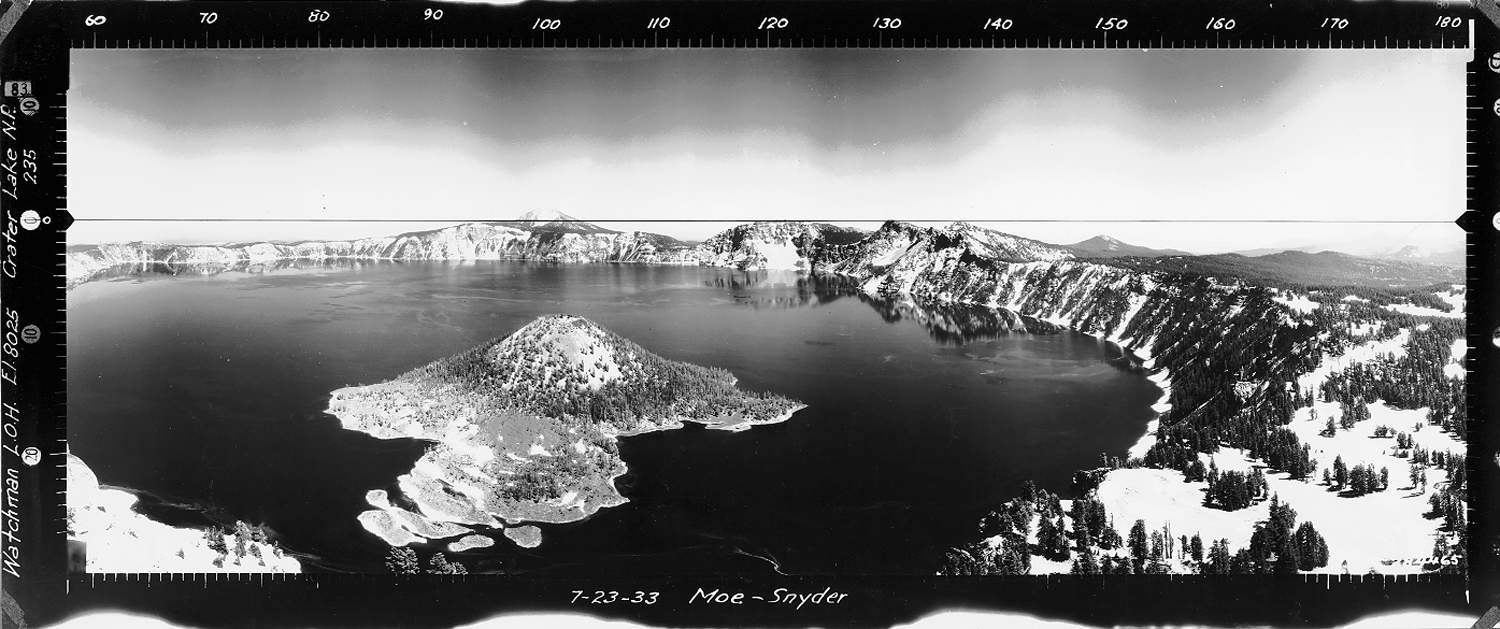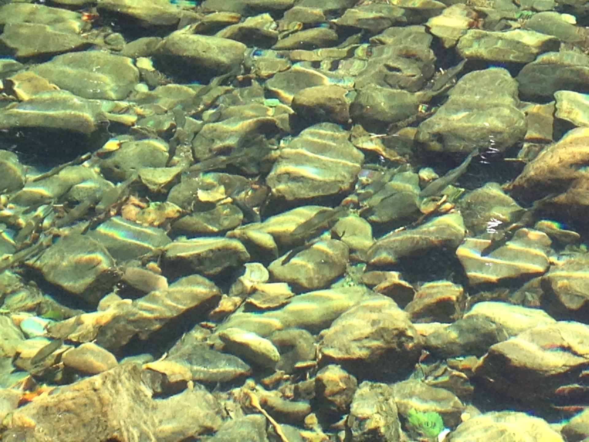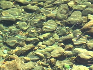
Native trout on the headwaters of the Blue River, Lane County, Oregon, August 24, 2013. How do salmonids respond in the years following a catastrophic wildfire? Photograph by Aaron L. Zybach.
If some of the regular readers here have wondered why I haven’t been too active the past several weeks, this post contains one of the reasons — I have been trying to put together a formal multi-agency/multi-county/multi-landowner research study based on an earlier posting: https://forestpolicypub.com/2013/09/25/calculating-the-true-costs-of-wildfire-the-douglas-complex/
This effort has mostly resulted in a lot of time on the telephone, email discussions, and meetings up and down I-5. The following proposal is one result, and it was sent to obtain USFS research access to Stanislaus Forest lands within the Rim Fire boundaries, and to obtain BLM research access to O&C Lands inside of Douglas Complex boundaries. Both requests are in their final stages of processing (the fires only ended a short while ago), but things are looking fairly positive in both directions, and formal approval is expected sometime in the next week or so. After that, depending on what we are told and whatever other feedback I get from this draft proposal, I will put together a final version for project fundraising purposes. As the proposal makes clear, the sooner start-up amounts can be raised, the better, and it is fairly critical that 5-year study plots be established in early spring with emergent vegetation.
This is a pretty long post to read online — although that works great for skimming — so I have also uploaded a PDF file for those (like myself) who are more comfortable reading a printed version: http://www.nwmapsco.com/ZybachB/DRAFT/Douglas-Rim_Proposal_20131202.pdf
Any and all comments will be very much appreciated, on any or all of this. Steve Wilent’s drone posting made me realize that I had left them off the list. Maybe this could be a good test operation for the drones the USFS already has available, or for the Amazon drone to perform seasonal repeat photography functions after the plot locations have been established. If there were a way to involve Google Earth as collaborators in the project, so much the better. These are semi-serious ideas for conducting environmental research as transparently and as safely and efficiently as possible, by using modern technology, Internet communications, and current environmental problems — such as wildfire mitigation.
Other thoughts?
Paired Wildfire Study: The Post-fire Effects of the 2013 Douglas Complex & Rim Fires
of Western Oregon & Northern California.
DRAFT Proposal
December 2, 2013
Bob Zybach, PhD
Program Manager, www.ORWW.org
General Description: Problems and Opportunity
This is a proposal to systematically examine and compare the biological, ecological, and economic effects of the actions taken on fire suppression and post-burn salvage and restoration activities on two major wildfires of the 2013 fire season: the Douglas Complex in western Oregon and the Rim Fire in northern California. Measures would be for five years. The term “action” in this sense can include thoughtful decisions to do nothing in some circumstances.
Catastrophic-scale wildfires have become increasingly larger, more costly, deadly, and dangerous during the past quarter century, perhaps beginning with the Silver Complex in 1987 and the Yellowstone Fires of 1988. This increase has been attributed to passive federal management policies that have been adopted during the past 40 years in regards to wildfires and wildlife habitat, drought, population expansion, diminished budgets and/or to climate changes related to anthropogenic global warming. Whatever the cause or causes, it remains obvious that these unprecedented problems are not likely to be resolved or significantly diminished in the foreseeable future unless corrective management actions are taken.
The 2013 Rim Fire in northern California and the Douglas Complex of southwest Oregon offer an ideal opportunity to test and evaluate the various management actions taken by private landowners and by key federal agencies in reaction to these types of events. This is primarily because of the landscape-scale patterns of diverse land ownerships that were directly affected by the fires, by the differing methods used to manage the fires, and by the various practices and decisions that will be implemented as a result of ownership and resource management differences in policies, budgets, and objectives.
This study proposes to combine the opportunity offered by pairing coincidental large-scale wildfire burn patterns in varied ownership and forest type landscapes with emerging technology in order to conduct a fully transparent documentation and analysis of pre-fire and post-fire actions and effects. Digital photography, GPS receivers, GIS mapping, and modern Internet communications will be used to identify and compare which types of management actions prove most effective in reducing wildfire risk and damage, and which types of actions prove most effective in mitigating wildfire damage once it has taken place. The study is intended to be inexpensive to establish and maintain so that it can be easily replicated in other areas subject to large- scale wildfires; and can also be readily integrated into the “first response” activities of wildfire managers and BAER (Burn Area Emergency Response) teams to the benefit of resource managers and the interested public. Most cost efficiencies are primarily due to the use of modern technology and related reductions in field study costs and to independent scientific oversight.
Background
The Douglas Complex started on July 26 and was fully contained by September 3, having burned 48,000 acres of O&C Lands: a checkerboard arrangement of square-mile lands managed alternately by the USDI Bureau of Land Management (BLM) and by several private and industrial forestland owners. The Rim Fire started August 17 and was fully contained by October 24, having burned 257,000 acres of the USDA Stanislaus National Forest (USFS), USDI Yosemite National Park (NPS), and Sierra Pacific Industries (SPI), a major industrial forestland owner. It was the third largest wildfire in California history, and the largest ever in the history of the Sierra-Nevada.
Suppression costs totaled $127 million for the Rim Fire, while the Douglas Complex formed a major portion of the 100,000+ acres and the $122 million spent on wildfire suppression costs by Oregon Department of Forestry (ODF) during the 2013 fire season, This was the first time that more than 100,000 acres of state-protected lands had burned in Oregon wildfires since 1951, during the last of the Tillamook 6-Year Jinx fires, and the most ever spent – by a wide margin –by ODF on suppressing wildfires.
Suppression costs are typically the only wildfire-related dollar amounts listed or discussed in the public media to describe the magnitude of large-scale wildfires. However, we estimate that total costs and losses from these fires are likely to be 10 times, or more, greater than suppression costs alone (Zybach, et al. 2009a; Zybach, et al. 2009b); and with much of this cost within the first five years. That is, ODF and Rim Fire suppression costs in 2013 are only about 10% of an estimated $2.5 billion in possible short-term and long-term damages caused by these fires. If these figures are anywhere close to accurate, then it is important for citizens, taxpayers, and their political representatives to become aware of the scope of the problem when establishing budgets or making policies. Of course, this is also important information for landowners and resource managers when making decisions regarding the management of a wildfire, or of its aftermath.
The basic idea for this proposal was first suggested by Paul Bell, of ODF, to Wayne Giesy, Oregon Websites & Watersheds Project, Inc (ORWW), in late August; at the same time John Marker and I were also integrating it into the articles we were preparing for the October Society of American Foresters (SAF) The Forest Source (Marker and Zybach 2013) and the Oregon Fish & Wildlife Journal (Zybach and Marker 2013). The focus of those articles was to help educate the public regarding the true scope of wildfire damage, and to do it in terms we can all understand: Plain English, dollars and land-based photographs. Since then, every effort has been made to contact and share information with key individuals and agencies needed to begin and to complete this proposal, as well as with fellow scientists Bob Alverts, Carl Johannessen, Frank Lake, Mike Newton, Tom Sensenig, and Peter Stine as reviewers and advisors.
In addition to the names just listed, other individuals who have been kept informed or have been actively involved in discussing and/or contributing to this proposal include current and former BLM employees Jerry Perez, Ed Shepard, Mary Smelcer, and Robin Snider; current and former USFS employees Bruce Courtright, William Derr, Euell Flanders, Larry Harrell, Zane Smith, Richard Stem, and Ted Stubblefield; political representatives Marcia Armstrong, Tim Freeman, and Doug Robertson; Jim Geisinger of Associated Oregon Loggers; and Nancy Hirsch of ODF
Need for Study
There is a growing need and a present opportunity for a comprehensive, interdisciplinary study of long-term economic, biological and ecological effects of large-scale wildfires in the western US. There are specific needs for better information in regards to human health and safety during a wildfire, changed resource management risks and opportunities following a wildfire, and long-term assessments of cumulative costs and damages — including positive effects — for these types of events. There is also a growing demand for public transparency in the use of taxpayer dollars to fund scientific research. This proposal is specific to those needs and concerns.
The study would specifically benefit managers and rural residents within, adjacent to, or in close proximity to federal forestlands. Additional beneficiaries would be resource managers, researchers, students, teachers, and the interested public via inexpensive, comprehensive, and transparent conducting of applied science research via Internet communications (Zybach 2008; Zybach and Alverts 2013). The potential for more specific benefits can be readily identified for the following categories:
Human Health and Safety. What are the medical and economic effects of wildfire smoke and wildfire risks to personal health and safety? These effects are fairly well known during the course of the fire, but long-term effects have only recently been seriously considered. This study would not focus on these issues directly, but would track the work of others and maintain comprehensive links and PDF articles and reports of current information readily available on the project website.
Resource Management Value. What vegetation patterns are most apt to burn during a wildfire and which are least likely? Under what types of conditions for each? Which vegetation patterns are improved or rejuvenated by wildfire? Which are significantly changed? What practices prove best for meeting management objectives following a wildfire? Where is time and money being wasted? These types of questions, of course, are of interest to resource managers confronted with wildfire risks and/or damages. These are also precisely the types of questions being addressed by this study; further, they are being considered at nearly 100% sampling on a landscape-scale.
An short-term benefit of this study would be the potential for integrating BAER documentation of a large-scale wildfire – and specifically the locations of any BAER projects prior to and immediately following any mitigating actions that are taken – as an effective and inexpensive way to monitor the results of management actions and decisions made during and immediately following such wildfire events.
Scientific Value. This study is intended to develop and provide a comprehensive, interdisciplinary, and transparent dataset that can be queried by a wide range of scientific disciplines. Research topics might reasonably include: comparative analyses of forest management actions; forest type responses to wildfire; evaluations of fuel loads and types; impacts to soil types and productivity; weather conditions and topographic factors in wildfire behavior; fish and wildlife mortality and population responses; short-term and long-term wildfire economics; air pollution measures and mitigation; human health effects of wildfire smoke, and etc. Further, there is direct interest in combining such queries with current technologies, such as digital imagery, remote sensing, GPS, GIS, and Internet communications. The value of such topics and datasets to statisticians, website designers, and modelers is also apparent.
Educational Value. The educational value of having scientific methodology and information readily available online for student research projects, reports, and discussions is obvious. The fact that this study focuses on a wide range of disciplines — including botany, economics, fish and wildlife, fire ecology, history, forestry, etc. — adds to its value, as do the opportunities for integrating mathematics, writing, speech communications, and website design with the teaching of these topics. Similarly, self-education and homeschooling are benefitted by access to this data via the same project websites.
Political Value. In terms of political value, this research would provide elected officials ready access to comprehensive data regarding two major wildfires of current and long-term management and budgetary importance. There should be much practical use in considering and establishing future policies and management directives in regards to wildfire mitigation and risk reduction by having direct access to significant environmental information that is easy to obtain and to understand. The potential for full public transparency and successful collaboration between affected agencies should also have a very positive political importance, and achieving these objectives at a relatively insignificant cost to taxpayers might also be considered a political value for those supporting this proposal.
General Budget and Short-term Funding Needs
A systematically designed interdisciplinary study of long-term ecological, economic and biological effects of wildfire over a wide range of land ownerships – at least to the degree that is being proposed here — has never been done before. This is due in large part because the technological capabilities of Internet communications, digital photography, remote sensors, GIS, and GPS receivers have only recently come into common use; and at reasonable costs with consistently improving quality and reliability. As such, making specific estimates of some intended operations can be difficult or impossible; rather, every effort is made to present projected costs at a level that can be conducted as economically and efficiently as possible, while still maintaining basic research objectives: one of which is to conduct this study as openly and as cost effectively as possible.
A basic assumption of this proposal is that current data-gathering techniques can be significantly improved via this study and adopted to good advantage at little or no additional cost as standard operating guidelines by BAER, beginning as early as the 2014 fire season. Internet display of landscape-scale baseline conditions and subsequent research findings would be comprehensive, timely, stable, easy to navigate, and accomplished largely via the use of pictures, videos, dollars, tables, graphs, and Plain English – and again, at a relatively insignificant cost when compared to methods currently used to inform and/or engage the public on the topics of federal and state wildfire and forest management.
Oregon Websites and Watersheds Project, Inc (ORWW) has supplied all funding to develop this proposal to date (12/1/2013). This document is being prepared in part for the purpose of generating initial start-up funding for this proposal: $15,000 for baseline landscape-scale photo-documentation for the Douglas Complex; $45,000 baseline landscape-scale photo-documentation for the Rim Fire; and $10,000 for design and construction of a permanent ORWW educational website to publicly share the results of these efforts. Proposed funding sources for these initial costs would ideally include the specific agencies, counties and/or landowners most affected by the fires. If these sources prove insufficient, then other affected agencies, organizations and/or potentially interested foundations and individuals can be approached. Time is of the essence, however, and the sooner photo-documentation can take place, the better, in that salvage logging, hazard tree removal, and winter weather have all impacted initial burn conditions.
A more detailed description of each of these three initial steps is included in the following pages, and their completion would include Bob Alverts as a research associate on the Douglas Complex and Larry Harrell and Euell Flanders as research assistants on the Rim Fire. The ideal solution for several of the remaining study measures would be for them to be undertaken – and information freely shared – by county and/or agency biologists, hydrologists, economists, GIS techs, and other experts and specialists already familiar with these locations and already budgeted for their time and equipment. If these resources were not made available, necessary fieldwork could be conducted by skilled volunteers, graduate students, and/or qualified contractors, which would have entirely different budgetary considerations.
When compared to the cost of fire suppression alone, however, much of significant wildfire and forest management value could seemingly be accomplished within existing agency budgets by relatively minor seasonal adjustments in field assignments of a few individuals and vehicles and by using other existing equipment. Agencies directly affected by these events include BLM, Cal-Fire, EPA, GAO, NOAA, NPS, ODF, USFS, and USFWS. Affected counties include Douglas, Josephine, Mariposa, and Tuolumne. A collaboration of these entities to openly gather and share information would quite likely produce more useful and scientifically credible results as well as potentially reduce study management and operations costs.
In addition to establishing baseline landscape scale conditions and a public website for the two burns, a number of seasonal measures would need to be set up and maintained to measure changing primary production, fish populations, stream discharge volumes, and TMDL of affected streams and representative plot-size documentation of understory, shrubland, and grassland responses to the fires and to subsequent management actions. These plots should ideally be established in late winter/early spring 2014 and be maintained 3- 4 times annually through the life of the study, scheduled to end December 31, 2018. Wildlife habitat, endangered species, and terrestrial vertebrate populations would also be accounted for, but methodology for doing so is variable and needs to be determined. Findings in regards to these measures would be entered into appropriate GIS layers and routinely uploaded and displayed on the project website, unless the information is deemed too sensitive or not allowed by law.
Greater details regarding the methods for establishing plots and for acquiring each of these measures and some estimated costs for implementing and completing them are given in the following pages. There has been no attempt to summarize total estimated costs for the reasons given above but, again, they are intended to be as modest as possible and total costs of the entire study over a five-year period are highly unlikely to be more than a few dollars an acre at most. The bulk of the study’s cost is incurred during the first year by documenting baseline conditions, creating a website, and establishing plot-scale photo-points. Subsequent years will mostly involve revisiting these locations on a seasonal basis, documenting changes, and adding that information to the existing datasets and the website for comparative analysis and other purposes.
Information about this project would be mostly accomplished via the website and by periodic newsletters and/or press releases to key audiences and media. Website maintenance and updating costs are generally well known and inexpensive when compared to mailings, publications, or other methods of sharing information. Peer reviews of methods and findings would likewise be public and could be enhanced at any time by making the website interactive and allowing public participation in the review and analysis processes. All project materials appearing on the web could easily be copied and used in other locations, such as agency websites, for presentations, and/or for purposes of research and education.
The cost of doing this needed research in a completely transparent fashion is relatively minimal, thanks in large part to major improvements in computer technology and Internet communications during the past several years, as stated. Scientific objectivity and credibility are critical to public and political acceptance of the findings. There is some concern that if this research were headed by an industrial group, or perhaps even by a single university, there would be perceptions of bias and the resulting findings could be disregarded or dismissed accordingly. Likewise, similar problems typically exist with a single government agency taking the lead. ODF would be a reasonable choice to head such a study in Oregon, but they have no budget for research. Douglas, Josephine and Tuolumne are the most affected counties, and BLM, EPA, NOAA, USFS, and USFWS are the most affected federal agencies. An ideal result would be to have several or all of these entities collaborate on funding and completion of this proposal.
Detailed Description & Proposed Methodology
This proposal has eight key points that are dependent upon establishing baseline data as quickly and as accurately as possible, so that changes in vegetation, erosion, stream flows, and fish and wildlife populations can be better measured and considered following these two events. Existing data are highly desirable, but not critical, to the success of this proposal, which is focused on the short-term and long-term results of various land management practices intended to mitigate the effects of large-scale forest wildfires. Relevant scientific literature, historical maps and photographs, and informative news articles would all be integrated into the analysis process and made readily available (if not protected by copyright or policy) via the project website as they are acquired and used.
Here are the proposed eight steps for completing this project:
1. Comprehensive documentation of baseline landscape-scale conditions of the burn area and its perimeter via digital photography using GPS-referenced photo points and GIS mapping.
Catastrophic wildfires occur on a landscape-scale basis — in this instance, 48,000-acres and 257,000-acres. It is important to look at mitigating strategies and results on a similar scale in order to be practical. Typically, this can be largely accomplished via existing road systems and trails to lookout towers and designated viewpoints, as well as old logging landings, road pullouts, and many new perspectives revealed by the burned landscape. Landscape scale photography requires complete access to all rocked roads around the perimeters and throughout the burned areas, some hiking trail access to key photo-points, and seasonal access to select vegetation plot and stream measurement locations.
This step would follow the methodology we have developed via ORWW and NW Maps Co. in our B&B Complex, Owl Ridge Trails, Upper South Umpqua headwaters, and Coquelle Trails projects, beginning with our transition to digital video and photography (rather than scanning and 35 mm. film) in 2003:
http://www.orww.org/B&B_Complex/Repeat_Photography_Grid/index.html
http://www.orww.org/Reports/Owl_Ridge_Trails/
http://www.orww.org/Rivers/Umpqua/South/Upper_Headwaters_Project/Maps/index.html
http://www.orww.org/Coquelle_Trails/Methodology/index.html
It is important to note that each of these websites is intended to be dynamic and to be built through time — depending on available funding and student interest – but that 100% of all photographs (typically 2000 to 4000 per project) remain filed and archived and readily available whenever they might be needed. For this project, photo documentation would be given a much higher priority for organization and display due to the focus and objectives of the study. The desired 85%-100% sampling targeted for comprehensive landscape-scale coverage would have ideally been completed as the fires were being contained and before winter storms set in (a suggested BAER-type project for future large-scale catastrophic events of similar magnitude), but still should be completed as quickly as possible, with areas currently being logged for salvage and roads being cleared of hazard trees given the highest priorities.
This process should be repeated at the conclusion of the five-year study period, and perhaps more frequently at key locations if conditions warrant. Following the conclusion of this study these photographs will likely remain valuable for repeat photography purposes for many decades to come — similar to the informational and research value Osborne photographs and early maps and aerial photos have at this time.
2. Systematic selection of a statistically significant number of permanent plot locations established to measure seasonal plot-scale changes in surface vegetation and in stream channels.
Permanent plot-scale repeat photography points should be systematically established and documented in early spring, as vegetation is first emerging, and follow the methods developed by Fred Hall in eastern Oregon (Hall 2001; 2002). These methods continue to be practiced and maintained by Bob Alverts, who has taken responsibility for Hall’s long-term photo-plots and has agreed to participate in this project as both advisor and field research associate.
Unrestricted road and trail access would be needed immediately, once funding is obtained to do baseline landscape-scale photographic coverage. Access to select vegetation plot and stream measurement locations would be needed beginning in spring, 2014, and continue seasonally (generally 3-4 times per year) until fall 2018, when research is expected to be completed. Landscape-scale photo documentation is referenced by GPS coordinates, but establishment of vegetation and stream plots may require rebar stakes to secure water temperature devises and to locate plot-scale repeat photography photo points.
Alverts and I have estimated that it will cost about $25,000 to establish and document – and track online — representative permanent plot locations for both streamside monitoring and for understory plant assemblages in order to measure their responses to post-fire management actions (including decisions to do nothing) for the Douglas Complex. Costs, of course, would be significantly less to revisit these locations and document changes in the future, once they have been established. Although the Rim Fire is more than five times larger than the Douglas Complex, it is likely that per acre costs to establish permanent plots will only be two or three times greater ($50,000 to $75,000) due to much of the NPS land being largely inaccessible to such research, and because streamside erosion is less of a factor in areas that have been impounded and do not have anadromous fish populations. Too, gaining research access to SPI lands, which are privately owned, may be problematic. However, it is also very probable that much valuable information already exists and will continue to be gathered by San Francisco Water and Power and other Metropolitan Utility Districts that have been affected by the Rim Fire and its aftermath. It would also seem that much or all of that information is publicly available and could be integrated into the project website with little difficulty or cost.
3. Establishment of a network of stream temperature measuring devices that can track variations in water temperature on an hourly and daily basis during spring through fall seasons.
The work by Mike Newton and others in measuring stream temperatures, streamflow, primary productivity, and fish volumes is generally well known and documented (e.g., Newton and Cole 2005). Perhaps the best known regional efforts in these regards have to do with the paired watershed studies conducted in western Oregon during the past decade, which had their beginnings in 1959, and in which Newton has been a principal contributor in recent years:
http://watershedsresearch.org/watershed-studies/
Newton recommends that stream temperatures be recorded with devices such as Onsett Tidbit thermistors, which are set to record at half-hour intervals for 24-hour days, from late May until early October, set in enough water to not go dry. This should result in 48 measurements a day to the nearest 0.1o C. Newton claims the Tidbits have enough capacity to collect data for a year and cost about $105 each ten years ago, but now may be down to about $30-35, maybe less, in recommended lots of 100 instruments. He also says they are not much bigger than a thumb and need to be anchored (“wired”) to a chunk of rebar, or something similar, and flagged so they can be readily relocated. He further says that 100 of these devices, with 10-20 in a main-stem stream and the rest at quarter-mile intervals in all fish-bearing tributaries, would give a good picture of the entire system affected by the Douglas Complex. Newton recommends using a major stream as the focus — selected among streams that have unburned headwater reaches of over a mile (if possible) — and several unburned miles downstream, with Tidbits every half mile or so.
This network should be easy to establish on the Douglas Complex — whether private landowners agree to research access or not — due to the checkerboard arrangement of BLM lands (and assuming BLM permits access for this research to take place). Depending on locations, the cost of distributing these devices across the landscape cannot be very great; probably less than the estimated $3500 or so needed to purchase them. The Rim Fire is another matter, due to reservoirs and lack of anadromous fish runs, and this information may already be in the process of being gathered, or is largely irrelevant when compared to erosion or other factors associated with water quality.
4. Seasonal measures of stream flow volumes at select locations; perhaps in conjunction with temperature measuring devices and/or streambank monitoring plots described above.
Newton suggests using the method practiced by him and Elizabeth Cole to measure discharge several times each summer in each study reach of the streams (Newton and Cole 2005), recording temperature every 300 feet, looking at (and documenting) everything from down logs, by size, to pools and riffles/glides every 10 feet, where depths were measured every foot of width to get cross-sections for computing volume. Mean molecule velocities were determined by standing 100 feet apart, with the upstream person dumping an amount of salt into the stream, while the downstream person measured conductivity of the water until it was below one-hundredth of the amount at its peak. Eleven measures of cross section in each 100 feet allows computation of volume. Volume times average velocity equals discharge — and determines the average time for all molecules and not just the center of stream. Newton suggests doing discharge measures a minimum of three times per year: June, mid-July, and late August, about a mile apart along the main-stem of the study area and also along the lowest quarter-mile of each major tributary.
These types of measures are quite likely already in place in many areas where drinking water, power production, and reservoir management are factors, and/or may be better collected and managed by affected agencies. Structural aspects of streams can be better documented with digital photographs taken from established plot locations as described above, so the main feature of these measures is water volume, and there may be easier methods for achieving this than those described by Newton – in any instance, it is principally the cost of revisiting these locations that is an issue, rather than the cost of actually taking needed measures.
5. Systematic seasonal measures of primary productivity and salmonid populations in the years following this disturbance.
Methods to measure primary productivity and fish volumes will hopefully be conducted by the agencies themselves and the need for special surveys or permits is unknown. This methodology should be determined by fish biologists and statisticians, and should be the same used to measure primary productivity as used to measure salmonid numbers and volumes. According to Newton, measurements should be taken at least four times annually, based on cubic-meter plots taken in both burned and unburned sections of the main stem, and with at least one measurement grid in each fish-bearing tributary.
These methods have been tested and perfected by participants in the paired watershed studies linked above, and potential costs can probably be obtained from those sources. Again, such measures are likely to be of greater importance on the Douglas Complex than the Rim Fire for reasons given above.
6. Seasonal and occasional documentation of terrestrial animal use, including descriptive and quantifiable changes in designated “critical habitat” conditions following the event.
This measurement would be dependent on local pre-fire “critical habitat” determinations within the study area, and can be measured and compared by repeat photography grids and GIS technology. Measures and documentation of terrestrial animal occupation and populations within the study area would, again, ideally be accomplished by affected agencies, and with information (except for endangered species, perhaps) being freely shared with other study participants.
7. Creation, population, and regular updating of an independent and fully transparent ORWW educational website with stable, easy to navigate, and comprehensive content that thoroughly documents the study’s methods and findings.
A primary value of this research is that it is fully transparent and available to the public and to resource managers as it is being conducted. The methodology is not limited to a single experiment, but rather designed to develop a number of useful and complementary datasets that can be queried from a wide variety of perspectives. Limitations include the current need for funding sources, potentials for missed or poorly documented data gathering opportunities, and possible agency concerns regarding public access to certain research findings.
The primary outreach strategy has been described above. ORWW has a 17-year history of stable, easy to navigate educational websites and all findings will be published on a website devoted specifically to this study. Periodic news releases, popular articles, and social media will also be used to direct interested individuals to the website. Land managers and others interested in this work will be able to readily access all findings – except those legally protected, such as cultural artifacts or rare plant species – in the same manner as the interested public.
At any point in time, if sufficient interest and funding are available, the website can be elevated from an essentially archival function to an interactive design specifically adopted for purposes of public input, peer review, and/or educational projects:
http://www.orww.org/Wildfires/Biscuit/Civic_Science/index.html
Upon completion of the project in fall 2018, the website would be maintained by ORWW and any potential mirror sites indefinitely, but all interactive functions, if they have been installed, may be eliminated at that time.
8. Cumulative “cost-plus-loss” values attributed to this event, from 2013 through 2018.
These evaluations can be tracked from multiple sources by using the referenced wildfire-economics.org website (Marker and Zybach 2013; Zybach and Marker 2013). This methodology has been presented to national and state audiences and received good reviews, but this study would constitute the first real test of this approach:
http://www.wildfire-economics.org/
In addition to costs and losses attributed to wildfires, this method would be expanded to include quantifiable benefits of these events as well. Ideally, these numbers would be tackled by agency economists and/or university professors, with their results being made publicly available on the project website. If the website were made interactive, then a public testing of the “one-pager” would also be possible, as well as open discussions of the methods and results used and found by others – including media and political representatives — with an interest in wildfire economics.
Although this website has not been entirely completed, it does contain a very useful PDF reference library through 2009, containing several excellent files specific to this topic:
http://www.wildfire-economics.org/Library/index.html
In sum, if this proposal is going to be adopted, in whole or in part, the most critical component to get started is a comprehensive series of GPS-referenced landscape-scale panoramas and locational photographs. These can typically be gathered at a rate of 5,000 acres or more per day (about 300 photos, on average), and which process would not have to be repeated for five years. Processing the photos for Internet display could be done at any time, but usually the sooner after completing fieldwork, the better, both for reasons of accuracy and efficiency. Stream cleaning, salvage logging, hazard tree removal, and winter storms have already impacted conditions in many locations following the fires, and those areas most affected should probably be documented first. This involves formal permission to perform research on O&C Lands from BLM in Oregon, and on USFS and NPS lands (and hopefully SPI properties) in California. Current limitations are formal permissions and funding.
Of secondary concern, but similar importance, is establishing permanent repeat photo-plot locations along streams and in representative forest, shrub and grassland types, to be used for the duration of the five-year study. The ideal time to do this would be in the late winter or early spring 2014, as emergent vegetation begins to show, with many locations being able to be determined off-site, via maps, consultations, and the completed landscape photos inventory. It is hoped that coordination of stream, fish, and terrestrial wildlife population measures can be accomplished largely via existing expertise and budgets, and those conversations would have to begin as soon as initial research permissions and funding can be obtained.
The website can be created at any point, but the ideal time would be at the beginning of the study as a place to display and share the initial landscape-scale photographs of the study area, as well as access most available references to the fires via a comprehensive and organic PDF reference library: similar to those included in several of the links above.
Application of Research Results
Research methods could be used almost immediately by the BAER program to document and monitor the specific results of decisions and actions taken during the 2014 fire season on future large-scale wildfires. Retrospective assessments of past actions for the 2012 and 2013 fire seasons could also be performed, with an emphasis on economics and success for attaining desired effects. This study could be used as both a test of this idea and, if it is successful, as the basis for an instructional report or manual for use on other past and future wildfires of significant size.
Expected results and other findings will be presented as they are obtained via easily accessed and navigated Internet communications. There are two points of emphasis: 1) to document and measure the ecological, economic and biological effects of differing wildfire mitigation actions taken by a wide variety of private and public landowners and resource managers in response to large-scale forest wildfires; and 2) to transparently present these findings in terms that can be readily understood by the general public: land-based photographs, videos, dollars, maps, tables, graphs, and Plain English.
It is anticipated that this information – and the methods by which it is made available – will also be of great value to the public and their elected representatives in helping to make political decisions regarding wildfire management and mitigation, and by resource managers in considering and implementing decisions regarding the treatment of future large-scale wildfires.
Qualifications of Principals
As principal investigator of this proposal, it is important potential funding sources and research collaborators know my qualifications. In these regards, the links given above, written works listed in the Reference section, and my online CV should be generally sufficient:
http://www.nwmapsco.com/ZybachB/Curriculum_Vitae.htm
Of more practical value for this study are my twenty years of experience operating a reforestation business with 15 to 40 full-time employees for most years, with crews typically operating in two states at a time for most months of those years, resulting in more than 80,000 acres of successfully completed reforestation projects, with a typical annual budget of several hundred thousand dollars. By contrast, management of a project of this size and nature is more nearly similar to the completion of my PhD research, which focused on western Oregon catastrophic wildfire history and included the area currently covered by the Douglas Complex (Zybach 2003).
John Marker, Mike Newton, and Bob Alverts are well known in the fields of forest and rangeland ecology, wildfire management, and forestry and have cumulatively held notable research and management positions with the US Forest Service, Society of American Foresters, and Bureau of Land Management through much of their respective careers. Their individual credentials are generally well known and readily available through multiple sources. All have agreed to serve as technical advisors on this study and all have made significant contributions to this proposal. In addition to this combined expertise, I have coauthored five of the works referenced in this proposal with either Marker or Alverts, and Alverts and I are also poised to begin locating and documenting photo-plots throughout the Douglas Complex so soon as access permission and funding can be obtained.
Research assistants Larry Harrell and Euell Flanders would conduct photographic fieldwork for the Rim Fire portion of this proposal under my direction. Both men are former USFS employees with extensive forestry experience in and near the study area, and both are located near the Fire boundaries. In addition to their more general backgrounds in forest management, Harrell is a professional photographer with knowledge of local endangered bird populations, Flanders has experience as an hydrologist, and they both have past experience working together: all excellent attributes for this type of study.
It has not been determined as to who will establish and monitor fish and stream data, but Mike Newton has agreed to serve in an advisory capacity in this regard. It is hoped that federal and state agencies directly affected by these events — including BLM, Cal-Fire, NOAA, NPS, ODF, USFS, and USFW – will collaborate in gathering and sharing data for this project, particularly in regards to streams, fish, and wildlife.
Finally, ORWW would be placed in position of being both a public clearinghouse and a reference library for data generated by this study, a role that perfectly fits its stated Mission, Goals, and Objectives, established in December 1996:
http://www.orww.org/Mission.htm
ORWW is a 501 c(3) educational nonprofit corporation that has been funded by local businesses, individuals, foundations, associations, tribes, counties, and other organizations who share its vision and concerns. It has been continuously online since it was launched in January 1997 and has had more than 3 million visitors since that time, with more than 100,000 additional visitors to its ORWWmedia YouTube video channel. The original design of the ORWW website has been slightly refined through the years, but its original postings and URL addresses have remained constant and online from the time they were first posted. More than half of the website has been constructed by Oregon students and teachers, varying from second-graders to graduate students.
In addition to purpose, stability, navigability, and reach of its website is the fact that ORWW has pioneered in use of digital photography, GPS-referenced photo-points, GIS cartography, and Internet communications in documenting large-scale post-fire and pre-fire forested landscapes, beginning with the B&B Complex (linked above) in 2003. This study offers ORWW an ideal opportunity to further refine its methods as well as expand its boundaries and continue its stated purpose and mission.
In conclusion, both ORWW and I are entirely independent of any of the agencies, schools, or other organizations mentioned in this proposal and have no conflicts of interest in those regards. Our intent is to conduct this study as openly and as honestly as possible, presenting information as completely and as unbiased as we are capable to resource managers, elected officials, students, teachers, and the interested public.
References
Hall, Frederick C. 2001. Ground-Based Photographic Monitoring. General Technical Report PNW-GTR-503, USDA Forest Service, Pacific Northwest Research Station, Portland, Oregon: 340 pp.
http://www.orww.org/Rivers/Umpqua/South/References/Hall_2001.pdf
Hall, Frederick C. 2002. Photo point monitoring handbook: Part A – field procedures. General Technical Report PNW-GTR-526, USDA Forest Service, Pacific Northwest Research Station, Portland, Oregon: 48 pp., 2 parts.
http://www.orww.org/Rivers/Umpqua/South/References/Hall_2002.pdf
Marker, John and Bob Zybach 2013. Beyond Suppression and Property Loss: Calculating the True Costs of Wildfire. Commentary, Society of American Foresters (SAF), The Forestry Source, October 2013: 11.
http://www.nwmapsco.com/ZybachB/Editorials/2009-2013/SAF_Forestry_Source/Marker-Zybach_20131000-11.pdf
Newton, Michael and Elizabeth Cole 2005. Linkage Between Riparian Buffer Features and Regeneration, Benthic Communities and Water Temperature in Headwater Streams, Western Oregon. Chapter 3 IN: Productivity of Western Forests: A Forest Products Focus. General Technical Report PNW-GTR-642, USDA Forest Service, Pacific Northwest Research Station, Portland, Oregon: 81-101
http://www.esipri.org/Library/Newton_Michael/Newton-Cole_2005.pdf
Zybach, Bob and Robert Alverts 2013. ESIPRI Environmental Sciences Peer Review Guidelines. Technical Report No. 1, Environmental Sciences Independent Peer Review Institute, Inc. (ESIPRI), Port Townsend, Washington: 155 pp.
http://www.esipri.org/Guidelines/
Zybach, Bob and John Marker 2013. The True Costs of Wildfire & The Douglas Complex. Oregon Fish & Wildlife Journal, Vol. 35, No. 4: 31-37.
http://www.nwmapsco.com/ZybachB/Articles/Douglas_Complex_2013/Zybach-Marker_2013.pdf
Zybach, Bob, Michael Dubrasich, Gregory Brenner, and John Marker 2009a. U.S. Wildfire Cost-Plus-Loss Economics Project: The “One-Pager” Checklist (online version). Wildland Fire Lessons Learned Center and US Wildfire Cost-Plus-Loss Economics Project: 9 pp.
http://www.wildfire-economics.org/Library/Zybach_et_al_2009a.pdf
Zybach, Bob, Michael Dubrasich, Gregory Brenner, and John Marker 2009b. U.S. Wildfire Cost-Plus-Loss Economics Project: The “One-Pager” Checklist (academic version). Wildland Fire Lessons Learned Center and US Wildfire Cost-Plus-Loss Economics Project: 20 pp.
http://www.wildfire-economics.org/Library/Zybach_et_al_2009b.pdf
Zybach, Bob 2003. The Great Fires: Indian burning and catastrophic forest fire patterns of the Oregon Coast Range, 1491-1951. PhD Dissertation, Oregon State University, Corvallis, Oregon: 451 pp.
http://www.nwmapsco.com/ZybachB/Thesis/Zybach_PhD_2003.pdf
Zybach, Bob. 2008. Conceptual Design Strategy to Create a Cooperative Interactive Educational Website for the Post-Biscuit Fire Management Study. Unpublished report. Oregon Websites and Watersheds Project, Inc. and USDA Forest Service Pacific Northwest Research Station, Corvallis, Oregon: 12 pp.
http://www.orww.org/Wildfires/Biscuit/Civic_Science/References/Zybach_2008.pdf


 Stationed on wooden platforms and rope lines 100 feet in the air, members of the group Cascadia Forest Defenders are protesting what they claim is a clear cut of native forest. The logging is part of a pilot project designed to mimic nature. credit: Amelia Templeton
 The White Castle timber sale near Roseburg, Ore., by the U.S. Bureau of Land Management has pitted environmentalists against forestry professors in a new debate over the management of Pacific Northwest forests. credit: Amelia Templeton
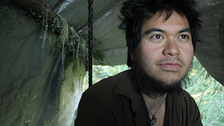
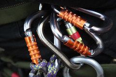
 Ground camp: Josh Eng, right, prepares to climb up a fir tree with fellow protesters (from left) Brian Garcia, Shannon Wilson and Kate Armstrong. The group is protesting a plan to log at the site. credit: Amelia Templeton
 Kate Armstrong climbing up to tree camp. She and her fellow Cascadia Forest Defender protesters are concerned about a plan to log 120-year-old forests on O&C Lands. credit: Amelia Templeton