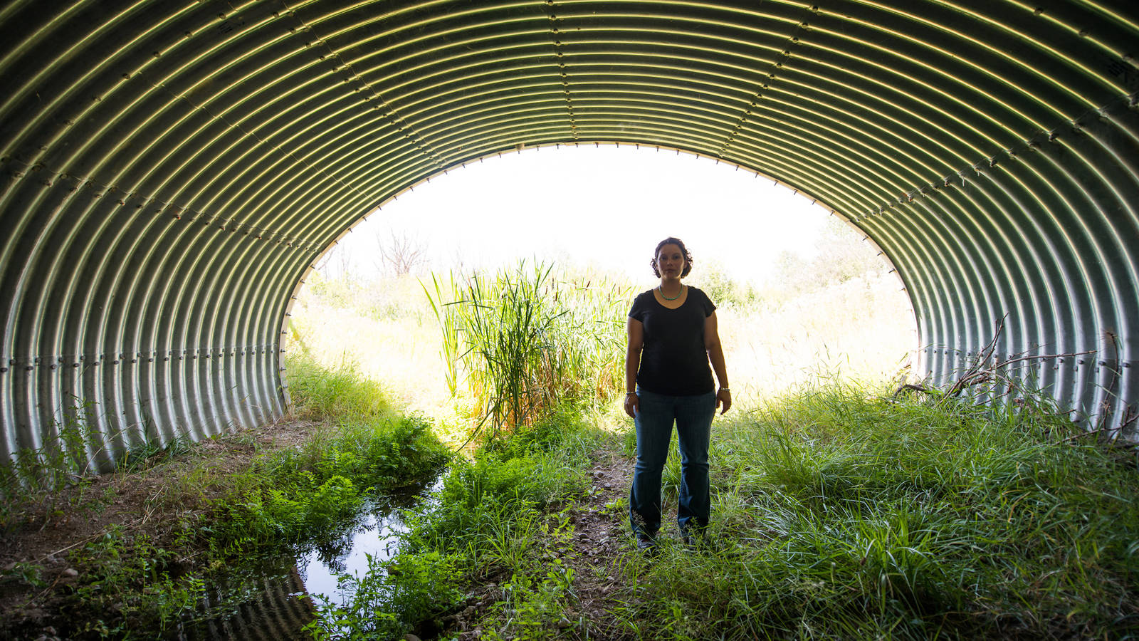
Federal lands are separated by highways all over the west. Those highways are a barrier to many species of wildlife, including species listed under the Endangered Species Act and those identified as Species of Conservation Concern (SCC) in national forest planning. Climate change is recognized as increasing the importance of wildlife movements.
Forest Service planning regulations pertaining to designation of SCC require consideration of all threats to the species’ persistence in the plan area, whether or not the threats occur within the plan area or are the result of national forest management. Often, significant threats to these at-risk species come from outside of the federal lands; one of these is the effect of highways on connectivity. The Forest Service could improve prospects for some species to persist in the plan area by making it easier for them to get to and from it. They can do two things to promote that. They can 1) collaborate with other agencies managing land, wildlife and transportation to identify the most important areas to jointly manage for connectivity, and 2) manage their lands in or near these areas to minimize barriers to wildlife movement, first by recognizing them as such in forest plans.
There’s a new tool from the Center for Landscape Conservation that could help with identifying the important areas consistently across the west. As with any newly available science, the agencies involved should be looking at this mapping tool and determining whether and how they will use it, and ideally documenting the rationale, especially for disregarding this new information. National forests should be checking their forest plans to see whether their assigned management areas would make these connectivity areas less attractive to wildlife movement, and amending plans as needed.
The study that produced these maps also found that “1,523 of the CC (“collision and connectivity”) segments (338 mi) have enough collisions to make it more cost-effective to build a wildlife crossing than to do nothing,” and land management agencies should support such efforts and manage their lands to facilitate their use by wildlife.
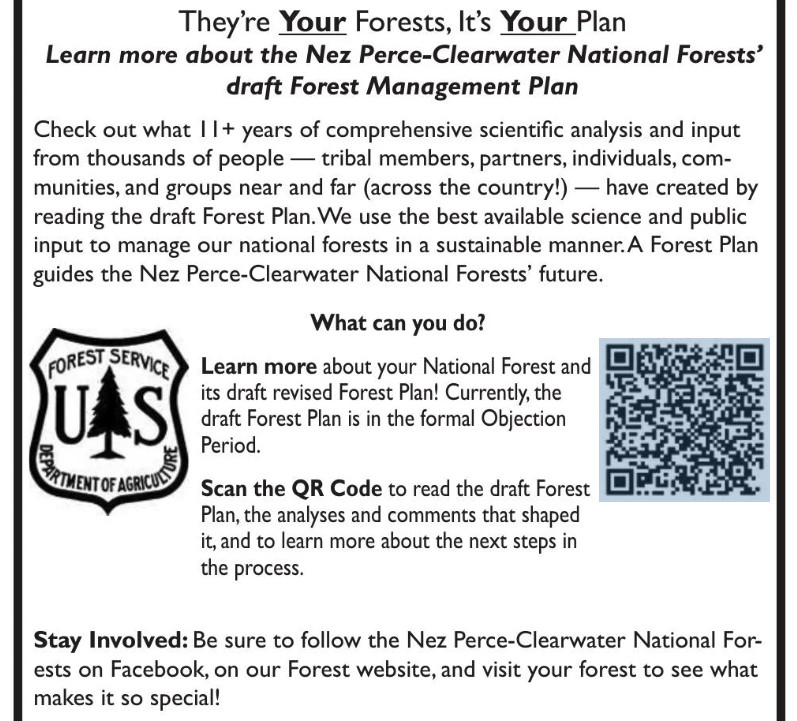
Here’s a little more (added to this) on the Nez Perce-Clearwater revised forest plan. Mostly I wanted to share this graphic of how they are “reaching out” to the public. They ask an important question: “What can you do?” The obvious meaning seems to be what can you do about the forest plan, and the answer for most people is “nothing.” They say that the plan is in the objection period, but don’t tell us that the only people who can participate are those who have already done so. They invite us to “learn more,” about this nearly-done deal, which they misleading label as a “draft Forest Management Plan.” (At the draft EIS stage, the Planning Rule refers to it as the “proposed plan,” and at the objection stage it is just the “plan.) While they have must have included similar outreach at earlier stages in the process, for those encountering this for the first time, it’s almost disingenuous.
But while I’m at it , there was also another article recently that focused on the State Line Trail, which runs through the Hoodoo Recommended Wilderness Area in the Great Burn between Idaho and Montana. (I’ve been there but haven’t been directly involved in the planning, so know only what I read.)
“It used to be a marquee backcountry ride for mountain bikers, too. That ended in 2012 when the Nez Perce-Clearwater National Forest, which controls the Idaho side of the trail, approved a new travel management plan that barred bicycles from its portion of the trail. On the Montana side, the Lolo National Forest has long allowed bicycles on the trail.”
A new revised forest plan for the Nez Perce-Clearwater could change that, by determining that bicycles are an appropriate use in the portions of Idaho around the trail, which would mirror access on the Montana side. If the changes in the plan are finalized, possibly later this year, that would set the stage for the Nez Perce-Clearwater to revisit and alter its 2012 travel plan to formally re-allow bicycles on the trail.”
The rationale behind these changes, according to the forest supervisor, don’t seem to include consistency (more on that later): “We have these types of very primitive, amazing, out in the middle of nowhere experiences that you can get to no matter what your matter of conveyance is.” No apparent agency recognition that the conveyance is part of the experience for those who encounter it, and for some it makes it feel unpleasantly more like “somewhere.”
One of the supporters added, “It’s a small segment of the sport that this is going to appeal to,” he said. “It’s not that close to Missoula. It’s hard. The trail’s in deteriorating condition. But this opportunity is, for certain people, something they really, really want.” That small segment of certain people (who apparently want to deteriorate the trail even more) must be pretty special to get this kind of personalized attention.
“Some mountain bikers are drawn to remote, rugged, and challenging backcountry trail experiences on wild and raw landscapes,” a group of supporters commented. “These are places where it is uncommon to see other trail users, and where riding requires a high level of physical fitness and technical skill — in many cases it involves pushing a bike instead of riding at all.” That would be like hiking, wouldn’t it? So, it’s not like closing the area to this use would exclude these physically fit people from these wild and raw landscapes. I’ll admit that I don’t understand the rationale of wanting to experience a “wild and raw landscape” on a machine, which (to me) reduces the rawness and wildness of the experience.
The aura of personal opinion and politics behind these wilderness debates is why I focus my energy on other things. Here there is also talk about snowmobiles and mountain goats, and why mountain goats are treated differently in adjacent national forests.
As for the effects of snowmobiles on mountain goats, the Idaho Department of Fish and Game blamed them for disappearance from one part of this area, but the founder of the Backcountry Sled Patriots says otherwise (citing other research). The Lolo National Forest cited the negative effect of motorized over-snow machines as reason for designating them a species of conservation concern. The Nez Perce-Clearwater is not concerned about mountain goats. The Forest Service minimizes the importance of the areas at issue to mountain goats (though they apparently used to be some places they are not found now).
About the Lolo, Marten, the regional forester, who determines which species are SCC, wrote:
“Compared to other ungulates, the species appears particularly sensitive to human disturbance. Motorized and non-motorized recreation, as well as aerial vehicles, are well documented to affect the species, particularly during winter and kid-rearing season, with impacts ranging from permanent or seasonal (displacement), to changes in behavior and productivity.”
The regional director for ecosystem planning said that she didn’t see the different listing decisions as being in conflict with each other. Rather, she said, they reflect that mountains goats are doing better overall on one forest than the other. This may be technically/legally possible since SCC are based on persistence in an individual forest plan area. However, it doesn’t make a lot of sense to me to manage one national forest to increase the risk to, and to contribute to SCC designation on, another forest. Moreover, the Planning Handbook states that “species of conservation concern in adjoining National Forest System plan areas” should be considered by the regional forester in making this designation. This all has kind of an arbitrary ring to it.
As for consistent management across national forest boundaries, The Nez Perce-Clearwater plans to change the shape of the Hoodoo RWA to remove the key snowmobile areas from it, so that boundary between the national forests becomes a boundary for the RWA. The Forest Service points out that the plan revision process in the hands of forest supervisors, not the regional office. The forest supervisors disclaim any obligation for consistency, and even suggest that travel planning may produce a different result, and “forest plans and travel management plans are continually updated and amended” so they could change again. That doesn’t square well with history. The every-third-of-a-century Forest plan revision should be the time to get it right. Even if the regional forester doesn’t want to say what the plans must do, that person could simply order them to be consistent along this boundary.
First of all, let me say that there are probably people in the Forest Service who have thought all this through. I’m hoping that they will help out with their explanations in the comments.
If old growth is old growth, and mature forests are on their way to old growth, and young forests are on their way to mature forests.. then it seems like there is no ceiling on the amount of old-growth needed, and no reason to ever have openings other than “natural” ones. This can be problematic, conceptually, as some groups believe that today’s wildfires and wind events are all unnatural or caused or “supercharged by” the anthropogenic part of climate change.
And if you believe that, then does any ecosystem have “integrity”? Or is the key thing to promote resilience (including biodiversity) in the face of climate change and protect key values of ecosystems and people from these and other dangers? To keep diverse living trees alive on the landscape, and to protect water, wildlife and other values? Perhaps some will say “it’s the same thing” and if it is, then perhaps the use of plain English would save time and misunderstanding.
Let’s go back to the 2012 Planning Rule Handbook:
Assessing the status of ecosystems—their level of ecological integrity—is difficult. There is no guide that provides a comprehensive protocol, and each ecosystem has a unique body of scientific information relevant to the ecological assessment. The planning rule and supporting handbook identify departure from the natural range of variation as a criterion to assess ecological integrity. The natural range of variation refers to the variation in key ecosystem characteristics produced by dominant natural disturbance regimes, usually in a pre-European influenced reference period. This method works well for ecosystems that are relatively well-studied and their natural range of variation can be estimated through ecological modeling or other methodology.
(my bold). Now, as most readers know, I wasn’t a fan of this approach at the time. At that time, my thinking went along these lines… (1) there’s a great deal of pre-European time and yet a certain time has to be selected, humans have been around since glaciation; (2) animals and plants move around and hybridize- and evolution is part of Nature, after all; (3) time’s arrow only goes one way, at least genetically; and (4) if climate is changing faster than usual, then there is no reason to think that the past is well adapted to the future. And don’t we want forests that are adapted to the future? As described in the Handbook, it unintentionally downplays the role of Indigenous fire management and the idea “natural= pre-European” only fits if Indigenous folks are part of Nature, which some now consider to be racist. It would perhaps be clearer and more accurate to say “we want to go back to Indigenous ways of managing the landscape,” if that’s really the case, but again we’d need more Indigenous people and give them authority over federal forests plus make them do not what they think best but what they think their ancestors did. And the importance of Indigenous management and climate have only become clearer or perhaps “supercharged” in more recent discourse.
Many forests have done vegetation modeling and historic research, and came up with desired conditions of say, certain amounts of habitat with certain characteristics. For example, x acres of early successional habitat, or y acres of western white pine or oaks, or even the historic densities of some species. So logically, to recreate these conditions, we may need to thin trees for density reduction and create openings for some pine and oak species to regenerate. There are different ways of getting openings. Depending on where you are, openings could occur due to wildfire, wind events, volcanoes, floods, trees dying from old age and/or native or introduced diseases and pests, and so on. With or without attribution to anthropogenic factors of climate change, some of these are more natural than others (fire suppression and non-native species obviously not).
Generally, the only other way is to manage is via prescribed fire or some combo of mechanical treatments (aka “logging” or “tree-cutting”) and prescribed fire. So do we still want those carefully arrived at NRV distributions or not? According to some, if the opening-treatments would occur in currently mature or old-growth forests, then not. So that leaves “natural” disturbances (affected by AGW, so then unnatural, except for volcanos?) and hoping that they get to the desired ratios; or alternatively, doing openings over and over in younger forests but not mature ones, so that they don’t go through their successional stages, which seems also unnatural. Look who wrote about the importance of early successional ecosystems in this 2011 paper (abstract)
Different disturbances contrast markedly in terms of biological legacies, and this will influence the resultant physical and biological conditions, thus affecting successional pathways. Management activities, such as post-disturbance logging and dense tree planting, can reduce the richness within and the duration of early-successional ecosystems . Where maintenance of biodiversity is an objective, the importance and value of these natural early-successional ecosystems are underappreciated.
So will the new OG amendment effectively replace the concept of “pre-European conditions” with “creating as much old growth as possible”? Because we can imagine quite a possible tension between “maximizing old growth” and “ensuring diversity of tree species”, and the latter would be important to fulfill certain requirements of NFMA, specifically.
“provide for diversity of plant and animal communities based on the suitability and capability of the specific land area in order to meet overall multiple-use objectives, and within the multiple-use objectives of a land management plan adopted pursuant to this section, provide, where appropriate, to the degree practicable, for steps to be taken to preserve the diversity of tree species similar to that existing in the region controlled by the plan;”
My bold, Of course, trees and bark beetles, do their own things, unbothered by humans’ desire for shade or carbon credits, or even plan amendments, forest-specific or national. From the Fire Effects website:
The average lifespan of Rocky Mountain lodgepole pine is 150 to 200 years [37,170], though some Rocky Mountain lodgepole pine trees live more than 400 years
You can read any number of articles right now about this that say ESA was adopted by a nearly unanimous Congress and signed by President Nixon on December 28, 1973. Its supporters find success in its protection of 99% of the species listed from extinction, while critics complain that only 3% have been recovered. To me, that’s apples vs oranges, because it is much easier for a law to stop bad things from happening than to make good things happen. I’d love to see those who complain about ESA out there arguing for more money to implement recovery plans. (And I fail to see the logic of opposing additional listings because recovery is unlikely, when recovery without listing is even less likely.)
But I was curious about what the Forest Service might have to say about this momentous anniversary, and this posting showed up on their website. It’s written about California, but must represent the agency’s perspective. The current priority is evident in the second paragraph:
Large, extremely hot fires have ripped through many of these lands, charring if not destroying habitat crucial to species survival. To help reduce the risk of large, devastating fires, the Forest Service is working to remove vegetation that could feed a fire and is working with the U.S. Fish and Wildlife Service to simultaneously support the conservation of listed species.
That would be listed species that depend on “vegetation that could feed a fire,” which would be removed. We’ve seen that with spotted owls, the Fish and Wildlife says this should mean focusing fuel reduction projects on areas that are less important to the species. It would be interesting to hear about how this approach is being implemented through agency policy, forest plans, and/or implementation strategies. This explanation by the Forest Service falls a little short of a “strategy” for accomplishing this.
The U.S. Fish and Wildlife Service, which manages the species program, often partners with the Forest Service on steps to protect species listed under the act. Collaborative efforts carry intertwined goals forward. Wildlife specialists and biologists from each agency review project plans, survey forests for species populations, collect data, and analyze the best available science. The Forest Service often includes wildlife conservation measures in as part of land management planning, which means on-the-ground activities needed to increase forest resilience align with the needs of wildlife.
For example, specific types, sizes and heights of trees are left in areas of a forest known to be actively used as nesting or denning sites by threatened or endangered species. The Forest Service plans work to occur during times of the year that will not disrupt key life stages, such as mating season or when adults are caring for young. The Fish and Wildlife Service reviews these plans before work is started to ensure that species needs are being met.
I like that they recognize the importance of forest plan standards as a key tool for protecting species, but I’d like to know more about “Collaborative efforts carry intertwined goals forward.”
The details of this plan are outside my range of knowledge, but I thought this story was interesting. First of all the headline, “shrinks Great Burn Wilderness”. Of course, forest plans can’t actually do that, so I looked further and the plan reduces the Recommended Wilderness. Which of course is not the same thing. Headlines.. sigh.
The Nez Perce-Clearwater National Forest supervisor trumpeted her new forest plan as the best compromise for all, but when it comes to proposed wilderness, both advocates and opponents disagree.I’m not a fan of using the word “trumpeted”. It seems like there’s been “emotional wording” inflation since folks discovered that emotions drive engagement which drives bucks in internet world.
The story has many quotes from Probert, the Forest Supe, the Great Burn Conservation Alliance executive director Hayley Newman, and other ENGO folks.
“The Forest Service has sat back while illegal motorized use has encroached on the Great Burn for years, and now it’s decided to reward illegal use by rewriting the forest plan to make it okay,” said Maddy Munson, Wild Montana Public Lands director.
Newman said one forest – the Nez Perce-Clearwater – shouldn’t be allowed to diminish a wilderness that’s partially managed, and managed differently, by another forest: the Lolo. For example, the Lolo Forest recently designated the mountain goat as a species of concern while the Nez Perce-Clearwater has not. Plus, one forest plan might sway another, said Katie Bilodeau, Friends of the Clearwater staff attorney.
Yes, plans done on a forest by forest basis may not harmonize across boundaries. The idea of “swaying” is interesting. Conceivably earlier plans may make it easier for the next plan to make the same kinds of choices. I don’t see that that is good or bad necessarily unless you don’t like ideas in the earlier ones.. but that could work both ways “hey that forest gave us an extra 100K of RW, so you should too!”
I thought that this was interesting.
In her decision rationale, Forest Supervisor Cheryl Probert said the question of what to recommend as wilderness garnered the most public interest of all aspects of the draft forest plan released in December 2019, accounting for 18% of almost 20,000 comments.
Different forests have people interested in different things during planning and apparently wilderness is big there.
Probert said she’d heard about the need to protect wolverine and mountain goats but also heard complaints from snowmobile users who said that “there are no replacements for the opportunities provided here.” She asked opposing groups to come up with a compromise, but none came. So she carved the area up to create one.
I don’t know if it’s just the way it’s reported, but it sounds like she herself did it. I’m thinking it’s likely that her staff and she had many discussions and they probably didn’t all agree. It sounds kind of dismissive “she carved up” versus, say, “after a series or far-ranging discussions with members of the public, interest groups, elected officials, she and her staff came up with this proposal as a possible solution.”
In fact, wilderness groups want the Forest Service to enlarge the Great Burn Wilderness to encompass adjacent roadless areas to the west, an addition of 40,000 acres. But, Probert bypassed three plan alternatives with more recommended wilderness – between 309,000 and 857,000 acres – preferring an alternative with just 197,700 acres of proposed wilderness.
However Probert did propose one new wilderness, Meadow Creek, with almost 73,000 acres adjacent to the Selway-Bitterroot Wilderness south of the Selway River.
Hopefully some TSW readers, including motorized folks (apparently not interviewed for this article) will weigh in and add their perspective. Just a thought.. there seem to be forest vegetation collaborative groups where people who disagree reach compromises.. this doesn’t seem common in recreation disputes (or is it?). Maybe our social science friends have studied why that might or might not be the case.
Finally, did opening up the decision about Recommended Wilderness via plan revision lead to a better on-the-ground outcome in some way? Did it encourage groups to work together, or just open a new arena for the same old battles?
Western bumblebee (Xerces Society / Rich Hatfield)
The rusty-patched bumblebee and Franklin’s bumblebee have been listed under ESA and other species are being considered. The Xerces Society considers 11 species of bumblebee to be at-risk. The Forest Service and BLM allow special use permits for non-native honeybee apiaries on their lands based on categorical exclusions. Here is the one applicable to the Forest Service (36 CFR 220.6(d)(8)):
(8) Approval, modification, or continuation of minor, short-term (1 year or less) special uses of National Forest System lands. Examples include but are not limited to: (i) Approving, on an annual basis, the intermittent use and occupancy by a State licensed outfitter or guide; (ii) Approving the use of National Forest System land for apiaries; and (iii) Approving the gathering of forest products for personal use.
Most scientists agree that honeybees are not native to the Americas. They were imported to the continent in the 1600s on cargo ships from Europe and arrived in Utah in the mid-1800s.
Honeybees tend to outcompete native bees for pollen. Tepedino said, “if you put enormous numbers of honeybees on public lands … the native bee population must, by necessity, be deprived.”
A study by Tepedino concludes that the honeybees in a single apiary can, in just four months, remove enough pollen to raise five to 13 million native bees.
O’Brien said that competition is also worsened by climate change. Because climate change leads to more drought and as a result fewer flowers, it is becoming more difficult for native bees to compete with honeybees, she said.
Mary O’Brien (a botanist) also said the CE was instituted in the 1980s, before scientists knew very much about native bees. She points to the western bumblebee, a species she said is “critically imperiled” in Utah. It is particularly threatened by diseases, including ones that are transmitted by honeybees.
Project Eleven Hundred was born about five years ago in response to a request for a permit to place 100 hives each at 49 sites in the Manti-La Sal National Forest. That permit was denied, but there is currently a permit on the Uinta-Wasatch-Cache National Forest that is up for renewal at the end of this year, which is being contested and may be litigated. Project 1100 has also petitioned to remove the CE.
In forest planning under the 2012 Planning Rule, species of conservation concern are to be designated SCC if there is a risk to their persistence in the plan area. Both listed species and SCC must be addressed in forest planning to ensure that the plan decisions (components) adequately protect these species from threats. Since commercial non-native apiaries are a threat to these species, a forest plan should consider, and probably adopt standards that regulate or prohibit issuance of permits for honeybees. (I’m guessing wild honeybees are found on most national forests.)
The proposed revision of the Manti-La Sal National Forest Management Plan allows apiaries, subject to a standard stating that permits “shall not be issued for placement of hives within 5 miles of known insect-pollinated, at-risk plant species locations or at-risk insect populations.” It also states that a maximum of 20 hives can be issued for each apiary special use permit (which is arguably “not commercially viable”). O’Brien said this is an impossible precaution to enforce. “As if they know where [native bees] are,” she said. “…The western bumblebee would be considered at risk, and they don’t know where it flies.”
The western bumblebee was NOT designated as an SCC in the Manti-La Sal’s draft of its revised forest plan.
The U.S. Department of Agriculture’s Forest Service today announced a Notice of Proposed Rulemaking (NPRM) that would allow the agency to consider proposals for potential carbon capture and sequestration projects on national forests and grasslands. This proposal would harmonize the framework between the federal government’s two largest land managers by aligning with regulatory structures already established for the U.S. Department of Interior’s Bureau of Land Management.
If this amendment is finalized, applications for carbon sequestration on national forests or grasslands would be considered for permanent use. The proposed regulation changes the initial screening criteria to allow the Forest Service to consider proposals for carbon capture and sequestration projects and does not allow for any other permanent uses on national forests and grasslands.
The United States Department of Agriculture, Forest Service (Forest Service or Agency), is proposing to amend its special use regulations, which prohibit authorizing exclusive and perpetual use and occupancy of National Forest System lands, to provide an exemption for carbon capture and storage.
Carbon dioxide injected in pore spaces may remain for over 1,000 years after injection and would be tantamount to an exclusive and perpetual use and occupancy if authorized on NFS lands.
The proposed rule would not authorize carbon capture and storage on NFS lands. Rather, the proposed rule would exempt proposals for carbon capture and storage from the initial screening criterion prohibiting authorization of exclusive use and occupancy of NFS lands, thereby allowing the Forest Service to review proposals and applications for carbon capture and storage and to authorize proposed carbon capture and storage on NFS lands if, where, and as deemed appropriate by the Agency.
Proposals for underground storage of carbon dioxide would have to meet all other screening criteria, including but not limited to consistency with the applicable land management plan, potential risks to public health or safety, conflicts or interference with authorized uses of NFS lands or use of adjacent non-NFS lands.
Of course it would have to be consistent with forest plans, but would a forest plan that authorizes “exclusive and perpetual use and occupancy” of national forest lands be consistent with the Multiple-Use Sustained-Yield Act? (Is the BLM different in this regard?) I assume that’s why the existing special use regulations are written to prohibit permanent uses. Maybe this should be viewed as a question of divesting ownership rather than a permitted special use.
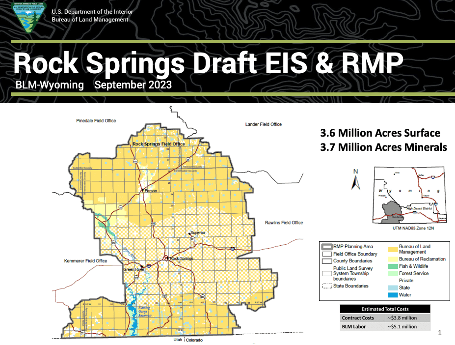
The Rock Springs (WY) office of the BLM has recently released a draft of its resource management plan. The DEIS includes the traditional four alternatives: no-change, protection, development, and “balanced.” As Governor Gordon’s natural resources policy advisor put it, “In this case they kind of broke precedent and chose (alternative) B, the most resource-restrictive development.” A retired BLM employee has alleged that presidential politics played a role.
The most balanced plan for managing millions of acres of federal land in central Wyoming — and the alternative that Bureau of Land Management employees and others put the most time, effort and money into — was rejected by the past two presidential administrations, a retired BLM employee said.
The Trump administration likely would have pushed Alternative C because it favors more drilling for oil, he said.
But the Biden administration has gone to the opposite extreme, so the BLM now is pushing forward with Alternative B, which designates 1.8 million acres as “areas of critical environmental concern” (ACES).
Evans said it’s disheartening that two presidential administrations boosted the plans with the least amount of effort put into them.
“The science and the work to do that was all done on D,” Evans said. “And it’s kind of a shame that what the people in the field office and the cooperators spent all that time doing was rejected.”
Now many of those same BLM insiders who worked for years and spent millions of dollars fleshing out a balanced alternative instead have to push the administration’s preference and sell it to Wyoming residents and officials.
The State of Wyoming is considering suing over the plan (even though is not final yet). Road management and minerals are key issues.
Based on my experience, I would agree that there may not be a precedent for selecting the most resource-restrictive land management plan alternative . I also have not seen this level of direct political involvement in picking an alternative in Forest Service planning. Typically in the Forest Service, any political “wants” would be built into the “balanced” alternative that would end up being selected. Please let us know if anyone has had a different experience. (Maybe this is a result of the different structures and cultures of the Forest Service and BLM.)
I have mixed feelings about this approach, where all but one are essentially straw alternatives. Legally, all action alternative must be given equal treatment in the effects analysis, but that doesn’t preclude more serious thought being put into to the design of one alternative. If one of the others is actually selected it would create the problem the employee described here – it has to be prettied-up at the end of the process. I think it is important to meaningfully evaluate all reasonable alternatives, but there is a difference between “reasonable” meaning “what would meet the purpose and need” and “reasonable” meaning, “what the agency could realistically select.” I think what is missing from public disclosure is the actual iterative alternatives that are considered in building the preferred alternative.
On October 9, the BLM extended the public comment period to January 17. I guess that would buy them more time to refigure out the details of this alternative, or as they point out “In any resource management planning process, the final plan may mix and match portions from all the alternatives.” “Rebalancing” them I suppose.
I guess this is a bookend to Sharon’s “Friday News Roundup.”
BLUE MOUNTAINS
I recently provided an update on the status of the Blue Mountains forest plan revisions here. And here’s a little more detail on that, especially on the question of “access.” (This term gets used for a couple of different things, and this one is about closing roads on national forests rather than creating access across private property to reach public lands.)
One group says its leading the charge to fight for what they call “original rights” is Forest Access for All. “We defend the rights that we’ve had since Oregon was a territory, free reign where we go and utilize the forests which are public lands,” says Bill Harvey, a group member and former Baker County Commissioner. “A couple decades ago the Forest Service began closing off sections of the forest and that’s when Forest Access for All was formed.” Harvey says his group’s particular ire is at the Wallowa-Whitman National Forest (WWNF), which he claims “have closed thousands of miles of roads in the forest the last twenty years.”
The group also has other “conflicts” with the Forest Service include the need for more vegetation management, economic benefits of (motorized) recreation, and better public engagement.
“By law right now, we have an open forest. They will admit it, everybody admits it, and it’s in the books, I’ve seen it a million times. It is an open access forest,” says Harvey. “Why in God’s name would we want to give that up? Nothing benefits us to give up our rights that we have currently. We’re not asking for more rights, we’re asking for the existing rights to stay in place.
I’m going to disagree with him on this one, and I hope the Forest Service does, too (although it looks like they could have done a better job of setting the locals straight on this before now). In 2005, Subpart B of the Travel Management Rule changed the culture of motor vehicle use on roads, trails, and areas from “Open unless closed” to a system of designated routes. As for why? The goal was to reduce resource damage from unmanaged motor vehicle use off that road system.
FLATHEAD
Newly revealed emails show that the Flathead National Forest under then supervisor Kurt Steele looked to keep a proposal of a tram up Columbia Mountain from public view for more than year prior to it being first proposed.
Does this sound familiar? It sounds to me like the “Holland Lake Model” that got the forest supervisor a “promotion” to forest planning. In this case the Forest properly rejected the proposal as inconsistent with its forest plan (thank you forest plan!). But it does suggest a pattern of incentives and behavior that may be broader than the Flathead National Forest.
“The process where the public comes into play is when it becomes the NEPA process,” Flathead Forest spokesperson Kira Powell said about the emails.
“Bringing you into the conversation about this potential project on the Flathead NF because it’s coming from investors who apparently have the financial resources to build a tramway, meaning they likely have political savvy also … wrote Keith Lannom, who was deputy regional forester for Region 1 at the time …”
This account offers a window into the role of “political savvy” in Forest Service decision-making.
ORGAN MOUNTAINS – DESERT PEAKS NATIONAL MONUMENT
Since President Barack Obama created the Organ Mountains-Desert Peaks National Monument in 2014, visitation has tripled and the national monument has spurred economic growth in the Las Cruces area as well as other communities near the national monument, according to a new report.
According to this overview, the report looks at the various factors that made this particular monument so successful, including its location relative to population centers and the uses it caters to. Also local community support.
“We have always recognized that the establishment of the monument was due in large part to the grassroots effort at the local community organizations and individuals,” Melanie Barnes, the state BLM director, said. “And due to this engaged and proud community, the monument has seen an increase in visitation.”
She said the BLM is working on a resource management plan that will address land use and resource protection. The public scoping period for that plan recently ended.
Once upon a time, in a city far away, the U. S. Forest Service posted its schedule for revising national forest plans on its national website. There was even a map showing the revisions completed under the 2012 Planning Rule. Today, they are not where they used to be on the website, and I couldn’t find them anywhere else. Maybe they didn’t like what I (or others) were doing with the information?
The last schedule that I saved was from May, 2022. I have compiled the current information on the plans listed in that schedule and a few others that I am aware of below, roughly in order of their status, from those completed to those just starting. I counted 14 completed and 16 officially ongoing revisions (if I have missed any, let me know).
COMPLETED REVISIONS
These plans were completed prior to May, 2022
Francis Marion (2017)
Flathead (2018)
El Yunque (2019)
Inyo (2019)
Chugach (2020)
Rio Grande (2020)
Helena-Lewis and Clark (2021)
Custer-Gallatin (2022)
The American Bar Association recently provided this favorable critique of the El Yunque revised plan.
No policy better reflects the agency’s increased awareness about the importance of understanding and utilizing local stakeholders than the 2019 plan’s “all-lands” management approach, which aims to bring landowners and stakeholders together to identify common goals for the forest.
These plans have been completed and adopted since May, 2022
It’s worth noting that lawsuits against these revised plans have been scarce. The Flathead has had two (one is discussed here) and there is a case currently pending against the Rio Grande (discussed here). Have I missed any? (The Colville revised plan litigation, discussed here, was developed under the previous planning regulations.)
PENDING REVISIONS (header links are to the Forest Service web page)
On May 19, 2023, the Regional Forester issued her final instructions to the Tonto Forest Supervisor and responded to the eligible objectors. These final instructions included changes the forest must make to the final plan or supporting documents before the Forest Supervisor may sign the Record of Decision and implement the new plan. Some additional information is in this article.
The objection filing period ended June 20, 2023. The Forest Service received objections from 14 individuals or organizations. An objection resolution meeting was scheduled for August 28.
The proposed final plan and FEIS were released August 30 and the objection period runs until October 30. A couple of articles covered the release – here and here.
The draft EIS was released in December, 2019. The FEIS is listed as “Proposed” “Summer 2023.” However, a recent article is now saying “by the end of the calendar year.”
The draft plan and EIS were available for public comment until November 2021. Local news suggests it’s not going smoothly: “Personally I believe you are trying to do the best that you can,” Jeff Bilberry, chairman of the Chaves County Board of Commissioners, said to Forest Service representatives. But he added soon after, “I am going to agree with former commissioner (Will) Cavin that we need to go back and start over again and let’s do this right so we don’t have everybody sitting here wondering what is fixing to happen.”
The Manti-La Sal National Forest released its proposed Land and Resource Management Plan and DEIS on Aug. 18. Public comments on the DEIS are being accepted until November 16.
In September 2019, Forest Supervisor Chuck Mark announced the Salmon-Challis National Forest will evaluate the 1988 Salmon Forest Plan and the 1987 Challis Forest Plan separately. A new timeline will be developed once public feedback has been gathered to inform steps moving forward.
Public meetings are ongoing to discuss the final assessment, need for change and developing the plan. A Notice of Intent to prepare an EIS is currently expected in January, 2024.
The Bridger-Teton National Forest aims to have the draft assessment report available for public review by late fall per this article. (And they are getting some help.)
Blue Mountains (Malheur, Umatilla, and Wallowa-Whitman) – restarting assessment
The most recent effort to revise the plan failed in 2019, and now the Forest Service is restarting the process, beginning the assessment process in June and public meetings are scheduled for this fall. Some background is provided here.
No forests in the area covered by the Northwest Forest Plan have formally started the revision process. A Bioregional Assessment was prepared in 2020. Based on the Bioregional Assessment findings, land management plans may be amended or revised at the same time or in groups according to common features like geography and ecosystems.
The most urgent need is to restore fire’s natural role in the frequent-fire dependent ecosystems closest to communities in the eastern Cascade Mountains, Klamath Mountains of southern Oregon and northern California, and the southern Coastal Mountains.
Based on that urgency, a cohort of northern California units and the Rogue River-Siskiyou National Forest in Southern Oregon are being considered as the first to begin plan modernization. Northern California cohort includes the Klamath and Butte Valley Grassland, Six Rivers, Shasta-Trinity, and Mendocino National Forests.
OTHER “PROGRAMMATIC” DECISIONS
On August 21, the Forest Service proposed to change the name of the Wayne National Forest in Ohio to the Buckeye National Forest. The national forest is currently named after General (“Mad”) Anthony Wayne, whose complicated legacy includes leading a violent campaign against the Indigenous peoples of Ohio that resulted in their removal from their homelands. Buckeye National Forest is one of the names suggested to the Forest Service by American Indian Tribes. But of course, Republicans have politicized it.