Center for Biological Diversity v. Rim Fire Salvage

The CBD’s expected lawsuit against the USFS over salvage on the Rim Fire near Yosemite.

The introduction offers some points to ponder:

“Snag forest habitat, also known as “complex early seral forest”, is one of the rarest and least protected of all forest habitat types in the Sierra Nevada.”

Rare? Says who? Chad Hanson:

“Due to fire suppression policies, there is now about one-fourth as much high-intensity fire—the type of fire that creates complex early seral forest—as there was prior to the early 20th century (Hanson and Odion 2014, Odion et al. 2014).”

“This habitat—if not subjected to post-fire logging—supports levels of native biodiversity and wildlife abundance comparable to, and sometimes higher than, that of unburned mature/old forest (Raphael et al. 1987, Burnett et al. 2010, Swanson et al. 2011).”

Yes, and clearcuts can also support higher levels of native biodiversity and wildlife abundance than old-growth.

“The Rim fire logging project would log most of the snag forest habitat within the Rim fire on the Stanislaus National Forest.”

The EIS says: “Salvage of dead trees and fuel reduction (28,326 acres) including ground based mechanized equipment such as harvesters and rubber tired skidders (24,127 acres), ground based/skyline swing (16 acres) and aerial based helicopter (2,930 acres) or cable systems (1,253 acres).”

The Rim Fire burned 257,314 acres, including 154,530 acres of National Forest System (NFS) lands.

So the USFS proposes salvage on about 18% of the burned area (but won’t be taking all dead trees). The CBD’s complaint says 60% of the burned area was conifer forest. I do’t know how much of the USFS lands were conifer forests, but I don’t think 28,326 acres is “most” of the “snag forest.”


Red Mountain Flume-Chessman Reservoir Project Update

Update on the Red Mountain Flume-Chessman Reservoir project, discussed in several recent threads, including this one. Photos of logs and and article:

Chessman Reservoir lawsuit to continue as timber harvest begins

At least one of the two conservation groups suing over the Red Mountain Flume-Chessman Reservoir project plans to proceed with a lawsuit despite a federal judge saying the groups are unlikely to succeed on the merits of their case while denying a temporary halt to the project.

“We’re proceeding,” said Steve Kelly, executive director of the Montana Ecosystems Defense Council. “It doesn’t discourage me in any way because the principles in the case are sound.”

Federal Judge Dana Christensen in Missoula denied the Native Ecosystems Council and Montana Ecosystem Defense Councils a preliminary injunction, saying in part that the councils failed to show endangered species would be harmed and that the threat of wildfire to Helena’s water supply is real.

….

Preparing For Rim Fire Logging Litigation

The battle has begun!

The picture below was taken in April, within the Rim Fire, and shows how quickly the bearclover returns, after a fire. Even the manzanita and deer brush have difficulty when the bearclover is so entrenched. California Indians knew that old growth pine and bearclover were the best of their available land management outcomes. Those landscapes had great advantages for humans living in the mid elevations of the Sierra Nevada.

http://www.mymotherlode.com/news/local/221325/preparing-rim-fire-logging-litigation.html

P9202274-web

Deputy Stanislaus National Forest Supervisor Scott Tangenberg spoke before the Tuolumne County Supervisors this morning, and said the Forest Service has been contacted by several individuals, or groups, that will likely file litigation later this week.

Well, we all knew that was coming and who was opposing the project. While on the Rim Fire tour, and at the SAF meeting, it was funny to see the Forest Service tiptoeing their way around “those who shall not be named”. *smirk*

BP makes the FS look bad

An interesting story of “all lands” planning (or not).  BP has filed a lawsuit against a large residential development adjacent to its forested property, and also adjacent to a national forest.

“Along two miles of Cainhoy Road, the plantation’s eastern border is shared by the 250,000-acre Francis Marion National Forest, which is home to numerous threatened and endangered species as well as miles of hiking, biking, and canoeing trails. Perhaps the single most important forest management tool that BP and the Forest Service have is prescribed burning.”

“There is still time for everyone – the developers, the city, BP, the Forest Service, and the local community – to agree on an outcome that benefits the region for decades to come.”

The Francis Marion is revising its forest plan by the way.  Should it write off ecological integrity in this area?

It will be interesting to see what BP’s arguments are in court.  Perhaps the Forest Service will at least submit an amicus brief explaining how its national resources will be affected by this development.

Conservationists Claim Clearwater Basin Collaborative Tarnishes Wilderness Act on its 50th Anniversary

What follows is a press release from Friends of the Clearwater.

Moscow—In an ongoing effort to commemorate the 50th Anniversary of the Wilderness Act, Friends of the Clearwater released a report today that critically examines the Clearwater Basin Collaborative  (CBC)Agreement and Work Plan. If enacted by Congress, the agreement would put into place provisions that are incompatible with the Wilderness Act, potentially causing a ripple effect throughout the entire National Wilderness Preservation System, too. A copy of the analysis can be found at friendsoftheclearwater.org.

“If passed in its current form, the legislation could have a detrimental effect on the entire National Wilderness Preservation System,” said Gary Macfarlane, Ecosystem Defense Director for Friends of the Clearwater. Citizens need to be aware that there is a group proposing legislation that would designate a minimal amount of supposedly new Wilderness in the Clearwater basin of Idaho, but that proposal contains provisions incompatible with the letter and spirit of Act. That would be “wilderness” in name only.

The Clearwater Basin Collaborative Agreement and Work Plan could give the Idaho Fish & Game Department motorized access to manage wildlife in newly designated Wilderness.

“The CBC Agreement and Work Plan could give the Idaho Fish & Game Department authority to land helicopters and use motorized equipment in newly designated Wilderness,” said Brett Haverstick, Education & Outreach Director. “This equates to the department running a game farm in what is supposed to be untrammeled and wild.”

Another red flag for conservationists is that the agreement contains language that would grant special rights to commercial outfitters in newly designated Wildernesses. These are rights not enjoyed by the general public or outfitters elsewhere in national forests, let alone Wilderness. Commercial enterprises are generally banned in Wilderness and only a narrow provision for outfitting is allowed so long as the outfitting is necessary and proper.

“As proposed, the potential legislation would grant special rights to outfitters, allowing them to maintain existing permanent structures in newly designated Wilderness, plus give them veto authority over the Forest Service if they are requested to relocate their camp due to resource damage or for any reason,” continued Brett Haverstick. “The Wilderness Act prohibits commercial services but makes a narrow exception for services like outfitting only as long as it is necessary and proper. Permanent structures, which are prohibited, and special rights for outfitters are neither necessary nor proper in Wilderness.

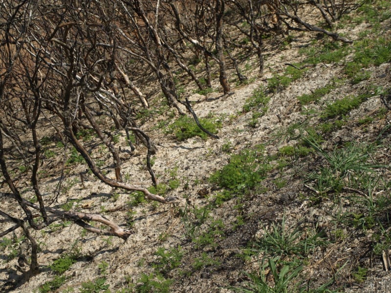
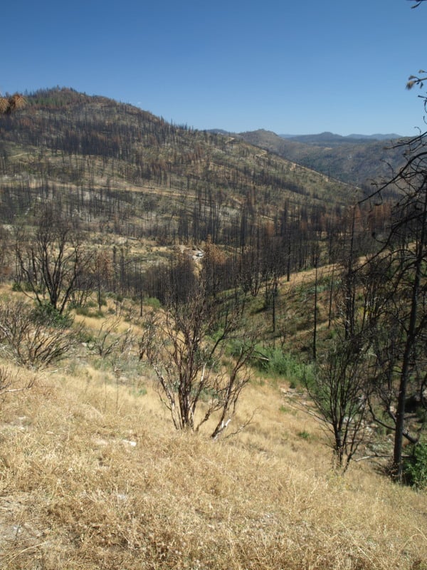
The Clearwater Basin contains 1.5-million acres of unprotected roadless wildlands. A study in 2001 (Carroll, et al.) noted that the basin contains the best overall habitat for large carnivores in the entire northern Rockies, including Yellowstone National Park and the Canadian Rockies. The group also claims that current management direction under the 1987 Clearwater National Forest Plan (as amended by the 1993 lawsuit agreement) provides far better protection than the proposed Agreement and Work Plan, even though the agreement also covers most of the Nez Perce National Forest.

“Out of 1.5-million acres of roadless wildlands, the CBC Agreement and Work Plan would designate 20% of the roadless base as Wilderness, or roughly 300,000-acres,” said Gary Macfarlane. “Areas such as Weitas Creek and Pot Mountain have been completely ignored for Wilderness. Current management direction on the Clearwater National Forest, as per the lawsuit settlement agreement, has over 500,000 acres managed as recommended wilderness.”

The CBC proposal also includes two special management areas, approximately 163,000 acres, with some protection, though one area would be open to some motorized use. Haverstick noted, “Ironically, the proposed western West Meadow Creek special management area on the Nez Perce National Forest, seems to have better overall protection than the proposed wildernesses because this proposal has provisions that would weaken wilderness protections.”

In addition, the Friends of the Clearwater report notes that the CBC proposed protection for wild and scenic rivers would be less than that proposed by the Forest Service and also the CBC agreement would lead to substantial increases in logging, even though many streams are not currently meeting water quality standards.

Gary Macfarlane concluded, “This agreement is a giant step backwards and a net loss for the roadless wildlands of the Clearwater Basin. On the 50th anniversary of the Wilderness Act, this special place deserves much better.”

You say ‘HRV,’ I say ‘NRV’ …

Dave Skinner asked, “has anyone besides me noticed the change away from “historic range of variability” terminology to “NATURAL range of variability” in USFS planning processes?”

This terminology is pretty important, but I don’t think the Forest Service has handled it very well. The best source of the Forest Service perspective on this is in the EIS for the planning rule, Chapter 3, pp. 88-91. It recognizes that shortcomings of HRV as a management objective (including the role of climate change), and concludes that, “HRV provides an informative benchmark or reference for understanding landscape change.”

On the other hand, NRV (natural range of variation) is a requirement of the planning rule. A plan must include plan components that maintain ecological integrity (36 CFR 219.8, 219.9). Ecological integrity occurs when “dominant ecological characteristics (for example, composition, structure, function, connectivity, and species composition and diversity) occur within the natural range of variation and can withstand and recover from most perturbations imposed by natural environmental dynamics or human influence” (36 CFR 219.19).

The draft planning directives say that there is no difference between HRV and NRV: “’Natural range of variation’(NRV) is a term used synonymously with historic range of variation or range of natural variation. The NRV is a tool for assessing ecological integrity, and does not necessarily constitute a management target or desired condition” (1909.12 FSH Zero Code definitions).   However, if NRV=HRV and NRV is required, then there is a mathematical principle that says plans must plan for historic conditions.

The draft directives then try to create exceptions to the requirement in the regulations that conditions occur within NRV. I think it would be more defensible if the directives define NRV as conditions that would allow an ecosystem or species to “recover from most perturbations imposed by natural environmental dynamics or human influence,” and require an explanation of the rationale (based on best available science) when this is different from historic conditions, or when information about historic conditions is not available.

(Glad you asked?)

The Rim Fire: Landscape View

Here is a view of the Granite Creek watershed, and a peek at the Tuolumne River canyon, too. The Rim Fire burned all the way to those most-distant ridgetops. For scale, you can see a vehicle in the middle of the picture. That road is the Cherry Oil Road, which connects Cherry Lake with Highway 120. That greenish tint is the vast growth of bearclover, easily reclaiming their “territory”. Bearclover is one of the reasons why clearcutting has been banned in Sierra Nevada National Forests since 1993.

P9232905-web

New Forest Service Data: Spotted Owls Living in Rim Fire Area Slated for Massive Logging Project

Source: Here.

SAN FRANCISCO New data from California’s Rim fire area shows there are at least 37 occupied owl territories in burned forest that the U.S. Forest Service wants to substantially cut as part of a post-fire logging project. Government surveys conducted this spring and summer in the Stanislaus National Forest, where last year’s Rim fire burned, found 33 owl pairs as well as six single owls. The majority are in the area where the agency has proposed to cut more than 600 million board feet of timber.

In a letter today the Wild Nature Institute, the Center for Biological Diversity and the John Muir Project told the Forest Service that the owl detection rates in the Rim fire area indicate that spotted owls are using burned forest at rates that are significantly greater than their use of unburned forests in the Sierras.

“I’m not surprised that so many spotted owls are living in the Rim fire area,” said Monica Bond, principal scientist for the Wild Nature Institute. “Recent science and survey results like those from the Rim fire are repudiating the old, outdated assumption that fire is bad for owls. Logging has always been the real danger to spotted owls, not fire.”

Forest Service managers have long assumed that fire is the most prominent threat to spotted owls, but current scientific evidence shows these rare birds of prey not only use severely burned forests but prefer it when searching for food.

Burned forests that are adjacent or near to owl sites — such as nests or roosting areas — can be critical to owl survival; published literature has determined that in post-fire landscapes such as the Rim fire area, salvage logging should be prohibited within about a mile of owl sites. The Rim fire logging project has not incorporated such protection for owls despite the exceptional number of owls in the area, and despite the recent published findings showing that spotted owls are in serious decline on Forest Service and private lands in the Sierras.

“The Rim fire area is teeming with wildlife that thrives in burned forests, including these spotted owls living right in the same forests the government wants to cut down,” said Justin Augustine with the Center for Biological Diversity. “We hope the Forest Service heeds the new data and drastically changes its approach so these owls get the protections they need and deserve.”

Spotted owls are not the only forest animals that use burned areas. Species like woodpeckers, bluebirds, deer and bats flourish in post-fire forests. As explained in a recent scientific publication, intense fire in mature forest creates one of the most biologically diverse and ecologically important forest habitat types in the Sierras.

“If the Forest Service continues with its plans to log the Rim fire area, the many owls residing in the post-fire forest mosaic will be harmed,” said research ecologist Dr. Chad Hanson of the John Muir Project. “And let’s not forget that the Forest Service has a conflict of interest because it sells the burned trees to private commercial logging corporations and keeps the profits to enhance its budget.”

The Forest Service proposal in the Rim fire area is one of the largest industrial logging projects in the history of the national forest system. Much of the logging would be concentrated in occupied spotted owl territories. The Forest Service’s final decision on the project is expected to be released on Aug. 28.


Recovery after Severe Fire in the Klamath-Siskiyou: What Happens without Planting?

Download the entire article from Fire Science here.

Summary

The Klamath-Siskiyou forest of southern Oregon and northern California is home to a fire-adapted conifer ecosystem that historically experienced frequent, low-intensity fire. Often the management response to severe fire in the Klamath- Siskiyou includes planting—there is genuine and historical concern that without planting, the conifers will diminish. But David Hibbs and his colleagues at Oregon State University realized that there were very little data on whether these forests require management-based planting to recover. They wondered if natural recovery was possible, even after severe wildfire. The team found a series of severely burned, unmanaged plots, and measured conifer abundance, age, and live-crown ratio. They found that even in unplanted, unmanaged burned forest natural conifer regeneration is reliable and abundant. Recruitment is also ongoing well after the fire. Furthermore, there was little evidence that tree recruitment was affected by distances as great as 400 meters to source trees. Their results suggest that in many cases, planting may not be required to support conifer forest recovery in the Klamath-Siskiyou.


Key Findings

  • On most sites, natural regeneration of conifers was abundant 10 to 20 years after a fire.
  • Natural regeneration of conifers was usually abundant up to 400 meters from living trees. It was difficult to find places more than 400 meters from living trees.
  • Conifers continued regenerating 10 to 15 years after the fire.
  • Natural regeneration was most limited on the drier, hotter low elevation, southern slopes on the eastern Klamath Mountains.
  • Shrub cover was positively associated with seedling growth in the Douglas-fir/tanoak association and negatively in the white fire association.